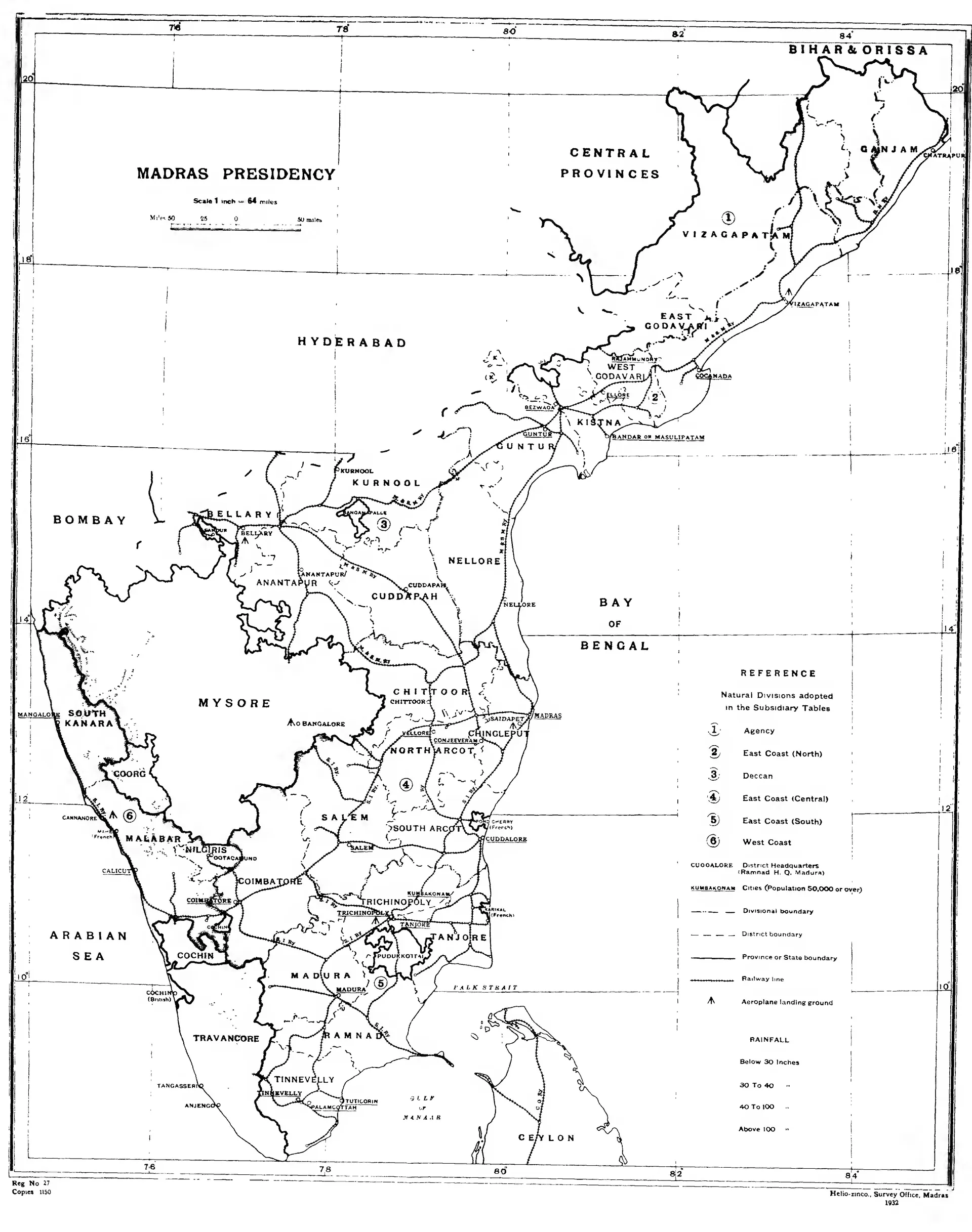
"Madras Presidency": key map of the districts and natural divisions, with East and West Godavari, Guntur and Chittoor (Census of India 1931, Madras, Part I, 1932)
Printed black-and-white map of the Madras Presidency from Ganjam to Cape Comorin, with district names, boundaries, railways and numbered natural divisions, and the Nizam's Hyderabad, Mysore and the Central Provinces outside it.
రకం
పటం
సృష్టికర్త
Survey Office, Madras, for the Census of India 1931, Vol. XIV, Madras, Part I