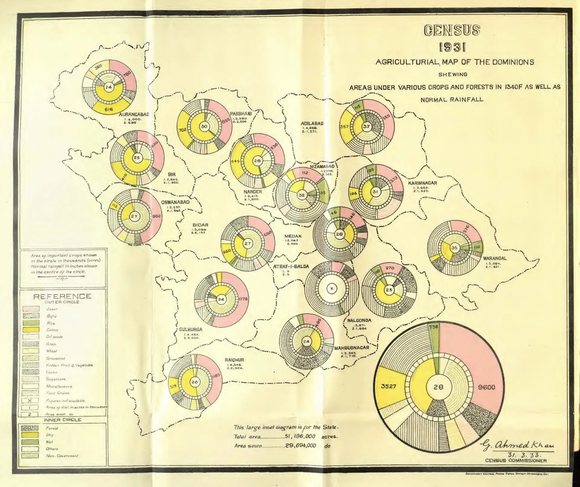
"Census 1931 Agricultural Map of the Dominions" (crops, forests and rainfall) (Census of India 1931, Hyderabad, folding map, PDF p. 35)
- Type
- Map
- Creator
- Gulam Ahmad Khan (Census of India 1931, H.E.H. the Nizam's Dominions)
- Date
- 1933
- Licence
- Public domain
- From
- Khan, Gulam Ahmad, Census of India 1931 vol.23 H.E.H. the Nizamʼs dominions (Hyderabad State); pt.1- Report (opens in a new tab), 1933, folding map, PDF p. 35
- Original
- archive.org (opens in a new tab)
- Appears in
- Mughals, Asaf Jahis & the British, Trade & economy