Trade & economy
Ports such as Motupalli and Machilipatnam, Golconda diamonds, tanks and farming, merchant guilds.
For most of its history, the Telugu country lived from the land. Rice grew in the deltas of the Krishna and the Godavari.12 On the dry uplands of Telangana and Rayalaseema, farming depended on tanks, reservoirs made by damming streams.12
Two other things made the region known abroad.345 One was a long coast with ports that traded across the Bay of Bengal and beyond. The other was goods that the rest of the world wanted, above all fine cotton cloth and diamonds.345
About the sources. The evidence comes in layers. For the early centuries there are a Greek sailing guide, Buddhist donation records and coin finds. For the Kakatiya period there are inscriptions. For the Golconda kingdom there are the reports of European merchants and a French jeweller. From about 1800 there are the statistics of British and Hyderabad officials. Each kind of writer saw what mattered to him: the merchants saw the coast, the jeweller the mines, and the officials revenue and exports. The page notes this where it matters.
The early coast and Rome
The Periplus of the Erythraean Sea is a guide written by a Greek-speaking merchant in the first century CE.3 It describes a region called Masalia “stretching a great way along the coast before the inland country”, where “a great quantity of muslins is made”.3
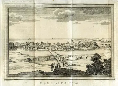
W. H. Schoff, its translator, identified Masalia with Ptolemy’s Maisolia, and with the later Machilipatnam (then Masulipatam).6 He thought it was then “the greatest market of the Andhra kingdom”.6 Robert Sewell summed up the classical writers. He noted that large numbers of Roman coins had been found in South India.7 He quoted Pliny’s complaint that India drained the Roman empire of 550 million sesterces a year.7
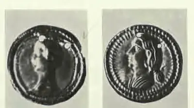
Some of that gold reached the Telugu coast. In 1786 or 1787 (the sources differ by a year), a farmer near Nellore found a small pot of Roman gold coins under the remains of a Hindu shrine.89 Most were of the emperors Trajan and Hadrian and of the empress Faustina. Many were melted down before about thirty were recovered.89 Gold coins of Hadrian were found again at Tangutur in 1903.8
A. H. Longhurst, who excavated Nagarjunakonda, saw Roman influence in some of its sculptures.10 This sea trade had brought “vast quantities of Roman gold” into South India.11 Longhurst suggested that its decline was one reason why the Buddhist centres of the lower Krishna declined.1011
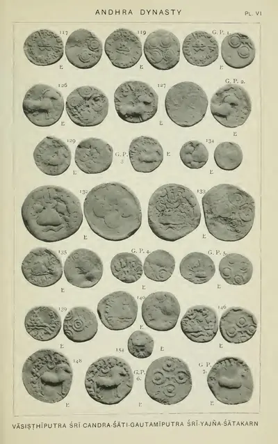
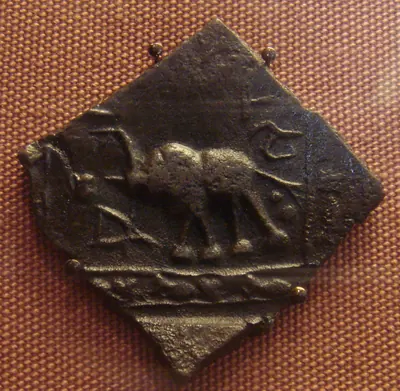
Local trade has left its own traces. Among the lead coins of the Andhra kings found at Gudivada was a type showing a two-masted ship.12 The donors named in the inscriptions of the Amaravati stupa (relic mound) include merchants and their families:131415
- the wife of a merchant named Nagatisa, giving with her sons, among them the goldsmith Budhi13
- a dealer called Kuta14
- Siridata, a dealer in perfumes and son of a merchant15
One slab was given by a donor described as “the Tamil Kanha”, with his brother and sister.16 At Bhattiprolu, one of the relic caskets lists the members of a negama. Georg Bühler translated this word as a guild or town corporation.17
The library has little on trade under the Ikshvakus, Vishnukundins and Eastern Chalukyas. This page passes over those centuries rather than guess.
Kakatiya markets and guilds
The Kakatiya inscriptions are much richer. P. V. Parabrahma Sastry studied them closely.18 He describes a countryside organised around the sthala, a group of villages with its own officers for accounts and tolls.18 Each had a weekly fair, the pemta or santa.1819
An inscription of 1310 at Koccherlakota shows how such a fair worked.1819 Traders rented thatched sheds by the week. They paid again to bring goods into the market yard, and paid a registration fee on everything they sold.1819 Sales taxes were farmed out (rented out) to toll-collectors. Even hawkers who carried goods in head-baskets paid a toll.19
A long inscription of Ganapatideva in Warangal Fort, dated about 1228, lays out the capital’s market.2021 It names groups of merchants and the goods each dealt in: cloth, indigo, areca nuts, betel leaves, vegetables and fruit, grain and oil, salt, metals, perfumes, pearls and beads, and yarn.2021
Parabrahma Sastry identifies this market, called Mathiya, with Mattewada.2223 Mattewada is still the business heart of Warangal.2223 He lists more than twenty other trade centres of the period.2223 They run from Panugal and Jadcherla in Telangana to Tripurantakam, Velpuru, Ghantasala and Nellore on the coastal side.23
Trade ran through guilds. Inscriptions name several kinds of merchants:2425
- the nakaramu (town merchants)
- the svadesi and paradesi (local and visiting merchants)
- the ubhaya-nanadesi, a body of travelling traders2425
One guild of 1269 held a licence to trade in certain goods in certain districts.2425 Weavers, oil-pressers, smiths and potters formed craft guilds of their own. They sold at the nearest fair.25
In 1282, members of the great Ayyavole guild came to Tripurantakam on guild business.26 Among them were men with reddi, nayudu and setti names. Parabrahma Sastry reads their visit as buying a trading licence.26 Goods moved on carts, asses, horses and pack-oxen.2728 An inscription of 1245 at Tripurantakam excuses the tax on 300 hired pack-oxen belonging to the temple.2728
Most retail trade, and much wholesale trade, was in the hands of the Komati merchants, also called settis.2930 Parabrahma Sastry notes that the Sumati Satakam calls the Komati the life of a town.2930 Kings and chiefs had their own royal settis.2930
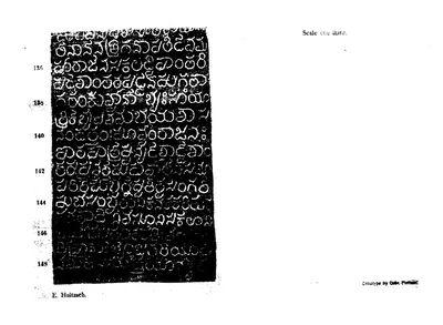
The coast gave the Kakatiyas their link to the sea. In 1244–45 Ganapatideva set up an edict at Motupalli.31 It promised sea traders that wrecked cargoes would no longer be seized.31 It fixed customs at one part in thirty, with special rates for sandal, camphor, pearls, ivory, metals, silks, pepper and areca nuts.31
E. Hultzsch, who edited the edict, concluded that Motupalli was the kingdom’s chief port.32 Parabrahma Sastry argued, against K. A. Nilakanta Sastri, that this trade was not left only to foreigners.33 See the Motupalli inscription.
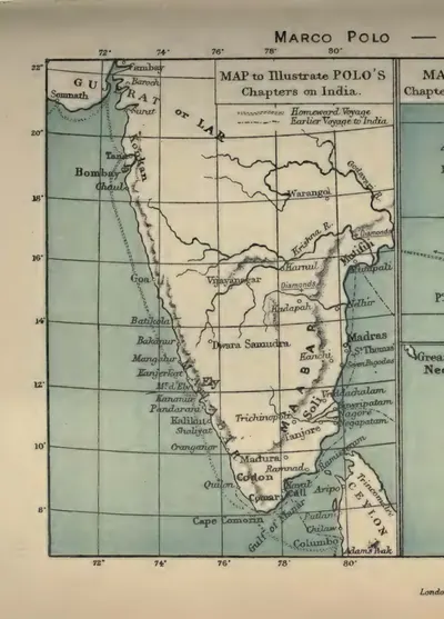
Marco Polo described a kingdom he called “Mutfili”.34 His editor Henry Yule identified it as the Kakatiya kingdom, named after Motupalli.34 Polo praised its cloth, “the best and most delicate buckrams”, which “look like tissue of spider’s web”.535 He also repeated an old legend about diamonds.535 In it, people threw meat down into deep valleys, and eagles carried the diamonds up with the meat.35
Tanks and new villages
In Telangana, the farming that fed all this trade depended on tanks. The 1909 Imperial Gazetteer explained why.1 The sandy soils of Telingana could not hold water. So dams were built across valleys and gorges to store the rain.1 Parabrahma Sastry credits Kakatiya kings, queens and their chiefs with founding many new villages on cleared forest land. Each often had its own tank.36
Two great lakes of the period were still watering thousands of acres in the 1970s.37 The Pakhal tank was built in Ganapatideva’s time by Jagadalu Mummadi, son of the minister Bayyana Nayaka.37 The Ramappa lake was made in 1213 by the general Recherla Rudra.37 Inscriptions counted building a tank among the seven good works, the sapta-santanas.38
In 1909 Pakhal was still the largest man-made lake in Hyderabad State, with a dam over 2,000 yards long.39 By then the state had 370 large tanks and over 11,000 smaller ones (kuntas).2 Former rulers and ministers had built most of the large ones.2 See also the Kakatiya period.
Reddis, Golconda and the European companies
After the fall of Warangal, at least one coastal ruler renewed the promise to sea traders. In 1358 Somaya was minister of Anavota, the Reddi ruler of Kondavidu.4041 Somaya issued a proclamation at Motupalli giving assurances to merchants who came to the port. It excused some duties and promised to charge the rest at the old rates.4041
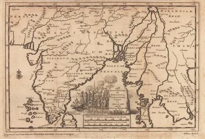
Under the Qutb Shahi kings of Golconda, Dutch and English merchants wrote the fullest accounts. W. H. Moreland edited them.42 He describes a kingdom that lived mainly by farming. It grew rice, millets and pulses.42 Indigo and chay-root were grown as dyes for the weavers, and tobacco, then a new crop, for export.42
According to Moreland, the chief exports were cotton cloth and high-quality iron and steel.42 The iron and steel were made inland and shipped from Machilipatnam.42 Diamond mining at Kollur became important during the period.42 Indigo went to Persia and cotton yarn to Burma.43 Spices, metals, camphor, porcelain and silk came in, and the balance was paid in gold and silver.43
The weavers worked in their own houses.44 But they depended on advance payments from buyers, who could dictate what they made.44 Fine muslins for export were known by the name of Warangal.44
The English merchant William Methwold describes the Komati merchants.45 Some travelled into the countryside to collect calicoes from the weavers, and sold them in bulk in the ports. Others worked as money-changers.45 He saw local ships of up to 600 tons, well built of timber and iron.46 They sailed to Mocha, Achin in Sumatra, Arakan, Pegu and Tenasserim, and along the coast to Ceylon.46
The Dutch merchant Antony Schorer reports that Muslims, Portuguese and Hindus built ships on the river at Narasapur.47 Timber and iron were at hand there, and wages were low.47 Tavernier mentions ships carrying goods and pilgrims from Machilipatnam to Mocha, on the way to Mecca.48 The Golconda chronicle boasted that under Ibrahim Qutb Shah, “Tulingana, like Egypt, became the mart of the whole world”.49
The European companies settled along this coast. The English ship Globe opened trade at Machilipatnam in 1611.50 The Dutch opened a factory (trading post) at Palakollu in the mid-17th century.515253 It had a branch at Narasapur with an iron foundry.515253 The English took the northern suburb of Narasapur in 1677. Their factory at Madapollam gave its name to a kind of cotton cloth.515253
The Dutch held Bheemunipatnam (then Bimlipatam) until 1825.54 See Machilipatnam.
Golconda diamonds
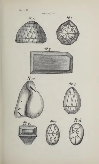
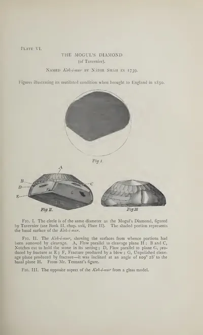
The diamond mines made Golconda famous in Europe. The French jeweller Jean-Baptiste Tavernier visited them in the 1640s.55 Kollur on the Krishna lay seven days east of Golconda.555657 He says the great diamond that Mir Jumla presented to the Mughal emperor was found there.555657
On his first visit, some 60,000 men, women and children worked at Kollur.555657 The men dug, and the women and children carried earth.555657 His editor, Valentine Ball, corrected two details. The stone was given to Shah Jahan, not Aurangzeb.56 It weighed 900 ratis (an Indian unit of weight), not carats.56 Another mine, at Ramallakota south of Kurnool, then lay in the territory of the king of Bijapur.58
Tavernier describes how the business worked. Merchants rented a patch of ground and hired fifty or a hundred miners.59 They paid the king a daily fee, and two per cent on all purchases.59 The miners themselves earned only about three pagodas (gold coins) a year. Watchmen were posted to stop them swallowing stones.59
At the mines he watched the merchants’ sons, aged ten to sixteen, sitting under a tree each morning.60 They bought and graded stones, and then divided the profit among themselves.60 Tavernier was a gem dealer writing for buyers, and his figures should be read with that in mind. Ball also warned that his dates for the discovery of the mines were of “no value”.61
Company rule, the Nizam’s state and the railway
The weavers of the coast lost their export markets in the early 19th century.62 The Godavari gazetteer records that the East India Company used to buy some seven lakhs of rupees’ worth of local cloth a year, and in some years over ten.62 When that trade ended, the district’s cloth exports fell sharply.62 Their value was over fourteen lakhs in 1825–26, but under two lakhs in 1842–43.62
The Kistna manual says Machilipatnam had once sent chintzes and coloured cloth worth fifty lakhs a year to the Persian Gulf alone.63 By 1883 the trade was worth about half a lakh.63 The old shipyards declined too.64 At Tallarevu on the Coringa river, a hundred ships were said to have been built each year two generations before 1907. But none were built in 1905.64
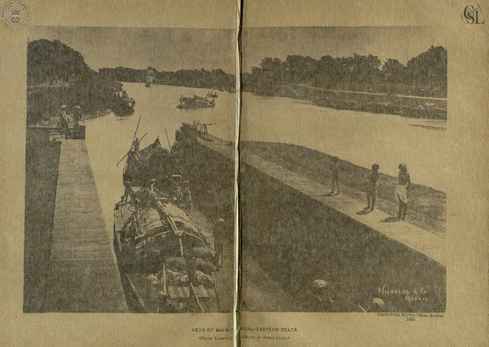
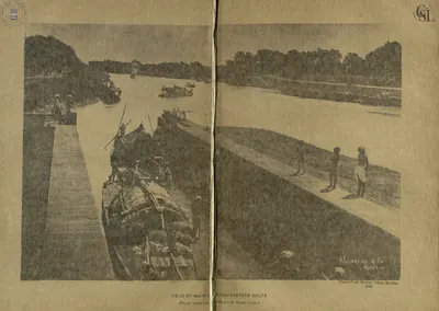
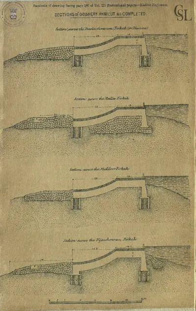
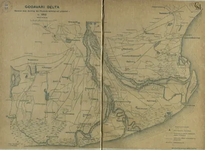
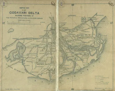
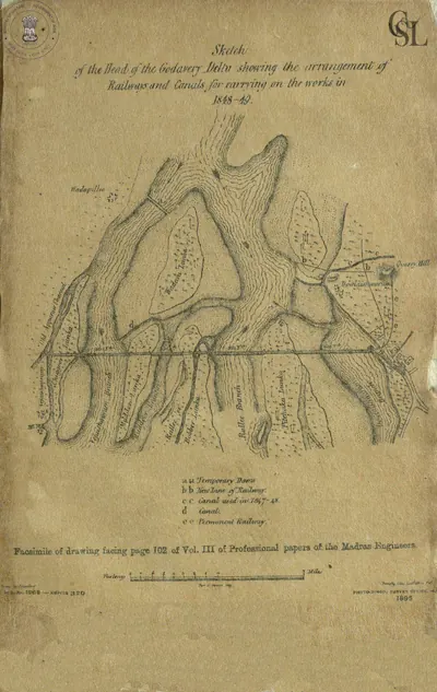
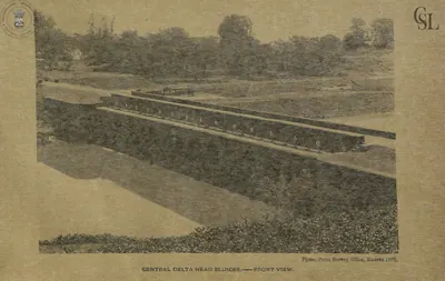
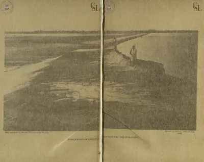
Irrigation changed the deltas. Arthur Cotton’s dam across the Godavari was begun in 1847.65 It watered 662,000 acres by 1903–04.65 The irrigation engineer G. T. Walch printed figures on the district’s exports.66 They show exports rising from about nine lakhs of rupees in the year before the dam to nearly forty-eight lakhs in 1863–64.66 These are an official account of an official project.66
Credit stayed in the hands of local lenders.67 Under the jatti system, a cultivator borrowed against his crop.67 He agreed to sell the crop to the lender below the market price.67 In Visakhapatnam (then Vizagapatam) district, the ports of Bheemunipatnam and Visakhapatnam exported gingelly, jaggery, hides and manganese ore.6869 The ore was mined from 1892 and shipped to Europe and America.6869
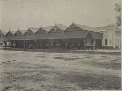
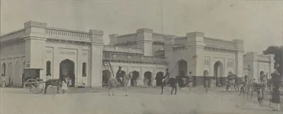
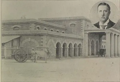
In Hyderabad State, all the broad-gauge railways were built before 1891.70 Among them was the Nizam’s Guaranteed State Railway.70 It ran east from Hyderabad to Warangal and on to Vijayawada (then Bezwada), with a branch to the Singareni coalfield.70 The coalfield was worked from 1886. Its output rose from about 3,000 tons in 1887 to over 400,000 tons by 1901.71 The first spinning and weaving mill near Hyderabad opened in 1877.72
The state exported grain, cotton, oilseeds, indigo, hides and coal.73 It imported mill cloth, yarn, salt, sugar and metals.73 The gazetteer names the Komatis as the trading caste of Telingana, with Marwari traders in all the large villages.73 The village bania was grain-dealer, cloth-seller and banker, and lent money to the cultivator.73 The cast-steel cakes of Nirmal, Jagtial and Warangal had once been exported to distant parts.74
After 1947
The library’s papers for the years after independence deal with the economy mainly as part of an argument about the shape of the new states. In 1951, for example, a shortage of yarn drove about 2,000 weavers from Venkatagiri to Nellore.75
The States Reorganisation Commission of 1955 set out both sides on joining Telangana to Andhra.7677 For Vishalandhra, it cited unified control of the Krishna and Godavari projects and the trade links between the two regions.7677 Against it, it reported the fears of some Telangana leaders.7677
These leaders feared that union would exchange Telangana’s settled revenues for the money troubles of the Andhra State.7677 Telangana had a much higher land revenue and excise, of about five crores a year.7677 They also feared that Telangana would lose its own rights over the Krishna and Godavari waters planned for its Nandikonda and Kushtapuram projects.7677 What followed, including the 1969 inquiry into Telangana’s surplus revenues, is told on the page Andhra State & Andhra Pradesh. The library does not yet hold sources on the farming, industry or ports of the state after 1956.
Footnotes
-
Imperial Gazetteer of India: Hyderabad State (1909), pp. 33–34 (archive.org (opens in a new tab)). ↩ ↩2 ↩3 ↩4
-
Imperial Gazetteer: Hyderabad (1909), p. 34 (archive.org (opens in a new tab)). ↩ ↩2 ↩3 ↩4
-
Wilfred H. Schoff (tr.), The Periplus of the Erythraean Sea (1912), § 62, p. 47 (archive.org (opens in a new tab)). ↩ ↩2 ↩3 ↩4
-
Jean-Baptiste Tavernier, tr. V. Ball, Travels in India, Vol. II (1889), pp. 72–74 (archive.org (opens in a new tab)). ↩ ↩2
-
Henry Yule and Henri Cordier, The Book of Ser Marco Polo, Vol. II (1903), p. 361 (archive.org (opens in a new tab)). ↩ ↩2 ↩3 ↩4
-
Schoff, Periplus (1912), p. 252 (archive.org (opens in a new tab)). ↩ ↩2
-
Robert Sewell, The Historical Inscriptions of Southern India (1932), p. 9 (archive.org (opens in a new tab)). ↩ ↩2
-
Imperial Gazetteer of India: Madras, Vol. I (1908), p. 345 (archive.org (opens in a new tab)). ↩ ↩2 ↩3
-
John A. C. Boswell, A Manual of the Nellore District (1873), pp. 688–689, citing the Madras Road Book of 1839 (archive.org (opens in a new tab)). ↩ ↩2
-
A. H. Longhurst, The Buddhist Antiquities of Nagarjunakonda (1938), p. 15 (archive.org (opens in a new tab)). ↩ ↩2
-
Longhurst, Nagarjunakonda (1938), p. 6 (archive.org (opens in a new tab)). ↩ ↩2
-
Alexander Rea, South Indian Buddhist Antiquities (1894), p. 20 (archive.org (opens in a new tab)). ↩
-
James Burgess, The Buddhist Stupas of Amaravati and Jaggayyapeta (1887), p. 82, inscription No. 28 (archive.org (opens in a new tab)). ↩ ↩2
-
Burgess, Amaravati and Jaggayyapeta (1887), p. 86, inscription No. 47 (archive.org (opens in a new tab)). ↩ ↩2
-
Burgess, Amaravati and Jaggayyapeta (1887), p. 105 (archive.org (opens in a new tab)). ↩ ↩2
-
Burgess, Amaravati and Jaggayyapeta (1887), p. 104, inscription No. 41 (archive.org (opens in a new tab)). ↩
-
G. Bühler, “The Bhattiprolu Inscriptions”, Epigraphia Indica II (1894), pp. 327–328 (archive.org (opens in a new tab)). ↩
-
P. V. Parabrahma Sastry, The Kakatiyas of Warangal (1978), p. 248. ↩ ↩2 ↩3 ↩4 ↩5
-
Parabrahma Sastry, The Kakatiyas of Warangal (1978), pp. 248–249. ↩ ↩2 ↩3 ↩4
-
Parabrahma Sastry, The Kakatiyas of Warangal (1978), pp. 242–243. ↩ ↩2
-
Parabrahma Sastry, The Kakatiyas of Warangal (1978), p. 247. ↩ ↩2
-
Parabrahma Sastry, The Kakatiyas of Warangal (1978), p. 252. ↩ ↩2 ↩3
-
Parabrahma Sastry, The Kakatiyas of Warangal (1978), p. 253. ↩ ↩2 ↩3 ↩4
-
Parabrahma Sastry, The Kakatiyas of Warangal (1978), p. 242. ↩ ↩2 ↩3
-
Parabrahma Sastry, The Kakatiyas of Warangal (1978), p. 243. ↩ ↩2 ↩3 ↩4
-
Parabrahma Sastry, The Kakatiyas of Warangal (1978), pp. 245–246. ↩ ↩2
-
Parabrahma Sastry, The Kakatiyas of Warangal (1978), p. 250. ↩ ↩2
-
Parabrahma Sastry, The Kakatiyas of Warangal (1978), pp. 251–252. ↩ ↩2
-
Parabrahma Sastry, The Kakatiyas of Warangal (1978), p. 244. ↩ ↩2 ↩3
-
Parabrahma Sastry, The Kakatiyas of Warangal (1978), pp. 244–245. ↩ ↩2 ↩3
-
E. Hultzsch, “Motupalli Pillar-Inscription of Ganapatideva”, Epigraphia Indica XII (1914), pp. 196–197 (archive.org (opens in a new tab)). ↩ ↩2 ↩3
-
Hultzsch, “Motupalli Pillar-Inscription” (1914), p. 190 (archive.org (opens in a new tab)). ↩
-
Parabrahma Sastry, The Kakatiyas of Warangal (1978), p. 256. ↩
-
Henry Yule and Henri Cordier, The Book of Ser Marco Polo, Vol. II (1903), p. 362, note 1 (archive.org (opens in a new tab)). ↩ ↩2
-
Yule and Cordier, Marco Polo, Vol. II (1903), pp. 360–361 (archive.org (opens in a new tab)). ↩ ↩2 ↩3
-
Parabrahma Sastry, The Kakatiyas of Warangal (1978), pp. 198–199. ↩
-
Parabrahma Sastry, The Kakatiyas of Warangal (1978), pp. 204–205. ↩ ↩2 ↩3
-
P. Sreenivasachar, A Corpus of Inscriptions in the Telingana Districts, Part I (1942), p. 30 (archive.org (opens in a new tab)); Parabrahma Sastry, The Kakatiyas of Warangal (1978), p. 203. ↩
-
Imperial Gazetteer: Hyderabad (1909), pp. 90–91 (archive.org (opens in a new tab)). ↩
-
J. Ramayya Pantulu (ed.), South Indian Inscriptions, Vol. X (1948), p. 304, No. 556 (archive.org (opens in a new tab)). ↩ ↩2
-
Sewell, Historical Inscriptions (1932), pp. 195, 199 (archive.org (opens in a new tab)). ↩ ↩2
-
W. H. Moreland (ed.), Relations of Golconda in the Early Seventeenth Century (1931), p. xviii (archive.org (opens in a new tab)). ↩ ↩2 ↩3 ↩4 ↩5 ↩6
-
Moreland, Relations of Golconda (1931), pp. xix–xx (archive.org (opens in a new tab)). ↩ ↩2
-
Moreland, Relations of Golconda (1931), pp. xviii–xix (archive.org (opens in a new tab)). ↩ ↩2 ↩3
-
Methwold’s Relation, in Moreland, Relations of Golconda (1931), p. 16 (archive.org (opens in a new tab)). ↩ ↩2
-
Methwold’s Relation, in Moreland, Relations of Golconda (1931), pp. 36–37 (archive.org (opens in a new tab)). ↩ ↩2
-
Schorer’s Relation, in Moreland, Relations of Golconda (1931), p. 63 (archive.org (opens in a new tab)). ↩ ↩2
-
Tavernier, Travels in India, Vol. I (1889), p. 162 (archive.org (opens in a new tab)). ↩
-
Golconda chronicle, in Muhammad Qasim Ferishta, tr. John Briggs, History of the Rise of the Mahomedan Power in India, Vol. III (1829), p. 446 (archive.org (opens in a new tab)). ↩
-
Imperial Gazetteer: Madras, Vol. I (1908), pp. 324–325 (archive.org (opens in a new tab)). ↩
-
Imperial Gazetteer: Madras, Vol. I (1908), p. 327 (archive.org (opens in a new tab)). ↩ ↩2 ↩3
-
Imperial Gazetteer: Madras, Vol. I (1908), p. 326 (archive.org (opens in a new tab)). ↩ ↩2 ↩3
-
Imperial Gazetteer: Madras, Vol. I (1908), p. 323 (archive.org (opens in a new tab)). ↩ ↩2 ↩3
-
Imperial Gazetteer: Madras, Vol. I (1908), p. 261 (archive.org (opens in a new tab)). ↩
-
Tavernier, Travels in India, Vol. II (1889), p. 72 (archive.org (opens in a new tab)). ↩ ↩2 ↩3 ↩4 ↩5
-
Tavernier, Travels in India, Vol. II (1889), p. 74, with Ball’s notes (archive.org (opens in a new tab)). ↩ ↩2 ↩3 ↩4 ↩5 ↩6
-
Tavernier, Travels in India, Vol. II (1889), p. 75 (archive.org (opens in a new tab)). ↩ ↩2 ↩3 ↩4
-
Tavernier, Travels in India, Vol. II (1889), p. 55 (archive.org (opens in a new tab)). ↩
-
Tavernier, Travels in India, Vol. II (1889), pp. 59–60 (archive.org (opens in a new tab)). ↩ ↩2 ↩3
-
Tavernier, Travels in India, Vol. II (1889), pp. 61–62 (archive.org (opens in a new tab)). ↩ ↩2
-
Ball’s note in Tavernier, Travels in India, Vol. II (1889), p. 72 (archive.org (opens in a new tab)). ↩
-
F. R. Hemingway, Madras District Gazetteers: Godavari, Vol. I (1907), p. 103 (archive.org (opens in a new tab)). ↩ ↩2 ↩3 ↩4
-
Gordon Mackenzie, A Manual of the Kistna District (1883), pp. 118, 368 (archive.org (opens in a new tab)). ↩ ↩2
-
Hemingway, Godavari (1907), p. 110 (archive.org (opens in a new tab)). ↩ ↩2
-
Imperial Gazetteer: Madras, Vol. I (1908), p. 165 (archive.org (opens in a new tab)). ↩ ↩2
-
George T. Walch, The Engineering Works of the Godavari Delta (1896), appendix, p. v (archive.org (opens in a new tab)). ↩ ↩2 ↩3
-
Hemingway, Godavari (1907), p. 112 (archive.org (opens in a new tab)). ↩ ↩2 ↩3
-
W. Francis, Madras District Gazetteers: Vizagapatam, Vol. I (1907), p. 129 (archive.org (opens in a new tab)). ↩ ↩2
-
Francis, Vizagapatam (1907), pp. 125–126 (archive.org (opens in a new tab)). ↩ ↩2
-
Imperial Gazetteer: Hyderabad (1909), p. 45 (archive.org (opens in a new tab)). ↩ ↩2 ↩3
-
Imperial Gazetteer: Hyderabad (1909), p. 39 (archive.org (opens in a new tab)). ↩
-
Imperial Gazetteer: Hyderabad (1909), p. 42 (archive.org (opens in a new tab)). ↩
-
Imperial Gazetteer: Hyderabad (1909), p. 43 (archive.org (opens in a new tab)). ↩ ↩2 ↩3 ↩4
-
Imperial Gazetteer: Hyderabad (1909), p. 40 (archive.org (opens in a new tab)). ↩
-
Census of India, 1951, Vol. III: Madras and Coorg, Part I: Report (1953), p. 19 (archive.org (opens in a new tab)). ↩
-
Report of the States Reorganisation Commission (1955), p. 104 (archive.org (opens in a new tab)). ↩ ↩2 ↩3 ↩4 ↩5 ↩6
-
Report of the States Reorganisation Commission (1955), pp. 105–106 (archive.org (opens in a new tab)). ↩ ↩2 ↩3 ↩4 ↩5 ↩6
Photos
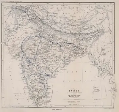 "A Map of India showing Tavernier's routes and the sites of the diamond mines mentioned by him" (Tavernier/Ball 1889, vol. I, folding map, PDF p. 499)Map · 1889
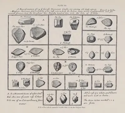 "A Representation of 20 of the fairest Diamonds chosen out among all those which Monsieur Tavernier sold to the King" (Pl. III) (Tavernier/Ball 1889, vol. II, Pl. III (PDF p. 155))Drawing · 1889
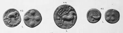 "Andhra Coins": lead coins from the Krishna district with an elephant, a horse and a two-masted ship (Elliot 1886, Pl. II, Nos. 43-45)Coin · 1886
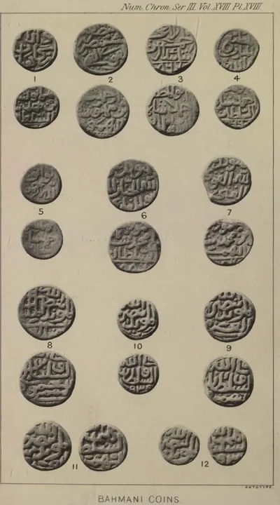 "Bahmani Coins": copper of the later Bahmani kings (O. Codrington, Numismatic Chronicle, 3rd series, Vol. XVIII (1898), Plate XVIII)Coin · 1898
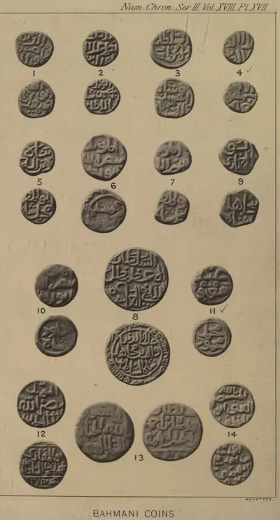 "Bahmani Coins": copper, silver and gold of the first ten Bahmani kings (O. Codrington, Numismatic Chronicle, 3rd series, Vol. XVIII (1898), Plate XVII)Coin · 1898
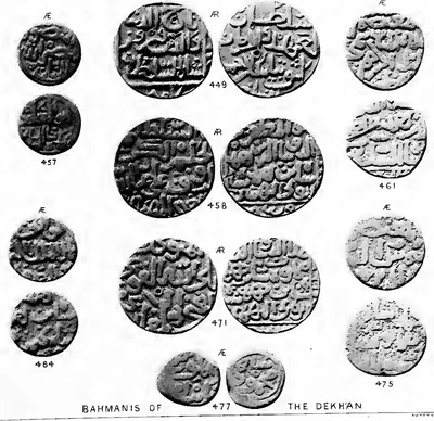 "Bahmanis of the Dekhan": coins of the Bahmani kings in the British Museum (Stanley Lane-Poole, The Coins of the Muhammadan States of India (1885), Plate XI, lower part)Coin · 1885
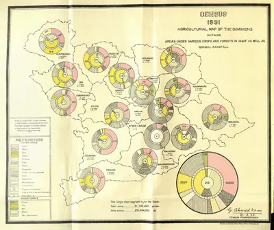 "Census 1931 Agricultural Map of the Dominions" (crops, forests and rainfall) (Census of India 1931, Hyderabad, folding map, PDF p. 35)Map · 1933
 "Coins of Chalukya-Chandra or Saktivarman." A, B and C, full size (Indian Antiquary XIX, plate facing p. 78 (PDF p. 85))Coin · 1890
 "Coins of Rajaraja II." D, E and F, full size (Indian Antiquary XIX, plate facing p. 78 (PDF p. 85))Coin · 1890
 "De Koninkryken van Golconda, Tanassari, Pegu en Aracam, aan de Golf van Bengale", map published by Pieter van der Aa, Leiden, 1706Map · 1706
 "Diamonds" (Pl. II): figures of large diamonds (Tavernier/Ball 1889, vol. II, Pl. II (PDF p. 151))Drawing · 1889
 "Head of Main Canal - Eastern Delta (from lower chamber of head lock)" (Walch 1896, PDF p. 145)Historic photograph · 1896
Show all (85)
 "IV. Bahmanis of Kulbarga": coins of the Bahmani kings in the Indian Museum, Calcutta (H. Nelson Wright, Catalogue of the Coins in the Indian Museum, Vol. II (1907), Plate VIII, upper part)Coin · 1907
 "Known as the Kuruki pagoda, struck by the Nawabs of Arcot": gold pagoda with three standing figures (Elliot 1886, Pl. IV, No. 180)Coin · 1886
 "Kurumbar or Pallava Coins of the Coromandel Coast": copper coins with a bull (Elliot 1886, Pl. I, Nos. 31-33)Coin · 1886
 "Kurumbar or Pallava Coins of the Coromandel Coast": copper coins with a bull, crab, fish and ship (Elliot 1886, Pl. I, Nos. 34-38)Coin · 1886
 "Map to illustrate Polo's chapters on India" (Marco Polo, Book III) (Yule & Cordier 1903, to face p. 312 (PDF p. 363, lower part))Map · 1903
 "Masulipatam": engraved view of the town from the landward side, after Bellin, from Prévost's Histoire générale des voyages (1752), when the French held it (1750–59)Drawing · 1752
 "Mints of Haidar Ali and Tipu Sultan": map with the boundaries of Mysore at the height of Tipu's power, after 1792 and after 1799 (Henderson 1921, frontispiece)Map · 1921
 "Pallava Coins": alloy coin of the maned-lion and vase type (Elliot 1886, Pl. II, No. 50)Coin · 1886
 "Pallava Coins": alloy coin with a maned lion and, on the reverse, a vase on a stand between two lamp-stands (Elliot 1886, Pl. II, No. 49)Coin · 1886
 "Pallava Coins": small gold coins with a lion (Elliot 1886, Pl. II, Nos. 52-54)Coin · 1886
 "Struck by Safdar 'Ali, of the family of the Arcot Nawab": gold pagoda with the letter ain on the reverse (Elliot 1886, Pl. IV, No. 181)Coin · 1886
 "The Mogul's Diamond (of Tavernier), named Koh-i-nur by Nadir Shah in 1739" (Pl. VI) (Tavernier/Ball 1889, vol. II, Pl. VI (PDF p. 477))Drawing · 1889
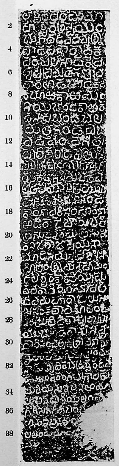 "Warangal inscription at Khan Saheb Gardens", face I (Sreenivasachar, Corpus of Inscriptions in the Telingana Districts II, Plate 19 (PDF p. 258))Inscription rubbing · 1940
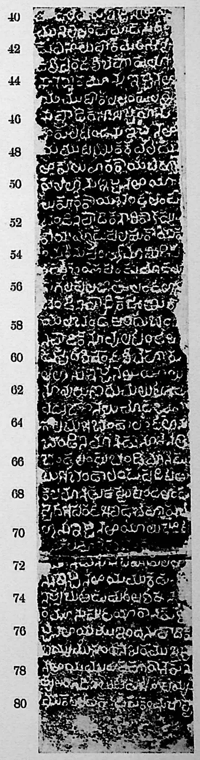 "Warangal inscription at Khan Saheb Gardens", face II (Sreenivasachar, Corpus of Inscriptions in the Telingana Districts II, Plate 19 (PDF p. 258))Inscription rubbing · 1940
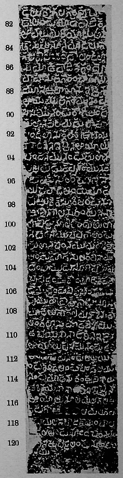 "Warangal inscription at Khan Saheb Gardens", face III (Sreenivasachar, Corpus of Inscriptions in the Telingana Districts II, Plate 19 (PDF p. 258))Inscription rubbing · 1940
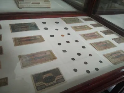 Coins during Nizam EraCoin · 2021
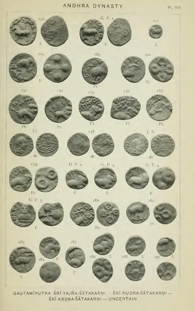 Coins of "Gautamiputra Sri-Yajna-Satakarni - Sri Rudra-Satakarni - Sri-Krsna-Satakarni - uncertain" (Rapson 1908, Pl. VII)Coin · 1908
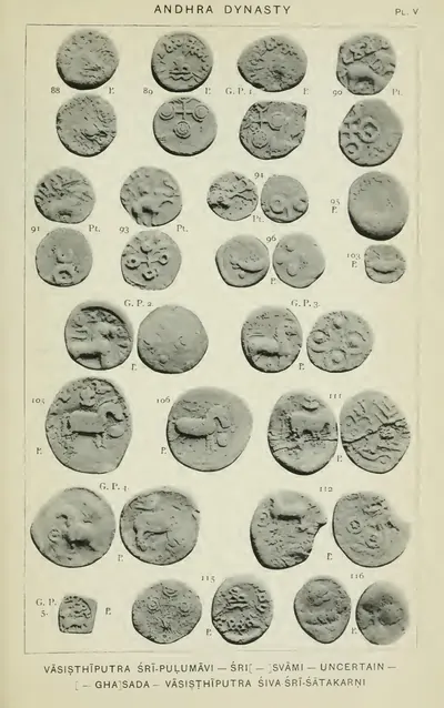 Coins of "Vasisthiputra Sri-Pulumavi - Sri[ ]svami - uncertain - [ ]ghasada - Vasisthiputra Siva Sri-Satakarni", including two-masted ship coins (Rapson 1908, Pl. V)Coin · 1908
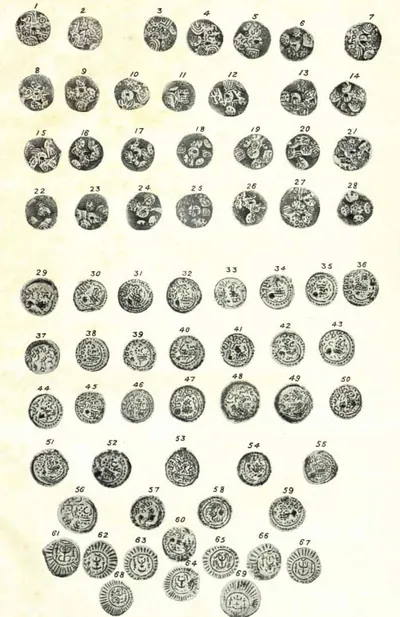 Coins of Western and Eastern Chalukyas (Hyderabad Arch. Report 1925-26, Pl. XVIII); P. V. Parabrahma Sastry (1978, pp. 259–262) assigns the boar-marked coins to Ganapatideva, Rudramadevi and PrataparudraCoin · 1928
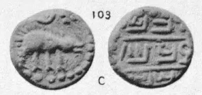 Copper coin No. 103: boar facing right, sword and sun above; legend Chalam Triramala taka (Elliot, Coins of Southern India, 1886, Plate III, No. 103 (PDF p. 191 of scan 00074712bsb))Coin · 1886
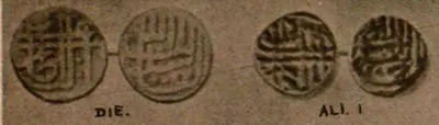 Copper coins of Ali Adil Shah I with the reconstructed die (Cousens 1916, pl. CXV, row 1)Coin · 1916
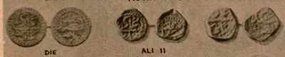 Copper coins of Ali Adil Shah II with the reconstructed die (Cousens 1916, pl. CXV, row 8)Coin · 1916
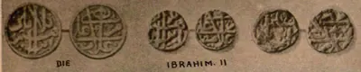 Copper coins of Ibrahim Adil Shah II with the reconstructed die (Cousens 1916, pl. CXV, row 2)Coin · 1916
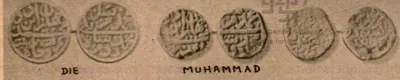 Copper coins of Muhammad Adil Shah with the reconstructed die (Cousens 1916, pl. CXV, row 5)Coin · 1916
 Copper coins of Sikandar Adil Shah with the reconstructed die (Cousens 1916, pl. CXV, row 9)Coin · 1916
 Copper paisa of Tipu Sultan from the Faiz Hisar (Gooty) mint, dated 1222 (Henderson 1921, pl. VI, No. 297)Coin · 1921
 Godavari anicut: "Sections of Godavery Annicut as completed" (facsimile from Professional Papers, Madras Engineers, vol. III) (Walch 1896, facsimile, PDF p. 45)Drawing · 1896
 Godavari delta: "Skeleton map showing the Channels existing and proposed in 1853" (Walch 1896, PDF p. 115)Map · 1896
 Godavari delta: "Sketch Map of the Godavari Delta showing positions of the principal irrigation & navigation works" (two halves joined) (Walch 1896, PDF pp. 17-18)Map · 1896
 Godavari delta: "Sketch of the Head of the Godavery Delta showing the arrangement of" railways and canals for carrying on the works in 1848-49 (Walch 1896, facsimile, PDF p. 58)Map · 1896
 Gold "new Muhammad Shahi" pagoda of Haidar Ali struck at Gooty, dated 1194 (Henderson 1921, pl. I, No. 3)Coin · 1921
 Gold coin attributed to Rama Raja, the "Gandikota pagoda": Vishnu standing under a canopy (V. A. Smith, Catalogue of the Coins in the Indian Museum, Vol. I, 1906, plate XXX, 31 (PDF p. 427))Coin · 1906
 Gold coin No. 100: Siva and Parvati seated; legend Sri Pratapa Sadasiva Raya (Elliot, Coins of Southern India, 1886, Plate III, No. 100 (PDF p. 191 of scan 00074712bsb))Coin · 1886
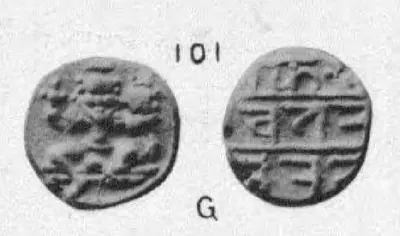 Gold coin No. 101: Siva and Parvati seated; legend possibly Sri Rama Triramala Raya (Elliot, Coins of Southern India, 1886, Plate III, No. 101 (PDF p. 191 of scan 00074712bsb))Coin · 1886
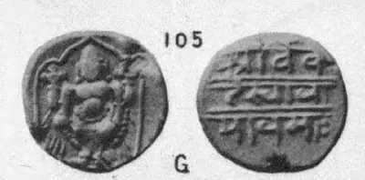 Gold coin No. 105: Vishnu; legend Sri Venkatesvaraya namah (Elliot, Coins of Southern India, 1886, Plate III, No. 105 (PDF p. 191 of scan 00074712bsb))Coin · 1886
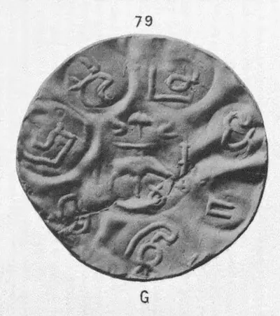 Gold coin No. 79, "South Indian Coins. Pl. III." (Elliot, Coins of Southern India, 1886, Plate III, No. 79 (PDF p. 191 of scan 00074712bsb))Coin · 1886
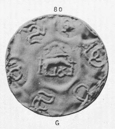 Gold coin No. 80, "South Indian Coins. Pl. III." (Elliot, Coins of Southern India, 1886, Plate III, No. 80 (PDF p. 191 of scan 00074712bsb))Coin · 1886
 Gold coin No. 96: Siva and Parvati seated; Nagari legend Sri Pratapa Harihara (Elliot, Coins of Southern India, 1886, Plate III, No. 96 (PDF p. 191 of scan 00074712bsb))Coin · 1886
 Gold coin No. 99: two-headed Gandabherunda bird holding elephants; legend Sri Pratapa Achyuta Raya (Elliot, Coins of Southern India, 1886, Plate III, No. 99 (PDF p. 191 of scan 00074712bsb))Coin · 1886
 Gold coin of Muhammad Shah III Bahmani struck at Muhammadabad (Bidar), AH 878 (1473-74), obverse and reverse (Wright, Coins in the Indian Museum, Vol. II (1907), Plate VIII, No. 34)Coin · 1907
 Gold fanam No. 85 from Rajamahendri, "South Indian Coins. Pl. III." (Elliot, Coins of Southern India, 1886, Plate III, No. 85 (PDF p. 191 of scan 00074712bsb))Coin · 1886
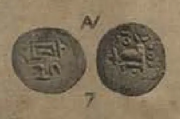 Gold fanam of Anantavarma Chodaganga, two faces (V. A. Smith, Catalogue of the Coins in the Indian Museum I, Plate XXX, No. 7)Coin · 1906
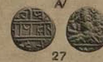 Gold half-pagoda of Krishnadeva Raya: god and goddess seated (V. A. Smith, Catalogue of the Coins in the Indian Museum, Vol. I, 1906, plate XXX, 27 (PDF p. 427))Coin · 1906
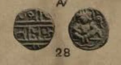 Gold half-pagoda of Krishnadeva Raya: seated Vishnu with shell (V. A. Smith, Catalogue of the Coins in the Indian Museum, Vol. I, 1906, plate XXX, 28 (PDF p. 427))Coin · 1906
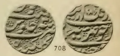 Gold mohur of Aurangzeb struck at Golkondah (Golconda), AH 1086, obverse and reverse (Lane-Poole, British Museum catalogue 1892, No. 708, pl. XVIII)Coin · 1892
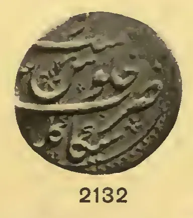 Gold mohur of Farrukhsiyar struck at Sikakul (Chicacole, Srikakulam) (Whitehead 1914, No. 2132, pl. XIII)Coin · 1914
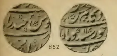 Gold mohur of the rebel prince Kam Bakhsh struck at Haidarabad (Hyderabad), AH 1120, obverse and reverse (Lane-Poole 1892, No. 852, pl. XXI)Coin · 1892
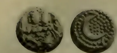 Gold pagoda of Haidar Ali, the "Bahaduri" pagoda: Siva and Parvati, and Haidar's initial (Henderson 1921, pl. I, No. 1)Coin · 1921
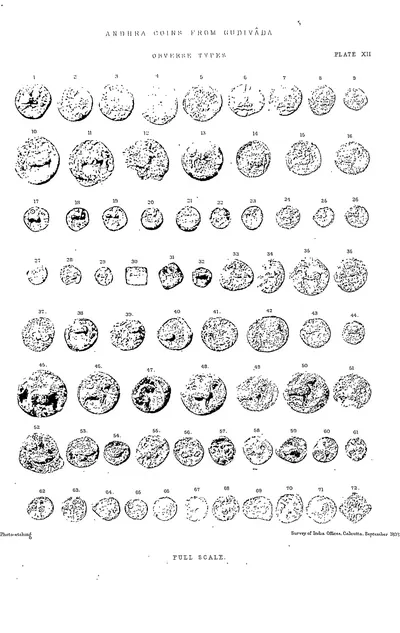 Gudivada: Andhra coins (obverse types) (Rea 1894, Pl. XII)Coin · 1894
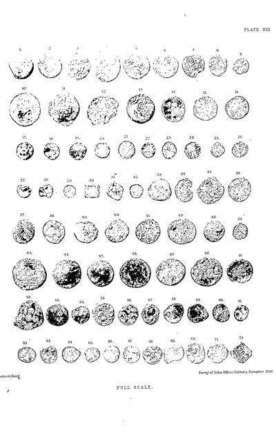 Gudivada: Andhra coins (reverse types) (Rea 1894, Pl. XIII)Coin · 1894
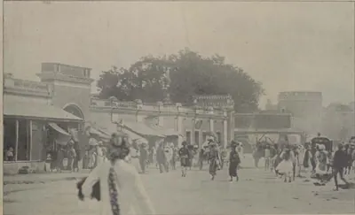 Hyderabad: "Entrance to Main Street, Hyderabad" (Campbell 1898, p. 161)Historic photograph · 1898
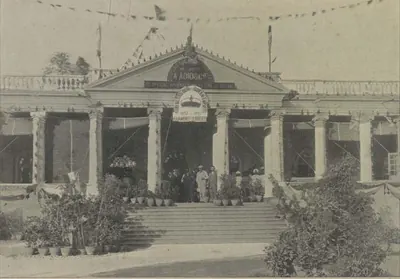 Hyderabad: "Establishment of Messrs. A. Abid & Co., Chudderghaut" (Campbell 1898, p. 515)Historic photograph · 1898
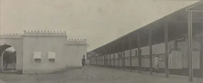 Hyderabad: "H. H. the Nizam's Private Railway Station" (Campbell 1898, p. 209)Historic photograph · 1898
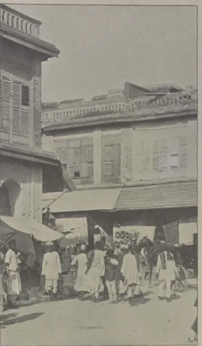 Hyderabad: "Street Scene" (Campbell 1898, p. 173)Historic photograph · 1898
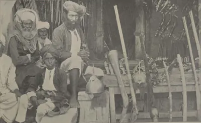 Hyderabad: "The Arms Bazaar, Hyderabad" (Campbell 1898, p. 173)Historic photograph · 1898
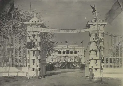 Hyderabad: "The Government Guest House, Chudderghaut" (Campbell 1898, p. 515)Historic photograph · 1898
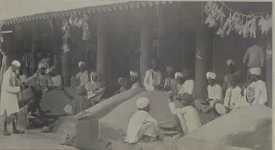 Hyderabad: "The Grain Market" (Campbell 1898, p. 161)Historic photograph · 1898
 Hyderabad: "The Hyderabad Railway Station" (Campbell 1898, p. 143)Historic photograph · 1898
 Hyderabad: "The Railway Station, Hyderabad" (Campbell 1898, p. 209)Historic photograph · 1898
 Lead coins of "Vasisthiputra Sri Candra-Sati" and "Gautamiputra Sri-Yajna-Satakarni" from the Kistna and Godavari districts (Rapson 1908, Pl. VI)Coin · 1908
 Map of part of the Northern Circars, 1793Map · 1793
 Motupalli pillar inscription of Ganapatideva, A.D. 1244-45 (part of the plate) (Epigraphia Indica XII, plate (PDF p. 258))Inscription rubbing · 1914
 Nagarjunakonda: "Small gold medallions found with the relics recovered from Stupa 6" (ASI Annual Report 1929-30, Pl. XXXVII e)Other · 1935
 Punch-marked coins, silver and copper (Smith 1906, Pl. XIX, Nos. 1-12)Coin · 1906
 Satavahana copper coin, 1st century BCECoin · 1st century BCE
 Secunderabad: "The Secunderabad Railway Station" (Campbell 1898, p. 144)Historic photograph · 1898
 Silver rupee of Aurangzeb struck at Golkondah (Golconda), AH 1069, regnal year 1, obverse and reverse (Lane-Poole 1892, No. 726, pl. XIX)Coin · 1892
 Silver rupee of Aurangzeb struck at Haidarabad "Daru-l-jihad", AH 1099 (Whitehead, Panjab Museum catalogue 1914, No. 1680, pl. XI)Coin · 1914
 Silver rupee of Aurangzeb struck at Machhlipatan (Machilipatnam), AH 1118, regnal year 51 (Whitehead 1914, No. 1898, pl. XI)Coin · 1914
 Silver rupee of Aurangzeb struck at Masulipatan (Machilipatnam), regnal year 44, obverse and reverse (Lane-Poole 1892, No. 822, pl. XX)Coin · 1892
 Small gold coins of Farrukhsiyar from the Deccan mints of Imtiyazgarh (Adoni), regnal year 3, and Guti (Gooty), AH 1128 (Lane-Poole 1892, Nos. 900a and 901, pl. XXII)Coin · 1892
 Small gold coins of Muhammad Adil Shah (Cousens 1916, pl. CXV, row 1, "Muhammad (Gold)")Coin · 1916
 South Indian coins, Nos. 1-10 (detail): copper and gold spherules (1-2), silver punch-marked pieces, "salakas, puranas, or eldlings" (3-6), and early gold pieces (7-10) (Elliot 1886, Pl. I)Coin · 1886
Related
Eras
Mauryas & Satavahanas
c. 300 BCE – 225 CE
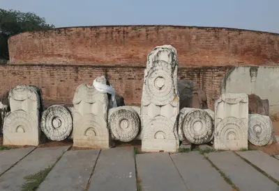
The Telugu lands enter written history with Asoka's edicts in Kurnool district and the Buddhist relic inscriptions of the Krishna delta. The Satavahanas, whose dates are still debated, ruled the Krishna valley by the 2nd century CE, when Amaravati and other stupas flourished.
Kakatiyas
1163–1323 CE
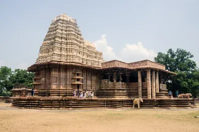
From about 1150 to 1323 the Kakatiya kings of Anumakonda and Orugallu (Warangal) brought much of the Telugu-speaking country under one dynasty. They built the great irrigation tanks and temples of Telangana, and fell to the armies of the Delhi Sultanate.
Dynasties
Mauryas
c. 322 BCE – 184 BCE
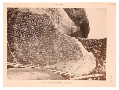
The Mauryan empire of Magadha (c. 322–185 BCE) held part of the Telugu country in the 3rd century BCE. Asoka's edicts at Erragudi and Rajula-Mandagiri in Kurnool district are among the earliest written records found in the region. His conquest of Kalinga reached the coast north of the Godavari.
Satavahanas
c. 200 BCE – 225 CE
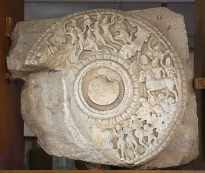
Deccan dynasty, called the Andhras in the Puranas, whose later kings ruled the Krishna valley, the Godavari delta and parts of Rayalaseema in the 2nd and early 3rd centuries CE. Its beginnings, its dates and when it reached the Telugu country are all debated.
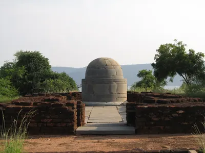
Ikshvakus of Vijayapuri
c. 225–350 CE
Dynasty of the lower Krishna valley in the 3rd and early 4th centuries CE, with its capital at Vijayapuri in the Nagarjunakonda valley. Four kings are known from Prakrit and Sanskrit inscriptions. The kings performed Vedic sacrifices and built temples to Shiva and Karttikeya, while the royal women endowed the Buddhist monasteries of the capital.
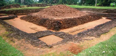
Salankayanas of Vengi
c. 300–470 CE
Dynasty of the country between the Krishna and the Godavari in the 4th and 5th centuries CE, ruling from Vengipura, the modern Pedavegi near Eluru. Seven copper-plate grants name seven kings in two lines descended from Hastivarman. Most scholars identify him with the 'Hastivarman of Vengi' of Samudragupta's Allahabad inscription. Their earlier grants are in Prakrit and their later ones in Sanskrit. Their seals bear a bull, and their family god was Chitrarathasvamin.
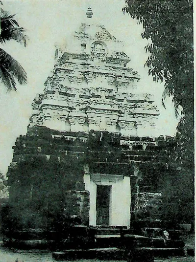
Eastern Chalukyas of Vengi
c. 615–1077 CE
A branch of the Chalukyas of Badami that ruled Vengi, the coastal country between the lower Godavari and Krishna, from the early 7th century. Its founder, Kubja Vishnuvardhana, was a younger brother of Pulakesin II. The kings fought the Rashtrakutas for two centuries. After about 1000 they were bound to the Cholas by marriage, and in 1070 their heir became the Chola emperor Kulottunga I. Their copper-plate grants record the length of every reign. The first Telugu literary work, Nannaya's Mahabharata, was written at their court in Rajahmundry.
Kakatiyas
c. 1163–1323 CE
Dynasty of Anumakonda (Hanamkonda) and Orugallu (Warangal). The Kakatiyas were Rashtrakuta and then Western Chalukya feudatories from the tenth century. They declared their sovereignty under Rudradeva in 1163, and under Ganapatideva they ruled the Telugu country from Telangana to the coast. Rudramadevi reigned as king under the name Rudradeva, and her grandson Prataparudra fell to the Delhi Sultanate in the 1320s. Their rule rested on allied chiefs, nayaka commanders holding land for military service, and village assemblies. It is remembered for its tanks, its temples, the Motupalli sea-trade edict and its court literature.
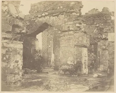
Reddis of Kondaveedu
c. 1325–1424 CE
Telugu dynasty of the Panta Reddi family. It rose on the coast after the fall of the Kakatiyas and ruled for about a hundred years, from about 1325 to the 1420s, first from Addanki and then from the hill fortress of Kondavidu. Its six kings, from Prolaya Vema to Racha Vema, held the country between Srisailam and the sea and at times the Godavari delta. They built the flights of steps at Srisailam and Ahobilam, fought the Recherla Velamas, Vijayanagara and the Bahmanis, and kept a court where Errapragada and Srinatha wrote. Under Kumaragiri the eastern half of the kingdom became a separate state at Rajahmundry.
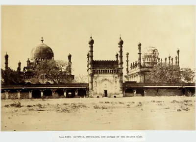
Adil Shahis of Bijapur
c. 1489–1686 CE
Sultans of Bijapur (about 1489–1686), founded by Yusuf Adil Khan, a governor who broke away from the Bahmanis. They fought Vijayanagara for a century over Raichur and Mudgal, and joined the league that defeated it in 1565. Then they advanced south of the Tungabhadra: they took Adoni in 1568, Kurnool early in the seventeenth century and Penukonda in 1652. In the 1630s–50s they overran the Karnatak and divided it with Golconda. They held the western Telugu uplands through Abyssinian governors, such as Siddi Masud of Adoni, and through tributary poligars, until Aurangzeb took Bijapur in 1686.
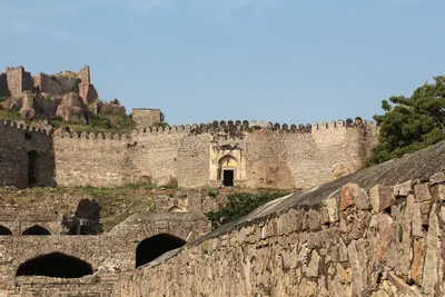
Qutb Shahis
c. 1518–1687 CE
Sultans of Golconda (1518–1687) who ruled Telangana and, from the 1520s, the coast between the Krishna and the Godavari. Later they ruled the northern coast and the Guntur country, and in the 17th century much of the Karnatak to the south. The founder, Sultan Quli, had governed Telingana for the Bahmanis. Ibrahim joined the alliance that destroyed Vijayanagara in 1565, and Muhammad Quli founded Hyderabad about 1589–91. From 1636 the kings paid tribute to the Mughals, and in 1687 Aurangzeb took Golconda by treachery after an eight months' siege. Persian nobles held the high offices, but Telugu soldiers held the forts and Brahmin accountants kept the revenue. Under the last king two Brahmin brothers, Madanna and Akkanna, ran the state.
Dutch East India Company
c. 1613–1825 CE
The Dutch East India Company (Vereenigde Oostindische Compagnie) traded on the Telugu coast from the early seventeenth century until 1825. Its factories at Masulipatam, Palakollu (from 1652), Draksharama, Jagannathapuram (Cocanada), Narasapur and Bimlipatam bought and dyed cotton cloth for its trade in the Indonesian islands. It coined money at Bimlipatam and Jagannathapuram. The Dutch seized Masulipatam from the King of Golconda for a time in 1686. But their settlements were trading stations held under farmans (royal orders) and the grants of the Raja of Vizianagaram, not territories. The English took them in 1781 and 1795 and handed them back in 1785 and 1818. They passed finally to the English East India Company on 1 June 1825.
Mughals in the Telugu country
1636–1724 CE
The Mughal emperors were overlords of Golconda from 1636, when Abdullah Qutb Shah accepted Shah Jahan as his suzerain. They ruled the whole Telugu country from 1687, when Aurangzeb took Golconda and made the kingdom the subah of Haidarabad. The province was governed through a subahdar at Hyderabad, faujdars in the districts and the old Telugu revenue officers, the deshmukhs and deshpandes. The coast formed the Northern Sarkars and the south the Haidarabadi Karnatak. Maratha raids, a prince's rebellion at Hyderabad in 1708–09 and the rising of the toddy-seller Pap Rai marked the years of decline. In 1724 Nizam-ul-Mulk defeated and killed the subahdar Mubariz Khan at Shakar Kheda and founded the Asaf Jahi state.
Marathas and the Telugu country
1677–1818 CE
The Maratha kings, and after them the Peshwas of Poona, entered Telugu history from the west and south. Shahji served Bijapur in the Karnatak. In 1677 his son Shivaji allied himself with Golconda, was received at Hyderabad by Abul Hasan Qutb Shah and his ministers Madanna and Akkanna, went on pilgrimage to Srisailam, and marched past Kurnool and through Cuddapah to Jinji. Bijapur's rights over the Bellary and Anantapur country were made over to him in 1680. From 1719 the Marathas claimed chauth and sardeshmukhi from the Deccan provinces, including Hyderabad. The Peshwas fought the Nizams at Palkhed (1728), Udgir (1760), Rakshasbhuvan (1763) and Kharda (1795). The Bhonsles of Nagpur raided the Carnatic and the Northern Circars, and in Rayalaseema the Marathas held Gurramkonda, Punganur and Penukonda at times between 1743 and 1774. Their power in the region ended with the Mysore treaties of 1792 and 1799, the British treaties of 1802–04 and the fall of the Peshwa in 1818.
Nawabs of the Carnatic (Arcot)
c. 1710–1801 CE
The Mughal and then Asaf Jahi governors of the Carnatic below the Ghats, the coast from Guntur to the Coleroon, who ruled from Arcot from about 1710 until 1801. Their Telugu districts were Nellore, Ongole and the Palnad, with the jagir of Udayagiri and the tributary poligars of Venkatagiri and Kalahasti. The first house, the Navayats of Saadatullah Khan, gave way in 1744 to Anwar-ud-din Khan, who was killed at Ambur in 1749. His son Muhammad Ali Walajah won the Nawabship with English help against Chanda Sahib and the French, while his brother Najib-ullah held Nellore and rebelled. Deep in debt to the East India Company and to private lenders, Muhammad Ali assigned his revenues to the Company in 1781. The Company managed the country in 1790–92, and in 1792 he bound himself to pay for its troops. After a secret correspondence with Tipu Sultan came to light, Azim-ud-daula handed over the government of the Carnatic in 1801, and Nellore and Ongole became a British district.
French East India Company
1750–1759 CE
The French Compagnie des Indes in the Telugu country. It traded at Masulipatam (Machilipatnam) from 1669 and at Yanam from before 1750. Dupleix and Bussy helped the Nizams Muzaffar Jang and Salabat Jang to the throne. In return the Company received Masulipatam and its country (1750), the Kondavid country (1751–52) and the four Northern Circars of Mustafanagar (Kondapalli), Ellore, Rajahmundry and Chicacole (1753), to pay for Bussy's army in the Deccan. Bussy governed the Circars through the Raja of Vizianagaram and the zamindars. In 1757 he destroyed Bobbili and took the English factories. Colonel Forde's victory at Condore (Chandurti) in December 1758 and his storm of Masulipatam in April 1759 ended French rule on the coast. By the treaty of May 1759 Salabat Jang shut the French out of the Deccan. Yanam, taken and given back several times, stayed French until 1954.
East India Company
1759–1858 CE
The English East India Company in the Telugu country, from its first landing on the coast in 1611 to the Crown's take-over in 1858. For a century and a half it traded through factories at Masulipatam, Nizampatnam, Madapollam, Viravasaram, Vizagapatam, Injaram and Bendamurlanka, under farmans of the Golconda kings and the Mughals. Its fort at Madras stood on land granted in 1639 through the Nayaka Damarla Venkatadri. After Forde drove out the French it received the Masulipatam country (1759), the five Northern Circars by the emperor's grant of 1765 and the treaties with the Nizam of 1766 and 1768, Guntur (1788), the Ceded Districts of Rayalaseema (1800) and Nellore with the Carnatic (1801). It governed through Chiefs and Councils, then Collectors. It settled the coastal zamindars permanently in 1802–03, and the Rayalaseema cultivators under Thomas Munro's ryotwari system. It broke the power of the Vizianagaram raja at Padmanabham (1794) and of the poligars. After the Guntur famine of 1832–33 it built the Godavari and Krishna anicuts.
Mysore under Haidar Ali and Tipu Sultan
1761–1799 CE
Haidar Ali, who made himself master of Mysore in 1761, and his son Tipu Sultan, who ruled until 1799, carried Mysore's frontier north and east into the Telugu country. Haidar took Penukonda and Madakasira from the Maratha Morari Rao in 1762, and recovered Gurramkonda through his brother-in-law Mir Sahib in 1768. He took Bellary in 1775 and Gooty in 1776, and conquered the Nawab of Cuddapah in 1779. The Nawab of Kurnool and the poligars of the Bellary and Anantapur country became his tributaries. Their wars with the Marathas, the Nizam and the East India Company were fought partly over these districts. By the treaty of 1792 Tipu ceded Cuddapah, Gurramkonda, Bellary and the Tadpatri country to the Nizam. After Tipu's death at Seringapatam in 1799 the Nizam took Gooty, Penukonda and the rest. In 1800 he ceded both gains to the Company as the Ceded Districts.
British Crown (Madras Presidency)
1858–1947 CE
The government of the Telugu districts of the Madras Presidency by the British Crown, from the transfer of the East India Company's territories in 1858 to independence in 1947. Under a Governor in Council at Madras, the coast and Rayalaseema were ruled through Collectors, a Board of Revenue, district and taluk boards and municipalities. The districts were redrawn (Godavari and Kistna in 1859, Anantapur in 1882, Guntur in 1904, Chittoor in 1911, West Godavari in 1925), and the Nizam ceded the Bhadrachalam and Rekapalli taluks in 1860. The ryotwari lands were surveyed and settled, and the inams registered by the Inam Commission. The great zamindaris of Vizianagaram, Bobbili, Pithapuram, Venkatagiri, Kalahasti and Karvetinagar kept their permanent settlements. The Godavari and Krishna deltas were irrigated, and railways reached Bezwada and Waltair. The great famine of 1876–78 emptied the Ceded Districts. The Rampa rising of 1879–80 was the last that needed regular troops in the Presidency.
People
Siva Sri Satakarni
c. 170–177 CE
Satavahana king of the later 2nd century CE. He is known almost only from lead coins found in the Krishna and Godavari districts, among them examples from Gudivada. He was probably a successor, perhaps a brother, of Vasishthiputra Pulumavi.
Yajna Sri Satakarni
c. 184–213 CE
Late Satavahana king of the later 2nd century CE, the last whose inscriptions and coins are found in both the western Deccan and the Krishna–Godavari country. His Chinna inscription, from the coast south of the Krishna, is dated in his 27th year. His silver coins bear what E. J. Rapson in 1908 called the only known coin-portrait of a Satavahana king.
Chandra Sri Satakarni
c. 219–229 CE
Satavahana king, called Vasishthiputra Chandra Sati on his lead coins from the Krishna and Godavari districts. A rock inscription at Kodavali near Pithapuram calls him Chandasati. Scholars disagree whether he reigned soon after Pulumavi or near the end of the dynasty, and whether two kings of the name are involved.
Saktivarman I
c. 999–1011 CE
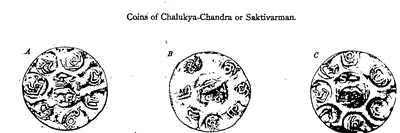
Eastern Chalukya king of Vengi (about 999–1011), the eldest son of Danarnava. He took the throne after the 27 years in which, as the later grants put it, Vengi had no ruler. The Chola king Rajaraja I is said to have restored order in Vengi at this time, and historians have read Saktivarman's accession as a Chola restoration. Gold coins with his title Chalukya-Chandra have been found in Arakan.
Udaya Choda II of Kandur
c. 1136–1176 CE
Kandur Choda chief, son of Gokarna. P. V. Parabrahma Sastry identified him with the 'king Udaya' to whom the Kakatiya Prola II gave back a kingdom after capturing Govindaraja. His records run from 1136 to 1176. The Kakatiya Rudradeva married his daughter and left him his fief (land held from a king). An inscription of 1162 at Jedcherla shows his customs officers granting coins called Gokarna-Singa rukas to the god of Kodur.
Ganapatideva
c. 1199–1262 CE
Kakatiya king (r. 1199–c. 1262) whose sixty-year reign carried Kakatiya power from Telangana to the coast and the far south. He moved the capital to Orugallu (Warangal). His reign produced the Motupalli sea-trade edict and the Ramappa and Ganapesvaram temples.
Anavota Reddi
c. 1353–1364 CE
Second Reddi king of Addanki (c. 1353–1364), elder son of Prolaya Vema. His only known copper-plate grant, from Koduru (1358), and his renewal of the Kakatiya charter for sea merchants at Motupalli (1358) survive. A Velama chronicle claims a victory over him at Dharanikota in 1361. His son Kumaragiri and his son-in-law Kataya Vema later ruled at Kondavidu and Rajahmundry.
Kumaragiri Reddi
c. 1386–1402 CE
Reddi king of Kondavidu (c. 1386–1402), son of Anavota. He is remembered for his spring festival and his court's foreign trade, and as the patron after whom Kataya Vema named his commentary on Kalidasa. He gave the Godavari country around Rajahmundry to his minister and brother-in-law Kataya Vema. At the end of his reign he lost Kondavidu to his kinsman Peda Komati Vema.
Abdullah Qutb Shah
1614–1672 CE
Seventh Qutb Shahi sultan of Golconda (1626–1672). He was crowned as a boy and left the government to his mother Hayat Bakhsh Begum and his ministers. In 1636 he accepted the Mughal emperor Shah Jahan as his overlord. His minister Mir Jumla conquered the Karnatak and its diamond mines. In 1656 Mir Jumla's quarrel with him brought Aurangzeb to besiege Golconda. An inscription in Persian and Telugu records the siege. He died without a son in 1672.
Joseph François Dupleix
1697–1764 CE
Governor of Pondicherry and of the French settlements in India from 1742 to 1754. By backing Muzaffar Jang and then Salabat Jang in the war for the Nizam's throne, he won for the French Company the grant of Masulipatam (1750) and, through his officer Bussy, the Northern Circars (1753). Superseded by Godeheu in 1754, he died in poverty in France.
Muhammad Ali Khan Walajah
1749–1795 CE
Nawab of the Carnatic (Arcot) from 1749 to 1795, the son of Anwar-ud-din Khan. His father was killed at Ambur in 1749. He held out at Trichinopoly and, with English help, won the Nawabship from Chanda Sahib and the French. The treaty of Paris of 1763 recognised him, and the Mughal emperor gave him the title Walajah. His Telugu districts were Nellore, held under his brother Najib-ullah, who rebelled in 1757, Ongole and the Palnad. He owed large debts to the Company and to private lenders. He handed the revenues of the Carnatic to the Company in 1781, saw it take over their management in 1790–92, and agreed by the treaty of 1792 to pay nine lakhs of pagodas a year for its troops. He died in October 1795.
Salabat Jang
1751–1761 CE
Third son of Nizam-ul-Mulk Asaf Jah I, raised to the throne of the Deccan by the French commander Bussy in 1751. Under Bussy's protection he defeated the Marathas and his elder brother Ghazi-ud-din, and in 1753 assigned the Northern Circars to the French. After Colonel Forde drove the French from the coast, he ceded Masulipatam to the English (1759). His brother Nizam Ali took power as his minister, deposed him in 1761 or 1762 and had him killed in prison about 1763.
Haidar Ali
1761–1782 CE
A soldier who made himself master of Mysore in 1761 and ruled it until he died in December 1782. In the Telugu country he took Penukonda and Madakasira from the Maratha Morari Rao in 1762. He won back Gurramkonda through his brother-in-law Mir Sahib in 1768, took Bellary in 1775 and took Gooty from Morari Rao in 1776. In 1779 he conquered the Nawab of Cuddapah, and the Nawab of Kurnool and the poligars of the Bellary and Anantapur country paid him tribute. His invasion of the Carnatic in 1780 began the Second Mysore War.
Tipu Sultan
1782–1799 CE
Son of Haidar Ali and ruler of Mysore from December 1782 until he was killed at the fall of Seringapatam on 4 May 1799. As a young commander he took Gurramkonda back from the Marathas in 1773–74. As Sultan he held Gooty, Gurramkonda, Cuddapah, Bellary and the Anantapur country. He gave Gooty and Gurramkonda the new names Faiz Hisar and Zafarabad and struck copper coins at both. He besieged Adoni in 1786 and seized the poligars of Rayadurg and Harpanahalli. By the treaty of 1792 he gave up Cuddapah, Gurramkonda, Bellary and Tadpatri to the Nizam. The rest of his Telugu districts went to the Nizam after his death and were ceded to the East India Company in 1800.
Sir Arthur Cotton
1803–1899 CE
Engineer officer of the Madras army (1803–1899). He planned and built the anicut (dam) across the Godavari at Dowlaishweram (1847–1852), which turned the Godavari delta into irrigated rice land. He backed the plan for the Krishna anicut at Bezwada (built 1852–1855). At Vizagapatam he built sea groins and St John's church in 1844. He planned the upper Godavari navigation, of which the Dummagudem anicut survives.
Kasinadhuni Nageswara Rao
1867–1938 CE
Founder of the Telugu paper Andhra Patrika and maker of the balm Amrutanjan (1867–1938), from Elakurru in Krishna district. He backed the non-cooperation movement through his paper, chaired a Madras meeting against the Simon Commission, and was jailed in the salt satyagraha of 1930 and the civil disobedience of 1932. He was elected to the Central Legislature in 1934.
Gobhada
King known only from copper coins found at Kotilingala on the Godavari, inscribed 'Rajno Gobhadasa'. Rachna Lodaya counts him as the first local king of the Deccan to put his name on coins. The excavators dated his coins to the first half of the 2nd century BCE and K. D. Bajpai to about 125–100 BCE. P. V. Parabrahma Sastry took him for the Sunga king Bhagabhadra, an identification Lodaya rejects.
Mahmud Gawan
before 1481 CE
Persian merchant who became chief minister of the Bahmani sultanate (c. 1461–1481). He was regent for two boy kings, fought in Telangana and on the west coast, reorganised the provinces and the army, and founded a great college at Bidar. Muhammad Shah III had him executed on a forged charge of treason in 1481.
Mir Jumla (Mir Muhammad Said Ardastani)
before 1663 CE
A Persian merchant who became chief minister and army commander of Abdullah Qutb Shah of Golconda. He is known by the title of his office, Mir Jumla. He conquered the Karnatak south of the Krishna, including Gandikota and the diamond country of Cuddapah, and he leased the diamond mines. His quarrel with the king in 1655–56 brought the Mughal prince Aurangzeb to besiege Golconda. He then joined Mughal service as Mu'azzam Khan and died in 1663 after an expedition to Assam.
Samagopa
King known only from his coins, found at Kotilingala, Peddabankur and Dhulikatta in the old Karimnagar district and at Chandrapur in Maharashtra. He issued more coins than any other Kotilingala king. Rachna Lodaya takes him for the last local king before the Satavahanas, ousted by Simuka about 52 BCE; P. V. Parabrahma Sastry took him for a Sunga king.
Places
Adoni
Hill-fort town in the Kurnool district. It was a Vijayanagara stronghold, which Bijapur besieged in 1535–37 and took in 1568. Its Bijapur governor Siddi Masud Khan built the Jama Masjid in 1666–67. He held the last Bijapur stronghold in the western Telugu country, and gave it up to Aurangzeb's army after Bijapur fell. The Mughals renamed it Imtiyazgarh, 'Distinction Fort'. Under Farrukhsiyar and his successors it was a Mughal mint for small gold coins of the southern pattern. From 1756 it was the jagir (land grant) of Basalat Jang, the Nizam's brother. Tipu Sultan besieged it in 1786, took its guns when the garrison left, destroyed its walls, and gave it back at the peace of 1787. In 1800 the Nizam ceded it to the East India Company in exchange for his districts north of the Tungabhadra.
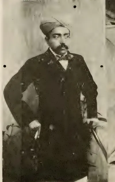
Banganapalle
Town in the Erramala valley of the old Kurnool district. It was the capital of the small nawabi state of Banganapalle, from the time of the Mughal killedar (fort commander) Muhammad Beg Khan in the early eighteenth century until the Madras government took over its administration in February 1948. It was known for its gardens and orchards on the Jurreru stream, its mangoes, oranges and lacquerware, and an old diamond mine near the town. It lay on the road from Gooty to Cumbum, and declined after the railway bypassed it.
Bheemunipatnam
Small port north of Visakhapatnam, at the mouth of the Chittivalasa river, known in old records as Bimlipatam. The Dutch East India Company built a fortified factory (trading post) and a mint here in the seventeenth century, under grants of the Rajas of Vizianagaram. The Marathas burnt it in 1754. The English took it in 1781 and 1795, gave it back to the Dutch in 1785 and 1819, and received it for good in 1825. Francis dates the tombstones of its Dutch cemetery from 1661 to 1720 and calls the 1661 tomb the oldest in the Northern Circars, but Rea reports stones dated 1623.
Bukkarayasamudram
Village at the eastern end of the great tank of Anantapur, named 'king Bukka's sea' after Bukka I of Vijayanagara. A Kanarese inscription of 1364 says that his minister Anantarasa dug the tank. The Anantapur chronicle names the builder Chikkappa Wadeyar, and makes Anantapur, at the western end, the village named after his wife. In the sixteenth century it became a seat of the Hande poligars (local chiefs) of Anantapur.
Dowleswaram
Town on the Godavari, four and a half miles below Rajahmundry, at the head of the delta. Arthur Cotton's great anicut (dam) was built across the river here in 1847–52. In 1907 it was the headquarters of two Executive Engineers and of the Public Works workshops. It is a specially holy bathing place, the last point at which the Godavari flows undivided.
Eluru (Ellore)
Town in the West Godavari district, the seat of the Ellore sarkar (district), one of the five Northern Circars of the Qutb Shahi and Mughal coast. Its carpet weaving was famous in the seventeenth century. Under the Mughals it had a qazi's court, a kotwal (police chief) and a market officer. Its assessment of about 5.6 lakhs of rupees stood on the imperial records until the French took the Circars in 1753.
Gangapuram
Village in the Mahbubnagar district of Telangana with eleven Kannada inscriptions of the Western Chalukya period. The dated ones run from 1091 to 1148, and they record gifts to its temples by royal officers and by merchant guilds. P. V. Parabrahma Sastry took it to be the Gangapura from which the prince Kumara Tailapa claimed to reign in 1137.
Golconda
Fortress and old royal town five miles west of Hyderabad. It was a Warangal frontier fort ceded to the Bahmanis in the 14th century, and then the first capital of the Qutb Shahi sultans. The court moved to Hyderabad in the 1590s, but the fortress remained their stronghold until 1687.
Gudivada
Taluk town in the Krishna delta, about twenty miles north-west of Machilipatnam. It has the remains of a demolished Buddhist stupa. An old village mound here has yielded large numbers of Satavahana (Andhra) lead coins, beads and pottery.
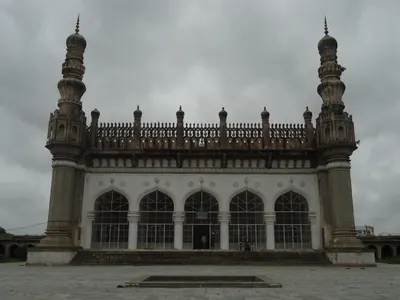
Hayathnagar
Village about nine miles east of Hyderabad on the old road to Masulipatam. Hayat Bakhsh Begum, mother of Abdullah Qutb Shah, founded it in AH 1035 (1625–26) as Hayatabad. Its great Qutb Shahi mosque stands inside a walled caravanserai (travellers' inn) of several hundred rooms. Tavernier's 'Jatenagar', the first stage on his road from Golconda to the Kollur diamond mine, has been identified with it.
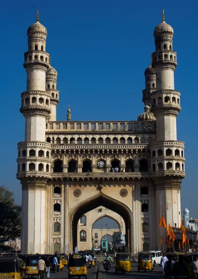
Hyderabad
City on the Musi founded by Muhammad Quli Qutb Shah around 1589–91 as Bhagnagar. It was the Qutb Shahi capital until 1687, then a Mughal provincial seat. From the 1720s it was the capital of the Asaf Jahi Nizams.
Jaggayyapeta
Market town on the Paleru near where it meets the Krishna, formerly called Betavolu. On a hill nearby, James Burgess excavated in 1882 the remains of an early Buddhist stupa with an inscription of the Ikshvaku period.
Kakinada
Port on the Godavari coast, known to the English as Cocanada, which grew as Coringa silted up. Its southern suburb, Jagannathapuram, was a Dutch factory (trading post) with a mint from the seventeenth century until 1825. A French party that landed there in 1759 was forced to surrender in the Dutch fort. Cocanada was one of the first Collectorates of the Northern Circars in 1794.
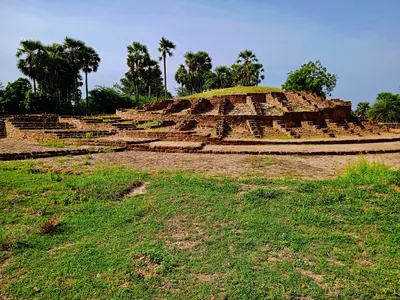
Kalingapatnam
Seaport at the mouth of the Vamsadhara in the Srikakulam district, long supposed to be Kalinganagara, the capital of the Ganga kings of Kalinga. E. Hultzsch still thought so in 1895. But G. V. Ramamurti found no antiquities there fit for a capital, and he placed Kalinganagara at Mukhalingam instead.
Khammam
Town in Telangana. In 1909 it was the head-quarters of the Khammamett taluk of the Warangal district of Hyderabad State, and the district's chief trading place after Mathwada near Warangal. In 1847 the future minister Salar Jang I, aged nineteen, began his career as talukdar (revenue officer) of the district.
Kollur
Deserted diamond-mining site on the Krishna, in the west of the old Sattenapalle taluk (Guntur). Tavernier visited its 'Gani' or 'Coulour' mine under the Qutb Shahis, and his editor V. Ball identified that mine with Kollur. Tavernier found close on 60,000 people working there. He was told that the great diamond Mir Jumla gave the Mughal emperor came from it. By 1883 only ruins of extensive habitations remained.
Kotilingala
Village on the south bank of the Godavari in the old Karimnagar district, at the mouth of the Peddavagu stream. Its large early mound, ringed by a mud fort, has given what its excavation report calls the earliest inscribed coins of the Deccan. They name local kings, Gobhada, Kamvaya, Narana and Samagopa, and the only known coins of Simuka, first king of the Satavahanas. Scholars disagree on whether these kings ruled before the Satavahanas, under them or beside them.
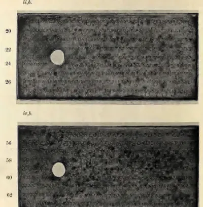
Machilipatnam
Port near the mouth of the Krishna, known to Europeans as Masulipatam and locally as Bandar. It was the main sea outlet of the Golconda kingdom, where the English, Dutch and French traded from the 17th century. Later it was the chief town of the Northern Circars and of Kistna district.
Motupalli
Coastal village, formerly in Guntur district, that was the main Kakatiya sea port. Ganapatideva set up his 1244 edict protecting sea traders here. Henry Yule identified it with a place Marco Polo called Mutfili.
Nalgonda
Town in southern Telangana, head of a district of the Nizam's Dominions. The Imperial Gazetteer of 1909 describes its fort, its market of Osmanganj and the Telugu-speaking district around it, which gained Cherial (Jangaon) and Kodar in 1905. The district suffered in the famines of 1877 and 1899–1900, and in 1946–48 it was a centre of the peasant struggle and of Razakar raids.
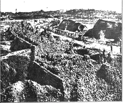
Nizamabad
Town in north-western Telangana, formerly Indur, head of the district renamed Nizamabad in 1905. The Imperial Gazetteer of 1909 describes the Indur fort turned into a Central Jail, the railway to Manmad, rice and silk, and a revenue survey finished in 1898. The great Nizam Sagar irrigation scheme, finished in 1931, watered the Bodhan, Nizamabad, Armur and Yellareddy taluks.
Nizampatnam
Old port on the Guntur coast south of the Krishna mouths. The Fifth Report's tables identify it with the Pettipolee or Pettapoli of the English records. Here the Globe landed English merchants on 20 August 1611, the first English trade on the eastern coast of India. It was a minor factory (trading post) of the Company in the seventeenth century. It gave its name to the Nizampatam Circar, granted to the French in 1751 and to the English by Salabat Jang's treaty of 1759.
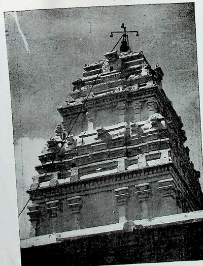
Palakollu
Market town in the western Godavari delta, six miles north of Narasapur. It is known as Kshirarama for its Shiva temple, one of the five Pancharama shrines. It was the first Dutch settlement on this coast, founded in the mid-17th century, and passed finally to the British in 1825.
Peddabankur
Village near Peddapalli in the old Karimnagar district, beside a 30-hectare early settlement dug for the Andhra Pradesh Department of Archaeology and Museums before 1978. The dig found brick enclosures and 22 wells, two hoards of silver punch-marked coins, Roman coins of Augustus and Tiberius with Satavahana coins, and coins of the local king Samagopa.
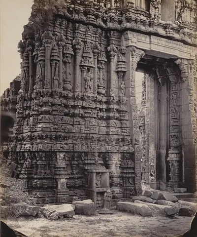
Tadpatri
Town on the south bank of the Penner in the Anantapur district. It was founded under Vijayanagara by Ramalinga Nayudu, whose family built its two richly carved temples of Ramalingesvara and Chintala Venkataramana. It passed to Muslim governors after 1565, to Morari Rao of Gooty and then to Haidar Ali. A Mughal-style pagoda (gold coin) was struck there. By the treaty of 1792 Tipu Sultan ceded the taluks of Tadpatri and Tadimarri to the Nizam, who ceded them to the East India Company in 1800.
Visakhapatnam
Port on the Vizagapatam coast, known to the English as Vizagapatam, where the East India Company founded a factory (trading post) in 1682. The factory was seized under Aurangzeb in 1689 and besieged by the Faujdar of Chicacole in 1710–11. It surrendered to Bussy in 1757, and the Raja of Vizianagaram gave it to the English in 1758. From 1769 it was the seat of a Chief and Council, and then of the Collector of the Vizagapatam district. Its old cemetery holds the graves of Chiefs of the settlement from 1705.
Yanam
Small town on the Godavari where the Coringa river leaves the Gautami branch. It was a French factory (trading post) from about 1750, and French territory apart from long English occupations in the wars, until the Government of India took over the French Establishments on 1 November 1954. It was famous in the eighteenth century for white long-cloth. Yanam is now a district of the Union Territory of Puducherry, surrounded by the East Godavari country.
Monuments
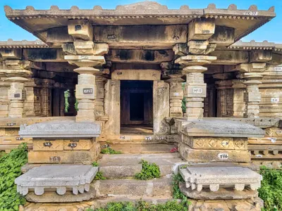
Choundesvara Temple, Kondaparti
1203 CE
A temple of Choundesvara and a tank, the Chaunda-samudra, at Kondaparti near Warangal. Both were built by Chaunda of the Malyala family, a general of the Kakatiya king Ganapatideva. His inscription there of 1203 records his part in Ganapatideva's conquest of the Divi island.
Ramappa Lake
1213 CE
The large reservoir at Palampet beside which the Ramappa (Rudreshvara) temple stands. P. V. Parabrahma Sastry, following the temple's inscription of 1213, gives it to the Kakatiya general Recherla Rudra, who probably built it together with the temple. Hyderabad's Archaeological Department counted it among the great tanks of the Kakatiya rulers.
Husain Sagar
c. 1562 CE
Large artificial lake between Hyderabad and Secunderabad, formed by a dam that the Golconda chronicle counts among the works of Ibrahim Qutb Shah. The Imperial Gazetteer dates it to about 1575. Bilgrami gives AH 970 (1562) and credits it to Husain Shah Wali, the king's son-in-law, after whom it is named. A tradition printed by Hastings Fraser in 1865 tells how the tank stood empty until Neknam Khan cut a channel from the Musi.
Purana Pul
c. 1578 CE
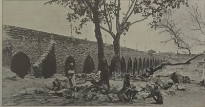
The 'old bridge' of stone across the Musi at the western end of old Hyderabad, on the road to Golconda. Bilgrami (1927) dates it by two chronograms to AH 986 (1578), under Ibrahim Qutb Shah, fourteen years before the city. He gives its Qutb Shahi name as Pul-i Narva, from the Telugu word for a causeway. The Imperial Gazetteer and Campbell date it to 1593 under Muhammad Quli. Tavernier compared it with the Pont Neuf. Its only inscription records the rebuilding after the flood of 1820.
Dutch tombs, Machilipatnam
1624–1743 CE
Carved granite gravestones of officers and families of the Dutch East India Company at Machilipatnam (Masulipatam), the oldest European monuments of the Telugu coast. The earliest is the tomb of Jacob Dedel, chief of the Company on the Coromandel coast, who died in 1624. A walled burial ground behind the Collector's office, at the place still called Valandupalem, holds slabs dated from 1662 to 1743, with coats of arms and verse epitaphs in Dutch.
Hayat Bakhshi Mosque, Hayathnagar
c. 1626 CE
Large Qutb Shahi mosque of five double arches between two tall minarets. It stands on a terrace inside a vast walled caravanserai (travellers' inn) at Hayathnagar, about nine miles east of Hyderabad. The village was founded in AH 1035 (1625–26) by Hayat Bakhsh Begum, daughter of Muhammad Quli, queen of Sultan Muhammad and mother of Abdullah Qutb Shah. The mosque has no inscription. Bilgrami dated the village to 1626 and the mosque to Abdullah's reign.
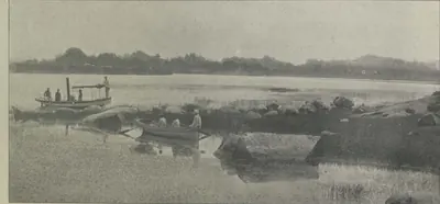
Mir Alam Tank
1806 CE
Large tank south-west of the old city of Hyderabad, held back by a dam of 21 semicircular granite arches 1,120 yards long. The minister Mir Alam built it out of his share of the prize money from Seringapatam (1799). It was completed in AH 1221 (1806), in the reign of Sikandar Jah, at a cost of eight lakhs. The Imperial Gazetteer says French engineers in the Nizam's service built the dam. An inscription on a reservoir stone records the date. Until the Osman Sagar was built it was a main source of the city's water.
Dowleswaram anicut
1847–1852 CE
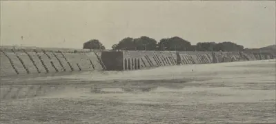
The masonry dam across the Godavari at Dowleswaram, at the head of the delta. Arthur Cotton designed it, and it was built in 1847–52 in four sections joined by the river islands, about 4,000 yards long. Its crest was raised in 1862–67, and again, with self-acting iron shutters, in 1897–99. By 1903–04 its three canal systems watered 662,000 acres of the Godavari delta.
Krishna anicut
1852–1855 CE
The masonry dam across the Krishna at Vijayawada (then Bezwada), at the head of the delta, where the river passes through a gap 1,300 yards wide between two hills. Planned after the Guntur famine of 1832–1833 and sanctioned in 1850, it was built under Captain Orr from 1852 to 1855. In 1903–04 its canals watered over 600,000 acres of government land.
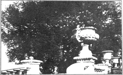
Osman Sagar (Gandipet)
c. 1912 CE
Reservoir formed by a dam across the Musi at Gandipet, about ten miles above Hyderabad. It was built after the terrible flood of September 1908, to protect the city from floods and to supply it with water. M. Visvesvaraya drew up the project. Mir Osman Ali Khan laid the foundation stone in 1322 Fasli (1912–13), and the lake was named after him. Mudiraj (1929) gives the cost as Rs 58,40,000. A sister dam on the Isi formed the Himayat Sagar, completed in 1924–25.
Himayat Sagar
1925 CE
Reservoir on the Isi (Esi), a tributary of the Musi, south-west of Hyderabad, built as the second part of the flood-protection scheme drawn up after the Musi flood of 1908. It was named after the heir-apparent, Himayat Ali Khan (Azam Jah), and completed in 1334 Fasli (1924–25) at a cost of Rs 92,43,255. Pictorial Hyderabad (1929) calls it both a flood moderator and an irrigation tank; a government farm at Himayat Sagar bred rice strains, cattle and poultry in the 1930s.
Nizam Sagar
c. 1931 CE
Dam and reservoir on the Manjra river in Nizamabad district, built in the reign of Mir Osman Ali Khan. Pictorial Hyderabad (1929) describes a dam 7,260 feet long and 111 feet high, then under construction; the census of 1931 records the scheme as just completed at a cost of 426 lakhs of rupees, with a main canal of 72½ miles meant to water 275,000 acres in the Bodhan, Nizamabad, Armur and Yellareddy taluks.
Bayyaram Tank
A large tank at Bayyaram in the old Khammam district, called Dharmakirti-samudra. It was built by Mailama (Mailamba), sister of the Kakatiya king Ganapatideva and wife of Natavadi Rudra. The inscribed granite pillar that records it, found in 1965, gives the fullest genealogy (family history) of the Kakatiya family.
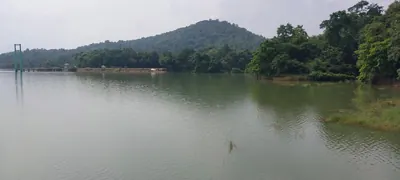
Laknavaram Lake
A large reservoir in the forests of the old Warangal district. P. V. Parabrahma Sastry counts it among the big tanks of the Kakatiya period, fed, like the Pakhal and Bayyaram tanks, by streams from one plateau. No builder or inscription is recorded for it in the sources used here.

Pakhal Lake
A great reservoir east of Narsampet, formed by a dam about a mile long across the Pakhal river and covering some 13 square miles when full. Local tradition recorded in 1900 gave it to Pratapa Rudra, or to a 'Raja Khaldya' sixteen centuries earlier. P. V. Parabrahma Sastry, citing the inscription on the bund, gives it to Jagadalu Mummadi, son of a minister, in the reign of the Kakatiya king Ganapatideva.
Inscriptions
Nagarjunakonda inscription of Bodhisiri
c. 268 CE
Prakrit inscription on the floor of an apsidal (round-ended) shrine on the Chula-Dhammagiri at Nagarjunakonda, dated in the 14th year of King Mathariputra (Virapurushadatta). It records the gifts of the lay woman Bodhisiri to Buddhist monks from Sri Lanka. It names the city of Vijayapuri, the Sriparvata and the trading town of Kantakasela.
Vilavatti grant of Simhavarman
c. 446 CE
Sanskrit copper-plate grant issued from Paddukkara in the tenth year of the Pallava king Simhavarman, son of the crown prince Vishnugopa. It gives the village of Vilavatti in Mundarashtra, with the taxes due from it, to the Brahman Vishnusarman. It was found about 1928 at Vavveru in the Kovur taluk of Nellore, and C. R. Krishnamacharlu edited it in 1938. It lists the dues of craftsmen and traders and bears the earliest clear Pallava bull on its seal.
Panugallu inscription of Mailamba
1124 CE
A Sanskrit and Telugu inscription of Saka 1046 (1124) at Panugallu near Nalgonda. It records that Mailamba, wife of a Kandur Choda king, gave an agrahara (Brahmin village) named Choda-Bhima-Narayana-pura to 108 Brahmans, for the welfare of her son Bhima. It names her three sons, Udayaditya, Bhima and Gokarna.
Jedcherla inscription of Udayana Choda
1162 CE
Telugu inscription of 25 December 1162 at Jedcherla in the Mahbubnagar district, in which two customs officers of the Kandur Choda chief Udayana Choda grant the god of Kodur five Gokarna-Singa coins a month from the shop dues of the town.
Motupalli pillar inscription of Ganapatideva
1244 CE
Edict of Saka 1166 (1244–45 CE) set up at the port of Motupalli. In it the Kakatiya king Ganapatideva promised sea traders safety for wrecked cargoes and fixed the customs duty on their goods.
Bukkarayasamudram tank inscription (1364)
1364 CE
A Kanarese (Kannada) inscription on a stone at Bukkarayasamudram, the great tank at Anantapur. It is dated Saka 1286, Krodhin (1364), in the reign of Bukka Raya of Vijayanagar. As V. Rangacharya summarised it in 1919, it records that the minister Anantarasa Udayar dug the tank and built a temple of Sankara on its banks. The Telugu chronicle translated by C. P. Brown as 'The Wars of the Rajas' gives the same year but names the builder Chikkappa Wadeyar.
Kondavidu pillar inscription of Nadindla Gopa (1520)
1520 CE
A four-sided pillar near the agrahara (Brahmin village) at Kondavidu, inscribed in Sanskrit and Telugu. H. Luders edited it with H. Krishna Sastri in 1901. It is dated at a lunar eclipse on 2 May 1520. It records that Nadindla Gopa, governor of Kondavidu and nephew of Saluva Timma, rebuilt the temple of Raghunayaka at Kondavidu. He gave the temple the customs on goods on every road of the Kondavidu country, with a list of rates for some fifty articles. The record curses Odda, Telugu and Turuka kings who might break the grant.
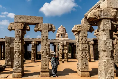
Lepakshi temple inscriptions of Achyuta Raya's reign (1533–1538)
1533–1538 CE
Some fifteen Sanskrit and Kannada inscriptions on the walls of the Virabhadra temple at Lepakshi in the Anantapur district. They were copied in 1912 and are dated between Saka 1455 and 1460 (1533–1538), in the reign of Achyuta Raya. They record gifts of villages, tolls and lands to the shrines of Virabhadra (Viresvara), Papavinasa and Raghunatha. The givers were Virupanna (Virappannayya) of Penukonda and his brother Virana Nayaka, sons of Nandi Lakkisetti of Lepakshi, and the king himself. Local tradition makes Virupanna a treasurer of Krishnadeva Raya.
References
Notes (0)
Sources (25)
Spotted an error on this page? Tell us
Last updated: