ప్రచురితమైన ఆధారాలతో నిర్మించిన కొత్త సైట్. ఏదైనా పొరపాటు కనిపించిందా? మాకు తెలియజేయండి

"Orissa in the reign of Kapilendra Deva": map in R. D. Banerji, History of Orissa, Vol. I (1930), facing p. 296
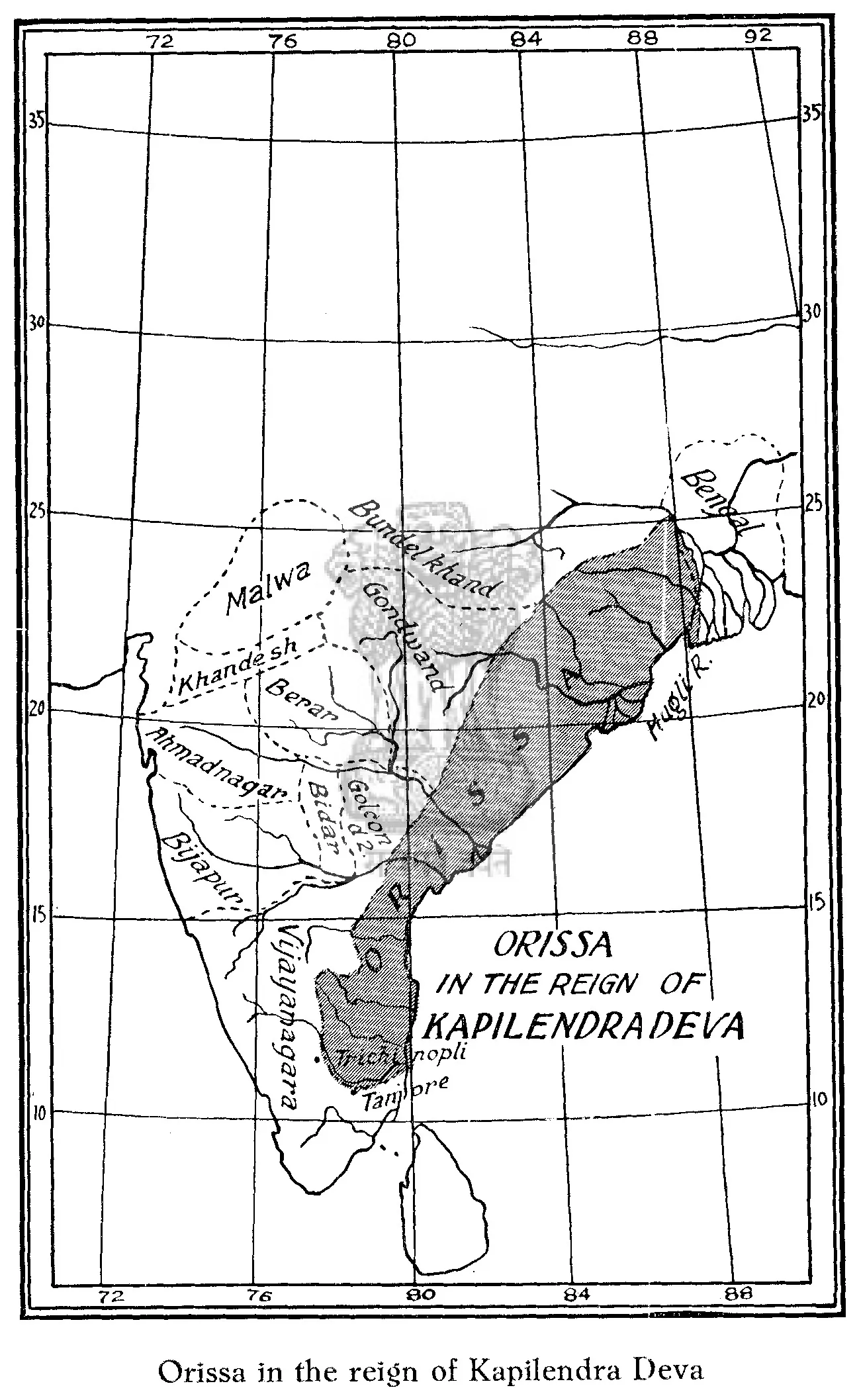
Printed outline map of eastern and southern India with a graticule; a shaded band runs down the east coast from Bengal past the Godavari and Krishna to the Kaveri, lettered "Orissa in the reign of Kapilendradeva", with neighbouring kingdoms named in italic.
రకం
పటం
సృష్టికర్త
R. D. Banerji, History of Orissa, Vol. I
తేదీ
1930
లైసెన్సు
Public domain
మూలం
R. D. Banerji, History of Orissa from the Earliest Times to the British Period, Vol. I (opens in a new tab), 1930, map facing p. 296 ("Map 4" in the list of illustrations; PDF p. 384); text pp. 289-304
మూలం
archive.org (opens in a new tab)
కనిపించే పేజీలు
నాయకులు, రెడ్డి రాజులు, బహమనీలు, ఒడిశా గజపతులు, కపిలేంద్రుడు (కపిలేశ్వరుడు), కోటలు, యుద్ధాలు