ప్రచురితమైన ఆధారాలతో నిర్మించిన కొత్త సైట్. ఏదైనా పొరపాటు కనిపించిందా? మాకు తెలియజేయండి

"Linguistic Map of Hyderabad State, Census 1931" (Census of India 1931, Hyderabad, folding map, PDF p. 241)
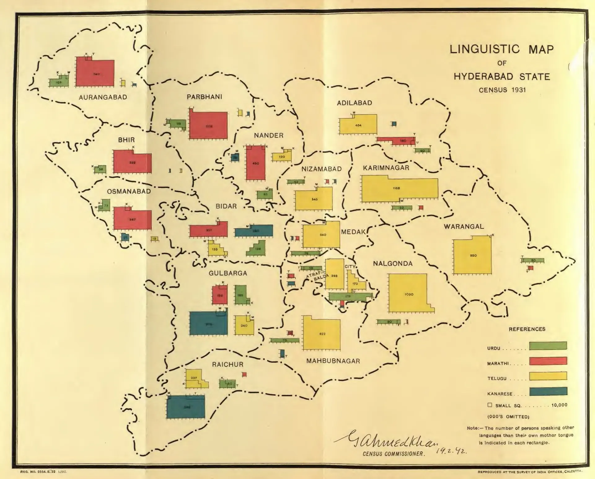
Map of the districts of Hyderabad State with coloured rectangles sized by the number of speakers of Urdu, Marathi, Telugu and Kanarese in each district; the Telugu (yellow) blocks fill the eastern districts.
రకం
పటం
సృష్టికర్త
Gulam Ahmad Khan (Census of India 1931, H.E.H. the Nizam's Dominions)
తేదీ
1933
లైసెన్సు
Public domain
మూలం
Khan, Gulam Ahmad, Census of India 1931 vol.23 H.E.H. the Nizamʼs dominions (Hyderabad State); pt.1- Report (opens in a new tab), 1933, folding map, PDF p. 241
మూలం
archive.org (opens in a new tab)
కనిపించే పేజీలు
మొఘలులు, అసఫ్ జాహీలు, బ్రిటిష్ పాలన, హైదరాబాద్, భాష, సాహిత్యం