ప్రచురితమైన ఆధారాలతో నిర్మించిన కొత్త సైట్. ఏదైనా పొరపాటు కనిపించిందా? మాకు తెలియజేయండి

Map of the "Godavari District (Agency Tracts)" (Hemingway 1907, PDF p. 4)
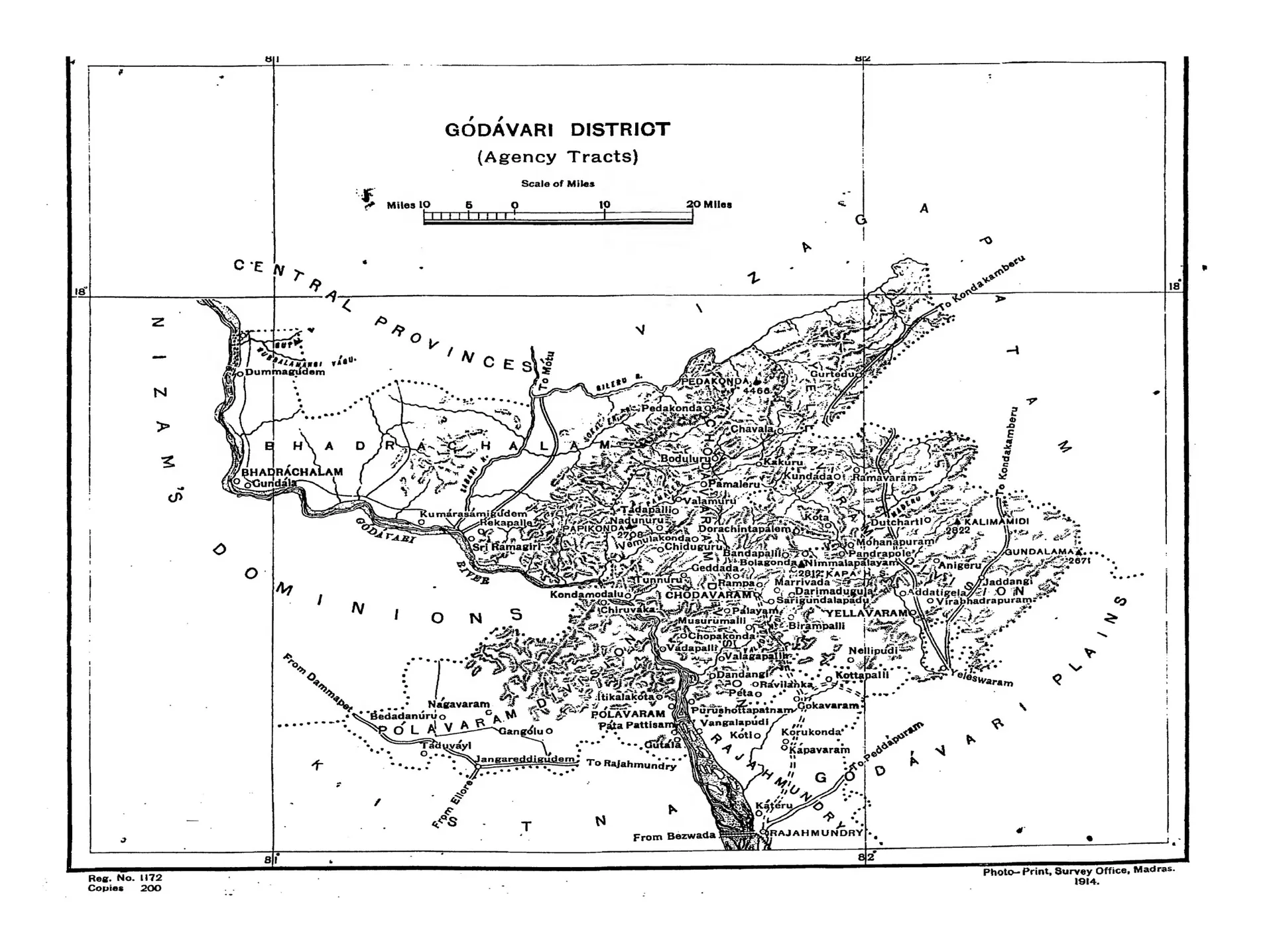
Folding map of the hilly Agency tracts of the Godavari district, bounded by the Nizam's Dominions, the Central Provinces and Vizagapatam, with the Godavari river, the Godavari plains to the south, and many hill villages. Printed sideways.
రకం
పటం
సృష్టికర్త
F. R. Hemingway (Madras District Gazetteers)
తేదీ
1907
లైసెన్సు
Public domain
మూలం
F. R. Hemingway, Madras District Gazetteers: Godavari, Vol. I (opens in a new tab), 1907, PDF p. 4
మూలం
archive.org (opens in a new tab)
కనిపించే పేజీలు
మొఘలులు, అసఫ్ జాహీలు, బ్రిటిష్ పాలన, బ్రిటిష్ రాజ్ (మద్రాసు ప్రెసిడెన్సీ), భద్రాచలం, రేకపల్లి