ప్రచురితమైన ఆధారాలతో నిర్మించిన కొత్త సైట్. ఏదైనా పొరపాటు కనిపించిందా? మాకు తెలియజేయండి

Vengi, the Krishna and the coast south to Kanchi and Tondamandalam: detail of "A Map of Southern India shewing the territories of the ancient dynasties according to the best authorities" (Elliot 1886, folding map, PDF p. 185)
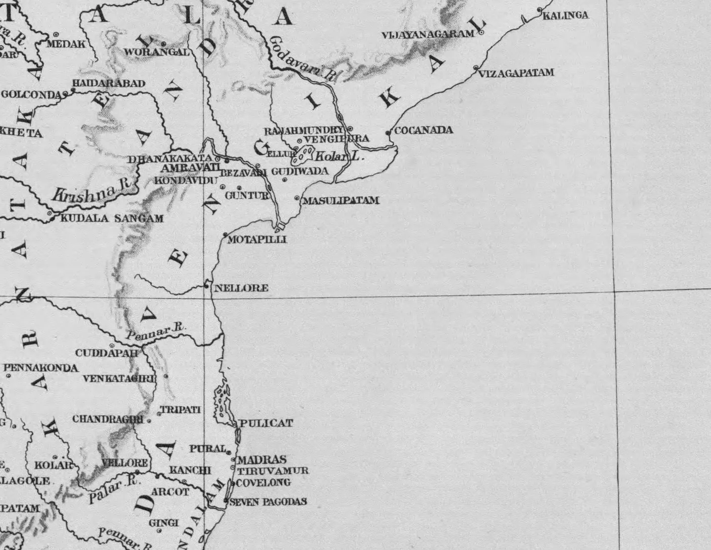
Detail of a printed map of the east coast: the Godavari and Krishna deltas with Rajahmundry, Vengipura, Ellur and Kolar Lake, Dhanakakata, Amravati, Bezavada, Guntur and Masulipatam, the coast south past Motapilli and Nellore to Pulicat, Madras, Kanchi and the Seven Pagodas; the large spaced letters VENGI and DRAVIDA mark the regions.
రకం
పటం
సృష్టికర్త
Walter Elliot (map by Stanford's Geographical Establishment, London; Trubner & Co.)
తేదీ
1886
లైసెన్సు
Public domain
మూలం
Walter Elliot, Coins of Southern India (International Numismata Orientalia, Vol. III, Part 2) (opens in a new tab), 1886, folding map (PDF p. 185 of scan elliot-1886-bsb), printed sideways; crop of the east-coast section
మూలం
archive.org (opens in a new tab)
కనిపించే పేజీలు
ఇక్ష్వాకులు, విష్ణుకుండినులు, తొలి రాజ్యాలు, పల్లవులు, వేంగి (పెదవేగి)