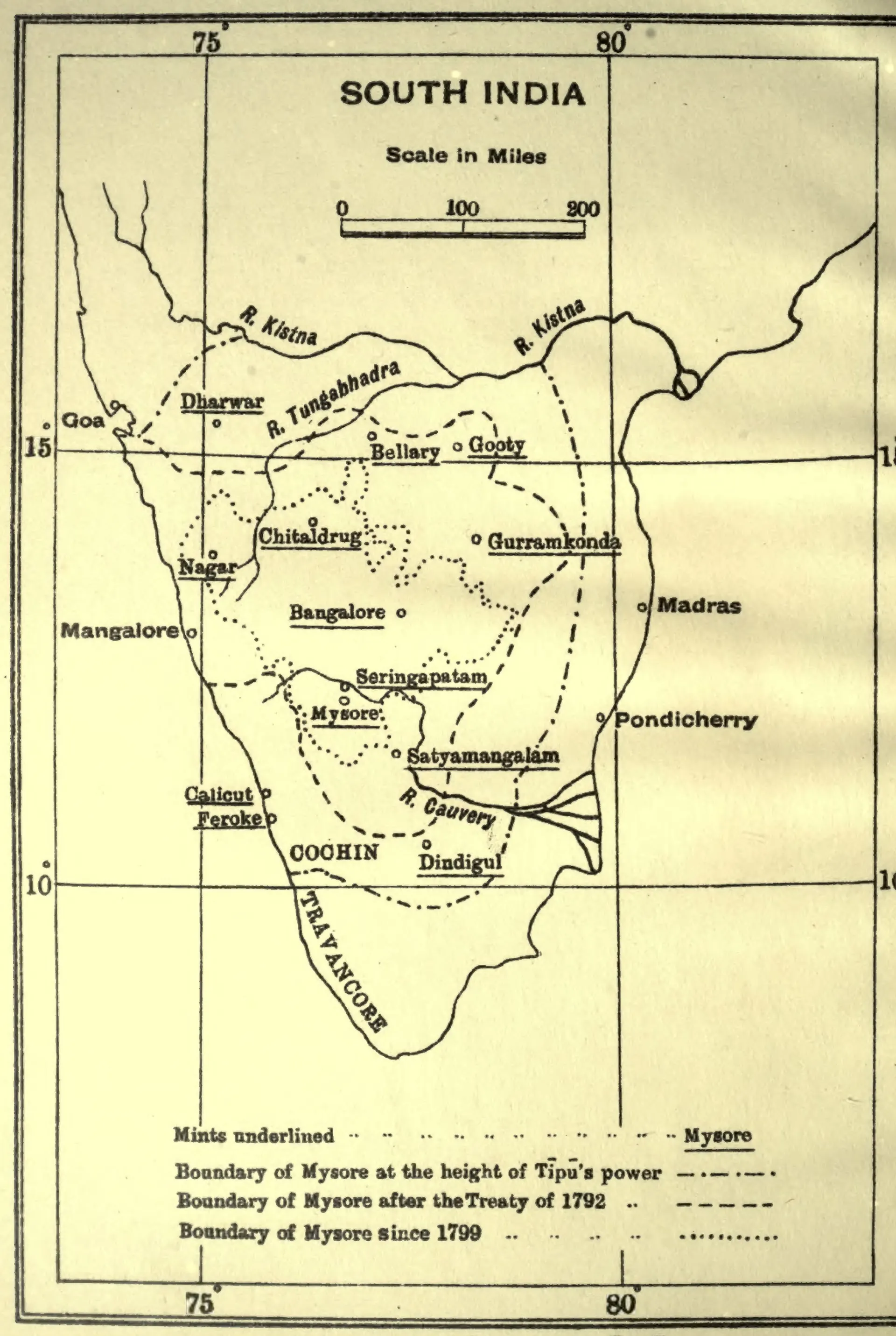
"Mints of Haidar Ali and Tipu Sultan": map with the boundaries of Mysore at the height of Tipu's power, after 1792 and after 1799 (Henderson 1921, frontispiece)
- రకం
- పటం
- సృష్టికర్త
- J. R. Henderson, The Coins of Haidar Ali and Tipu Sultan (Madras Government Museum)
- తేదీ
- 1921
- లైసెన్సు
- Public domain
- మూలం
- J. R. Henderson, The Coins of Haidar Ali and Tipu Sultan (Bulletin of the Madras Government Museum, New Series, General Section, Vol. I, Part 2) (opens in a new tab), 1921, frontispiece map (PDF p. 6)
- కనిపించే పేజీలు
- హైదర్ అలీ, టిప్పు సుల్తాన్ కాలపు మైసూరు, గుత్తి, గుర్రంకొండ, బళ్ళారి, వ్యాపారం, ఆర్థిక వ్యవస్థ