ప్రచురితమైన ఆధారాలతో నిర్మించిన కొత్త సైట్. ఏదైనా పొరపాటు కనిపించిందా? మాకు తెలియజేయండి

సు. క్రీ.శ. 150 నాటి ఆంధ్రుల, పశ్చిమ క్షత్రపుల రాజ్యాల రేఖాపటం (రాప్సన్ 1908)
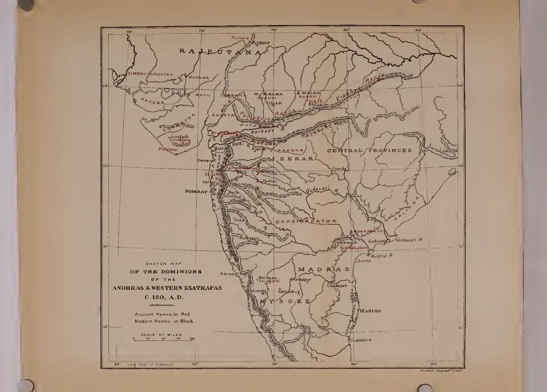
Map of western and southern India from Rajputana to Madras, showing rivers and hill ranges; ancient names printed in red include Dakshinapatha, Andhradesa and Kalinga, with Amaravati, Sri-Kakulam, Gudivada and Chinna marked near the mouth of the Krishna.
రకం
పటం
సృష్టికర్త
E. J. Rapson (British Museum; engraved by Stanford's Geographical Establishment)
తేదీ
1908
లైసెన్సు
Public domain
మూలం
E. J. Rapson, Catalogue of the Coins of the Andhra Dynasty, the Western Ksatrapas, the Traikutaka Dynasty, and the 'Bodhi' Dynasty (Catalogue of the Indian Coins in the British Museum) (opens in a new tab), 1908, map (PDF p. 214)
మూలం
archive.org (opens in a new tab)
కనిపించే పేజీలు
మౌర్యులు, శాతవాహనులు, శాతవాహనులు, అమరావతి, ధరణికోట