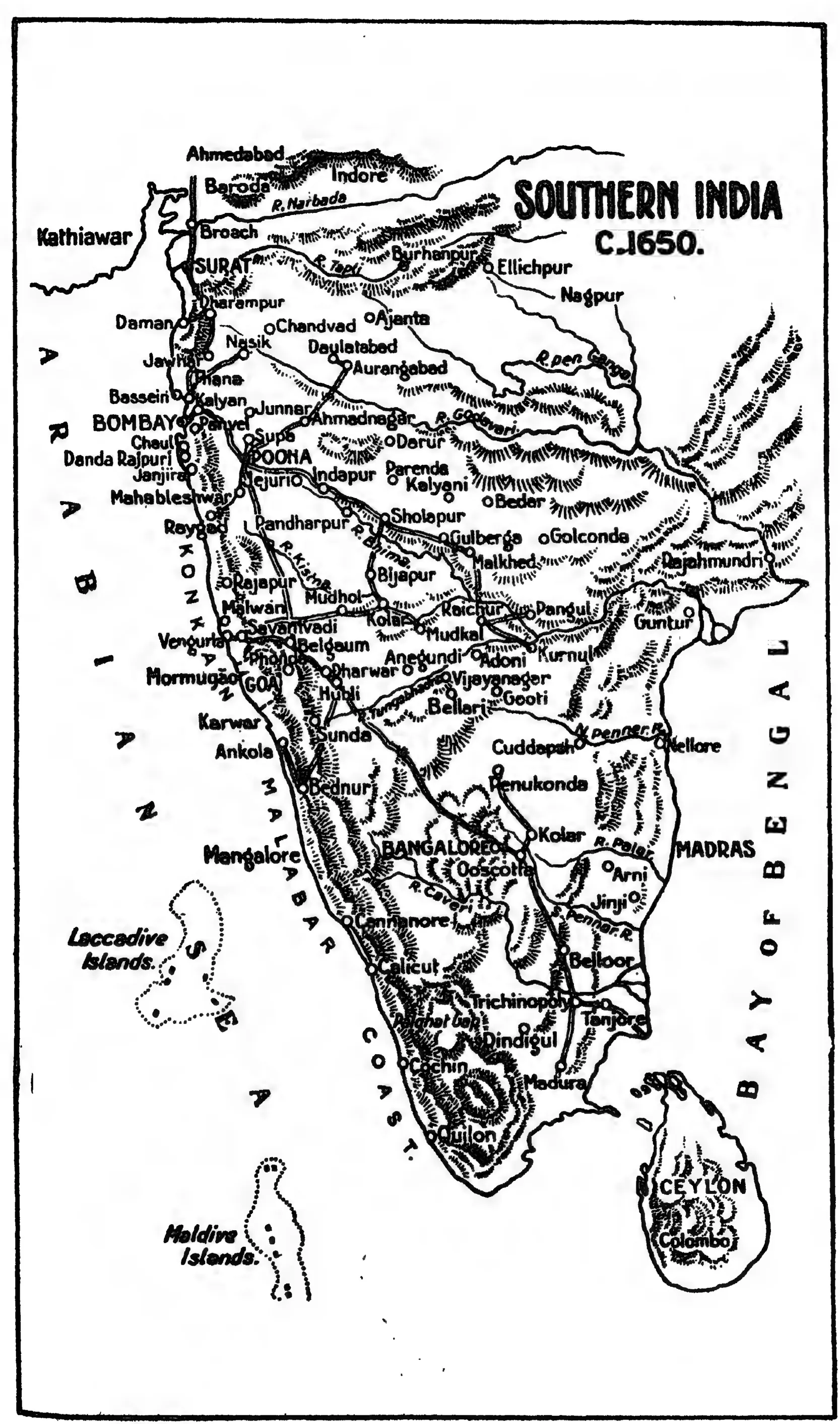
"Southern India c. 1650": map in the Source Book of Maratha History (1928), facing p. 176
- రకం
- పటం
- సృష్టికర్త
- R. P. Patwardhan and H. G. Rawlinson (eds.), Source Book of Maratha History (Government of Bombay)
- తేదీ
- 1928
- లైసెన్సు
- Public domain
- మూలం
- R. P. Patwardhan and H. G. Rawlinson (eds.), Source Book of Maratha History, Vol. I (to the death of Shivaji) (opens in a new tab), 1928, map facing p. 176 (PDF p. 204)
- కనిపించే పేజీలు
- విజయనగరం, కుతుబ్ షాహీలు, మరాఠాలు, తెలుగు దేశం, శివాజీ, షాహ్జీ భోంస్లే