ప్రచురితమైన ఆధారాలతో నిర్మించిన కొత్త సైట్. ఏదైనా పొరపాటు కనిపించిందా? మాకు తెలియజేయండి

"A Map of India showing Tavernier's routes and the sites of the diamond mines mentioned by him" (Tavernier/Ball 1889, vol. I, folding map, PDF p. 499)
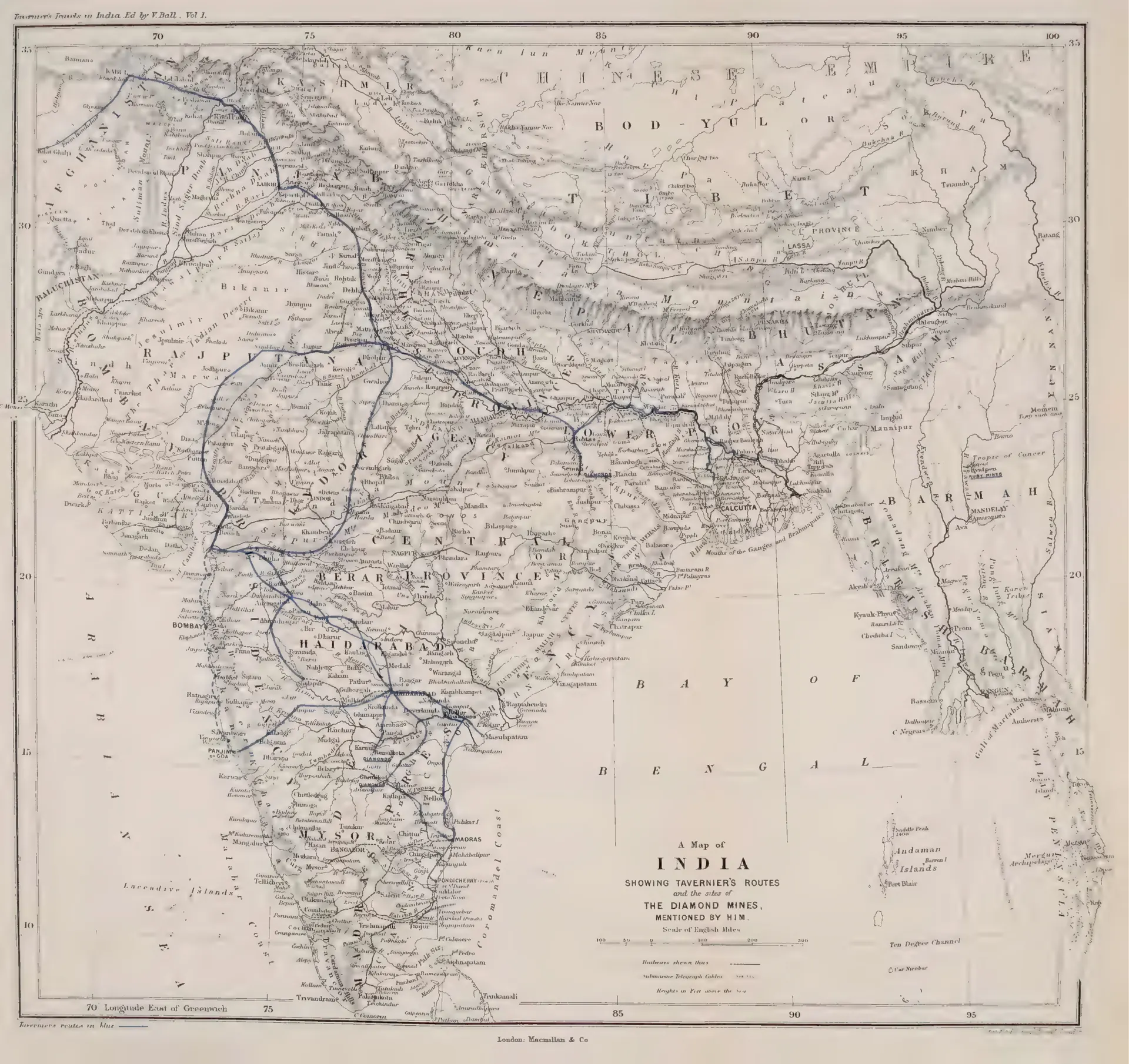
Map of India with Tavernier's travel routes drawn in blue, crossing the Deccan by Haidarabad and Golconda to Masulipatam and Madras, with the diamond mine sites marked. Published by Macmillan & Co.
రకం
పటం
సృష్టికర్త
Jean-Baptiste Tavernier (tr. V. Ball)
తేదీ
1889
లైసెన్సు
Public domain
మూలం
Jean-Baptiste Tavernier (tr. V. Ball), Travels in India, Vol. I (opens in a new tab), 1889, folding map, PDF p. 499
మూలం
archive.org (opens in a new tab)
కనిపించే పేజీలు
విజయనగరం, కుతుబ్ షాహీలు, గోల్కొండ, మచిలీపట్నం, వ్యాపారం, ఆర్థిక వ్యవస్థ