A new site, built from published sources. Spotted a mistake? Please tell us

"Map of the Western Chalukyan Territories" (H. Cousens, The Chalukyan Architecture of the Kanarese Districts, 1926, map before the list of plates (PDF p. 5))
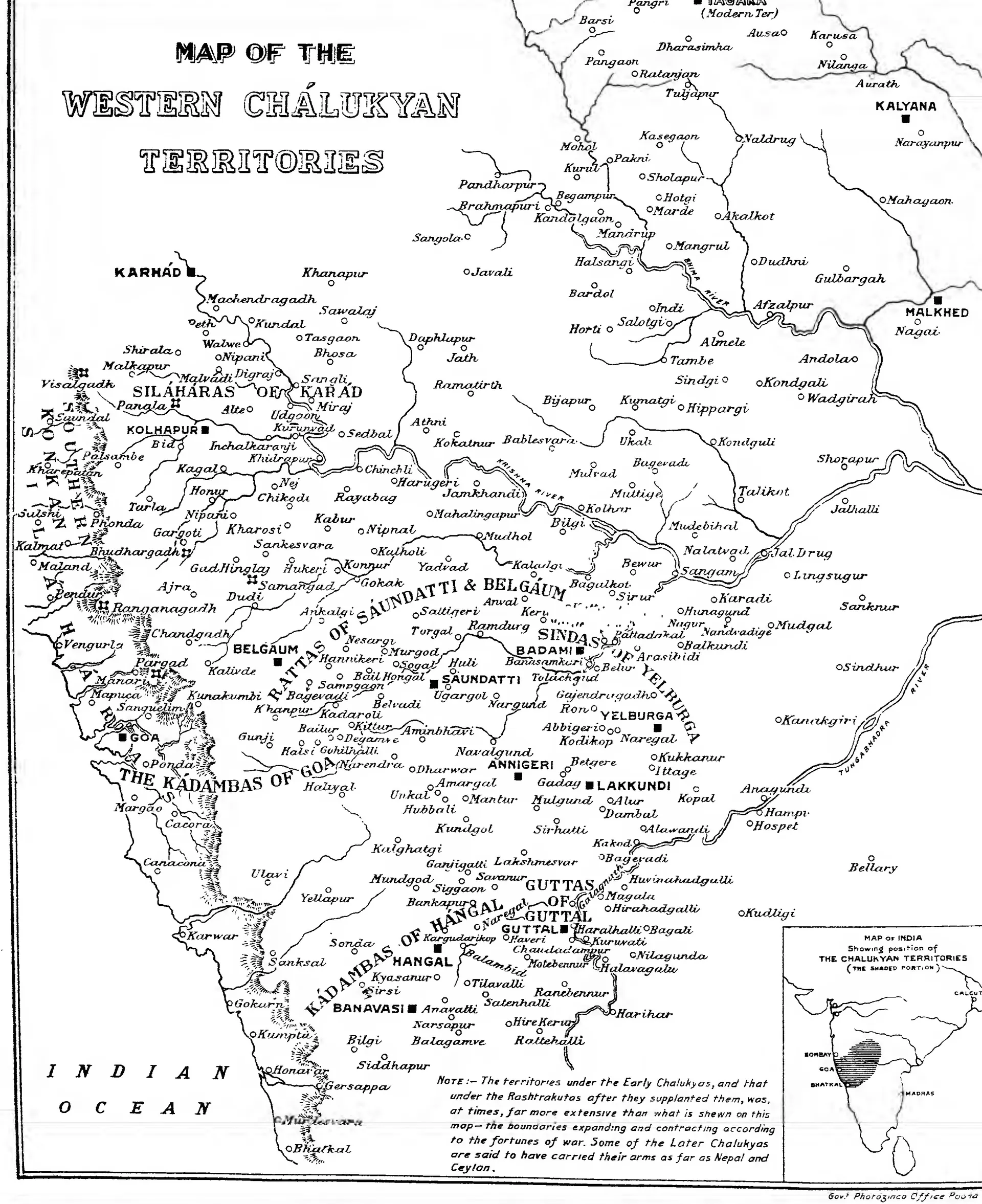
Printed map of the western Deccan, the Arabian Sea on the left: dots and names of towns and temple sites, the territories of feudatory families (Silaharas of Karad, Rattas of Saundatti and Belgaum, Kadambas of Goa and of Hangal, Sindas, Guttas) lettered across them, Kalyana and Malkhed near the top right, and an inset map of India with the Chalukyan territories shaded.
Type
Map
Creator
Henry Cousens (Archaeological Survey of India, New Imperial Series XLII); Government Photozinco Office, Poona
Date
1926
Licence
Public domain
From
Henry Cousens, The Chalukyan Architecture of the Kanarese Districts (Archaeological Survey of India, New Imperial Series, Vol. XLII) (opens in a new tab), 1926, map, unnumbered, listed first ("MAP.") in the list of plates (PDF p. 5)
Original
archive.org (opens in a new tab)
Appears in
Eastern Chalukyas & the Deccan powers, Western Chalukyas of Kalyani, Chalukyas of Badami, Kalyani (Basavakalyan), Temples & architecture