A new site, built from published sources. Spotted a mistake? Please tell us

"India 1318–1338": the land frontier of the Kingdom of Delhi (The Cambridge History of India, Vol. III, 1928, Map 3, PDF p. 185 of the archive.org scan cambridgehistory03wols)
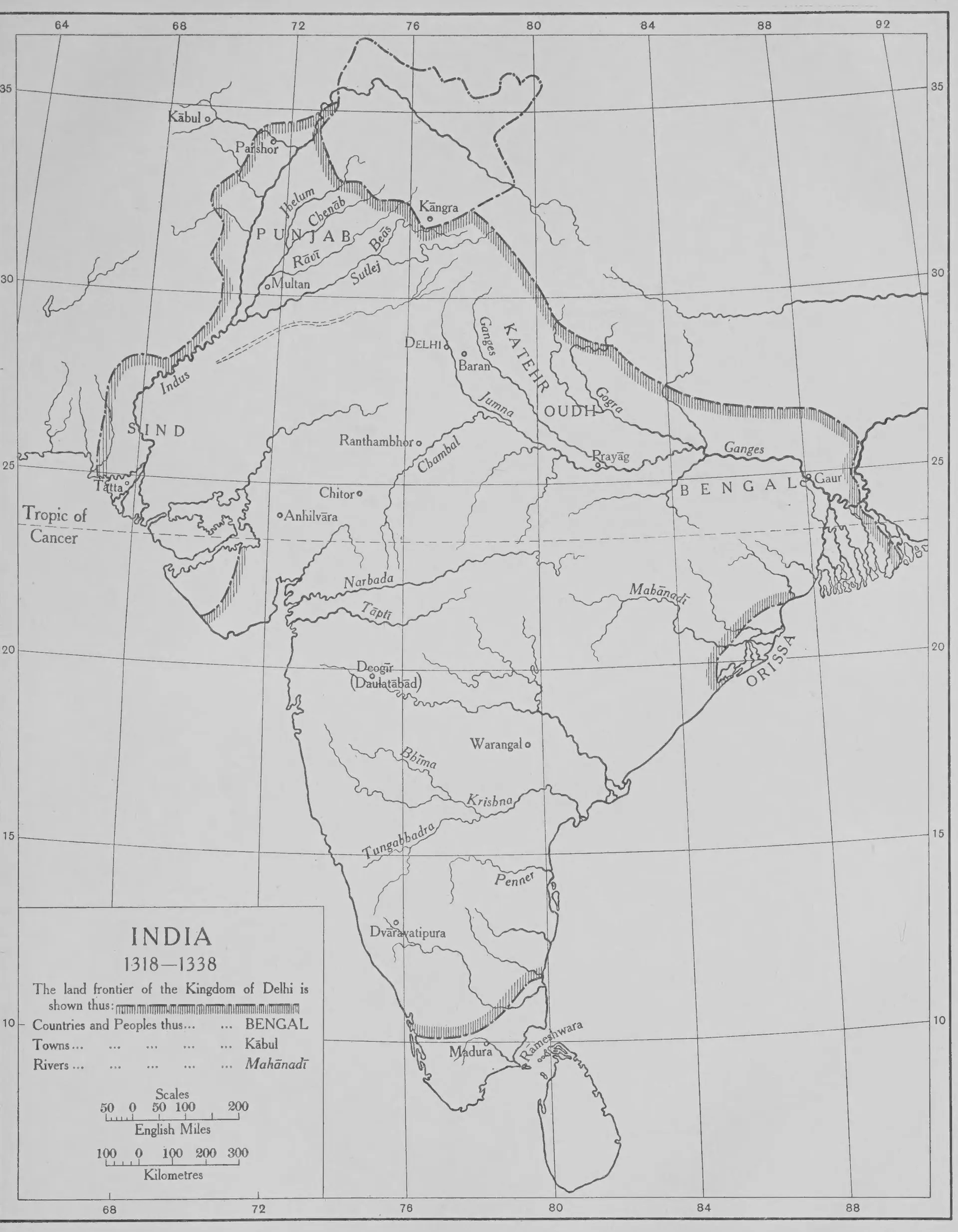
Black-and-white outline map of India between latitudes 8 and 35 degrees north, with a hatched line marking the frontier of the Delhi kingdom; inside it are Delhi, Deogir (Daulatabad), Warangal, Dvaravatipura and Madura, with the Narbada, Tapti, Bhima, Krishna and Tungabhadra rivers.
Type
Map
Creator
Wolseley Haig (ed.), The Cambridge History of India, Vol. III (Cambridge University Press)
Date
1928
Licence
Public domain
From
Wolseley Haig (ed.), The Cambridge History of India, Vol. III: Turks and Afghans (opens in a new tab), 1928, Map 3, between pp. 144 and 145 (PDF p. 185)
Original
archive.org (opens in a new tab)
Appears in
Kakatiyas, Nayakas, Reddis & Bahmanis, Delhi Sultanate in the Telugu country, Muhammad bin Tughluq, Warangal