Nayakas, Reddis & Bahmanis
From the fall of Warangal in 1323 to the rise of Golconda. Telugu chiefs drove out the Delhi garrisons. The Reddi kings ruled from Kondavidu and Rajahmundry, chiefs held the hill forts of Telangana, and the Gajapatis of Orissa came down the coast. The Bahmani sultanate's province of Telingana became the Qutb Shahi kingdom.
Swipe sideways to see the whole chart; tap a bar for details.
Each bar is a ruling power in its region; time runs left to right. Dashed = approximate dates. Select a bar for details.
Show as a list
Kakatiyas 1163–1323 CE
- Telangana
- Kakatiyas (c. 1163–1323 CE)
- Coastal Andhra
- Eastern Gangas of Kalinga (c. 537–1434 CE) · Haihayas of Kona and Palnadu (c. 1073–1364 CE) · Kotas of Dharanikota (c. 1100–1276 CE) · Telugu Chodas of Pottapi and Nellore (c. 1106–1316 CE) · Cholas of Tanjore (c. 1135–1264 CE) · Kakatiyas (c. 1185–1323 CE) · Pandyas (c. 1260–1264 CE)
- Rayalaseema
- Cholas of Tanjore (c. 985–1268 CE) · Pandyas (1285–1293 CE) · Telugu Chodas of Pottapi and Nellore (c. 1120–1268 CE) · Hoysalas (c. 1178–1342 CE) · Kakatiyas (c. 1250–1323 CE)
Nayakas, Reddis & Bahmanis 1323–1518 CE
- Telangana
- Musunuri Nayakas (c. 1336–1368 CE) · Gajapatis of Orissa (c. 1459–1461 CE) · Adil Shahis of Bijapur (c. 1489–1686 CE) · Delhi Sultanate (Tughluqs) (c. 1323–1336 CE) · Bahmani Sultanate (c. 1347–1518 CE) · Recherla Velamas (Padmanayakas) (c. 1361–1475 CE) · Shitab Khan (Sitapati) of Warangal (c. 1504–1516 CE)
- Coastal Andhra
- Eastern Gangas of Kalinga (c. 537–1434 CE) · Gajapatis of Orissa (c. 1446–1571 CE) · Haihayas of Kona and Palnadu (c. 1073–1364 CE) · Reddis of Rajahmundry (c. 1386–1448 CE) · Bahmani Sultanate (c. 1471–1489 CE) · Delhi Sultanate (Tughluqs) (c. 1323–1326 CE) · Vijayanagara Empire (c. 1350–1579 CE) · Reddis of Kondaveedu (c. 1325–1424 CE) · Musunuri Nayakas (c. 1325–1346 CE)
- Rayalaseema
- Vijayanagara Empire (c. 1336–1646 CE) · Reddis of Kondaveedu (c. 1346–1386 CE) · Hoysalas (c. 1178–1342 CE)
Vijayanagara & the Qutb Shahis 1336–1687 CE
- Telangana
- Musunuri Nayakas (c. 1336–1368 CE) · Gajapatis of Orissa (c. 1459–1461 CE) · Adil Shahis of Bijapur (c. 1489–1686 CE) · Bahmani Sultanate (c. 1347–1518 CE) · Vijayanagara Empire (c. 1563–1565 CE) · Recherla Velamas (Padmanayakas) (c. 1361–1475 CE) · Qutb Shahis of Golconda (c. 1518–1687 CE) · Shitab Khan (Sitapati) of Warangal (c. 1504–1516 CE)
- Coastal Andhra
- Eastern Gangas of Kalinga (c. 537–1434 CE) · Gajapatis of Orissa (c. 1446–1571 CE) · Haihayas of Kona and Palnadu (c. 1073–1364 CE) · Reddis of Rajahmundry (c. 1386–1448 CE) · Bahmani Sultanate (c. 1471–1489 CE) · Qutb Shahis of Golconda (c. 1524–1687 CE) · Vijayanagara Empire (c. 1350–1579 CE) · Reddis of Kondaveedu (c. 1325–1424 CE) · Musunuri Nayakas (c. 1325–1346 CE)
- Rayalaseema
- Vijayanagara Empire (c. 1336–1646 CE) · Reddis of Kondaveedu (c. 1346–1386 CE) · Adil Shahis of Bijapur (c. 1568–1686 CE) · Hoysalas (c. 1178–1342 CE) · Qutb Shahis of Golconda (c. 1579–1687 CE)
Kingdoms and empires
Kakatiyas
Open page- Telangana: c. 1052–1162 CE (c. 110 years)
Partial: feudatory chiefs of Anumakonda (Hanamkonda) under the Chalukyas of Kalyani. Prola I received the Anumakonda district as a permanent fief from Someshvara I (record of 1053); Prola II's last record as a subordinate is of 1149; Rudradeva subdued the other Telangana chiefs c. 1157–62 (Parabrahma Sastry). Earlier members served the Rashtrakutas (Mangallu grant, c. 956) according to Parabrahma Sastry, a link rejected by Venkataramanayya and Somasekhara Sarma (1960).
- Telangana: c. 1163–1323 CE (c. 160 years)
Sovereign from Rudradeva's Anumakonda inscription of January 1163; capital moved to Orugallu (Warangal) under Ganapatideva. Warangal taken by Ulugh Khan in 1323 (Parabrahma Sastry, after Isami); Barani and the Imperial Gazetteer give 1321.
- Coastal Andhra: c. 1185–1323 CE (c. 138 years)
Rudradeva subdued the Kotas of Dharanikota and the Kondapadumatis (Tripurantakam grant 1185); Ganapatideva annexed Divi (1203) and Velanadu (records from 1209; Jaya governor 1213) and held the coast from the Godavari to the Penna; Kakatiya records at Draksharama from 1212, but the Eastern Gangas held the region north of the Godavari c. 1230–33 and again c. 1262–78; the Telugu Chodas of Nellore were allies; Nellore was lost to the Pandyas c. 1263 and recovered under Prataparudra.
- Rayalaseema: c. 1250–1323 CE (c. 73 years)
Through the Kayastha chiefs (Gangaya Sahini, bahattara-niyogadhipati c. 1250, capital Valluru in Cuddapah); Ambadeva independent c. 1272–1291, until Prataparudra's armies retook Tripurantakam (between 13 June and 11 August 1291) and the Kayastha lands within about eight years.
Rulers (11)
Capitals
Monuments (16)
Inscriptions (36)
- Kazipet Dargah pillar inscription
- Matedu inscription of Vemabola Malle-nayaka
- Gudur pillar inscriptions of the Viriyala family
- Thousand Pillar Temple inscription of Rudradeva
- Karimnagar inscription of Gangadhara
- Warangal fort inscription of Rudradeva
… and 30 more
- Pillalamarri inscription of Recherla Nami-reddi
- Kondaparti inscription of Malyala Chaunda
- Inugurti pillar inscription of Natavadi Rudra
- Bayyaram tank inscription of Mailama
- Chebrolu inscription of Jaya
- Palampet pillar inscription of Recherla Rudra
- Ganapavaram inscription of Devapala
- Warangal toll inscription of Ganapatideva
- Ganapesvaram inscription of Jaya
- Upparapalli pillar inscription of Kataya
- Motupalli pillar inscription of Ganapatideva
- Pakhal lake inscription of Jagadala Mummadi
- Rayaparti fragment of Saka 1169
- Ekamranatha temple inscription of Ganapati
- Nayanapalle inscription of Ganapatideva
- Durgi inscription of Gangaya-sahini
- Sarngapuram plates of Sarngadhara
- Bothpur tank inscription of Malyala Gunda
- Garavapadu plates of Ganapatideva
- Malkapuram pillar inscription of Rudramadevi
- Kotagiri plates of Viryala Sura
- Kolanupaka inscription of Rudramadevi's reign
- Chandupatla inscription
- Panugallu inscription of Immadi Mallikarjuna-nayaka
- Tripurantakam inscription of Ambadeva
- Raichur fort inscription of Gona Vithala
- Mellacheruvu inscription of Prataparudra's reign
- Srirangam inscription of Prataparudra
- Dharmasagar inscription of the minister Malla
- Hanamkonda inscription of Gangadhara
Sources (7)
Kingdoms and empires
Musunuri Nayakas
Open page- Coastal Andhra: c. 1325–1346 CE (c. 21 years)
Prolaya Nayaka recovered the coast from Delhi in 1325-26 and ruled from Rekapalli on the Godavari (Vilasa grant, about 1330); latest dated Musunuri records on the coast are Kapaya's Guraja grant (February 1346) and his Ganapesvaram inscription (1346-47). Partial: the Reddis of Addanki and the Korukonda chiefs held parts of the coast as Kapaya's kinsmen and subordinates
- Telangana: c. 1336–1368 CE (c. 32 years)
Kapaya Nayaka took Warangal about 1336-37 (Ferishta: 1343-44) and ruled as "lord of the Andhra country" (Pillalamarri inscription, 1357); ceded Kaulas and then Golconda (1364-65) to the Bahmanis; overthrown by the Recherla chief Anapota about 1368 (Kapaya named in the Akkalapundi grant of 1368; Anapota ruling Orugallu in July 1369)
Rulers
Capitals
Inscriptions
Sources (9)
Kingdoms and empires
Gajapatis of Orissa
Open page- Coastal Andhra: c. 1446–1571 CE (c. 125 years)
Kapilendra (Kapilesvara, r. 1434-35 to 1469-70) took the Reddi kingdom of Rajahmundry between 1444 and 1448 and held Kondavidu by 1454 through his kinsman Ganadeva; the Bahmanis took Rajahmundry and Kondapalli or Kondavidu in 1470-71 and Purushottama had recovered the Godavari-Krishna country and the Ongole taluk by 1489; the country south of the Krishna passed to Saluva Narasimha after 1470 and, with Udayagiri, Kondavidu and Kondapalli, to Krishnadeva Raya in 1513-16; Golconda took the Godavari-Krishna doab from about 1522 and Rajahmundry in 1571-72. The northern coast (Srikurmam, Simhachalam) stayed Gajapati throughout.
- Telangana: c. 1459–1461 CE (c. 2 years)
Brief: Orissan troops relieved Devarakonda from the Bahmanis in 1459, and Kapilendra's son Hamvira and nephew Raghudeva took Warangal on 2 February 1460 (two gateway inscriptions); in 1461-62 the Orissan army and the zemindars of Telangana marched on Bidar. How long Warangal was held is not recorded
- Telangana: c. 1497–1516 CE (c. 19 years)
Partial: the uplands of Khammam and the Kondapalli-Nelakondapalli country, held by Prataparudra until Krishnadeva Raya's campaigns (Banerji; Nizam's Archaeological Department)
Rulers
- Kapilendra (Kapilesvara) (c. 1434–1470 CE)
- Purushottama (Gajapati) (c. 1470–1497 CE)
- Prataparudra (Gajapati) (c. 1497–1540 CE)
- Kalua Deva (c. 1540–1541 CE)
- Kakharua Deva (c. 1541 CE)
Inscriptions (8)
Sources (10)
Sultanates
Adil Shahis of Bijapur
Open page- Telangana: c. 1489–1686 CE (c. 197 years)
After the Bahmani break-up part of Mahbubnagar district went to Bijapur (the rest to Golconda) and stayed with it until Aurangzeb annexed Bijapur in 1686; the Raichur district article likewise passes Raichur (which then included the Alampur taluk and Gadwal) from the Bahmanis to the Adil Shahis.
- Rayalaseema: c. 1568–1686 CE (c. 118 years)
Partial, the western uplands only. Adoni taken by Ali Adil Shah's general Ankus Khan in 1568 after a failed siege in 1535-37; Penukonda besieged in the 1570s (dates disputed) and taken in 1652 (Mackenzie MS); Kurnool taken from Gopala Raja early in the 17th century and governed by Abdul Wahab (d. 1618) and later deputies, Siddi Jauhar holding it as his jagir about 1660; the Bellary and Anantapur uplands held through governors and tributary poligars; Bijapur's rights there passed to Shivaji in 1677-80 (Francis); Bijapur fell to Aurangzeb on 12 September 1686, but Siddi Masud held Adoni until 1688 (Sarkar) or 1687 (Bellary gazetteer)
Rulers (9)
Capitals
Monuments
Sources (11)
Sultanates
Delhi Sultanate (Tughluqs)
Open page- Telangana: c. 1323–1336 CE (c. 13 years)
Province of Tilang after Ulugh Khan (Muhammad bin Tughluq) took Warangal and renamed it Sultanpur (1321 by Barani's date for the campaign, 1323 in Haig and the editors of the Vilasa grant). Earlier Khalji campaigns (1303, 1309-10, 1318) ended in failure or tribute and are not drawn. Lost to a Hindu rising under Kanya Naik (Kapaya Nayaka) soon after the cholera of 1335 (Barani), about 1336-37 (modern historians) or in 1343-44 (Ferishta)
- Coastal Andhra: c. 1323–1326 CE (c. 3 years)
Brief hold on the Godavari delta and the coast: mosque at Rajahmundry built in 1324 by Ulugh Khan's servant Salar Ulwi; the coast retaken by Prolaya Nayaka and his allies between 1325 and 1326
Rulers
- Ala-ud-din Khalji (1296–1316 CE)
- Qutb-ud-din Mubarak Shah (1316–1320 CE)
- Ghiyas-ud-din Tughluq (1320–1325 CE)
- Muhammad bin Tughluq (1325–1351 CE)
Sources (7)
Sultanates
Bahmani Sultanate
Open page- Telangana: c. 1347–1518 CE (c. 171 years)
Western Telangana from 1347 (Kaulas taken or ceded; Bhongir taken late in Bahman Shah's reign, the province of Bidar reaching east to Bhongir); Golconda ceded under Muhammad Shah I (1362 Bilgrami; 1364-65 Haig, IG); Warangal taken in AH 828 (end of 1424 per Haig, 1422 per IG, 1425 per the Kistna Manual) and the rayas of Devarakonda and Rachakonda made tributary. Partial afterwards (Telugu chiefs regained districts under Ahmad I; Devarakonda relieved by Orissa 1459; Warangal held by the Gajapatis 1460 and by Shitab Khan from 1504). Governed for Mahmud Shah by Sultan Quli from 1495-96 until his independence (1512 per Haig; 1518 per Bilgrami, from the Golconda mosque inscription of AH 924)
- Coastal Andhra: c. 1471–1489 CE (c. 18 years)
Rajahmundry and Kondapalli (Ferishta) or Kondavidu (Haig, Burhan-i Ma'asir) taken by Malik Hasan Bahri in AH 876 (1471-72), on the invitation of a claimant to the Orissan throne (the Godavari gazetteer says Purushottama ceded the two districts); Muhammad Shah III at Rajahmundry for nearly three years after his Orissa campaign of 1478, and raided Masulipatam and Kanchi in 1481; Telingana split into the provinces of Rajahmundry and Warangal; Rajahmundry still Bahmani in 1486; the Godavari-Krishna country recovered by the Gajapati Purushottama by 1489
Rulers (18)
- Ala-ud-din Hasan Bahman Shah (1347–1358 CE)
- Muhammad Shah I (1358–1375 CE)
- Mujahid Shah (1375–1378 CE)
- Daud Shah (1378 CE)
- Muhammad Shah II (1378–1397 CE)
- Ghiyas-ud-din (1397 CE)
… and 12 more
- Shams-ud-din Daud (1397 CE)
- Firuz Shah (1397–1422 CE)
- Ahmad Shah I (1422–1435 CE)
- Ala-ud-din Ahmad Shah II (1435–1458 CE)
- Humayun Shah (1458–1461 CE)
- Nizam Shah (1461–1463 CE)
- Muhammad Shah III (1463–1482 CE)
- Mahmud Shah Bahmani (1482–1518 CE)
- Ahmad Shah (c. 1518–1521 CE)
- Ala-ud-din (c. 1521–1523 CE)
- Wali-ullah Shah (c. 1523–1525 CE)
- Kalim-ullah Shah (c. 1525–1527 CE)
Inscriptions
Sources (12)
Kingdoms and empires
Vijayanagara Empire
Open page- Rayalaseema: c. 1336–1646 CE (c. 310 years)
Founded c. 1335-36; Bukka I held Penukonda and Gooty (records of 1352 and a Gooty rock inscription) and his minister built the Bukkarayasamudram tank near Anantapur in 1364; Cuddapah in the 14th century; Kurnool wholly annexed under Krishnadeva Raya. After Talikota (1565) the kings ruled from Penukonda, which held out against Bijapur in 1577 and Golconda in 1589; the country north of Penukonda was lost after Sriranga I's capture (c. 1579-80); Venkatapati II moved to Chandragiri c. 1592; Golconda held the Cuddapah district and took Chandragiri (Chittoor) in 1646. Bijapur and Golconda took most of the region piecemeal after 1565
- Coastal Andhra: c. 1350–1579 CE (c. 229 years)
Vijayanagara officers kept Guntur (Kondavidu, Vinukonda, Bellamkonda) and the governor of Udayagiri kept Nellore after Talikota; Golconda took Kondavidu in April 1579 (Kistna Manual) or 1580 (a Guntur record of 1592 cited by Sewell), though Sewell thinks Guntur was already under Muslim rule by 1576 and the Nellore Manual says the Muslims held Nellore from 1565.
- Telangana: c. 1563–1565 CE (c. 2 years)
To end the confederate invasion of Golconda, Ibrahim Qutb Shah let Rama Raja keep the forts of Ghanpur and Panagal (Mahbubnagar) until Talikota; Ferishta places this after the Kalyani campaign of the early 1560s, the Kistna Manual dates it to 1557.
Rulers (24)
- Harihara I (Vijayanagara) (c. 1336–1355 CE)
- Bukka I (Vijayanagara) (1355–1377 CE)
- Harihara II (1377–1404 CE)
- Bukka II (1404–1406 CE)
- Deva Raya I (1406–1422 CE)
- Vijaya (Bukka III) (1422 CE)
… and 18 more
- Deva Raya II (Vijayanagara) (1422–1446 CE)
- Mallikarjuna (1446–1465 CE)
- Virupaksha (1465–1485 CE)
- Saluva Narasimha (1485–1492 CE)
- Immadi Narasimha (1492–1505 CE)
- Narasa Nayaka (c. 1505 CE)
- Vira Narasimha (1505–1509 CE)
- Krishnadeva Raya (1509–1529 CE)
- Achyuta Raya (1529–1542 CE)
- Venkata I (1542 CE)
- Sadasiva (c. 1542–1569 CE)
- Tirumala (Aravidu) (c. 1569–1572 CE)
- Sriranga I (1572–1586 CE)
- Venkatapati II (Vijayanagara) (1586–1614 CE)
- Sriranga II (1614 CE)
- Rama Deva (1614–1630 CE)
- Pedda Venkata (1630–1642 CE)
- Sriranga III (c. 1642–1670 CE)
Monuments (7)
- Penukonda fort and Gagan Mahal
- Kalahastisvara temple, Srikalahasti
- Virabhadra temple, Lepakshi
- Chandragiri fort and Raja Mahal
- Gooty fort
- Narasimha temples, Ahobilam
… and 1 more
Inscriptions (14)
- Penukonda fort inscription (1354)
- Gooty rock inscription of Bukka I
- Bitragunta grant of Sangama II (1356)
- Bukkarayasamudram tank inscription (1364)
- Tirumala inscriptions of Krishnadeva Raya and his queens (1513–1514)
- Amaravati inscription of Krishnadeva Raya (1515)
… and 8 more
- Mangalagiri and Kaza pillar inscriptions (1515–1518)
- Simhachalam inscriptions of Krishnadeva Raya (1516–1519)
- Srikalahasti inscription of Krishnadeva Raya (1516)
- Kondavidu pillar inscription of Nadindla Gopa (1520)
- Lepakshi temple inscriptions of Achyuta Raya's reign (1533–1538)
- Kanuma grant of Sadasiva (1548)
- Penukonda inscription of Channappa Nayudu (1577)
- Ahobilam inscription of Sriranga I (1584)
Sources (20)
Kingdoms and empires
Recherla Velamas (Padmanayakas)
Open page- Telangana: c. 1361–1475 CE (c. 114 years)
Anapota at Rachakonda (Rajukonda) and Mada at Devarakonda after their victories of 1361 (family chronicle); Rachakonda fortified in August 1365; Warangal, Bhongir and Rachakonda ruled by July 1369 (Inavolu inscription). The rayas of Devarakonda and Rachakonda paid tribute to Ahmad Shah Bahmani after his capture of Warangal (end of 1424); Devarakonda routed a Bahmani army with Orissan help in 1459; last dated record of the Rachakonda line 1464. End about 1475 per the list of rulers in Epigraphia Telanganica; no source dates the annexation
Rulers (7)
- Singama Nayaka (Recherla) (c. 1336–1361 CE)
- Anapota Nayaka (Recherla) (c. 1361–1384 CE)
- Mada Nayaka (Recherla) (c. 1361–1384 CE)
- Singabhupala (Recherla) (c. 1384–1399 CE)
- Peda Vedagiri (Recherla) (c. 1384–1410 CE)
- Lingama Nayaka (Recherla) (c. 1427–1475 CE)
… and 1 more
- Singama Nayaka, 'Sarvajna' (Rachakonda) (c. 1430–1475 CE)
Capitals
Monuments
Inscriptions
Sources (7)
Sultanates
Qutb Shahis of Golconda
Open page- Telangana: c. 1518–1687 CE (c. 169 years)
Sultan Quli governed Telingana for the Bahmanis from 1493-95 and declared independence in 1512 (Ferishta, Haig, IG Hyderabad) or 1518 (Bilgrami, from the Golconda mosque inscription of AH 924); he took the forts of the Telugu chiefs, among them Rachakonda, Devarakonda and, from Shitab Khan, Warangal and Khammam (1519-1525 per Bilgrami). Tributary to the Mughals from 1635-36 (khutba and coins in Shah Jahan's name; two lakhs of huns a year). Hyderabad taken by the Mughals in 1656 and 1685; Golconda surrendered on 21 September 1687 (Old Style) and was annexed
- Coastal Andhra: c. 1524–1687 CE (c. 163 years)
Sultan Quli took Kondapalli and fixed the Godavari as his frontier with Orissa (Ellore ceded) some time before his 1530 campaign, and a 1524 record shows him granting villages near Kondapalli and Bezwada; the Godavari gazetteer and IG Madras date the Krishna-Godavari doab to c. 1540 or 'before 1543', and the IG Madras Kistna article to after 1565.
- Rayalaseema: c. 1579–1687 CE (c. 108 years)
Partial; the sources disagree on when Golconda's hold began. IG Madras says Kurnool and Cuddapah were overrun soon after 1565. The Kurnool Manual dates the campaigns that took Gurramkonda (1579) and Gandikota, Nandyal and Musalimadugu (c. 1590). The Cuddapah gazetteer says Golconda only turned to Cuddapah in the early 17th century and never really conquered it. Chandragiri fell to Golconda in 1646.
Rulers (8)
Capitals
Monuments (13)
Inscriptions (7)
- Epitaph of Sultan Quli, Golconda (1543)
- Makka Darwaza inscription, Golconda (1559)
- Jami Masjid inscription, Hyderabad
- Epitaph of Muhammad Quli Qutb Shah, Golconda (1612)
- Ma Saheba tank inscriptions (1625)
- Musa Burj inscription, Golconda fort (1666–67)
… and 1 more
Sources (23)
Kingdoms and empires
Shitab Khan (Sitapati) of Warangal
Open page- Telangana: c. 1504–1516 CE (c. 12 years)
Partial (Warangal, Khammam and other hill forts, with Bellamkonda south of the Krishna; probably Nalgonda). A former Bahmani officer, Shitab Khan or Sitapati, took Warangal fort from the Muslims on 21 January 1504 by his pillar inscription, and held it until Sultan Quli Qutb Shah defeated him and his Gajapati allies; the Kistna manual calls him apparently a vassal of Orissa. The end is uncertain: Sastri allows him six or seven years (to 1512), the Hyderabad archaeological report of 1925-26 dates the loss of Warangal to 1513-1516, the Kistna manual places the war after 1516, and Bilgrami gives 1519-1525
Rulers
Capitals
Monuments
Inscriptions
Sources (6)
Kingdoms and empires
Eastern Gangas of Kalinga
Open page- Coastal Andhra: c. 537–1434 CE (c. 897 years)
Partial: only the far north coast (the old Ganjam and Vizagapatam districts, now Srikakulam-Vizianagaram- Visakhapatnam), capital Kalinganagara (Mukhalingam). Earliest dated grant: Jirjingi, near Tekkali, Ganga year 39 (c. 537 on Mirashi's epoch of 498; Fleet put the early grants in the 7th century and Sewell used an epoch of 877-78; the Imperial Gazetteer, the 7th century). Later line in power from the end of the 9th century (Vizagapatam gazetteer): Vajrahasta III crowned 1038; Anantavarman Chodaganga 1078-1146, with records at Mukhalingam, Srikurmam, Simhachalam and Visakhapatnam. South of the Godavari only records and raids (Draksharama 1128-1274; Bendapudi). Ended 1434, when the minister Kapilesvara founded the Gajapati line
Rulers (15)
- Vajrahasta III (Eastern Ganga) (1038–1070 CE)
- Rajaraja I (Eastern Ganga) (1070–1078 CE)
- Anantavarman Chodaganga (c. 1078–1146 CE)
- Madhu-Kamarnava (c. 1146–1152 CE)
- Raghava (c. 1152–1166 CE)
- Rajaraja II (c. 1166–1192 CE)
… and 9 more
- Aniyanka-Bhima (c. 1192–1202 CE)
- Anangabhima III (c. 1219–1253 CE)
- Narasimha I (Eastern Ganga) (c. 1253–1256 CE)
- Bhanudeva I (c. 1256–1275 CE)
- Narasimha II (c. 1275–1306 CE)
- Bhanudeva II (c. 1306–1323 CE)
- Narasimha III (c. 1323–1346 CE)
- Bhanudeva III (c. 1346–1378 CE)
- Narasimha IV (c. 1378–1397 CE)
Capitals
Monuments
Inscriptions (8)
Sources (10)
Kingdoms and empires
Haihayas of Kona and Palnadu
Open page- Coastal Andhra: c. 1073–1364 CE (c. 291 years)
Partial. Kona chiefs of Konamandala (the Godavari delta, Amalapuram taluk), with records at Draksharama and Palakol from Saka 995 (1073) to 1364–65, dependent on the Chola–Chalukya kings and the Velanati Chodas, later on the Kakatiyas; Haihaya chiefs of the Chagi family in the Palnadu (Macherla 1111, Gurazala 1129) as feudatories of the Chalukyas of Kalyani; the Palnadu war of the ballads is undated (proposals 1080–1386).
Rulers
- Rajendra Choda I of Kona (1128 CE)
- Mummadi-Bhima II and Satya I (1135 CE)
- Bhima III (c. 1153–1168 CE)
- Mallideva of Kona (c. 1155–1207 CE)
- Ganapatideva of Kona (c. 1262–1300 CE)
- Bhima-Vallabha (1318 CE)
Inscriptions
Sources (5)
Kingdoms and empires
Reddis of Rajahmundry
Open page- Coastal Andhra: c. 1386–1448 CE (c. 62 years)
Partial: the Godavari delta and the coast north to Simhachalam, capital Rajahmundry. Kataya Vema, minister of Kumaragiri, received "the eastern country" by 1386 (Ramayya; Sewell c. 1380); after his death (c. 1414-16) Allada Reddi, then Allada's sons Allaya Vema and Virabhadra (records 1423-1437, a record of 1444). Godavari gazetteer: family in the Draksharama inscriptions until 1447; a Gajapati record of 1448 at Penugonda marks the end (Somasekhara Sarma); Kapilesvara's minister ruling at Rajahmundry in 1458
Rulers
- Kataya Vema (c. 1386–1415 CE)
- Allada Reddi (c. 1416–1420 CE)
- Allaya Vema and Virabhadra (c. 1423–1448 CE)
Capitals
Inscriptions
Sources (6)
Kingdoms and empires
Kotas of Dharanikota
Open page- Coastal Andhra: c. 1100–1276 CE (c. 176 years)
Partial (the Six-thousand country, Konnatavadi, south of the Krishna about Amaravati–Dharanikota and the Sattenapalle taluk). Line from Bhima I (c. 1100, Sewell); Keta II from about 1182; subdued by the Kakatiya Rudradeva about 1185 and thereafter Kakatiya subordinates and relatives by marriage (Ganapamba, widow of Kota Beta, ruled in the 1250s); last record of a Kota Rudra 1275–76.
Rulers
- Kota Keta II (c. 1182–1209 CE)
- Manma-Keta (Keta III) (c. 1234–1240 CE)
- Kota Beta (c. 1250–1251 CE)
- Ganapamba (c. 1251–1257 CE)
- Bhima IV (1265 CE)
Capitals
Inscriptions
Sources (5)
Kingdoms and empires
Telugu Chodas of Pottapi and Nellore
Open page- Coastal Andhra: c. 1106–1316 CE (c. 210 years)
Konidena branch in the Guntur country from 1106 to about 1150; the main line at Nellore (Vikramasimhapura) from Tammusiddhi's anointment in 1205-06, under the Cholas and then the Kakatiyas, who restored Manumasiddhi II; held Kanchi under Tikka I (1209/1223-1248/1250) and Manmasiddhi III. Last date 1316 (Sewell); the Nellore gazetteer finds no Telugu Choda record in Nellore after 1305.
- Rayalaseema: c. 1120–1268 CE (c. 148 years)
Pottapinadu (Pullampet country of Cuddapah), seat of the Madhurantaka Pottapi-Cholas under the Chola emperors: Betta 1120-21, Vimaladitya c. 1125; Pottapi remained their seat until Tikka I moved to Nellore; Manumasiddhi II recorded at Pottapi 1258-59; the country passed to the Kayastha Ambadeva after 1268.
Rulers
- Tammusiddhi (c. 1205–1209 CE)
- Tikka I (Telugu Choda of Nellore) (c. 1209–1248 CE)
- Manumasiddhi II (c. 1248–1290 CE)
- Manmasiddhi III (c. 1290–1316 CE)
Capitals
Inscriptions
Sources (5)
Kingdoms and empires
Reddis of Kondaveedu
Open page- Coastal Andhra: c. 1325–1424 CE (c. 99 years)
Capital Addanki, then (from Anavema, after 1361) Kondavidu. Coast south of the Krishna and at times the Godavari delta (Anavema's grants at Vanapalli, Nadupuru, Palivela, Draksharama 1374-81). Start: Mallavaram record of 1325 (Somasekhara Sarma); the Kistna manual says 1328, the Godavari gazetteer has the earliest record in 1344. End disputed: Vijayanagara conquest by 1424 (Somasekhara Sarma), Racha Vema killed 1428 (Kistna manual), overthrown 1427 (Sewell 1884), a Gajapati conquest c. 1420 (village chronicles). From c. 1386 the Godavari country belonged to the separate Rajahmundry kingdom
- Rayalaseema: c. 1346–1386 CE (c. 40 years)
Partial: the Srisailam plateau and the Markapur taluk (records at Tripurantakam, 1346 and 1347; Anavema's Viramantapa at Srisailam, 1378); Prolaya Vema's steps at Srisailam and Ahobilam
Rulers
Capitals
Monuments
Inscriptions (8)
Sources (8)
Kingdoms and empires
Cholas of Tanjore
Open page- Rayalaseema: c. 985–1268 CE (c. 283 years)
Rajaraja I (from 982/985) claims Nulambapadi and had the Vaidumbas of Cuddapah as feudatories. Chola inscriptions in Kurnool are dated 1108 and 1123. The east of Cuddapah (Pottapi-nadu) stayed under Chola suzerainty through the Telugu Chodas until Rajendra III's death in 1268. IG Madras has Cuddapah Chola from the 11th to the 13th century.
- Coastal Andhra: c. 999–1135 CE (c. 136 years)
Overlords of the Eastern Chalukya kings from 999; Kulottunga I's sons ruled Vengi as viceroys 1077-1118; Vengi was lost to the Western Chalukyas after Vikrama-Chola left in 1118, and his records reappear at Chebrolu (1127) and Nidubrolu (1135). Nellore stayed under Chola suzerainty into the 13th century (IG Madras)
- Coastal Andhra: c. 1135–1264 CE (c. 129 years)
Partial (Nellore). After Vengi was lost, Nellore stayed under the Cholas until their 13th-century decline: Rajaraja III is recognised there in 1237 and Rajendra III in 1253, with the Telugu Choda chiefs ruling locally as their vassals. A Tamil record at Punjulurupadu, in the Gudur country, is still dated in the 20th year of Rajendra III, Saka 1185 (1263-64).
Rulers (14)
- Rajaraja I (Chola) (985–1016 CE)
- Rajendra I (Chola) (1012–1043 CE)
- Rajadhiraja I (Chola) (1018–1052 CE)
- Rajendradeva (1052–1063 CE)
- Virarajendra (Chola) (1063–1070 CE)
- Adhirajendra (1070 CE)
… and 8 more
- Kulottunga I (1070–1118 CE)
- Vikrama-Chola (1118–1133 CE)
- Kulottunga II (Chola) (1133–1146 CE)
- Rajaraja II (Chola) (1146–1163 CE)
- Rajadhiraja II (1163–1178 CE)
- Kulottunga III (Chola) (1178–1216 CE)
- Rajaraja III (1216–1246 CE)
- Rajendra III (Chola) (1246–1267 CE)
Capitals
Inscriptions (10)
Sources (9)
Kingdoms and empires
Pandyas
Open page- Coastal Andhra: c. 1260–1264 CE (c. 4 years)
Partial (Nellore). Jatavarman Sundara Pandya I beat the Telugus at Mudugur, drove them to the Krishna and was crowned at Nellore (Aiyangar, from his records); Sewell dates the march to 1260, Parabrahma Sastry the battle to 1263. Aiyangar says the conquest was not permanent and the Nellore gazetteer says Ganapati recovered Nellore almost at once, so the span is short. A later Jatavarman Sundara Pandya, crowned at Nellore after 1276 (Nellore gazetteer), endowed a hall in the Ranganayaka temple there; no source gives the length of this second hold, so it has no span.
- Rayalaseema: 1285–1293 CE (8 years)
Partial (Nandalur, east Cuddapah). Jatavarman Sundara Pandya II has dated records at Nandalur in 1285, 1286 and 1293, six in all from 1286-1293, as Pandya power spread north after the Chola collapse.
Rulers
- Jatavarman Sundara Pandya I (c. 1251–1268 CE)
- Maravarman Kulasekhara I (1268–1311 CE)
- Jatavarman Sundara Pandya (crowned at Nellore) (c. 1276–1293 CE)
Inscriptions
Sources (5)
Kingdoms and empires
Hoysalas
Open page- Rayalaseema: c. 1178–1342 CE (c. 164 years)
Partial (south and west Anantapur: Hemavati, Madakasira, Penukonda, Gooty claim; Rayachoti taluk in the later 13th century). A record at Parigi (Hindupur taluk) of Saka 1100 (1178) shows Ballala II ruling at Dorasamudra; he took Nolambavadi, and his inscription of 1205-06 is at Hemavati. A record at Kodigepalle of 1328 shows Ballala III's minister ruling at Penugonda. Ballala III's inscriptions in Anantapur district run from 1317 through 1320 and 1323 to 1340. He was killed fighting the Sultan of Madurai on 8 September 1342.
Rulers
- Ballala II (Hoysala) (1173–1220 CE)
- Narasimha II (1220–1235 CE)
- Somesvara (1233–1254 CE)
- Narasimha III (1254–1291 CE)
- Ballala III (Hoysala) (1291–1342 CE)
- Ballala IV (Virupaksha) (1342–1343 CE)
Capitals
Sources (6)
The army of the Delhi sultanate captured Warangal in 1323.1 This ended the Kakatiya kingdom.1 For nearly two centuries after that, no single power held the Telugu country. Telugu chiefs drove out the Delhi garrisons within twenty years.2
A family of Reddi cultivators built a kingdom on the coast.3 Chiefs held the hill forts of Telangana.34 The Gajapati kings of Orissa pressed south along the coast.4 The Bahmani sultanate, founded in 1347, slowly took over the interior.56 This page outlines the period, and the main powers have their own pages: the Delhi Sultanate in the Telugu country, the Musunuri Nayakas, the Bahmanis, the Reddis of Kondavidu and the Qutb Shahis.
The fall of Warangal
Gribble follows the Persian histories. He describes how Prince Ulugh Khan, son of the Delhi sultan Ghiyas-ud-din Tughluq, besieged Warangal twice.1 The first siege broke up on a false rumour of the sultan’s death.1 The second siege, in 1323, took the city. The king and his family were sent to Delhi, and Warangal was renamed Sultanpur.1
The Imperial Gazetteer of Hyderabad dates the final breaking of Kakatiya power to 1321.7 Hirananda Sastri notes that the last secure date for Prataparudra in the inscriptions is Saka 1246 (1323–24; Saka is an Indian way of counting years).8 He adds that no one knows what became of the Kakatiya family afterwards. Later accounts name different successors, but no inscriptions of theirs have been found.8
The Delhi army pushed on to the coast.9 The Godavari gazetteer cites an inscription on a mosque at Rajahmundry.9 It records that Muhammad Tughluq built the mosque in 1324.9
Driving out Delhi
Delhi’s hold did not last. Gribble writes that Muhammad Tughluq soon returned north.2 Then “a Hindoo named Kanya Naick” raised an army and drove the governor Malik Makbul out of Warangal.2 After this, Gribble says, the province was “completely lost to the Mahomedans”.2
Sewell quotes Ferishta’s version for AH 744 (1343–44; AH is the Islamic way of counting years).10 In it, Krishna Naik, “son of Rudra Deva of Warangal”, made an agreement with Ballala, the ruler of Dvarasamudra. They would raise the Hindus of Telingana together.10 Their forces retook Warangal and drove its governor back to Daulatabad.10
The Kistna district manual names Virabhadraya, a son of Prataparudra, as the leader.11 It says he declared his independence at Warangal in 1344.11 These older sources do not settle whether the names refer to the same man. Twentieth-century historians identified the leader with the Musunuri chief Kapaya Nayaka.1213 The Vilasa grant of his cousin Prolaya Nayaka was issued about 1330, but published only in 1957–58.1213 It credits Prolaya with driving the Delhi garrisons from the Telugu country.13
A Telugu inscription of 1357 gives a glimpse from the time itself. At Pillalamarri, an officer named Era-Potu-lemka governed the village.14 He records that he set up again the image of the god Erakesvara. “Sultan Alavadin” had damaged it in the disorders of the time.14 He made the gift for the merit of his ruler, Kapaya-nayaka. The inscription calls Kapaya lord of the Andhra country and lord of the city of Anumanamgallu.14 See the Pillalamarri inscription.
The officers of the Deccan rebelled against Delhi in 1345–47.5 Gribble says the ruler of Warangal sent 15,000 men to help their leader Hasan. Hasan defeated the Sultan’s army near Bidar.5 He then became the first Bahmani sultan.5
Vijayanagara
The new Hindu kingdom of Vijayanagara on the Tungabhadra was founded in the same years.15 Gribble repeats a tradition about its founders, the brothers Harihara and Bukka. In it, they had served in the army of the king of Warangal and fled south when the city fell.15 He notes that the city’s founding is generally dated 1336.15 Sewell discusses several versions of its origin.16 The Vijayanagara & Qutb Shahi page continues its story.
The Bahmanis in Telingana
The Bahmani sultans first allied with Warangal and then turned on it.17 A war under Sultan Muhammad Shah I ended with the Raja of Warangal giving up the fort of Golconda as the frontier.17 He also handed over a jewelled throne. The Imperial Gazetteer dates this cession to 1364.17
Warangal itself fell to Ahmad Shah in the 1420s.6 Gribble gives 1424, and says it was never again a royal city.6 Telingana became a Bahmani province.18 But Gribble notes that “there were still a number of unsubdued Hindoo princes on the East Coast”.18
The Reddis and the coast
On the coast, the Reddis rose to power. The Godavari gazetteer describes them as cultivators who had served the Warangal kings.3 Their earliest inscription is of 1344.3 Their first capital was Addanki, and their later one the hill fortress of Kondavidu.3 A branch ruled the Godavari delta from Rajahmundry until the 1440s.3
The Kistna manual calls the Reddis “great patrons of Telugu literature”.19 It places the poet Srinatha at their court.19
By the 1450s the Gajapati king Kapilesvara of Orissa was overlord as far south as Kondavidu.4 In 1470–71 the Bahmanis gained Rajahmundry and Kondapalli, during a disputed succession in Orissa.20 Then came a famine and a revolt at Kondapalli. After these, Sultan Muhammad Shah III spent three years at Rajahmundry.20 He carried a raid as far south as Kanchipuram.20
Chiefs of the hill forts
Inland, local chiefs held the hill forts of Telangana. In 1459 a Bahmani army was sent against the “revolted Telugu fortress” of Devarakonda.21 The Raja of Orissa defeated it.21
The clearest case is Sitapati, known in Persian sources as Shitab Khan.22 A Sanskrit and Telugu inscription on a pillar in Warangal fort records that he took the fort on 21 January 1504.22 It claims that he put back on their thrones a Krishna image and the image of the Kakatiya family goddess. They had been removed by “the wicked Turushkas” (the Turks).22
Sastri thought Sitapati had begun as a Bahmani officer and was of humble Boya birth.23 Sastri also identified him as the patron praised in the Telugu poem Chitra-Bharatamu of Charigonda Dhannanna. The poem was dedicated to his minister Peddanna.23 Sitapati held Khammam and Bellamkonda as well as Warangal, until Sultan Quli of Golconda defeated him.24
Towards Golconda
The governor of Telingana for the late Bahmani kings was Sultan Quli. He was a Persian who had come to Bidar as a young man and risen in the king’s service.25 Golconda was his seat.25
The Golconda chronicle says he spent his first years bringing “the neighbouring zemindars of Tulingana” under control.26 It quotes him as claiming more than sixty forts. Among them were Rajakonda, Devarakonda, Warangal and Khammam.26
When the Bahmani kingdom broke up, Sultan Quli too became a king.27 Ferishta dates this to 1512.27 But the inscription of his mosque in Golconda fort, dated 1518, still names the Bahmani king as sovereign.27 The Qutb Shahi kingdom of Golconda that followed is the subject of the next era.
About the sources
Much of this period is known from two kinds of source. The first is Persian chronicles written for Muslim courts, read here in the English of Briggs, Sewell and Gribble. The second is Telugu inscriptions.28 The chroniclers present the wars as holy war.28 They name Telugu leaders in forms that are hard to match with the inscriptions. Kanya Naick, Krishna Naik and Nagdeo appear in the Persian narratives. Kapaya-nayaka and Sitapati appear in the inscriptions.28
The gazetteers used the Mackenzie local histories (kaifiyats).28 These add traditions that, as Sastri warned, often mix up different people of the same name.28 The Musunuri Nayakas are known mainly from inscriptions edited after 1930. They have their own page.12 So do the Recherla Velamas of Rachakonda and Devarakonda, the chiefs of the Telangana hill forts.
Footnotes
-
J. D. B. Gribble, A History of the Deccan, Vol. I (1896), pp. 12–13 (archive.org (opens in a new tab)). ↩ ↩2 ↩3 ↩4 ↩5
-
Gribble, History of the Deccan (1896), pp. 19–20 (archive.org (opens in a new tab)). ↩ ↩2 ↩3 ↩4
-
Hemingway, Godavari (1907), pp. 25–26 (archive.org (opens in a new tab)). ↩ ↩2 ↩3 ↩4 ↩5 ↩6
-
Hemingway, Godavari (1907), p. 26 (archive.org (opens in a new tab)). ↩ ↩2 ↩3
-
Gribble, History of the Deccan (1896), pp. 20–22 (archive.org (opens in a new tab)). ↩ ↩2 ↩3 ↩4
-
Gribble, History of the Deccan (1896), p. 86 (archive.org (opens in a new tab)). ↩ ↩2 ↩3
-
Imperial Gazetteer of India: Hyderabad State (1909), p. 11 (archive.org (opens in a new tab)). ↩
-
Hirananda Sastri, Shitab Khan of Warangal (1932), p. 2 (archive.org (opens in a new tab)). ↩ ↩2
-
F. R. Hemingway, Madras District Gazetteers: Godavari, Vol. I (1907), p. 25 (archive.org (opens in a new tab)). ↩ ↩2 ↩3
-
Robert Sewell, A Forgotten Empire (1900), ch. 3 (Gutenberg (opens in a new tab)). ↩ ↩2 ↩3
-
Gordon Mackenzie, A Manual of the Kistna District (1883), pp. 9, 15–16 (archive.org (opens in a new tab)). ↩ ↩2
-
N. Venkataramanayya and M. Somasekhara Sarma, “Vilasa Grant of Prolaya-nayaka”, Epigraphia Indica XXXII (1957–58), p. 256 (archive.org (opens in a new tab)). Paraphrased. ↩ ↩2 ↩3
-
Venkataramanayya and Somasekhara Sarma, “Vilasa Grant” (1957–58), pp. 241–242 (archive.org (opens in a new tab)). Paraphrased. ↩ ↩2 ↩3
-
P. Sreenivasachar (ed.), A Corpus of Inscriptions in the Telingana Districts, Part II (1940), pp. 113–114, No. 40 (archive.org (opens in a new tab)). ↩ ↩2 ↩3
-
Gribble, History of the Deccan (1896), pp. 23–25 (archive.org (opens in a new tab)). ↩ ↩2 ↩3
-
Sewell, A Forgotten Empire (1900), ch. 2 (Gutenberg (opens in a new tab)). ↩
-
Gribble, History of the Deccan (1896), pp. 37–39 (archive.org (opens in a new tab)); Imperial Gazetteer: Hyderabad (1909), p. 114 (archive.org (opens in a new tab)). ↩ ↩2 ↩3
-
Gribble, History of the Deccan (1896), p. 110 (archive.org (opens in a new tab)). ↩ ↩2
-
Mackenzie, Kistna District (1883), p. 10 (archive.org (opens in a new tab)). ↩ ↩2
-
Hemingway, Godavari (1907), pp. 26–27 (archive.org (opens in a new tab)); Sewell, A Forgotten Empire (1900), ch. 8 (Gutenberg (opens in a new tab)). ↩ ↩2 ↩3
-
Mackenzie, Kistna District (1883), p. 17 (archive.org (opens in a new tab)). ↩ ↩2
-
Sastri, Shitab Khan of Warangal (1932), pp. 13, 15 (archive.org (opens in a new tab)). ↩ ↩2 ↩3
-
Sastri, Shitab Khan of Warangal (1932), pp. 10–11, 15 (archive.org (opens in a new tab)). ↩ ↩2
-
Sastri, Shitab Khan of Warangal (1932), pp. 3–5 (archive.org (opens in a new tab)); Golconda chronicle, in Muhammad Qasim Ferishta, tr. John Briggs, History of the Rise of the Mahomedan Power in India, Vol. III (1829), pp. 360–364 (archive.org (opens in a new tab)). ↩
-
Ferishta, tr. Briggs, Rise of the Mahomedan Power, Vol. III (1829), p. 322 (archive.org (opens in a new tab)); Briggs, Vol. III, pp. 343–345 (archive.org (opens in a new tab)). ↩ ↩2
-
Briggs, Rise of the Mahomedan Power, Vol. III (1829), pp. 352–355 (archive.org (opens in a new tab)). ↩ ↩2
-
Ferishta, tr. Briggs, Rise of the Mahomedan Power, Vol. III (1829), p. 323 (archive.org (opens in a new tab)); Syed Ali Asgar Bilgrami, Landmarks of the Deccan (1927), pp. 111, 195 (archive.org (opens in a new tab)). ↩ ↩2 ↩3
-
Sastri, Shitab Khan of Warangal (1932), pp. 5–6, 9 (archive.org (opens in a new tab)). ↩ ↩2 ↩3 ↩4 ↩5
Milestones
- Rise of a power
- End of a power
- Inscription
- Monument
- c. 1323End of a power:Kakatiyas
- c. 1323Rise of a power:Delhi Sultanate (Tughluqs)
- c. 1325Rise of a power:Musunuri Nayakas
- c. 1325Rise of a power:Reddis of Kondaveedu
- c. 1330Inscription:Vilasa grant of Prolaya Nayaka
- c. 1336End of a power:Delhi Sultanate (Tughluqs)
- c. 1336Rise of a power:Vijayanagara Empire
- c. 1342End of a power:Hoysalas
- 1345Inscription:Madras Museum plates of Vema (1345)
- 1346Inscription:Guraja grant of Kapaya Nayaka
- 1346Inscription:Puvvada grant of Prolaya Vema (1346)
- c. 1347Rise of a power:Bahmani Sultanate
- 1354Inscription:Penukonda fort inscription (1354)
- 1354Monument:Penukonda fort and Gagan Mahal
- c. 1355Inscription:Gooty rock inscription of Bukka I
- 1356Inscription:Bitragunta grant of Sangama II (1356)
- 1357Inscription:Pillalamarri inscription of the reign of Kapaya Nayaka
- 1358Inscription:Koduru grant of Anavota Reddi (1358)
- c. 1360Monument:Kondapalli fort
- c. 1361Rise of a power:Recherla Velamas (Padmanayakas)
- c. 1364End of a power:Haihayas of Kona and Palnadu
- 1364Inscription:Bukkarayasamudram tank inscription (1364)
- 1365Inscription:Rachakonda inscriptions of Anapota (1365)
- c. 1368End of a power:Musunuri Nayakas
- 1369Inscription:Inavolu inscription of Recherla Anapota
- c. 1374Inscription:Nadupuru grant of Anavema
- 1374Inscription:Pachchanitandiparru grant of Anavema (1374)
- 1375Inscription:Kandikonda inscription of Venna (1375)
- 1377Inscription:Umamahesvaram inscription of Mada Nayaka (1377)
- 1378Inscription:Pedapalakaluru plates of Anavema (1378)
- 1380Inscription:Vanapalli plates of Anavema (1380)
- c. 1386Rise of a power:Reddis of Rajahmundry
- 1410Inscription:Phirangipuram pillar inscription of Peda Komati Vema (1410)
- 1411Inscription:Tottaramudi plates of Kataya Vema (1411)
- c. 1424End of a power:Reddis of Kondaveedu
- 1429Inscription:Devalanagaram inscription of Nagamba (1429)
- 1431Inscription:Konkuduru plates of Allaya Dodda (1431)
- c. 1434End of a power:Eastern Gangas of Kalinga
- 1434Inscription:Vemavaram grant of Allaya Vema (1434)
- c. 1446Rise of a power:Gajapatis of Orissa
- c. 1448End of a power:Reddis of Rajahmundry
- 1452Inscription:Gajapati inscriptions at Srikurmam (1452–1503)
- c. 1455Inscription:Kondavidu plates of Ganadeva (1455)
- 1456Inscription:Raghudevapuram and Dorapalem grants of Raghudeva (1455–56)
- 1458Inscription:Veligalani grant of Kapilesvara (1458)
- 1460Inscription:Warangal inscriptions of Hamvira and Raghudeva (1460)
- 1461Inscription:Chiruvroli grant of Hambira (1461)
- 1464Inscription:Sayampeta inscription of Dharma-ravu (1464)
- c. 1475End of a power:Recherla Velamas (Padmanayakas)
- 1484Inscription:Rachakonda mosque inscription
- 1489Inscription:Potavaram grant of Purushottama (1489)
- c. 1489Rise of a power:Adil Shahis of Bijapur
- 1504Inscription:Warangal pillar inscription of Shitab Khan (1504)
- c. 1504Monument:Shitab Khan's hall, Warangal
- c. 1504Rise of a power:Shitab Khan (Sitapati) of Warangal
- c. 1510Inscription:Velicherla grant of Prataparudra Gajapati (1510 or 1511)
- 1513Inscription:Tirumala inscriptions of Krishnadeva Raya and his queens (1513–1514)
- 1515Inscription:Amaravati inscription of Krishnadeva Raya (1515)
- 1515Inscription:Mangalagiri and Kaza pillar inscriptions (1515–1518)
- c. 1516End of a power:Shitab Khan (Sitapati) of Warangal
- 1516Inscription:Simhachalam inscriptions of Krishnadeva Raya (1516–1519)
- 1516Inscription:Srikalahasti inscription of Krishnadeva Raya (1516)
- 1516Monument:Kalahastisvara temple, Srikalahasti
- c. 1518End of a power:Bahmani Sultanate
- 1518Inscription:Jami Masjid inscription, Golconda fort
- c. 1518Rise of a power:Qutb Shahis of Golconda
Photos
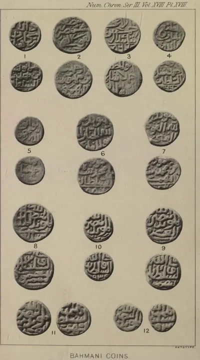 "Bahmani Coins": copper of the later Bahmani kings (O. Codrington, Numismatic Chronicle, 3rd series, Vol. XVIII (1898), Plate XVIII)Coin · 1898
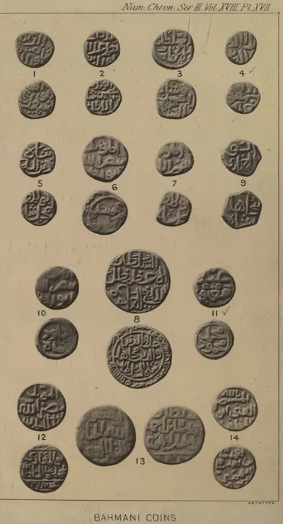 "Bahmani Coins": copper, silver and gold of the first ten Bahmani kings (O. Codrington, Numismatic Chronicle, 3rd series, Vol. XVIII (1898), Plate XVII)Coin · 1898
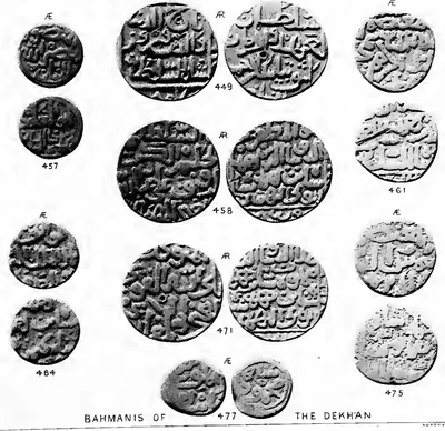 "Bahmanis of the Dekhan": coins of the Bahmani kings in the British Museum (Stanley Lane-Poole, The Coins of the Muhammadan States of India (1885), Plate XI, lower part)Coin · 1885
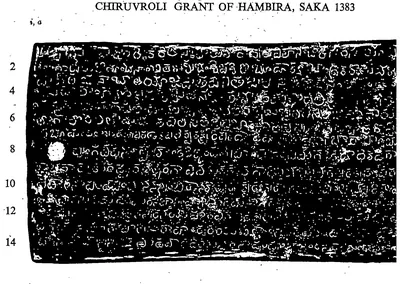 "Chiruvroli Grant of Hambira, Saka 1383", first side of the first plate (lines 1-14) (Epigraphia Indica XXXIV, between pp. 184 and 185)Inscription rubbing · 1963
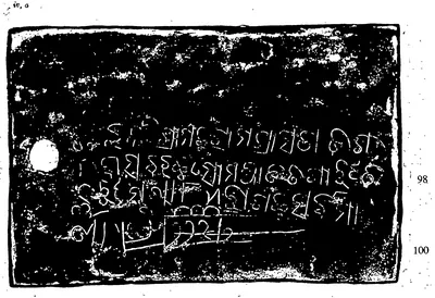 "Chiruvroli Grant of Hambira, Saka 1383": the fourth plate, four lines in Oriya with the drawn sword (Epigraphia Indica XXXIV, between pp. 184 and 185)Inscription rubbing · 1963
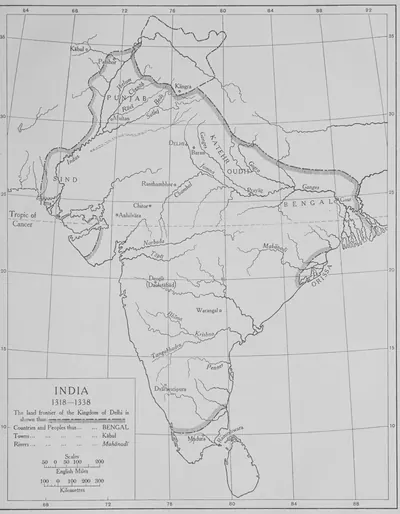 "India 1318–1338": the land frontier of the Kingdom of Delhi (The Cambridge History of India, Vol. III, 1928, Map 3, PDF p. 185 of the archive.org scan cambridgehistory03wols)Map · 1928
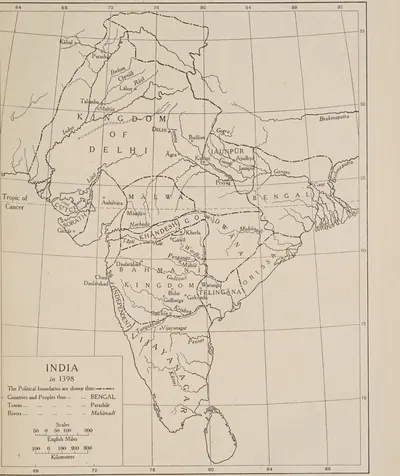 "India in 1398", showing Telingana between the Bahmani kingdom, Orissa and Vijayanagar (The Cambridge History of India, Vol. III, Map 4, between pp. 192 and 193, PDF p. 235 of the archive.org scan cambridgehistory03wols)Map · 1928
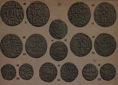 "IV. Bahmanis of Kulbarga": coins of the Bahmani kings in the Indian Museum, Calcutta (H. Nelson Wright, Catalogue of the Coins in the Indian Museum, Vol. II (1907), Plate VIII, upper part)Coin · 1907
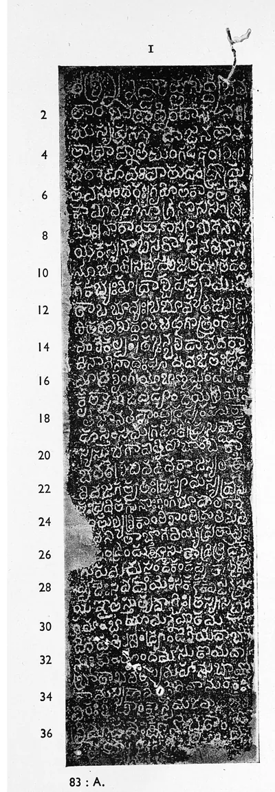 "Kandikonda inscription of Recerla Vennama-naya", face I (A Corpus of Inscriptions in the Telingana Districts, Part III, plate 6, panel 83 : A)Inscription rubbing · 1956
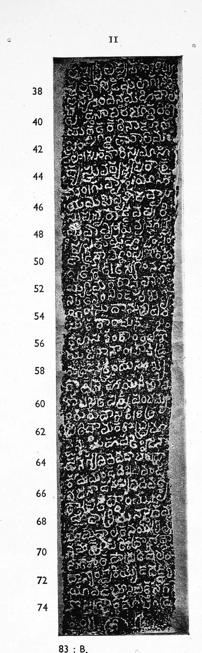 "Kandikonda inscription of Recerla Vennama-naya", face II (Corpus of Inscriptions in the Telingana Districts, Part III, plate 6, panel 83 : B)Inscription rubbing · 1956
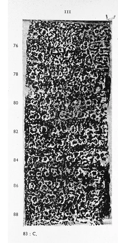 "Kandikonda inscription of Recerla Vennama-naya", face III (Corpus of Inscriptions in the Telingana Districts, Part III, plate 7, panel 83 : C)Inscription rubbing · 1956
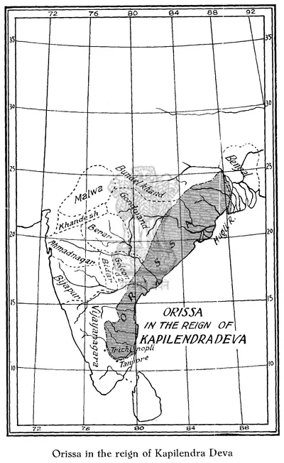 "Orissa in the reign of Kapilendra Deva": map in R. D. Banerji, History of Orissa, Vol. I (1930), facing p. 296Map · 1930
Show all (66)
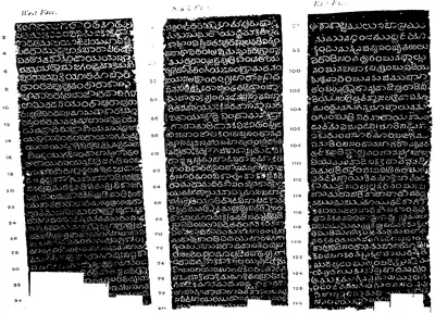 "Phirangipuram pillar inscription of Peda-Komati-Vema": west face (lines 1-34), south face (lines 50-80) and east face (lines 92-128) (Epigraphia Indica XI, plate between pp. 320 and 321, PDF p. 377)Inscription rubbing · 1912
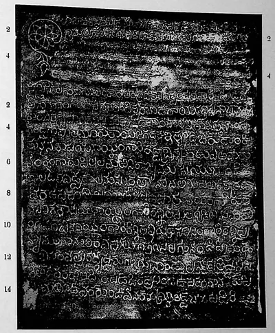 "Pillalamaṟṟi inscription; Pillalamaṟṟi inscription of the reign of Kāpaya-Nāyaka (dated Saka 1279)" (Sreenivasachar, Corpus of Inscriptions in the Telingana Districts II, Plate 37 (PDF p. 294))Inscription rubbing · 1940
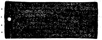 "Plates of Ganadeva of Kondavidu.—Saka-Samvat 1377", first side of the first plate (lines 1-9) (Indian Antiquary XX, plate with p. 390)Inscription rubbing · 1891
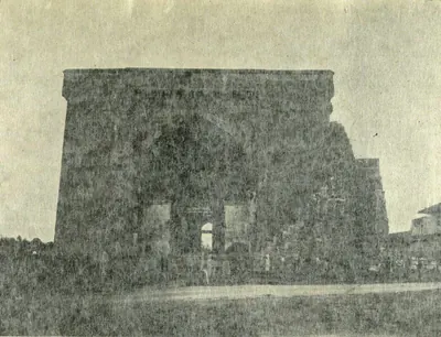 "Shitab Khan's Hall: Front View" (Sastri 1932, Pl. II (a))Book plate · 1932
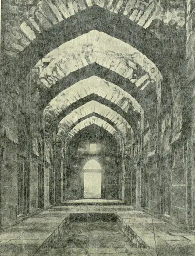 "Shitab Khan's Hall: Interior" (Sastri 1932, Pl. II (b))Book plate · 1932
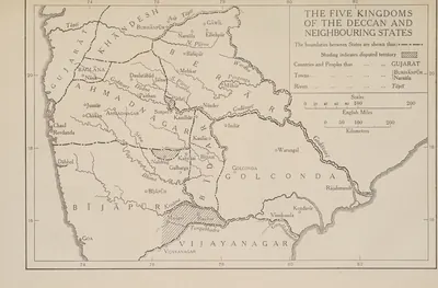 "The Five Kingdoms of the Deccan and Neighbouring States", with Golconda holding Telingana from Warangal to Rajahmundry and Kondavir (The Cambridge History of India, Vol. III (1928), Map 6)Map · 1928
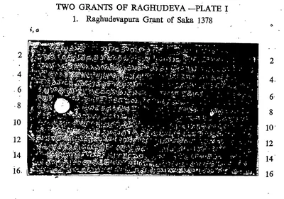 "Two Grants of Raghudeva.—Plate I. 1. Raghudevapura Grant of Saka 1378", first side of the first plate (lines 1-16) (Epigraphia Indica XXXIII, between pp. 12 and 13)Inscription rubbing · 1963
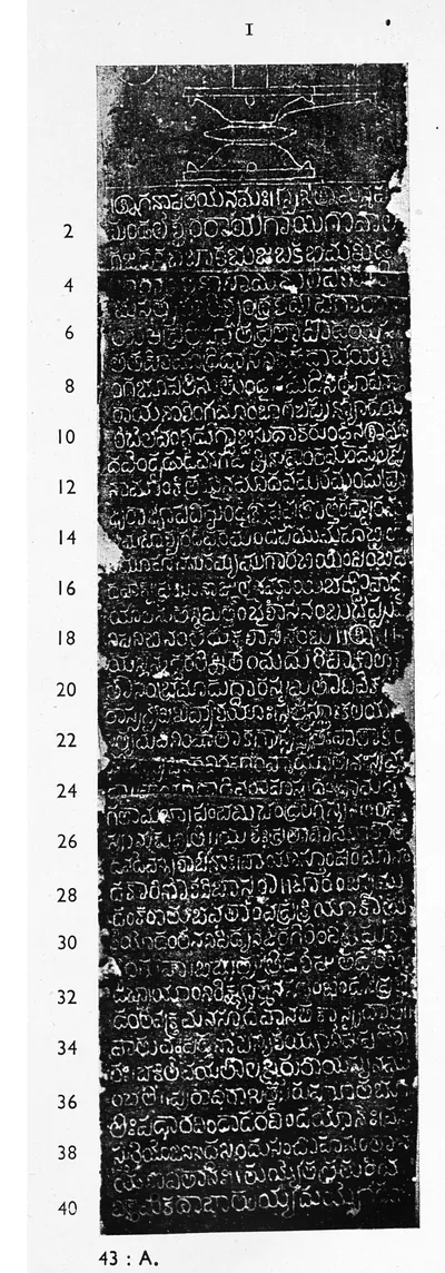 "Umamahesvaram inscription of Recerla Madhava-naya", face I (Corpus of Inscriptions in the Telingana Districts, Part III, plate 21, panel 43 : A)Inscription rubbing · 1956
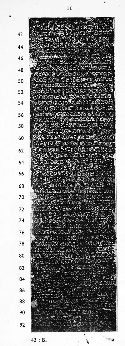 "Umamahesvaram inscription of Recerla Madhava-naya", face II (Corpus of Inscriptions in the Telingana Districts, Part III, plate 21, panel 43 : B)Inscription rubbing · 1956
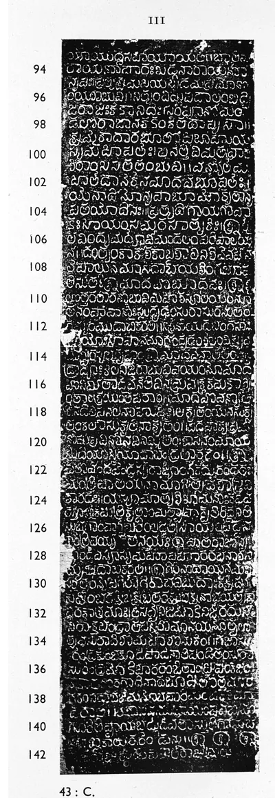 "Umamahesvaram inscription of Recerla Madhava-naya", face III (Corpus of Inscriptions in the Telingana Districts, Part III, plate 22, panel 43 : C)Inscription rubbing · 1956
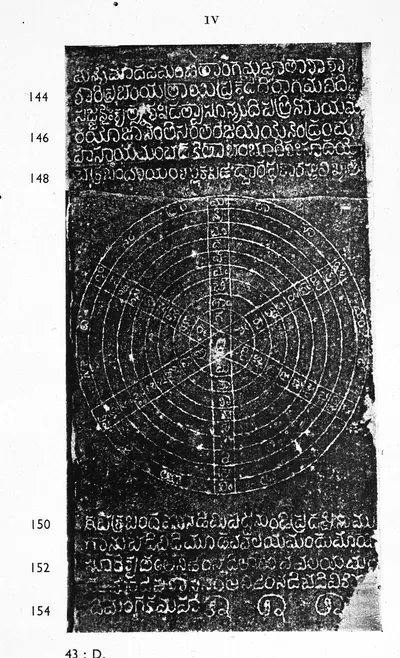 "Umamahesvaram inscription of Recerla Madhava-naya", face IV (Corpus of Inscriptions in the Telingana Districts, Part III, plate 22, panel 43 : D)Inscription rubbing · 1956
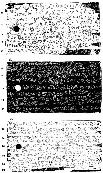 "Vanapalli Plates of Anna-Vema.—Saka-Samvat 1300", plates i a, i b and ii a (lines 1-32) (Epigraphia Indica III, plates between pp. 62 and 63, PDF p. 100)Inscription rubbing · 1895
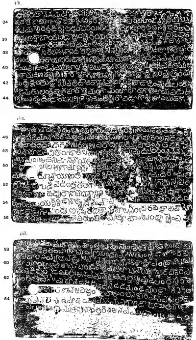 "Vanapalli Plates of Anna-Vema.—Saka-Samvat 1300", plates ii b, iii a and iii b (lines 33-65) (Epigraphia Indica III, plates between pp. 62 and 63, PDF p. 101)Inscription rubbing · 1895
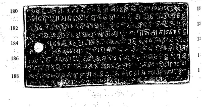 "Veligalani Grant of Kapilesvara, Saka 1380": plate face with lines 180-188, the Oriya summary (Epigraphia Indica XXXIII, plates between pp. 286 and 287)Inscription rubbing · 1963
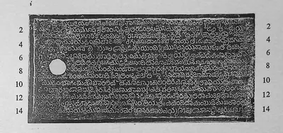 "Vilasa Grant of Prolaya-nayaka", plate i (Epigraphia Indica XXXII, plate between pp. 260 and 261, PDF p. 363 of the archive.org scan kmm-0149-epigraphia-indica-1962)Inscription rubbing · 1959
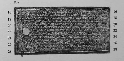 "Vilasa Grant of Prolaya-nayaka", plate ii, a (Epigraphia Indica XXXII, plate between pp. 260 and 261, PDF p. 363)Inscription rubbing · 1959
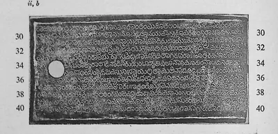 "Vilasa Grant of Prolaya-nayaka", plate ii, b (Epigraphia Indica XXXII, plate between pp. 260 and 261, PDF p. 364)Inscription rubbing · 1959
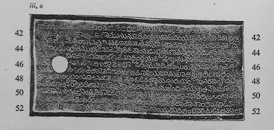 "Vilasa Grant of Prolaya-nayaka", plate iii, a (Epigraphia Indica XXXII, plate between pp. 260 and 261, PDF p. 364)Inscription rubbing · 1959
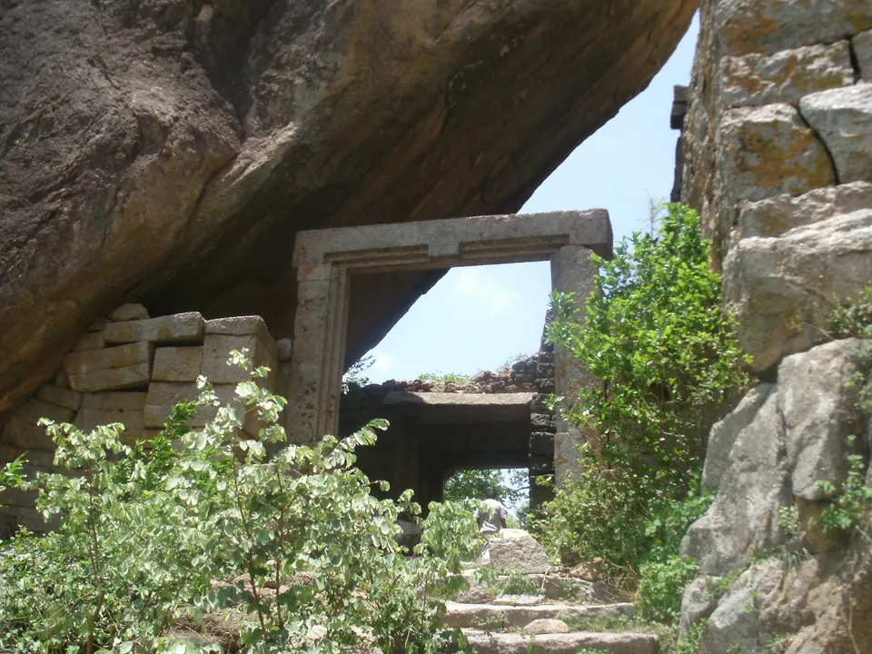
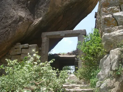 A gateway of Rachakonda Fort under an overhanging boulderPhotograph · 2011
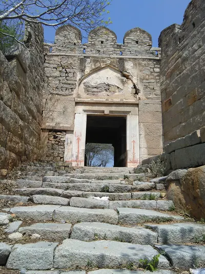 A gateway on the way up Devarakonda FortPhotograph · 2019
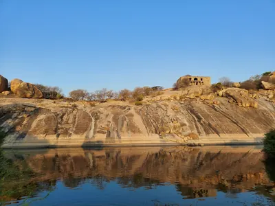 Devarakonda Fort hill above a pondPhotograph · 2021
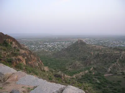 Devarakonda town seen from the fort hillPhotograph · 2007
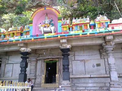 Front of the Umamahesvara temple at UmamahesvaramPhotograph · 2013
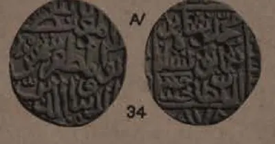 Gold coin of Muhammad Shah III Bahmani struck at Muhammadabad (Bidar), AH 878 (1473-74), obverse and reverse (Wright, Coins in the Indian Museum, Vol. II (1907), Plate VIII, No. 34)Coin · 1907
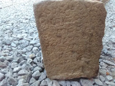 Inscribed stone at the entrance of Devarakonda FortPhotograph · 2017
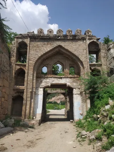 Lion Gate, Devarakonda FortPhotograph · 2019
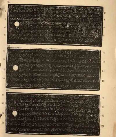 Pachchanitandiparru grant of Anna-Vema, Saka 1296 (A.D. 1374): ink impressions of plates i b, ii a and ii b (lines 1-25) (Epigraphia Indica XXI, No. 41 B, plates between pp. 274 and 275)Inscription rubbing · 1933
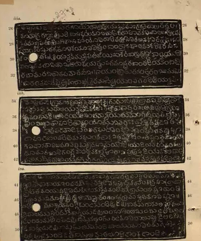 Pachchanitandiparru grant of Anna-Vema, Saka 1296 (A.D. 1374): ink impressions of plates iii a, iii b and iv a (lines 26-51) (Epigraphia Indica XXI, No. 41 B, plates between pp. 274 and 275)Inscription rubbing · 1933
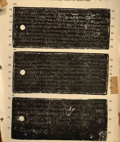 Pachchanitandiparru grant of Anna-Vema, Saka 1296 (A.D. 1374): ink impressions of plates iv b, v a and v b (lines 52-80) (Epigraphia Indica XXI, No. 41 B, plates between pp. 274 and 275)Inscription rubbing · 1933
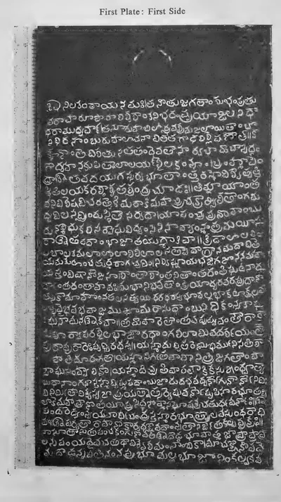 Pedapalakaluru plates of Anavema Reddi, Saka 1300 (A.D. 1378): photograph of the first plate, first side (lines 1-31) (Ramesan 1962, Plate XII (a), PDF p. 249)Photograph · 1962
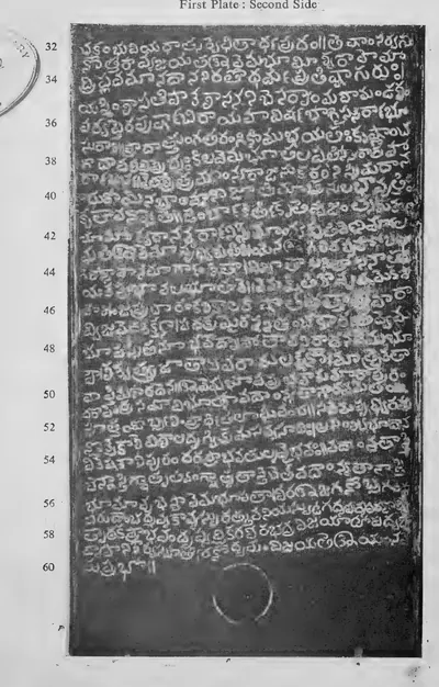 Pedapalakaluru plates of Anavema Reddi, Saka 1300 (A.D. 1378): photograph of the first plate, second side (lines 32-60) (Ramesan 1962, Plate XII (b), PDF p. 250)Photograph · 1962
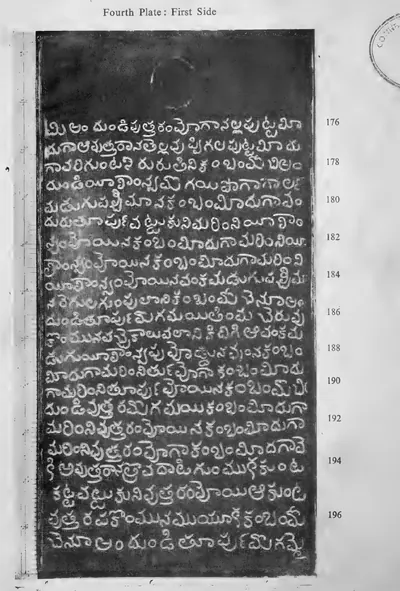 Pedapalakaluru plates of Anavema Reddi, Saka 1300 (A.D. 1378): photograph of the fourth plate, first side (lines 176-197) (Ramesan 1962, Plate XII (g), PDF p. 261)Photograph · 1962
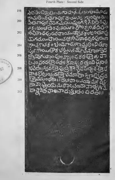 Pedapalakaluru plates of Anavema Reddi, Saka 1300 (A.D. 1378): photograph of the fourth plate, second side (lines 198-212) (Ramesan 1962, Plate XII (h), PDF p. 262)Photograph · 1962
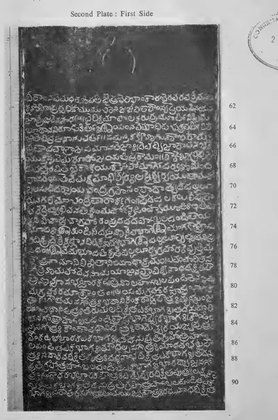 Pedapalakaluru plates of Anavema Reddi, Saka 1300 (A.D. 1378): photograph of the second plate, first side (lines 61-91) (Ramesan 1962, Plate XII (c), PDF p. 253)Photograph · 1962
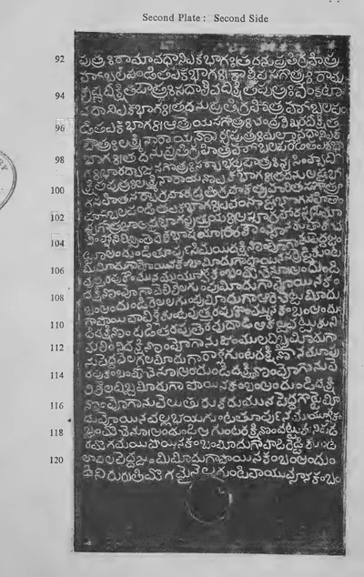 Pedapalakaluru plates of Anavema Reddi, Saka 1300 (A.D. 1378): photograph of the second plate, second side (lines 92-121) (Ramesan 1962, Plate XII (d), PDF p. 254)Photograph · 1962
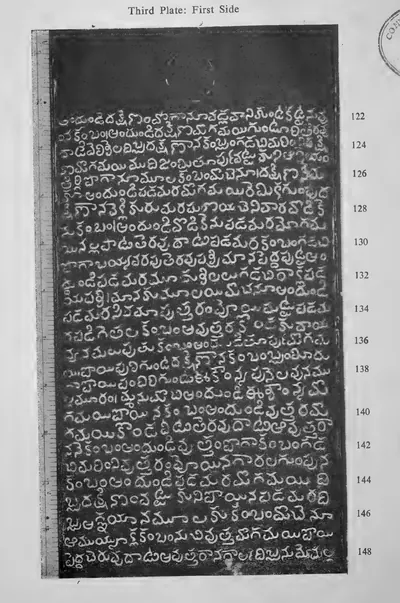 Pedapalakaluru plates of Anavema Reddi, Saka 1300 (A.D. 1378): photograph of the third plate, first side (lines 122-148) (Ramesan 1962, Plate XII (e), PDF p. 257)Photograph · 1962
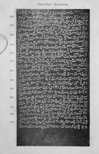 Pedapalakaluru plates of Anavema Reddi, Saka 1300 (A.D. 1378): photograph of the third plate, second side (lines 149-175) (Ramesan 1962, Plate XII (f), PDF p. 258)Photograph · 1962
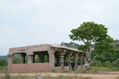 Pillared hall on a hill at Rachakonda FortPhotograph · 2026
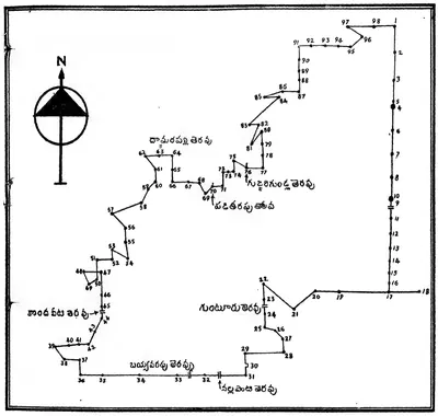 Plan of Pedapalakaluru village drawn by the editor from the boundaries given in the grant of Anavema Reddi (Ramesan 1962, Text Figure I, PDF p. 246)Map · 1962
 Puvvada grant of Prolaya Vema, Saka 1268 (A.D. 1346): general view of the five plates on their ring with the seal (Ramesan 1962, Plate XI (d), PDF p. 231)Photograph · 1962
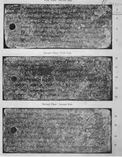 Puvvada grant of Prolaya Vema, Saka 1268 (A.D. 1346): photographs of the plates, first plate second side, second plate both sides (lines 1-27) (Ramesan 1962, Plate XI (a), PDF p. 226)Photograph · 1962
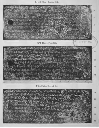 Puvvada grant of Prolaya Vema, Saka 1268 (A.D. 1346): photographs of the plates, fourth plate second side, fifth plate both sides (lines 55-82) (Ramesan 1962, Plate XI (c), PDF p. 230)Photograph · 1962
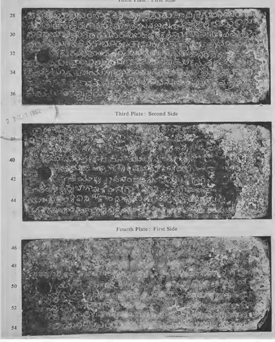 Puvvada grant of Prolaya Vema, Saka 1268 (A.D. 1346): photographs of the plates, third plate both sides, fourth plate first side (lines 28-54) (Ramesan 1962, Plate XI (b), PDF p. 227)Photograph · 1962
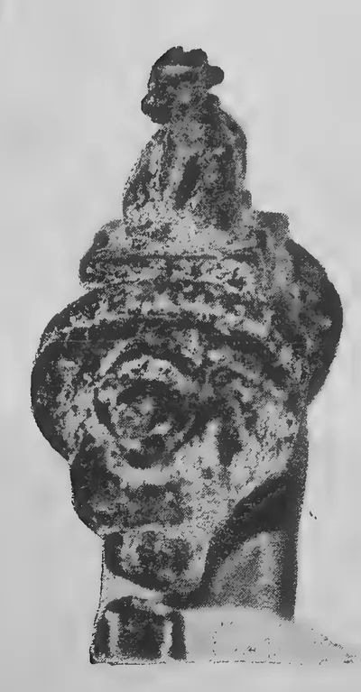 Puvvada grant of Prolaya Vema, Saka 1268 (A.D. 1346): the Nandi seal on the ring (Ramesan 1962, Plate XI (d), PDF p. 231)Photograph · 1962
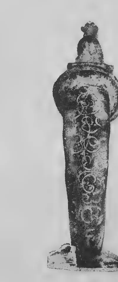 Puvvada grant of Prolaya Vema, Saka 1268 (A.D. 1346): the ring, inscribed "Sri Pallava Trinetra" (Ramesan 1962, Plate XI (d), PDF p. 231)Photograph · 1962
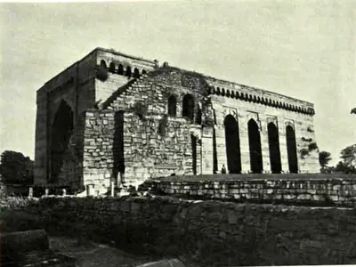 Shitab Khan's Hall: view from N.-W., Warangal Fort (Hyderabad Arch. Report 1925-26, Pl. XV (b))Historic photograph · 1928
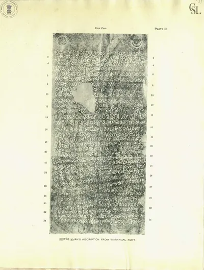 Shitab Khan's inscription from Warangal Fort: first face (Sastri 1932, Pl. III)Inscription rubbing · 1932
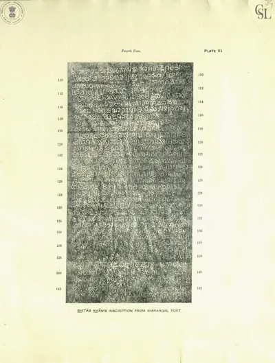 Shitab Khan's inscription from Warangal Fort: fourth face (Sastri 1932, Pl. VI)Inscription rubbing · 1932
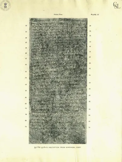 Shitab Khan's inscription from Warangal Fort: second face (Sastri 1932, Pl. IV)Inscription rubbing · 1932
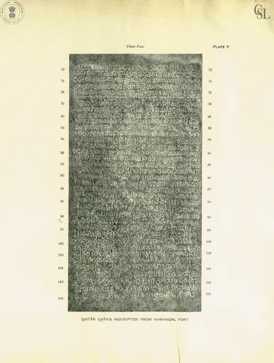 Shitab Khan's inscription from Warangal Fort: third face (Sastri 1932, Pl. V)Inscription rubbing · 1932
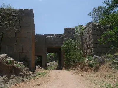 Stone gateway of Rachakonda FortPhotograph · 2011
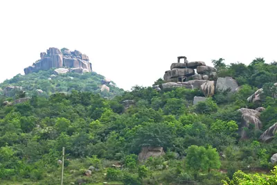 The hills of Rachakonda FortPhotograph · 2026
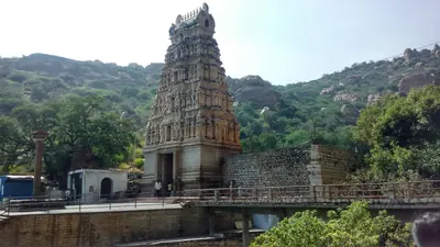 Umamahesvara temple, Umamahesvaram, with its gateway towerPhotograph · 2017
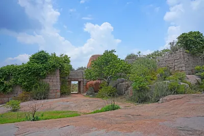 Walls and a gateway of Rachakonda FortPhotograph · 2026
Maps
- Unified Andhra Pradesh (pre-2014)
- Present-day state borders, for orientation
- Route
Ports of the Telugu coast in the sources, from the Periplus's Masalia and the Kakatiya port of Motupalli to the Dutch and English factories of the 17th century and the steamer ports of about 1900, with the road from Golconda that Tavernier took to Masulipatam. Sea routes show only the direction of the voyages the sources name; all routes are approximate.
Base map: Natural Earth (opens in a new tab) (public domain).
- Unified Andhra Pradesh (pre-2014)
- Present-day state borders, for orientation
- Approximate extent
Vijayanagara and the Muslim kingdoms of the Deccan, after Robert Sewell's 1900 map of the "general political position" from 1336 to 1570. Every area is approximate, and the map folds two centuries into one picture: the Bahmani kingdom, founded in 1347, broke up into the five sultanates of Bijapur, Bidar, Berar, Ahmadnagar and Golconda only from 1489 on, and the Krishna–Godavari coast passed between Orissa, Vijayanagara and Golconda.
Historical boundaries are approximate. Base map: Natural Earth (opens in a new tab) (public domain). Redrawn from: S. India, General Political Position, Period A.D. 1336–1570 (opens in a new tab), Robert Sewell, 1900 (Public domain). Attributions
- Unified Andhra Pradesh (pre-2014)
- Present-day state borders, for orientation
- Route
Warangal and the places named in the Delhi campaigns against the Kakatiyas and in the Tughluq province of Tilang: the roads of Malik Kafur in 1309–10 (by Devagiri and the frontier town of Indur) and of Ulugh Khan in 1323 (by Devagiri and Bidar), the hill of Anumakonda from which Kafur watched the city, the mosque of 1324 at Rajahmundry, and Kaulas and Golconda, later lost by the Musunuri chiefs to the Bahmanis.
Base map: Natural Earth (opens in a new tab) (public domain).
- Unified Andhra Pradesh (pre-2014)
- Present-day state borders, for orientation
Hill forts and walled towns that the sources show being besieged, taken or held, from the Ikshvaku citadel at Nagarjunakonda to the siege of Bobbili in 1757 and the storming of Masulipatam in 1759. The story of each is told on the Forts & warfare page.
Base map: Natural Earth (opens in a new tab) (public domain).
- Unified Andhra Pradesh (pre-2014)
- Present-day state borders, for orientation
Places in the records of the Musunuri chiefs who freed the Telugu country from the Delhi Sultanate: Prolaya Nayaka's capital Rekapalli on the Godavari and the village of Vilasa that he granted; Guraja, findspot of Kapaya Nayaka's grant of 1346; Warangal, which Kapaya took from the Delhi governors; Ganapesvaram, with an inscription of his reign; Korukonda and Addanki, seats of his kinsmen and allies; and Kaulas and Golconda, lost to the Bahmanis.
Base map: Natural Earth (opens in a new tab) (public domain).
- Unified Andhra Pradesh (pre-2014)
- Present-day state borders, for orientation
Places in the records of the Recherla Velama chiefs: their two hill capitals, Rachakonda (Rajukonda), fortified by Anapota Nayaka in 1365, and Devarakonda, seat of Mada Nayaka and his line, besieged by the Bahmanis in 1459; Warangal and Bhongir (Tribhuvanagiri), which Anapota ruled by 1369; Inavolu, where he granted a village to the god Mailara; Umamahesvaram and Srisailam, where the brothers built a pavilion and steps; Golconda, ceded to the Bahmanis by Kapaya Nayaka or by Anapota (the sources disagree); and Dharanikota (Amaravati), where the family chronicle places a victory over the Reddis.
Base map: Natural Earth (opens in a new tab) (public domain).
- Unified Andhra Pradesh (pre-2014)
- Present-day state borders, for orientation
Where the heroic and popular ballads recorded between the 1820s and the 1900s are set: the Palnadu war of Brahma Nayudu, Katama Raju's war with Nellore, the fall of Bobbili in 1757, and the songs of the Vizagapatam ballad-singers and of Ramadasu at Bhadrachalam.
Base map: Natural Earth (opens in a new tab) (public domain).
- Unified Andhra Pradesh (pre-2014)
- Present-day state borders, for orientation
- Route
Places of the Bahmani sultans in the Telugu country, 1347–1518: their capitals Gulbarga and Bidar; Kaulas, Indur and Medak in the western province of Bidar; Bhongir, the founder's eastern frontier; Golconda, ceded by the ruler of Warangal under Muhammad Shah I; Pangal, where Firuz Shah was defeated in 1419; Warangal, taken in 1424 or 1425; Devarakonda and Rachakonda, seats of the Velama rayas; Balkonda, the rebel Sikandar Khan's fort; Rajahmundry, Kondapalli, Kondavidu and Masulipatam on the coast, taken in 1471–81; and Muhammad Shah III's raid on Kanchi.
Base map: Natural Earth (opens in a new tab) (public domain).
- Unified Andhra Pradesh (pre-2014)
- Present-day state borders, for orientation
- Approximate extent
The forts held by the Telugu chief Shitab Khan, or Sitapati, in the early sixteenth century: Warangal, which his inscription says he took from the Muslims in January 1504, Khammam and Bellamkonda, with Rachakonda, the "Rajadri" of his inscription, and the Pakhal lake, whose dam he is said to have repaired. Kondapalli, where he fled to the Gajapati prince, and Golconda, the capital of his enemy Sultan Quli, are shown outside. The shaded area is a rough sketch joining the named forts, not a boundary.
Historical boundaries are approximate. Base map: Natural Earth (opens in a new tab) (public domain).
- Unified Andhra Pradesh (pre-2014)
- Present-day state borders, for orientation
Capitals, forts and temples of the Reddi kings (c. 1325–1448): Addanki, the first capital, and the hill fortress of Kondavidu; the forts of Kondapalli, Bellamkonda and Vinukonda; Rajahmundry, capital of the eastern kingdom of Kataya Vema and Allada's sons; the port of Motupalli, where Anavota renewed the Kakatiya charter for sea merchants; and the shrines they endowed, Srisailam and Ahobilam in the west, Amaravati, Draksharama, Palakollu and Pithapuram on the coast and Simhachalam in the north. The grants describe the kingdom as reaching "from the eastern slopes of Srigiri to the eastern sea".
Base map: Natural Earth (opens in a new tab) (public domain). Redrawn from: Part of the Telugu Country, including Masulipatam, Guntoor, & Rajahmundry (Church Missionary Atlas, 3rd edition) (opens in a new tab), Church Missionary Society, 1862 (Public domain). Attributions
- Unified Andhra Pradesh (pre-2014)
- Present-day state borders, for orientation
- Route
Places of the Gajapati kings of Orissa in the Telugu country, 1434–1571: their capital Cuttack; the temples of Srikurmam, Mukhalingam, Simhachalam, Draksharama and Srisailam with their records; Rajahmundry and Raghudevapuram, seat and grant of the governor Raghudeva; the Krishna-country grants at Chavali, Kapilesvarapuram and Chiruvolu; Kondavidu, Kondapalli, Addanki and Vinukonda; Devarakonda and Warangal, relieved and taken in 1459–60; Udayagiri and Kanchi in the south; Bidar, the Bahmani capital they marched on; and the route of Krishnadeva Raya's campaign of 1512–16 from Udayagiri to Potnuru.
Base map: Natural Earth (opens in a new tab) (public domain).
Related
Dynasties
Eastern Gangas of Kalinga
c. 498–1434 CE
Dynasty of Kalinga that ruled from Kalinganagara, now Mukhalingam in the Srikakulam district, and later from Orissa, from about the 6th century until 1434. Its early grants are dated in a Ganga era whose starting point is still disputed. The north of the Telugu country, the old Ganjam and Vizagapatam districts, was the heart of the kingdom. Their copper plates come from Chicacole, Achyutapuram, Jirjingi, Nadagam and Alamanda, and hundreds of their inscriptions in Telugu and Sanskrit survive at Mukhalingam, Srikurmam and Simhachalam. Anantavarman Chodaganga, a grandson of Kulottunga I, reigned from 1078 for about seventy years. The later kings fought the Kakatiyas across the Godavari, and their minister Kapilesvara founded the Gajapati dynasty in 1434.
Delhi Sultanate in the Telugu country
c. 1303–1344 CE
The Khalji and Tughluq sultans of Delhi sent five armies against the Kakatiya capital Warangal between 1303 and 1323. Malik Kafur's siege of 1309–10 and Khusrau Khan's of 1318 ended in tribute. Ulugh Khan, the future Muhammad bin Tughluq, took the city at his second attempt, sent Prataparudra towards Delhi and renamed Warangal Sultanpur. For a little over a decade Telingana (Tilang) was a province of the sultanate, governed for a time by the Telugu convert Malik Maqbul. Then a rising under Kapaya Nayaka, called Kanya Naik by Barani, drove the Delhi officers out.
Musunuri Nayakas
c. 1325–1368 CE
A family of Telugu military chiefs (nayakas) who led the recovery of the Telugu country from the Delhi Sultanate after the fall of Warangal in 1323. Prolaya Nayaka, from his hill capital at Rekapalli on the Godavari, freed the coast and gave back the Brahmin villages seized by the Delhi officers. His cousin Kapaya Nayaka took Warangal in the later 1330s and ruled as 'lord of the Andhra country'. He helped the founders of the Bahmani kingdom against Delhi, then lost Kaulas and Golconda to the Bahmanis, giving up the turquoise throne in 1365. He was overthrown by the Recherla Velamas in about 1368.
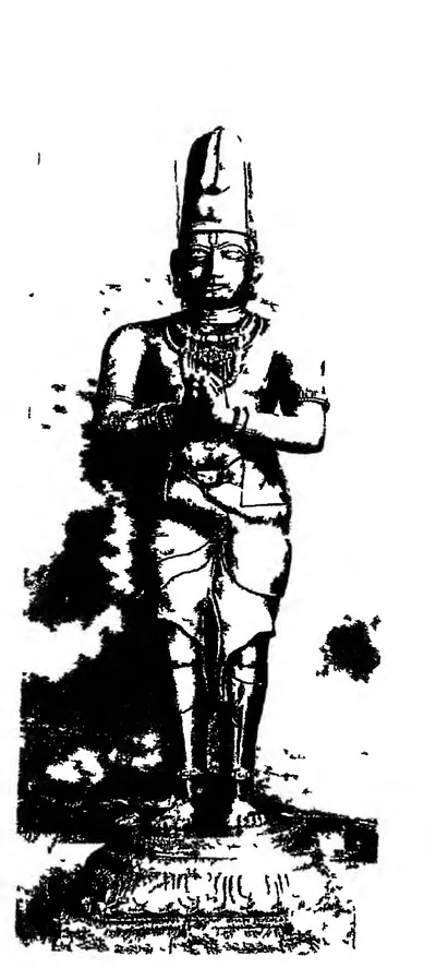
Reddis of Kondaveedu
c. 1325–1424 CE
Telugu dynasty of the Panta Reddi family. It rose on the coast after the fall of the Kakatiyas and ruled for about a hundred years, from about 1325 to the 1420s, first from Addanki and then from the hill fortress of Kondavidu. Its six kings, from Prolaya Vema to Racha Vema, held the country between Srisailam and the sea and at times the Godavari delta. They built the flights of steps at Srisailam and Ahobilam, fought the Recherla Velamas, Vijayanagara and the Bahmanis, and kept a court where Errapragada and Srinatha wrote. Under Kumaragiri the eastern half of the kingdom became a separate state at Rajahmundry.
Recherla Velamas
c. 1336–1475 CE
A family of Telugu warrior chiefs of the Recherla line and the Velama (Padmanayaka) community who rose after the fall of the Kakatiyas. Singama Nayaka's sons Anapota and Mada overthrew the Musunuri chief Kapaya Nayaka about 1368. They ruled Telangana from the hill forts of Rachakonda and Devarakonda for about a century, between the Bahmanis, the Reddis, Vijayanagara and the Gajapatis of Orissa. The king Singabhupala wrote the Sanskrit Rasarnavasudhakara, and tradition links the poets Srinatha and Potana with their court.
Vijayanagara Empire
c. 1336–1646 CE
The South Indian empire founded about 1336 by the brothers Harihara and Bukka on the Tungabhadra. The Sangama, Saluva, Tuluva and Aravidu dynasties ruled it in turn. It held Rayalaseema and the Nellore country from the fourteenth century. It fought the Reddis, the Velamas, the Bahmanis and the Gajapatis of Orissa for the Telugu coast, and under Krishnadeva Raya it took Udayagiri, Kondavidu and Kondapalli and marched to Simhachalam. Its court made Telugu a language of high poetry. After the defeat of 1565 its kings ruled from Penukonda and Chandragiri, until Golconda took the last of the Telugu districts in the 1640s.
Bahmanis
1347–1527 CE
Sultans of the Deccan (1347–1527) who ruled from Gulbarga and, from the 1420s, from Bidar. Their founder won his throne with troops sent by the ruler of Warangal. His successors took Kaulas, Bhongir and Golconda from the Telugu chiefs, sacked Warangal (in 1422, 1424 or 1425, by different accounts) and held western Telangana as the province of Bidar. They fought the Musunuri and Recherla nayakas, the Reddis, Vijayanagara and the Gajapatis of Orissa, and held the coast from Rajahmundry to Kondapalli and Kondavidu in the 1470s. Mahmud Gawan split the province of Telingana between Rajahmundry and Warangal. Its last governor, Sultan Quli, founded the Qutb Shahi kingdom of Golconda.
Reddis of Rajahmundry
c. 1386–1448 CE
The eastern Reddi kingdom, centred on Rajahmundry and the Godavari delta. It grew out of the Kondavidu kingdom when Kumaragiri Reddi gave 'the eastern country' to his minister and brother-in-law Kataya Vema in the 1380s. After Kataya Vema's death about 1414–16, his kinsman Allada Reddi fought off the Telugu Choda Annadeva, the Kondavidu king and a Bahmani army. Allada's sons Allaya Vema and Virabhadra ruled jointly until the 1440s, when the Gajapati Kapilesvara of Orissa took the delta. Srinatha wrote his last poems at their court.
Gajapatis of Orissa
c. 1434–1541 CE
The Suryavamsi kings of Orissa, 'lords of elephants', who ruled from Cuttack from 1434–35 to about 1541. Kapilendra (Kapilesvara) took the throne of the last Eastern Ganga king. He conquered the Reddi kingdoms of Rajahmundry and Kondavidu, and sent his son Hamvira and his nephew Raghudeva into Telangana, where they took Warangal in 1460. He carried his arms down the coast towards the Kaveri. His son Purushottama lost the Godavari–Krishna country to the Bahmanis and won it back. Prataparudra lost everything south of the Godavari or the Krishna to Krishnadeva Raya of Vijayanagara in 1513–19, and the coastal districts fell to Golconda in the following decades.
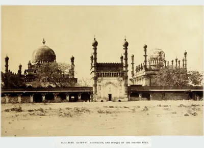
Adil Shahis of Bijapur
c. 1489–1686 CE
Sultans of Bijapur (about 1489–1686), founded by Yusuf Adil Khan, a governor who broke away from the Bahmanis. They fought Vijayanagara for a century over Raichur and Mudgal, and joined the league that defeated it in 1565. Then they advanced south of the Tungabhadra: they took Adoni in 1568, Kurnool early in the seventeenth century and Penukonda in 1652. In the 1630s–50s they overran the Karnatak and divided it with Golconda. They held the western Telugu uplands through Abyssinian governors, such as Siddi Masud of Adoni, and through tributary poligars, until Aurangzeb took Bijapur in 1686.
Shitab Khan of Warangal
c. 1504–1516 CE
Short-lived Telugu principality of the chief Shitab Khan, or Sitapati, between the fall of the Bahmani power and the rise of Golconda. He was a former officer of the Bahmanis. By his pillar inscription, he took Warangal fort from the Muslims on 21 January 1504. He held it with Khammam, Bellamkonda and other hill forts, and restored the Kakatiya family goddess and a Krishna image to their temples. The Kistna manual thought him a vassal of the Gajapatis of Orissa, with whose prince he fought at Palanchinur. Sultan Quli Qutb Shah of Golconda took his forts. The sources date the conquest of Warangal anywhere from 1512 to 1525.
People
Errapragada
c. 1280–1350 CE
Telugu poet of the 14th century, the third of the 'Kavitraya' who completed the Telugu Mahabharata. He finished the Aranya Parva that Nannaya had left incomplete. He was a Niyogi Brahman of Gudluru in the Nellore country and a devotee of Siva (Sambhudasa). He was attached to Prolaya Vema, the founder of the Reddi kingdom, and dedicated his Harivamsa to him. He also wrote a Ramayana and the Narasimha Purana for the god of Ahobilam.
Malik Maqbul (Khan-i Jahan)
c. 1323–1370 CE
Telugu noble of Warangal, called Kattu before his conversion, who entered the service of Muhammad bin Tughluq after the fall of the Kakatiyas. He governed the province of Telingana until Kanya Naik's revolt drove him out. He rose to be chief minister of Sultan Firuz Tughluq with the title Khan-i Jahan.
Muhammad bin Tughluq
1325–1351 CE
Sultan of Delhi (1325–1351). As Prince Ulugh Khan he besieged Warangal twice in the early 1320s, captured the Kakatiya king Prataparudra and renamed the city Sultanpur. As sultan he held Telingana as a province until a Telugu rising, after his visit of 1335, took Warangal from his governor. This page covers only his part in the history of the Telugu country.
Prolaya Nayaka
c. 1325–1336 CE
Musunuri chief (fl. c. 1325–1336). According to his Vilasa grant, he rose after Prataparudra's death and drove the Delhi garrisons out of the Telugu coast. He ruled from Rekapalli on the Godavari and gave back to the Brahmins the villages that the conquerors had seized.
Prolaya Vema Reddi
c. 1325–1353 CE
Founder of the Reddi kingdom of Addanki and Kondavidu (c. 1325–1353). He took over the country between Srisailam and the sea after the fall of the Kakatiyas. His grants of 1345 and 1346 say he restored the Brahman villages seized by the Muslim conquerors of Warangal. Later records remember him for the flights of steps at Srisailam and Ahobilam, and the poet Errapragada dedicated his Harivamsa to him.
Harihara I (Vijayanagara)
c. 1336–1355 CE
First ruler of Vijayanagara and eldest of the five sons of Sangama. With his brother Bukka he founded the kingdom on the Tungabhadra about 1336. His first dated inscription, of 1340, calls him only a mahamandalesvara, 'great lord'. It is disputed whether he and his brothers came from the service of the Kakatiyas of Warangal, of the Rai of Kampili or of the Hoysalas. His brother Kampa held Udayagiri and Nellore, the first Vijayanagara base in the Telugu country.
Kapaya Nayaka
c. 1336–1368 CE
Musunuri chief (fl. c. 1336–1368), cousin and successor of Prolaya Nayaka. He took Warangal from the Delhi governors and ruled as 'lord of the Andhra country'. He is identified with the Kanya Naik of Barani and the Krishna Naik of Ferishta. He helped the founders of the Bahmani kingdom, then lost Kaulas and Golconda to them. He was overthrown by the Recherla Velamas in about 1368.
Singama Nayaka (Recherla)
c. 1336–1361 CE
Recherla chief of the mid-fourteenth century, son of Dacaya and father of Anapota and Mada, the founders of the Velama kingdoms of Rachakonda and Devarakonda. He fought the Musunuri chief Kapaya Nayaka and settled Brahmins on the Krishna. The family chronicle says he was stabbed to death while besieging the fort of Jallipalli, about 1361.
Ala-ud-din Hasan Bahman Shah
1347–1358 CE
Officer of the Delhi sultanate who led the Deccan revolt against Muhammad bin Tughluq, with help from the ruler of Warangal. In 1347 he founded the Bahmani sultanate at Gulbarga. He took Kaulas from Warangal and made western Telangana a province of his kingdom.
Anavota Reddi
c. 1353–1364 CE
Second Reddi king of Addanki (c. 1353–1364), elder son of Prolaya Vema. His only known copper-plate grant, from Koduru (1358), and his renewal of the Kakatiya charter for sea merchants at Motupalli (1358) survive. A Velama chronicle claims a victory over him at Dharanikota in 1361. His son Kumaragiri and his son-in-law Kataya Vema later ruled at Kondavidu and Rajahmundry.
Bukka I (Vijayanagara)
c. 1355–1377 CE
Second ruler of Vijayanagara, brother and successor of Harihara I, who turned the frontier kingdom into an empire. He fought the Bahmani sultans Muhammad Shah I and Mujahid for the Raichur doab. His son Kumara Kampana destroyed the sultanate of Madura, and his inscriptions boast of driving the Andhras into the hills towards Udayagiri. His minister built the tank of Bukkarayasamudram in the Anantapur country in 1364. Sewell dated his reign 1343–1379 in 1900 and 1355–1377 in 1932.
Muhammad Shah I
1358–1375 CE
Second Bahmani sultan (1358–1375), son of the founder. He organised the court, the army and the four provinces, struck the dynasty's own gold coin, and fought the first great wars with Warangal and Vijayanagara. In Ferishta's account the ruler of Warangal ceded Golconda to him and gave up a jewelled throne, the Takht-i-Feroza or turquoise throne. The Burhan-i Ma'asir tells of the Telingana war in a single sentence.
Anapota Nayaka (Recherla)
c. 1361–1384 CE
Recherla Velama chief (r. c. 1361–1384), son of Singama Nayaka. He fortified Rachakonda in 1365 and overthrew the Musunuri chief Kapaya Nayaka about 1368. By July 1369 he ruled Warangal, Bhongir and Rachakonda. With his brother Mada of Devarakonda he made the Recherla family the leading power of Telangana.
Mada Nayaka (Recherla)
c. 1361–1384 CE
Recherla Velama chief (r. c. 1361–1384), younger son of Singama Nayaka and brother of Anapota. He ruled from Devarakonda and is counted as the founder of the Devarakonda branch. His inscription of 1377 records a pavilion he built at Umamahesvaram, the northern gateway of Srisailam. His son Venna governed Kandikonda.
Anavema Reddi
c. 1364–1386 CE
Third Reddi king (c. 1364–1386), younger son of Prolaya Vema, who ruled from Kondavidu and carried the kingdom's grants into the Godavari delta. He is known from five copper-plate grants (Pachchanitandiparru 1374, Nadupuru, Pedapalakaluru 1378, Vanapalli 1380 and others) and from records at Srisailam and Draksharama. He was surnamed Vasantaraya for his spring festival. The poet Srinatha's connection with the Reddis probably began under him.
Srinatha
c. 1365–1440 CE
Telugu poet of the late 14th and early 15th centuries, often ranked with the three translators of the Mahabharata. He served Peda Komati Vema of Kondavidu as vidyadhikarin and composed his grants and inscriptions. He then wrote for the Reddis of Rajahmundry. His Sringaranaishadham, Bhimakhandam and Kasikhandam are dedicated to Reddi kings and ministers, and they are a main source for their history.
Peda Vedagiri (Recherla)
c. 1384–1410 CE
Recherla Velama chief of Devarakonda (r. c. 1384–1410), son of Mada Nayaka. An inscription of 1399 calls him ruler of the land between Srisailam and the Vindhyas. The family chronicle credits him with a victory near Warangal in the war against Kapaya Nayaka.
Singabhupala (Recherla)
c. 1384–1399 CE
Recherla Velama king of Rachakonda (late 14th century), son of Anapota Nayaka. He wrote the Rasarnavasudhakara, a Sanskrit book on drama whose opening verses are the fullest early account of his family. Later tradition calls him, or a namesake of the next century, Sarvajna ('the all-knowing') Singa, patron of Srinatha and Potana. Who was who is disputed.
Kataya Vema
c. 1386–1415 CE
Minister and brother-in-law of Kumaragiri of Kondavidu. He received 'the eastern country' with Rajahmundry as its capital in the 1380s, and ruled the Godavari delta and the coast to Simhachalam until about 1414–16. A grandson of Prolaya Vema through his mother, he was also a Sanskrit scholar. He wrote the Kumaragirirajiyam, a commentary on Kalidasa's plays.
Kumaragiri Reddi
c. 1386–1402 CE
Reddi king of Kondavidu (c. 1386–1402), son of Anavota. He is remembered for his spring festival and his court's foreign trade, and as the patron after whom Kataya Vema named his commentary on Kalidasa. He gave the Godavari country around Rajahmundry to his minister and brother-in-law Kataya Vema. At the end of his reign he lost Kondavidu to his kinsman Peda Komati Vema.
Firuz Shah
1397–1422 CE
Eighth Bahmani sultan (1397–1422), a grandson of the founder. A learned and tolerant king in his early years, he fought Vijayanagara for most of his reign. The Burhan-i Ma'asir credits him with conquering Telingana as far as Rajahmundry. In 1417 he took tribute from the raja of Telingana, but then lost a two-year siege of Pangal to Vijayanagara and the raja of Telingana together. He gave up the throne to his brother Ahmad in 1422 and died days later.
Bammera Potana
c. 1400–1475 CE
Telugu poet of the fifteenth century, author of the Telugu Bhagavata. Tradition links him with Sarvajna Singa, a Recherla Velama king of Rachakonda. It says he wrote the Bhoginidandakamu in praise of the king's mistress but refused to dedicate his Bhagavata to a mortal king. No inscription confirms the story.
Peda Komati Vema
c. 1402–1420 CE
Fifth Reddi king of Kondavidu (c. 1402–1420), a grandson of Prolaya Vema's elder brother Macha, known as a scholar-king. The Sringaradipika commentary on the Amarusataka and other works are ascribed to him, and the poet Srinatha served him as vidyadhikarin and composed his grants. His reign was spent in wars with the Rajahmundry Reddis, Vijayanagara and the Recherla Velamas.
Allada Reddi
c. 1416–1420 CE
Reddi noble of the Duvvuri branch of the Panta family who took control of the Rajahmundry kingdom after Kataya Vema's death (c. 1416–1420). It seems he ruled first as regent for Kataya Vema's son and daughter. His sons' grants credit him with victories over the Kondavidu king Peda Komati Vema and over 'Alpa Khan', and with friendship with the Gajapati and the king of Vijayanagara. His sons Allaya Vema and Virabhadra ruled Rajahmundry after him.
Ahmad Shah I
1422–1435 CE
Ninth Bahmani sultan (1422–1435), called Wali, 'the Saint'. He took the throne from his brother Firuz and defeated Vijayanagara. In 1424 or 1425 he took Warangal, killing its raja, and the Velama rayas of Devarakonda and Rachakonda then paid him tribute. He moved the capital from Gulbarga to Bidar. He had to march into Telangana again to put down the chiefs who rose while he fought Gujarat and Malwa.
Deva Raya II (Vijayanagara)
1422–1446 CE
King of Vijayanagara from 1422 or 1423 to 1446, the greatest ruler of the first dynasty. He enlisted Muslim archers in his army, survived an attempt on his life in 1443 and received the Persian envoy Abdur Razzaq. His inscriptions reach the Godavari delta and the Guntur and Nellore country. The Telugu poet Vallabharaya governed Vinukonda for him, and Srinatha was bathed in gold in his Pearl Hall. After his death the Bahmani sultan and the Gajapati of Orissa besieged his capital together.
Lingama Nayaka (Recherla)
c. 1427–1475 CE
Recherla Velama chief of Devarakonda in the fifteenth century, and a great-great-grandson of Mada Nayaka according to an inscription of 1427. He is known from two tank inscriptions of 1427 and from a long list of victories in the family chronicle. The chronicle makes him a rival of the Reddi kings and a contemporary of the Vijayanagara king Praudha Devaraya.
Kapilendra (Kapilesvara)
c. 1434–1470 CE
Founder of the Suryavamsi Gajapati dynasty of Orissa, who took the throne of the last Eastern Ganga king in 1434–35 and reigned until about 1470. He conquered the Reddi kingdoms of Rajahmundry and Kondavidu, and governed them through his nephew Raghudeva and his kinsman Ganadeva. He relieved Devarakonda from the Bahmanis in 1459, and his son Hamvira and Raghudeva took Warangal in 1460. His records credit him with conquests down the coast to the Kaveri.
Humayun Shah
1458–1461 CE
Eleventh Bahmani sultan (1458–1461), remembered as Zalim, 'the Cruel'. In Telangana he put down the revolt of his cousin Sikandar Khan, who claimed the province. He sent an army against the Velama fort of Devarakonda, which was routed by its defenders and an Orissan relief force in 1459. He camped at Warangal, left Mahmud Gawan to hold Telangana, and returned to Bidar to take a savage revenge on a rising there.
Hamvira (Hambira)
c. 1459–1478 CE
Son of the Gajapati king Kapilendra and the leading general of his conquests in the Telugu and Tamil countries. He captured the fort of Warangal on 2 February 1460 and made the Chiruvroli grant on the Krishna in 1461. In 1464 his son Dakshina-Kapilesvara governed Kondavidu and the forts of the south. Ferishta writes of an 'Ambur Ray' who took the Orissan throne with Bahmani help after Kapilendra's death. This man has been identified with Hamvira, but the succession is disputed.
Muhammad Shah III
1463–1482 CE
Bahmani sultan (1463–1482) who came to the throne as a boy. He brought Rajahmundry, Kondapalli and the Krishna–Godavari coast under Bahmani rule, and spent three years settling Telangana. In 1481 he had his great minister Mahmud Gawan executed because of a forged letter, a deed the sources blame for the break-up of the kingdom.
Purushottama (Gajapati)
c. 1470–1497 CE
Gajapati king of Orissa from 1469–70 to 1496–97, son of Kapilendra. Early in his reign the Bahmanis took Rajahmundry and Kondapalli or Kondavidu, after a disputed succession in which he may have bought their help. His attempt to recover the Godavari country in the 1470s ended with Muhammad Shah III's invasion of Orissa. But by 1489 his grants and inscriptions reach the Krishna and the Ongole country again. Orissan tradition credits him with an expedition to Kanchi and a romantic marriage.
Mahmud Shah Bahmani
1482–1518 CE
Fourteenth Bahmani sultan (1482–1518). He came to the throne at twelve and spent his reign as the puppet of his ministers, while the governors became kings. Telangana stayed loyal longest. He campaigned at Warangal in 1486 and gave the province to Sultan Quli Qutb-ul-Mulk in the 1490s. Bahmani mosques of his reign stand at Rachakonda (1484) and Golconda (1518), the latter still naming him as sovereign.
Saluva Narasimha
c. 1485–1492 CE
Chief of the Saluva family of Chandragiri. He drove the Gajapatis of Orissa back up the coast towards Rajahmundry and faced the Bahmani sultan there in the 1470s. In 1485–86 he took the throne of Vijayanagara from the last Sangama king and founded the second, Saluva, dynasty. He died in 1492–93 and left his young sons in the charge of his general Narasa Nayaka. Whether he recovered Udayagiri from Orissa is disputed.
Yusuf Adil Khan (Yusuf Adil Shah)
c. 1489–1510 CE
Founder of the Adil Shahi dynasty of Bijapur (r. about 1489–1510). He was a foreign-born officer of the Bahmani kings who governed the province of Bijapur with the title Adil Khan. He declared his independence in AH 895 (1489–90). In 1493 he defeated the Vijayanagara regent Timmaraja and took Mudgal and Raichur. This began a century of war over the Raichur doab.
Shitab Khan (Sitapati) of Warangal
c. 1504–1516 CE
A Telugu chief of humble birth who held Warangal, Khammam and Bellamkonda in the early sixteenth century. Hirananda Sastri identified him with an officer who had fled the Bahmani Sultan Humayun Shah about 1461, and with the Sitapati of the Golconda chronicle. His pillar inscription in Warangal fort records that he took the fort from the Muslims on 21 January 1504. He put back the images of Krishna and of the Kakatiya family goddess. He supported Telugu poets and called himself king of the Bhogi family. Sultan Quli Qutb Shah of Golconda defeated him. He took shelter with the Gajapati prince at Kondapalli and fought on the losing side at Palanchinur. The Kistna manual thought he was a vassal of Orissa.
Jakkana
Telugu poet of the early 15th century, author of the Vikramarka Charitramu, tales of the legendary King Vikramaditya of Ujjain. He dedicated it to Vennelaganti Siddamantri, whose family was favoured at the court of the Vijayanagara king Devaraya II. K. Sitaramaiya counted him among the later poets who imitated Nannechoda's style.
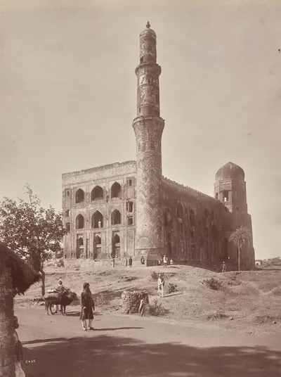
Mahmud Gawan
before 1481 CE
Persian merchant who became chief minister of the Bahmani sultanate (c. 1461–1481). He was regent for two boy kings, fought in Telangana and on the west coast, reorganised the provinces and the army, and founded a great college at Bidar. Muhammad Shah III had him executed on a forged charge of treason in 1481.
Malik Hasan Bahri
before 1486 CE
Bahmani noble, born a Brahman and brought up as a Muslim. As Nizam-ul-Mulk he took Rajahmundry and Kondapalli or Kondavidu for Muhammad Shah III in about 1471, and governed all of Telingana. He resented its division by Mahmud Gawan and led the plot that had the minister executed in 1481. He then ruled the kingdom as Malik Naib until he was killed in 1486 after a campaign at Warangal. His son Ahmad founded the Nizam Shahi kingdom of Ahmadnagar.
Nachana Somana
Telugu poet at the court of Bukka I of Vijayanagara in the 14th century and author of the Uttara Harivamsamu, a retelling of the later life of Krishna. Critics ranked him with the three poets of the Telugu Mahabharata, and N. Venkataramanayya pointed to him as the only poet in a spoken language known to have been patronised by Bukka.
Sultan Quli Qutb-ul-Mulk
before 1543 CE
Persian-born officer of the Bahmani sultanate who governed Telingana from Golconda. He conquered much of Telangana and the Krishna–Godavari coast, and founded the Qutb Shahi dynasty. He was assassinated in 1543. According to the Golconda chronicle, he was killed at prayer in the mosque of Golconda fort. According to Ferishta, a slave killed him while he was examining jewels.
Vemana
Telugu poet of short moral, religious and satirical verses, each ending with the refrain 'Viswad abhi rama vinara Vema'. His verses were the moral schoolbook of the Telugu country. Nothing certain is known of his life: C. P. Brown, who collected and translated the verses from 1824, heard that he lived about 1600, while Chenchiah and Bhujanga Rao preferred the early 15th century.
Vinukonda Vallabharaya
Telugu poet of the 15th century, governor of Vinukonda under the Vijayanagara king Devaraya II, named as the author of the Kridabhiramamu, a lively tour of the streets of Warangal told as a play. His family served the Vijayanagara kings from Bukka I onward as ministers, generals and keepers of the royal jewels. P. T. Raju and K. Sitaramaiya give the Kridabhiramamu to Srinatha instead.
Places
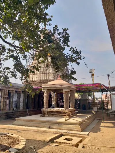
Ahobilam
Village and temple of Narasimha on the Nallamalai hills in the Kurnool district, 'the most sacred Vaishnava shrine' of the district. Reddi records credit Prolaya Vema with a flight of steps there. Kataya Vema gave it villages named after Kumaragiri in 1410, and Errapragada dedicated his Narasimha Purana to its god.
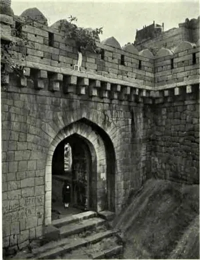
Bhongir
Town at the foot of a great isolated granite rock about thirty miles east of Hyderabad, crowned by a fort. The Warangal kings are said to have built the fort, and the Muslim rulers rebuilt it. The first Bahmani sultan took it in a year-long campaign in Telangana, and it became the eastern limit of his kingdom. Ahmad Shah I later gave it to his commander in Telangana as an estate.
Devarakonda
Town and hill fort in the south-west of the Nalgonda district. From Mada Nayaka in the 1360s it was the seat of the Devarakonda branch of the Recherla Velamas. In 1459 its chief, with an army from Orissa, routed a Bahmani force sent against it. Sultan Quli of Golconda took it early in the sixteenth century.
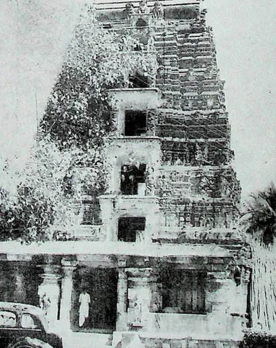
Draksharama
Temple town in the Godavari delta, four miles south of Ramachandrapuram. It is famous as the 'Southern Benares' for its temple of Bhimesvara, whose walls carry hundreds of inscriptions from the 11th century onwards. Tradition derives its name from Daksharama, the garden of Daksha. It counts the temple's linga among the five Pancharama shrines.
Ganapesvaram
Hamlet near Talagada-Divi on Divi island in the Krishna delta. It is named after the Ganapeshvara temple that the Kakatiya general Jaya built there in 1231 in honour of his king Ganapatideva.
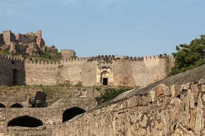
Golconda
Fortress and old royal town five miles west of Hyderabad. It was a Warangal frontier fort ceded to the Bahmanis in the 14th century, and then the first capital of the Qutb Shahi sultans. The court moved to Hyderabad in the 1590s, but the fortress remained their stronghold until 1687.
Guraja
Village in the old Gudivada taluk of Kistna (Krishna) district. It is the findspot of a copper-plate grant of 1346. In it the Musunuri chief Kapaya Nayaka gave the village of Prolavaram for the merit of his predecessor Prolaya Nayaka.
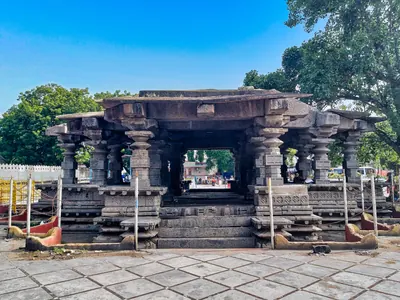
Inavolu
Village near Warangal with a temple of Mailara (Malleshvara). In 1369, after the fall of the Kakatiyas, the Recherla Velama chief Anapota-nayaka granted the village to this temple.
Kandikonda
Village with a hill fort near Mahabubabad, the Skandadri of the inscriptions. Venna, son of the Recherla chief Mada Nayaka, ruled here in the 1370s and built temples of Janardana and of Skandadrinatha.
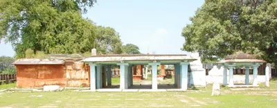
Karempudi
Town on the Nagileru river in the Palnadu, west of Guntur. It is remembered as the battlefield of the Palnadu heroes and the seat of their cult. Its temple of the heroes, described by Robert Sewell in 1879, has inscriptions of 1324 and 1333. A minister of the Velanati chief Gonka II built a temple of Suresvara there in 1154.
Kaulas
Fort of the Telugu country which the first Bahmani sultan took from the ruler of Warangal. Haig names this ruler Kanhayya Naik, and an epigraphy report of 1934–35 notes that he has been identified with the Musunuri chief Kapaya Nayaka. His attempt to win Kaulas back led to war with the Bahmani sultan Muhammad Shah I.
Kondapalli
Town and hill fortress on the north side of the Krishna, about ten miles north-west of Vijayawada. The fort is said to have been built by the Reddi kings of Kondavidu in the 14th century. It passed to the Gajapatis, was ceded to the Bahmanis in 1470, and was taken by Krishnadeva Raya about 1515 and by Golconda in 1531. It was later the seat of the Kondapalli or Mustafanagar Circar.
Kondavidu
Village and hill fortress in Guntur district. It was the capital of the Reddi kings in the 14th and early 15th centuries, a prize fought over by Orissa, Vijayanagara and Golconda in the 16th, and the seat of the Murtazanagar or Kondavidu Circar.
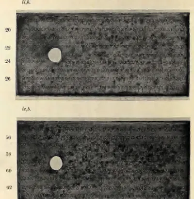
Machilipatnam
Port near the mouth of the Krishna, known to Europeans as Masulipatam and locally as Bandar. It was the main sea outlet of the Golconda kingdom, where the English, Dutch and French traded from the 17th century. Later it was the chief town of the Northern Circars and of Kistna district.
Palakollu
Market town in the western Godavari delta, six miles north of Narasapur. It is known as Kshirarama for its Shiva temple, one of the five Pancharama shrines. It was the first Dutch settlement on this coast, founded in the mid-17th century, and passed finally to the British in 1825.
Phirangipuram
Village near Guntur, two miles from the Kondavidu hills. A pillar in front of its Virabhadra temple carries a verse inscription of 1410, composed by Srinatha. It records the tank Santana-sagara built by Suramamba, queen of the Reddi king Peda Komati Vema.
Rachakonda
Village and ruined hill fort in the hills east of Hyderabad, the Rajukonda or Rajachala of the inscriptions. It was the capital of the Recherla Velama kings of the late fourteenth and fifteenth centuries. Anapota Nayaka fortified it in 1365, and Sultan Quli of Golconda took it early in the sixteenth century.
Rajahmundry
Town on the left bank of the Godavari, the ancient Rajamahendravaram. It was the eastern capital of the Reddis, and a frontier fortress fought over by Orissa, the Bahmanis, Vijayanagara and Golconda. It was Bussy's headquarters in the 1750s, and in the 1920s the home of the Andhra Historical Research Society.
Rekapalli
Village on the Godavari in the old Bhadrachalam taluk. N. Venkataramanayya and M. Somasekhara Sarma identified it with the Rekapalli at the foot of the Malyavanta hill that was the capital of the Musunuri chief Prolaya Nayaka, after the Telugu coast was freed from the Delhi Sultanate.
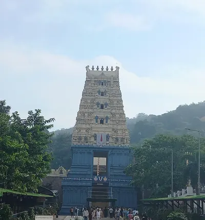
Simhachalam
Hill just north of Visakhapatnam with the temple of Narasimha, the richest and best-known shrine of the old Vizagapatam district. More than five hundred inscriptions on the temple record gifts from the Chola king Kulottunga I, the Eastern Ganga kings and their feudatories, the Reddis and the Vijayanagara king Krishnadeva Raya.
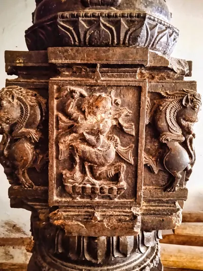
Srikurmam
Village and place of pilgrimage near Srikakulam, with the temple of Vishnu as the tortoise (Kurma). The temple's black stone pillars carry more than a hundred inscriptions. Many of them are of the Eastern Ganga kings, their ministers and feudatories (subordinate chiefs), and of the Gajapatis.
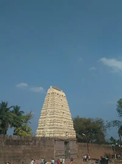
Srisailam
Temple town of Siva as Mallikarjuna, on the northernmost plateau of the Nallamalai hills, above the gorge of the Krishna in the Kurnool district. The Reddi kings of Kondavidu claimed the country 'from Srisailam to the eastern sea'. Their inscriptions credit Prolaya Vema with a flight of steps from the Patalaganga to the shrine, and Anavema built a hall there in 1378. Shivaji spent about ten days at the shrine in March 1677, on his way from Hyderabad to the Karnatak.
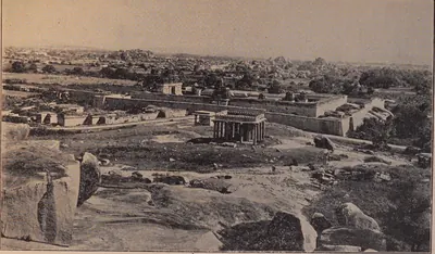
Udayagiri (Nellore)
Town in the west of the Nellore district below the Udayagiri Droog, an isolated hill of 3,079 feet once fortified with thirteen strongholds. It was the seat of a Vijayanagara province in the fourteenth century. The Gajapatis of Orissa held it in the later fifteenth century, and Krishnadeva Raya took it from Prataparudra after a long siege in 1512–13. Later it was a seat of Golconda and of the jagirdars (land-grant holders) of the Nawabs of Arcot.
Umamahesvaram
Hill shrine of Siva near Achampet in the Mahbubnagar district, known as the northern gateway of Srisailam. The Recherla chief Mada Nayaka of Devarakonda built a pavilion for the god here in 1377.
Vilasa
Village of the Konasima, the Godavari delta between the Vasishtha and Gautami branches, a few miles from Amalapuram. The Musunuri chief Prolaya Nayaka granted it to the scholar Vennaya in about 1330. Vennaya renamed it Prolavaram after the king.
Monuments
Kondavidu fort
c. 1150 CE
Hill fortress on a small range of hills west of Guntur. It was the capital of the Reddi kings from the time of Anavema (after 1361) to the 1420s. The Imperial Gazetteer dates the fortress to the 12th century, and local chronicles credit Prolaya Vema with rebuilding its inner fort. Its walls run for miles along the tops of the hills. Orissa, Vijayanagara and Golconda fought over it until 1579.
Kondapalli fort
c. 1360 CE
Hill fortress north-west of Vijayawada, said to have been built by the Reddi kings of Kondavidu about 1360. It has lines of fortifications with bastions, a lower fort guarding the main approach, and a palace on the hill. Muslim governors rebuilt the palace and called the place Mustafanagar.
Shitab Khan's hall, Warangal
c. 1504 CE
Tall roofless stone hall in Warangal fort, near the western gateway of the old central temple. It is named after the chief Shitab Khan, who held Warangal from 1504. The Hyderabad Archaeological Department conserved it in 1925–26. It compared the hall with the Hindola Mahal at Mandu and thought it built about the turn of the fifteenth and sixteenth centuries. The hall is 86 feet by 24, with cross arches 28 feet high that once carried a flat vault, sloping walls, a cistern in the floor and a tall arched entrance on the north.
Bhimesvara temple, Draksharama
Two-storeyed Shiva temple at Draksharama in the Godavari delta, one of the five Pancharama shrines and the most famous temple of the coastal Telugu country. Its walls carry some 270 inscriptions dated from 1055. Popular tradition in 1907 gave it to an unknown Chola king. M. Rama Rao (1964) gave it to the Eastern Chalukya king Chalukya-Bhima I, after whom he took the god to be named.
Golconda Fort
Walled hill fortress five miles west of Hyderabad. The Bahmani sultans received it from the ruler of Warangal in the 14th century. It became the seat of the Qutb Shahi sultans and was rebuilt in stone under Ibrahim Qutb Shah. It fell to Aurangzeb in 1687 after a siege of more than eight months.
Kshiraramalingesvara temple, Palakollu
Shiva temple in the middle of Palakollu, in the western Godavari delta, one of the five Pancharama shrines under the name Kshirarama. M. Rama Rao (1964) gave its shrine to the Eastern Chalukya king Chalukya-Bhima I, and the foreword to his monograph counts it among the original Chalukya buildings. Its own inscriptions, more than forty, run from 1136 to 1640. They record gifts of the Velanadu chiefs, the Haihaya chiefs of Konamandala, the Chalukya chiefs of Nidadavolu and the Reddi kings.
Rachakonda Fort
Hill fort of the Recherla Velama kings on the twin hills of Rajukonda and Naganayanikonda, east of Hyderabad. Three inscriptions of August 1365 record that Anapota Nayaka built its stone walls and wells and dug the tank between the two hills. Sultan Quli of Golconda took it by storm early in the sixteenth century.
Simhachalam temple
Temple of Narasimha on the Simhachalam hill north of Visakhapatnam, described in 1907 as the most famous, richest and best carved shrine of the district. Its walls hold more than five hundred inscriptions, many of Eastern Ganga kings. The district gazetteer credits the Ganga king Narasimha I with building its central shrine, halls and enclosing verandah in black stone in 1267–68. Its records include a Tamil inscription of Kulottunga I, gifts of Reddi and Matsya chiefs, and the inscriptions of Krishnadeva Raya of Vijayanagara.
Srikurmam temple
Temple of Vishnu in his tortoise incarnation at Srikurmam, near Srikakulam. Its granite verandas and black stone pillars carry more than a hundred inscriptions. Most of them belong to the Eastern Ganga kings who came after Anantavarman Chodaganga, to their ministers and feudatories, and later to the Gajapatis. An inscription of 1283 credits a Brahmin contemporary of a king Anangabhima with building an enclosure of black stone for the temple.
Inscriptions
Vilasa grant of Prolaya Nayaka
c. 1330 CE
A Sanskrit copper-plate charter of about 1330, in Telugu script. In it the Musunuri chief Prolaya Nayaka gives the village of Vilasa in the Kona country, on the Godavari, to the scholar Vennaya. Its opening is the only account from the Telugu country, written at the time, of Prataparudra's death on the way to Delhi. It also tells of the Delhi occupation, of Prolaya's war to free the land and of his capital at Rekapalli.
Madras Museum plates of Vema (1345)
1345 CE
A copper-plate grant of 18 March 1345, in which Vema (Prolaya Vema), founder of the Reddi kingdom, gave the village of Atukuru on the Krishna to Brahmans and renamed it Vemapuram. It names his capital as Addanki in the Pungi country and gives the earliest Reddi family tree. It says that he restored the Brahman villages seized by the Muslim conquerors of the Kakatiya kingdom.
Guraja grant of Kapaya Nayaka
1346 CE
A copper-plate grant from Guraja in the old Kistna district, dated at the solar eclipse of 22 February 1346. By it the Musunuri chief Kapaya Nayaka gave the village of Prolavaram, on the Malaghni stream, to the scholar Kandaya Peddi-Bhatta. He gave it for the merit of his predecessor Prolaya Nayaka. The grant gives the Musunuri family line for three generations and places Kapaya's capital at Ekasilanagari, Warangal.
Puvvada grant of Prolaya Vema (1346)
1346 CE
Five copper plates of 1346, found in an old well in the Tenali taluk and now in the Andhra Pradesh State Museum, Hyderabad. They record Prolaya Vema's gift of the village of Puvvada to Brahmans in sixty-four shares. The village lay between the forts of Addanki and Vinukonda and was renamed Vemapuri. The ring carries a Nandi seal and the sign-manual (royal signature) Sri Pallava Trinetra.
Pillalamarri inscription of the reign of Kapaya Nayaka
1357 CE
A Telugu inscription of 1357 at Pillalamarri, near Suryapet. In it Era-Potu-lemka, servant of Kapaya Nayaka, 'lord of the Andhra country' and lord of the city of Anumanamgallu, records that he set up again the image of the god Erakesvara. 'Sultan Alavadin' had damaged the image in the disturbances of the time. Era-Potu-lemka also gives land for its offerings.
Koduru grant of Anavota Reddi (1358)
1358 CE
Five copper plates of January 1358, found at Koduru in the Gudivada taluk. They record the gift of Koduru, renamed Annavotapuram, to sixty-one Brahmans by Anavota, the second Reddi king. The court poet Balasarasvati composed the text, and it is the only known copper-plate grant of Anavota.
Rachakonda inscriptions of Anapota (1365)
1365 CE
Three Telugu inscriptions of August 1365 at Rachakonda fort. In them the Recherla Velama chief Anapota-nayaka records the stone fortifications and wells he built on the twin hills of Rajukonda and Naganayanikonda. They also record the tank Anapota-samudram, dug between the hills, and an image of Bhairava set up under his title Pratigandabhairava.
Inavolu inscription of Recherla Anapota
1369 CE
A Sanskrit and Telugu inscription of 19 July 1369 at the Mailara (Mallikarjuna) temple of Inavolu near Warangal. In it the Recherla Velama chief Anapota-nayaka, who ruled Orugallu after the Kakatiyas, grants the village to the god. Its family history says his grandfather Dacaya conquered the Pandyas for Prataparudra.
Nadupuru grant of Anavema
c. 1374 CE
Three copper plates, known from impressions (copies) made for Sir Walter Elliot. They record Anavema Reddi's gift of the village of Nadupuru in the Godavari delta to twenty Brahmans, for the merit of his sister Vemasani, queen of Nallanunka. The village was renamed Vemapura. The grant was made in the temple of Vijayesvara on the Godavari, and it is dated in Saka 1296 (1374–75).
Pachchanitandiparru grant of Anavema (1374)
1374 CE
Five copper plates of 22 August 1374 that record Anavema Reddi's gift of the village of Pachchani-Tandiparru to the astronomer Peddi. They were composed by the court poet Balasarasvati. They were published in Epigraphia Indica XXI (1931–32) with two other Reddi copper plates: a plate of Vema from Chimakurti, and the Pinapadu grant of Komati Vema written by Srinatha.
Kandikonda inscription of Venna (1375)
1375 CE
An inscription of August 1375 at Kandikonda (Skandadri) near Mahabubabad. It records that Venna, son of the Recherla chief Mada Nayaka of Devarakonda, built a temple of Janardana and gave it land. It gives the family's descent from Dacha. It says that Venna came from Devarakonda to rule Skandadri at his father's order.
Umamahesvaram inscription of Mada Nayaka (1377)
1377 CE
A Telugu and Sanskrit inscription of early 1377 at Umamahesvaram, the northern gateway of Srisailam. It records the stone pavilion built for the god Mahesvara by the Recherla chief Mada (Madhava) Nayaka of Devarakonda. It gives a long family tree of his family and ends with a circular verse diagram.
Pedapalakaluru plates of Anavema (1378)
1378 CE
Four copper plates of 4 December 1378, found at Pedapalakaluru near Guntur in 1954 and now in the Andhra Pradesh State Museum, Hyderabad. They record Anavema Reddi's gift of the village to the scholar Ahobala Pandita and eight other Brahmans. Half of the 212 lines describe the village boundaries in Telugu. The family history in the grant credits Prolaya Vema with flights of steps at Srisailam and Ahobilam.
Vanapalli plates of Anavema (1380)
1380 CE
Three copper plates of 6 February 1380, found at Vanapalli in the Amalapuram taluk of the Godavari district and now in the Madras Museum. They record Anavema Reddi's gift of the village of Immadilanka, renamed Anna-Vemapura, to his minister and preceptor (religious teacher) Immadi. They name Kondavidu as the king's capital and describe his court.
Phirangipuram pillar inscription of Peda Komati Vema (1410)
1410 CE
A verse inscription on a stone pillar in front of the Virabhadra temple at Phirangipuram near Guntur, composed by the poet Srinatha. It records the dedication in February 1410 of a tank, Santana-sagara, built by Suramamba, queen of the Reddi king Peda Komati Vema. Half of it is in Sanskrit and half in Telugu. It gives the king's descent from Macha, the elder brother of Prolaya Vema.
Tottaramudi plates of Kataya Vema (1411)
1411 CE
Three copper plates of Saka 1333 (1411–12), found at Tottaramudi in the Amalapuram taluk and now in the Madras Museum. By them Kataya Vema of Rajahmundry gave the village of Mallavaram, named after his wife, to a Brahman. They give the family tree of the Kondavidu kings down to Kumaragiri. They also tell how Kataya Vema, Kumaragiri's minister, received the eastern country with Rajahmundry as its capital.
Devalanagaram inscription of Nagamba (1429)
1429 CE
A Sanskrit inscription of March–April 1429 on the bund of the tank Nagasamudram near Rachakonda. It records the tank dug by Nagamba, queen of the Recherla prince Ravu Madhava. It gives his descent from Era Dacha through Anapota and Singa. It says that he wrote a commentary on the Ramayana, the Raghaviya, in 1427.
Konkuduru plates of Allaya Dodda (1431)
1431 CE
Seven copper plates found in 1887 at Konkuduru, near Ramachandrapuram in the Godavari district. In them Dodda, a son of Allada Reddi of Rajahmundry, gave the village of Gumpini, renamed Alladareddidoddavaram, to Brahmans on 14 January 1431. They give the family tree of Allada's family. Their editor compared it with the accounts in Srinatha's Kasikhandam and Bhimakhandam.
Vemavaram grant of Allaya Vema (1434)
1434 CE
Eight copper plates in the British Museum, received from Rajahmundry. They record a grant by Allaya Vema, son of Allada Reddi, on the day of a total eclipse of the sun, 7 June 1434. The grant founded the village of Allada-Reddi-Vemavaram near Ramachandrapuram. It describes the wars of Allada and the conquests and gifts of Vema.
Gajapati inscriptions at Srikurmam (1452–1503)
1452–1503 CE
Short Telugu records on the black stone pillars of the Srikurmam temple. They are dated in the reigns of the Gajapati kings Kapilendra (1452, 1455, 1460), Purushottama (1470–1495) and Prataparudra (1503), and record gifts of land, lamps, images and silver vessels. They were copied in 1896 and printed in South-Indian Inscriptions V (1925). Monmohan Chakravarti and R. D. Banerji used them to fix the regnal years of the kings, and V. Rangacharya used them to argue that the kings came to the throne earlier.
Kondavidu plates of Ganadeva (1455)
c. 1455 CE
Three copper plates, sent to E. Hultzsch from the Kistna district and edited by him in 1891. They record a gift of the village of Chavali in the Repalle taluk to a number of Brahmins by Ganadeva, called Rautaraya, governor of Kondavidu. The gift was made on the day of a lunar eclipse in Saka 1377. The grant praises 'king Kapila' of the Solar race, the Gajapati of Orissa, whose capital was Cuttack. A pillar inscription of the same Ganadeva at Chintapallipadu is a year older, of April 1454.
Raghudevapuram and Dorapalem grants of Raghudeva (1455–56)
1456 CE
Two copper-plate charters of Raghudeva, nephew of the Gajapati Kapilendra and his governor at Rajahmundry. D. C. Sircar edited them in Epigraphia Indica XXXIII (1959–60): one from a set in the collection of the Andhra Historical Research Society at Rajahmundry, and one from a single plate in private hands. The Raghudevapura grant of June 1456 founded an agrahara (Brahmin village) on the Godavari for forty shares of Brahmins, and it gives the first family tree of Kapilendra's family. The broken Dorapalem grant of 1455–56 gave a village on the Godavari to a Brahmin.
Veligalani grant of Kapilesvara (1458)
1458 CE
Ten surviving plates of a copper charter whose first plate is lost, edited by D. C. Sircar and K. H. V. Sarma in 1963. By it the Gajapati Kapilendra (Kapilesvara), camping on the bank of the Godavari on the full moon of Vaisakha, Saka 1380 (27 April 1458), gave the village of Veligalani to 120 Brahmins and renamed it Kapilesvarapura. It is the only known copper-plate grant of the king himself. It has sections in Sanskrit, Telugu and Oriya, names his father and mother, and is the first to give him the titles Gajapati, Gaudesvara and Navakoti-Karnata-Kalavaragesvara.
Warangal inscriptions of Hamvira and Raghudeva (1460)
1460 CE
Two short records on gateways of the Warangal fort. Both are dated Saturday, the tenth of the bright half of Magha in the year Pramathin, 2 February 1460. They record the capture of the fort from the Bahmanis by two princes of the Gajapati house of Orissa. One was Hamvira (Ambira-deva), son of Kapilendra. The other was his cousin Raghudeva, governor of Rajahmundry, who says that he spared the lives of the Bahmani commander and his men.
Chiruvroli grant of Hambira (1461)
1461 CE
Copper plates found in 1941 at Nemalikallu near Ravela in the Guntur district, and edited by D. C. Sircar and K. H. V. Sarma in 1963. They are the only known copper-plate grant of Hamvira (Hambira), son of the Gajapati Kapilendra. On 4 September 1461 he gave the village of Chiruvroli on the Krishna, renamed Hambirapura, to more than a hundred Brahmins. A plate in Oriya, from another grant, was found with them.
Sayampeta inscription of Dharma-ravu (1464)
1464 CE
A Telugu inscription of April 1464 on a pillar near Sayampeta, north-east of Warangal. In it Dharma-ravu, a great-grandson of the Recherla chief Anapota Nayaka, gives the villages of Muccerla and Mada to the god Tiruvengalesvara and to Brahmin donees. The cultivators attached to their shares go with the gift.
Rachakonda mosque inscription
1484 CE
An Arabic inscription of AH 889 (1484), in the reign of the Bahmani king Mahmud Shah, recording the building of a mosque at Rachakonda by Malik An-Ni'mat, son of Mubarak. G. Yazdani, who translated it, took Malik An-Ni'mat to be the Bahmani governor and the mosque to have been a Hindu temple. Rachakonda had earlier been held by the rayas (chiefs) of Rajkonda, who paid tribute to Ahmad Shah I.
Warangal pillar inscription of Shitab Khan (1504)
1504 CE
A Sanskrit verse inscription, with two lines of Telugu prose, on a four-faced red sandstone pillar in front of the Sambhuni-gudi in Warangal fort. In 143 lines and 36 verses it records that the chief Chittapa Khan (Shitab Khan, or Sitapati) of the Bhogi family took Warangal from the Muslims. This happened on Sunday, the fifth day of the bright half of Magha, Saka 1425, which Hirananda Sastri reckoned as 21 January 1504. The record gives his ancestors, wives and sons, and says that he restored the images of Krishna and of the Kakatiya family goddess. It was composed by Madhava, son of Annarya, and edited by Sastri in 1932.
Jami Masjid inscription, Golconda fort
1518 CE
An inscription of AH 924 (1518) over the doorway of the congregational mosque (Masjid Safa) in Golconda fort. It records that Sultan Quli Qutb-ul-Mulk built the mosque in the reign of the Bahmani king Mahmud Shah, son of Muhammad Shah. Syed Ali Asgar Bilgrami used it to argue that Sultan Quli stayed loyal to the Bahmanis until 1518, and became independent only after Mahmud Shah's death.
Themes
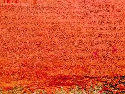
Language & literature
From Prakrit inscriptions and the first Telugu records to Nannaya, Pothana, Vemana and modern prose.
Music & dance
Annamacharya, Tyagaraja, Kuchipudi, Perini and the folk performance traditions.
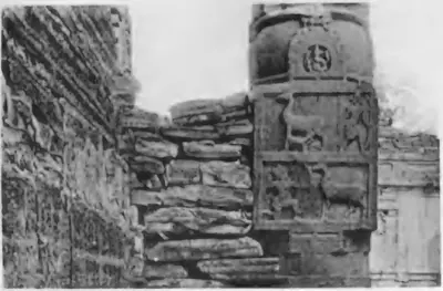
Religion & philosophy
Buddhism, Jainism, Shaiva and Vaishnava movements, Islam and the Sufi orders, Christianity and village deities.
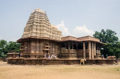
Temples & architecture
Stupas, rock-cut caves, temples, mosques, tombs and palaces, and how they were built.
Forts & warfare
Hill forts, city walls, armies and the battles that changed who ruled the region.
Trade & economy
Ports such as Motupalli and Machilipatnam, Golconda diamonds, tanks and farming, merchant guilds.
Government & administration
Kingship, the nayankara system, village officers, land revenue and law.
Society & communities
Castes, communities and tribes, and how social life changed over time, from scholarly sources.
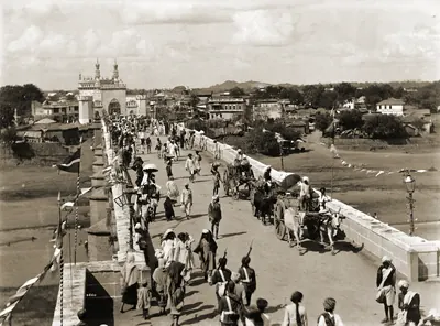
Daily life & festivals
Food, dress, homes and games; Sankranti, Ugadi, Bathukamma, Bonalu and other festivals.
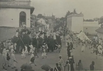
Folk songs & oral traditions
Burrakatha, Oggu katha, Yakshaganam and the heroic ballads of Palnadu and Bobbili.
Inscriptions & sources
How we know: inscriptions, coins, travellers' accounts, the Mackenzie kaifiyats and archives.
Old names of regions
The old country names of the Telugu lands and where the sources place them: Andhra and Telingana, Vengi between the two deltas, Kammanadu round Ongole, Velanadu in the western Krishna delta, Pakanadu between Ongole and Nellore, Renadu round Kadapa, the Kondapalli and Kondavidu countries, and the later names Circars and Ceded Districts. Names only: for how borders changed, see How the map changed.
References
Notes (0)
Sources (12)
Spotted an error on this page? Tell us
Last updated: