A new site, built from published sources. Spotted a mistake? Please tell us

"India in 1398", showing Telingana between the Bahmani kingdom, Orissa and Vijayanagar (The Cambridge History of India, Vol. III, Map 4, between pp. 192 and 193, PDF p. 235 of the archive.org scan cambridgehistory03wols)
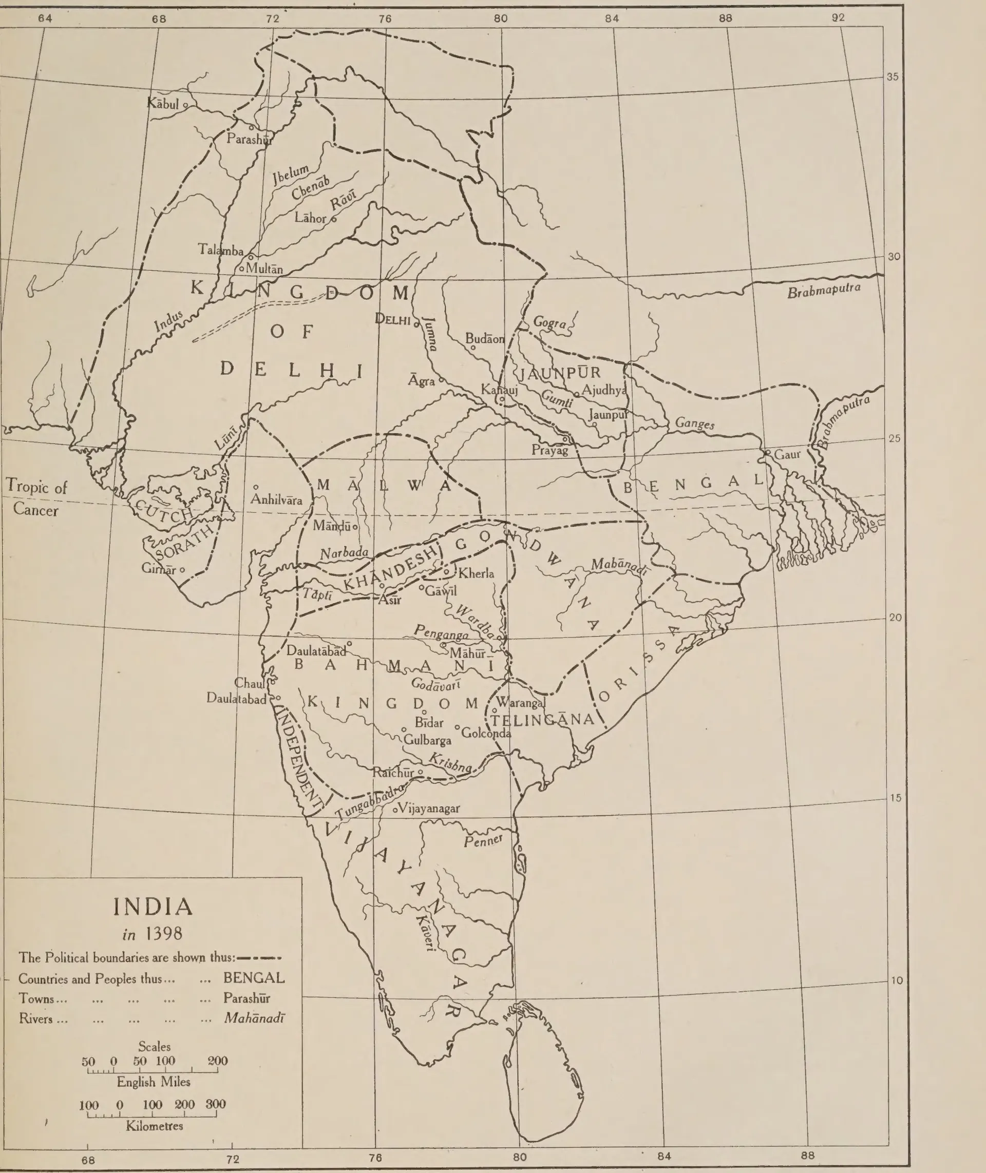
Printed outline map of India with political boundaries in dash-dot lines; in the Deccan it names the Bahmani Kingdom with Gulbarga, Bidar and Golconda, Telingana around Warangal, Orissa to the north-east and Vijayanagar to the south; a title box at lower left reads India in 1398.
Type
Map
Creator
Wolseley Haig (ed.), The Cambridge History of India, Vol. III (Cambridge University Press)
Date
1928
Licence
Public domain
From
Wolseley Haig (ed.), The Cambridge History of India, Vol. III: Turks and Afghans (opens in a new tab), 1928, Map 4, between pp. 192 and 193 (PDF p. 235)
Original
archive.org (opens in a new tab)
Appears in
Nayakas, Reddis & Bahmanis, Recherla Velamas, Bahmanis, Vijayanagara Empire