A new site, built from published sources. Spotted a mistake? Please tell us

Godavari delta: "Sketch Map of the Godavari Delta showing positions of the principal irrigation & navigation works" (two halves joined) (Walch 1896, PDF pp. 17-18)
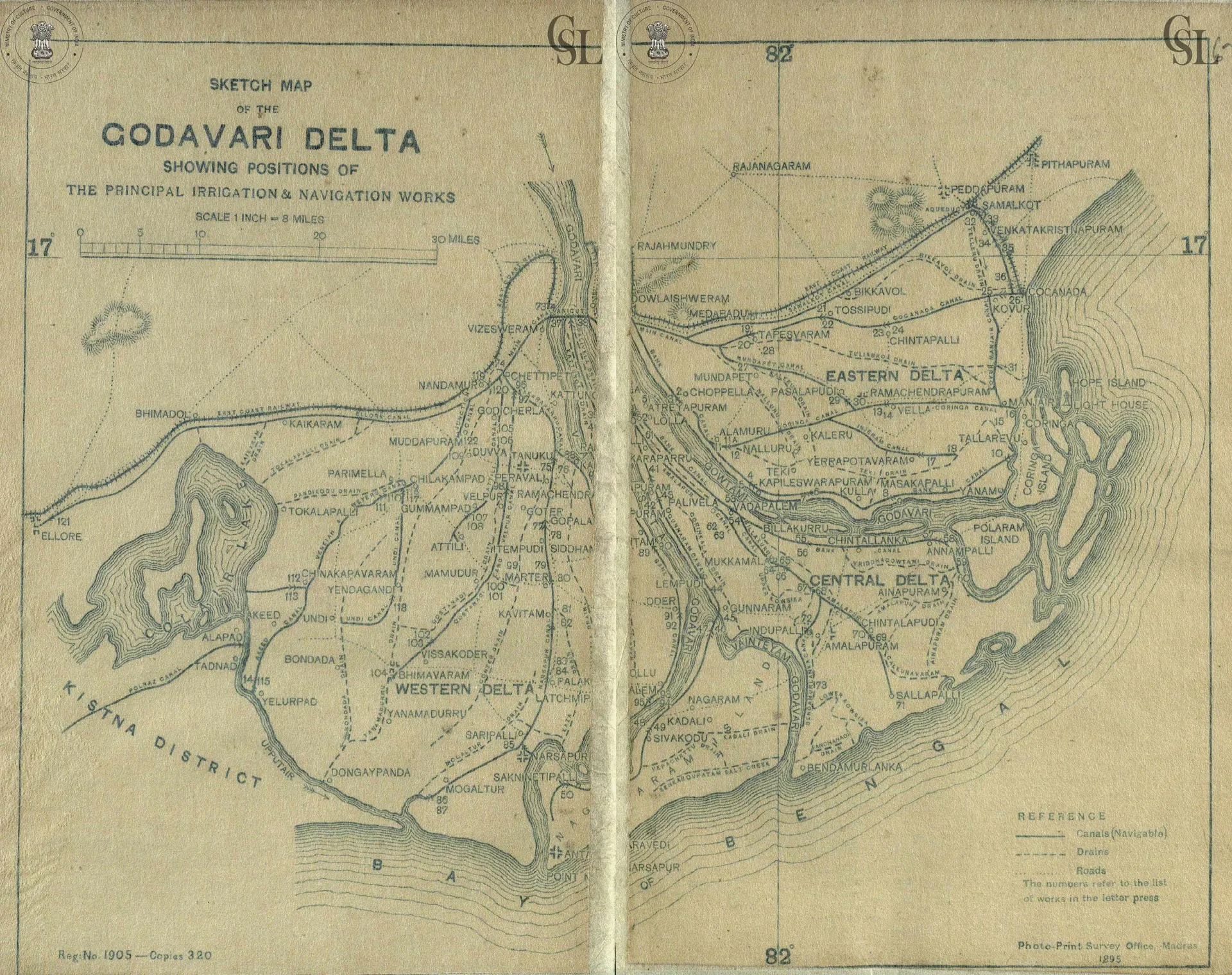
Folding map of the Godavari delta between the Kistna district and the Bay of Bengal, showing the Western, Central and Eastern Delta, canals, drains and roads, with towns such as Rajahmundry, Dowlaishweram, Cocanada, Ellore and Narsapur. Printed by the Photo-Print Survey Office, Madras, 1895.
Type
Map
Creator
George T. Walch
Date
1896
Licence
Public domain
From
George T. Walch, The Engineering Works of the Godavari Delta: A Descriptive and Historical Account (opens in a new tab), 1896, PDF pp. 17-18
Original
archive.org (opens in a new tab)
Appears in
Mughals, Asaf Jahis & the British, Sir Arthur Cotton, Rajahmundry, Kakinada, Trade & economy