Rajahmundry
Town on the left bank of the Godavari, the ancient Rajamahendravaram. It was the eastern capital of the Reddis, and a frontier fortress fought over by Orissa, the Bahmanis, Vijayanagara and Golconda. It was Bussy's headquarters in the 1750s, and in the 1920s the home of the Andhra Historical Research Society.

Rajahmundry, in Telugu Rajamahendravaram, stands on the left bank of the Godavari at the head of its delta. The Imperial Gazetteer of 1908 places it at 17°1′ N, 81°46′ E, in what was then Godavari district.1 It had 36,408 inhabitants in 1901.1
According to the gazetteer, the town was a fortress of importance from its foundation, because it was the key to the crossing of the Godavari.1 The gazetteer says it was “almost certainly” founded by the Chalukya kings, not by those of Orissa.1
The Telugu Mahabharata
The Andhra Historical Research Society was founded at Rajahmundry in the early 1920s.2 It recalled the town as the capital where the Eastern Chalukya king Rajaraja Narendra came to the throne.2 At his court Nannaya Bhatta composed the Telugu Mahabharata.2 The Society called it the only known Telugu kavya (literary poem) of the early period.2
In 1922 the Society marked the ninth centenary of the king’s accession with a commemorative volume in Telugu.2 It also held an exhibition of inscriptions showing the development of the Telugu script.2 The Kistna district manual likewise places Nannaya at Rajahmundry in the 11th century.3
A frontier fortress
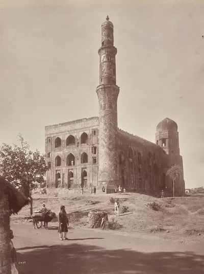
An inscription over the gateway of the main mosque records its building in 1324, the year after the Delhi sultanate took Warangal.4 After the Kakatiyas the town became the eastern capital of the Reddis. The Godavari gazetteer says that Kataya Vema governed from here between 1385 and 1422 for the Kondavidu king Kumaragiri.5 It adds that a separate Reddi line under Allada and his sons followed him until the 1440s.5
From the mid-15th century the town passed back and forth between the powers of the region:1
- The Gajapati kings of Orissa held it by the 1450s.6
- In 1470 the Bahmani sultan Muhammad Shah III gained it from Orissa.7 When Orissa tried to win it back, the sultan relieved his besieged governor in person and stayed three years at Rajahmundry settling the country.7
- Orissa recovered it after the Bahmani kingdom broke up. The Imperial Gazetteer says Krishnadeva Raya of Vijayanagara captured it in 1512 and gave it back to Orissa.8 The Godavari gazetteer puts his campaign in this region in 1515.8
- Sultan Quli of Golconda reached Rajahmundry and made the Godavari his boundary with Orissa.9
- The town fell finally to Golconda in AH 979 (1571–72; AH is the Islamic way of counting years), when Rafat Khan, called Malik Naib, took it after a siege of four months.10 According to the Golconda chronicle, its defenders Vidyadhara and Sitapati were allowed to leave with their families.10 The terms were agreed through Yellu Pandit, a Hindu accountant in the Muslim army.10
Under the Mughals and the Nizams, Rajahmundry was the capital of one of the five Northern Circars.11
French and English
The French general Bussy made Rajahmundry his headquarters from 1754 to 1757.12 After its defeat by Colonel Forde at Condore (Chandurti) in December 1758, the French army retreated there.12 The English occupied the fort without a fight.12 The French briefly retook it in 1759 and then abandoned it.12 A small British detachment under Lieutenant Cosby was stationed there until the Northern Circars were ceded to the Company in 1765–66.13
The modern town
By 1908 Rajahmundry was a railway town.14 There the East Coast Railway crossed the Godavari on a girder bridge of 56 spans.14 The town had a Central Jail built in 1864, a museum, and a municipality formed in 1866.14
Its college began as a district school in 1853 and had become a first-grade college by 1877.14 The town also had a teachers’ training college and a high school run by the American Evangelical Lutheran Mission.14 In 1928 questions in the Madras Legislative Council recorded a decision of the Senate of the Andhra University.15 The Senate had resolved to set up a University College of Science at Rajahmundry.15
Footnotes
-
Imperial Gazetteer of India: Madras, Vol. I (1908), p. 296 (archive.org (opens in a new tab)). ↩ ↩2 ↩3 ↩4 ↩5
-
Journal of the Andhra Historical Research Society, Vol. I (1926), editorial and “Brief history of the Society”, PDF pp. 12–15 (archive.org (opens in a new tab)). ↩ ↩2 ↩3 ↩4 ↩5 ↩6
-
Gordon Mackenzie, A Manual of the Kistna District (1883), p. 12 (archive.org (opens in a new tab)). ↩
-
Imperial Gazetteer: Madras, Vol. I (1908), p. 296 (archive.org (opens in a new tab)); F. R. Hemingway, Madras District Gazetteers: Godavari, Vol. I (1907), p. 25 (archive.org (opens in a new tab)). ↩
-
Hemingway, Godavari (1907), p. 26 (archive.org (opens in a new tab)). ↩ ↩2
-
Hemingway, Godavari (1907), p. 26 (archive.org (opens in a new tab)). ↩
-
Imperial Gazetteer: Madras, Vol. I (1908), p. 296 (archive.org (opens in a new tab)); Hemingway, Godavari (1907), pp. 26–27 (archive.org (opens in a new tab)). ↩ ↩2
-
Imperial Gazetteer: Madras, Vol. I (1908), p. 296 (archive.org (opens in a new tab)); Hemingway, Godavari (1907), p. 27 (archive.org (opens in a new tab)). ↩ ↩2
-
Golconda chronicle, in Muhammad Qasim Ferishta, tr. John Briggs, History of the Rise of the Mahomedan Power in India, Vol. III (1829), p. 364 (archive.org (opens in a new tab)). ↩
-
Briggs, Rise of the Mahomedan Power, Vol. III (1829), pp. 421–423 (archive.org (opens in a new tab)); Hemingway, Godavari (1907), p. 28 (archive.org (opens in a new tab)). ↩ ↩2 ↩3
-
Hemingway, Godavari (1907), p. 29 (archive.org (opens in a new tab)). ↩
-
Imperial Gazetteer: Madras, Vol. I (1908), p. 296 (archive.org (opens in a new tab)); Hemingway, Godavari (1907), pp. 30–32 (archive.org (opens in a new tab)). ↩ ↩2 ↩3 ↩4
-
Hemingway, Godavari (1907), p. 33 (archive.org (opens in a new tab)). ↩
-
Imperial Gazetteer: Madras, Vol. I (1908), pp. 296–297 (archive.org (opens in a new tab)). ↩ ↩2 ↩3 ↩4 ↩5
-
Madras Legislative Council: Questions and Answers, 23 January 1928 (archive.org (opens in a new tab)). ↩ ↩2
Photos
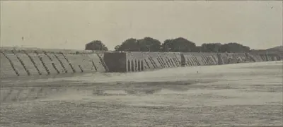
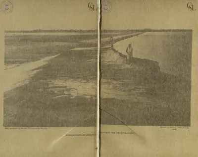 "Dowlaishveram Anicut from near the under sluices" (photograph by Messrs. Nicholas & Co., two halves joined) (Walch 1896, PDF pp. 81-82)Historic photograph · 1896
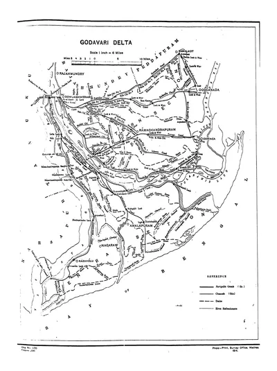 "Godavari Delta" map, with navigable canals, channels, drains and river embankments (Hemingway 1907, PDF p. 97)Map · 1907
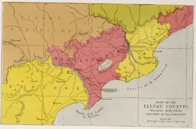 "Part of the Telugu Country, including Masulipatam, Guntoor, & Rajahmundry", map from the Church Missionary Atlas, 3rd edition, London, 1862 (cropped to the map)Map · 1862
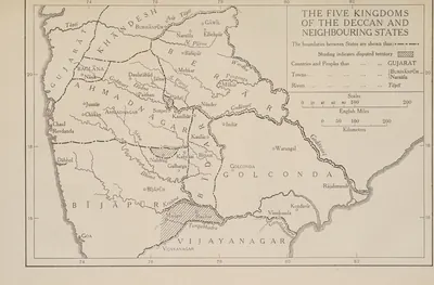 "The Five Kingdoms of the Deccan and Neighbouring States", with Golconda holding Telingana from Warangal to Rajahmundry and Kondavir (The Cambridge History of India, Vol. III (1928), Map 6)Map · 1928
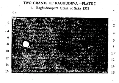 "Two Grants of Raghudeva.—Plate I. 1. Raghudevapura Grant of Saka 1378", first side of the first plate (lines 1-16) (Epigraphia Indica XXXIII, between pp. 12 and 13)Inscription rubbing · 1963
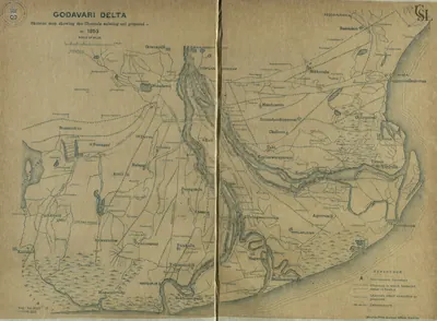 Godavari delta: "Skeleton map showing the Channels existing and proposed in 1853" (Walch 1896, PDF p. 115)Map · 1896
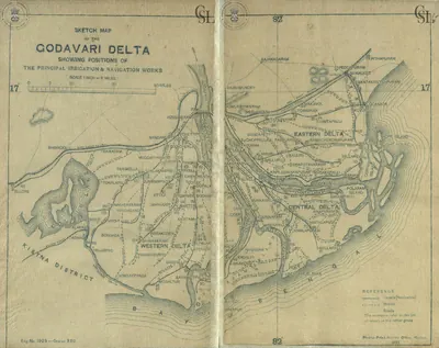 Godavari delta: "Sketch Map of the Godavari Delta showing positions of the principal irrigation & navigation works" (two halves joined) (Walch 1896, PDF pp. 17-18)Map · 1896
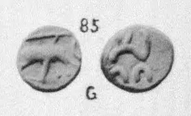 Gold fanam No. 85 from Rajamahendri, "South Indian Coins. Pl. III." (Elliot, Coins of Southern India, 1886, Plate III, No. 85 (PDF p. 191 of scan 00074712bsb))Coin · 1886
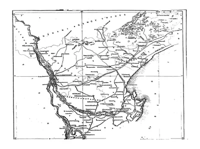 Map of the Godavari District (plains), folding map (Hemingway 1907, PDF p. 3)Map · 1907
Related
Dynasties
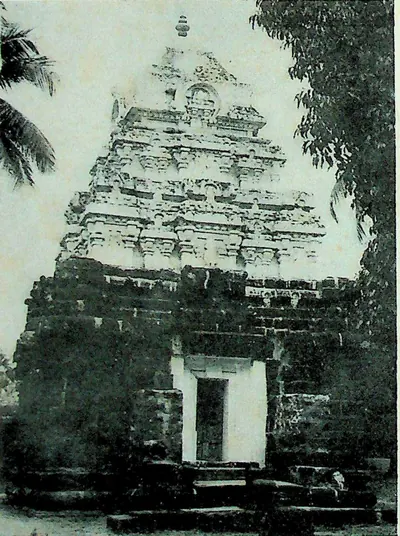
Eastern Chalukyas of Vengi
c. 615–1077 CE
A branch of the Chalukyas of Badami that ruled Vengi, the coastal country between the lower Godavari and Krishna, from the early 7th century. Its founder, Kubja Vishnuvardhana, was a younger brother of Pulakesin II. The kings fought the Rashtrakutas for two centuries. After about 1000 they were bound to the Cholas by marriage, and in 1070 their heir became the Chola emperor Kulottunga I. Their copper-plate grants record the length of every reign. The first Telugu literary work, Nannaya's Mahabharata, was written at their court in Rajahmundry.
Reddis of Rajahmundry
c. 1386–1448 CE
The eastern Reddi kingdom, centred on Rajahmundry and the Godavari delta. It grew out of the Kondavidu kingdom when Kumaragiri Reddi gave 'the eastern country' to his minister and brother-in-law Kataya Vema in the 1380s. After Kataya Vema's death about 1414–16, his kinsman Allada Reddi fought off the Telugu Choda Annadeva, the Kondavidu king and a Bahmani army. Allada's sons Allaya Vema and Virabhadra ruled jointly until the 1440s, when the Gajapati Kapilesvara of Orissa took the delta. Srinatha wrote his last poems at their court.
French East India Company
1750–1759 CE
The French Compagnie des Indes in the Telugu country. It traded at Masulipatam (Machilipatnam) from 1669 and at Yanam from before 1750. Dupleix and Bussy helped the Nizams Muzaffar Jang and Salabat Jang to the throne. In return the Company received Masulipatam and its country (1750), the Kondavid country (1751–52) and the four Northern Circars of Mustafanagar (Kondapalli), Ellore, Rajahmundry and Chicacole (1753), to pay for Bussy's army in the Deccan. Bussy governed the Circars through the Raja of Vizianagaram and the zamindars. In 1757 he destroyed Bobbili and took the English factories. Colonel Forde's victory at Condore (Chandurti) in December 1758 and his storm of Masulipatam in April 1759 ended French rule on the coast. By the treaty of May 1759 Salabat Jang shut the French out of the Deccan. Yanam, taken and given back several times, stayed French until 1954.
People
Amma I
c. 918–925 CE
Eastern Chalukya king of Vengi (918–925), grandson of Chalukya-Bhima I. He came to the throne against a conspiracy of his own relatives allied with the Rashtrakutas. His surname Raja-Mahendra led J. F. Fleet to suggest that Rajahmundry (Rajamahendrapuram) was named after him. His death in 925 opened nine years of civil war among the branches of the dynasty. His son Beta-Vijayaditya V, deposed as a child, founded the line of the Chalukya princes of Pithapuram.
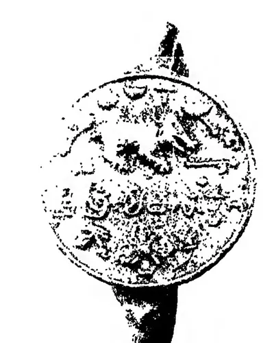
Rajaraja Narendra
1022–1063 CE
Eastern Chalukya king of Vengi (crowned 1022, died about 1061–63), the son of a Chola princess and husband of another, who ruled from Rajahmundry. His reign was disturbed by Chola and Western Chalukya intervention and by a rising of his half-brother Vijayaditya VII. Telugu tradition remembers him as the patron of Nannaya, whose Mahabharata is the oldest surviving Telugu literary work.
Muhammad bin Tughluq
1325–1351 CE
Sultan of Delhi (1325–1351). As Prince Ulugh Khan he besieged Warangal twice in the early 1320s, captured the Kakatiya king Prataparudra and renamed the city Sultanpur. As sultan he held Telingana as a province until a Telugu rising, after his visit of 1335, took Warangal from his governor. This page covers only his part in the history of the Telugu country.
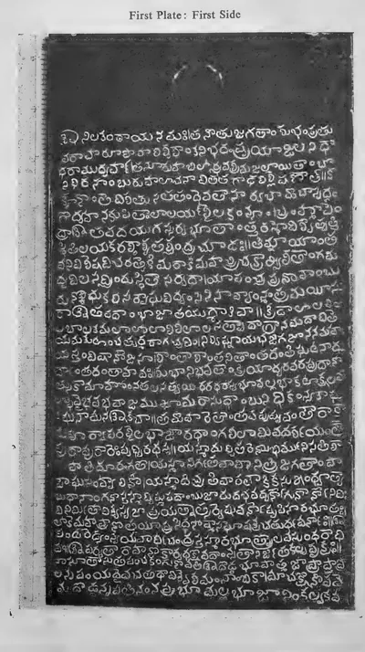
Anavema Reddi
c. 1364–1386 CE
Third Reddi king (c. 1364–1386), younger son of Prolaya Vema, who ruled from Kondavidu and carried the kingdom's grants into the Godavari delta. He is known from five copper-plate grants (Pachchanitandiparru 1374, Nadupuru, Pedapalakaluru 1378, Vanapalli 1380 and others) and from records at Srisailam and Draksharama. He was surnamed Vasantaraya for his spring festival. The poet Srinatha's connection with the Reddis probably began under him.
Srinatha
c. 1365–1440 CE
Telugu poet of the late 14th and early 15th centuries, often ranked with the three translators of the Mahabharata. He served Peda Komati Vema of Kondavidu as vidyadhikarin and composed his grants and inscriptions. He then wrote for the Reddis of Rajahmundry. His Sringaranaishadham, Bhimakhandam and Kasikhandam are dedicated to Reddi kings and ministers, and they are a main source for their history.
Kataya Vema
c. 1386–1415 CE
Minister and brother-in-law of Kumaragiri of Kondavidu. He received 'the eastern country' with Rajahmundry as its capital in the 1380s, and ruled the Godavari delta and the coast to Simhachalam until about 1414–16. A grandson of Prolaya Vema through his mother, he was also a Sanskrit scholar. He wrote the Kumaragirirajiyam, a commentary on Kalidasa's plays.
Kumaragiri Reddi
c. 1386–1402 CE
Reddi king of Kondavidu (c. 1386–1402), son of Anavota. He is remembered for his spring festival and his court's foreign trade, and as the patron after whom Kataya Vema named his commentary on Kalidasa. He gave the Godavari country around Rajahmundry to his minister and brother-in-law Kataya Vema. At the end of his reign he lost Kondavidu to his kinsman Peda Komati Vema.
Allada Reddi
c. 1416–1420 CE
Reddi noble of the Duvvuri branch of the Panta family who took control of the Rajahmundry kingdom after Kataya Vema's death (c. 1416–1420). It seems he ruled first as regent for Kataya Vema's son and daughter. His sons' grants credit him with victories over the Kondavidu king Peda Komati Vema and over 'Alpa Khan', and with friendship with the Gajapati and the king of Vijayanagara. His sons Allaya Vema and Virabhadra ruled Rajahmundry after him.
Kapilendra (Kapilesvara)
c. 1434–1470 CE
Founder of the Suryavamsi Gajapati dynasty of Orissa, who took the throne of the last Eastern Ganga king in 1434–35 and reigned until about 1470. He conquered the Reddi kingdoms of Rajahmundry and Kondavidu, and governed them through his nephew Raghudeva and his kinsman Ganadeva. He relieved Devarakonda from the Bahmanis in 1459, and his son Hamvira and Raghudeva took Warangal in 1460. His records credit him with conquests down the coast to the Kaveri.
Muhammad Shah III
1463–1482 CE
Bahmani sultan (1463–1482) who came to the throne as a boy. He brought Rajahmundry, Kondapalli and the Krishna–Godavari coast under Bahmani rule, and spent three years settling Telangana. In 1481 he had his great minister Mahmud Gawan executed because of a forged letter, a deed the sources blame for the break-up of the kingdom.
Purushottama (Gajapati)
c. 1470–1497 CE
Gajapati king of Orissa from 1469–70 to 1496–97, son of Kapilendra. Early in his reign the Bahmanis took Rajahmundry and Kondapalli or Kondavidu, after a disputed succession in which he may have bought their help. His attempt to recover the Godavari country in the 1470s ended with Muhammad Shah III's invasion of Orissa. But by 1489 his grants and inscriptions reach the Krishna and the Ongole country again. Orissan tradition credits him with an expedition to Kanchi and a romantic marriage.
Saluva Narasimha
c. 1485–1492 CE
Chief of the Saluva family of Chandragiri. He drove the Gajapatis of Orissa back up the coast towards Rajahmundry and faced the Bahmani sultan there in the 1470s. In 1485–86 he took the throne of Vijayanagara from the last Sangama king and founded the second, Saluva, dynasty. He died in 1492–93 and left his young sons in the charge of his general Narasa Nayaka. Whether he recovered Udayagiri from Orissa is disputed.
Prataparudra (Gajapati)
c. 1497–1540 CE
Gajapati king of Orissa from 1496–97 to about 1540, son of Purushottama, and the last great king of the Suryavamsi line. At his accession his empire reached from Bengal to the Guntur and Nellore country. In 1512–19 the Vijayanagara king Krishnadeva Raya took Udayagiri, Kondavidu and Kondapalli, captured his son Virabhadra, marched to Simhachalam and married his daughter. The Qutb Shahi sultan of Golconda then took the Godavari–Krishna country. The legal digest Sarasvativilasa bears his name. He was a disciple of Chaitanya.
Ibrahim Qutb Shah
1530–1580 CE
Fourth Qutb Shahi sultan of Golconda (1550–1580), a younger son of Sultan Quli. He spent seven years as an exile at Vijayanagara under Rama Raya. He came back to take the throne with the help of the Telugu foot soldiers who held the forts. He joined the alliance that destroyed Vijayanagara at Talikota in 1565, and he conquered Rajahmundry, the northern coast and Kondavidu. Telugu poets dedicated works to him and to his officers, and Telugu records call him Ibharama. A Sanskrit copper-plate grant from Nellore calls him Malikibharama.
Charles de Bussy
1718 CE
French general, born in 1718, who commanded the French troops at the court of the Nizams Muzaffar Jang and Salabat Jang from 1751 to 1758. He raised Salabat Jang to the throne and obtained from him the four Northern Circars for the French Company in 1753. He governed them through the Raja of Vizianagaram and the zamindars. In 1757 he destroyed the fort of Bobbili and took the English factories on the coast. Lally recalled him to the Carnatic in 1758, and he left the Circars to be lost to Colonel Forde.
Salabat Jang
1751–1761 CE
Third son of Nizam-ul-Mulk Asaf Jah I, raised to the throne of the Deccan by the French commander Bussy in 1751. Under Bussy's protection he defeated the Marathas and his elder brother Ghazi-ud-din, and in 1753 assigned the Northern Circars to the French. After Colonel Forde drove the French from the coast, he ceded Masulipatam to the English (1759). His brother Nizam Ali took power as his minister, deposed him in 1761 or 1762 and had him killed in prison about 1763.
Nizam Ali Khan (Asaf Jah II)
1761–1803 CE
Fourth son of Nizam-ul-Mulk Asaf Jah I. He pushed aside his brother Salabat Jang in 1761–62 and ruled the Deccan until his death at Hyderabad in 1803. In his reign the Northern Circars passed to the East India Company (1766, Guntur in 1788). The Nizam joined the British against Tipu Sultan, was defeated by the Marathas at Kharda (1795) and accepted a permanent subsidiary force (1798). To pay for it he gave up his Mysore gains, the later Ceded Districts of Rayalaseema (1800). He is the first Nizam buried at the Mecca Masjid.
Sir Arthur Cotton
1803–1899 CE
Engineer officer of the Madras army (1803–1899). He planned and built the anicut (dam) across the Godavari at Dowlaishweram (1847–1852), which turned the Godavari delta into irrigated rice land. He backed the plan for the Krishna anicut at Bezwada (built 1852–1855). At Vizagapatam he built sea groins and St John's church in 1844. He planned the upper Godavari navigation, of which the Dummagudem anicut survives.
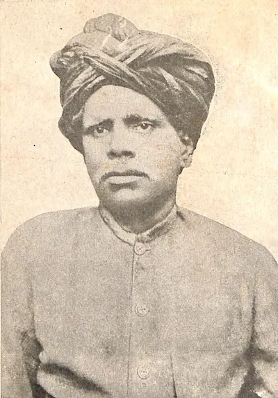
Kandukuri Veeresalingam
1848–1919 CE
Social reformer, journalist and writer of Rajahmundry (1848–1919). He worked for the education of girls and the remarriage of widows, and conducted the first widow remarriage in the Madras Presidency in 1881. He wrote the early Telugu social novel Rajasekhara Charitramu.
Chandrayya of Rampa
c. 1879–1881 CE
Leader of hill bands in the Rampa rebellion of 1879–1880 in the Godavari and Visakhapatnam hill tracts, a rising against the exactions of the mansabdar of Rampa, new toddy rules and the police. He burnt the Addatigala police station in 1879, held out for months, and was killed in 1880 or 1881, the sources differ, after being betrayed by another rebel.
Karam Tammanna Dora
1879–1880 CE
One of the chief leaders of the Rampa rebellion of 1879–1880 in the Godavari and Visakhapatnam hill tracts. The police history calls him the chief leader of the rising and says a police officer shot him on 25 July 1880; the Godavari gazetteer has him leading a raid into Visakhapatnam district in October 1880.
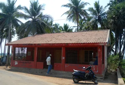
Alluri Sitarama Raju
1897–1924 CE
Leader of the Rampa or Agency rebellion of 1922–1924 in the hill tracts of the Godavari and Vizagapatam districts. He raided police stations for arms, held out against special police and the Assam Rifles for nearly two years, and was captured and shot dead in May 1924. Government and nationalist accounts differ over his aims and the manner of his death.
Anwar-ud-din Khan
before 1749 CE
Nawab of the Carnatic (Arcot) from 1744 until he was killed at the battle of Ambur in 1749, and the founder of the family of the later Nawabs, the Walajahs. He was an officer of Nizam-ul-Mulk. From 1725 to 1741 he governed the Ellore and Rajahmundry country in the Telugu north, and then the Nizam gave him Arcot. His sons Mahfuz Khan and Muhammad Ali fought beside him at Ambur against Chanda Sahib, Muzaffar Jang and the French. Muhammad Ali escaped to Trichinopoly and, with English support, won his claim to the Nawabship.
Bulusu Sambamurti
Congress leader of Kakinada and the Godavari districts who pressed for complete independence from 1924. He presided over the Andhra Provincial Independence League in 1928, was jailed for a year for campaigning against the Simon Commission, broke the salt laws at Chollangi in 1930, and was badly beaten by the police at Kakinada. He later became Speaker of the Madras Legislative Assembly.
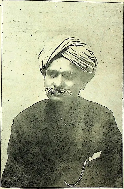
Chilakamarti Lakshmi Narasimham
Telugu novelist, playwright and speaker of Rajahmundry in the early 20th century, a follower of Kandukuri Veeresalingam's social reform. Jayanti Ramayya in 1913 credited him with starting the Telugu historical novel on the model of Walter Scott, drawing on Tod's Annals of Rajasthan. His plays, above all Prasanna Yadavamu and Gayopakhyanamu, were very popular, and K. Sitaramaiya notes that he wrote and spoke although he was blind.
Francis Forde
before 1770 CE
Irish officer of the 39th Foot, sent by Clive from Bengal in 1758. He routed the French under Conflans at Condore (Chandurti) near Pithapuram on 9 December 1758 and stormed Masulipatam in April 1759, so winning the Northern Circars from the French for the East India Company. He had earlier led the English detachment in the failed attack on Nellore (1757). Appointed one of the Company's Supervisors in 1769, he was lost at sea when the frigate Aurora disappeared after leaving the Cape at the end of that year.
Gadicherla Harisarvottama Rao
Nationalist journalist who, as a teacher trainee at Rajahmundry, was expelled and barred from government service in 1907 for his part in the Vande Mataram movement. He was jailed in 1908 for an article in his weekly Swaraj, and later led the Home Rule League in Andhra. Regani counts him among the first political prisoners of the movement in Andhra.
Mahmud Gawan
before 1481 CE
Persian merchant who became chief minister of the Bahmani sultanate (c. 1461–1481). He was regent for two boy kings, fought in Telangana and on the west coast, reorganised the provinces and the army, and founded a great college at Bidar. Muhammad Shah III had him executed on a forged charge of treason in 1481.
Malik Hasan Bahri
before 1486 CE
Bahmani noble, born a Brahman and brought up as a Muslim. As Nizam-ul-Mulk he took Rajahmundry and Kondapalli or Kondavidu for Muhammad Shah III in about 1471, and governed all of Telingana. He resented its division by Mahmud Gawan and led the plot that had the minister executed in 1481. He then ruled the kingdom as Malik Naib until he was killed in 1486 after a campaign at Warangal. His son Ahmad founded the Nizam Shahi kingdom of Ahmadnagar.
Nannaya
Telugu poet of the 11th century, the author of the earliest surviving Telugu literary work. He wrote the first parvas (books) of the Telugu Mahabharata at the request of the Eastern Chalukya king Rajaraja Narendra of Rajahmundry. A Telugu grammar in Sanskrit, the Andhra-sabda-chintamani, is traditionally said to be his, though later historians doubted it. A. C. Burnell placed him in the 12th century in 1878; the editors of the inscriptions and later historians place him under Rajaraja in the 11th.
Nyapathi Subba Rao
Lawyer of Rajahmundry and a leader of the moderate wing of the Congress in the Telugu districts. During the Vandemataram years of 1905–1908 he led the Swadeshi movement at Rajahmundry, interceded for expelled students, defended the men charged after the Kakinada club riot of 1907 and opened the National High School at Rajahmundry. In 1917 he signed the Madras Congress call for passive resistance to free the Home Rule leaders.
Inscriptions
References
Notes (0)
Sources (6)
Spotted an error on this page? Tell us
Last updated: