ప్రచురితమైన ఆధారాలతో నిర్మించిన కొత్త సైట్. ఏదైనా పొరపాటు కనిపించిందా? మాకు తెలియజేయండి

"The Nizam's Dominions, shewing the territories retained, those retransferred and those ceded" (coloured map) (Briggs 1861, folding map, PDF p. 26)
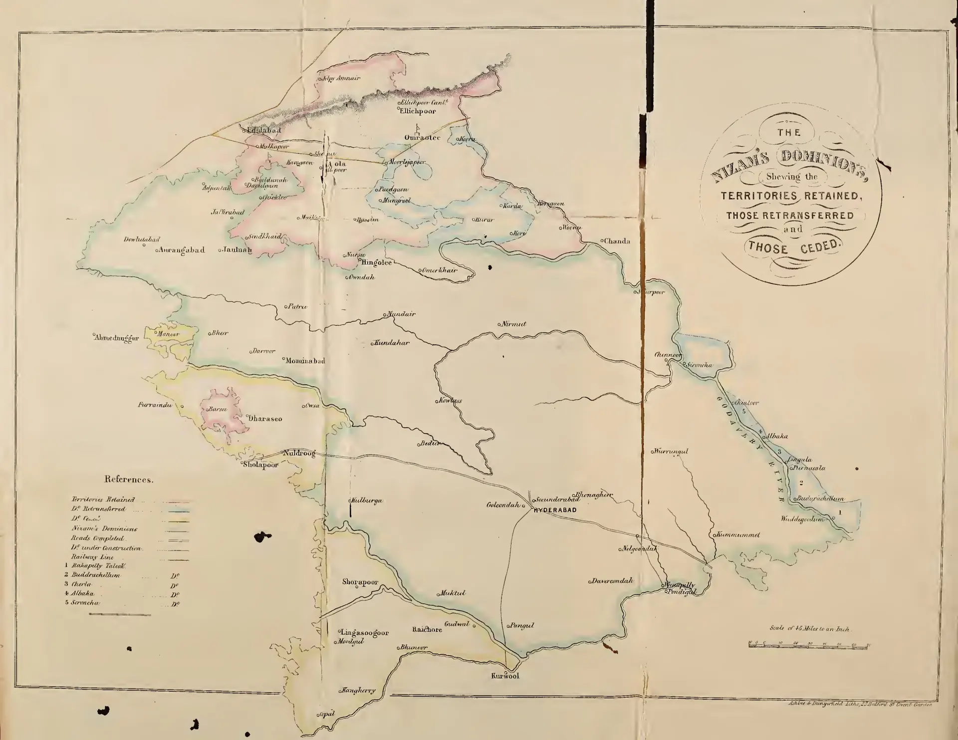
Coloured folding map of the Nizam's dominions with coloured boundaries for territories retained, retransferred and ceded, roads and railway, and numbered taluks on the Godavari (Rakapelly, Buddrachellum, Cherla, Albaka, Seroncha).
రకం
పటం
సృష్టికర్త
Henry George Briggs
తేదీ
1861
లైసెన్సు
Public domain
మూలం
Henry George Briggs, The Nizam: His History and Relations with the British Government, Vol. I (opens in a new tab), 1861, folding map, PDF p. 26
మూలం
archive.org (opens in a new tab)
కనిపించే పేజీలు
మొఘలులు, అసఫ్ జాహీలు, బ్రిటిష్ పాలన, అసఫ్ జాహీలు (నిజాములు), హైదరాబాద్, ఔరంగాబాద్