ప్రచురితమైన ఆధారాలతో నిర్మించిన కొత్త సైట్. ఏదైనా పొరపాటు కనిపించిందా? మాకు తెలియజేయండి

"Map to illustrate Polo's chapters on India" (Marco Polo, Book III) (Yule & Cordier 1903, to face p. 312 (PDF p. 363, lower part))
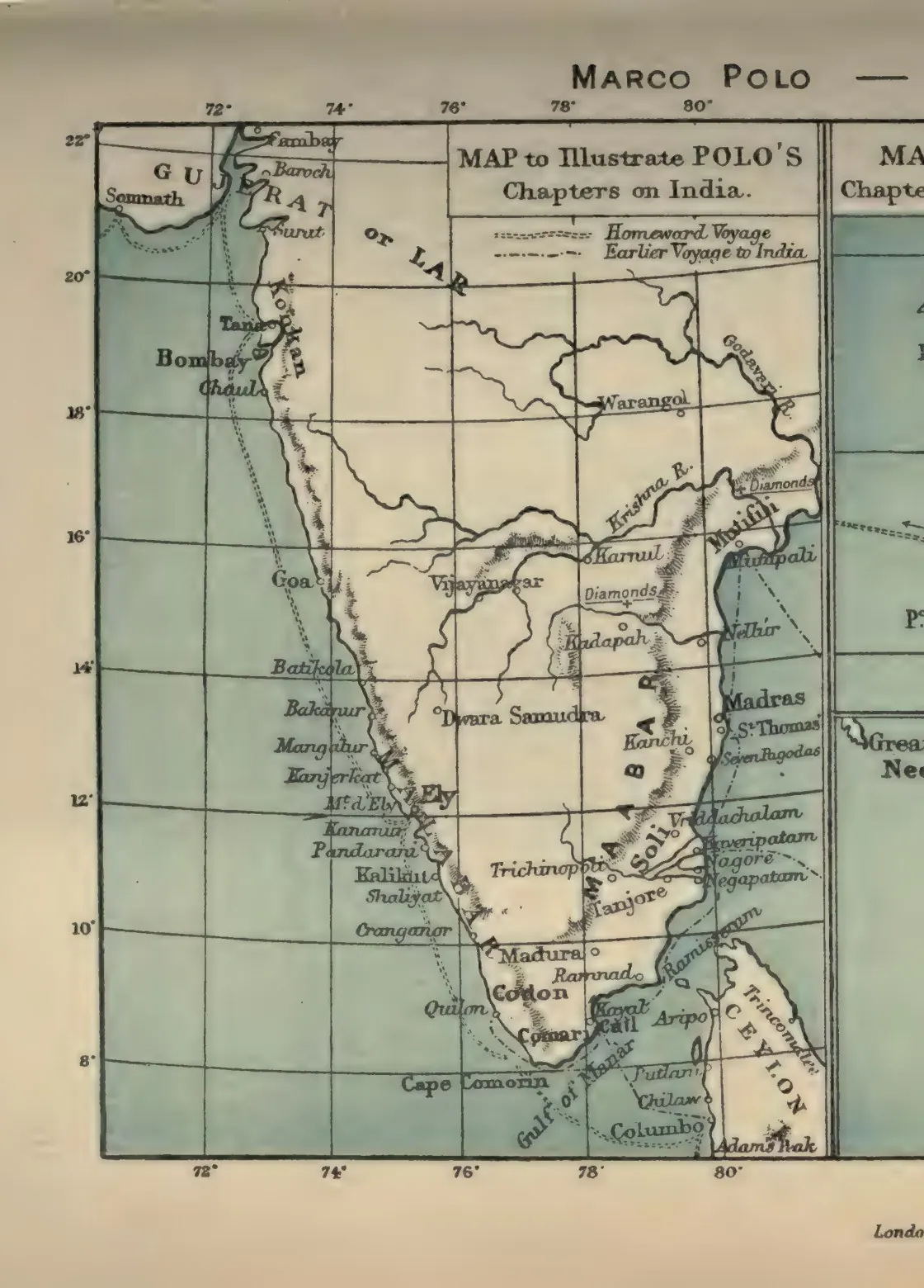
Coloured map of peninsular India showing Polo's homeward and earlier voyages along the coast, with Mutfili, Warangol, the Kistna and Godavari rivers, Diamonds, Madras, St Thomas and Ceylon. Printed sideways.
రకం
పటం
సృష్టికర్త
Henry Yule and Henri Cordier (eds.)
తేదీ
1903
లైసెన్సు
Public domain
మూలం
Henry Yule and Henri Cordier (eds.), The Book of Ser Marco Polo the Venetian, Vol. II (3rd ed.) (opens in a new tab), 1903, to face p. 312 (PDF p. 363, lower part)
మూలం
archive.org (opens in a new tab)
కనిపించే పేజీలు
కాకతీయులు, మోటుపల్లి, వరంగల్, వ్యాపారం, ఆర్థిక వ్యవస్థ