ప్రచురితమైన ఆధారాలతో నిర్మించిన కొత్త సైట్. ఏదైనా పొరపాటు కనిపించిందా? మాకు తెలియజేయండి

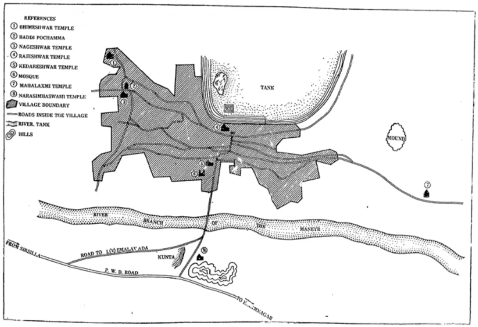
"Site plan of Lēmulavāḍa Village, Karimnagar Dist." (N. Venkataramanayya, The Chalukyas of L(V)emulavada, 1953, plate 6)

Sketch plan of Vemulavada village: the built-up area shaded beside a large tank to the north, a river running across the south, roads and numbered temples marked, with a key at upper left.
రకం
నిర్మాణ నక్షా
సృష్టికర్త
Archaeological Department, Government of Hyderabad, in N. Venkataramanayya, The Chalukyas of L(V)emulavada (1953)
తేదీ
1953
లైసెన్సు
Public domain in India
మూలం
N. Venkataramanayya, The Chalukyas of L(V)emulavada (opens in a new tab), 1953, plate 6 (PDF p. 115); not discussed in the text
మూలం
archive.org (opens in a new tab)
కనిపించే పేజీలు
తూర్పు చాళుక్యులు, దక్కన్ రాజ్యాలు, వేములవాడ చాళుక్యులు, వేములవాడ, వేములవాడ ఆలయాలు, ఆలయాలు, వాస్తుశిల్పం