A new site, built from published sources. Spotted a mistake? Please tell us

"District of Nellore and Ongole at the date of the assumption in 1801" (coloured lithograph) (Boswell 1873, PDF p. 496)
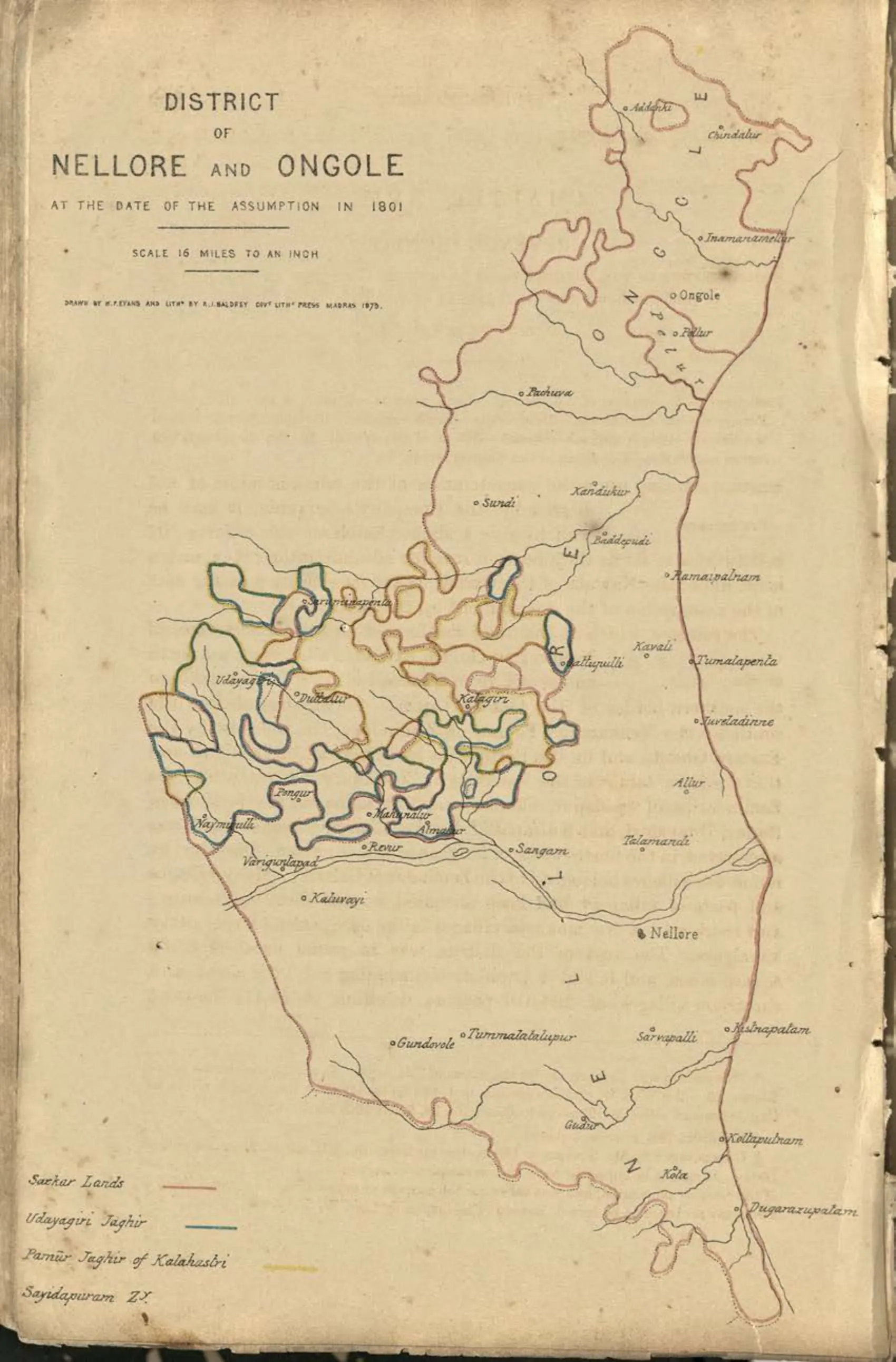
Coloured map of the Nellore and Ongole district in 1801, with coloured outlines distinguishing the Sircar lands, the Udayagiri jaghir, the Pamur jaghir of Kalahasti and Sandapuram, and towns including Ongole, Kandukur, Kavali, Nellore, Atmakur, Gudur and Udayagiri.
Type
Map
Creator
John A. C. Boswell
Date
1873
Licence
Public domain
From
John A. C. Boswell, A Manual of the Nellore District in the Presidency of Madras (opens in a new tab), 1873, PDF p. 496
Original
archive.org (opens in a new tab)
Appears in
Mughals, Asaf Jahis & the British, Nawabs of the Carnatic (Arcot), Nellore, Ongole, Udayagiri (Nellore), Kandukur, Kavali, Government & administration