A new site, built from published sources. Spotted a mistake? Please tell us

"Map of the Kingdom of Beejapoor, shewing its probable boundary before and after the Battle of Talikota, A.D. 1565" (Taylor and Fergusson, Architecture at Beejapoor, 1866, facing p. 1)
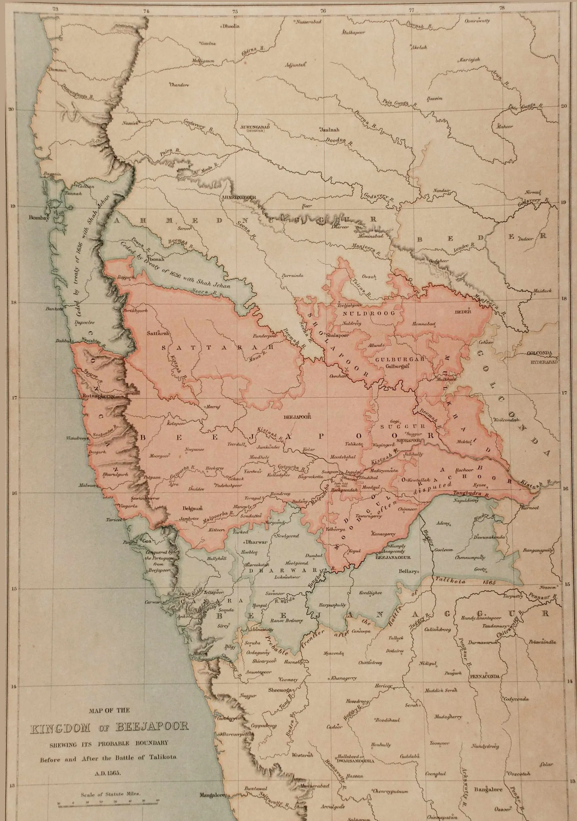
Hand-coloured map of the western Deccan from the Godavari to Mangalore; the kingdom of Bijapur before 1565 is tinted pink, and a green-tinted band south of the Tungabhadra around Bellary, Adoni and Gooty marks the probable frontier after Talikota; the Raichur doab is marked "often disputed".
Type
Map
Creator
Philip Meadows Taylor and James Fergusson (John Murray, London)
Date
1866
Licence
Public domain
From
Philip Meadows Taylor and James Fergusson, Architecture at Beejapoor, an Ancient Mahometan Capital in the Bombay Presidency (opens in a new tab), 1866, map facing p. 1 (PDF p. 10)
Original
archive.org (opens in a new tab)
Appears in
Vijayanagara & the Qutb Shahis, Adil Shahis of Bijapur, Bijapur (Vijayapura), Adoni, Raichur, Talikota, Gooty