ప్రచురితమైన ఆధారాలతో నిర్మించిన కొత్త సైట్. ఏదైనా పొరపాటు కనిపించిందా? మాకు తెలియజేయండి

"Godavari Delta" map, with navigable canals, channels, drains and river embankments (Hemingway 1907, PDF p. 97)
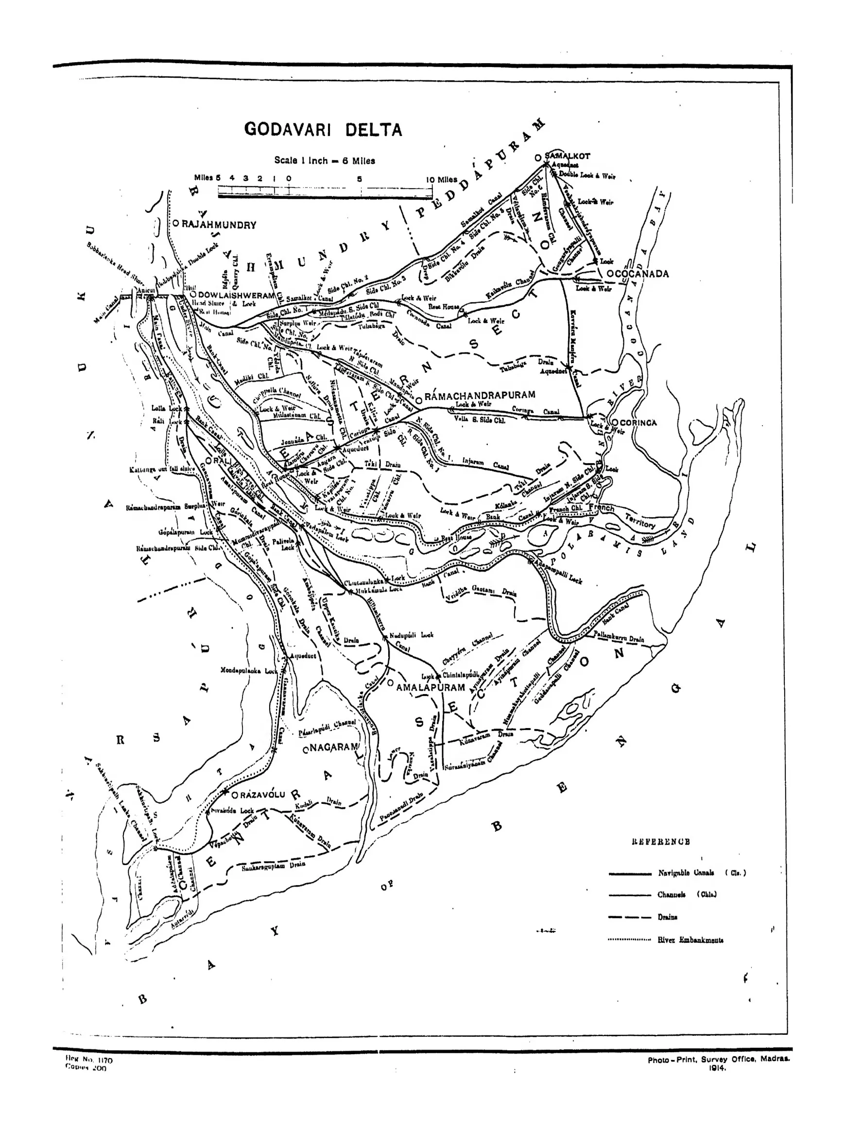
Map of the Godavari delta from Rajahmundry and Dowlaishweram to the sea, showing navigable canals, channels, drains and river embankments, with Cocanada, Ramachandrapuram, Amalapuram, Nagaram and Razavolu.
రకం
పటం
సృష్టికర్త
F. R. Hemingway (Madras District Gazetteers)
తేదీ
1907
లైసెన్సు
Public domain
మూలం
F. R. Hemingway, Madras District Gazetteers: Godavari, Vol. I (opens in a new tab), 1907, PDF p. 97
మూలం
archive.org (opens in a new tab)
కనిపించే పేజీలు
మొఘలులు, అసఫ్ జాహీలు, బ్రిటిష్ పాలన, బ్రిటిష్ రాజ్ (మద్రాసు ప్రెసిడెన్సీ), సర్ ఆర్థర్ కాటన్, రాజమహేంద్రవరం, కాకినాడ, ధవళేశ్వరం ఆనకట్ట