Pakhal Lake
A great reservoir east of Narsampet, formed by a dam about a mile long across the Pakhal river and covering some 13 square miles when full. Local tradition recorded in 1900 gave it to Pratapa Rudra, or to a 'Raja Khaldya' sixteen centuries earlier. P. V. Parabrahma Sastry, citing the inscription on the bund, gives it to Jagadalu Mummadi, son of a minister, in the reign of the Kakatiya king Ganapatideva.
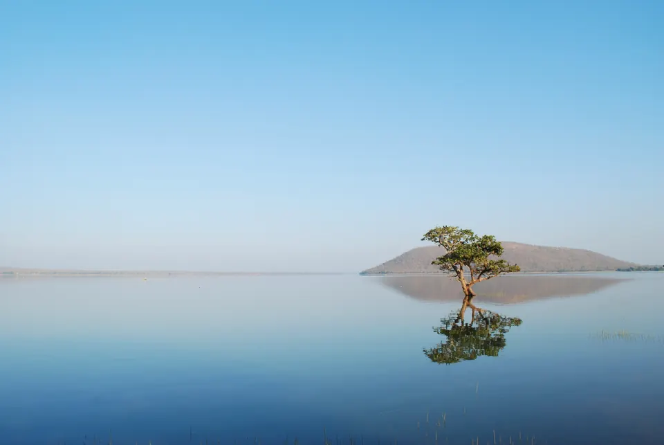
Pakhal Lake (Pakhal) lies about 50 km east of Warangal, in the old Narsampet taluk.1 It is in the basin of the Munneru river, with forest stretching away on all four sides.1 The Imperial Gazetteer of 1909 described it as formed by “throwing a dam, 2,000 yards long, across the Pakhal river, between two low headlands”.23
The lake was 8,000 yards long and 6,000 broad.23 It covered 13 square miles when full.23 The Munneru flows out of it.23
Who built it: tradition and inscription
Henry Cousens’s list of 1900 gives the local traditions.4 The great lake was “ascribed to” Raja Pratapa Rudra.4 He was also said to have built a summer palace of great unmortared blocks about four miles north-east of the village, of which nothing remained.4 Yet tradition also held that the bund had been built 1,600 years earlier by a “Raja Khaldya”.4 A stone pillar on the bund bore an inscription that was said to name the builder, but Cousens’s informants could not read it.4
That inscription was later read. In 1915–16 G. Yazdani copied “the important Kakatya inscriptions of Pakhal, Ramappa and Uparpalli”, and sent the impressions to L. D. Barnett to be deciphered.5
P. V. Parabrahma Sastry wrote in 1978 from a later edition of the record.1 He states that, according to the inscription on the bund, the lake was built in the time of Ganapatideva Maharaja.1 From the same inscription he names the builder as Jagadalu Mummadi, son of the minister Bayyana Nayaka and Bachamamba.1 See the Pakhal lake inscription of Jagadala Mummadi for the record.
The Hyderabad Archaeological Department, in its report for 1932–33, counted “the large and extensive tanks built at Pakhal, Palampet and other places” among the works of the Kakatiya dynasty.6
The dam and the water
Parabrahma Sastry describes the dam as a mile long, built of laterite pebbles and red earth.1 It is 30 to 50 feet wide at the top, with 40 artificial channels.1 He gives its catchment (the area that drains into it) as 80 square miles.1 He says it could water about 17,258 acres, of which 9,037 were then irrigated.1 The lake was not known to have ever run dry, and crocodiles were said to live in it.1
Cousens noted the ruins of a small pavilion in the middle of the bund, called the chabutra of Sitah Khan.4 The Imperial Gazetteer lists Pakhal first among the chief tanks of the district.7
Yazdani planned to survey the monuments at Pakhal late in 1916.8 It was among places that had been “important political and religious centres in the palmy days of the Kakatya dynasty”.8
Footnotes
-
P. V. Parabrahma Sastry, The Kakatiyas of Warangal (1978), p. 205, citing the edition of the inscription in Journal of Archives, Andhra Pradesh I, pp. 61–62 (archive.org (opens in a new tab)). Cite-only; paraphrased. ↩ ↩2 ↩3 ↩4 ↩5 ↩6 ↩7 ↩8 ↩9 ↩10
-
Imperial Gazetteer of India, Provincial Series: Hyderabad State (1909), p. 162 (archive.org (opens in a new tab)). ↩ ↩2 ↩3 ↩4
-
Imperial Gazetteer: Hyderabad State (1909), p. 171 (archive.org (opens in a new tab)). ↩ ↩2 ↩3 ↩4
-
Henry Cousens, Lists of Antiquarian Remains in His Highness the Nizam’s Territories (1900), p. 49 (archive.org (opens in a new tab)). ↩ ↩2 ↩3 ↩4 ↩5 ↩6
-
G. Yazdani, Annual Report of the Archaeological Department of His Highness the Nizam’s Dominions, 1915–16 (1917), p. 10 (archive.org (opens in a new tab)). ↩
-
Annual Report of the Archaeological Department of H.E.H. the Nizam’s Dominions for the year 1342 Fasli (1932–33), bound with the report for 1931–32 (1935), p. 66 (archive.org (opens in a new tab)). ↩
-
Imperial Gazetteer: Hyderabad State (1909), p. 166 (archive.org (opens in a new tab)). ↩
-
Yazdani, Annual Report … 1915–16 (1917), p. 12 (archive.org (opens in a new tab)). ↩ ↩2
Photos
References
Notes (0)
Sources (5)
Spotted an error on this page? Tell us
Last updated: