Medak
Hill-fort town in western Telangana that gave its name to a district and, from 1905, to the Medak Gulshanabad Division of the Nizam's Dominions, although the district headquarters were at Sangareddy. The Imperial Gazetteer of 1909 describes the fort with its Dutch gun of 1620, the Wesleyan mission of 1887, a rice-growing district that the gazetteer called free of famine thanks to its tanks, the new Manjra canal of 1904 and the revenue settlements of 1892–1905.
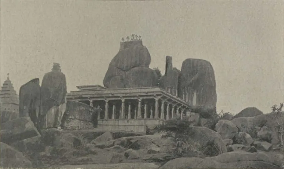
Medak is a town on a fortified hill in western Telangana. Under the Nizams it gave its name to a district and, from 1905, to one of the four divisions of the state, the Medak Gulshanabad Division.1 The district headquarters, however, were at Sangareddy.2
The town and its fort
The Imperial Gazetteer of India volume on Hyderabad (1909) says Medak town is built on the northern and eastern sides of a high hill.3 The fort on the hill stands about 300 feet above the plain.4 The gazetteer reports a story that a Warangal Raja built the first walls.3 It dates the present fort to about the middle of the sixteenth century.3 The fort held a brass gun ten feet long, cast at Rotterdam for the Dutch in 1620.3
A Persian inscription in the taluk office records the building of a mosque in 1641 on the ruins of a temple.3 The gazetteer also says that Malik Kafur, the general of Ala-ud-din Khalji, took Medak in 1309 on his way to Warangal.4 See Malik Kafur.
In 1901 the town had 8,511 people.5 A Wesleyan mission began work there in 1887.6 It opened a school the same year and a hospital in 1895.6 Most of its followers, the gazetteer says, came from the Mala caste.6
The district in 1909
The district had 366,722 people in 1901.2 Telugu was the main language.2 Rice was the chief crop, grown with water from 351 large and 1,658 small tanks.6 The gazetteer of 1909 says that up to then the district “has always been immune from famine, owing to the large number of tanks it contains”.7 About ten years later, the famine of 1918–20 partly struck it.8 A large canal from the Manjra river, which cost more than 10 lakhs of rupees, opened in 1904.67 It was expected to water 10,000 acres.6
Two railways crossed the district.7 The Nizam’s Guaranteed State Railway ran for 22 miles through its south.7 The Hyderabad-Godavari Valley Railway ran along its eastern edge.7 Goods for the interior came by rail to Shankarpalli and Mirzapalli and went on by road to the market towns.7
Revenue: from farming to survey
The gazetteer gives this outline of revenue in the district:9
- At first, groups of villages were let out to contractors, who kept one rupee in every ten they collected.9
- Then came the katal (share) system, under which the state took three-fifths of the crop on land watered by tanks.9
- In 1866 the ryotwari system began, with revenue collected in cash from each farmer.9
- Regular settlements followed: Kalabgur taluk in 1892, Andol in 1898, Ramayampet and Medak in 1900, Tekmal in 1901 and Baghat in 1905.9
The survey found that the dry land in the farmers’ holdings was more than twice the area shown in the old records.9 The settlement raised the revenue of the five surveyed taluks by 2 lakhs of rupees, or 16 per cent.9
The changes of 1905 and after
In 1905 the old Bidar Division was broken up and the Medak Gulshanabad Division formed.1 Its headquarters were at Patancheru.1 Medak district lost Ramayampet and Tekmal taluks to mergers.2 It gained Ibrahimpatan from Mahbubnagar and Siddipet from Karimnagar.2 The census of 1931 records that the four subas (divisions) were abolished in 1922 and set up again in 1929.10 The Medak suba then held the Medak, Nalgonda and Mahbubnagar districts.10
The census of 1931 lists Medak among the Telangana districts and gives it a high density of people on its farmland.11 It also records the Pocharam project in Medak district, a masonry dam across the Allair river finished between 1921 and 1931.12 The dam cost 32 lakhs of rupees and was meant to water 13,000 acres of rice land.12 Medak was also one of eight districts partly struck by the famine of 1918–20.8 See also Patancheru.
Footnotes
-
Imperial Gazetteer of India: Hyderabad State (1909), pp. 121–122 (archive.org (opens in a new tab)). ↩ ↩2 ↩3
-
Imperial Gazetteer: Hyderabad (1909), p. 134 (archive.org (opens in a new tab)). ↩ ↩2 ↩3 ↩4 ↩5
-
Imperial Gazetteer: Hyderabad (1909), p. 140 (archive.org (opens in a new tab)). ↩ ↩2 ↩3 ↩4 ↩5
-
Imperial Gazetteer: Hyderabad (1909), p. 133 (archive.org (opens in a new tab)). ↩ ↩2
-
Imperial Gazetteer: Hyderabad (1909), pp. 138–139 (archive.org (opens in a new tab)). ↩
-
Imperial Gazetteer: Hyderabad (1909), p. 135 (archive.org (opens in a new tab)). ↩ ↩2 ↩3 ↩4 ↩5 ↩6
-
Imperial Gazetteer: Hyderabad (1909), p. 136 (archive.org (opens in a new tab)). ↩ ↩2 ↩3 ↩4 ↩5 ↩6
-
Report on the Famine Relief Operations in H.E.H. the Nizam’s Dominions during 1918–19 and 1919–20 (1923), p. 1 (archive.org (opens in a new tab)). ↩ ↩2
-
Imperial Gazetteer: Hyderabad (1909), p. 137 (archive.org (opens in a new tab)). ↩ ↩2 ↩3 ↩4 ↩5 ↩6 ↩7
-
Census of India 1931, Vol. XXIII: H.E.H. the Nizam’s Dominions, Part I: Report (1933), p. 1 (archive.org (opens in a new tab)). ↩ ↩2
-
Census of India 1931, Vol. XXIII, Part I (1933), p. 16 (archive.org (opens in a new tab)). ↩
-
Census of India 1931, Vol. XXIII, Part I (1933), p. 24 (archive.org (opens in a new tab)). ↩ ↩2
Photos
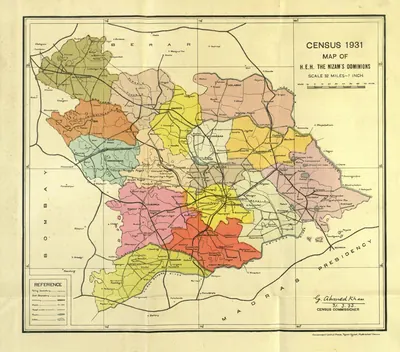 "Census 1931 Map of H.E.H. the Nizam's Dominions" (coloured) (Census of India 1931, Hyderabad, folding map, PDF p. 3)Map · 1933
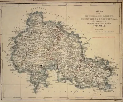 "Circars of Medduck, Golcondah, Bhonagheer & Nelgoondah, in the Dominions of His Highness the Nizam of Hyderabad" (map No. 6, atlas presented to the Nizam, 1865), with Hyderabad and Golconda marked; Bhonagheer is Bhongir (identification ours)Map · 1865
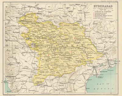 Hyderabad State (Imperial Gazetteer, 1909)Map · 1909
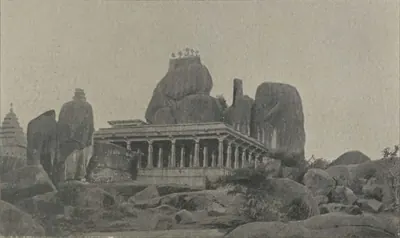 Medak: "Hindu Temple, Medak" (Campbell 1898, p. 472)Historic photograph · 1898
 Medak: "Hindu Temple, Medak" (Campbell 1898, p. 473)Historic photograph · 1898
References
Notes (0)
Sources (3)
Spotted an error on this page? Tell us
Last updated: