A new site, built from published sources. Spotted a mistake? Please tell us

"Census 1931 Map of H.E.H. the Nizam's Dominions" (coloured) (Census of India 1931, Hyderabad, folding map, PDF p. 3)
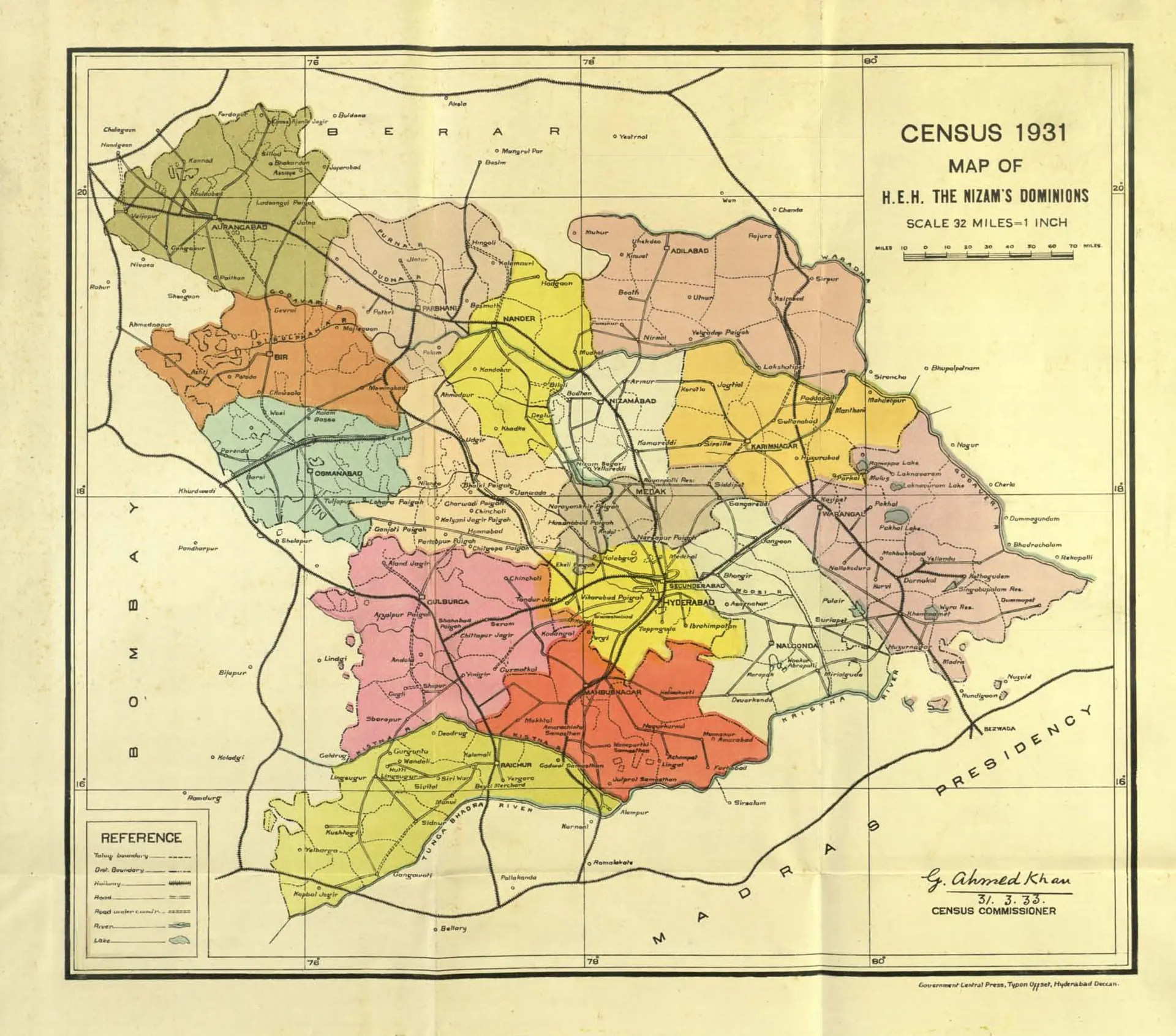
Coloured map of Hyderabad State in 1931 with each district in a different colour, railways and roads, Berar to the north, the Bombay Presidency to the west and the Madras Presidency to the south and east; signed by the Census Commissioner, G. Ahmed Khan.
Type
Map
Creator
Gulam Ahmad Khan (Census of India 1931, H.E.H. the Nizam's Dominions)
Date
1933
Licence
Public domain
From
Khan, Gulam Ahmad, Census of India 1931 vol.23 H.E.H. the Nizamʼs dominions (Hyderabad State); pt.1- Report (opens in a new tab), 1933, folding map, PDF p. 3
Original
archive.org (opens in a new tab)
Appears in
Mughals, Asaf Jahis & the British, Asaf Jahis (Nizams of Hyderabad), Hyderabad, Aurangabad, Secunderabad, Khammam, Nalgonda, Mahbubnagar, Medak, Sangareddy, Nizamabad, Adilabad, Nirmal, Suryapet