ప్రచురితమైన ఆధారాలతో నిర్మించిన కొత్త సైట్. ఏదైనా పొరపాటు కనిపించిందా? మాకు తెలియజేయండి

James Rennell, "The Peninsula of India, from the Khrishnah River to Cape Comorin" (London, 1788), British Library Maps K.Top.115.65.1: the Mahrattas, Visiapour, Adoni, Gooty, Golconda and the Circars
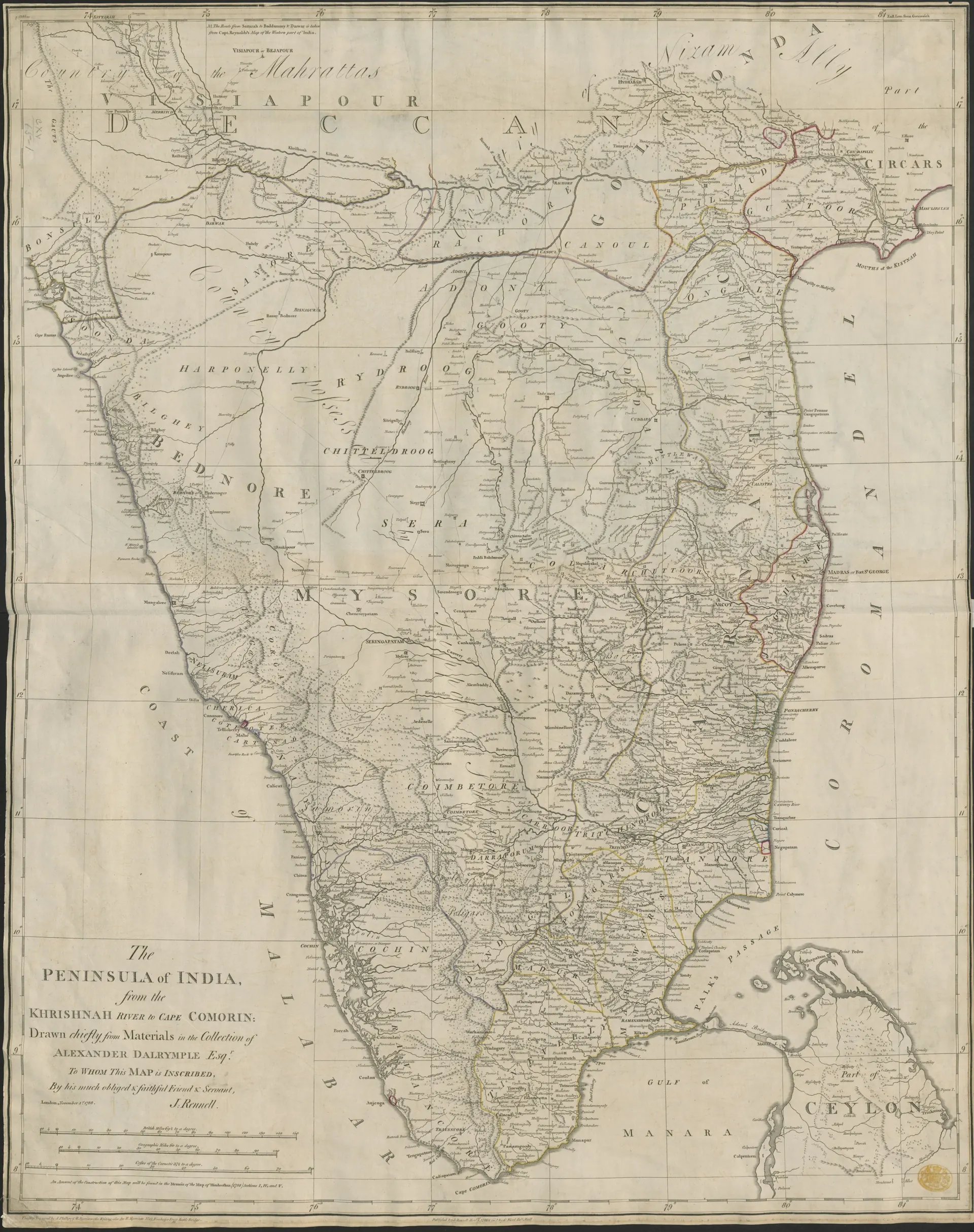
Engraved 18th-century map of southern India from the Krishna to Cape Comorin, with region names such as Mahrattas, Visiapour, Golconda, Mysore and the Circars and a decorative title at lower left.
రకం
పటం
సృష్టికర్త
James Rennell (British Library), via Wikimedia Commons
తేదీ
1788
లైసెన్సు
No known copyright restrictions (British Library)
మూలం
commons.wikimedia.org (opens in a new tab)
కనిపించే పేజీలు
మొఘలులు, అసఫ్ జాహీలు, బ్రిటిష్ పాలన, మరాఠాలు, తెలుగు దేశం, హైదర్ అలీ, టిప్పు సుల్తాన్ కాలపు మైసూరు, గుత్తి మురారిరావు, గుర్రంకొండ, గుత్తి, ఆదోని