Nizam Sagar
Dam and reservoir on the Manjra river in Nizamabad district, built in the reign of Mir Osman Ali Khan. Pictorial Hyderabad (1929) describes a dam 7,260 feet long and 111 feet high, then under construction; the census of 1931 records the scheme as just completed at a cost of 426 lakhs of rupees, with a main canal of 72½ miles meant to water 275,000 acres in the Bodhan, Nizamabad, Armur and Yellareddy taluks.
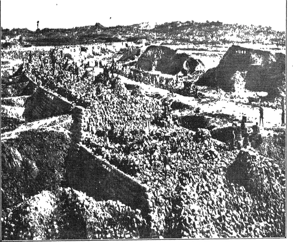
The Nizam Sagar is a dam and reservoir on the Manjra river in Nizamabad district, in north-western Telangana. It was being built in 1927, in the reign of Mir Osman Ali Khan, and was finished by 1931.12 Its canals were meant to water the land of four taluks.2
The dam
K. Krishnaswamy Mudiraj’s Pictorial Hyderabad (1929) lists the Nizam Sagar first among the new dams in the districts.3 He gives these figures for the scheme, which was then still being built:3
- dam 7,260 feet long and 111 feet high3
- storage of 23,999 million cubic feet3
- a catchment (drainage area) of 8,376 square miles3
- a main channel of 62½ miles3
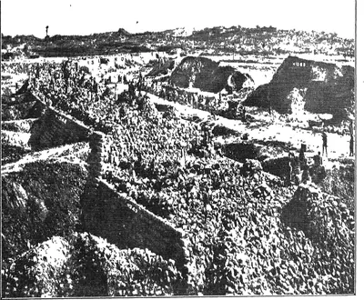
- an estimated cost of 305 lakhs of rupees3 His book prints photographs of the work.145 One shows the main dam under construction in 1927, blocking the Manjra.1 Another shows a bridge across the Manjra at Nizam Sagar with 19 vents.4 Other plates show the cuttings at Jagellepalli and Ibrahimpet and an aqueduct at Narwa.678
The finished scheme
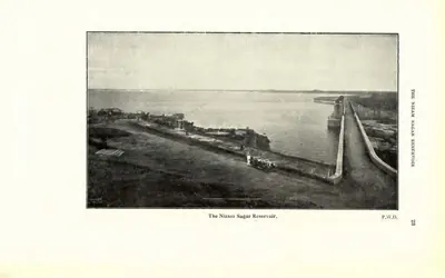
The census of 1931 says the Nizam Sagar irrigation scheme “has just been completed”.2 It cost 426 lakhs of rupees.2 Its main canal was 72½ miles long.2 The canal and its branches, about 600 miles in all, were designed to water 275,000 acres.2 The land lay in the Yellareddy, Bodhan, Nizamabad and Armur taluks.2 The census report prints photographs of the sluices and the reservoir.910
The work needed more labourers than the district could supply.11 The Irrigation Department reported that the Nizam Sagar project drew a fifth of its labour from Vijayawada (then Bezwada) in the Madras Presidency.11
Settling the new canal land
To develop the land under the dam, Bodhan taluk and some villages of Yellareddy were made into a separate Nizam Sagar district for a time.12 A government farm was opened at Nizam Sagar for the area under the reservoir.2 In 1932–33 a tahsil (revenue sub-division) was set up at Banswada for five years for the same purpose.13
The administration report for 1342 Fasli (1932–33) records the progress of the canals.14 By the end of that year, 265 miles of distributaries and 137 miles of field channels had been finished.14 They could water a net area of 84,292 acres.14 The same report notes that a new sugar-cane variety, Coimbatore 213, had spread quickly in the Nizam Sagar area.15 It also says cotton strains were being tried on land under the canal.15 See Nizamabad and Bodhan.
Footnotes
-
K. Krishnaswamy Mudiraj, Pictorial Hyderabad, Vol. I (1929), p. 91 (archive.org (opens in a new tab)). ↩ ↩2 ↩3
-
Census of India 1931, Vol. XXIII, Part I (1933), p. 24 (archive.org (opens in a new tab)). ↩ ↩2 ↩3 ↩4 ↩5 ↩6 ↩7 ↩8
-
Mudiraj, Pictorial Hyderabad (1929), p. 101 (archive.org (opens in a new tab)). ↩ ↩2 ↩3 ↩4 ↩5 ↩6 ↩7
-
Mudiraj, Pictorial Hyderabad (1929), p. 92 (archive.org (opens in a new tab)). ↩ ↩2
-
Mudiraj, Pictorial Hyderabad (1929), p. 98 (archive.org (opens in a new tab)). ↩
-
Mudiraj, Pictorial Hyderabad (1929), p. 230 (archive.org (opens in a new tab)). ↩
-
Mudiraj, Pictorial Hyderabad (1929), p. 231 (archive.org (opens in a new tab)). ↩
-
Mudiraj, Pictorial Hyderabad (1929), p. 232 (archive.org (opens in a new tab)). ↩
-
Census of India 1931, Vol. XXIII, Part I (1933), p. 22, plate “The Nizam Sagar Sluices” (archive.org (opens in a new tab)). ↩
-
Census of India 1931, Vol. XXIII, Part I (1933), p. 23, plate “The Nizam Sagar Reservoir” (archive.org (opens in a new tab)). ↩
-
Census of India 1931, Vol. XXIII, Part I (1933), p. 40 (archive.org (opens in a new tab)). ↩ ↩2
-
Census of India 1931, Vol. XXIII: H.E.H. the Nizam’s Dominions, Part I: Report (1933), p. 2 (archive.org (opens in a new tab)). ↩
-
Report on the Administration of H.E.H. the Nizam’s Dominions for 1342 Fasli (1932–33) (1935), p. 2 (archive.org (opens in a new tab)). ↩
-
Administration Report, 1342 Fasli (1932–33) (1935), pp. vii–viii (archive.org (opens in a new tab)). ↩ ↩2 ↩3
-
Administration Report, 1342 Fasli (1932–33) (1935), p. 52 (archive.org (opens in a new tab)). ↩ ↩2
Photos
References
Notes (0)
Sources (3)
Spotted an error on this page? Tell us
Last updated: