Nalgonda
Town in southern Telangana, head of a district of the Nizam's Dominions. The Imperial Gazetteer of 1909 describes its fort, its market of Osmanganj and the Telugu-speaking district around it, which gained Cherial (Jangaon) and Kodar in 1905. The district suffered in the famines of 1877 and 1899–1900, and in 1946–48 it was a centre of the peasant struggle and of Razakar raids.
Nalgonda is a town in southern Telangana. Under the Nizams it was the head of a district that reached south to the Krishna river.1 Most of its people spoke Telugu.2 The district lived through famines and revenue reforms, and in the 1940s it became a centre of armed conflict in the villages.34
The town
The Imperial Gazetteer of India volume on Hyderabad (1909) describes Nalgonda as lying between two hills.5 A tomb of a Muslim saint, Shah Latif, stands on the northern hill.5 A strong fortress with a masonry wall stands on the southern one.5 The gazetteer says the town was once called Nilgiri and took its present name after its conquest by Ala-ud-din Bahman Shah, the first Bahmani king.5 It had a large rest house (sarai) built by the minister Mir Alam, a busy market called Osmanganj, a jail, a dispensary and schools for boys and girls.5 In 1901 the town had 5,889 people.5
The district
The district had 699,799 people in 1901.6 About 91 per cent of them spoke Telugu.2 The gazetteer counts the Kapus (farmers) as the largest caste.2 Rice was grown on land watered by tanks (storage ponds) and channels from the Musi and other rivers.7 Weavers at Charlapalli and Pangal made fine silk cloth, and potters at Bhongir made light drinking vessels for sale in Hyderabad.8
The gazetteer gives a short history of land revenue in the district:39
- Until 1821, an estimator (anchanadar) valued the standing crops for every ten villages.3
- In 1821, revenue managers (ziladars) made ten-year agreements with the village headmen.3
- From 1835, groups of villages were let out to zamindars (revenue contractors) under the sarbasta (contract) system.9
- In 1866, when regular districts were formed, the contract system ended and fixed rates per bigha (three-quarters of an acre) were set.9
By 1909 the revenue survey of the district was not yet finished.9 Only the Nalgonda and Miryalaguda (then Devalpalli) taluks had been newly settled, and their revenue rose by more than 16 per cent.9
Roads, railway and the changes of 1905
The road from Hyderabad to Machilipatnam (then Masulipatam) crossed the district.8 Madras Sappers and Miners built it for the army in 1832.8 The Nizam’s Guaranteed State Railway (the company line from Wadi to Vijayawada (then Bezwada)) ran through Bhongir taluk for 21 miles, with five stations.8 Three feeder roads from Nalgonda, including those to Devarakonda and Nakrekal, were made as famine works in 1877–78.3
In 1905 the state redrew its districts.10 Nalgonda moved from the Warangal Division to the new Medak Gulshanabad Division.11 It also gained the Cherial taluk, with its new headquarters at Jangaon, and the Kodar sub-taluk, which became the Pochamcherla taluk.21213 The census of 1931 still lists Nalgonda in the Medak suba (division).14
Famines
The gazetteer lists the famines that struck the district.3
- In 1790, grain sold at one seer (a small measure of weight) to the rupee.3
- In 1877, grain sold at four seers to the rupee, and the district lost more than 34,000 cattle.3
- The famine of 1899–1900 was less severe, but its effects lasted nearly two years.3
The census of 1931 names Nalgonda among the districts that suffered most in 1899–1900.15 Nalgonda was also one of eight districts partly struck by the famine of 1918–20.16 In 1921 parts of the district were again declared famine-stricken.17
The struggle of the 1940s
Sarojini Regani’s history of the freedom movement is written from the Congress side.4 She says the communists began a violent struggle against landlords in the Jangaon and Bhongir taluks from October 1946.4 She lists Razakar raids on Nalgonda villages in 1948, including Suryapet and its neighbourhood.18 She also says that 20 customs posts on the district’s borders closed down.18 By her account, Congress and communist workers were said to have destroyed 13 of them, and the government closed the rest.18 At Renikunta in Bhongir taluk, on 4 March 1948, she writes, 26 villagers died fighting the Nizam’s forces and the Razakars.19
The new government’s own account, Hyderabad Reborn (1949), describes the communists of Nalgonda and Warangal very differently.20 It calls them a menace and says that in one district alone they had killed more than 200 people.20 The later story of the peasant struggle is told on the Movements page. See also Bhongir, Devarakonda, Panugallu and Suryapet.
Footnotes
-
Imperial Gazetteer: Hyderabad (1909), pp. 150–151 (archive.org (opens in a new tab)). ↩
-
Imperial Gazetteer: Hyderabad (1909), p. 153 (archive.org (opens in a new tab)). ↩ ↩2 ↩3 ↩4
-
Imperial Gazetteer: Hyderabad (1909), p. 156 (archive.org (opens in a new tab)). ↩ ↩2 ↩3 ↩4 ↩5 ↩6 ↩7 ↩8 ↩9
-
Sarojini Regani, Highlights of the Freedom Movement in Andhra Pradesh, p. 208 (archive.org (opens in a new tab)). ↩ ↩2 ↩3
-
Imperial Gazetteer: Hyderabad (1909), p. 160 (archive.org (opens in a new tab)). ↩ ↩2 ↩3 ↩4 ↩5 ↩6
-
Imperial Gazetteer: Hyderabad (1909), p. 152 (archive.org (opens in a new tab)). ↩
-
Imperial Gazetteer: Hyderabad (1909), p. 154 (archive.org (opens in a new tab)). ↩
-
Imperial Gazetteer: Hyderabad (1909), p. 155 (archive.org (opens in a new tab)). ↩ ↩2 ↩3 ↩4
-
Imperial Gazetteer: Hyderabad (1909), pp. 156–157 (archive.org (opens in a new tab)). ↩ ↩2 ↩3 ↩4 ↩5
-
Imperial Gazetteer of India: Hyderabad State (1909), p. 121 (archive.org (opens in a new tab)). ↩
-
Imperial Gazetteer: Hyderabad (1909), p. 122 (archive.org (opens in a new tab)). ↩
-
Imperial Gazetteer: Hyderabad (1909), p. 158 (archive.org (opens in a new tab)). ↩
-
Imperial Gazetteer: Hyderabad (1909), p. 159 (archive.org (opens in a new tab)). ↩
-
Census of India 1931, Vol. XXIII: H.E.H. the Nizam’s Dominions, Part I: Report (1933), p. 1 (archive.org (opens in a new tab)). ↩
-
Census of India 1931, Vol. XXIII, Part I (1933), p. 19 (archive.org (opens in a new tab)). ↩
-
Report on the Famine Relief Operations in H.E.H. the Nizam’s Dominions during 1918–19 and 1919–20 (1923), p. 1 (archive.org (opens in a new tab)). ↩
-
Census of India 1931, Vol. XXIII, Part I (1933), p. 20 (archive.org (opens in a new tab)). ↩
-
Regani, Highlights of the Freedom Movement, p. 219 (archive.org (opens in a new tab)). ↩ ↩2 ↩3
-
Regani, Highlights of the Freedom Movement, p. 220 (archive.org (opens in a new tab)). ↩
-
Hyderabad Reborn (Government of Hyderabad, 1949), p. 21 (archive.org (opens in a new tab)). ↩ ↩2
Photos
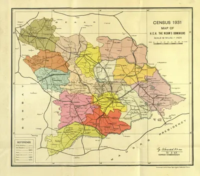 "Census 1931 Map of H.E.H. the Nizam's Dominions" (coloured) (Census of India 1931, Hyderabad, folding map, PDF p. 3)Map · 1933
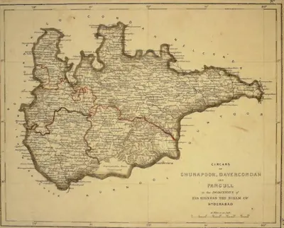 "Circars of Chunapoor, Davercondah and Pangull, in the Dominions of His Highness the Nizam of Hyderabad" (map No. 3, atlas presented to the Nizam, 1865); Davercondah is Devarakonda and Pangull Panagal (identifications ours)Map · 1865
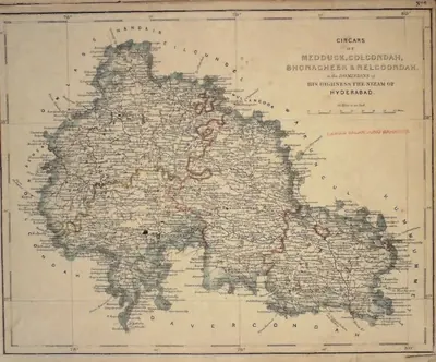 "Circars of Medduck, Golcondah, Bhonagheer & Nelgoondah, in the Dominions of His Highness the Nizam of Hyderabad" (map No. 6, atlas presented to the Nizam, 1865), with Hyderabad and Golconda marked; Bhonagheer is Bhongir (identification ours)Map · 1865
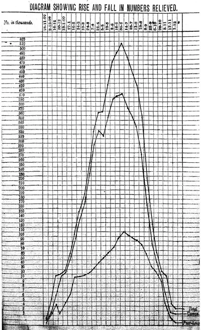 "Diagram showing rise and fall in numbers relieved": numbers on famine relief in the Nizam's Dominions, November 1899 to December 1900 (Report on the Famine Relief Operations ... 1309 Fasli (1899-1900), Vol. I, 1901)Drawing · 1901
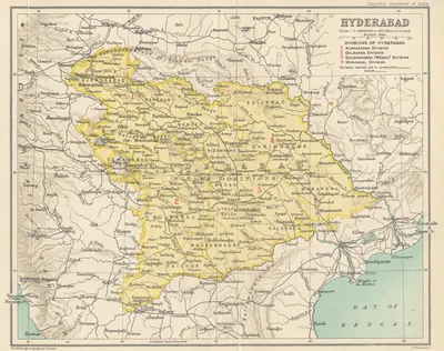 Hyderabad State (Imperial Gazetteer, 1909)Map · 1909
References
Notes (0)
Sources (5)
Spotted an error on this page? Tell us
Last updated: