Bhongir
Town at the foot of a great isolated granite rock about thirty miles east of Hyderabad, crowned by a fort. The Warangal kings are said to have built the fort, and the Muslim rulers rebuilt it. The first Bahmani sultan took it in a year-long campaign in Telangana, and it became the eastern limit of his kingdom. Ahmad Shah I later gave it to his commander in Telangana as an estate.
The rock and the fort
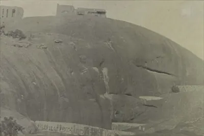
The Imperial Gazetteer of 1909 describes Bhongir as the headquarters of a taluk of the Nalgonda district, “situated at the foot of a fortified rock”.1 It says the fort stands on an isolated rock whose eastern and southern sides “are quite unscalable” (impossible to climb).12
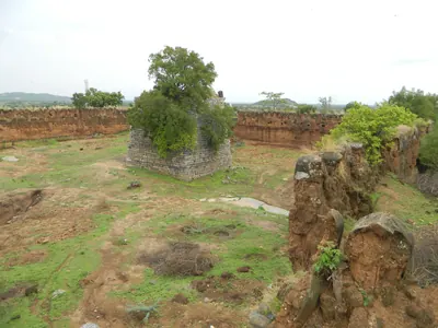
A citadel on top commands a view for long distances.12 Henry Cousens, listing the antiquities of the Nizam’s territories in 1900, called it “the famous old fort of Bhongir” and suggested that the name came from Bhavanagiri. The defences are in two parts: an upper fort on the summit, and a lower fort running west along a spur towards the village. A deep cleft between them has been dammed by cross walls into a descending chain of tanks, fed by channels cut in the rock. On the upper fort he found an old Muhammadan palace in ruins and a small bastion carrying two guns.3
A photographic survey of the Nizam’s dominions in 1898 counted nine tanks in the chain.4 It said that on a clear morning Golconda fort could be seen from the palace.4
Hindu walls and Muslim rebuilding
Cousens found what was “most interesting” about the fort. It was “a Muhammadan re-construction of a very ancient one said to have been built by the Warangal Kings”, one of the outworks of that city. Parts of the old walls and gates remained, of cyclopean masonry (huge stones), “while the latter is the poorest rubble”. A mutilated Nandi and temple pillars showed that a temple had once stood there.3
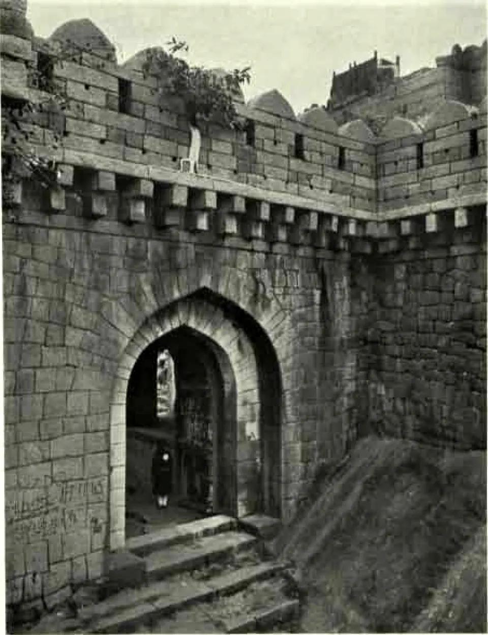
The Nizam’s Archaeological Department repaired the bastions, walls, gateways and the hilltop pavilion (baradari) in 1925–26.56 Its report says that the fort “is one of the earliest in the Deccan”.56 Like Warangal, it was once protected by an outer mud wall.56
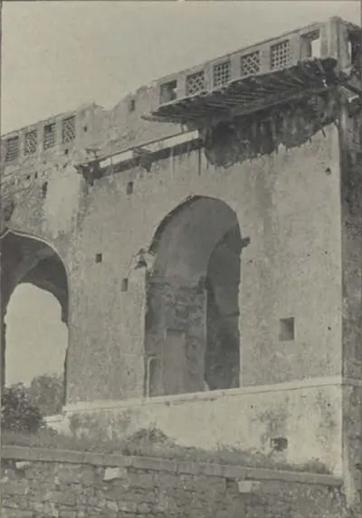
The report separates the unmortared walls of huge blocks, “the work of early Hindu builders”, from walls of the Muslim period in coursed ashlar (cut stone).56 The first gateway is reached after a climb of about 125 feet.56 It is “of Muslim style”, with a barbican (outer defence) in front of it.56
G. Yazdani later grouped the walls of Bhongir with those of Warangal and Golconda as cyclopean work of Hindu kings.7 T. W. Haig wrote in 1907 that the people of Warangal would tell visitors that Bhongir was merely a bastion of the outermost of the seven walls of their old city.8 He worked out that such a wall would have run for 373 miles.8
The Bahmani frontier
The Burhan-i Ma’asir says that late in his reign the first Bahmani sultan, Ala-ud-din Bahman Shah, spent nearly a year in Telingana.9 He took “the district of Bhonngir”, overthrew its temples, and built mosques and schools in their place.9 His dominions then reached “from the east side of Daulatabad to Bhonagir and the river Godavari”.9
Haig says that the sultan subdued the country between Bhongir and Kohir.10 At the end of the reign the province of Bidar extended east “as far as Bhongir”.10 In his earlier book Haig called Bhongir “the frontier post of the Bahmani kingdom”.11 He thought it had been allowed to fall back into Hindu hands, perhaps in exchange for Kaulas, because the towns listed in the province of Bidar did not include it.11
In the reign of Ahmad Shah I, Telugu chiefs had retaken much of Telingana.12 The Burhan-i Ma’asir says that the king made Ibrahim Sanjar Khan commander of the army in Telingana.12 He gave him “as a jagir the fort of Bhonagir and several districts”.12
The Imperial Gazetteer adds that in 1709 a freebooter called Pap Rai plundered Warangal and Bhongir.12 He was later captured and executed.12
Footnotes
-
Imperial Gazetteer of India: Hyderabad State (1909), p. 159 (archive.org (opens in a new tab)). ↩ ↩2 ↩3 ↩4 ↩5
-
Imperial Gazetteer: Hyderabad (1909), p. 160 (archive.org (opens in a new tab)). ↩ ↩2 ↩3 ↩4
-
Henry Cousens, Lists of Antiquarian Remains in His Highness the Nizam’s Territories (1900), p. 51 (archive.org (opens in a new tab)). ↩ ↩2
-
A. Claude Campbell, Glimpses of the Nizam’s Dominions (1898), p. 495 (archive.org (opens in a new tab)). ↩ ↩2
-
Annual Report of the Archaeological Department of H.E.H. the Nizam’s Dominions, 1925–26 (1928), p. 9 (archive.org (opens in a new tab)). ↩ ↩2 ↩3 ↩4 ↩5 ↩6
-
Annual Report … 1925–26 (1928), p. 10 (archive.org (opens in a new tab)). ↩ ↩2 ↩3 ↩4 ↩5 ↩6
-
G. Yazdani, Bidar: Its History and Monuments (1947), p. 82, note (archive.org (opens in a new tab)). ↩
-
T. W. Haig, Historic Landmarks of the Deccan (1907), p. 69 (archive.org (opens in a new tab)). ↩ ↩2
-
J. S. King, The History of the Bahmani Dynasty, founded on the Burhan-i Ma’asir (1900), p. 21 (archive.org (opens in a new tab)). ↩ ↩2 ↩3
-
Wolseley Haig (ed.), The Cambridge History of India, Vol. III (1928), p. 375 (archive.org (opens in a new tab)). ↩ ↩2
-
Haig, Historic Landmarks of the Deccan (1907), p. 73 (archive.org (opens in a new tab)). ↩ ↩2
-
King, History of the Bahmani Dynasty (1900), p. 62 (archive.org (opens in a new tab)). ↩ ↩2 ↩3
Photos
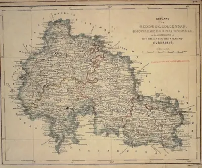 "Circars of Medduck, Golcondah, Bhonagheer & Nelgoondah, in the Dominions of His Highness the Nizam of Hyderabad" (map No. 6, atlas presented to the Nizam, 1865), with Hyderabad and Golconda marked; Bhonagheer is Bhongir (identification ours)Map · 1865
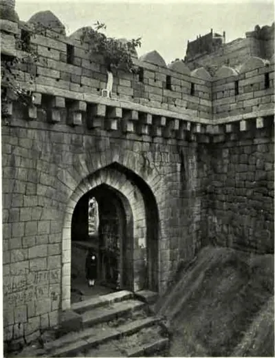 Bhongir Fort: First Gateway (Hyderabad Arch. Report 1925-26, Pl. XI (b))Historic photograph · 1928
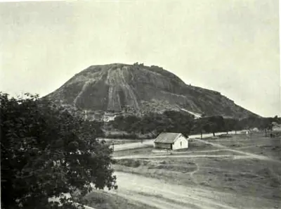 Bhongir Fort: General View (Hyderabad Arch. Report 1925-26, Pl. XII (a))Historic photograph · 1928
 Bhongir: "Chain of Tanks, Bhonagar" (Campbell 1898, p. 495)Historic photograph · 1898
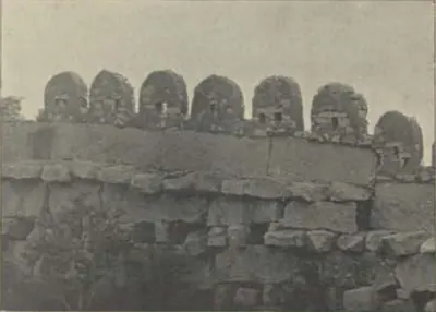 Bhongir: "Fort Wall, Bhonagar" (Campbell 1898, p. 496)Historic photograph · 1898
 Bhongir: "Ruins of the King's Palace, Bhonagar" (Campbell 1898, p. 496)Historic photograph · 1898
Related
People
Ala-ud-din Hasan Bahman Shah
1347–1358 CE
Officer of the Delhi sultanate who led the Deccan revolt against Muhammad bin Tughluq, with help from the ruler of Warangal. In 1347 he founded the Bahmani sultanate at Gulbarga. He took Kaulas from Warangal and made western Telangana a province of his kingdom.
Sarvaya Papadu (Pap Rai)
c. 1708 CE
Telangana rebel of the early eighteenth century, a toddy-drawer by caste, whom the Mughal historian Khafi Khan calls Pap Rai. From forts at Shahpur in the Bhongir country and at a second stronghold, he plundered the roads and killed Mughal officers. In 1708 he sacked Warangal. He was betrayed, captured and executed, and his head was sent to the emperor's court. Telangana tradition remembers him as Sarvaya Papadu, a Goundla hero who robbed the rich, fed the poor and held Golconda for three hours.
Ravi Narayana Reddy
1908 CE
Telangana leader who went to jail in the Hyderabad State Congress satyagraha of 1938. He led the left wing that took control of the Andhra Mahasabha in 1944, and was a leader of the Communist Party in Hyderabad during the Telangana armed struggle. Congress and government sources of the time describe that struggle in sharply different terms.
Arutla Ramachandra Reddy
1909 CE
Worker of the Arya Samaj and the Andhra Mahasabha from Kolanupaka in Nalgonda district, born in 1909. He was beaten in police custody during the Vandemataram movement of 1938, confined to his village in 1945, and held for a year as an undertrial prisoner. The Razakars looted his house in 1947–48. He joined the Communist Party in 1952.
Renukunta Rami Reddy
1915–1948 CE
Landlord and Andhra Mahasabha worker of Renukunta, in Bhongir taluk of Nalgonda district (born 1915). He trained and led the village's armed squad against the Razakars and the Nizam's police, and was killed when they besieged the village on 4 March 1948 after a fight of about twelve hours. Government, Congress-side and communist sources all record the fight but differ on how he died and how many were killed.
Arutla Lakshminarasimha Reddy
1918–1976 CE
Lawyer and communist leader from Kolanupaka in Nalgonda district (1918–1976). He organised campaigns against the jagirdars in Nalgonda in 1936–37, led a batch in the Hyderabad State Congress satyagraha of October 1938 and was jailed until April 1939. He joined the Communist Party in 1940, sat on the working committee of the Andhra Mahasabha, and was wanted by the Nizam's government in 1947. He later served in both houses of the Andhra Pradesh legislature.
Arutla Kamala Devi
1921 CE
Communist worker from Bhongir taluk of Nalgonda district, born in 1921. She was general secretary of the Hyderabad Women's Association in 1942–44 and worked underground in the Telangana struggle of 1946–48, organising women against the Razakars. She was later a member of the Hyderabad and Andhra Pradesh legislative assemblies from 1952 to 1967.
Jamshid Quli Qutb Shah
before 1550 CE
Second Qutb Shahi sultan of Golconda (1543–1550), the third son of Sultan Quli. The Golconda chronicle says he had his father killed at prayer and blinded the heir, his brother Qutb-ud-din. His reign was spent in wars with Bidar and Bijapur, and his younger brother Ibrahim fled to Vijayanagara. He died of a long illness in 1550.
References
Notes (0)
Sources (8)
Spotted an error on this page? Tell us
Last updated: