A new site, built from published sources. Spotted a mistake? Please tell us

"The Five Kingdoms of the Deccan and Neighbouring States", with Golconda holding Telingana from Warangal to Rajahmundry and Kondavir (The Cambridge History of India, Vol. III (1928), Map 6)
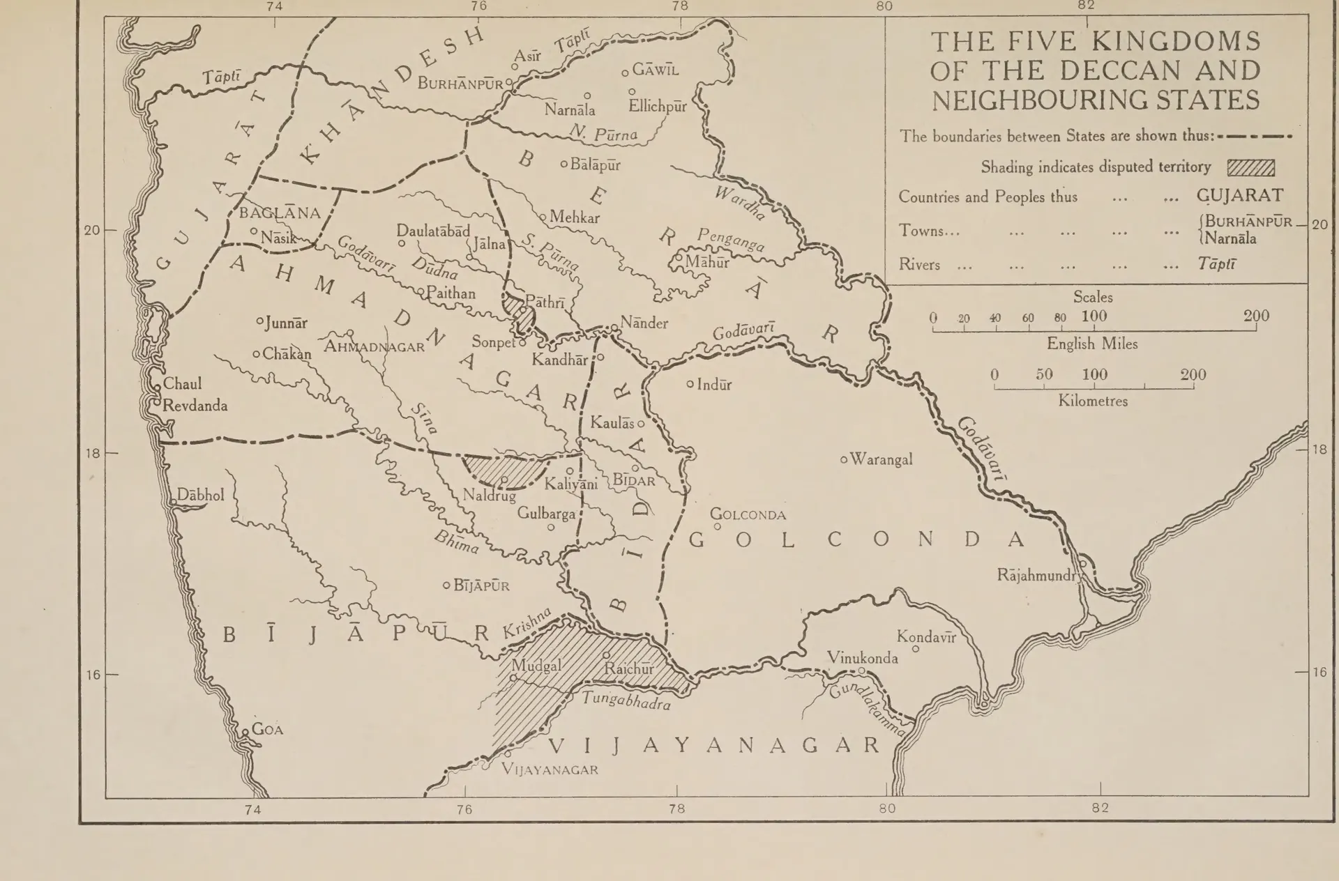
Printed outline map of the Deccan between the Tapti and the Tungabhadra with rivers and dash-dot state boundaries; capital letters name Ahmadnagar, Berar, Bidar, Bijapur, Golconda and Vijayanagar, with Warangal, Rajahmundry, Kondavir and Vinukonda in Golconda and hatched disputed land in the Raichur doab; a title box at the top right.
Type
Map
Creator
Wolseley Haig (ed.), The Cambridge History of India, Vol. III (Cambridge University Press)
Date
1928
Licence
Public domain
From
Wolseley Haig (ed.), The Cambridge History of India, Vol. III: Turks and Afghans (opens in a new tab), 1928, Map 6, between pp. 432 and 433 (PDF p. 479); text pp. 425-432
Original
archive.org (opens in a new tab)
Appears in
Nayakas, Reddis & Bahmanis, Vijayanagara & the Qutb Shahis, Bahmanis, Qutb Shahis, Vijayanagara Empire, Adil Shahis of Bijapur, Golconda, Warangal, Rajahmundry, Kondavidu, Kaulas, Bijapur (Vijayapura)