Warangal Fort
The fortified Kakatiya capital of Orugallu, a round city ringed by an earthen wall and a stone wall with moats. Its central Svayambhu temple survives as four carved stone gateways. The fort held out against Delhi armies from 1310 and finally fell to them in the 1320s.
Plan
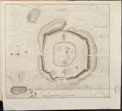
Warangal fort is the walled city of Orugallu, the capital of the Kakatiya kings.1 It lies about 4 miles south-east of Hanamkonda.1 In 1900 Henry Cousens described it as a great circular fort with an outer earthen wall and an inner wall of masonry.2 It had only four gates, one at each cardinal point (north, south, east and west).2 The rock that gave the city its name, Orugallu or Ekashila (“single rock”), stands in the middle of the fort.3
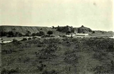
P. V. Parabrahma Sastry describes three ramparts. The outermost was a mud wall about ten feet high. It once enclosed the villages of Kazipet and Hanamkonda, but it survives only in broken stretches. The second is a huge mud wall about twenty feet high, with four gates and a deep moat. About a furlong inside it stands the third, a stone wall called the kanchu-kota (“bronze fort”), with its own moat and more bastions.4
Cousens saw traces of the outermost wall between Narsimallugudium and Timmapuram, about 4 miles south-west of Warangal.5 A gateway threshold slab 19 feet long still lay there.5
T. W. Haig, writing in 1907, gives the circuit of the stone wall as 4 miles 630 yards.6 He gives the diameter of the area inside the inner earthen wall as about two miles.6 He traced the outermost earthen wall round an almost circular area 8½ to 9 miles across, more than 29 miles in circuit.6 Haig took it for a boundary round the suburban villages, since no army could have defended so long a wall.6 He dismissed the local belief that the city had once had seven walls.6
A. Claude Campbell quoted an earlier report by Cousens in his Glimpses of the Nizam’s Dominions (1898).7 The report put the circuit of this outermost wall at nearly 30 miles.7
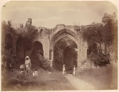
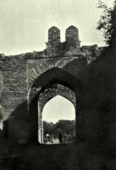
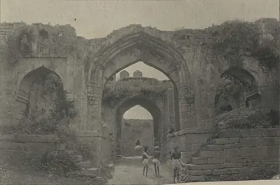
Campbell gives local names for the two inner walls: Pedda-kotta for the stone wall and Bumikotta for the earthen one.8 He says the earthen wall had two entrances, the Bandara gate on the east and the Hyderabad gate on the west.8 A deep, wide ditch lay outside it.8 Of the four gates in the stone wall, he says, the northern and southern were by then closed.8 His figure of seventy feet for the height of the earthen wall is far above Parabrahma Sastry’s twenty.84
Who built it
According to Parabrahma Sastry, Rudradeva began the new fortified site late in the twelfth century.910 Ganapatideva completed it and moved the capital there.910
The Imperial Gazetteer of 1909 says that Ganapati began the stone wall.1 It says that his “widow or daughter” Rudramadevi finished it and added the outer mud wall in the mid-thirteenth century.1 Hirananda Sastri gives the same account, but he treats the idea that she was Ganapati’s widow as an error.11
Campbell and Haig also credit Rudramadevi with finishing the stone wall and adding the earthen one, and both call her Ganapati’s widow.812 Late Telugu chronicles say the bastions were each entrusted to a nayaka (military chief). Parabrahma Sastry reports their numbers variously as 70, 72, 75 or 77.4101314 These figures are tradition rather than record.4101314
Campbell and Haig agree that the stone wall was Hindu work, later repaired by the Muslim rulers.86 Campbell says its upper part was added by them.8 Haig saw countless carved stones from the great temple at the centre of the fort built into the wall at random.6 Some had the carved face turned inward.6
Cousens, in his report for 1894–95 as quoted by Campbell, doubted whether the outer earthen wall was Hindu work at all.7 He wrote that its gateways were “decidedly Mahomedan”.7 An old temple called the Lanja gudi lay almost buried beneath it.7 Amir Khusrau’s account of the siege of 1309–10, given below, already describes an earthen outer wall.15
The Svayambhu temple and its gateways
At the centre of the fort stood the temple of Svayambhudeva, the “self-born” Shiva who was the family god of the Kakatiyas.1617 Ganapatideva’s Motupalli edict opens with an invocation to this god.17
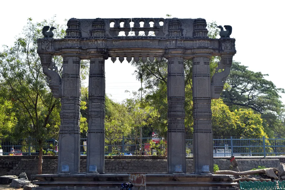
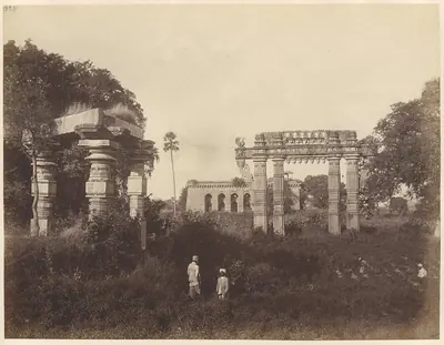
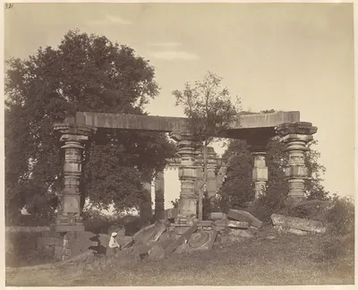
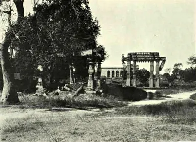
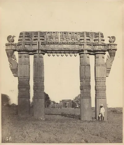
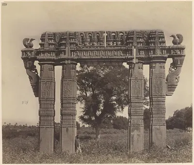
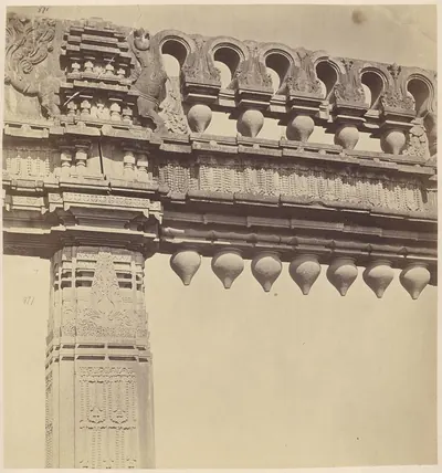
By 1900 the temple was gone, except for a group of pillars and lintels at its south-west corner.18 Four great carved gateways also remained, standing before its four entrances.18 They are called locally the Char Kaman.18 The north and south gateways are 480 feet apart and the east and west 433 feet.18 Cousens thought the temple, when whole, could have been compared only with the great Rudra Mal at Siddhpur in Gujarat.18
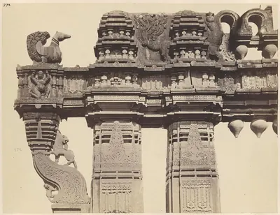
India’s 2017 World Heritage nomination dossier calls these gateways the Keerthi Thoranas.19 Campbell called them kirtti stambhas, “gates of victory”.8 He compared them with the gateways of the stupa (relic mound) at Sanchi, and suggested that they might be nearly two thousand years old.8 That does not fit the Kakatiya date that their inscriptions and carvings show (see below).820
The gateways (Kirti Toranas)
James Fergusson’s History of Indian and Eastern Architecture was revised by James Burgess in 1910 from Henry Cousens’s notes. It calls the four gateways Kirtti Stambhas and illustrates one of them from a photograph. It describes them as being “of one pattern, facing one another”.2122 They formed the gateways to a large temple, of which only a group of pillars and lintels at the south-west corner remained.2122 There was ample space between them “for a temple of unusual size and splendour”.2122
Fergusson did not think much of them as art.22 He wrote: “It cannot be said they are particularly elegant specimens of art.”22 Their main interest, he said, lay in their being “the lineal descendants of the four gateways at Sanchi”.22 He thought they showed how a style first worked out in wood could, over a thousand years, lose all trace of its origin.22
Not everyone accepted that the gateways belonged to a temple. H. Krishna Sastri wrote about this in Epigraphia Indica in 1908.23 He noted the view of the government epigraphist’s report for 1901–02.23 The report thought that the four gateways “might have belonged to the palace of the Kakatiya kings”.23 He also recorded that Cousens thought they had belonged to a great temple in the centre of the city.23 The later excavations described below exposed parts of the temple between them.24
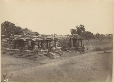
Fergusson’s account also describes the many smaller temples and shrines in the fort, in the same style.22 Judging by the bulls found almost everywhere, most were dedicated to Shiva.22 Most were ruined, and he was “inclined to believe this is owing to Moslim violence”.22 He noted that they were built without mortar, with joints “by no means well fitted”.22 They were remarkably free of figure sculpture.22
P. V. Parabrahma Sastry, writing in 1978, notes that a model of one of the gateways of the Svayambhu temple had been put up at Delhi.25 It stood in the grounds of the Archaeological Survey of India, to display the gateway’s grandeur.25
Excavation, 1934–35
Excavation later uncovered parts of the temple. Parabrahma Sastry records that the floor of its central chamber was a single polished slab two feet thick and sixteen feet square.24 He argued that the temple was built in stages. Some pillar brackets show a woman warrior on a lion standing on an elephant. He read this figure as Rudramadevi bearing her title raya-gaja-kesari. It was one of the Kakatiya titles that likened the ruler to a lion (kesari) facing elephants (gaja). On this basis he took the western hall to be her work, built to mark a victory over the Yadavas.242627 He took the gateways to be later still.242627 This identification is his interpretation. Verses inscribed on the Ekashila rock and on the gateways name a poet, Narasimha, of Prataparudra’s court.20
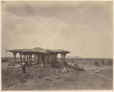
The Archaeological Department of Hyderabad State acquired the site in 1934–35.28 It cleared the site of houses, trees and fields, and excavated the great mound at its centre.28 Before the work began, the four gateways marked the bounds of the temple.28 Near the middle stood a ruined pavilion of five pillars.28
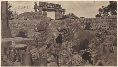
The department judged this pavilion a later rebuilding from the temple’s own stones, perhaps in Shitab Khan’s time.28 A half-buried temple near the south-east corner was cleared, and its door-keeper figures and Nandi were set up again.28
The digging exposed much of the ground plan:2829
- three parallel lines of basement2829
- a drain 67 feet long, with a yoni (the base in which a linga stands) at its western end, which showed that the shrine lay, as usual, on the west2829
- a star-shaped carved basement of fawn sandstone for the central hall2829
- a polished basalt Nandi pedestal2829
An unfinished enclosure wall, built like the one at Palampet, ran on the east and south.2829 It oddly blocked the line of the gateways, 16 feet from them.2829
The department concluded that the plan was incomplete.29 It found that piles of building stone and half-finished carvings showed that work had stopped while in full swing.29 In its view the Muslim invasions of the early fourteenth century had probably interrupted the work.29
The department thought the carving finer than that of the Thousand Pillar Temple, and close to that of the Great Temple at Palampet.2930 It praised the temple’s simple design and lifelike figures.2930 In a footnote it ascribed both the Palampet temples and the fort to Ganapatideva.29
That differs from the Palampet inscription, which names the general Recherla Rudra as founder of the Rudreshvara temple in 1213.31 It also differs from Parabrahma Sastry’s view, given above, that parts of the Svayambhu temple were Rudramadevi’s work.26
Many carved pieces from the excavation went to the Hyderabad Museum.32 By 1937–38 carved pillars and ceiling stones had been set up there as a pavilion (mandapa) in the old Kakatiya manner.32
S. Gopalakrishna Murthy wrote about the building in 1964, from the excavated remains. He described it as a triple temple of Kesava, Sri (Lakshmi) and Svayambhu, built by Ganapatideva himself, with a four-faced linga in the sanctum. He took the great Nandi now in the Shambhuni gudi to be the bull that had faced Svayambhu-Shiva.3334 From its fragments he judged that this had been the finest temple of the kingdom for its sculpture.3334
He thought the ceiling of the central hall had been put back together wrongly in the Hyderabad Museum, with its triangular panels out of their original order.34 He is not consistent about the temple’s destruction.3435 In one place he says it was pulled down by Chitaph (Shitab) Khan, a general of the Qutb Shahi kings.3435 In another he says it was destroyed in the time of Ibrahim Qutb Shah.3435
He saw the four gateways as the last stage of a Kakatiya design begun at Hanamkonda, improved at Kolanupaka and refined at Inavolu.35 He noted the outline of a star-shaped basement between the northern gateway and the temple.35
Other remains
Cousens listed some twenty other monuments inside the walls. They include:1836
- the Shambhuni gudi, a repaired Shiva temple
- a Venkateshvara temple with an inscription of Prataparudra
- a rock knoll in the south-east quarter, fortified with a gun bastion
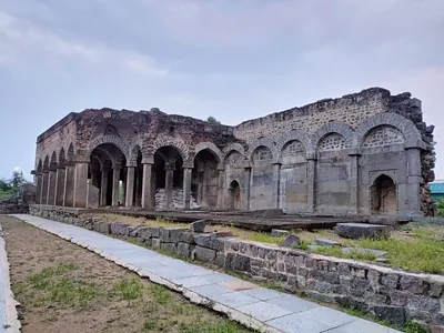
- an old mosque
- the Khasi Mahal, a massive, lofty hall near the middle of the fort, whose roof was never finished1836
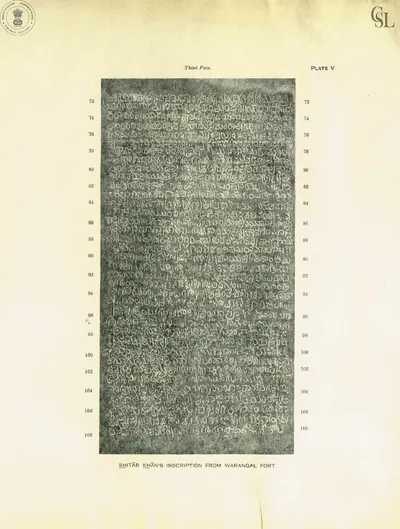
Hirananda Sastri describes a Darbar Hall of Shitab Khan, who ruled Warangal around 1500.3738 It stands near the western gateway of the central shrine.3738 Shitab Khan’s Sanskrit inscription is in the Shambhuni gudi.3738 Campbell, too, mentions a building near the western gate put up by Shitab Khan.8 He also describes:8
- a half-buried temple of Mahadeva, with three carved stone bulls before it
- granite pillars bearing Sanskrit inscriptions
- ruined buildings near the southern gate, used as commissariat (army supply) stores
- a building near the northern gate thought to have been a powder magazine8
The inscriptions in and around the fort range from Saka 1151 (1229 CE; Saka is an Indian way of counting years), in the reign of Ganapati, to Saka 1425 (1503 CE).36
Sieges
Amir Khusrau wrote an account of Malik Kafur’s siege of 1309–10.1539 He describes an earthen outer wall “so strong that a spear of steel could not pierce it”.1539 He gives its circuit as 12,546 yards.1539 After the besiegers had battered down part of the outer wall, filled the ditch and taken it, they swam the inner moat and attacked the stone fort. At that point the king asked for peace and agreed to pay tribute.40
Barani adds that the defenders had gathered in the mud fort, “which was stronger than the stone one”.41 Parabrahma Sastry dates the start of this siege to 19 January 1310.13 When Khusrau Khan came in 1318, Amir Khusrau again described Warangal as having two walls, the outer of mud and the inner of stone.42
Ulugh Khan, the future Sultan Muhammad bin Tughluq, besieged both walls in a campaign that Barani dates to 721 AH (1321 CE). The first siege collapsed when his army mutinied. In a second campaign he took the mud fort and then the whole city.4344 He captured Prataparudra and renamed the city Sultanpur.4344 Parabrahma Sastry, following the contemporary historian Isami, places the final siege in 1323 and says it lasted five months.45
Campbell’s short summary of these wars differs from the contemporary accounts.7 For example, it has Warangal surrender after a short siege in 1321.7 It also says that Prataparudra was restored to his kingdom and died in 1341.7 It is not followed here.7 The fort’s later history, under the Bahmanis, Shitab Khan and the Qutb Shahis, is outlined on the Warangal page.137
Footnotes
-
Imperial Gazetteer of India, Provincial Series: Hyderabad State (1909), p. 173 (archive.org (opens in a new tab)). ↩ ↩2 ↩3 ↩4 ↩5
-
Henry Cousens, Lists of Antiquarian Remains in His Highness the Nizam’s Territories (1900), p. 46. ↩ ↩2
-
Hirananda Sastri, Shitab Khan of Warangal (1932), p. 1 (archive.org (opens in a new tab)). ↩
-
P. V. Parabrahma Sastry, The Kakatiyas of Warangal (1978), p. 174. ↩ ↩2 ↩3 ↩4
-
T. W. Haig, Historic Landmarks of the Deccan (1907), pp. 68–69 (archive.org (opens in a new tab)). ↩ ↩2 ↩3 ↩4 ↩5 ↩6 ↩7 ↩8
-
A. Claude Campbell, Glimpses of the Nizam’s Dominions (1898), p. 478 (archive.org (opens in a new tab)). ↩ ↩2 ↩3 ↩4 ↩5 ↩6 ↩7 ↩8 ↩9
-
Campbell, Glimpses of the Nizam’s Dominions (1898), p. 479 (archive.org (opens in a new tab)). ↩ ↩2 ↩3 ↩4 ↩5 ↩6 ↩7 ↩8 ↩9 ↩10 ↩11 ↩12 ↩13 ↩14
-
Parabrahma Sastry, The Kakatiyas of Warangal (1978), p. 172. ↩ ↩2
-
Parabrahma Sastry, The Kakatiyas of Warangal (1978), p. 116. ↩ ↩2 ↩3 ↩4
-
Sastri, Shitab Khan of Warangal (1932), pp. 1–2 (archive.org (opens in a new tab)). ↩
-
Haig, Historic Landmarks of the Deccan (1907), pp. 66–67 (archive.org (opens in a new tab)). ↩
-
Parabrahma Sastry, The Kakatiyas of Warangal (1978), p. 132. ↩ ↩2 ↩3
-
Parabrahma Sastry, The Kakatiyas of Warangal (1978), p. 195. ↩ ↩2
-
H. M. Elliot and John Dowson, The History of India as Told by Its Own Historians, vol. III (1871), p. 80 (archive.org (opens in a new tab)). ↩ ↩2 ↩3 ↩4
-
Parabrahma Sastry, The Kakatiyas of Warangal (1978), p. 282. ↩
-
E. Hultzsch, Motupalli Pillar-Inscription of Ganapatideva, Epigraphia Indica XII (1914), p. 188 (archive.org (opens in a new tab)). ↩ ↩2
-
Cousens, Lists of Antiquarian Remains (1900), p. 47. ↩ ↩2 ↩3 ↩4 ↩5 ↩6 ↩7
-
Archaeological Survey of India, Nomination Dossier: Rudreshwara (Ramappa) Temple, Palampet (2017), p. 19 (whc.unesco.org (opens in a new tab)). ↩
-
Parabrahma Sastry, The Kakatiyas of Warangal (1978), p. 295. ↩ ↩2
-
James Fergusson, History of Indian and Eastern Architecture, revised by James Burgess, vol. I (1910), p. 434 and woodcut 253 (archive.org (opens in a new tab)). ↩ ↩2 ↩3
-
Fergusson, History of Indian and Eastern Architecture, vol. I (1910), p. 435 (archive.org (opens in a new tab)). ↩ ↩2 ↩3 ↩4 ↩5 ↩6 ↩7 ↩8 ↩9 ↩10 ↩11 ↩12
-
H. Krishna Sastri, “Anmakonda Inscription of Prola”, Epigraphia Indica IX (1908), p. 256, note 8 (archive.org (opens in a new tab)). ↩ ↩2 ↩3 ↩4
-
Parabrahma Sastry, The Kakatiyas of Warangal (1978), pp. 302–303. ↩ ↩2 ↩3 ↩4
-
P. V. Parabrahma Sastry, The Kakatiyas of Warangal (1978), p. 290 (archive.org (opens in a new tab)). Cite-only; paraphrased. ↩ ↩2
-
Parabrahma Sastry, The Kakatiyas of Warangal (1978), pp. 121–122. ↩ ↩2 ↩3
-
Parabrahma Sastry, The Kakatiyas of Warangal (1978), p. 142. ↩ ↩2
-
G. Yazdani (Director), Annual Report of the Archaeological Department of H.E.H. the Nizam’s Dominions, 1344 F. (1934–35) (1938), p. 7 (archive.org (opens in a new tab)). Public domain in India; paraphrased. ↩ ↩2 ↩3 ↩4 ↩5 ↩6 ↩7 ↩8 ↩9 ↩10 ↩11 ↩12 ↩13
-
Yazdani, Annual Report … 1934–35 (1938), p. 8 and notes 1–2 (archive.org (opens in a new tab)). Public domain in India; paraphrased. ↩ ↩2 ↩3 ↩4 ↩5 ↩6 ↩7 ↩8 ↩9 ↩10 ↩11 ↩12 ↩13
-
Yazdani, Annual Report … 1934–35 (1938), p. 9 (archive.org (opens in a new tab)). Public domain in India; paraphrased. ↩ ↩2
-
L. D. Barnett (ed.), Inscriptions at Palampet and Uparpalli (1919), p. v (archive.org (opens in a new tab)). ↩
-
Annual Report of the Archaeological Department of H.E.H. the Nizam’s Dominions, 1347–49 F. (1937–40) (1942), pp. 13–14 (archive.org (opens in a new tab)). Public domain in India; paraphrased. ↩ ↩2
-
S. Gopalakrishna Murthy, The Sculpture of the Kakatiyas (Andhra Pradesh Government Archaeological Series 34, n.d.; preface dated 1964), p. 28 (archive.org (opens in a new tab)). Public domain in India; paraphrased. ↩ ↩2
-
S. Gopalakrishna Murthy, The Sculpture of the Kakatiyas (Andhra Pradesh Government Archaeological Series 34, n.d.; preface dated 1964), p. 29 (archive.org (opens in a new tab)). Public domain in India; paraphrased. ↩ ↩2 ↩3 ↩4 ↩5 ↩6
-
S. Gopalakrishna Murthy, The Sculpture of the Kakatiyas (Andhra Pradesh Government Archaeological Series 34, n.d.; preface dated 1964), p. 30 (archive.org (opens in a new tab)). Public domain in India; paraphrased. ↩ ↩2 ↩3 ↩4 ↩5
-
Cousens, Lists of Antiquarian Remains (1900), p. 48. ↩ ↩2 ↩3
-
Sastri, Shitab Khan of Warangal (1932), p. 2 (archive.org (opens in a new tab)). ↩ ↩2 ↩3 ↩4
-
Sastri, Shitab Khan of Warangal (1932), p. 3 (archive.org (opens in a new tab)). ↩ ↩2 ↩3
-
Elliot and Dowson, History of India, vol. III (1871), p. 81 (archive.org (opens in a new tab)). ↩ ↩2 ↩3
-
Elliot and Dowson, History of India, vol. III (1871), pp. 82–84 (archive.org (opens in a new tab)). ↩
-
Elliot and Dowson, History of India, vol. III (1871), p. 202 (archive.org (opens in a new tab)). ↩
-
Elliot and Dowson, History of India, vol. III (1871), p. 558 (archive.org (opens in a new tab)). ↩
-
Elliot and Dowson, History of India, vol. III (1871), pp. 231–232 (archive.org (opens in a new tab)). ↩ ↩2
-
Elliot and Dowson, History of India, vol. III (1871), p. 233 (archive.org (opens in a new tab)). ↩ ↩2
-
Parabrahma Sastry, The Kakatiyas of Warangal (1978), pp. 136–139. ↩
Photos
 Kakatiya Kala Thoranam, Warangal FortPhotograph · 2018
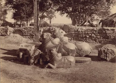 "Bulls or Nadias with Ornamental Carvings, Side View, Warangal", by Lala Deen Dayal, 1887Historic photograph · 1887
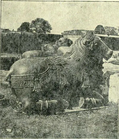 "Carved Stone Bulls in front of the Sambhuni-gudi Temple" (Sastri 1932, Pl. I (b))Book plate · 1932
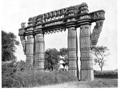 "Kirti Stambha or Toran, Warangal" (F. B. and W. H. Workman, Through Town and Jungle, 1904, p. 131 (PDF leaf 156 of scan ldpd_7460476_000))Historic photograph · 1904
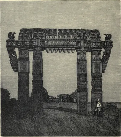 "Kirtti Stambha at Orangal. (From a Photograph.)" (Fergusson, History of Indian and Eastern Architecture, revised ed. 1910, vol. I, woodcut 253, p. 434 (PDF leaf 498 of scan historyofindiane01ferguoft))Drawing · 1910
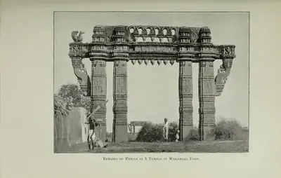 "Remains of Entrance to Temple in Warangal Fort" (Gribble 1896, PDF p. 109)Historic photograph · 1896
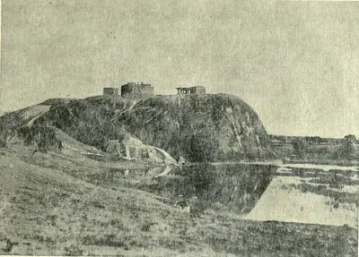 "Rock of the Warangal Fort" (Sastri 1932, Pl. I (a))Book plate · 1932
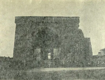 "Shitab Khan's Hall: Front View" (Sastri 1932, Pl. II (a))Book plate · 1932
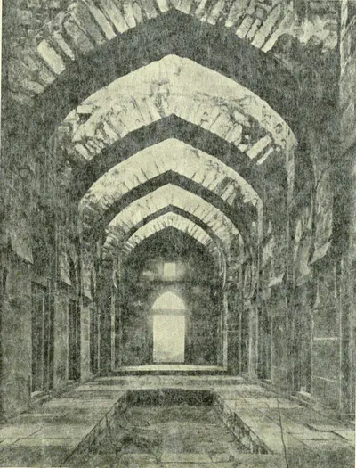 "Shitab Khan's Hall: Interior" (Sastri 1932, Pl. II (b))Book plate · 1932
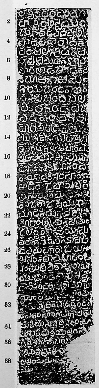 "Warangal inscription at Khan Saheb Gardens", face I (Sreenivasachar, Corpus of Inscriptions in the Telingana Districts II, Plate 19 (PDF p. 258))Inscription rubbing · 1940
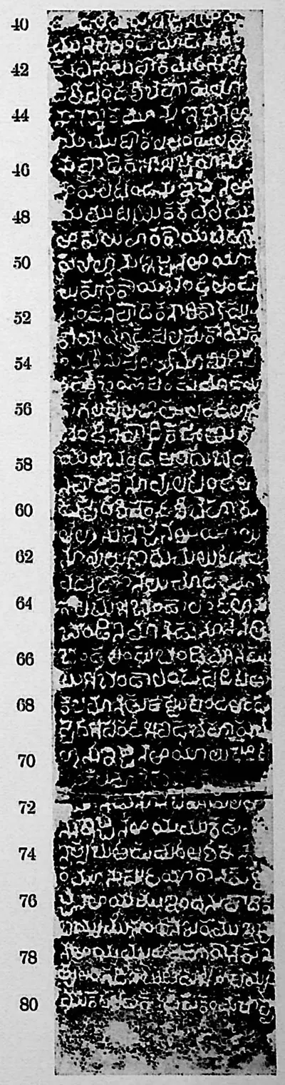 "Warangal inscription at Khan Saheb Gardens", face II (Sreenivasachar, Corpus of Inscriptions in the Telingana Districts II, Plate 19 (PDF p. 258))Inscription rubbing · 1940
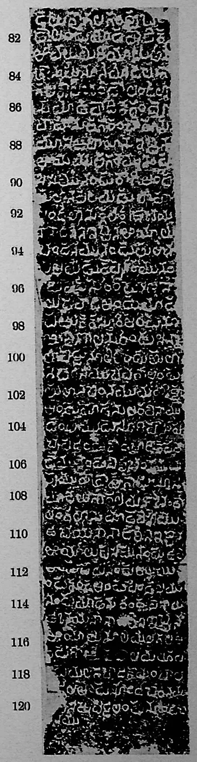 "Warangal inscription at Khan Saheb Gardens", face III (Sreenivasachar, Corpus of Inscriptions in the Telingana Districts II, Plate 19 (PDF p. 258))Inscription rubbing · 1940
Show all (41)
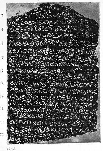 "Warangal inscription of Kakati Rudra-deva", face I (Sreenivasachar, Corpus of Inscriptions in the Telingana Districts III, Plate 1 (PDF p. 191))Inscription rubbing · 1956
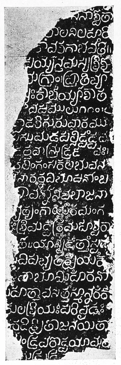 "Warangal inscription of Kakati Rudra-deva", face II (Sreenivasachar, Corpus of Inscriptions in the Telingana Districts III, Plate 1 (PDF p. 191))Inscription rubbing · 1956
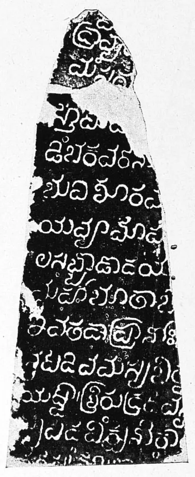 "Warangal inscription of Kakati Rudra-deva", face III (Sreenivasachar, Corpus of Inscriptions in the Telingana Districts III, Plate 1 (PDF p. 191))Inscription rubbing · 1956
 "West (entrance?), Warangal Fort", 1850-1886Historic photograph · c. 1850-1886
 A carved pillar standing alone among ruins at Warangal, 1850-1886Historic photograph · c. 1850-1886
 Carved stone bulls at Warangal Fort, 1850-1886Historic photograph · c. 1850-1886
 Gateway and temple ruins, Warangal, 1870sHistoric photograph · 1870s
 Gateway, Warangal Fort (Hyderabad Arch. Report 1925-26, Pl. XVII (b))Historic photograph · 1928
 Konda Masjid, Warangal FortPhotograph · 2024
 Mud Walls, Warangal Fort (Hyderabad Arch. Report 1925-26, Pl. XVII (a))Historic photograph · 1928
 Pillared pavilion in Warangal Fort, 1850-1886Historic photograph · c. 1850-1886
 Pillared ruin at Warangal Fort, 1850-1886Historic photograph · c. 1850-1886
 Plan of the Fort of Warangal, 1793Map · 1793
 Ruined temple in Warangal Fort, 1850-1886Historic photograph · c. 1850-1886
 Ruins of the Old Temple, Warangal Fort (Hyderabad Arch. Report 1925-26, Pl. XVI (a))Historic photograph · 1928
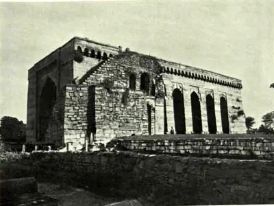 Shitab Khan's Hall: view from N.-W., Warangal Fort (Hyderabad Arch. Report 1925-26, Pl. XV (b))Historic photograph · 1928
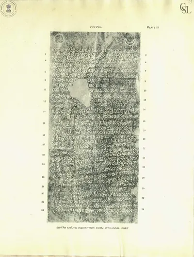 Shitab Khan's inscription from Warangal Fort: first face (Sastri 1932, Pl. III)Inscription rubbing · 1932
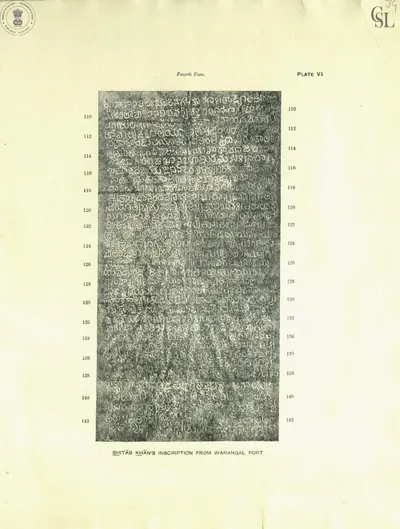 Shitab Khan's inscription from Warangal Fort: fourth face (Sastri 1932, Pl. VI)Inscription rubbing · 1932
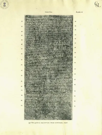 Shitab Khan's inscription from Warangal Fort: second face (Sastri 1932, Pl. IV)Inscription rubbing · 1932
 Shitab Khan's inscription from Warangal Fort: third face (Sastri 1932, Pl. V)Inscription rubbing · 1932
 Stone gateway (torana), Warangal Fort, 1850-1886Historic photograph · c. 1850-1886
 Stone gateway with trees behind, Warangal Fort, 1850-1886Historic photograph · c. 1850-1886
 Top of a stone gateway, Warangal Fort, 1850-1886Historic photograph · c. 1850-1886
 Upper part of a stone gateway, Warangal Fort, 1850-1886Historic photograph · c. 1850-1886
 View from a hill in Warangal Fort over water and fields, 1850-1886Historic photograph · c. 1850-1886
 View from a hill in Warangal Fort, 1850-1886Historic photograph · c. 1850-1886
 Warangal: "Hyderabad Gate, Warangal" (Campbell 1898, p. 476)Historic photograph · 1898
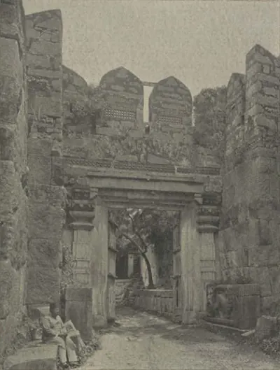 Warangal: "Inner Western Gate, Warangal Fort" (Campbell 1898, p. 478)Historic photograph · 1898
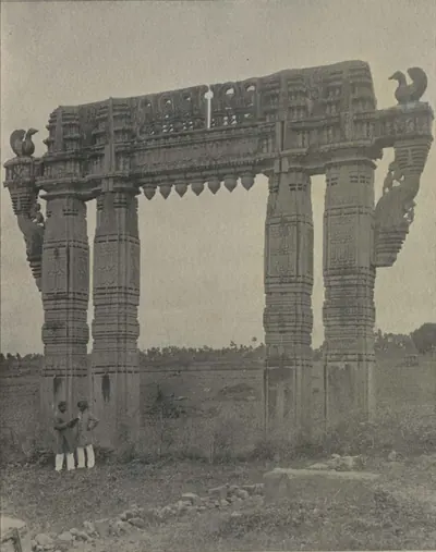 Warangal: "The Gate of Victory, Warangal" (Campbell 1898, p. 477)Historic photograph · 1898
References
Notes (0)
Sources (14)
Spotted an error on this page? Tell us
Last updated: