Gandikota
Village and hill fort five miles west of Jammalamadugu in the Cuddapah district, above the gorge that the Penner cuts through sandstone cliffs. Its name means 'gorge fort'. Its temple legend credits a Kaka Maharaju with the fort about 1290, and 'Harihara Bukkarayalu' with the temple of Madhavasvami. Under Vijayanagara it was the head of the Gandikota sima (district). Golconda took it in the late sixteenth century, and Mir Jumla held it.
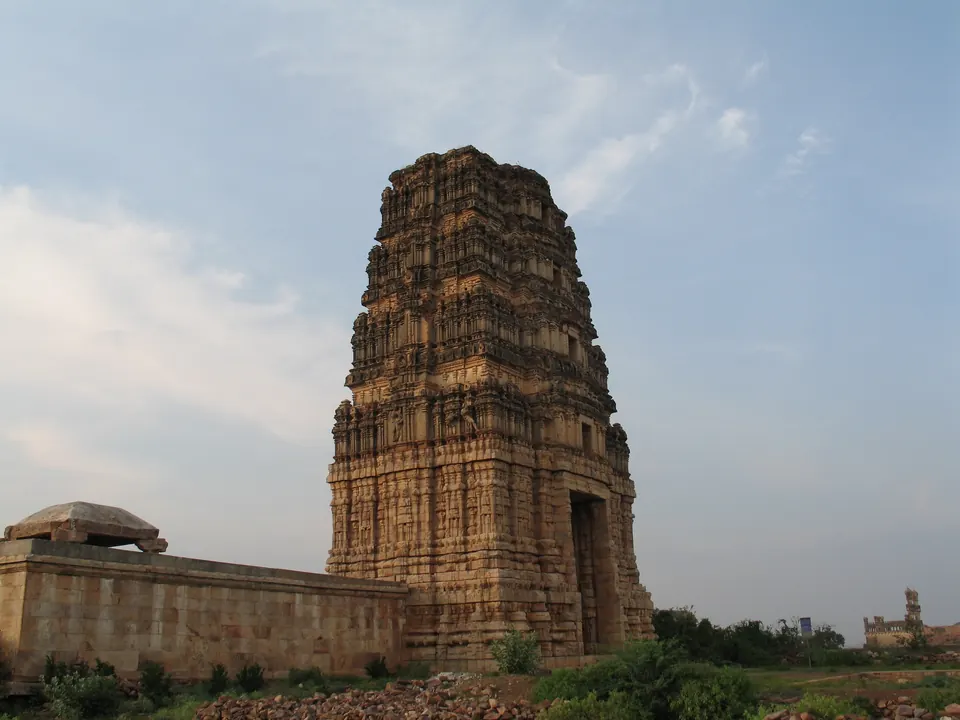
The Cuddapah gazetteer of 1915 describes Gandikota as “a village of less than a thousand inhabitants, situated on a hill about five miles west of Jammalamadugu”.1 “The name is comprised of two Telugu words, gandi, a gorge, and kota, a fort; and in these lie all the interest and importance that the place possesses.”1 “It is perhaps the most striking spot in the district.”1
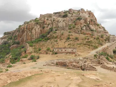
The gorge of the Penner is four miles long, between cliffs of bedded sandstone two or three hundred feet high.1 The gazetteer adds that “the height overlooking the river on the south bank is crowned by extensive fortifications”.1 The Imperial Gazetteer of 1908 called it “the finest river pass in the District, and indeed in Southern India”.2 The only exception it made was the gorge of the Krishna through the Nallamalais.2 See the Gandikota fort.
Legend and history
The gazetteer gives the sthala purana (temple legend) of the place.13 It says that a king called Kaka Maharaju of Bommanapalle discovered the site while hunting.13 He founded the village and fortified the hill in the 1213th year of the Salivahana era, which the gazetteer took to be about 1290.1
The legend says that in its 1297th year “Harihara Bukkarayalu reigned in Vijayanagar”.1 He visited Benares, and on his way back he found images of four gods buried in the sand of the Godavari.13 He installed two of them at Gooty and Pamidi before coming to Gandikota.13 There the god Madhavasvami told him to build a temple.3
The gazetteer suggested that Kaka Maharaju was a Kakatiya king or his viceroy at Valluru.3 It noted that the legend treats Harihara and Bukka as one man.3 See Bukka I.
The gazetteer says: “During the Vijayanagar ascendancy Gandikota sima was a district embracing the present taluks of Pulivendla, Proddatur, Kamalapuram and Cuddapah, and possibly a part of Kurnool district.”3 “It was subordinate to the Udayagiri province.”3 Sixteenth-century records at Ahobilam mention villages “in the Ghandikota-sima”.45
The legend’s last date, 1601, names one Thimma Nayudu, in whose time the fort fell to the Muslims.6 The gazetteer thought him a local officer who had made himself independent after 1565.6 The Kurnool manual records that about 1590 Muhammad Quli Qutb Shah of Golconda subdued the zamindars (landholders) of Gandikota and other places.7 He left a garrison in Gandikota under Shah-sawar Khan.7 See Udayagiri.
Under Golconda, Gandikota “became the headquarters of a Nawab”.6 The first is said to be Mir Jumla, who used the materials of temples for the Jama Masjid and strengthened the fortifications.6 Later it was an outpost of the Nawabs of Cuddapah.6 The Imperial Gazetteer adds that Haidar Ali improved and garrisoned it before Captain Little took it in 1791.2 See the Qutb Shahis.
Footnotes
-
C. F. Brackenbury, Madras District Gazetteers: Cuddapah, Vol. I (1915), p. 191 (archive.org (opens in a new tab)). ↩ ↩2 ↩3 ↩4 ↩5 ↩6 ↩7 ↩8 ↩9 ↩10 ↩11
-
Imperial Gazetteer of India: Madras, Vol. I (1908), p. 394 (archive.org (opens in a new tab)). ↩ ↩2 ↩3
-
Brackenbury, Cuddapah Gazetteer, Vol. I (1915), p. 192 (archive.org (opens in a new tab)). ↩ ↩2 ↩3 ↩4 ↩5 ↩6 ↩7 ↩8 ↩9
-
V. Rangacharya, A Topographical List of the Inscriptions of the Madras Presidency, Vol. II (1919), p. 973, Kurnool No. 587 (archive.org (opens in a new tab)). ↩
-
Rangacharya, Topographical List, Vol. II (1919), p. 975, Kurnool No. 596 (archive.org (opens in a new tab)). ↩
-
Brackenbury, Cuddapah Gazetteer, Vol. I (1915), p. 193 (archive.org (opens in a new tab)). ↩ ↩2 ↩3 ↩4 ↩5
-
Narahari Gopalakristnamah Chetty, A Manual of the Kurnool District in the Presidency of Madras (1886), p. 28 (archive.org (opens in a new tab)). ↩ ↩2
Photos
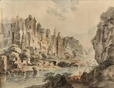 "View within the Northern Entrance of Gundecotta Pass": watercolour of about 1800 attributed on Commons to Thomas Anburey (Indian Museum, Kolkata)Drawing · c. 1800
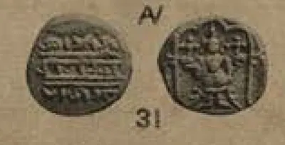 Gold coin attributed to Rama Raja, the "Gandikota pagoda": Vishnu standing under a canopy (V. A. Smith, Catalogue of the Coins in the Indian Museum, Vol. I, 1906, plate XXX, 31 (PDF p. 427))Coin · 1906
 Tower of the Madhavaraya temple in the Gandikota fort (2006)Photograph · 2006
Related
People
Muhammad Quli Qutb Shah
1566–1612 CE
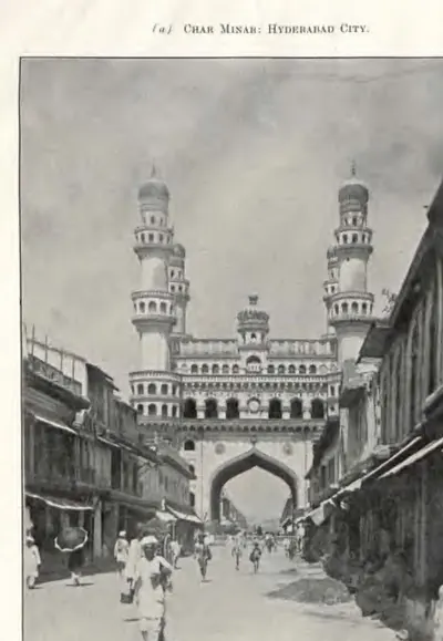
Fifth Qutb Shahi sultan of Golconda (1580–1612), third son of Ibrahim Qutb Shah. He founded the city of Bhagnagar, later Hyderabad, on the Musi river around 1589–91, and built the Charminar, the Jami Masjid and the Dar-ush-Shifa hospital there. Ferishta says he named the city after a singer, Bhagmati. The sources differ on who she was and on how the city got its later name. He wrote poetry in Persian and the old Urdu of the Deccan.
Abdullah Qutb Shah
1614–1672 CE
Seventh Qutb Shahi sultan of Golconda (1626–1672). He was crowned as a boy and left the government to his mother Hayat Bakhsh Begum and his ministers. In 1636 he accepted the Mughal emperor Shah Jahan as his overlord. His minister Mir Jumla conquered the Karnatak and its diamond mines. In 1656 Mir Jumla's quarrel with him brought Aurangzeb to besiege Golconda. An inscription in Persian and Telugu records the siege. He died without a son in 1672.
Muhammad Adil Shah
1627–1656 CE
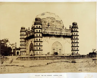
Seventh Adil Shahi sultan of Bijapur (r. 1627–1656), called Mahmud in some histories, and the builder of the Gol Gumbaz. He made peace with Shah Jahan in 1636 and then sent his armies into the Karnatak, with Shahji Bhonsle among the commanders. Bijapur took Jinji and Vellore, Penukonda (1652, by a Mackenzie manuscript) and the uplands of the Bellary and Anantapur country. It divided the Karnatak with Golconda's minister Mir Jumla.
Abdul Nabi Khan (Nawab of Cuddapah)
c. 1714 CE
Pathan (Miana) Nawab of Cuddapah in the early eighteenth century. Gribble's chronology calls him 'the greatest of the Cuddapah Nabobs'. Kirmani says that the emperor Bahadur Shah gave him Cuddapah as a land grant, and the Cuddapah gazetteer dates his governorship from 1714. He took Sidhout from its fort commander in 1714 and held Gandikota, Cumbum and Gurramkonda. He made the poligar of Punganur pay him tribute, raided the Baramahal and joined the Nawab of Arcot in taking money from Mysore. Local tradition says he founded the town of Cuddapah. He had stopped ruling by 1732, when an inscription names his son as Nawab.
Abdul Halim Khan (Nawab of Cuddapah)
1761–1779 CE
The last Pathan Nawab of Cuddapah. He ruled Cuddapah and Sidhout from 1761 until Haidar Ali conquered him in 1779. A Telugu account translated by C. P. Brown says he was freed from prison in the fort of Sidhout in 1761 and became ruler when the Nawab Mohsin Khan left. Gribble says he followed his uncle, whom he calls Mahasim Khan. He paid Haidar money in 1769 and sent him horsemen in 1776, but he sided with the Nizam's general against him. In 1779 Haidar and Mir Sahib defeated his Pathan horsemen near Duvvur, took Cuddapah and forced him to surrender at Sidhout. He died a prisoner at Seringapatam, and his sister became Haidar's wife as Bakhshi Begum.
Haidar Ali
1761–1782 CE
A soldier who made himself master of Mysore in 1761 and ruled it until he died in December 1782. In the Telugu country he took Penukonda and Madakasira from the Maratha Morari Rao in 1762. He won back Gurramkonda through his brother-in-law Mir Sahib in 1768, took Bellary in 1775 and took Gooty from Morari Rao in 1776. In 1779 he conquered the Nawab of Cuddapah, and the Nawab of Kurnool and the poligars of the Bellary and Anantapur country paid him tribute. His invasion of the Carnatic in 1780 began the Second Mysore War.
Nizam Ali Khan (Asaf Jah II)
1761–1803 CE
Fourth son of Nizam-ul-Mulk Asaf Jah I. He pushed aside his brother Salabat Jang in 1761–62 and ruled the Deccan until his death at Hyderabad in 1803. In his reign the Northern Circars passed to the East India Company (1766, Guntur in 1788). The Nizam joined the British against Tipu Sultan, was defeated by the Marathas at Kharda (1795) and accepted a permanent subsidiary force (1798). To pay for it he gave up his Mysore gains, the later Ceded Districts of Rayalaseema (1800). He is the first Nizam buried at the Mecca Masjid.
Balwant Rao Mendle
before 1760 CE
Maratha commander of the Peshwa Balaji Baji Rao, left in the Carnatic in 1757 to collect tribute. On 24 September 1757 he defeated the Nawabs of Cuddapah and Kurnool near Cuddapah. The Nawab of Cuddapah was killed, and the Marathas took Gurramkonda and Punganur. He then marched across the Cuddapah country to the coast. He took tribute from the zamindars of Venkatagiri and Kalahasti and was bought off before Nellore. He was killed at Panipat in December 1760.
Mir Jumla (Mir Muhammad Said Ardastani)
before 1663 CE
A Persian merchant who became chief minister and army commander of Abdullah Qutb Shah of Golconda. He is known by the title of his office, Mir Jumla. He conquered the Karnatak south of the Krishna, including Gandikota and the diamond country of Cuddapah, and he leased the diamond mines. His quarrel with the king in 1655–56 brought the Mughal prince Aurangzeb to besiege Golconda. He then joined Mughal service as Mu'azzam Khan and died in 1663 after an expedition to Assam.
Monuments
References
Notes (0)
Sources (4)
Spotted an error on this page? Tell us
Last updated: