Mukhalingam
Village on the left bank of the Vamsadhara in the Srikakulam district. Since 1897 it has been identified with Kalinganagara, the capital named in the copper-plate grants of the Eastern Ganga kings. Its three Orissan-style Siva temples, the Madhukesvara, Bhimesvara and Somesvara, stand among ruins that stretch south to Nagarakatakam. They carry scores of Ganga inscriptions in Telugu and Sanskrit.
The Imperial Gazetteer (1908) describes Mukhalingam as a village in the Parlakimedi tahsil of the Ganjam district.1 It lies “on the left bank of the Vamsadhara, 18 miles from Parlakimedi”, and is famous for its Siva temple.1 The gazetteer says that “the inscriptions show that Mukhalingam was formerly inhabited by Buddhists”.1 They also show “that it, and not Calingapatam or Chicacole, as was once supposed, was the site of the capital of the old Ganga kings of Kalinga”.1
The Vizagapatam district gazetteer of 1907 likewise says that the Ganga kings ruled “from Kalinganagara, which has been identified with Mukhalingam on the bank of the Vamsadhara in Ganjam, where notable temples and inscriptions yet survive”.2 See the temples of Mukhalingam.
Ramamurti’s identification
The identification was made by G. V. Ramamurti in 1897. E. Hultzsch had thought Kalinganagara “probably the modern Calingapatam”.3 But Ramamurti found no antiquities at Kalingapatnam that could suggest a capital.4 He pointed instead to the ruins that run for about two miles from Mukhalingam to the village of Nagarakatakam.5 He took the name Nagarakatakam to mean “a royal residence in Nagara”.5
Inscriptions in the temples call the place Nagara, or “the Nagara of the Kalinga (country)”.5 A local Kshetramahatmya (account of a holy place) gives it four names at different periods: Govinda-kanana, Jayantapura, Madhukesvara and Mukhalingam.5
Following a suggestion made to him, Ramamurti derived the present name from Mohalingam.345 This is an Oriya form of Madhuka-linga, the linga (stone emblem of Siva) of the madhuka tree.345 Telugu Brahmins had reinterpreted it as mukha-linga, “a linga with a face”.345
Ramamurti added that a stone inscription of Anantavarmadeva had just been found in the Madhukesvara temple.5 It records a grant issued “from Kalinganagara”, and Ramamurti wrote that this “confirms my identification”.5 See Kalingapatnam and the Eastern Gangas.
The Achyutapuram plates of the Ganga king Indravarman were found at Achyutapuram near Mukhalingam.6 Ramamurti reported that they, and a set of plates published by J. F. Fleet, had been discovered near the site of the ruins.5
Footnotes
-
Imperial Gazetteer of India, Provincial Series: Madras, Vol. I (1908), p. 228 (archive.org (opens in a new tab)). ↩ ↩2 ↩3 ↩4
-
W. Francis, Madras District Gazetteers: Vizagapatam, Vol. I (1907), p. 26 (archive.org (opens in a new tab)). ↩
-
E. Hultzsch, “Alamanda Plates of Anantavarman”, Epigraphia Indica III (1894–95), p. 18, note 1 (archive.org (opens in a new tab)). ↩ ↩2 ↩3 ↩4
-
G. V. Ramamurti, “Nadagam Plates of Vajrahasta; Saka-Samvat 979”, Epigraphia Indica IV (1896–97), p. 187 (archive.org (opens in a new tab)). ↩ ↩2 ↩3 ↩4
-
Ramamurti, “Nadagam Plates of Vajrahasta” (1897), p. 188 and note 2 (archive.org (opens in a new tab)). ↩ ↩2 ↩3 ↩4 ↩5 ↩6 ↩7 ↩8 ↩9 ↩10
-
E. Hultzsch, “Achyutapuram Plates of Indravarman; the Year 87”, Epigraphia Indica III (1894–95), p. 127 (archive.org (opens in a new tab)). ↩
Photos
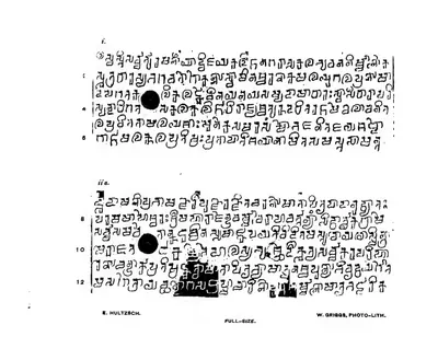 "Achyutapuram Plates of Indravarman. The Year 87": first plate and first side of the second plate, full size (Epigraphia Indica III)Inscription rubbing · 1895
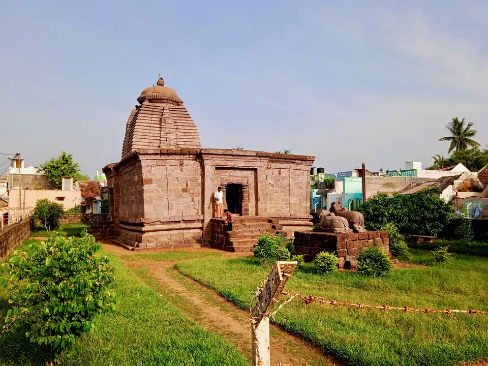
 Bhimesvara temple, MukhalingamPhotograph · 2021
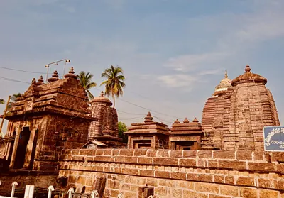 Courtyard of the Madhukesvara (Mukhalingesvara) temple group at Mukhalingam, with shrines along the enclosure wallPhotograph · 2021
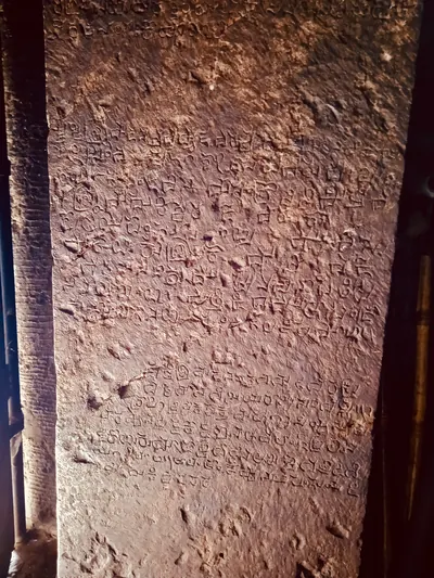 Inscriptions cut on a wall of the Madhukesvara (Mukhalingesvara) temple group at MukhalingamPhotograph · 2021
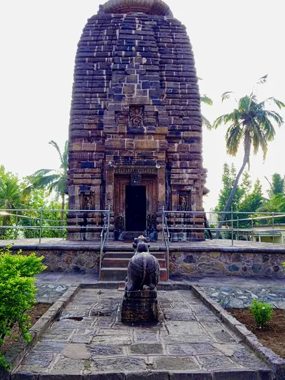 Somesvara temple, Mukhalingam, with a Nandi in frontPhotograph · 2021
Related
Dynasties
People
Vajrahasta III (Eastern Ganga)
c. 1038–1070 CE
Eastern Ganga king of Kalinga, crowned on 3 May 1038. His Nadagam plates of 1058 give the earliest exactly dated event in the history of the later Gangas, and a family tree of his predecessors. He styled himself lord of the Three Kalingas and issued his grants from Kalinganagara. He was the grandfather of Anantavarman Chodaganga. Historians number him Vajrahasta III or Vajrahasta V.
Rajaraja I (Eastern Ganga)
c. 1070–1078 CE
Eastern Ganga king of Kalinga, also called Devendravarman. He reigned for eight years between his father Vajrahasta III and his son Anantavarman Chodaganga (1070–1078 in Sewell's chronology, 1068–1076 in Ramamurti's). His wife Rajasundari was probably a daughter of the Chola-Chalukya emperor Kulottunga I. His general Vanapati claimed victories over the Cholas and the kings of Vengi and Orissa. The grants of his son say that he sheltered the Eastern Chalukya Vijayaditya VII against the Cholas.
Anantavarman Chodaganga
c. 1078–1146 CE
Eastern Ganga king of Kalinga, crowned in 1078 and still reigning in his 72nd regnal year (1146–47). He was a son of the Ganga king Rajaraja and of Rajasundari, a daughter of Kulottunga I, so he was a grandson of the Chola-Chalukya emperor whose armies invaded Kalinga in his reign. Dozens of his Telugu and Sanskrit inscriptions survive at Mukhalingam, Srikurmam, Simhachalam, Draksharama and other places in the north of the Telugu country. His grants trace the Ganga family back to Brahma.
Monuments
Inscriptions
References
Notes (0)
Sources (4)
Spotted an error on this page? Tell us
Last updated: