Ikshvakus, Vishnukundins & early kingdoms
The four centuries between the end of Satavahana rule on the Krishna (about 225 CE) and the Eastern Chalukya conquest of Vengi (about 615–630). The Ikshvakus of Vijayapuri, the Pallavas, Brihatphalayanas and Salankayanas, and the Vishnukundins are known almost only from Prakrit and Sanskrit inscriptions, whose dates are still debated.
Swipe sideways to see the whole chart; tap a bar for details.
Each bar is a ruling power in its region; time runs left to right. Dashed = approximate dates. Select a bar for details.
Show as a list
Mauryas & Satavahanas 300 BCE – 225 CE
- Telangana
- Satavahanas (c. 220 BCE – 225 CE)
- Coastal Andhra
- Satavahanas (c. 220 BCE – 225 CE)
- Rayalaseema
- Satavahanas (c. 1–225 CE)
Ikshvakus, Vishnukundins & early kingdoms 225–624 CE
- Telangana
- Vakatakas (c. 300–500 CE) · Ikshvakus (c. 225–352 CE) · Vishnukundins (c. 375–612 CE)
- Coastal Andhra
- Pallavas (c. 250–630 CE) · Ikshvakus (c. 225–350 CE) · Vishnukundins (c. 500–630 CE) · Salankayanas of Vengi (c. 300–470 CE) · Eastern Gangas of Kalinga (c. 537–1434 CE) · Eastern Chalukyas of Vengi (c. 615–973 CE) · Chalukyas of Badami (c. 615–642 CE)
- Rayalaseema
- Pallavas (c. 300–900 CE) · Telugu Cholas of Renadu (c. 550–800 CE)
Eastern Chalukyas & the Deccan powers 624–1163 CE
- Telangana
- Chalukyas of Badami (c. 655–753 CE)
- Coastal Andhra
- Pallavas (c. 250–630 CE) · Chalukyas of Badami (c. 655–680 CE) · Vishnukundins (c. 500–630 CE) · Eastern Gangas of Kalinga (c. 537–1434 CE) · Eastern Chalukyas of Vengi (c. 615–973 CE)
- Rayalaseema
- Pallavas (c. 300–900 CE) · Telugu Cholas of Renadu (c. 550–800 CE) · Chalukyas of Badami (c. 654–753 CE)
Kingdoms and empires
Satavahanas
Open page- Telangana: c. 220 BCE – 225 CE (c. 445 years)
IG Hyderabad: rise c. 220 BCE, end about a century after Pulumayi II (acc. c. 138 CE); Sewell: by c. 170 BCE the Andhra king ruled Hyderabad as well as the Telugu tracts
- Coastal Andhra: c. 220 BCE – 225 CE (c. 445 years)
Sources disagree: IG Madras 220 BCE-236 CE; Sewell 'from at least 250 BCE' to c. 225 CE when the Pallava Bappa ended the line; Godavari gazetteer dates the known kings c. 110-220 CE, last inscriptions c. 218
- Rayalaseema: c. 1–225 CE (c. 224 years)
Sewell: about 1 CE the Andhra king ruled parts of Cuddapah and Kurnool; an inscription of Pulumayi II (c. 145 CE) in Adoni taluk proves Andhra rule there; Bellary gazetteer: the Andhras ruled that district in the 2nd century CE. When their rule here began is not recorded
Rulers (12)
- Simuka (c. 220 BCE – 197 BCE)
- Krishna (Kanha) (c. 197 BCE – 179 BCE)
- Sri Satakarni (c. 179 BCE – 169 BCE)
- Sivasvati (c. 85–113 CE)
- Gautamiputra Satakarni (c. 113–138 CE)
- Vasishthiputra Pulumavi (c. 138–170 CE)
… and 6 more
- Siva Sri Satakarni (c. 170–177 CE)
- Sivaskanda Satakarni (c. 177–184 CE)
- Yajna Sri Satakarni (c. 184–213 CE)
- Vijaya Satakarni (c. 213–219 CE)
- Chandra Sri Satakarni (c. 219–229 CE)
- Pulumavi III (c. 229–236 CE)
Capitals
Inscriptions
Sources (5)
Kingdoms and empires
Vakatakas
Open page- Telangana: c. 300–500 CE (c. 200 years)
Partial: the Adilabad, Nizamabad and Karimnagar country north of the Godavari, as part of the Vakataka lands of central India and the northern Deccan. Goel et al. (2022) place the Vakataka lands from the findspots of their 37 inscriptions and name only these three Telangana districts. Jouveau-Dubreuil (1920) claimed much more: almost the whole of the Hyderabad State, and up to Kurnool. A Vakataka princess married the Vishnukundin Madhavavarman (Chikkulla plates). No Vakataka inscription from Telangana is listed in Epigraphia Telanganica I; this span rests on modern histories. Dates follow the Sewell table (Vindhyasakti c. 275-300 to Harishena c. 465-500).
Rulers (8)
- Vindhyasakti (c. 275–300 CE)
- Pravarasena I (c. 300–330 CE)
- Rudrasena I (c. 330–340 CE)
- Prithvisena I (c. 340–390 CE)
- Rudrasena II (c. 390–395 CE)
- Pravarasena II (c. 395–420 CE)
… and 2 more
- Devasena (c. 445–465 CE)
- Harishena (c. 465–500 CE)
Sources (5)
Kingdoms and empires
Chalukyas of Badami
Open page- Coastal Andhra: c. 615–642 CE (c. 27 years)
Pulakesin II took Pishtapura (Pithapuram) and the Kolleru lake country (Aihole inscription) about 615 and left his brother Vishnuvardhana to govern Vengi, which was an independent kingdom by 632 (Fleet); his Kopparam plates grant land in Karmarashtra (Guntur) in 631, and Hultzsch read them as showing Vishnuvardhana still his subordinate then. The Vizagapatam gazetteer adds that the Badami Chalukyas had already conquered Kalinga in the 6th century.
- Rayalaseema: c. 654–753 CE (c. 99 years)
Copper-plate grants of Vikramaditya I in Kurnool (654-55, 657-58, 663); his grant names the Nalavadi district (near Madakasira, Anantapur); grants of 680 in Anantapur and Bellary; grants of Vinayaditya in the Kurnool district (Nandyal, 689-90); the Telugu Cholas of Renadu were their vassals. Fleet guessed that Kirtivarman I's enemies the Nalas lived towards Bellary and Kurnool.
- Telangana: c. 655–753 CE (c. 98 years)
Partial: the Alampur-Gadwal country. Amudalapadu plates of Vikramaditya I (Alampur taluk, 660), Gadval plates (674), Pallepadu plates of Vinayaditya (682, issued at Pangal), and inscriptions in the Alampur temples of a queen of Vikramaditya I, of Vinayaditya's reign and of Vijayaditya (704, 713). IG Hyderabad: displaced by the Rashtrakutas (Dantidurga, 753).
- Coastal Andhra: c. 655–680 CE (c. 25 years)
Partial: Nellore. Talamanchi plates of Vikramaditya I (found near Nellore, 13 July 660), a grant to his preceptor Meghacharya.
Rulers (9)
- Pulakesin I (c. 550–566 CE)
- Kirtivarman I (c. 566–597 CE)
- Mangalesa (c. 597–609 CE)
- Pulakesin II (c. 609–642 CE)
- Vikramaditya I (Chalukya of Badami) (c. 655–680 CE)
- Vinayaditya (c. 680–696 CE)
… and 3 more
- Vijayaditya (c. 696–733 CE)
- Vikramaditya II (c. 733–746 CE)
- Kirtivarman II (c. 746–757 CE)
Capitals
Monuments
Inscriptions
Sources (12)
Kingdoms and empires
Ikshvakus
Open page- Coastal Andhra: c. 225–350 CE (c. 125 years)
Lower Krishna valley (Vijayapuri at Nagarjunakonda, Jaggayyapeta, Uppugundur); four kings known; dated inscriptions of 273–74 and 333–34 (Sircar), with an Abhira interlude about 278–79
- Telangana: c. 225–352 CE (c. 127 years)
Partial: the lower Krishna valley on the Nalgonda side. Inscriptions of the Ikshvaku kings Chamtamula and Rudrapurushadatta at Phanigiri (Nalgonda); the editors of Epigraphia Telanganica date Rudrapurushadatta's pillar to 352 and take it as the end of Ikshvaku rule.
Rulers
Capitals
Monuments
Inscriptions
Sources (5)
Kingdoms and empires
Vishnukundins
Open page- Telangana: c. 375–612 CE (c. 237 years)
Partial: the early kingdom north of Srisailam (Nalgonda and Mahabubnagar), with its capital at Keesaragutta near Hyderabad or at Indrapura (Indrapala Gutta near Tummalagudem, Nalgonda); the capital later moved to Trivaranagara (Tiruvuru). The Tummalagudem plates of Govindavarman (37th year) and Vikramendravarman II (Saka 488, 566-67) were found in Nalgonda. The early dates (Indravarman c. 375-400) and the end in 612 follow Goel et al.
- Coastal Andhra: c. 500–630 CE (c. 130 years)
Krishna-Godavari country; later capital Lendulura (Denduluru near Vengi); grants from the Godavari delta, Tenali taluk and the Vizianagaram region, and a pillar at Velpuru south of the Krishna. Dates disputed: K. V. Lakshman Rao (in Sewell 1932) about 357-610; Panchamukhi (1936) about 500 to the Chalukya conquest of 621-631; Mirashi puts Madhavavarman I about 510-568; Sircar (1939) about 500-670 and an end later still
Rulers (7)
- Vikramahendra (c. 500–520 CE)
- Govindavarman (c. 520–535 CE)
- Madhavavarman (Vishnukundin) (c. 535–585 CE)
- Madhavavarman II (Vishnukundin) (c. 585–615 CE)
- Vikramendravarman I (c. 615–625 CE)
- Indravarman (Vishnukundin) (c. 625–655 CE)
Capitals
Inscriptions (7)
- Chikkulla plates of Vikramendravarman II
- Ipur plates (set I) of Govindavarman's son Madhavavarman
- Ipur plates (set II) of Madhavavarman II
- Khanapur plates of Madhavavarman
- Polamuru plates of Madhavavarman Janashraya
- Ramatirtham plates of Indravarman
… and 1 more
Sources (8)
Kingdoms and empires
Pallavas
Open page- Coastal Andhra: c. 250–630 CE (c. 380 years)
Krishna-Guntur, Ongole and Nellore. Prakrit grant of the crown prince Sivaskandavarman to his officer at Dhanyakataka (Amaravati), dated from about 234 (Sewell) or 250-275 (Jouveau-Dubreuil) to the first half of the 4th century (Sircar); Sanskrit grants of a Nellore-Guntur line (Omgodu, Uruvupalli, Pikira, Mangalur, Vilavatti, Chura) in the 5th and 6th centuries. Karmarashtra (Ongole-Bapatla) was Chalukya by about 630 (Kopparam plates of Pulakesin II). The Godavari gazetteer calls 200-615 a Pallava age, and IG Madras calls Vengi originally a Pallava province; Sircar found no evidence that the Pallavas held Vengi itself.
- Rayalaseema: c. 300–900 CE (c. 600 years)
Partial. Pallava frontier guards at Sriparvata (Kurnool) in the 4th century (Talagunda inscription; Sircar); Ganga kings of the Penukonda plates installed by Pallava kings (5th century); inscription of Paramesvaravarman II at Ulchala near Kurnool (728-29); Bana vassals in the Chittoor country under Nripatunga (9th century). The Cuddapah gazetteer has the Pallavas hold the eastern Cuddapah taluks for four centuries until the Chola Aditya I crippled them at the end of the 9th century. The Cuddapah gazetteer says the Pallavas of Kanchi pushed up the Penner from Nellore into north Cuddapah for a time and then ruled the eastern Cuddapah taluks for four centuries, until the Chola Aditya I crippled them at the end of the 9th century; Sewell gives a Pallava regnal-year record in Chittoor (864-65), with the Banas as Pallava vassals.
- Coastal Andhra: c. 670–750 CE (c. 80 years)
Southern Nellore only: grants of Paramesvaravarman I (Podili-Kandukur country, 687) and Narasimhavarman II (Revuru, Atmakur taluk, about 700-711), and a Tamil record of the 15th year of Nandipottarasar at Mallam (Gudur taluk), read as Pallava supremacy (Nellore gazetteer, 1942) or as Pallava rule under the Western Chalukyas (Butterworth and Venugopaul Chetty, 1905).
Rulers (18)
- Bappa (c. 225–250 CE)
- Sivaskandavarman (Pallava) (c. 250–275 CE)
- Vishnugopa of Kanchi (c. 325–350 CE)
- Kumaravishnu II (Pallava) (c. 425–450 CE)
- Skandavarman II (Pallava) (c. 450–475 CE)
- Simhavarman II (Pallava) (c. 500–525 CE)
… and 12 more
- Vishnugopavarman (c. 525–550 CE)
- Simhavishnu (c. 575–600 CE)
- Mahendravarman I (c. 600–630 CE)
- Narasimhavarman I (c. 630–668 CE)
- Mahendravarman II (c. 668–670 CE)
- Paramesvaravarman I (c. 670–690 CE)
- Narasimhavarman II (c. 690–715 CE)
- Nandivarman II Pallavamalla (c. 717–779 CE)
- Dantivarman (c. 779–830 CE)
- Nandivarman III (c. 830–854 CE)
- Nripatunga (c. 854–880 CE)
- Aparajita (c. 880–900 CE)
Capitals
Inscriptions (14)
Sources (19)
Kingdoms and empires
Salankayanas of Vengi
Open page- Coastal Andhra: c. 300–470 CE (c. 170 years)
Vengi (Pedavegi near Eluru), between the Krishna and the Godavari. Dates debated: D. C. Sircar (1939) about 320-470, from Devavarman to Skandavarman; B. V. Krishna Rao puts Nandivarman I at the close of the 3rd century, Sircar (1960) the Ellore and Kanukollu grants in the mid-4th; Subramanian about 275-450; Subba Rao has the Vishnukundins take Vengi about 450. Older works call these rulers Pallavas
Rulers
Capitals
Inscriptions
Sources (5)
Kingdoms and empires
Eastern Gangas of Kalinga
Open page- Coastal Andhra: c. 537–1434 CE (c. 897 years)
Partial: only the far north coast (the old Ganjam and Vizagapatam districts, now Srikakulam-Vizianagaram- Visakhapatnam), capital Kalinganagara (Mukhalingam). Earliest dated grant: Jirjingi, near Tekkali, Ganga year 39 (c. 537 on Mirashi's epoch of 498; Fleet put the early grants in the 7th century and Sewell used an epoch of 877-78; the Imperial Gazetteer, the 7th century). Later line in power from the end of the 9th century (Vizagapatam gazetteer): Vajrahasta III crowned 1038; Anantavarman Chodaganga 1078-1146, with records at Mukhalingam, Srikurmam, Simhachalam and Visakhapatnam. South of the Godavari only records and raids (Draksharama 1128-1274; Bendapudi). Ended 1434, when the minister Kapilesvara founded the Gajapati line
Rulers (15)
- Vajrahasta III (Eastern Ganga) (1038–1070 CE)
- Rajaraja I (Eastern Ganga) (1070–1078 CE)
- Anantavarman Chodaganga (c. 1078–1146 CE)
- Madhu-Kamarnava (c. 1146–1152 CE)
- Raghava (c. 1152–1166 CE)
- Rajaraja II (c. 1166–1192 CE)
… and 9 more
- Aniyanka-Bhima (c. 1192–1202 CE)
- Anangabhima III (c. 1219–1253 CE)
- Narasimha I (Eastern Ganga) (c. 1253–1256 CE)
- Bhanudeva I (c. 1256–1275 CE)
- Narasimha II (c. 1275–1306 CE)
- Bhanudeva II (c. 1306–1323 CE)
- Narasimha III (c. 1323–1346 CE)
- Bhanudeva III (c. 1346–1378 CE)
- Narasimha IV (c. 1378–1397 CE)
Capitals
Monuments
Inscriptions (8)
Sources (10)
Kingdoms and empires
Eastern Chalukyas of Vengi
Open page- Coastal Andhra: c. 615–973 CE (c. 358 years)
Vengi, between the Godavari and the Krishna, with the Vizagapatam country to the north (Chipurupalle grant of 632) and Karmarashtra, the Ongole-Guntur country, to the south (grants of 664 and 673). Kubja Vishnuvardhana was installed as yuvaraja in 615 (Fleet) and was independent by 632; others date the start about 605 (Hultzsch 1890, Mackenzie), after 631 (Kopparam plates, Hultzsch 1926) or in 624-25 (Rama Rao 1964). The line of kings from the grants ends with Danarnava (970-973).
- Telangana: c. 935–973 CE (c. 38 years)
Partial: the Chalukya chiefs of Mudigonda and Koravi (Khammam and Warangal) owed allegiance to Vengi rather than to the Rashtrakutas, in Parabrahma Sastry's account; ended after the death of Danarnava in 973.
- Coastal Andhra: c. 999–1077 CE (c. 78 years)
After an interval that the grants call twenty-seven years without a ruler, Saktivarman I was restored about 999 with the help of the Chola Rajaraja I, "as king (or perhaps feudatory)" in the Godavari gazetteer's words. His successors married Chola princesses; Rajendra II, heir to Vengi in 1063, became the Chola emperor Kulottunga I in 1070. His uncle Vijayaditya VII governed Vengi until he died in 1077 (1076 in Sewell's table), after which Vengi was ruled for the Cholas by viceroys.
Rulers (29)
- Kubja Vishnuvardhana (c. 615–633 CE)
- Jayasimha I (c. 633–663 CE)
- Indra-Bhattaraka (c. 663 CE)
- Vishnuvardhana II (Eastern Chalukya) (c. 663–672 CE)
- Mangi-yuvaraja (c. 672–696 CE)
- Jayasimha II (Eastern Chalukya) (c. 696–709 CE)
… and 23 more
- Kokkili (c. 709 CE)
- Vishnuvardhana III (Eastern Chalukya) (c. 709–746 CE)
- Vijayaditya I (c. 746–764 CE)
- Vishnuvardhana IV (Eastern Chalukya) (c. 764–799 CE)
- Vijayaditya II Narendra-mrigaraja (c. 799–843 CE)
- Kali-Vishnuvardhana V (c. 843–844 CE)
- Gunaga Vijayaditya III (c. 844–888 CE)
- Chalukya-Bhima I (c. 888–918 CE)
- Vijayaditya IV (Kollabhiganda) (c. 918 CE)
- Amma I (c. 918–925 CE)
- Beta-Vijayaditya V (c. 925 CE)
- Tadapa (c. 925 CE)
- Vikramaditya II (c. 926 CE)
- Bhima III (c. 926–927 CE)
- Yuddhamalla II (c. 927–934 CE)
- Chalukya-Bhima II (c. 934–945 CE)
- Amma II (945–970 CE)
- Danarnava (970–973 CE)
- Saktivarman I (c. 999–1011 CE)
- Vimaladitya (1011–1022 CE)
- Rajaraja Narendra (1022–1063 CE)
- Kulottunga I (c. 1063–1070 CE)
- Vijayaditya VII (c. 1063–1076 CE)
Capitals
Monuments
Inscriptions (36)
- Satara grant of Vishnuvardhana I
- Timmapuram plates of Vishnuvardhana I
- Chipurupalle plates of Vishnuvardhana I
- Pedda-Vegi plates of Jayasimha I
- Niduparu grant of Jayasimha I
- Pulibumra plates of Jayasimha I
… and 30 more
- Gudivada plates of Jayasimha I (three grants)
- Chendalur plates of Sarvalokasraya (Mangi-yuvaraja)
- Penukaparu grant of Jayasimha II
- Ipur plates of Vishnuvardhana III
- Ederu plates of Vijayaditya II
- Addanki inscription of Pandaranga
- Masulipatam (?) plates of Vijayaditya III
- Bezwada plates of Chalukya-Bhima I
- Bezwada pillar inscription of Yuddhamalla
- Chevuru plates of Amma I
- Ederu plates of Amma I
- Diggubarru grant of Chalukya-Bhima II
- Gundugolanu plates of Amma II
- Kaluchumbarru grant of Amma II
- Maliyapundi grant of Amma II
- Masulipatam plates of Amma II
- Padamkaluru grant of Amma II
- Vandram plates of Amma II
- Vemalurpadu plates of Amma II
- Yelavarru plates of Amma II
- Arumbaka plates of Badapa
- Mangallu grant of Amma II
- Sripundi plates of Tala II
- Tandikonda grant of Amma II
- Ranastipundi grant of Vimaladitya
- Kalidindi grant of Rajaraja I
- Korumelli plates of Rajaraja I
- Nandamapundi grant of Rajaraja Narendra
- Teki plates of Rajaraja-Chodaganga
- Chellur plates of Vira-Choda
Sources (10)
Kingdoms and empires
Telugu Cholas of Renadu
Open page- Rayalaseema: c. 550–800 CE (c. 250 years)
Renandu, the country between the Chitravati and the Cheyyeru (most of Cuddapah, parts of Kolar and Chittoor; Sewell: Cuddapah and Kurnool), with capitals at Chippili and Malepadu. Undated records placed by EI XXVII between the later 6th and the end of the 8th century (Nandivarman c. 550, Punyakumara c. 625); Krishna Sastri (1912) and Narasimhaswami (1956) put Punyakumara near 800 and about 740. A collateral line at Budili lasted to Srikantha, c. 850.
Rulers (9)
- Nandivarman (c. 550–575 CE)
- Dhananjaya (Telugu Chola) (c. 575–600 CE)
- Mahendravikrama (Telugu Chola) (c. 600–625 CE)
- Punyakumara (c. 625–650 CE)
- Vikramaditya I (c. 650–675 CE)
- Saktikumara (c. 675–700 CE)
… and 3 more
- Vikramaditya II (Telugu Chola) (c. 700–725 CE)
- Uttamaditya (c. 725–750 CE)
- Vijayaditya Chola (Telugu Chola) (c. 750–775 CE)
Capitals
Inscriptions (7)
- Kalamalla inscription of Erikal Muturaju Dhananjaya
- Erragudipadu inscription of Erikal-Mutturaju
- Malepadu plates of Punyakumara
- Tippaluru inscription of Punyakumara
- Malepadu stone inscription of Satyaditya
- Dommara-Nandyala plates of Punyakumara
… and 1 more
Sources (4)
The Satavahanas declined early in the 3rd century CE. The Chalukyas arrived in the early 7th. In between, the Telugu country was divided among a series of regional dynasties.12 None of them left chronicles. They are known from short inscriptions on Buddhist monuments and from copper-plate charters recording grants of land.12
Most of these are dated only in the regnal years (years of the reign) of the king who issued them.12 As a result, the order of these dynasties is fairly clear, but their exact dates have been argued over for more than a century, and older books in the library often give a picture that later discoveries have changed.
The end of the Satavahanas on the Krishna
Robert Sewell compiled a chronology from inscriptions known up to 1923. He published it with S. Krishnaswami Aiyangar in 1932.3 In it, the Pallava ruler Bappa, once a governor under the last Satavahana king, ended the Andhra (Satavahana) dynasty about 225 CE. Bappa then ruled its old territory from Kanchi.3
The Godavari district gazetteer of 1907 likewise treated the whole period from about 200 to 615 as a Pallava age.4 Neither account knew of the Ikshvakus, whose capital was excavated only from 1926.5
D. C. Sircar, writing in 1959, placed the end of Satavahana rule in the Krishna–Guntur region about the close of the first quarter of the 3rd century.67 He also published a Prakrit inscription from Velpuru in Guntur district. It is of a Maharaja of an Aira family, and he dated it to the first half of the 2nd century.78 He took it as evidence that other dynasties ruled parts of the region before the later Satavahanas.8
The Ikshvakus of Vijayapuri
The first successors of the Satavahanas on the lower Krishna for whom there is clear evidence are the Ikshvakus. They claimed descent from the legendary solar dynasty of Ayodhya.9 A pillar inscription of their king Virapurushadatta was found at Jaggayyapeta in 1882. James Burgess dismissed the Ikshvaku claim as “most probably an idle boast”.9
The excavations at Nagarjunakonda from 1926 revealed their capital, Vijayapuri.10 They also revealed the names of three kings: Chamtamula, his son Virapurushadatta and his grandson Ehuvula Chamtamula.10 Much larger excavations followed in 1954–60, before the valley was to be flooded by the Nagarjunasagar dam.1112 They added a fourth king, Rudrapurushadatta, son of Ehuvula Chamtamula.1113
J. Ph. Vogel edited their inscriptions.1 He concluded that they were rulers of some importance.1 They married into the royal families of Vanavasi and probably Ujjain.1
The Ikshvaku inscriptions are written in Prakrit, the spoken language descended from Sanskrit, in Brahmi script.14 The kings performed Vedic sacrifices such as the Ashvamedha (horse sacrifice) and Vajapeya.14 Queens and princesses paid for the great Buddhist stupa (relic mound) and monasteries of the capital.14
Inscriptions found in the 1950s added temples to Shiva.1516 A prince built one (inscription).15 A noble built another, in the reign of the third king, Ehuvula Chamtamula.16
Scholars have dated Virapurushadatta differently:1176
- Vogel accepted Bühler’s date in the 3rd century.1
- Hirananda Sastri and A. H. Longhurst spoke of the 2nd and 3rd centuries.17
- Sircar placed him about the middle of the 3rd century.6
Almost all Ikshvaku records are dated only in regnal years.1819 But Sircar later read two of them as dated in the cyclic year Vijaya.18 He converted these dates to 273–74, under Virapurushadatta, and 333–34, under Ehuvula Chamtamula.1819 He concluded that the Ikshvakus were not overthrown before about the middle of the 4th century.19
An inscription from the valley is dated in the 30th year of the Abhira king Vasushena.202122 His family ruled around Nasik.2021 To Sircar, it suggested that the Abhiras held the kingdom for a short time about 278.22
Sircar then offered two reconstructions.1923 In the first, Virapurushadatta reigned about 255–75, the Abhiras about 275–80, and Ehuvula Chamtamula about 280–335.1923 In the second, Virapurushadatta, his son and his grandson together filled about 265–335.1923 See Nagarjunakonda and its Mahachaitya.
The Pallavas and Brihatphalayanas in Andhrapatha
The Pallavas, whose later capital was Kanchi, appear in the Krishna region in Prakrit copper-plate grants.324 The Mayidavolu plates were found in the Krishna region. They record an order of Sivaskandavarman, then crown prince, to his officer at Dhannakada (Dhanyakataka, the Amaravati–Dharanikota area).324 The order granted a village in Andhrapatha, the Andhra country.324 Sewell dated the plates about 234 CE.3 Sircar placed them about the first quarter of the 4th century.24
Sircar also published a Prakrit pillar inscription from Manchikallu in Palnad taluk.2524 It is of a Pallava king Simhavarman.25 Sircar regarded it as the earliest Pallava inscription and dated it to about the close of the 3rd century.2524 From it he guessed that Simhavarman had pushed out the Ikshvakus, and perhaps destroyed Vijayapuri.24
After reading the Vijaya-year dates, Sircar moved the Pallava conquest of the Krishna–Guntur region to about the middle of the 4th century.19 He placed both Simhavarman and Sivaskandavarman of the Mayidavolu plates in about the fourth and fifth decades of that century.19
Another Prakrit charter was found at Kondamudi, on the north bank of the Krishna near its mouth. It was issued by a Maharaja Jayavarman from his camp at Gudur.26 Sewell did not know who he was. He wondered whether he might be Bappa under another name.26 B. V. Krishna Rao, writing later, described him as the Brihatphalayana king Jayavarman.27
Sewell’s chronology also records the southern campaign of the Gupta emperor Samudragupta in the mid-4th century.26 According to the emperor’s Allahabad pillar inscription, he seized Vengi in this campaign. Sewell took its ruler Hastivarman to be a Pallava viceroy.26 Later scholars identified Hastivarman instead with the first king of the Salankayanas of Vengi. R. Subba Rao did so in 1926.28 D. C. Sircar argued against Sewell’s view in 1939.29
The Salankayanas of Vengi
The Salankayanas ruled from Vengipura, the city of Vengi near modern Eluru (then Ellore).30 Their seals bore a bull.30 In 1960 B. V. Krishna Rao published two of their grants from Kanukollu in Krishna district.31 He argued that they had governed Vengi under the Satavahanas and then the Ikshvakus. In his view they became independent in the second half of the 3rd century.31
Krishna Rao dated the earlier of the two grants, issued by Nandivarman I, to the close of the 3rd century.31 D. C. Sircar, editing the volume, thought these dates too early.31 He placed the grant about the middle of the 4th century.31
The Kanukollu grant is in Prakrit.2732 It records the gift of a village to a Brahmin learned in the four Vedas, who belonged to the Rathakara community.2732 Krishna Rao and Sircar disagreed in their notes about what this means for the community’s social standing.32
Sewell listed a Prakrit order of the Salankayana Devavarman to the villagers of Eluru.33 He also took the Sanskrit Komarti plates of a king Chandavarman to be Salankayana.33 This was later disputed. The editor of a second grant of Chandavarman, from Bobbili, noted that C. R. Krishnamacharlu and D. C. Sircar had opposed making him a Salankayana.34 The editor treated him as a king of Kalinga.34
The Vishnukundins
The Vishnukundins came after the Salankayanas in the Krishna–Godavari country.352 They ruled from Lendulura, identified with Dendaluru near Vengi.352 Their Sanskrit grants credit their best-known king, Madhavavarman, with eleven horse sacrifices.36 They also credit him with a marriage alliance with the Vakatakas of central India.3637
Their dates are the most disputed of all:35238
- F. Kielhorn in 1897 put the Chikkulla plates in the 7th or 8th century.35
- Sewell and Aiyangar followed K. V. Lakshman Rao. They gave tentative dates from the mid-4th century to about 610.2
- V. V. Mirashi placed the great Madhavavarman about 510–560.38
The grants also show a change of language. The Ikshvaku and early Pallava records are in Prakrit.525 The Vishnukundin charters are in Sanskrit.36 The Salankayanas had already moved from Prakrit grants to Sanskrit ones.393327 Kielhorn noticed that the Chikkulla plates use a Telugu-style plural, samvassarambul (“years”), in their date. He concluded that the writer spoke Telugu.36
The Telugu Cholas of Renadu
In the Kadapa and Kurnool country, Sewell and Aiyangar placed about 575 the rule of a family of Telugu Choda chiefs over the “Renandu 7000”.40 These chiefs claimed descent from the Chola king Karikala.40 Sewell and Aiyangar noted that the date rests on an assumption: that one of the chiefs, Mahendra, was named after the Pallava king Mahendravarman I.40 Their records are discussed on the page for the Telugu Cholas of Renadu.
Religion
The period saw the high point and then the decline of Buddhism on the lower Krishna. The Nagarjunakonda inscriptions record monks of several schools.41 They also record a shrine built for monks from Sri Lanka.42
Vogel linked this wealth with the sea trade of the Krishna delta.42 He gave three causes for the decline:42
- the falling-off of the Roman trade
- the southern campaign of Samudragupta
- the rise of dynasties devoted to Brahmanical religion, such as the Pallavas and the Chalukyas42
Longhurst repeated this explanation.43
At the same time, nearly every royal family of the period made its Vedic sacrifices known.143624 These included the Ikshvaku Chamtamula and the Vishnukundin Madhavavarman.1436 They also included the Pallavas, whose bull emblem Sircar took as a sign of Shaiva leanings.24
At Nagarjunakonda, the excavators of the 1950s found that Brahmanical shrines, among them temples of Karttikeya, clustered along the river and in the fortified part of the Ikshvaku capital.44 Buddhist monasteries filled the rest of the valley.44
The Chalukya conquest
The period ends with the expansion of the Chalukyas of Badami. Pulakeshin II conquered the eastern Deccan and took Pithapuram.45 He placed his brother Kubja Vishnuvardhana at Vengi.45 Sewell and Aiyangar dated this about 615.452 They saw the Vishnukundin Madhava III as defeated by the Chalukyas about 610.2
The Godavari gazetteer put the conquest about 615.46 It put Vishnuvardhana’s independence by 632, with his capital at Pedda Vegi near Eluru.46 His line, the Eastern Chalukyas of Vengi, opens the next era.
Footnotes
-
Vogel, Prakrit Inscriptions from Nagarjunikonda (1933), p. 6 (archive.org (opens in a new tab)). ↩ ↩2 ↩3 ↩4 ↩5 ↩6 ↩7 ↩8
-
Sewell and Aiyangar, Historical Inscriptions of Southern India (1932), p. 404 (archive.org (opens in a new tab)). ↩ ↩2 ↩3 ↩4 ↩5 ↩6 ↩7 ↩8 ↩9
-
Robert Sewell and S. Krishnaswami Aiyangar, The Historical Inscriptions of Southern India (1932), p. 16 (archive.org (opens in a new tab)). ↩ ↩2 ↩3 ↩4 ↩5 ↩6
-
F. R. Hemingway, Madras District Gazetteers: Godavari (1907), p. 18 (archive.org (opens in a new tab)). ↩
-
J. Ph. Vogel, Prakrit Inscriptions from a Buddhist Site at Nagarjunikonda, Epigraphia Indica XX (1933), p. 1 (archive.org (opens in a new tab)). ↩ ↩2
-
D. C. Sircar, “Two Inscriptions from Guntur District”, Epigraphia Indica XXXII (1959), p. 83 (archive.org (opens in a new tab)). ↩ ↩2 ↩3
-
Sircar, “Two Inscriptions from Guntur District” (1959), p. 85 (archive.org (opens in a new tab)). ↩ ↩2
-
Sircar, “Two Inscriptions from Guntur District” (1959), p. 86 (archive.org (opens in a new tab)). ↩ ↩2
-
James Burgess, The Buddhist Stupas of Amaravati and Jaggayyapeta (1887), p. 111 (archive.org (opens in a new tab)). ↩ ↩2
-
Vogel, Prakrit Inscriptions from Nagarjunikonda (1933), p. 3 (archive.org (opens in a new tab)). ↩ ↩2
-
B. Ch. Chhabra, “Nagarjunakonda Inscription of Ehavalasri’s time, Year 11”, Epigraphia Indica XXXIII (1959–60, publ. 1963), p. 147 (archive.org (opens in a new tab)). ↩ ↩2
-
A. Ghosh (ed.), Indian Archaeology 1957–58: A Review (1958), p. 9 (archive.org (opens in a new tab)). ↩
-
Sircar and Krishnan, “Two Inscriptions from Nagarjunikonda” (1963), p. 20 (archive.org (opens in a new tab)). ↩
-
Vogel, Prakrit Inscriptions from Nagarjunikonda (1933), p. 4 (archive.org (opens in a new tab)). ↩ ↩2 ↩3 ↩4 ↩5
-
D. C. Sircar and K. G. Krishnan, “Two Inscriptions from Nagarjunikonda”, Epigraphia Indica XXXIV (1961–62, publ. 1963), p. 18 (archive.org (opens in a new tab)). ↩ ↩2
-
Chhabra, “Nagarjunakonda Inscription of Ehavalasri’s time” (1963), p. 148 (archive.org (opens in a new tab)). ↩ ↩2
-
A. H. Longhurst, “Excavations at Nagarjunikonda”, Annual Report of the Archaeological Survey of India 1927–28 (1931), p. 115 (archive.org (opens in a new tab)). ↩ ↩2
-
D. C. Sircar, “More Inscriptions from Nagarjunikonda”, Epigraphia Indica XXXV (1963–64), p. 2 (archive.org (opens in a new tab)). ↩ ↩2 ↩3
-
Sircar, “More Inscriptions from Nagarjunikonda”, p. 6 (archive.org (opens in a new tab)). ↩ ↩2 ↩3 ↩4 ↩5 ↩6 ↩7 ↩8
-
D. C. Sircar, “Nagarjunikonda Inscription of the time of Abhira Vasushena, Year 30”, Epigraphia Indica XXXIV (1963), p. 197 (archive.org (opens in a new tab)). ↩ ↩2
-
Sircar, “Inscription of Abhira Vasushena” (1963), p. 201 (archive.org (opens in a new tab)). ↩ ↩2
-
Sircar, “Inscription of Abhira Vasushena” (1963), p. 202 (archive.org (opens in a new tab)). ↩ ↩2
-
Epigraphia Indica XXXV, “Additions and Corrections”, correction to p. 6, line 30 (archive.org (opens in a new tab)). ↩ ↩2 ↩3
-
Sircar, “Two Inscriptions from Guntur District” (1959), p. 89 (archive.org (opens in a new tab)). ↩ ↩2 ↩3 ↩4 ↩5 ↩6 ↩7 ↩8 ↩9
-
Sircar, “Two Inscriptions from Guntur District” (1959), p. 88 (archive.org (opens in a new tab)). ↩ ↩2 ↩3 ↩4
-
Sewell and Aiyangar, Historical Inscriptions of Southern India (1932), p. 17 (archive.org (opens in a new tab)). ↩ ↩2 ↩3 ↩4
-
Krishna Rao, “Two Salankayana Charters” (1960), p. 2 (archive.org (opens in a new tab)). ↩ ↩2 ↩3 ↩4
-
R. Subba Rao, “Pedavegi Copper-plates of Nandivarman II”, Journal of the Andhra Historical Research Society I, pt. 2 (1926), pp. 93–94 (archive.org (opens in a new tab)). ↩
-
D. C. Sircar, The Successors of the Satavahanas in Lower Deccan (1939), pp. 70–72; paraphrased (archive.org (opens in a new tab)). ↩
-
B. V. Krishna Rao, “Two Salankayana Charters from Kanukollu”, Epigraphia Indica XXXI (1960), p. 1 (archive.org (opens in a new tab)). ↩ ↩2
-
Krishna Rao, “Two Salankayana Charters” (1960), p. 3 (archive.org (opens in a new tab)). ↩ ↩2 ↩3 ↩4 ↩5
-
Krishna Rao, “Two Salankayana Charters” (1960), p. 4 (archive.org (opens in a new tab)). ↩ ↩2 ↩3
-
Sewell and Aiyangar, Historical Inscriptions of Southern India (1932), p. 18 (archive.org (opens in a new tab)). ↩ ↩2 ↩3
-
R. K. Ghoshal, “Bobbili Plates of Chandavarman, King of Kalinga”, Epigraphia Indica XXVII (1956), p. 34 (archive.org (opens in a new tab)). ↩ ↩2
-
Kielhorn, “Chikkulla Plates” (1897), p. 195 (archive.org (opens in a new tab)). ↩ ↩2 ↩3 ↩4
-
F. Kielhorn, “Chikkulla Plates of Vikramendravarman II”, Epigraphia Indica IV (1897), p. 194 (archive.org (opens in a new tab)). ↩ ↩2 ↩3 ↩4 ↩5 ↩6
-
Mirashi and Gupte, “Khanapur Plates” (1956), p. 315 (archive.org (opens in a new tab)). ↩
-
V. V. Mirashi and Y. R. Gupte, “Khanapur Plates of Madhavavarman”, Epigraphia Indica XXVII (1956), p. 314 (archive.org (opens in a new tab)). ↩ ↩2
-
R. Subba Rao, “Pedavegi Copper-plates of Nandivarman II”, Journal of the Andhra Historical Research Society I, pt. 2 (1926), p. 96 (archive.org (opens in a new tab)). ↩
-
Sewell and Aiyangar, Historical Inscriptions of Southern India (1932), p. 21 (archive.org (opens in a new tab)). ↩ ↩2 ↩3
-
Vogel, Prakrit Inscriptions from Nagarjunikonda (1933), p. 7 (archive.org (opens in a new tab)). ↩
-
Vogel, Prakrit Inscriptions from Nagarjunikonda (1933), p. 10 (archive.org (opens in a new tab)). ↩ ↩2 ↩3 ↩4
-
A. H. Longhurst, The Buddhist Antiquities of Nagarjunakonda (1938), p. 6 (archive.org (opens in a new tab)). ↩
-
A. Ghosh (ed.), Indian Archaeology 1956–57: A Review (1957), p. 36 (archive.org (opens in a new tab)). ↩ ↩2
-
Sewell and Aiyangar, Historical Inscriptions of Southern India (1932), p. 22 (archive.org (opens in a new tab)). ↩ ↩2 ↩3
-
Hemingway, Godavari (1907), p. 19 (archive.org (opens in a new tab)). ↩ ↩2
Milestones
- Rise of a power
- End of a power
- Inscription
- Monument
- c. 225End of a power:Satavahanas
- c. 225Rise of a power:Ikshvakus
- c. 250Inscription:Mayidavolu plates of Sivaskandavarman
- c. 250Inscription:Nagarjunakonda inscriptions of Chamtisiri
- c. 250Rise of a power:Pallavas
- c. 268Inscription:Nagarjunakonda inscription of Bodhisiri
- c. 273Inscription:Memorial pillar of Chamtamula, Nagarjunakonda
- c. 274Inscription:Jaggayyapeta inscriptions of Virapurushadatta
- c. 278Inscription:Nagarjunakonda inscription of Abhira Vasushena
- c. 295Inscription:Nagarjunakonda inscription of Pushpabhadrasvamin
- c. 300Inscription:Manchikallu inscription of Simhavarman
- c. 300Rise of a power:Salankayanas of Vengi
- c. 300Rise of a power:Vakatakas
- c. 345Inscription:Ellore plates of Devavarman
- c. 350Inscription:Kanukollu plates of Nandivarman I
- c. 352End of a power:Ikshvakus
- c. 375Rise of a power:Vishnukundins
- c. 430Inscription:Kolleru plates of Nandivarman II
- c. 430Inscription:Peddavegi plates of Nandivarman II
- c. 440Inscription:Omgodu grant of Simhavarman (No. 2)
- c. 446Inscription:Vilavatti grant of Simhavarman
- c. 470End of a power:Salankayanas of Vengi
- c. 500End of a power:Vakatakas
- c. 537Inscription:Jirjingi plates of Indravarman
- c. 537Rise of a power:Eastern Gangas of Kalinga
- c. 550Rise of a power:Telugu Cholas of Renadu
- c. 575Inscription:Kalamalla inscription of Erikal Muturaju Dhananjaya
- c. 585Inscription:Achyutapuram plates of Indravarman
- c. 590Inscription:Erragudipadu inscription of Erikal-Mutturaju
- c. 615Rise of a power:Chalukyas of Badami
- c. 615Rise of a power:Eastern Chalukyas of Vengi
- c. 616Inscription:Satara grant of Vishnuvardhana I
- c. 616Inscription:Timmapuram plates of Vishnuvardhana I
Photos
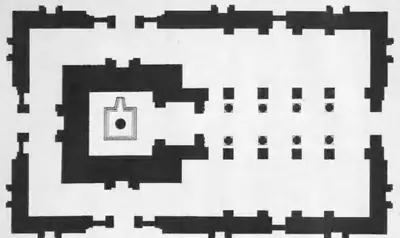 "(a) Plan of the Arka Brahma Temple. Scale: 9 ft. to 1 in." (Annual Report of the Archaeological Department of H.E.H. the Nizam's Dominions 1926-27, Plate IV (a) (PDF p. 61))Plan · 1929
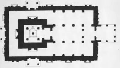 "(a) Plan of the Sulka Brahma Temple: 'Alampur. Scale: 12 ft. to 1 in." (Annual Report of the Archaeological Department of H.E.H. the Nizam's Dominions 1926-27, Plate III (a) (PDF p. 59))Plan · 1929
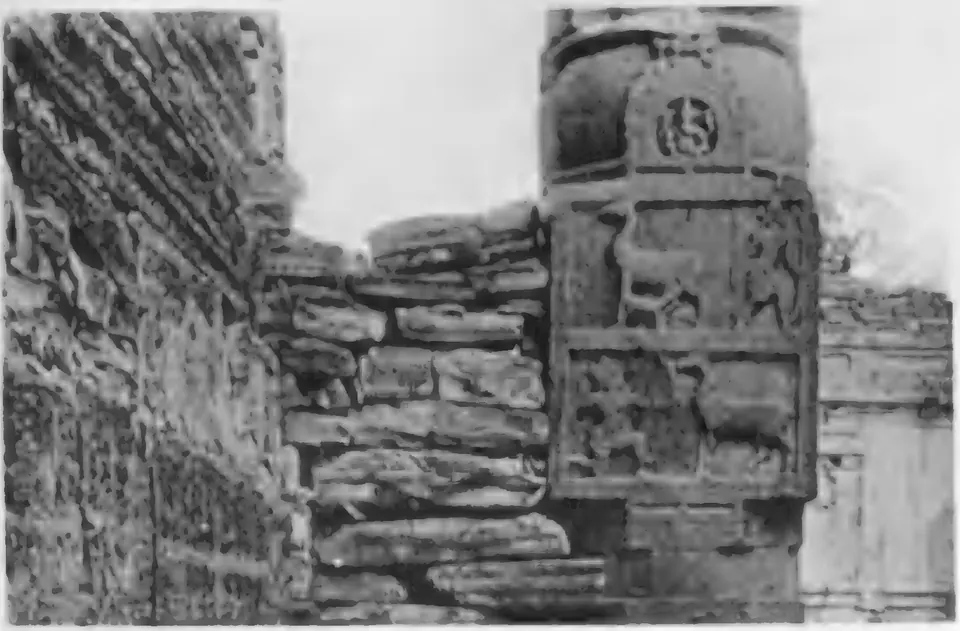
 "(a) Story of the Deer: Gateway of the Temples: 'Alampur." (Annual Report of the Archaeological Department of H.E.H. the Nizam's Dominions 1926-27, Plate XI (a) (PDF p. 89))Historic photograph · 1929
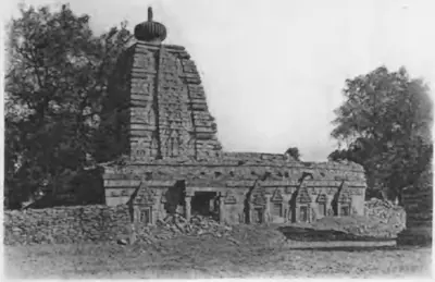 "(a) Temple No. 1: 'Alampur (Raichur)." (Annual Report of the Archaeological Department of H.E.H. the Nizam's Dominions 1926-27, Plate X (a) (PDF p. 85))Historic photograph · 1929
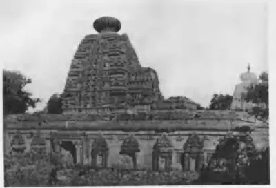 "(a) Temple No. 4: 'Alampur: General View." (Annual Report of the Archaeological Department of H.E.H. the Nizam's Dominions 1926-27, Plate XIII (a) (PDF p. 97))Historic photograph · 1929
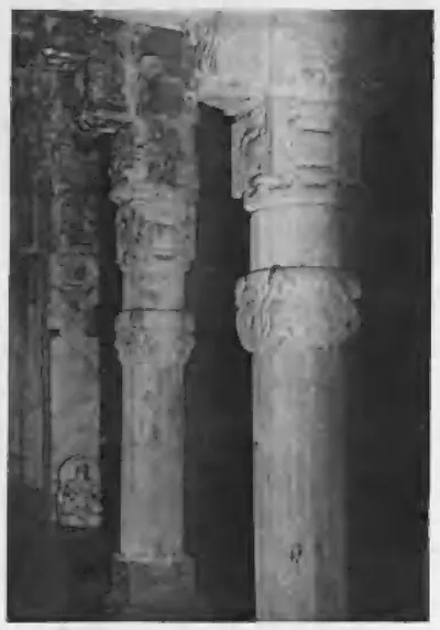 "(a) Temple No. 4: 'Alampur: Pillars." (Annual Report of the Archaeological Department of H.E.H. the Nizam's Dominions 1926-27, Plate XII (a) (PDF p. 93))Historic photograph · 1929
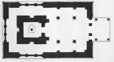 "(b) Plan of the Kumar Brahma Temple: 'Alampur. Scale: 9 ft. to 1 in." (Annual Report of the Archaeological Department of H.E.H. the Nizam's Dominions 1926-27, Plate III (b) (PDF p. 59))Plan · 1929
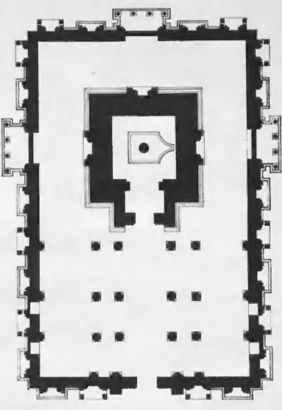 "(b) Plan of the Taraka Brahma Temple: 'Alampur. Scale: 12 ft. to 1 in." (Annual Report of the Archaeological Department of H.E.H. the Nizam's Dominions 1926-27, Plate II (b) (PDF p. 57))Plan · 1929
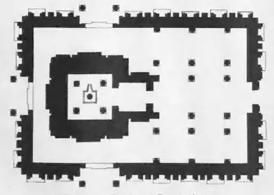 "(b) Plan of the Vira Brahma Temple: 'Alampur. Scale: 15 ft. to 1 in." (Annual Report of the Archaeological Department of H.E.H. the Nizam's Dominions 1926-27, Plate IV (b) (PDF p. 61))Plan · 1929
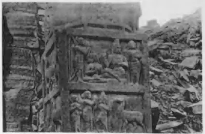 "(b) Story of the Deer: Another Episode." (Annual Report of the Archaeological Department of H.E.H. the Nizam's Dominions 1926-27, Plate XI (b) (PDF p. 89))Historic photograph · 1929
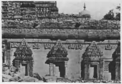 "(b) Temple No. 4: Carving." (Annual Report of the Archaeological Department of H.E.H. the Nizam's Dominions 1926-27, Plate XIII (b) (PDF p. 97))Historic photograph · 1929
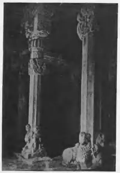 "(b) Temple No. 6: 'Alampur: Pillars." (Annual Report of the Archaeological Department of H.E.H. the Nizam's Dominions 1926-27, Plate XII (b) (PDF p. 93))Historic photograph · 1929
Show all (166)
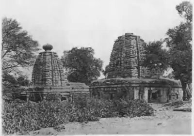 "(b) Temples Nos. 6 and 7: 'Alampur (Raichur)." (Annual Report of the Archaeological Department of H.E.H. the Nizam's Dominions 1926-27, Plate X (b) (PDF p. 85))Historic photograph · 1929
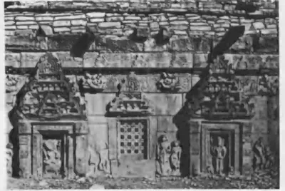 "(c) Temple No. 2: 'Alampur: Carving." (Annual Report of the Archaeological Department of H.E.H. the Nizam's Dominions 1926-27, Plate XIII (c) (PDF p. 97))Historic photograph · 1929
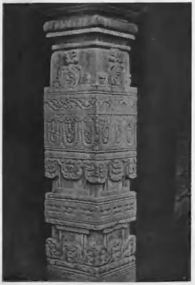 "(c) Temple No. 6: Another Pillar." (Annual Report of the Archaeological Department of H.E.H. the Nizam's Dominions 1926-27, Plate XII (c) (PDF p. 93))Historic photograph · 1929
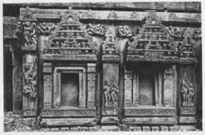 "(c) Temple No. 7: 'Alampur: Carving." (Annual Report of the Archaeological Department of H.E.H. the Nizam's Dominions 1926-27, Plate XI (c) (PDF p. 89))Historic photograph · 1929
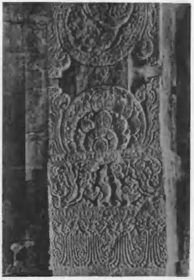 "(d) Dharmasala: 'Alampur: Pillar." (Annual Report of the Archaeological Department of H.E.H. the Nizam's Dominions 1926-27, Plate XII (d) (PDF p. 93))Historic photograph · 1929
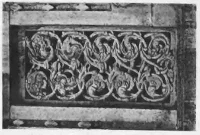 "(d) Dharmasala: 'Alampur: Window Grill." (Annual Report of the Archaeological Department of H.E.H. the Nizam's Dominions 1926-27, Plate XI (d) (PDF p. 89))Historic photograph · 1929
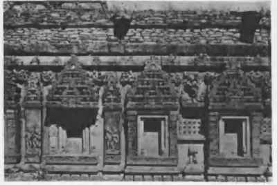 "(d) Temple No. 7: 'Alampur: Carving." (Annual Report of the Archaeological Department of H.E.H. the Nizam's Dominions 1926-27, Plate XIII (d) (PDF p. 97))Historic photograph · 1929
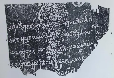 "2. Manchikallu Inscription of Pallava Simhavarman" (Epigraphia Indica XXXII, plate with No. 8, "Two Inscriptions from Guntur District" (PDF p. 137))Inscription rubbing · 1959
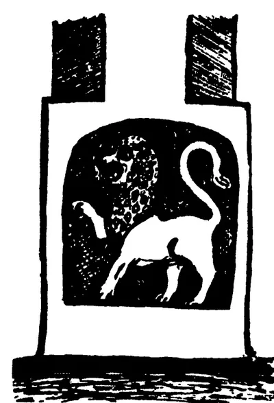 "A lion (simha) at Undavalli" (Jouveau-Dubreuil, The Pallavas, 1917, Fig. 1, p. 33)Drawing · 1917
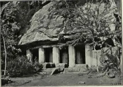 "Akkanna Madanna temple at Bezwada" (Longhurst, Pallava Architecture I, 1924, Plate V (d) (PDF p. 62))Historic photograph · 1924
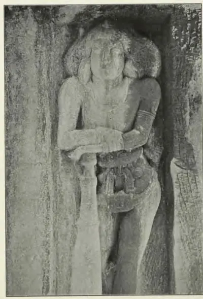 "Bhairavakonda temple No. III: detail of doorkeeper" (Longhurst, Pallava Architecture I, 1924, Plate XVII (b) (PDF p. 86))Historic photograph · 1924
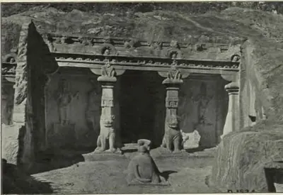 "Bhairavakonda temple No. VII: general view" (Longhurst, Pallava Architecture I, 1924, Plate XX (b) (PDF p. 92))Historic photograph · 1924
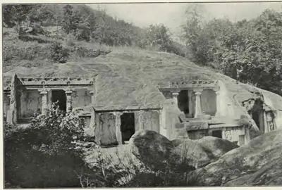 "Bhairavakonda: general view of ten rock-cut temples" (Longhurst, Pallava Architecture I, 1924, Plate XV (a) (PDF p. 82))Historic photograph · 1924
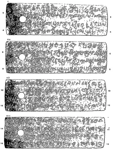 "Chendalur plates of Kumaravishnu II", plates i, ii a, ii b and iii a (Epigraphia Indica VIII, plate with No. 23 (PDF p. 295))Inscription rubbing · 1906
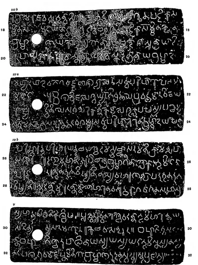 "Chendalur plates of Kumaravishnu II", plates iii b, iv a, iv b and v (Epigraphia Indica VIII, plate with No. 23 (PDF p. 296))Inscription rubbing · 1906
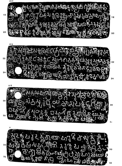 "Chikkulla Plates of Vikramendravarman II", second page of the plate: plates iii b, iv a, iv b and v, lines 17-32 (Epigraphia Indica IV, plate (PDF p. 242))Inscription rubbing · 1897
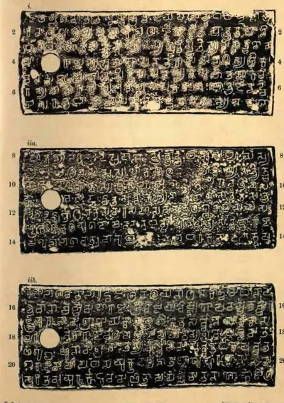 "Chura Grant of Pallava Vijaya-Vishnugopavarman", plates i, ii a and ii b (Epigraphia Indica XXIV, plate with No. 18 (PDF p. 174))Inscription rubbing · 1938
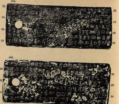 "Chura Grant of Pallava Vijaya-Vishnugopavarman", plates iii a and iii b (Epigraphia Indica XXIV, plate with No. 18 (PDF p. 175))Inscription rubbing · 1938
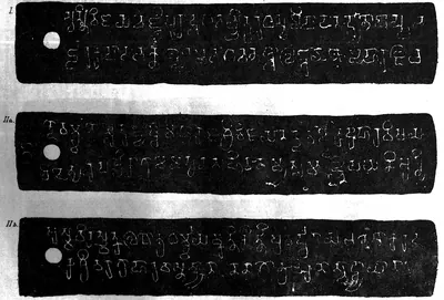 "Copper-plate grant of the kings of the Vengi country": Kollair (Kolleru) grant of the Salankayana Maharaja Vijaya-Nandivarman, plates I, IIa and IIb (Indian Antiquary V, 1876, plate at p. 176 (PDF p. 214))Inscription rubbing · 1876
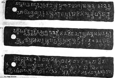 "Copper-plate grant of the kings of the Vengi country": Kollair (Kolleru) grant of the Salankayana Maharaja Vijaya-Nandivarman, plates IIIa, IIIb and IV (Indian Antiquary V, 1876, plate at p. 177 (PDF p. 215))Inscription rubbing · 1876
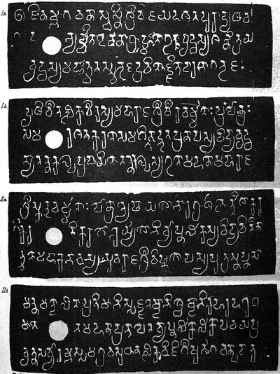 "Copper-plate Grant of the Pallava Dynasty" (the Mangalur grant of Simhavarman), plates I a, I b, II a and II b (Indian Antiquary V, 1876, plate at p. 154 (PDF p. 186))Inscription rubbing · 1876
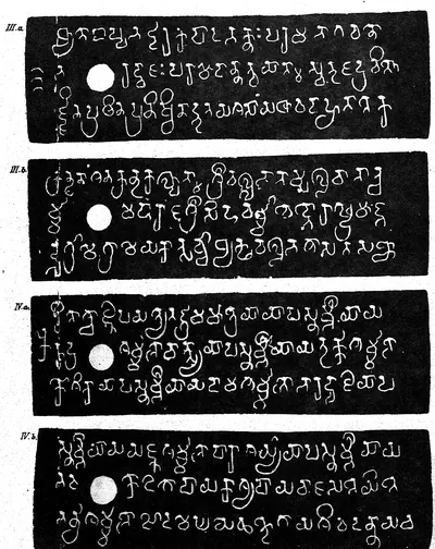 "Copper-plate Grant of the Pallava Dynasty" (the Mangalur grant of Simhavarman), plates III a, III b, IV a and IV b (Indian Antiquary V, 1876, plate at p. 155 (PDF p. 187))Inscription rubbing · 1876
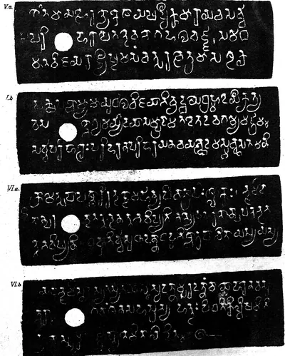 "Copper-plate Grant of the Pallava Dynasty" (the Mangalur grant of Simhavarman), plates V a, V b, VI a and VI b (Indian Antiquary V, 1876, plate at p. 156 (PDF p. 190))Inscription rubbing · 1876
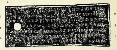 "Dommara-Nandyala Plates of Punyakumara, 10th Year", plate i (Epigraphia Indica XXVII, plate with No. 44 after p. 274, plate i (PDF p. 370))Inscription rubbing · 1956
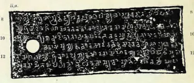 "Dommara-Nandyala Plates of Punyakumara, 10th Year", plate ii a (Epigraphia Indica XXVII, plate with No. 44 after p. 274, plate ii a (PDF p. 370))Inscription rubbing · 1956
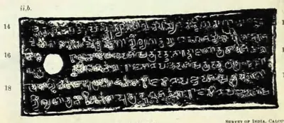 "Dommara-Nandyala Plates of Punyakumara, 10th Year", plate ii b (Epigraphia Indica XXVII, plate with No. 44 after p. 274, plate ii b (PDF p. 370))Inscription rubbing · 1956
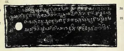 "Dommara-Nandyala Plates of Punyakumara, 10th Year", plate iii (Epigraphia Indica XXVII, plate with No. 44 after p. 274, plate iii (PDF p. 371))Inscription rubbing · 1956
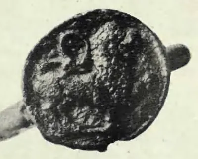 "Dommara-Nandyala Plates of Punyakumara, 10th Year": the seal ("From a photograph") (Epigraphia Indica XXVII, plate with No. 44 after p. 274, lower half (PDF p. 371))Historic photograph · 1956
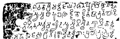 "First Plate of a Pallava Copper-plate Grant" (the Darsi fragment) (Epigraphia Indica I, plate with No. XLV, facing p. 397 (PDF p. 446 of the scan in.ernet.dli.2015.56636))Inscription rubbing · 1892
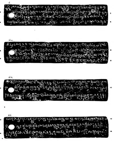 "Ipur Plates of Govindavarman's Son Madhavavarman": plates i, ii a, ii b and iii, lines 1-14 (Epigraphia Indica XVII, plate between pp. 334 and 335 (PDF p. 388 of scan in.ernet.dli.2015.180697))Inscription rubbing · 1924
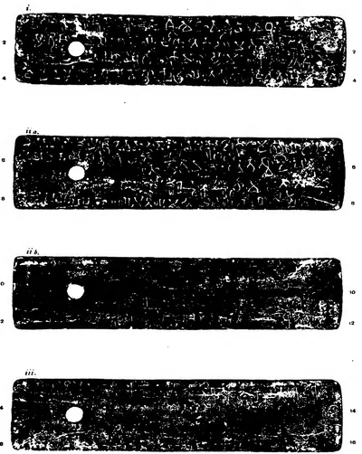 "Ipur Plates of Madhavavarman II": plates i, ii a, ii b and iii, lines 1-16 (Epigraphia Indica XVII, plate between pp. 338 and 339 (PDF p. 394 of scan in.ernet.dli.2015.180697))Inscription rubbing · 1924
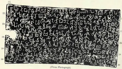 "Khanapur Plates of Madhavavarman": plate iii, lines 22-30 (Epigraphia Indica XXVII, plate between pp. 316 and 317 (PDF p. 421, printed sideways))Book plate · 1956
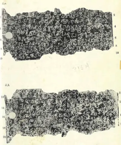 "Khanapur Plates of Madhavavarman": plates ii a and ii b, lines 1-20 (Epigraphia Indica XXVII, plate between pp. 316 and 317 (PDF p. 420))Book plate · 1956
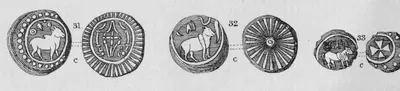 "Kurumbar or Pallava Coins of the Coromandel Coast": copper coins with a bull (Elliot 1886, Pl. I, Nos. 31-33)Coin · 1886
 "Kurumbar or Pallava Coins of the Coromandel Coast": copper coins with a bull, crab, fish and ship (Elliot 1886, Pl. I, Nos. 34-38)Coin · 1886
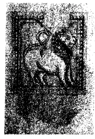 "Lion seal and sculptures of about the Seventh Century A.D.", D: "Sculpture on the rock-cut temple, Siyamangalam" (a Pallava lion, shown for comparison with the seal of the Malepadu plates) (Epigraphia Indica XI, plate to face p. 338, panel D (PDF p. 400))Historic photograph · 1912
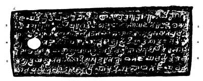 "Malepadu plates of Punyakumara; the fifth year", plate i (lines 1-7) (Epigraphia Indica XI, plate between pp. 344 and 345, plate i (PDF p. 408, printed sideways, turned here))Inscription rubbing · 1912
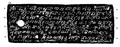 "Malepadu plates of Punyakumara; the fifth year", plate ii a (lines 8-14) (Epigraphia Indica XI, plate between pp. 344 and 345, plate ii a (PDF p. 408, printed sideways, turned here))Inscription rubbing · 1912
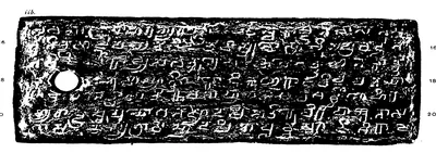 "Malepadu plates of Punyakumara; the fifth year", plate ii b (lines 15-21) (Epigraphia Indica XI, plate between pp. 344 and 345, plate ii b (PDF p. 409, printed sideways, turned here))Inscription rubbing · 1912
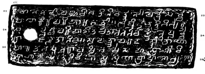 "Malepadu plates of Punyakumara; the fifth year", plate iii (lines 22-27) (Epigraphia Indica XI, plate between pp. 344 and 345, plate iii (PDF p. 409, printed sideways, turned here))Inscription rubbing · 1912
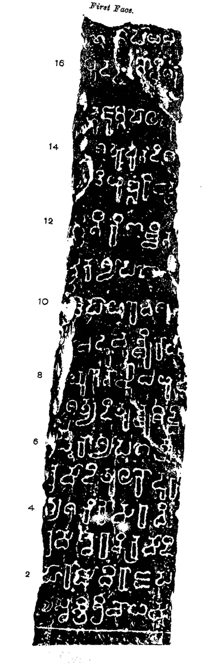 "Malepadu stone inscription of Satyaditya", First Face (Epigraphia Indica XI, plate to face p. 346, first face (PDF p. 412))Inscription rubbing · 1912
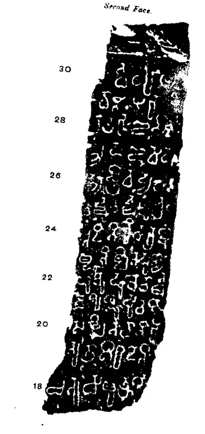 "Malepadu stone inscription of Satyaditya", Second Face (Epigraphia Indica XI, plate to face p. 346, second face (PDF p. 412))Inscription rubbing · 1912
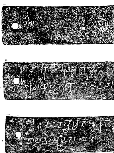 "Mayidavolu Plates of Sivaskandavarman", plates i a, i b and ii a (Epigraphia Indica VI, plate between pp. 84 and 85 (PDF p. 112 of the archive.org scan in.ernet.dli.2015.56212))Inscription rubbing · 1901
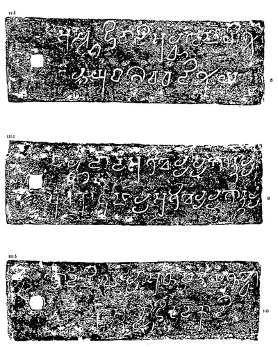 "Mayidavolu Plates of Sivaskandavarman", plates ii b, iii a and iii b (Epigraphia Indica VI, plate between pp. 84 and 85 (PDF p. 113 of scan in.ernet.dli.2015.56212))Inscription rubbing · 1901
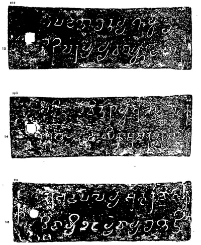 "Mayidavolu Plates of Sivaskandavarman", plates iv a, iv b and v a (Epigraphia Indica VI, second plate between pp. 86 and 87 (PDF p. 116 of scan in.ernet.dli.2015.56212))Inscription rubbing · 1901
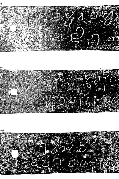 "Mayidavolu Plates of Sivaskandavarman", plates v b, vi a and vi b (Epigraphia Indica VI, second plate between pp. 86 and 87 (PDF p. 117 of scan in.ernet.dli.2015.56212))Inscription rubbing · 1901
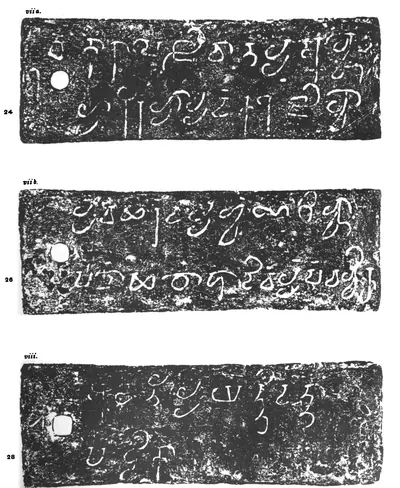 "Mayidavolu Plates of Sivaskandavarman", plates vii a, vii b and viii (Epigraphia Indica VI, third plate (PDF p. 115 of the archive.org scan EpigraphiaIndicaVol6))Inscription rubbing · 1901
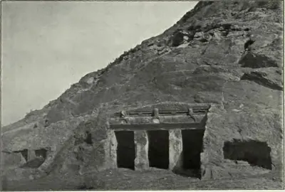 "Mogalrajapuram: Temple No. III" (Longhurst, Pallava Architecture I, 1924, Plate VIII (a) (PDF p. 68))Historic photograph · 1924
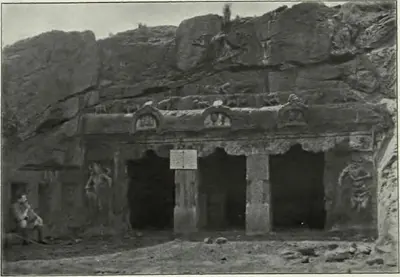 "Mogalrajapuram: Temple No. IV" (Longhurst, Pallava Architecture I, 1924, Plate VIII (b) (PDF p. 68))Historic photograph · 1924
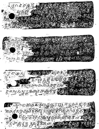 "Omgodu Grant of the Pallava Simhavarman II: the 4th year", first page, lines 1-16 (Epigraphia Indica XV, plate with No. 11 (PDF p. 304))Inscription rubbing · 1920
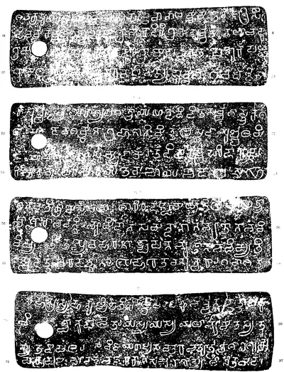 "Omgodu Grant of the Pallava Simhavarman II: the 4th year", second page, lines 17-32 (Epigraphia Indica XV, plate with No. 11 (PDF p. 305))Inscription rubbing · 1920
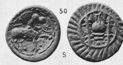 "Pallava Coins": alloy coin of the maned-lion and vase type (Elliot 1886, Pl. II, No. 50)Coin · 1886
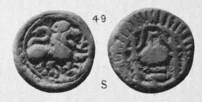 "Pallava Coins": alloy coin with a maned lion and, on the reverse, a vase on a stand between two lamp-stands (Elliot 1886, Pl. II, No. 49)Coin · 1886
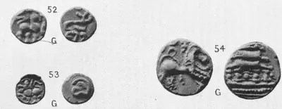 "Pallava Coins": small gold coins with a lion (Elliot 1886, Pl. II, Nos. 52-54)Coin · 1886
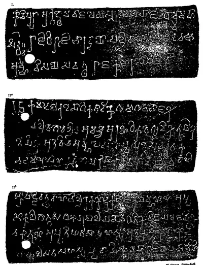 "Pallava Copperplate Grant of Sivaskandavarman" (Hirahadagalli plates), Plate I: plates I, II a and II b (Epigraphia Indica I, Plate I with No. I (PDF p. 20))Inscription rubbing · 1892
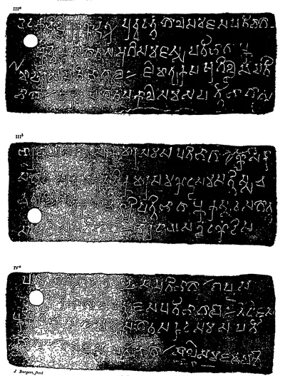 "Pallava Copperplate Grant of Sivaskandavarman" (Hirahadagalli plates), Plate II: plates III a, III b and IV a (Epigraphia Indica I, Plate II with No. I (PDF p. 21))Inscription rubbing · 1892
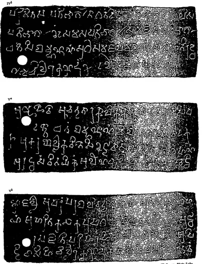 "Pallava Copperplate Grant of Sivaskandavarman" (Hirahadagalli plates), Plate III: plates IV b, V a and V b (Epigraphia Indica I, Plate III with No. I (PDF p. 22))Inscription rubbing · 1892
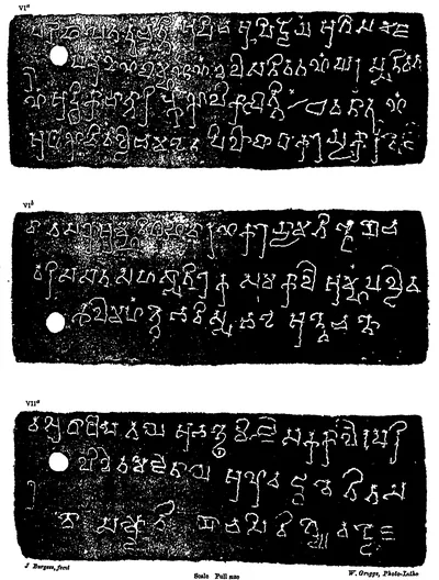 "Pallava Copperplate Grant of Sivaskandavarman" (Hirahadagalli plates), Plate IV: plates VI a, VI b and VII a (Epigraphia Indica I, Plate IV with No. I (PDF p. 23))Inscription rubbing · 1892
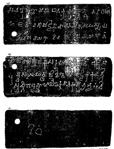 "Pallava Copperplate Grant of Sivaskandavarman" (Hirahadagalli plates), Plate V: plates VII b, VIII and I a (Epigraphia Indica I, Plate V with No. I (PDF p. 24))Inscription rubbing · 1892
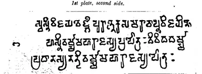 "Pedavegi Copper-plates of Nandivarman II": "1st plate, second side" (eye-copy) (Journal of the Andhra Historical Research Society I, pt. 2, Oct. 1926, p. 101 (PDF p. 122))Drawing · 1926
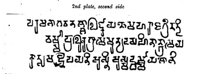 "Pedavegi Copper-plates of Nandivarman II": "2nd plate, second side" (eye-copy) (Journal of the Andhra Historical Research Society I, pt. 2, Oct. 1926, p. 102 (PDF p. 123))Drawing · 1926
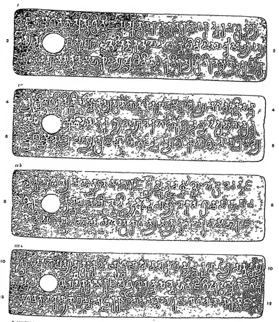 "Pikira grant of Simhavarman", plates i, ii a, ii b and iii a (Epigraphia Indica VIII, plate with No. 15 (PDF p. 201))Inscription rubbing · 1906
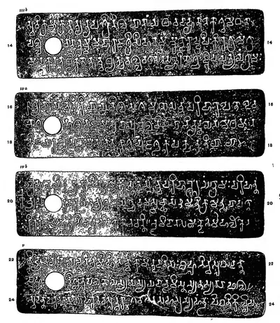 "Pikira grant of Simhavarman", plates iii b, iv a, iv b and v (Epigraphia Indica VIII, plate with No. 15 (PDF p. 202))Inscription rubbing · 1906
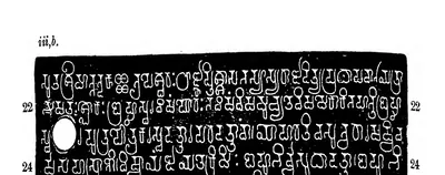 "Reyuru Grant of Pallava Narasimhavarman; Year 12", plate iii b (Epigraphia Indica XXIX, plate with No. 11 (PDF p. 199))Inscription rubbing · 1952
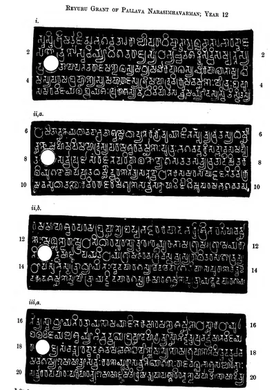 "Reyuru Grant of Pallava Narasimhavarman; Year 12", plates i, ii a, ii b and iii a (Epigraphia Indica XXIX, plate with No. 11 (PDF p. 198))Inscription rubbing · 1952
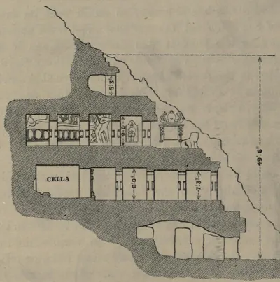 "Section of the Undavilla Cave, from a Drawing by Mr. Peters. Scale 20 feet to 1 inch" (Fergusson and Burgess, The Cave Temples of India, 1880, woodcut No. 24, p. 100)Drawing · 1880
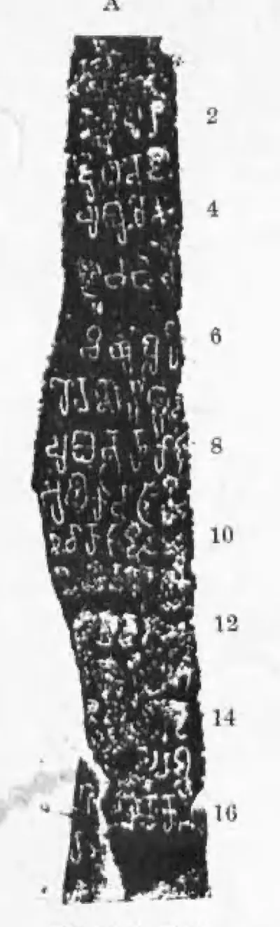 "Telugu Chola Records from Anantapur and Cuddapah (I)", A: the Kalamalla inscription of Erikal-Muturaju Dhananjaya (Epigraphia Indica XXVII, Plate (I) between pp. 228 and 229, panel A (PDF p. 316, printed sideways))Inscription rubbing · 1956
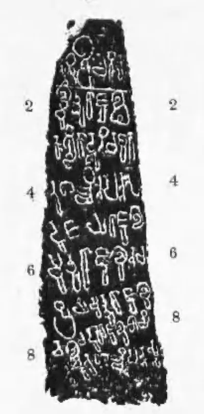 "Telugu Chola Records from Anantapur and Cuddapah (I)", B: the Erragudipadu inscription of Erikal-Mutturaju, first side (lines 1-8) (Epigraphia Indica XXVII, Plate (I) between pp. 228 and 229, panel B upper (PDF p. 316))Historic photograph · 1956
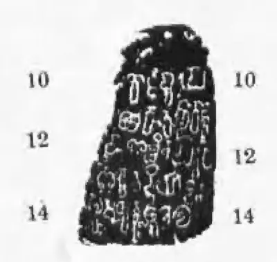 "Telugu Chola Records from Anantapur and Cuddapah (I)", B: the Erragudipadu inscription of Erikal-Mutturaju, second side (lines 10-14) (Epigraphia Indica XXVII, Plate (I) between pp. 228 and 229, panel B lower (PDF p. 316))Historic photograph · 1956
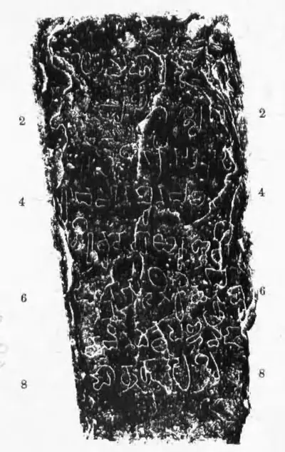 "Telugu Chola Records from Anantapur and Cuddapah (I)", C: the Uruturu inscription of Chola-Maharaja (Epigraphia Indica XXVII, Plate (I) between pp. 228 and 229, panel C (PDF p. 316))Inscription rubbing · 1956
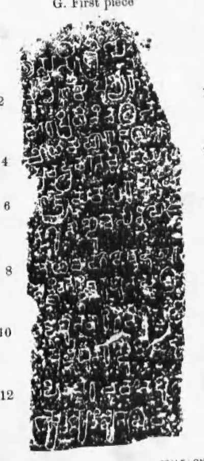 "Telugu Chola Records from Anantapur and Cuddapah (II)", G: the Ramesvaram pillar inscription of Punyakumara, first piece (lines 1-13) (Epigraphia Indica XXVII, Plate (II) between pp. 236 and 237, panel G first piece (PDF p. 326, printed sideways))Inscription rubbing · 1956
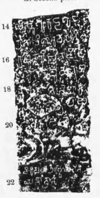 "Telugu Chola Records from Anantapur and Cuddapah (II)", G: the Ramesvaram pillar inscription of Punyakumara, second piece (lines 14-22) (Epigraphia Indica XXVII, Plate (II) between pp. 236 and 237, panel G second piece (PDF p. 326))Inscription rubbing · 1956
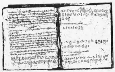 "Telugu Chola Records from Anantapur and Cuddapah (II)", K: the Chamaluru inscription as copied by Colin Mackenzie's assistants (Mackenzie manuscript, photograph) (Epigraphia Indica XXVII, Plate (II) between pp. 236 and 237, lower right (PDF p. 326))Historic photograph · 1956
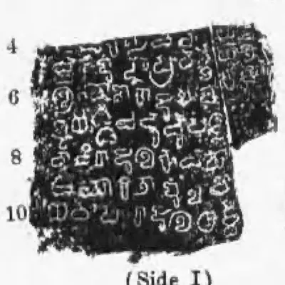 "Telugu Chola Records from Anantapur and Cuddapah (II)", K: the Chamaluru inscription of Prithivivallabha Vijayaditya-Chola, side I (Epigraphia Indica XXVII, Plate (II) between pp. 236 and 237, panel K, side I (PDF p. 326))Historic photograph · 1956
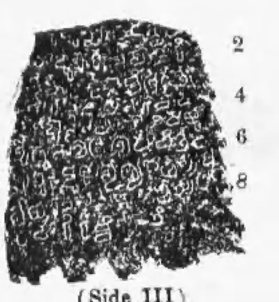 "Telugu Chola Records from Anantapur and Cuddapah (II)", K: the Chamaluru inscription of Prithivivallabha Vijayaditya-Chola, side III (Epigraphia Indica XXVII, Plate (II) between pp. 236 and 237, panel K, side III (PDF p. 326))Historic photograph · 1956
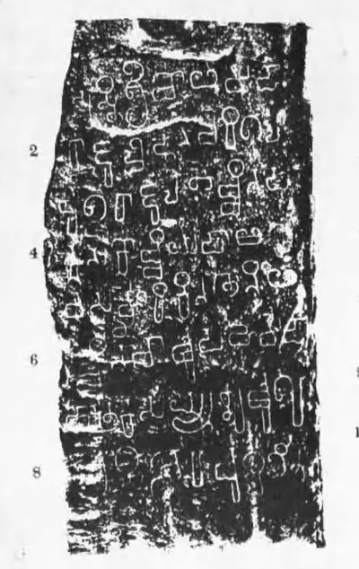 "Telugu Chola Records from Anantapur and Cuddapah", D: the Indukuru inscription of Chola-Maharaja (Epigraphia Indica XXVII, second plate page between pp. 228 and 229, panel D (PDF p. 317, printed sideways))Inscription rubbing · 1956
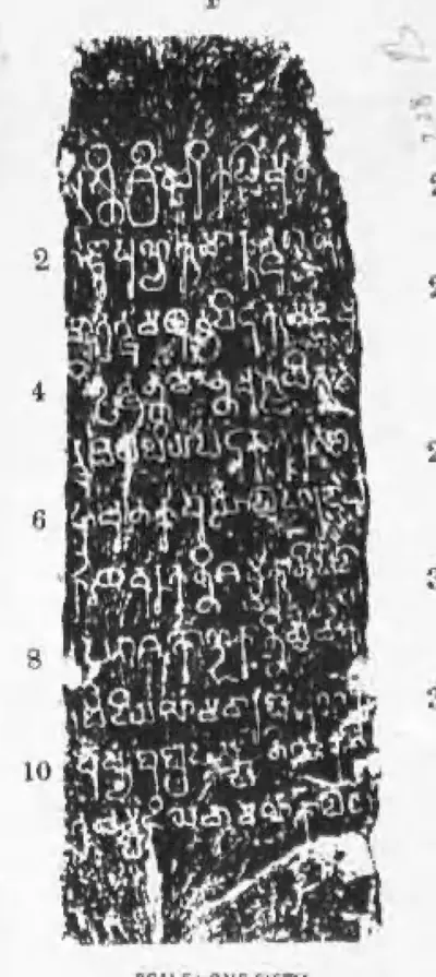 "Telugu Chola Records from Anantapur and Cuddapah", F: the Tippaluru inscription of Erikal-Muturaju Punyakumara (Epigraphia Indica XXVII, second plate page between pp. 228 and 229, panel F (PDF p. 317))Inscription rubbing · 1956
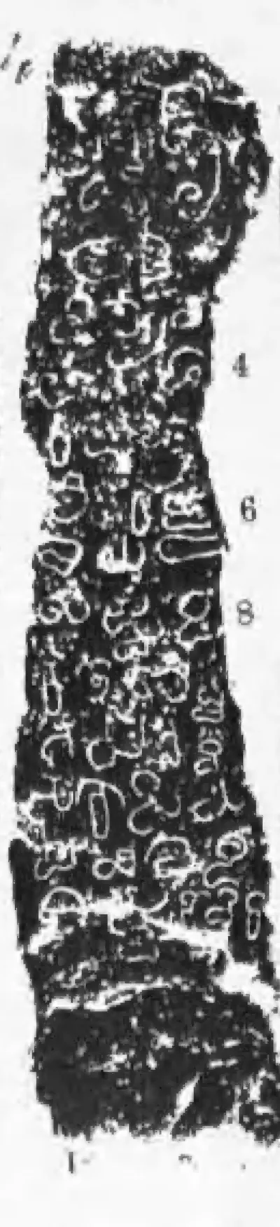 "Telugu Chola Records from Anantapur and Cuddapah", J: the Veludurti inscription of Uttamaditya Chola-Maharaja, face with lines 1-9 (Epigraphia Indica XXVII, second plate page between pp. 228 and 229, panel J, middle face (PDF p. 317))Inscription rubbing · 1956
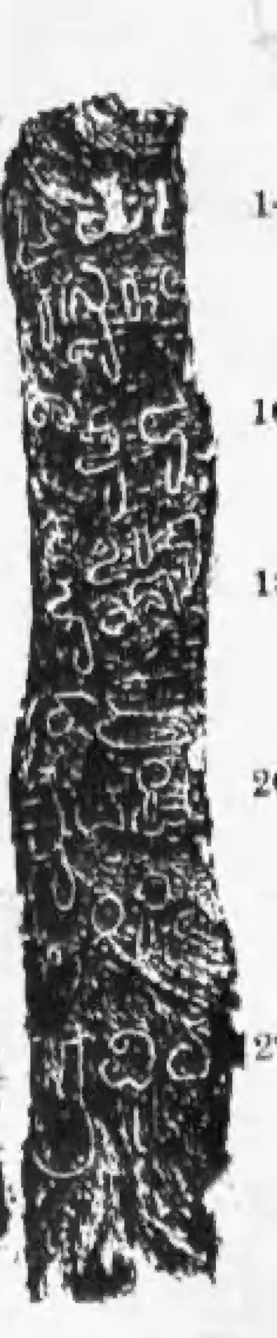 "Telugu Chola Records from Anantapur and Cuddapah", J: the Veludurti inscription of Uttamaditya Chola-Maharaja, face with lines 14-22 (Epigraphia Indica XXVII, second plate page between pp. 228 and 229, panel J, right-hand face (PDF p. 317))Inscription rubbing · 1956
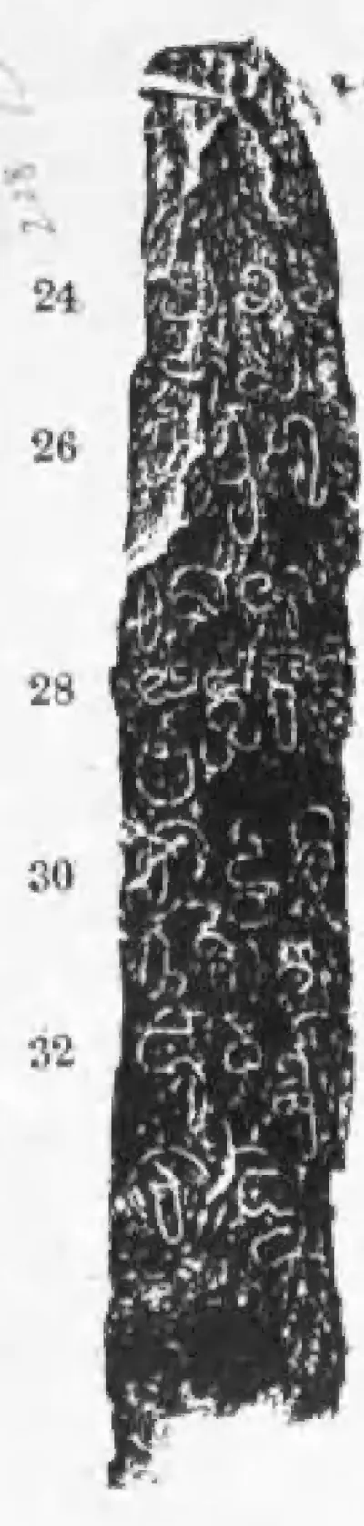 "Telugu Chola Records from Anantapur and Cuddapah", J: the Veludurti inscription of Uttamaditya Chola-Maharaja, face with lines 24-32 (Epigraphia Indica XXVII, second plate page between pp. 228 and 229, panel J, left-hand face (PDF p. 317))Inscription rubbing · 1956
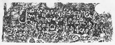 "Telugu Chola Records from Anantapur and Cuddapah", L: the Budidigaddapalle hero-stone inscription of Kapi-Bola-Mutturaju (Epigraphia Indica XXVII, second plate page between pp. 236 and 237, panel L (PDF p. 327, printed sideways))Inscription rubbing · 1956
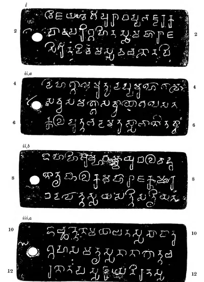 "Two Salankayana Charters from Kanukollu-Plate I. A.-Plates of Nandivarman (I), Year 14": plates i to iii a (Epigraphia Indica XXXI, Plate I, left half, between pp. 4 and 5 (PDF p. 24))Inscription rubbing · 1960
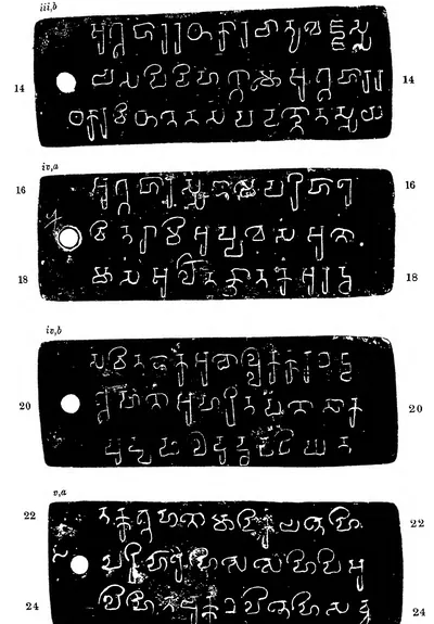 "Two Salankayana Charters from Kanukollu-Plate I. A.-Plates of Nandivarman (I), Year 14": plates iii b to v a (Epigraphia Indica XXXI, Plate I, right half, between pp. 4 and 5 (PDF p. 25))Inscription rubbing · 1960
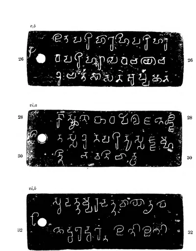 "Two Salankayana Charters from Kanukollu-Plate II. A.-Plates of Nandivarman (I), Year 14": plates v b to vi b (Epigraphia Indica XXXI, Plate II, left half, between pp. 6 and 7 (PDF p. 28))Inscription rubbing · 1960
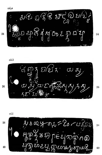 "Two Salankayana Charters from Kanukollu-Plate II. A.-Plates of Nandivarman (I), Year 14": plates vii a to viii (Epigraphia Indica XXXI, Plate II, right half, between pp. 6 and 7 (PDF p. 29))Inscription rubbing · 1960
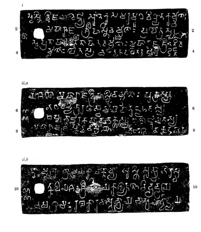 "Two Salankayana Charters from Kanukollu-Plate III. B.-Plates of Skandavarman, Year 1": plates i to ii b (Epigraphia Indica XXXI, Plate III, left half, between pp. 8 and 9 (PDF p. 32))Inscription rubbing · 1960
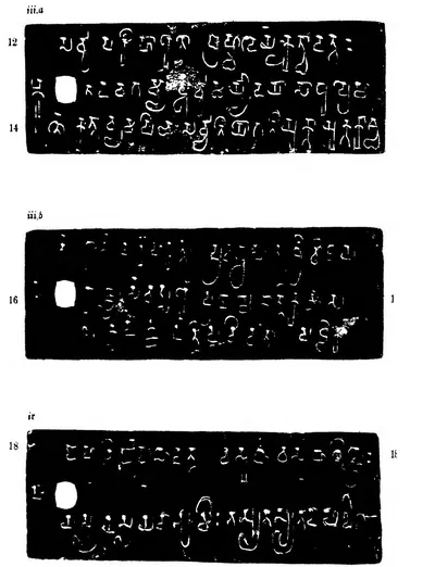 "Two Salankayana Charters from Kanukollu-Plate III. B.-Plates of Skandavarman, Year 1": plates iii a to iv (Epigraphia Indica XXXI, Plate III, right half, between pp. 8 and 9 (PDF p. 33))Inscription rubbing · 1960
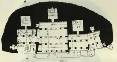 "Undavalli temple, Guntur District.—Plans": 1st Storey (Longhurst, Pallava Architecture I, 1924, Plate IX (PDF p. 70))Plan · 1924
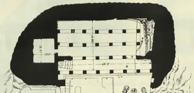 "Undavalli temple, Guntur District.—Plans": 2nd Storey (Longhurst, Pallava Architecture I, 1924, Plate X (PDF p. 72))Plan · 1924
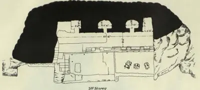 "Undavalli temple, Guntur District.—Plans": 3rd Storey (Longhurst, Pallava Architecture I, 1924, Plate X (PDF p. 72))Plan · 1924
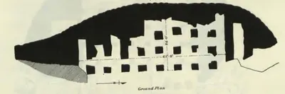 "Undavalli temple, Guntur District.—Plans": Ground Plan (Longhurst, Pallava Architecture I, 1924, Plate IX (PDF p. 70))Plan · 1924
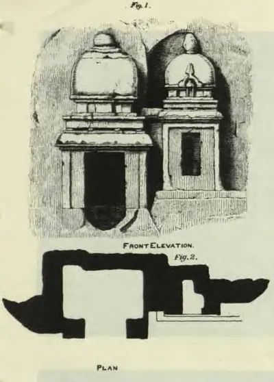 "Undavalli temple, Guntur District.—Rock-cut memorial shrines on the hill", Figs. 1-2 (Longhurst, Pallava Architecture I, 1924, Plate XIII (PDF p. 78))Drawing · 1924
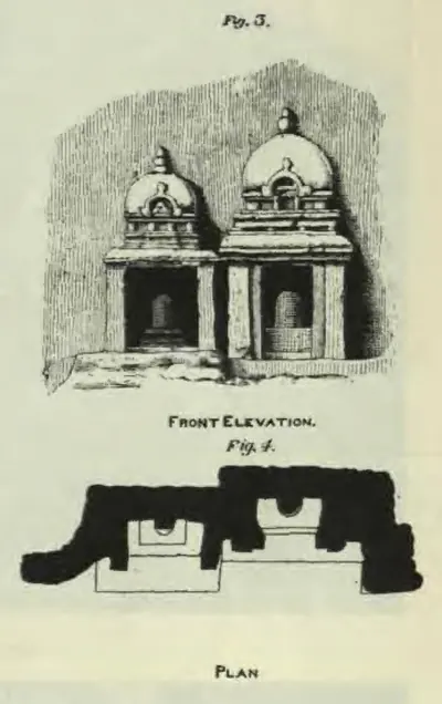 "Undavalli temple, Guntur District.—Rock-cut memorial shrines on the hill", Figs. 3-4 (Longhurst, Pallava Architecture I, 1924, Plate XIII (PDF p. 78))Drawing · 1924
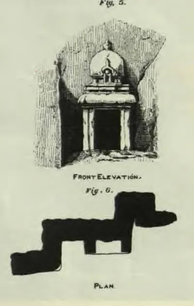 "Undavalli temple, Guntur District.—Rock-cut memorial shrines on the hill", Figs. 5-6 (Longhurst, Pallava Architecture I, 1924, Plate XIII (PDF p. 78))Drawing · 1924
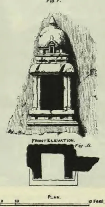 "Undavalli temple, Guntur District.—Rock-cut memorial shrines on the hill", Figs. 7-8 (Longhurst, Pallava Architecture I, 1924, Plate XIII (PDF p. 78))Drawing · 1924
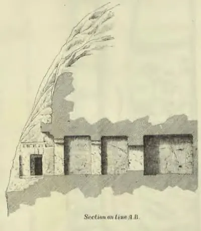 "Undavalli temple, Guntur District.—Sections": "Section on Line A.B." (Longhurst, Pallava Architecture I, 1924, Plate XI (PDF p. 74))Plan · 1924
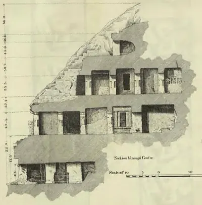 "Undavalli temple, Guntur District.—Sections": "Section through Centre" (Longhurst, Pallava Architecture I, 1924, Plate XI (PDF p. 74))Plan · 1924
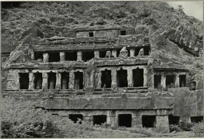 "Undavalli: Rock-cut temple" (Longhurst, Pallava Architecture I, 1924, Plate XIV (a) (PDF p. 80))Historic photograph · 1924
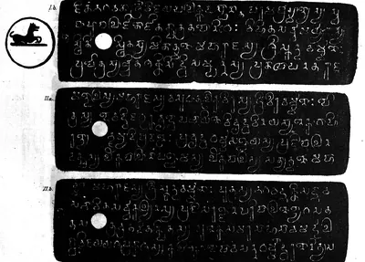 "Uruvupalli Copper-plate Grant of the Pallava Dynasty", plates I b, II a and II b, with the seal (Indian Antiquary V, 1876, plate at p. 50, printed sideways (PDF p. 66))Inscription rubbing · 1876
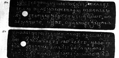 "Uruvupalli Copper-plate Grant of the Pallava Dynasty", plates III a and III b (Indian Antiquary V, 1876, plate at p. 51, printed sideways (PDF p. 67))Inscription rubbing · 1876
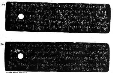 "Uruvupalli Copper-plate Grant of the Pallava Dynasty", plates IV b and V a (Indian Antiquary V, 1876, plate at p. 52, printed sideways (PDF p. 70))Inscription rubbing · 1876
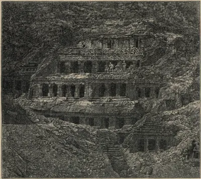 "View of the Undavilli Cave, from a Photograph" (Fergusson and Burgess, The Cave Temples of India, 1880, woodcut No. 23, p. 97)Drawing · 1880
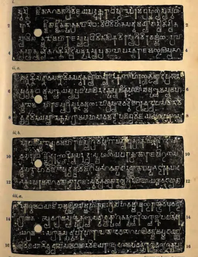 "Vilavatti Grant of Pallava Simhavarman", plates i, ii a, ii b and iii a (Epigraphia Indica XXIV, plate with No. 43 (PDF p. 382))Inscription rubbing · 1938
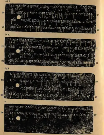 "Vilavatti Grant of Pallava Simhavarman", plates iii b, iv a, iv b and v (Epigraphia Indica XXIV, plate with No. 43 (PDF p. 383))Inscription rubbing · 1938
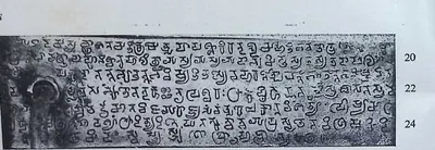 "Vunna Guravayapalem Plates of Paramesvaravarman I, Year 19", plate iii, lines 19-24 (Epigraphia Indica XXXII, plate with No. 9 (PDF p. 149))Historic photograph · 1959
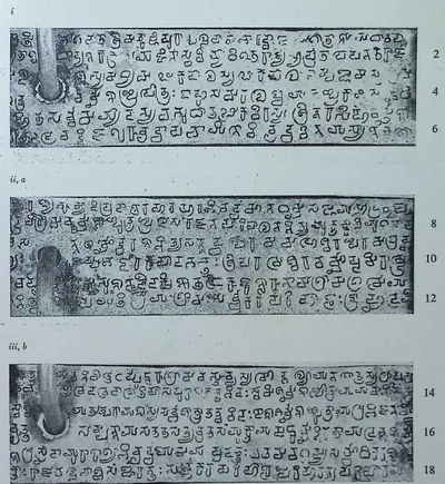 "Vunna Guravayapalem Plates of Paramesvaravarman I, Year 19", the first three inscribed plate sides, lines 1-18 (Epigraphia Indica XXXII, plate with No. 9 (PDF p. 148))Historic photograph · 1959
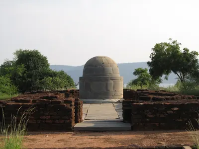 Bodhisri chaitya, NagarjunakondaPhotograph · 2013
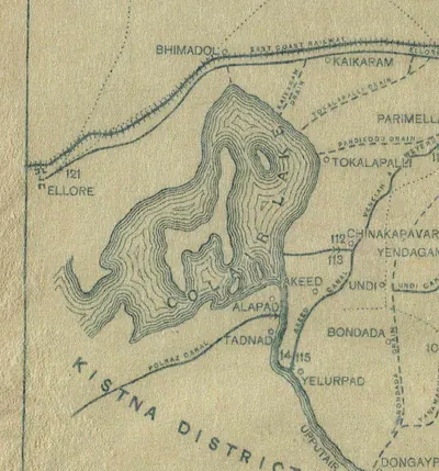 Ellore and Colair (Kolleru) Lake, detail of the "Sketch Map of the Godavari Delta showing positions of the principal irrigation & navigation works" (Walch 1896, folding map, PDF p. 17)Map · 1896
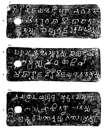 Ellore Prakrit grant: "Plates of Vijaya-Devavarman", plates i, ii a and ii b (Epigraphia Indica IX, plate between pp. 58 and 59 (PDF p. 83))Inscription rubbing · 1908
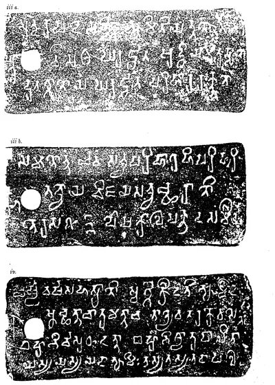 Ellore Prakrit grant: "Plates of Vijaya-Devavarman", plates iii a, iii b and iv (Epigraphia Indica IX, plate between pp. 58 and 59 (PDF p. 84))Inscription rubbing · 1908
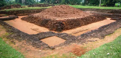 Excavated brick remains at Pedavegi (ancient Vengi), West Godavari district (photograph, 2007)Photograph · 2007
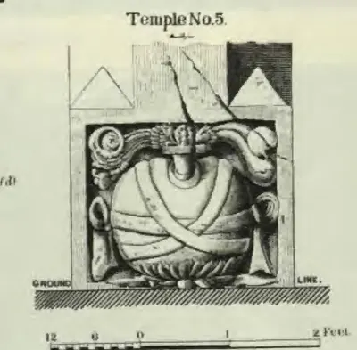 Mogalrajapuram "Temple No. 5", detail A (Longhurst, Pallava Architecture I, 1924, Plate VII (d) (PDF p. 66))Drawing · 1924
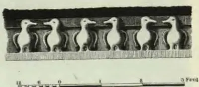 Mogalrajapuram temple No. V, detail B: frieze of geese (Longhurst, Pallava Architecture I, 1924, Plate VII (e) (PDF p. 66))Drawing · 1924
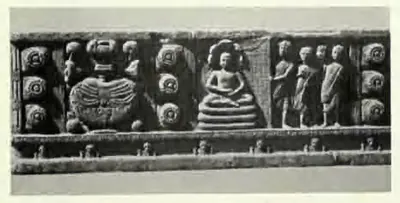 Nagarjunakonda: "A Chakravartti and his family as Buddhist disciples" (ASI Annual Report 1929-30, Pl. XXXIX (d))Book plate · 1935
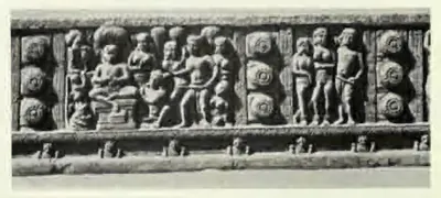 Nagarjunakonda: "A Chakravartti and his family being converted to Buddhism" (ASI Annual Report 1929-30, Pl. XXXIX (e))Book plate · 1935
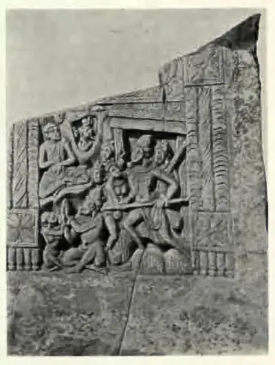 Nagarjunakonda: "A Chakravartti and his wife converted to Buddhism (Stupa 2)" (ASI Annual Report 1929-30, Pl. XL (b))Book plate · 1935
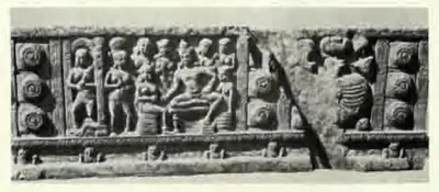
 Nagarjunakonda: "A Chakravartti denouncing Brahmanism" (ASI Annual Report 1929-30, Pl. XXXIX (c))Book plate · 1935
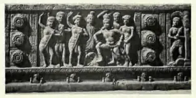
 Nagarjunakonda: "A Chakravartti in his palace (Stupa 9)" (ASI Annual Report 1929-30, Pl. XXXIX (a))Book plate · 1935
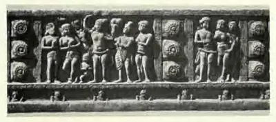 Nagarjunakonda: "A Chakravartti renouncing his kingdom" (ASI Annual Report 1929-30, Pl. XXXIX (b))Book plate · 1935
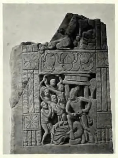 Nagarjunakonda: "A Chakravartti, denouncing Brahmanism (Stupa 2)" (ASI Annual Report 1929-30, Pl. XL (a))Book plate · 1935
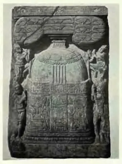 Nagarjunakonda: "Ayaka panel from Stupa 9" (ASI Annual Report 1929-30, Pl. XL (c))Book plate · 1935
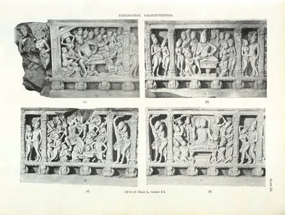 Nagarjunakonda: "Beam A, panels 1-4" (ASI Annual Report 1927-28, Pl. LI)Book plate · 1931
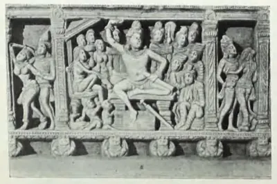 Nagarjunakonda: "Beam A, panels 5-7" (ASI Annual Report 1927-28, Pl. LI(a) (a))Book plate · 1931
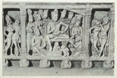 Nagarjunakonda: "Beam A, panels 5-7" (ASI Annual Report 1927-28, Pl. LI(a) (b))Book plate · 1931
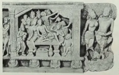 Nagarjunakonda: "Beam A, panels 5-7" (ASI Annual Report 1927-28, Pl. LI(a) (c))Book plate · 1931
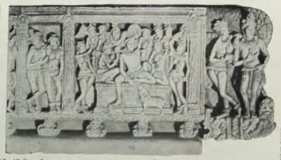 Nagarjunakonda: "Beam B, end panel" (ASI Annual Report 1927-28, Pl. LI(a) (d))Book plate · 1931
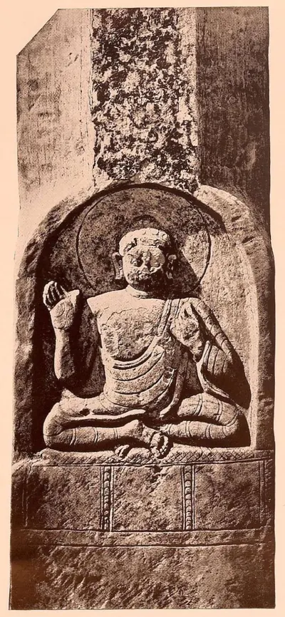 Nagarjunakonda: "Carved ayaka-pillar" (ASI Annual Report 1928-29, Pl. XLVI (a))Book plate · 1933
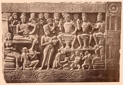 Nagarjunakonda: "Casting the horoscope" (ASI Annual Report 1928-29, Pl. XLVIII (b))Book plate · 1933
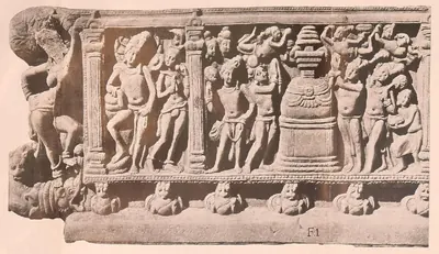 Nagarjunakonda: "Mahaparinirvana" (ASI Annual Report 1928-29, Pl. L (a))Book plate · 1933
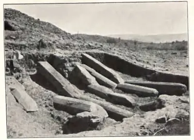 Nagarjunakonda: "Nagarjunikonda: Site No. 1, showing broken pillars on west side of stupa" (ASI Annual Report 1926-27, Pl. XXXVII (a))Historic photograph · 1930
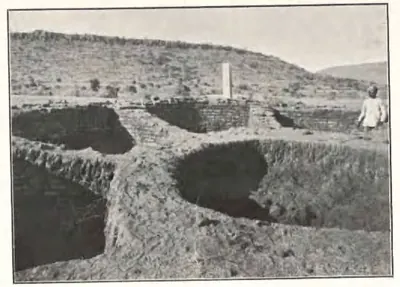 Nagarjunakonda: "Nagarjunikonda: Site No. 1, showing wheel-shaped foundation of stupa" (ASI Annual Report 1926-27, Pl. XXXVII (b))Historic photograph · 1930
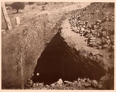 Nagarjunakonda: "Outer wall of the Great Stupa (findspot of relics marked by a cross)" (ASI Annual Report 1928-29, Pl. XLV (b))Plan · 1933
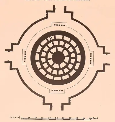 Nagarjunakonda: "Plan of the Great Stupa (findspot of relics marked by a cross)" (ASI Annual Report 1928-29, Pl. XLV (a))Plan · 1933
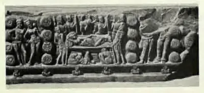 Nagarjunakonda: "Queen Maya's dream (Stupa 9)" (ASI Annual Report 1929-30, Pl. XXXIX (f))Book plate · 1935
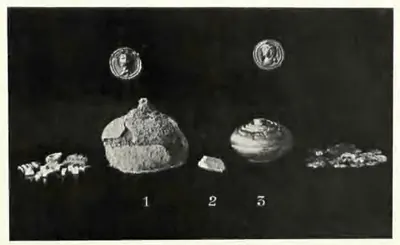 Nagarjunakonda: "Relics recovered from Stupa 6: 1. silver casket; 2. bone relic; 3. gold reliquary. Actual size" (ASI Annual Report 1929-30, Pl. XXXVII d)Book plate · 1935
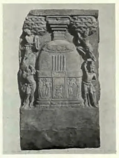 Nagarjunakonda: "Representation of a Buddhist stupa (Stupa 9)" (ASI Annual Report 1929-30, Pl. XL (d))Book plate · 1935
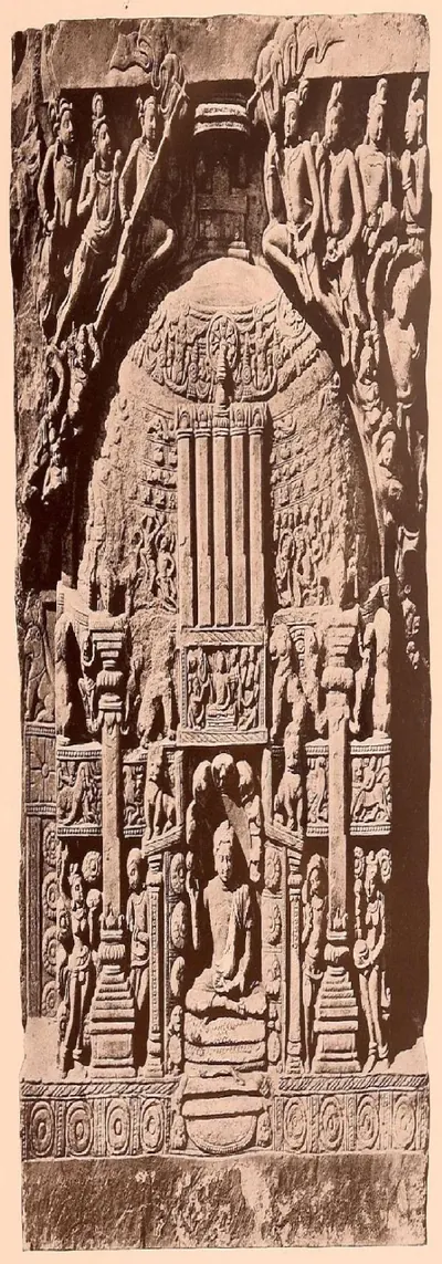 Nagarjunakonda: "Representation of a stupa" (ASI Annual Report 1928-29, Pl. XLVII (a))Book plate · 1933
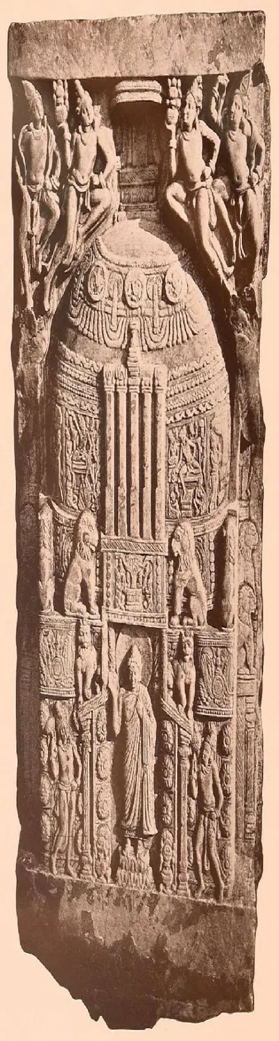 Nagarjunakonda: "Representation of a stupa" (ASI Annual Report 1928-29, Pl. XLVII (b))Book plate · 1933
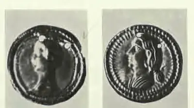 Nagarjunakonda: "Small gold medallions found with the relics recovered from Stupa 6" (ASI Annual Report 1929-30, Pl. XXXVII e)Other · 1935
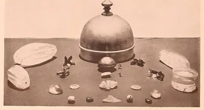 Nagarjunakonda: "The Buddha relics after cleaning and showing (1) the bone relic and (2) the gold box" (ASI Annual Report 1928-29, Pl. XLVI (c))Book plate · 1933
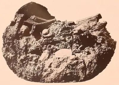 Nagarjunakonda: "The Buddha relics when first discovered" (ASI Annual Report 1928-29, Pl. XLVI (b))Book plate · 1933
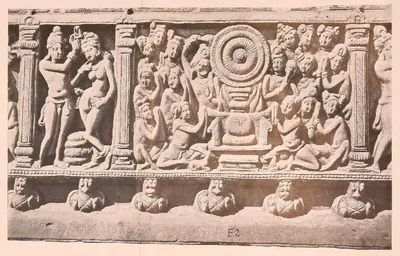 Nagarjunakonda: "The First Sermon" (ASI Annual Report 1928-29, Pl. L (b))Book plate · 1933
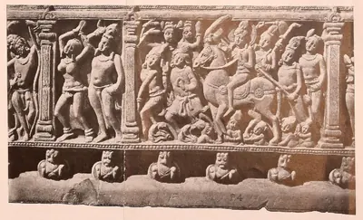 Nagarjunakonda: "The Great Renunciation" (ASI Annual Report 1928-29, Pl. L (d))Book plate · 1933
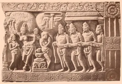 Nagarjunakonda: "The Nativity and the Seven Steps" (ASI Annual Report 1928-29, Pl. XLVIII (a))Book plate · 1933
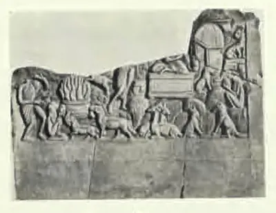 Nagarjunakonda: "The Sasa Jataka (Stupa 9)" (ASI Annual Report 1929-30, Pl. XXXVII f)Book plate · 1935
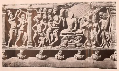 Nagarjunakonda: "The Temptation" (ASI Annual Report 1928-29, Pl. L (c))Book plate · 1933
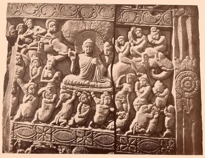 Nagarjunakonda: "The Temptation" (ASI Annual Report 1928-29, Pl. XLIX (b))Book plate · 1933
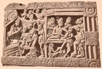 Nagarjunakonda: "To right: The child being presented to Asita; to left: Siddhartha's visit to the Temple" (ASI Annual Report 1928-29, Pl. XLIX (a))Book plate · 1933
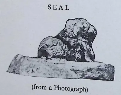
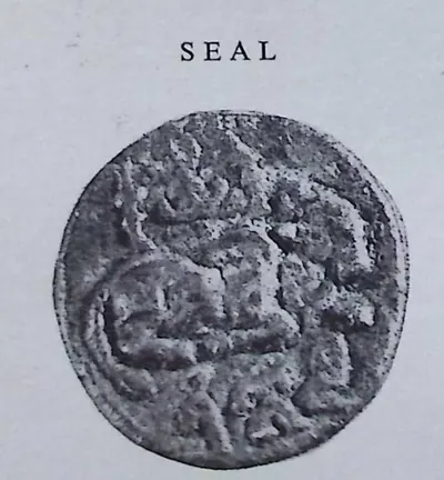 Seal of the "Vunna Guravayapalem Plates of Paramesvaravarman I, Year 19" (Epigraphia Indica XXXII, plate with No. 9 (PDF p. 149))Historic photograph · 1959
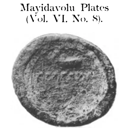 Seal of the Mayidavolu plates of Sivaskandavarman: "Mayidavolu Plates (Vol. VI, No. 8)", from the plate "Seals. Full-size" (Epigraphia Indica VI, plate of seals printed with No. 28 (PDF p. 369 of the archive.org scan EpigraphiaIndicaVol6))Historic photograph · 1901
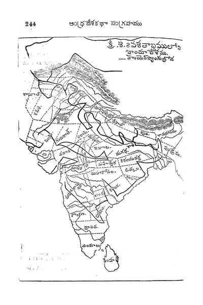 Telugu map of India in the seventh century AD with Hiuen Tsang's route ("క్రీ.శ. 7వ శతాబ్దములో హిందూదేశము") (Veerabhadra Rao 1910, printed p. 244 (PDF p. 284))Map · 1910
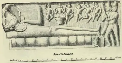 Undavalli temple: "Anantasayana" (Longhurst, Pallava Architecture I, 1924, Plate XII (PDF p. 76))Drawing · 1924
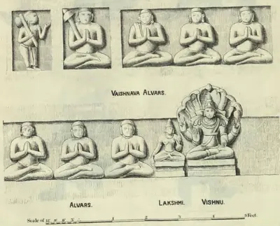 Undavalli temple: "Vaishnava Alvars" and "Alvars, Lakshmi, Vishnu" (Longhurst, Pallava Architecture I, 1924, Plate XII (PDF p. 76))Drawing · 1924
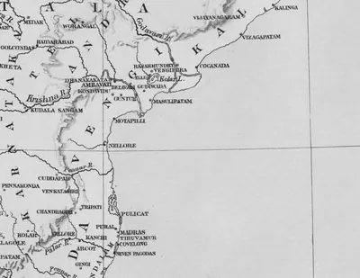 Vengi, the Krishna and the coast south to Kanchi and Tondamandalam: detail of "A Map of Southern India shewing the territories of the ancient dynasties according to the best authorities" (Elliot 1886, folding map, PDF p. 185)Map · 1886
Maps
- Unified Andhra Pradesh (pre-2014)
- Present-day state borders, for orientation
Where the region's earliest writing has been found, from Asoka's edicts in Kurnool to the stupas of the Krishna valley.
Base map: Natural Earth (opens in a new tab) (public domain).
- Unified Andhra Pradesh (pre-2014)
- Present-day state borders, for orientation
Where the Prakrit inscriptions of the Ikshvaku kings of Vijayapuri (3rd century CE) were found, at Nagarjunakonda and Jaggayyapeta on the Krishna, with Manchikallu, where a Prakrit pillar inscription of the Pallava king Simhavarman marks the dynasty's successors, and Banavasi, the Vanavasa whose Maharaja married a daughter of King Virapurushadatta.
Base map: Natural Earth (opens in a new tab) (public domain).
- Unified Andhra Pradesh (pre-2014)
- Present-day state borders, for orientation
- Approximate extent
Vengipura (Pedavegi near Eluru), capital of the Salankayana kings in the 4th and 5th centuries, with the places their copper-plate grants name or were found at: Eluru (Elura of Devavarman's grant), the Kolleru lake (the reported findspot of the Kolleru plates), Kanukollu (two grants, found before 1946), Denduluru (later Vishnukundin capital, part of the ruin field of Vengi), and Gudivada and Machilipatnam, the two places proposed for the district of Kudrahara. The shaded area is a rough sketch of the kingdom's extent as described in 1926 and 1932.
Historical boundaries are approximate. Base map: Natural Earth (opens in a new tab) (public domain).
- Unified Andhra Pradesh (pre-2014)
- Present-day state borders, for orientation
Where the Vishnukundin grants were kept or found, and the places they name that can be located: Denduluru (Lendulura, the residence of the Chikkulla grant) on the ruins of Vengi; Ramatirtham, Ipur and Polamuru; the Velpuru pillar; Ravirela on the Krishna (Ravireva of the Chikkulla grant); and Amaravati, which D. C. Sircar thought was probably the [Ama]rapura of the second Ipur grant. Also shown are Vinukonda, where F. Kielhorn thought the family name survived, Srisailam (Sriparvata, the family god's hill), the Kolleru lake (the "water of Kunala"), and the cave temples at Undavalli and Mogalrajapuram that G. Jouveau-Dubreuil attributed to the dynasty.
Base map: Natural Earth (opens in a new tab) (public domain).
- Unified Andhra Pradesh (pre-2014)
- Present-day state borders, for orientation
- Approximate extent
Findspots and places of the Pallava charters of the Telugu country, from the Prakrit plates of Sivaskandavarman at Mayidavolu and the pillar inscription of Simhavarman at Manchikallu to the Sanskrit grants of the Nellore–Guntur kings (Chendalur, Darsi, Nelatur, Vavveru) and the later grants of the kings of Kanchi (Reyuru), with Dhanyakataka (Amaravati), the Kopparam plates of the Chalukya Pulakesin II, the Sriparvata frontier, and the places that mark the Pallavas' Ganga, Bana and Kurnool connections. The shaded districts are rough sketches of Karmarashtra and Mundarashtra as the sources describe them.
Historical boundaries are approximate. Base map: Natural Earth (opens in a new tab) (public domain).
- Unified Andhra Pradesh (pre-2014)
- Present-day state borders, for orientation
Places in the Telugu country named in the records of the Chalukyas of Badami: Pishtapura (Pithapuram) and the Kolleru lake from Pulakesin II's Aihole inscription, Vengi given to his brother Vishnuvardhana, the findspot of his Kopparam plates, the temples of Alampur and the findspots of Vikramaditya I's grants at Gadwal and Talamanchi, with the capital Badami and the inscription at Aihole to the west and the Pallava capital Kanchipuram to the south.
Base map: Natural Earth (opens in a new tab) (public domain).
- Unified Andhra Pradesh (pre-2014)
- Present-day state borders, for orientation
- Approximate extent
Findspots of the records of the Telugu Cholas of Renandu (6th–8th centuries): the early Telugu stones at Kalamalla, Erragudipadu and Tippaluru, the copper plates of Punyakumara from Malepadu and Dommara-Nandyala, the Chamaluru stone of Vijayaditya Chola, and Budili, seat of the collateral line of Srikantha. The shaded area is a rough sketch of Renandu, the country between the Chitravati and the Cheyyeru, as its 1956 editors described it.
Historical boundaries are approximate. Base map: Natural Earth (opens in a new tab) (public domain).
- Unified Andhra Pradesh (pre-2014)
- Present-day state borders, for orientation
Hill forts and walled towns that the sources show being besieged, taken or held, from the Ikshvaku citadel at Nagarjunakonda to the siege of Bobbili in 1757 and the storming of Masulipatam in 1759. The story of each is told on the Forts & warfare page.
Base map: Natural Earth (opens in a new tab) (public domain).
- Unified Andhra Pradesh (pre-2014)
- Present-day state borders, for orientation
- Approximate extent
Places in the old Ganjam and Vizagapatam districts named in the records of the Eastern Ganga kings of Kalinga: Mukhalingam (Kalinganagara), their capital, with its temples; the findspots of their copper plates at Chicacole (Srikakulam), Nadagam and Alamanda; Dirghasi near the old port of Kalingapatnam; the temples of Srikurmam and Simhachalam, with hundreds of their inscriptions; Visakhapatnam and Bhogapuram, with records of Anantavarman Chodaganga; Mahendragiri, the mountain of their god Gokarnasvamin; and, south of the Godavari, Draksharama, where their queens and kings left records, and Bendapudi, which a Ganga army took from the Kakatiya viceroys. The shaded area is a rough sketch of Kalinga as the Imperial Gazetteer describes it.
Historical boundaries are approximate. Base map: Natural Earth (opens in a new tab) (public domain).
- Unified Andhra Pradesh (pre-2014)
- Present-day state borders, for orientation
- Approximate extent
Rough sketches of the old country names of the Telugu coast and Rayalaseema as the sources place them: Vengi between the mouths of the Krishna and the Godavari; Velanadu in the western Krishna delta; Kammanadu (Karmarashtra) round Ongole and Bapatla; Pakanadu between Ongole and Nellore; and Renandu round Kadapa. The shaded areas are approximate.
Historical boundaries are approximate. Base map: Natural Earth (opens in a new tab) (public domain).
Related
Dynasties
Ikshvakus of Vijayapuri
c. 225–350 CE
Dynasty of the lower Krishna valley in the 3rd and early 4th centuries CE, with its capital at Vijayapuri in the Nagarjunakonda valley. Four kings are known from Prakrit and Sanskrit inscriptions. The kings performed Vedic sacrifices and built temples to Shiva and Karttikeya, while the royal women endowed the Buddhist monasteries of the capital.
Pallavas
c. 250–900 CE
Dynasty of Kanchi (Kanchipuram) whose kings held the Telugu country south of the Krishna for much of the 4th to 7th centuries CE. Their earliest charters, in Prakrit, were sent from Kanchi to an officer at Dhanyakataka near Amaravati. A later line issued Sanskrit grants of villages in the Guntur and Nellore country from camps such as Palakkada and Dasanapura. The Chalukyas took Vengi and the Guntur country early in the 7th century. But Pallava kings still granted villages in Nellore until about 700, and their vassals held parts of Chittoor and Rayalaseema until the Chola conquest about 900.
Vakatakas
c. 275–530 CE
Dynasty of the northern Deccan and central India, about the 3rd to the 6th century, with its heartland in Vidarbha (Berar) north of the Telugu country. Its kings married into the Gupta imperial family, and one of their princesses married the Vishnukundin king Madhavavarman. G. Jouveau-Dubreuil (1920) thought the Vakatakas ruled almost the whole of the later Hyderabad State and placed the first Vishnukundin on the throne of Vengi. A modern history of Telangana (2022) counts only the Adilabad, Nizamabad and Karimnagar country inside their lands. The Ajanta inscription credits their last great king, Harishena, with the conquest of Andhra.
Salankayanas of Vengi
c. 300–470 CE
Dynasty of the country between the Krishna and the Godavari in the 4th and 5th centuries CE, ruling from Vengipura, the modern Pedavegi near Eluru. Seven copper-plate grants name seven kings in two lines descended from Hastivarman. Most scholars identify him with the 'Hastivarman of Vengi' of Samudragupta's Allahabad inscription. Their earlier grants are in Prakrit and their later ones in Sanskrit. Their seals bear a bull, and their family god was Chitrarathasvamin.
Eastern Gangas of Kalinga
c. 498–1434 CE
Dynasty of Kalinga that ruled from Kalinganagara, now Mukhalingam in the Srikakulam district, and later from Orissa, from about the 6th century until 1434. Its early grants are dated in a Ganga era whose starting point is still disputed. The north of the Telugu country, the old Ganjam and Vizagapatam districts, was the heart of the kingdom. Their copper plates come from Chicacole, Achyutapuram, Jirjingi, Nadagam and Alamanda, and hundreds of their inscriptions in Telugu and Sanskrit survive at Mukhalingam, Srikurmam and Simhachalam. Anantavarman Chodaganga, a grandson of Kulottunga I, reigned from 1078 for about seventy years. The later kings fought the Kakatiyas across the Godavari, and their minister Kapilesvara founded the Gajapati dynasty in 1434.
Vishnukundins
c. 500–630 CE
Dynasty of the Krishna–Godavari country that ruled after the Salankayanas and before the Eastern Chalukyas. It is known from a handful of Sanskrit copper-plate grants and one stone inscription. Its kings worshipped the lord of Sriparvata, claimed eleven horse sacrifices for their greatest ruler, Madhavavarman, and married into the Vakataka royal family. Their capital in the later grants was Lendulura (Denduluru near Vengi). Scholars have dated them anywhere from the 4th to the 8th century. Most later reconstructions put the main line in the 6th century and end it with the Chalukya conquest of the early 7th, though D. C. Sircar continued it to about 670.
Chalukyas of Badami
c. 550–757 CE
Dynasty of the western Deccan that ruled from Vatapi (Badami) from about 550 to 757. Pulakesin II took Pishtapura (Pithapuram) and the Kolleru lake country about 615. He left his brother Vishnuvardhana in Vengi, where the Eastern Chalukya line began. Their grants and inscriptions show them holding the Guntur country in 631, the Kurnool and Alampur country under Vikramaditya I and his successors, and land in Nellore in 660. The Rashtrakuta Dantidurga overthrew the last king, Kirtivarman II, in the 750s.
Telugu Cholas of Renadu
c. 550–800 CE
Kings of Renandu, the country around Kadapa, from about the later 6th to the 8th century. They claimed descent from the Chola king Karikala, took the names of their Pallava and then Chalukya overlords, and ruled from Chippili and Malepadu. Their stone inscriptions at Kalamalla and Erragudipadu are among the earliest records written wholly in Telugu. None of their records is dated in an era. Three editors have placed the same king, Punyakumara, about 625, about 740 and about 800.
People
Vasishthiputra Chamtamula
c. 225–255 CE
First known king of the Ikshvakus of Vijayapuri (Nagarjunakonda). His descendants' inscriptions remember him as a performer of the horse sacrifice and other Vedic rites, while the women of his family founded the Buddhist monuments of the Krishna valley. His reign ended before about 255; D. C. Sircar had dated it to about 223–240.
Sivaskandavarman (Pallava)
c. 250–275 CE
Earliest Pallava king known from his own charters. As crown prince he sent the Mayidavolu plates from Kanchipura to his officer at Dhannakada (Amaravati), granting a village in Andhrapatha, the Telugu country. As king he issued the Hirahadagalli plates and claimed the horse sacrifice. His date is disputed: from the early 3rd century to the middle of the 4th.
Virapurushadatta
c. 255–275 CE
Ikshvaku king of Vijayapuri (3rd century CE). In his reign the women of the royal family rebuilt the Great Stupa at Nagarjunakonda, and founded shrines and monasteries for Buddhist monks, including monks from Sri Lanka. His records run to his 20th regnal year, and one is dated in a cyclic year equated with 273–74. D. C. Sircar dated his reign to about 255–275.
Vijaya-Skandavarman (Pallava)
c. 275–340 CE
Pallava king in whose reign the queen Charudevi, wife of the crown prince Vijaya-Buddhavarman, granted land to a temple of Narayana. Her Prakrit grant was found near Guntur and is now in the British Museum. It is the only record of his reign. Scholars disagree whether he was the same man as Sivaskandavarman of the Mayidavolu and Hirahadagalli plates.
Ehuvula Chamtamula
c. 280–335 CE
Third known Ikshvaku king of Vijayapuri (Nagarjunakonda), son of Virapurushadatta. His records run to his 24th regnal year. In his reign a prince and a noble built the earliest dated Shiva temples in the valley. Queens, bankers and lay Buddhists went on giving gifts to its monasteries. D. C. Sircar dated his reign to about 280–335.
Devavarman (Salankayana)
c. 320–345 CE
Salankayana king of Vengi. He is known from a Prakrit grant of his 13th year addressed to the villagers of Ellore, in which he calls himself a performer of the horse sacrifice and a devotee of Shiva. His place in the family is unknown. Scholars have made him a son of Hastivarman, an earlier king (perhaps Hastivarman's father), and a successor of Nandivarman I.
Vishnugopa of Kanchi
c. 325–350 CE
King of Kanchi named in the Allahabad pillar inscription of the Gupta emperor Samudragupta, among the southern kings whom he captured and released, about the middle of the 4th century. Most scholars take him for a Pallava. G. Jouveau-Dubreuil argued that the meeting took place near the Krishna, where Vishnugopa led an alliance of eastern kings, not at Kanchi.
Rudrapurushadatta
c. 335–346 CE
Fourth and last known Ikshvaku king of Vijayapuri (Nagarjunakonda), son of Ehuvula Chamtamula. He was identified in 1955–56 from a memorial pillar of his 11th regnal year. D. C. Sircar thought his reign ended before about 350, when the Pallavas took the Krishna–Guntur region.
Hastivarman (Salankayana)
c. 345–370 CE
Salankayana king of Vengi, the earliest king in the family list of his family's copper-plate grants, which praise him for victories in many battles. Since 1926 most scholars have identified him with the Hastivarman of Vengi whom the Gupta emperor Samudragupta claims to have captured and released in the mid-4th century. Older works took that king for a Pallava viceroy.
Nandivarman I (Salankayana)
c. 370–395 CE
Salankayana king of Vengi, son of Hastivarman and father of Chandavarman and Hastivarman II. A Prakrit grant of his 14th year, found at Kanukollu and published in 1960, is the only record of his own. Its editor dated it to the close of the 3rd century, but D. C. Sircar placed it about the middle of the 4th.
Chandavarman (Salankayana)
c. 395–420 CE
Salankayana king of Vengi, son of Nandivarman I and father of Nandivarman II. He is known only from his son's grants, which say that subordinate rulers bowed to his power. He has often been confused with Chandavarman, a 5th-century king of Kalinga who issued the Komarti plates.
Nandivarman II (Salankayana)
c. 420–445 CE
Salankayana king of Vengi, eldest son of Chandavarman, and the best-documented king of the dynasty. The Kolleru plates of his 7th year, the Peddavegi plates of his 10th and probably one of the Kanteru grants are his. He called himself a parama-bhagavata (devout worshipper of the Lord) and gave land to a temple of Vishnu. Most scholars date him to the first half or middle of the 5th century.
Kumaravishnu II (Pallava)
c. 425–450 CE
Pallava king of Kanchi known from the Chendalur plates. He issued them from Kanchipura in the second year of his reign, granting land in the village of Chendalura in Karmarashtra, in the present Prakasam district. Where he belongs in the Pallava line is disputed: before Simhavarman, according to Jouveau-Dubreuil, or between Simhavarman and Simhavishnu, according to Hultzsch.
Skandavarman II (Pallava)
c. 450–475 CE
Pallava king of the Nellore–Guntur country, known from the first Omgodu grant, issued from Tambrapa in the 33rd year of his reign. The grant gives his ancestors back to a Kumaravishnu, who performed the horse sacrifice. He was the father of the crown prince Vishnugopa and the grandfather of Simhavarman, whose grants come from the same region.
Vishnugopa (Pallava crown prince)
c. 475–500 CE
Pallava prince of the Nellore–Guntur line, son of Skandavarman II and father of Simhavarman. As crown prince (yuvamaharaja) he issued the Uruvupalli grant from Palakkada, dated in the 11th year of a king Simhavarman, giving land to a temple at Kandukura. Scholars disagree whether he ever reigned, and who the Simhavarman of his grant was.
Madhavavarman (Vishnukundin)
c. 535–585 CE
The most famous Vishnukundin king. His own and his descendants' grants credit him with eleven horse sacrifices and a thousand agnishtoma rites. He married into the Vakataka royal family. Whether he was also Madhavavarman Janashraya, the son of Govindavarman and donor of the first Ipur and the Polamuru plates, is disputed: D. C. Sircar and V. V. Mirashi thought so, while other scholars made Janashraya a later king, Madhavavarman III. His date is also disputed: Sircar placed him about 535–585, Mirashi about 510–560.
Dhananjaya (Telugu Chola)
c. 575 CE
Telugu Chola ruler of Renandu in the Kadapa country, whom his editors date to about 575. As Erikal-Muturaju Dhananjaya he is named in the Kalamalla pillar inscription, one of the earliest records written wholly in Telugu. As Dhananjayavarman, youngest son of Nandivarman, he heads the line of Punyakumara in the Malepadu plates.
Madhavavarman II (Vishnukundin)
c. 585–615 CE
Vishnukundin king, son of Devavarman and grandson of the great Madhavavarman. He is known from the second set of Ipur plates, issued from [Ama]rapura. The grant calls him lord of the Trikuta and Malaya mountains. Scholars have read this claim as an empty boast, as evidence of a western Vishnukundin realm, or as the name of a local hill. His place in the line and his date are disputed.
Mahendravarman I
c. 600–630 CE
Pallava king of Kanchi (about 600–630), son of Simhavishnu. In his reign the Chalukya Pulakesin II took Vengi and the Pallava provinces of the Guntur and Nellore country, though Mahendravarman defended Kanchi. Some of his surnames in his cave inscriptions in the Tamil country are Telugu. This led Jouveau-Dubreuil to argue that his family and his cave style came from the Telugu country.
Mahendravikrama (Telugu Chola)
c. 600 CE
Telugu Chola king of Renandu, son of Dhananjaya and father of Punyakumara, the first of his line to take the title Chola-Maharaja. His name copies that of the Pallava king Mahendravarman I, and his editors placed him about 600. Short Telugu stone records of a 'Chola-Maharaja' at Uruturu and Indukuru are assigned to him.
Pulakesin II
c. 609–642 CE
Chalukya king of Badami (609–642), the son of Kirtivarman I. His Aihole inscription of 634–35 says that he humbled the Kalingas and Kosalas, took the fortress of Pishtapura (Pithapuram), ravaged 'the water of Kunala' (taken to be the Kolleru lake) and drove the Pallava king behind the walls of Kanchi. He gave the conquered Vengi country to his younger brother Vishnuvardhana, the founder of the Eastern Chalukyas. His Kopparam plates of about 631 grant land in the Guntur country. He died when the Pallava Narasimhavarman I took Badami, probably in 642.
Indravarman (Vishnukundin)
c. 625–655 CE
Vishnukundin king, called Indrabhattarakavarman in his son's Chikkulla plates, who issued the Ramatirtham plates near Vizianagaram in his 27th year. His grants praise his victories with war elephants. Most scholars identify him with the Indrabhattaraka against whom a group of kings fought, according to the Godavari plates of Prithivimula. His date depends on the disputed Vishnukundin chronology: about 469–496, 535, 570–600 and 625–655 have all been proposed.
Punyakumara
c. 625 CE
Telugu Chola king of Renandu and Hiranyarashtra, the best-documented ruler of the family. He is known from two sets of Sanskrit copper plates (Malepadu, fifth year; Dommara-Nandyala, tenth year) and from Telugu stone records at Tippaluru, Ramesvaram and Veludurti. His titles imitate those of the Pallava Mahendravarman I. Editors have dated him about 625, about 740 and near the end of the 8th century.
Vikramaditya I (Chalukya of Badami)
c. 655–680 CE
Chalukya king of Badami (about 655–680), a son of Pulakesin II. He restored the kingdom after the Pallavas took Badami, fought three Pallava kings and took Kanchi. His copper-plate grants come from the Telugu country: Amudalapadu and Gadwal in today's Telangana, the Kurnool district, Talamanchi near Nellore, and Hyderabad. His Amudalapadu plates of 660 record his initiation into the Shaiva faith. A queen of his installed a linga at Alampur.
Vikramendravarman II (Vishnukundin)
c. 655–670 CE
Vishnukundin king, eldest son of Indravarman, who issued the Chikkulla plates from Lendulura (Denduluru near Vengi) in his 10th year, giving a village on the Krishna to a Shiva temple. The plates say he took up the government as a child. Some scholars identify him with the Vikramahendra of the Polamuru plates, the grandfather of the last known Vishnukundin king; D. C. Sircar did not. Sircar dated him about 655–670, and the scheme printed by Sewell in 1932 about 496–521.
Bhatideva
Ikshvaku queen, wife of King Virapurushadatta and mother of King Ehuvula Chamtamula. In the 2nd year of her son's reign she founded a monastery at Nagarjunakonda for Buddhist teachers of the Bahusutiya school.
Chamtisiri
Ikshvaku princess, sister of King Chamtamula and aunt and later mother-in-law of King Virapurushadatta. She was the chief donor of the Buddhist monuments of Vijayapuri (Nagarjunakonda). She gave the pillars of the Great Stupa, an apsidal shrine and a pillared hall beside it, all to the Aparamahavinaseliya school, in the 3rd century CE.
Simhavarman (Pallava, Manchikallu inscription)
Pallava king of the Bharadvaja gotra, known only from a broken Prakrit pillar inscription found at Manchikallu in the Palnad taluk. D. C. Sircar took it for the earliest Pallava record. He suggested that this Simhavarman brought the Krishna–Guntur country under the Pallavas, pushing out the Ikshvakus, and was perhaps the father of Sivaskandavarman.
Simhavarman II (Pallava)
Pallava king of the Nellore–Guntur country, son of the crown prince Vishnugopa. Four of his grants survive. All give villages in the Guntur and Nellore districts and were issued from camps, not from Kanchi: the second Omgodu grant (year 4), the Pikira grant from Menmatura (year 5), the Mangalur grant from Dasanapura (year 8) and the Vilavatti grant (year 10). Many scholars date his accession to 436 from a Jain work, the Lokavibhaga; others place him about 500.
Skandavarman (Salankayana)
Salankayana king of Vengi, known from two Sanskrit grants of his first regnal year, from Kanteru and Kanukollu. The Kanukollu plates, published in 1960, make him a son of Hastivarman II and a great-grandson of Hastivarman I, a cousin of Nandivarman II; before they were found he was usually placed after Nandivarman II as the last known king of the line.
Places
Alamanda
Village in the old Sringavarapukota taluk of the Vizagapatam district, now in the Vizianagaram district. Copper plates of the Ganga king Anantavarman, son of Rajendravarman, were found underground here in the early 1890s. They are dated in the 304th year of the Gangeya race.
Alampur
Town on the west bank of the Tungabhadra near its meeting with the Krishna, now in Telangana. It was formerly the head of a taluk of the Raichur and then the Mahbubnagar district of Hyderabad State. Its fort holds the Nava Brahma temples, whose inscriptions name kings and queens of the Chalukyas of Badami. Copper-plate grants of Vikramaditya I and Vinayaditya were found in the taluk. Inscriptions call the place Hatampura, and its god Brahmesvara the guardian of the western gate of Srisailam.
Badami (Vatapi)
Town in northern Karnataka, the ancient Vatapi. It was the capital of the Chalukyas of Badami from the 6th to the 8th century. Pulakesin I acquired it, and Kirtivarman I adorned it with temples and finished its great Vaishnava cave temple. The Pallava Narasimhavarman I captured and ruined it about 642.
Bhairavakonda
Hill site in the old Udayagiri taluk of the Nellore district, near the Cuddapah border. It has a group of early rock-cut cave temples reported by A. H. Longhurst in 1921. R. Gopalan described them as of the Pallava age and very like the caves of Mahendravarman I.
Chendalur
Village formerly in the Ongole taluk. It is the Chendalura of a Pallava copper-plate grant of Kumaravishnu II and the Chendapura of an Eastern Chalukya grant of 673. Both sets of plates were dug up there from a pot of paddy husk while a house was being built.
Chikkulla
Agrahara (village granted to Brahmins) in the former Tuni division of Godavari district, later East Godavari. A copper-plate grant of the Vishnukundin king Vikramendravarman II was dug up from a tank here in the 1880s.
Chippili
Village in the Madanapalle country of the former Chittoor district. It has been identified with Chirpali, the capital of Renandu named in the Tippaluru inscription of the Telugu Chola Punyakumara. A Kannada memorial stone there names a Punyakomaran ruling Chirpuli.
Darsi
Town formerly in the Podili division of the Nellore district, now in Prakasam, where the first plate of a lost Pallava grant issued from Dasanapura was found in a tobacco field. V. Venkayya suggested that Dasanapura, one of the camps of the Pallava kings of the Nellore–Guntur country, was the old name of Darsi itself.
Erragudipadu
Village in the former Kamalapuram taluk of Kadapa district. A stone beside its Chennakesava temple carries an inscription of an Erikal-Mutturaju of the Telugu Cholas of Renandu. Its editors dated it to the late 6th century, and it is among the earliest records written in Telugu.
Gadwal
Town in Telangana. In 1909 it was the seat of the Gadwal samasthan (tributary estate) of the Raichur district of Hyderabad State. The Gadval plates of the Chalukya king Vikramaditya I, dated 674, were kept in a house there and were said to have been found in its fields.
Ghantasala
Village west of Machilipatnam in the Krishna delta, site of a large brick Buddhist stupa excavated by A. Rea in 1892. Carved limestone slabs and inscribed pillars from it survive scattered through the village.
Ipur
Village in the former Tenali taluk of Guntur district. Two sets of Vishnukundin copper plates, kept as heirlooms in a Brahmin household, were secured here in 1919–20. One is a grant of Govindavarman's son Madhavavarman, the other of Madhavavarman II. With them were two early Eastern Chalukya grants.
Jaggayyapeta
Market town on the Paleru near where it meets the Krishna, formerly called Betavolu. On a hill nearby, James Burgess excavated in 1882 the remains of an early Buddhist stupa with an inscription of the Ikshvaku period.
Jirjingi
Village near Tekkali in the Srikakulam district. Copper plates of the Ganga king Indravarman, lord of Trikalinga, dated in the year 39, were found here during the excavation of an old temple. The village is itself the Jijjika granted in the plates.
Kalamalla
Village in the former Kamalapuram taluk of Kadapa district. A broken pillar in its Chennakesava temple carries a late-6th-century inscription of the Telugu Chola Dhananjaya. It is one of the earliest records written entirely in Telugu.
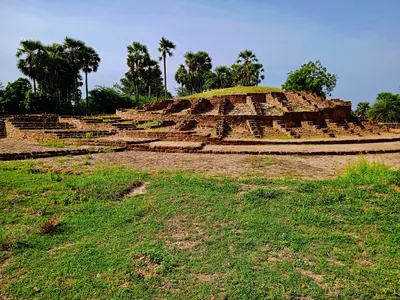
Kalingapatnam
Seaport at the mouth of the Vamsadhara in the Srikakulam district, long supposed to be Kalinganagara, the capital of the Ganga kings of Kalinga. E. Hultzsch still thought so in 1895. But G. V. Ramamurti found no antiquities there fit for a capital, and he placed Kalinganagara at Mukhalingam instead.
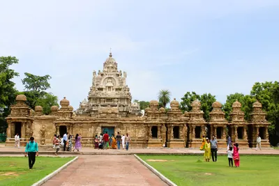
Kanchipuram
City in the Tamil country, the capital of the Pallava kings. The earliest Pallava charter of the Telugu country, the Mayidavolu plates, was issued from Kanchipura. So were later Pallava grants of villages in the Ongole and Nellore country. The Chalukyas besieged the city in the 7th and 8th centuries, and the Chola Aditya I conquered it at the end of the 9th.
Kandukur
Town formerly in the Nellore district, now in Prakasam. C. R. Krishnamacharlu took it to be the Kandukura of the Pallava Uruvupalli grant. The grant gave land to a temple of Vishnuhara there, which he thought was one of the early temples of Kandukur. He also thought the southern part of the Kandukur taluk lay in the ancient Mundarashtra.
Kanukollu
Village in the Krishna delta, formerly in the Gudivada taluk of Krishna district. Two copper-plate grants of the Salankayana kings Nandivarman I and Skandavarman were dug up here on the old village site, outside the ramparts of a ruined mud fort.
Kopparam
Village in the old Narasaraopet taluk of the Guntur district, near which the copper-plate grant of the 21st year of the Chalukya king Pulakesin II (probably 631) was found. The grant gives land in Karmarashtra and shows the Chalukyas of Badami granting land in the Guntur country at that time.
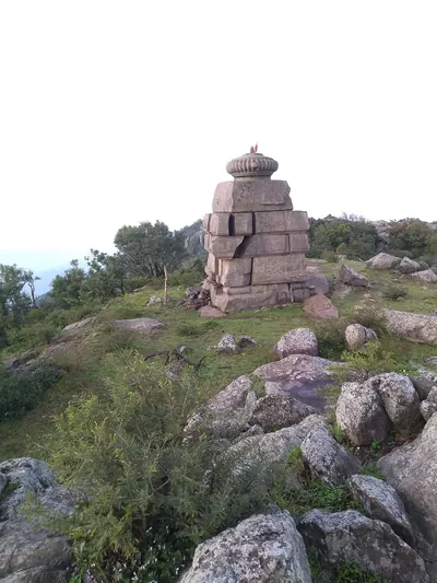
Mahendragiri
Mountain in the Eastern Ghats in southern Odisha. It is the Mahendra mountain of the Eastern Ganga grants, and on its summit the kings worshipped the god Gokarnasvamin. Old temples of large granite blocks stand on the top, and an inscription there records a Chola pillar of victory.
Malepadu
Village on the south bank of the Penner near Proddatur in Kadapa district. The copper plates of the Telugu Chola king Punyakumara and a stone inscription of Satyaditya came to light here in 1904. The 1956 editors of the Telugu Chola records thought it was perhaps Biriparu, one of the family's capitals.
Manchikallu
Village in the old Palnad taluk of the Guntur district, near Rentachintala. A fragment of an octagonal pillar came from here, with a Prakrit inscription of the Pallava king Simhavarman. D. C. Sircar took the inscription for the earliest Pallava record.
Mayidavolu
Village about twelve miles east of Narasaraopet, formerly in the Kistna and later the Guntur district, where the Prakrit copper plates of the Pallava crown prince Sivaskandavarman, the earliest Pallava charter, were dug up in 1899 on the site of an abandoned village with the ruins of a small old temple.
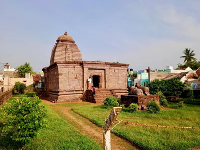
Mukhalingam
Village on the left bank of the Vamsadhara in the Srikakulam district. Since 1897 it has been identified with Kalinganagara, the capital named in the copper-plate grants of the Eastern Ganga kings. Its three Orissan-style Siva temples, the Madhukesvara, Bhimesvara and Somesvara, stand among ruins that stretch south to Nagarakatakam. They carry scores of Ganga inscriptions in Telugu and Sanskrit.
Nagarjunakonda
Hill and enclosed valley on the right bank of the Krishna in Palnad taluk, Guntur district. It is the site of Vijayapuri, capital of the Ikshvakus in the 3rd and early 4th centuries CE. A. H. Longhurst excavated its Buddhist monuments in 1927–31. The Archaeological Survey excavated the whole valley in 1954–60, before the Nagarjunasagar dam was to submerge it.
Ongole
Town on the Gundlakamma in the old Guntur district, now the headquarters of Prakasam district. H. Krishna Sastri suggested that it was the Omgodu given away in two Pallava copper-plate grants. The country round it was the Karmarashtra (later Kammanadu) of the Pallava and Eastern Chalukya charters. In the eighteenth century Ongole belonged to the Nawabs of the Carnatic (Arcot). The Company took over its management in 1790 and its government in 1801, when it was joined to the Nellore district.
Pithapuram
Town in the Godavari country, about twelve miles north by east of Kakinada (Cocanada). It has been identified with Pishtapura, the fortress taken by the Chalukya king Pulakesin II according to his Aihole inscription of 634–35. It has also been identified with the Pishtapura of Samudragupta's Allahabad inscription.
Polamuru
Village near Anaparti in the former Ramachandrapuram taluk of Godavari district. D. C. Sircar identified it with Puloburu, the village granted by the Vishnukundin king Madhavavarman Janashraya. The Eastern Chalukya Jayasimha I granted it again to the donee's son. Another scholar placed the village at a Polamuru in Bhimavaram taluk.
Ramatirtham
Village near Vizianagaram, where a family of pandits kept the copper-plate grant of the Vishnukundin king Indravarman. It was published in 1914 as the Ramatirtham plates. The grant itself concerns a village in the Plaki district, which most writers place in the Vizianagaram region.
Srikakulam
Town on the Langulya river, formerly Chicacole. In 1908 it was the headquarters of a taluk of the Ganjam district. A hoard of six copper-plate grants dug up in the town is now in the Madras Museum. It includes several of the oldest grants of the Ganga kings of Kalinganagara. In the Qutb Shahi period the town was the capital of the Chicacole Sarkar.
Talamanchi
Village north of Nellore town, in the old Nellore taluk. Here a ploughman turned up the copper-plate grant of the sixth year of the Chalukya king Vikramaditya I (660). He found it in land called Talamanchipadu, said to be the site of a former village.
Tippaluru
Village in the former Kamalapuram taluk of Kadapa district, the Tirpaluru of an early Telugu stone inscription of the Telugu Chola Punyakumara. The letters of the inscription resemble those of the Pallava Mahendravarman I. Its date contains the earliest mention of the hora (planetary hour) then known in south Indian inscriptions.
Undavalli
Village on the south bank of the Krishna opposite Vijayawada (Bezwada), in Guntur district. It is known for its large rock-cut temple of several storeys with a colossal reclining Vishnu. G. Jouveau-Dubreuil attributed the caves to the Vishnukundins. A. H. Longhurst thought them Pallava work of the early 7th century.
Vavveru
Village near Buchireddipalem in the old Kovur taluk of the Nellore district. About 1928 the copper-plate grant of the Pallava king Simhavarman, giving the village of Vilavatti, was dug up here from about eight feet below the old village site. Its editor thought Vilavatti might be Vavveru itself or the neighbouring Vidavaluru.
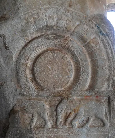
Velpuru
Village in the former Sattenapalle taluk of Guntur district. Its hilltop Ramalingasvamin temple holds a marble pillar with the only known stone inscription of the Vishnukundin dynasty. The hill is covered with old bricks of the kind found on Buddhist stupa mounds, and a second early Brahmi inscription has been found in the village.
Vengi (Pedavegi)
Village a few miles north of Eluru (Ellore). It stands on the site generally taken to be Vengipura, the capital of the Salankayana kings and then of the early Eastern Chalukyas. Nineteenth-century surveys found ruined temples and mounds spread over Pedavegi, Chinavegi and Denduluru. The city gave its name to the whole country between the Krishna and the Godavari.
Monuments
Jaggayyapeta stupa
c. 200 BCE
Small early Buddhist stupa on Dhana Bodu hill near Jaggayyapeta. Its old limestone casing slabs and Mauryan-type letters point to the 2nd century BCE. Pillar inscriptions of the Ikshvaku king Virapurushadatta record a later dedication.
Ghantasala stupa
c. 200 CE
Brick Buddhist stupa at Ghantasala in the Krishna delta, excavated by A. Rea in 1892. Its foundations show a solid core inside a ring of radiating cells. Rea dated it a little after the later work at Amaravati.
Alampur temples (Nava Brahma temples)
Group of early stone temples inside the old fort of Alampur on the Tungabhadra, in today's Telangana, known as the Nava Brahma or Navalingesvara temples. Inscriptions on them name queens and kings of the Chalukyas of Badami. They name a queen of Vikramaditya I (655–680), a queen of Vinayaditya, and Vijayaditya, under whom an enclosure was built in 704 and 713. The Nizam's Archaeological Department surveyed them in 1926-27 and compared their curved towers with the Papanatha temple at Pattadakal.
Bhairavakonda cave temples
Group of early rock-cut cave temples at Bhairavakonda in the old Udayagiri taluk of the Nellore district, reported by A. H. Longhurst in 1921. R. Gopalan described them as attributable to the Pallava age and closely resembling the caves of Mahendravarman I; the Madras epigraphy office linked one shrine, named Damodaresvaram in an archaic inscription, with the Ananda king Damodaravarman.
Chula-Dhammagiri monastery
Buddhist monastery buildings on the hill of Naharallabodu at Nagarjunakonda. It is identified with the monastery on the Lesser Dhammagiri east of Vijayapuri. There the lay woman Bodhisiri built an apsidal (round-ended) shrine for monks from Sri Lanka in the 14th year of the Ikshvaku king Virapurushadatta.
Nagarjunakonda Mahachaitya
The Great Stupa of the Ikshvaku city of Vijayapuri. Its limestone ayaka pillars carry Prakrit inscriptions of the princess Chamtisiri and other royal women, dated in the 6th year of King Virapurushadatta. A small bone relic was found in one of its chambers during the 1928–29 excavations.
Temples of Mukhalingam
Three Siva temples at Mukhalingam on the Vamsadhara: the Madhukesvara (Mukhalingesvara), Bhimesvara (Aniyankabhimesvara) and Somesvara. They are in the Orissan style and stand among the ruins of Kalinganagara, the capital of the Eastern Ganga kings. A grant of Anantavarman Chodaganga credits the Madhukesvara temple to an early king Kamarnava, and the Bhimesvara is thought to be named after the king Vajrahasta Aniyankabhima. Their walls and pillars carry scores of Telugu and Sanskrit inscriptions of the Gangas.
Undavalli cave temple
Four-storeyed rock-cut temple on the south bank of the Krishna opposite Vijayawada. Medieval inscriptions call it Anantashayanagudi, after its huge image of Vishnu lying on the serpent. No inscription records who cut it. G. Jouveau-Dubreuil (1917, 1920) gave it and the caves of Bezwada, Mogalrajapuram and Sitanagaram to the Vishnukundins. A. H. Longhurst (1924) judged it a Pallava monument of the time of Mahendravarman I.
Vijayapuri citadel
Citadel with brick walls and a moat, the heart of the Ikshvaku capital on the Krishna bank in the Nagarjunakonda valley, excavated in 1956–59. Inside and around it the excavators found barracks, royal houses, a stepped tank they connected with the horse sacrifice, temples of Karttikeya and Shiva, a river ghat and a large stadium.
Inscriptions
Mayidavolu plates of Sivaskandavarman
c. 250 CE
A Prakrit copper-plate grant issued from Kanchipura by the Pallava crown prince Sivaskandavarman to his official at Dhannakada (Amaravati). It gives the village of Viripara in Andhrapatha, the Telugu country, to two Brahmans. It was found in 1899 at Mayidavolu near Narasaraopet and edited by E. Hultzsch in 1901. It is the earliest Pallava copper-plate charter, and it shows the Pallavas ruling as far as the Krishna.
Nagarjunakonda inscriptions of Chamtisiri
c. 250 CE
Prakrit inscriptions at Nagarjunakonda recording gifts by the Ikshvaku princess Chamtisiri. They are cut on the ayaka pillars of the Great Stupa (Mahachaitya), on the pillars of a stone hall and on the floor of an apsidal shrine beside it. They are dated in the 6th, 15th and 18th regnal years of King Virapurushadatta.
Nagarjunakonda inscription of Bodhisiri
c. 268 CE
Prakrit inscription on the floor of an apsidal (round-ended) shrine on the Chula-Dhammagiri at Nagarjunakonda, dated in the 14th year of King Mathariputra (Virapurushadatta). It records the gifts of the lay woman Bodhisiri to Buddhist monks from Sri Lanka. It names the city of Vijayapuri, the Sriparvata and the trading town of Kantakasela.
Memorial pillar of Chamtamula, Nagarjunakonda
c. 273 CE
A carved pillar found near Stupa 9 at Nagarjunakonda, with a Prakrit inscription. It records that the sisters, mothers and queens of the dead Ikshvaku king Chamtamula raised it in the reign of his son Virapurushadatta. Vogel dated it to the king's 20th year. Sircar re-read the date as the cyclic year Vijaya, 273–74, the earliest known use of the cyclic year in Indian inscriptions.
Jaggayyapeta inscriptions of Virapurushadatta
c. 274 CE
Three copies of a Prakrit inscription on the ayaka pillars of the Jaggayyapeta stupa. They record the gift of five pillars at the eastern gate of the Great Chaitya by the artisan Siddhartha, in the 20th year of the Ikshvaku king Virapurushadatta. James Burgess found them in 1882, and they were the first Ikshvaku records to be discovered.
Nagarjunakonda inscription of Abhira Vasushena
c. 278 CE
A Sanskrit-Prakrit inscription found on the Krishna bank at Nagarjunakonda in 1958–59, dated in year 30 of the Abhira king Vasishthiputra Vasushena. It records that a local noble and men from Avanti, Sanjayapura and Vanavasa installed the god Ashtabhujasvamin, a form of Vishnu. D. C. Sircar dated it to about 278–79, and took it as evidence of a short Abhira break in Ikshvaku rule.
Nagarjunakonda inscription of Pushpabhadrasvamin
c. 295 CE
A Sanskrit inscription on a four-faced flagstaff pillar from a temple at the foot of Nagarjuna's hill, dated in the 16th year of the Ikshvaku king Ehuvula Chamtamula. It records that his son, the prince Virapurushadatta, built a shrine of the god Shiva as Pushpabhadrasvamin and gave it a village. It is the first direct evidence of Shaiva worship in the Ikshvaku royal house.
Manchikallu inscription of Simhavarman
c. 300 CE
A broken Prakrit inscription on part of an eight-sided stone pillar from Manchikallu in the Palnad taluk. It records gifts by the Pallava king Simhavarman of the Bharadvaja gotra to the priests of the god Jivasivasvamin. D. C. Sircar, who edited it, took it for the earliest Pallava record. He dated it first to the end of the 3rd century and later to the middle of the 4th.
Ellore plates of Devavarman
c. 345 CE
A Prakrit copper-plate grant of the 13th year of the Salankayana king Devavarman, issued from Vengipura. It is addressed to the villagers of Elura (Ellore, now Eluru), and gives twenty nivartanas of land and house sites to a Brahmin. E. Hultzsch edited it in 1908, and it gave the dynasty its modern name, 'the Salankayana Maharajas of Vengipura'.
Kanukollu plates of Nandivarman I
c. 350 CE
Prakrit copper-plate grant of the 14th year of the Salankayana king Nandivarman I, issued from Vengipura and found at Kanukollu in the Krishna delta. It gives a village as an agrahara (Brahmin village) to a Brahmin learned in the four Vedas of the Rathakara community. Its editor dated it to the close of the 3rd century, and D. C. Sircar to about the middle of the 4th.
Kolleru plates of Nandivarman II
c. 430 CE
Sanskrit copper-plate grant of the 7th year of the Salankayana king Nandivarman, eldest son of Chandavarman. He issued it from Vengipura, giving a village in the Kuduhara country to 157 Brahmins. It was reported found in the Kolleru lake before 1840. It was the first record of the dynasty to be known, and A. C. Burnell and J. F. Fleet edited it in the 1870s.
Peddavegi plates of Nandivarman II
c. 430 CE
A Sanskrit copper-plate grant of the 10th year of the Salankayana king Nandivarman II, found near Pedavegi north of Ellore and first published in 1924. It gives land in four villages to a temple of Vishnu. Its four-generation family line, beginning with Hastivarman of Vengi, is the backbone of the dynasty's history.
Omgodu grant of Simhavarman (No. 2)
c. 440 CE
A Sanskrit copper-plate grant of the Pallava king Simhavarman, son of the crown prince Vishnugopa, made in the fourth year of his reign. It gives the village of Omgodu in Karmarashtra, bounded by Kodikim, Narachadu, Kadakuduru and Penukaparru, to the Brahman Devasarman of Kundur. Its editor, H. Krishna Sastri, thought it a 7th-century copy of an earlier grant. Its date became part of the debate over the Lokavibhaga date of 436 for Simhavarman.
Vilavatti grant of Simhavarman
c. 446 CE
Sanskrit copper-plate grant issued from Paddukkara in the tenth year of the Pallava king Simhavarman, son of the crown prince Vishnugopa. It gives the village of Vilavatti in Mundarashtra, with the taxes due from it, to the Brahman Vishnusarman. It was found about 1928 at Vavveru in the Kovur taluk of Nellore, and C. R. Krishnamacharlu edited it in 1938. It lists the dues of craftsmen and traders and bears the earliest clear Pallava bull on its seal.
Jirjingi plates of Indravarman
c. 537 CE
A copper-plate grant of the Ganga king Indravarman, lord of Trikalinga, issued from Dantapura and dated in the year 39. It was found in an old temple site at Jirjingi near Tekkali in the Srikakulam country. When R. K. Ghoshal re-edited it in 1940, it was the oldest known record of the Eastern Gangas. It gives the village of Jijjika, the modern Jirjingi, to a Brahmin. On V. V. Mirashi's epoch (starting date) of the Ganga era, the year 39 falls in about 537.
Kalamalla inscription of Erikal Muturaju Dhananjaya
c. 575 CE
A damaged pillar inscription from Kalamalla in Kadapa district, dated from the shape of its letters to about 575 CE. Its editors called it one of the earliest records written entirely in Telugu.
Achyutapuram plates of Indravarman
c. 585 CE
Three small copper plates, found near Mukhalingam in the Srikakulam country. They record a gift of land made at Kalinganagara by the Ganga king Indravarman, alias Rajasimha, at the consecration of a tank in honour of his mother. The grant is dated in the 87th year of a reckoning that most later scholars took to be the Ganga era. The plates are among the best-preserved early Ganga grants and show the box-headed Kalinga script.
Erragudipadu inscription of Erikal-Mutturaju
c. 590 CE
An early Telugu stone record beside the Chennakesava temple at Erragudipadu in the Kamalapuram country. Its letters are almost the same as those of the Kalamalla pillar, and its editors dated it to the last quarter of the 6th century or a little later. It records a tax-free grant of 24 measures of land to a Brahmana in the reign of an Erikal-Mutturaju. The witnesses included a Mutturaju called Navapriya and a 'Vallava Dukaraju', perhaps a Pallava crown prince.
Malepadu plates of Punyakumara
c. 625 CE
Three Sanskrit copper plates with a lion seal, found at Malepadu in the Cuddapah district and given to the Madras Museum. They record a grant of land by the Telugu Chola king Punyakumara in the fifth year of his reign. Published in 1912, they gave the first family tree of the Telugu Cholas, from Nandivarman through Dhananjaya and Mahendravikrama. Their date has been put near 800, about 625 and about 750.
Tippaluru inscription of Punyakumara
c. 625 CE
An early Telugu stone record at Tippaluru in the Kamalapuram country. It was issued while Erikalla-Mutturaju Punyakumara ruled Renandu from his capital Chirpali. Its ornamental letters look like those of the Pallava Mahendravarman I's Vallam rock inscription. It names the weekday and the hora (planetary hour), the earliest mention of the hora then known in south Indian inscriptions.
Kopparam plates of Pulakesin II
c. 631 CE
A Sanskrit copper-plate grant of the 21st year of the Chalukya king Pulakesin II, probably 631, found near Kopparam in the Narasaraopet taluk of the Guntur district. It gives a field of 800 nivartanas in Karmarashtra to a Brahmana of Mugamur. E. Hultzsch read its 'Prithividuvaraja' as Pulakesin's brother Vishnuvardhana, still a subordinate in that year. Its first editor, K. V. Lakshmana Rao, identified him with another Chalukya prince.
Aihole inscription of Pulakesin II
634 CE
A Sanskrit poem of 37 verses by the Jaina poet Ravikirti, engraved in 634–35 on the Meguti temple at Aihole in Karnataka. It is the main account of the conquests of the Chalukya king Pulakesin II, including his eastern campaign. There he humbled the Kalingas and Kosalas, took Pishtapura (Pithapuram), and ravaged 'the water of Kunala', which Kielhorn identified with the Kolleru lake. He also defeated the Pallava king before Kanchi.
Amudalapadu plates of Vikramaditya I
660 CE
A Sanskrit copper-plate grant of the fifth year of the Chalukya king Vikramaditya I, from Amudalapadu in the Alampur taluk (now in Telangana). D. C. Sircar dated it to 30 April 660. It records the gift of a village to the king's guru Sudarsanacharya when the king was initiated into the Shaiva faith. Its letters are early Telugu-Kannada, and the editors of Epigraphia Telanganica (2023) call it the earliest Telugu inscription in Telangana.
Talamanchi plates of Vikramaditya I
660 CE
A Sanskrit copper-plate grant of the sixth year of the Chalukya king Vikramaditya I, found by a ploughman at Talamanchi in the Nellore taluk and now in the Madras Museum. It gives the village of Elasatti to the king's own teacher, Srimeghacharya. F. Kielhorn dated its solar eclipse to 13 July 660, and used it to fix Vikramaditya's accession between September 654 and July 655.
Gadval plates of Vikramaditya I
674 CE
A Sanskrit copper-plate grant of the 20th year of the Chalukya king Vikramaditya I, dated 25 April 674. It was kept at Gadwal (then in Hyderabad State, now in Telangana) and is said to have been found in the fields there. Issued from a camp at Uragapura on the south bank of the Kaveri, it names the three Pallava kings whom Vikramaditya defeated. E. Hultzsch noted two Telugu terms for measures of grain in it.
Chicacole plates of Devendravarman, son of Gunarnava
c. 681 CE
A copper-plate grant of the Ganga king Devendravarman, son of Gunarnava, issued from Kalinganagara and dated in the 183rd year of the Ganga reckoning. It is one of six sets of plates dug up together at Srikakulam (then Chicacole). It gives the village of Poppangika as an agrahara (Brahmin village) to six Brahmin brothers living at Kalinganagara. It shows an early use of a decimal zero beside the old number symbols.
Alamanda plates of Anantavarman
c. 802 CE
A copper-plate grant of the Ganga king Anantavarman, son of Rajendravarman, found near Alamanda in the Vizagapatam district (now Vizianagaram). It was issued from Kalinganagara on a solar eclipse at the consecration of a tank, and it gives the village of Medelaka to a Brahmin. It is dated in the 304th year of the reign of the Gangeya race, one of the clearest references to a Ganga era.
British Museum grant of Charudevi
A Prakrit copper-plate grant of the Pallava queen Charudevi, wife of the crown prince Vijaya-Buddhavarman, made in the reign of the Maharaja Vijaya-Skandavarman. It gives four nivartanas of land to the temple of Narayana at Dalura. Sir Walter Elliot secured the plates, which are now in the British Museum. They were reported to have been found near Guntur. J. F. Fleet first edited them in 1880, and E. Hultzsch edited them again in 1906.
Chendalur plates of Kumaravishnu II
A Sanskrit copper-plate grant issued from Kanchipura in the second year of the Pallava king Kumaravishnu II. It gives a field of 432 pattikas (a land measure) in the village of Chendalura in Karmarashtra to the Brahman Bhavaskandatrata. It was found buried in a pot of paddy husk at Chendalur in the Ongole taluk, and E. Hultzsch edited it in 1906. With it he edited a grant of the same village by the Eastern Chalukya Sarvalokasraya of 673, which was reported found in the same way.
Chikkulla plates of Vikramendravarman II
A Vishnukundin copper-plate grant, issued from Lendulura in the king's 10th regnal year, giving the village of Regonram near the Krishna to a Shiva temple. It was found in a tank at Chikkulla near Tuni, and F. Kielhorn edited it in 1897. Its date depends on the disputed Vishnukundin chronology.
Chura grant of Vijaya-Vishnugopavarman
A Sanskrit copper-plate grant, with some Telugu words, issued from Palotkata by the Pallava king Vijaya-Vishnugopavarman, son of a Simhavarman. It gives 108 nivartanas in the village of Chura in Karmarashtra to the Brahman Chasamisarman of Kundur. It was obtained at Narasaraopet and edited by C. R. Krishnamacharlu in 1938. It is written in letters of about the 7th century, and he took it to be a copy of an older grant.
Darsi plate of a Pallava grant
Single copper plate, the first of a lost Sanskrit grant of a Pallava king, found in a tobacco field at Darsi in the Nellore district and now in the Madras Museum. A great-grandson of the Maharaja Virakorchavarman issued it 'from the prosperous and victorious residence of Dasanapura'. E. Hultzsch edited it in 1892. Later scholars identified Virakorchavarman with Viravarman of the Nellore–Guntur line and Dasanapura with Darsi itself.
Ipur plates (set I) of Govindavarman's son Madhavavarman
Sanskrit copper-plate grant of the Vishnukundin king Madhavavarman, son of Govindavarman. He issued it from his camp at Kudavada in his 37th year, giving the village of Vilembali in the Guddadi district to a Brahmin. It is one of two Vishnukundin sets found at Ipur in Tenali taluk, and E. Hultzsch edited it in 1924. Whether its king is the great Madhavavarman I or a later Madhavavarman III is disputed.
Ipur plates (set II) of Madhavavarman II
A damaged Sanskrit copper-plate grant of the Vishnukundin king Madhavavarman II, son of Devavarman and grandson of Madhavavarman I, issued from [Ama]rapura. It calls the king lord of the Trikuta and Malaya mountains. It was found at Ipur in Tenali taluk, and E. Hultzsch edited it in 1924. It is in the most archaic script of all the Vishnukundin grants, and its regnal year has been read as 47, 37 and 17.
Kanteru plates of the Salankayanas
Two Sanskrit copper-plate grants of Salankayana kings found buried at Kanteru, six miles from Guntur. One is of Skandavarman in his first year, and one of a king Nandivarman, probably Nandivarman II. Both were issued from Vengi, and both gave land to Brahmins of the Maudgalya gotra. One seal shows a crouching bull, the clearest image of the dynasty's emblem.
Kanukollu plates of Skandavarman
A Sanskrit copper-plate grant of the first year of the Salankayana king Skandavarman, issued from Vengi. It was found at Kanukollu with a Prakrit grant of Nandivarman I. Its four-generation family line, published in 1960, showed that Skandavarman was a great-grandson of Hastivarman I through a second son of Nandivarman I.
Khanapur plates of Madhavavarman
An incomplete Sanskrit copper-plate grant of a Maharaja Madhavavarman, found in 1927 at Khanapur in Satara district, Maharashtra. It gives a village on the Krishna near Karad to two Brahmins. Its first plate, which would have named the dynasty, is lost. V. V. Mirashi and Y. R. Gupte, who edited it in 1956, gave it to the Vishnukundin Madhavavarman I because of the sacrifices and the imperial title it claims. They took it as proof of a Vishnukundin empire reaching into Maharashtra.
Mangalur grant of Simhavarman
A Sanskrit copper-plate grant issued from Dasanapura in the eighth year of the Pallava king Simhavarman, son of the crown prince Vishnugopa. It gives the village of Mangadur in Vengorashtra to eight Brahmans. J. F. Fleet published it in 1876 from Sir Walter Elliot's facsimiles. D. C. Sircar took Vengorashtra to be the southern edge of the Vengi country, and V. Venkayya suggested that Dasanapura was Darsi.
Omgodu grant of Skandavarman II (No. 1)
Sanskrit copper-plate grant of the Pallava king Vijaya-Skandavarman (Skandavarman II), issued from Tambrapa in the 33rd year of his reign. It gives the village of Omgodu in Karmarashtra to the Brahman Golasarman. H. Krishna Sastri edited it in 1920. It gave the earliest known members of the Pallava line of the Nellore–Guntur country and is dated in the old seasonal manner of the Prakrit charters.
Pikira grant of Simhavarman
A Sanskrit copper-plate grant issued from the camp at Menmatura in the fifth year of the Pallava king Simhavarman, son of the crown prince Vishnugopa. It gives the village of Pikira in Mundarashtra to the Brahman Vilasasarman. The village munsiff (headman) of Nelatur in the Ongole taluk sent in the plates, which had been the unclaimed property of a dead ascetic. E. Hultzsch edited the grant in 1906.
Polamuru plates of Madhavavarman Janashraya
A Sanskrit copper-plate grant of the Vishnukundin king Madhavavarman Janashraya, son of Govindavarman and grandson of Vikramahendra. He made it while crossing the Godavari to conquer the east. It gave the village of Polamuru to a Brahmin whose son received the same village again from the Eastern Chalukya king Jayasimha I. Noticed in 1914 and edited in Telugu-country journals, it is the key to the Vishnukundin chronology. But its regnal year, its date and even its king are disputed.
Ramatirtham plates of Indravarman
Sanskrit copper-plate grant of the Vishnukundin king Indravarman (Indrabhattarakavarman), issued from Puranisangama in his 27th year. It gives the village of Peruvataka in the Plaki district to a Brahmin. A family of pandits at Ramatirtham near Vizianagaram held it. It was noticed in 1909, and E. Hultzsch edited it in 1914. Its short family line confirmed the line of the Chikkulla plates and the Vishnukundin marriage with the Vakatakas.
Uruvupalli grant of Vishnugopavarman
A Sanskrit copper-plate grant of the Pallava crown prince Vishnugopavarman, issued from Palakkada in the 11th year of a king Simhavarman. It gives two hundred nivartanas of land in the village of Uruvupalli, in the country of Munda, to a temple at Kandukura. J. F. Fleet published it in 1876 from Sir Walter Elliot's facsimiles. Its findspot is unknown.
Velpuru pillar inscription of Madhavavarman
A Sanskrit inscription on a white marble pillar in the Ramalingasvamin temple at Velpuru, in the former Sattenapalle taluk of Guntur district. It names a Vishnukundin king Madhavavarman. Noticed in 1925, it is the only known stone inscription of the dynasty. Only the exposed part has been copied, because the pillar could not be removed from the temple.
Themes
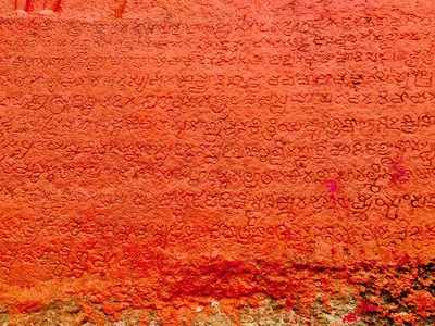
Language & literature
From Prakrit inscriptions and the first Telugu records to Nannaya, Pothana, Vemana and modern prose.
Music & dance
Annamacharya, Tyagaraja, Kuchipudi, Perini and the folk performance traditions.
Religion & philosophy
Buddhism, Jainism, Shaiva and Vaishnava movements, Islam and the Sufi orders, Christianity and village deities.
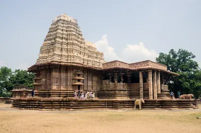
Temples & architecture
Stupas, rock-cut caves, temples, mosques, tombs and palaces, and how they were built.
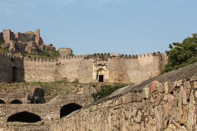
Forts & warfare
Hill forts, city walls, armies and the battles that changed who ruled the region.
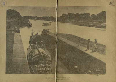
Trade & economy
Ports such as Motupalli and Machilipatnam, Golconda diamonds, tanks and farming, merchant guilds.
Government & administration
Kingship, the nayankara system, village officers, land revenue and law.
Society & communities
Castes, communities and tribes, and how social life changed over time, from scholarly sources.
Inscriptions & sources
How we know: inscriptions, coins, travellers' accounts, the Mackenzie kaifiyats and archives.
Land, rivers and water
How the land shaped Telugu history: a coastal plain with two great river deltas, the forested hills of the Eastern Ghats, and the dry Deccan plateau of Telangana and Rayalaseema. The deltas rarely failed, while the uplands lived by rain and by tanks. The pages below follow the rivers, the water works, the forests and hills, and the famines, floods and cyclones that the old records describe.
Rivers of the Telugu country
The Godavari, the Krishna and its tributaries the Tungabhadra and the Musi, the Penna (Pennar) and the Kolleru lake, as the gazetteers of about 1900 describe them: their courses through the Telugu country, their deltas, the holy places and towns on their banks, their floods and their crossings.
Old names of regions
The old country names of the Telugu lands and where the sources place them: Andhra and Telingana, Vengi between the two deltas, Kammanadu round Ongole, Velanadu in the western Krishna delta, Pakanadu between Ongole and Nellore, Renadu round Kadapa, the Kondapalli and Kondavidu countries, and the later names Circars and Ceded Districts. Names only: for how borders changed, see How the map changed.
References
Notes (0)
Sources (17)
Spotted an error on this page? Tell us
Last updated: