చిత్రమాలిక: పటం
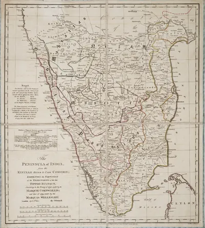 James Rennell, "The Peninsula of India ... exhibiting the partition of the territories of the late Tippoo Sultaun, according to the treaty of 1792 ... and that of 1799" (London, 1800), Royal Museums Greenwich K1047పటం · 1800
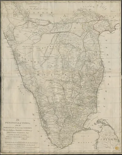 James Rennell, "The Peninsula of India, from the Khrishnah River to Cape Comorin" (London, 1788), British Library Maps K.Top.115.65.1: the Mahrattas, Visiapour, Adoni, Gooty, Golconda and the Circarsపటం · 1788
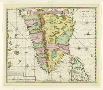 Kaart van Zuid-India Nova tabula terrarum Cucan, Canara, Malabaria, Madura, & Coromandella, cum parte septentrionali insulae Ceylon, in mari Indico Orientali edente Hadriano Relando (titel op object), NG-501-71పటం · 1720
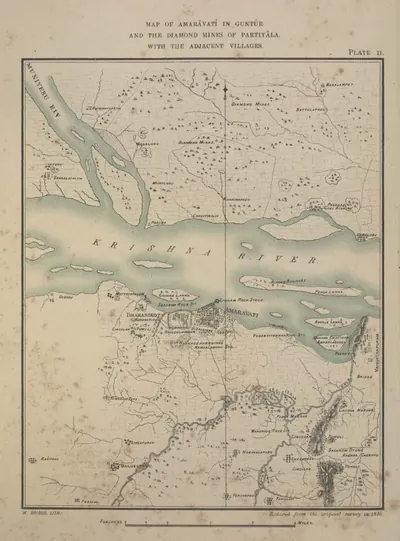 Map of Amaravati in Guntur with the adjacent villages, and the diamond mines of Partiyala (reduced from the survey of 1816) (Burgess 1887, Pl. II)పటం · 1887
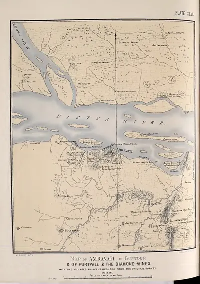 Map of Amravati in Guntoor & of Purtyall & the diamond mines, with the villages adjacent, reduced from the original survey in 1816 (Fergusson 1868, Pl. XLVI)పటం · 1868
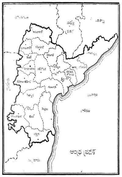 ఆంధ్రప్రదేశ్ జిల్లాల పటం, రాష్ట్ర ప్రభుత్వ పత్రిక నుంచి (1956)పటం · 1956
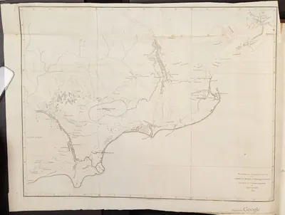 Map of part of the Northern Circars, 1793పటం · 1793
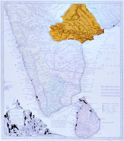 Map of peninsular India with the kingdom of Golconda coloured, published by the Homann Heirs, Nuremberg, 1733 (University of Michigan, Clark Library)పటం · 1733
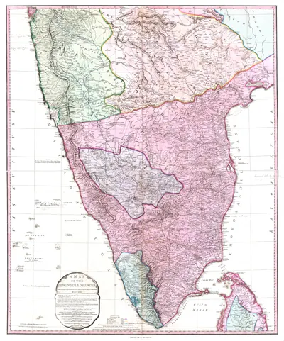 Map of Peninsular India, c. 1800పటం · c. 1800
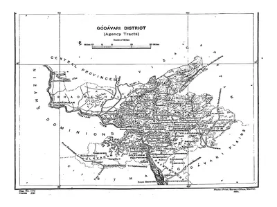 Map of the "Godavari District (Agency Tracts)" (Hemingway 1907, PDF p. 4)పటం · 1907
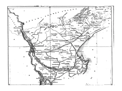 Map of the Godavari District (plains), folding map (Hemingway 1907, PDF p. 3)పటం · 1907
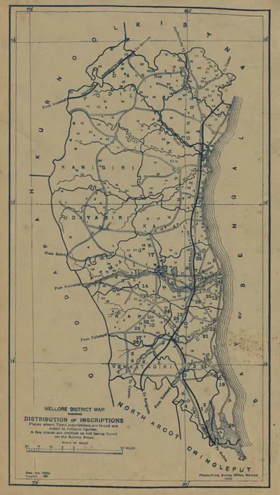 Nellore District map showing the distribution of inscriptions (Butterworth & Chetty 1905, PDF p. 7)పటం · 1905
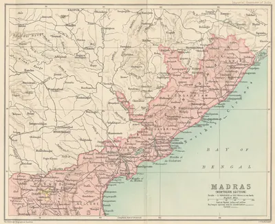 Northern Madras Presidency (Imperial Gazetteer, 1909)పటం · 1909
![Sujet : Machilipatnam -- ca 1750 Couverture : Inde Langue : français Éditeur : [s.n.]](https://media.teluguhistory.org/hyd/plan-de-masulipatnam-et-environs-par-le-capitaine-du-g-nie-leveux-btv1-400.webp) Plan de Masulipatnam et environs - par le capitaine du génie Leveux - btv1b53030090vపటం · 1750
Plan de Masulipatnam et environs - par le capitaine du génie Leveux - btv1b53030090vపటం · 1750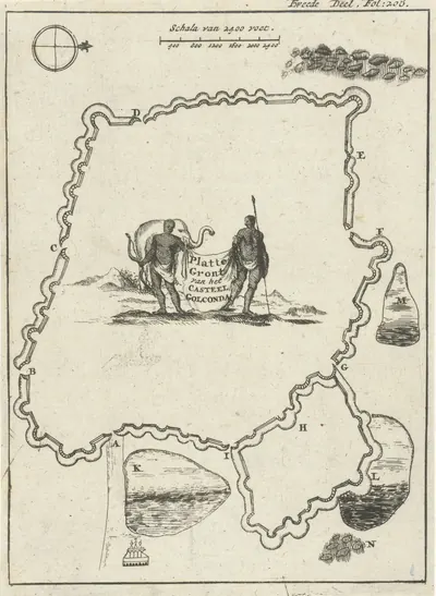 గోల్కొండ కోట నక్షా, 1693పటం · 1693
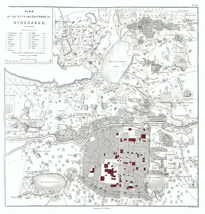 Plan of Hyderabad, 1854పటం · 1854
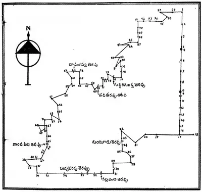 Plan of Pedapalakaluru village drawn by the editor from the boundaries given in the grant of Anavema Reddi (Ramesan 1962, Text Figure I, PDF p. 246)పటం · 1962
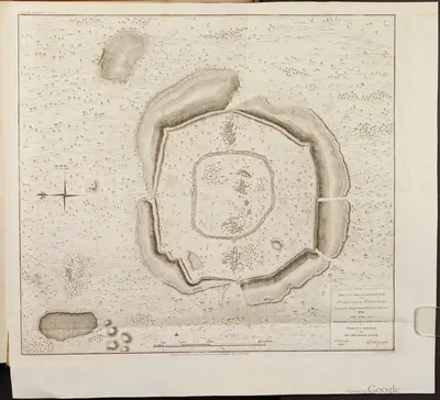 వరంగల్ కోట నక్షా, 1793పటం · 1793
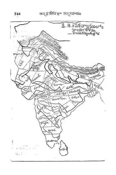 Telugu map of India in the seventh century AD with Hiuen Tsang's route ("క్రీ.శ. 7వ శతాబ్దములో హిందూదేశము") (Veerabhadra Rao 1910, printed p. 244 (PDF p. 284))పటం · 1910
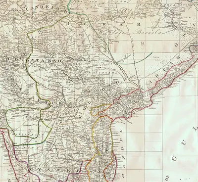 The Deccan in James Rennell's "Map of Hindoostan, or the Mogul Empire" (London, 1788): detail with Golconda, Telingana, Visiapour, Adoni, Dowlatabad, Berar and the Circarsపటం · 1788
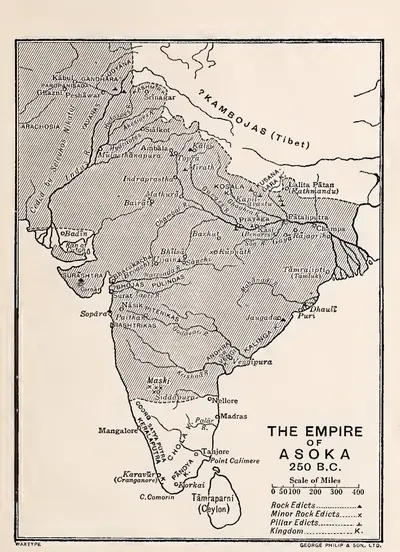 అశోకుని సామ్రాజ్యం, క్రీ.పూ. 250 (స్మిత్ 1920, చివరి పటం)పటం · 1920
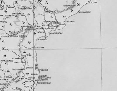 Vengi, the Krishna and the coast south to Kanchi and Tondamandalam: detail of "A Map of Southern India shewing the territories of the ancient dynasties according to the best authorities" (Elliot 1886, folding map, PDF p. 185)పటం · 1886