చిత్రమాలిక: పటం
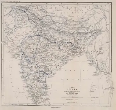 "A Map of India showing Tavernier's routes and the sites of the diamond mines mentioned by him" (Tavernier/Ball 1889, vol. I, folding map, PDF p. 499)పటం · 1889
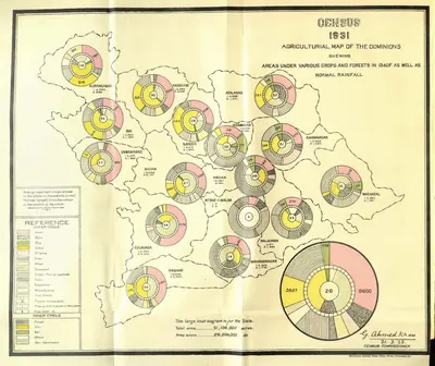 "Census 1931 Agricultural Map of the Dominions" (crops, forests and rainfall) (Census of India 1931, Hyderabad, folding map, PDF p. 35)పటం · 1933
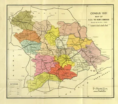 "Census 1931 Map of H.E.H. the Nizam's Dominions" (coloured) (Census of India 1931, Hyderabad, folding map, PDF p. 3)పటం · 1933
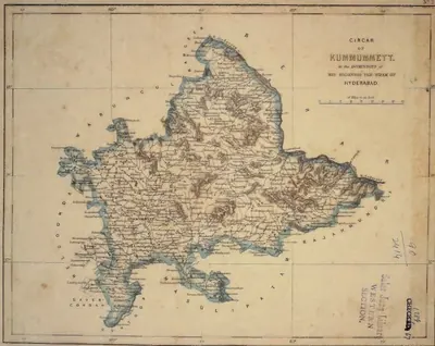 "Circar of Kummumett, in the Dominions of His Highness the Nizam of Hyderabad" (map No. 2 of an atlas presented to the Nizam by S. Veeraragavooloo Naidoo, Arcot, 1865); Kummumett is Khammam (identification ours)పటం · 1865
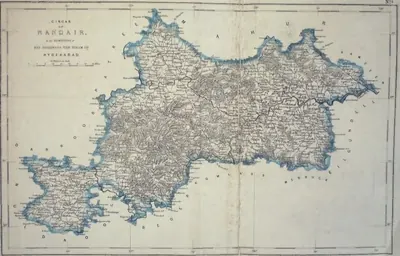 "Circar of Nandair, in the Dominions of His Highness the Nizam of Hyderabad" (map No. 9, atlas presented to the Nizam, 1865)పటం · 1865
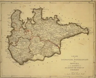 "Circars of Chunapoor, Davercondah and Pangull, in the Dominions of His Highness the Nizam of Hyderabad" (map No. 3, atlas presented to the Nizam, 1865); Davercondah is Devarakonda and Pangull Panagal (identifications ours)పటం · 1865
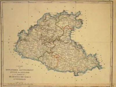 "Circars of Dowlutabad, Baythulwaddy, Pyton and Jaulnah, in the Dominions of His Highness the Nizam of Hyderabad" (map No. 12, atlas presented to the Nizam, 1865), with Aurangabad markedపటం · 1865
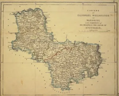 "Circars of Eilgundel, Mullangoor and Warungul, in the Dominions of His Highness the Nizam of Hyderabad" (map No. 8, atlas presented to the Nizam, 1865); Warungul is Warangal and Eilgundel Elgandal in Karimnagar district (identifications ours)పటం · 1865
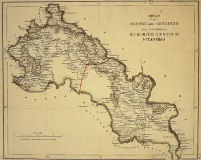 "Circars of Mahoor and Ramgheer, in the Dominions of His Highness the Nizam of Hyderabad" (map No. 14, atlas presented to the Nizam, 1865), noted on the map as not yet surveyedపటం · 1865
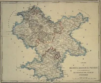 "Circars of Maiker, Bassim & Patree, in the Dominions of His Highness the Nizam of Hyderabad" (map No. 11, atlas presented to the Nizam, 1865)పటం · 1865
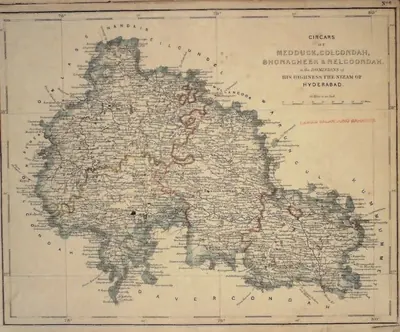 "Circars of Medduck, Golcondah, Bhonagheer & Nelgoondah, in the Dominions of His Highness the Nizam of Hyderabad" (map No. 6, atlas presented to the Nizam, 1865), with Hyderabad and Golconda marked; Bhonagheer is Bhongir (identification ours)పటం · 1865
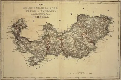 "Circars of Nuldroog, Kullianee, Beder & Kowlass, in the Dominions of His Highness the Nizam of Hyderabad" (map No. 7, atlas presented to the Nizam, 1865); Kullianee is Kalyani (identification ours)పటం · 1865
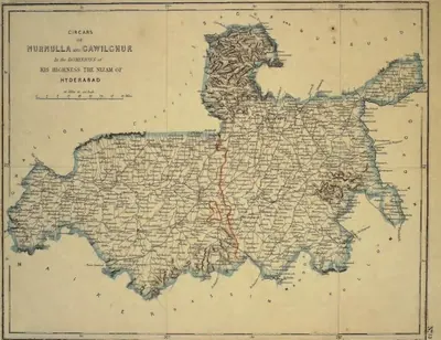 "Circars of Nurnulla and Gawilghur, in the Dominions of His Highness the Nizam of Hyderabad" (map No. 13, atlas presented to the Nizam, 1865)పటం · 1865
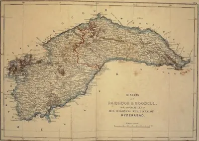 "Circars of Raichoor & Moodgul, in the Dominions of His Highness the Nizam of Hyderabad" (map No. 4, atlas presented to the Nizam, 1865); Raichoor is Raichur (identification ours)పటం · 1865
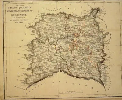 "Circars of Succur, Koolburga, Mulkhaid, Hoonanabad and Koilkondah, in the Dominions of His Highness the Nizam of Hyderabad" (map No. 5, atlas presented to the Nizam, 1865)పటం · 1865
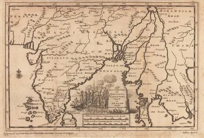 "De Koninkryken van Golconda, Tanassari, Pegu en Aracam, aan de Golf van Bengale", map published by Pieter van der Aa, Leiden, 1706పటం · 1706
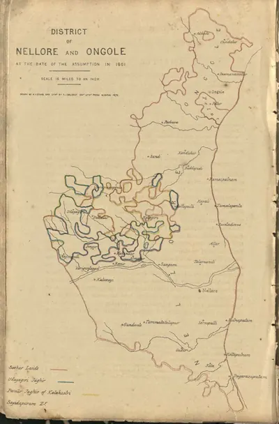 "District of Nellore and Ongole at the date of the assumption in 1801" (coloured lithograph) (Boswell 1873, PDF p. 496)పటం · 1873
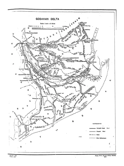 "Godavari Delta" map, with navigable canals, channels, drains and river embankments (Hemingway 1907, PDF p. 97)పటం · 1907
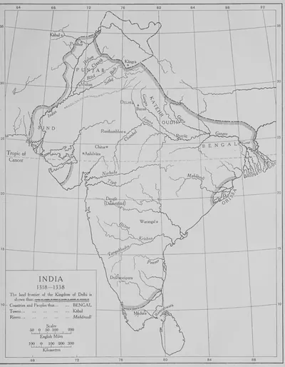 "India 1318–1338": the land frontier of the Kingdom of Delhi (The Cambridge History of India, Vol. III, 1928, Map 3, PDF p. 185 of the archive.org scan cambridgehistory03wols)పటం · 1928
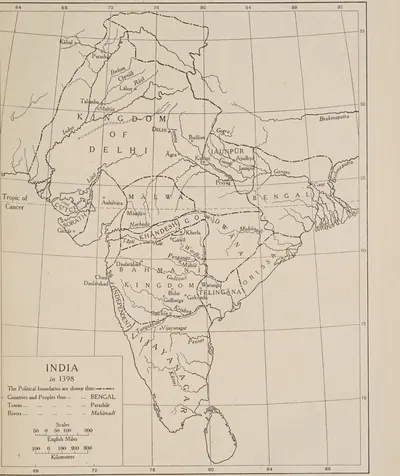 "India in 1398", showing Telingana between the Bahmani kingdom, Orissa and Vijayanagar (The Cambridge History of India, Vol. III, Map 4, between pp. 192 and 193, PDF p. 235 of the archive.org scan cambridgehistory03wols)పటం · 1928
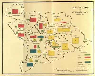 "Linguistic Map of Hyderabad State, Census 1931" (Census of India 1931, Hyderabad, folding map, PDF p. 241)పటం · 1933
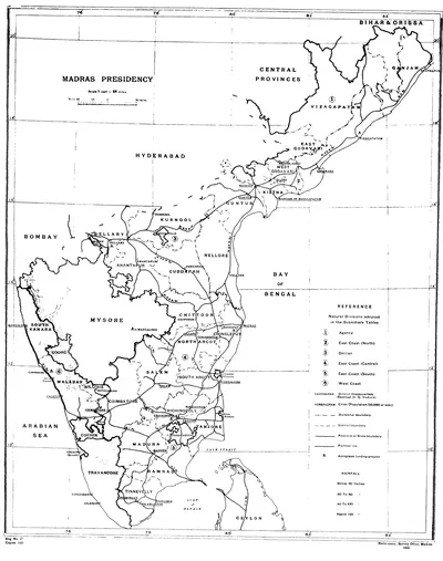 "Madras Presidency": key map of the districts and natural divisions, with East and West Godavari, Guntur and Chittoor (Census of India 1931, Madras, Part I, 1932)పటం · 1932
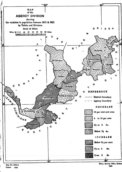 "Map of the Agency Division showing the variation in population between 1911 & 1921 by Taluks and Divisions": the hill tracts of Ganjam, Vizagapatam and Godavari (Census of India 1921, Madras, Part I, 1922)పటం · 1922
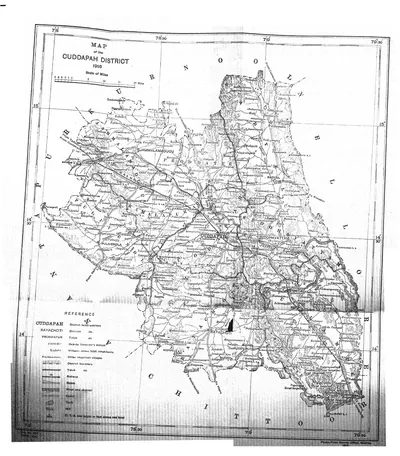 "Map of the Cuddapah District 1915" (Brackenbury 1915, folding map, PDF p. 1)పటం · 1915
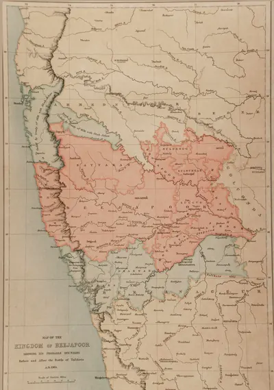 "Map of the Kingdom of Beejapoor, shewing its probable boundary before and after the Battle of Talikota, A.D. 1565" (Taylor and Fergusson, Architecture at Beejapoor, 1866, facing p. 1)పటం · 1866
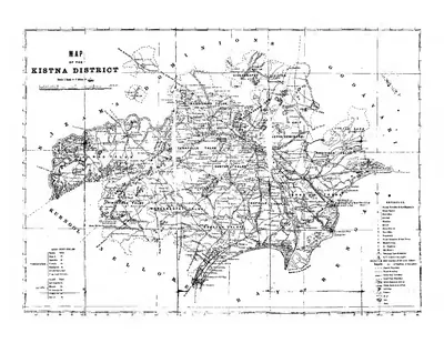 "Map of the Kistna District" (folding map) (Mackenzie 1883, folding map, PDF p. 1)పటం · 1883
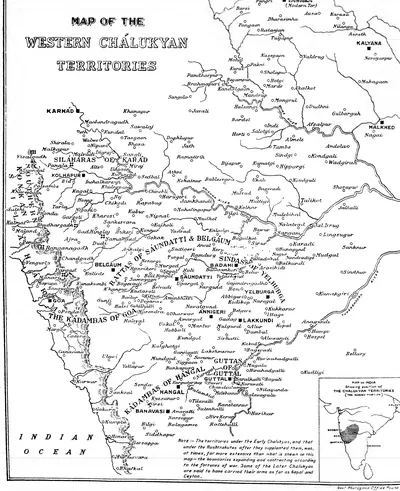 "Map of the Western Chalukyan Territories" (H. Cousens, The Chalukyan Architecture of the Kanarese Districts, 1926, map before the list of plates (PDF p. 5))పటం · 1926
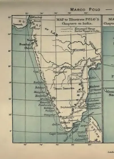 "Map to illustrate Polo's chapters on India" (Marco Polo, Book III) (Yule & Cordier 1903, to face p. 312 (PDF p. 363, lower part))పటం · 1903
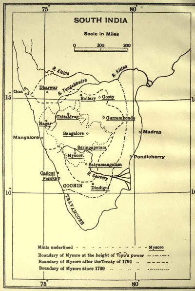 "Mints of Haidar Ali and Tipu Sultan": map with the boundaries of Mysore at the height of Tipu's power, after 1792 and after 1799 (Henderson 1921, frontispiece)పటం · 1921
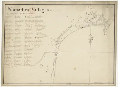 "Noms des villages de la province de Nizampatnam et du Condavir": French manuscript map of the coast with numbered villages and a key, 18th centuryపటం · 1750
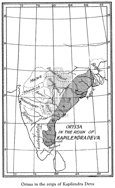 "Orissa in the reign of Kapilendra Deva": map in R. D. Banerji, History of Orissa, Vol. I (1930), facing p. 296పటం · 1930
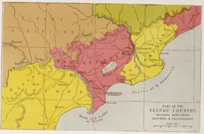 "Part of the Telugu Country, including Masulipatam, Guntoor, & Rajahmundry", map from the Church Missionary Atlas, 3rd edition, London, 1862 (cropped to the map)పటం · 1862
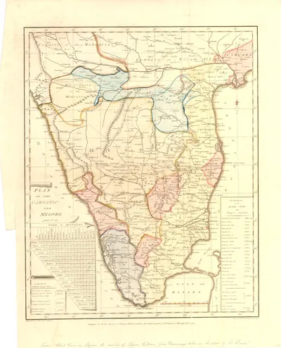 "Plan of the Carnatic and Mysore": hand-coloured map engraved after Robert Home, published 1794 (British Museum)పటం · 1794
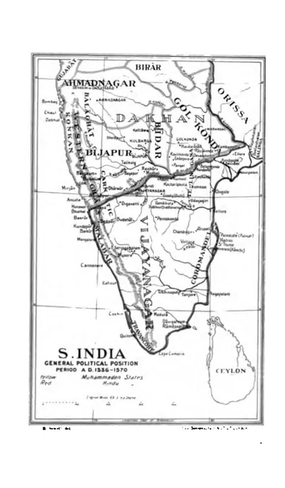 "S. India, General Political Position, Period A.D. 1336-1570" (Sewell 1900, to face p. 1 (PDF p. 38))పటం · 1900
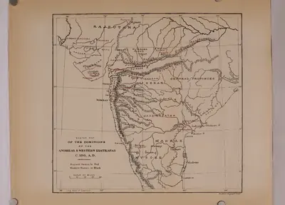 సు. క్రీ.శ. 150 నాటి ఆంధ్రుల, పశ్చిమ క్షత్రపుల రాజ్యాల రేఖాపటం (రాప్సన్ 1908)పటం · 1908
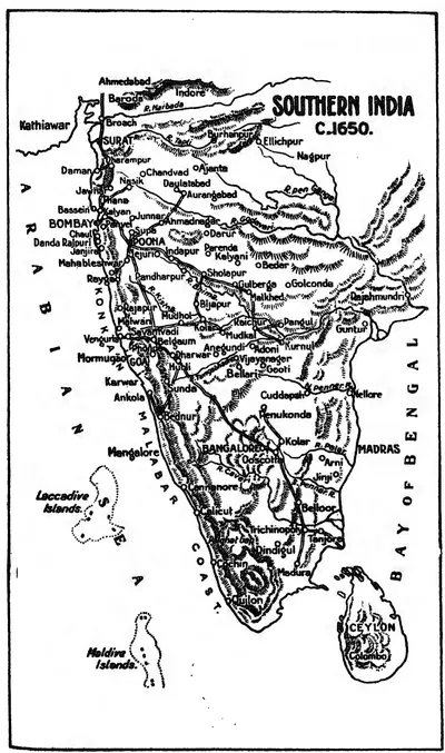 "Southern India c. 1650": map in the Source Book of Maratha History (1928), facing p. 176పటం · 1928
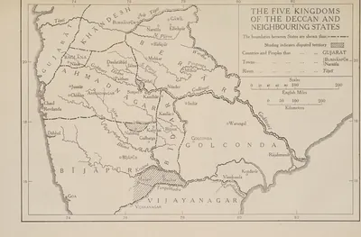 "The Five Kingdoms of the Deccan and Neighbouring States", with Golconda holding Telingana from Warangal to Rajahmundry and Kondavir (The Cambridge History of India, Vol. III (1928), Map 6)పటం · 1928
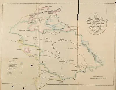 "The Nizam's Dominions, shewing the territories retained, those retransferred and those ceded" (coloured map) (Briggs 1861, folding map, PDF p. 26)పటం · 1861
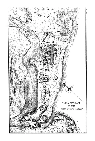 "Vizagapatam in 1758 (From Orme's History)" (Francis 1907, PDF p. 62)పటం · 1907
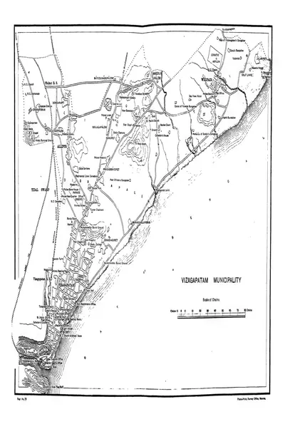 "Vizagapatam Municipality" town plan (Francis 1907, PDF p. 344)పటం · 1907
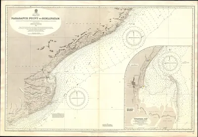 Chart No 1711 Narasapur Point to Bimlipatam, Published 1893, New Edition 1914పటం · 1896
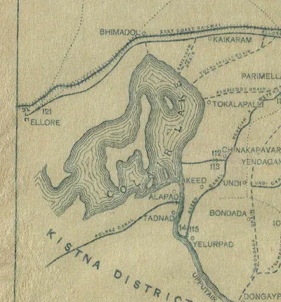 Ellore and Colair (Kolleru) Lake, detail of the "Sketch Map of the Godavari Delta showing positions of the principal irrigation & navigation works" (Walch 1896, folding map, PDF p. 17)పటం · 1896
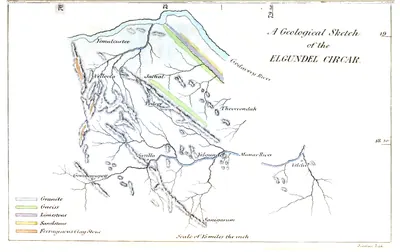 Geology Elgundel Circarపటం · 1851
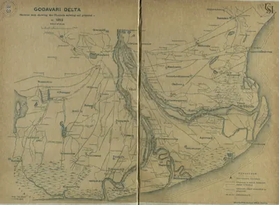 Godavari delta: "Skeleton map showing the Channels existing and proposed in 1853" (Walch 1896, PDF p. 115)పటం · 1896
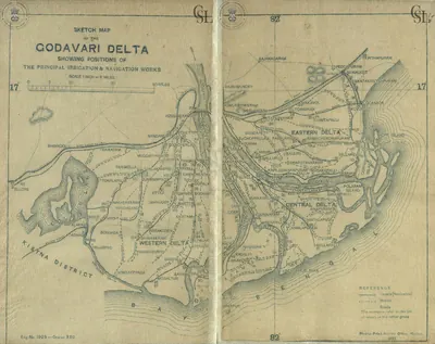 Godavari delta: "Sketch Map of the Godavari Delta showing positions of the principal irrigation & navigation works" (two halves joined) (Walch 1896, PDF pp. 17-18)పటం · 1896
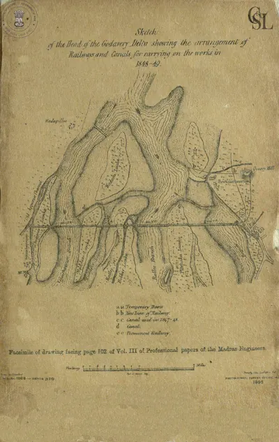 Godavari delta: "Sketch of the Head of the Godavery Delta showing the arrangement of" railways and canals for carrying on the works in 1848-49 (Walch 1896, facsimile, PDF p. 58)పటం · 1896
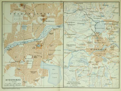 Hyderabad and Golconda (Baedeker, 1914)పటం · 1914
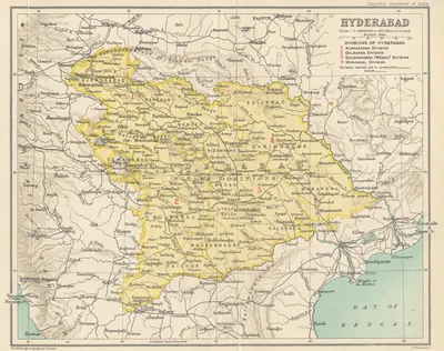 Hyderabad State (Imperial Gazetteer, 1909)పటం · 1909