Railways in the Telugu lands, 1868–1966
How the railway came to the Telugu lands, side by side in the Madras districts and the Nizam's Hyderabad State. It follows the Madras Railway's line through Rayalaseema from 1868, the Nizam's Guaranteed State Railway from 1874, the Southern Mahratta and South Indian lines, the East Coast line with its great bridge over the Godavari, the Kazipet–Balharshah line, what the trains carried, the towns that grew around junctions, the Nizam's purchase of his railway in 1930 and the railway zones after 1950.
Download
From 1868 onwards, railways reached every part of the Telugu lands.12 They were built by companies and governments in both the Madras Presidency and the Nizam’s Hyderabad State.34 The trains carried grain, cotton, coal and pilgrims, made famine relief faster, and turned a few junctions into busy towns.567 This page follows the lines in the order they were built, and tells what they changed.
About the sources. The dates come from the district gazetteers of Anantapur (1905), Godavari (1907), Vizagapatam (1907) and Nellore (1942), and from the Imperial Gazetteers of Madras (1908) and Hyderabad (1909).189101112 For the Nizam’s railway the page uses the Hyderabad Statistical Year Book of 1938, the census of 1931 and a government souvenir of 1947.21314 The sources sometimes give different dates for the same line, because one may give the first opening and another the completion.
The first lines through Rayalaseema
The first railway in the Telugu lands was the north-west line of the Madras Railway.1 It ran from Madras through the Rayalaseema districts towards Bombay.13 The Anantapur gazetteer gives its dates:1
The Madras Railway was one of the old company lines.11 The government guaranteed the company 5 per cent a year on its money.11 By 1908 the government had paid over ten million pounds to make up the company’s losses.11
The Nizam’s railway
In Hyderabad State the first line ran from Wadi, on the Bombay–Madras line, to Secunderabad.24 It opened on 9 October 1874.2 The Nizam’s government provided the money, and the line was worked first by the Great Indian Peninsula Railway, then by a state agency.14 From January 1885 an English company, the Nizam’s Guaranteed State Railway Company, worked it.4
The company carried the line east quickly. It opened from Secunderabad towards Vijayawada (then Bezwada) on 8 April 1886.2 A branch from Dornakal to the Singareni coal mines opened on 1 January 1888.2 By 1909 the main line ran 310 miles from Wadi to Vijayawada.12 A metre-gauge line, the Hyderabad–Godavari Valley Railway, opened from Secunderabad to Manmad on 21 October 1899.2
The Southern Mahratta and South Indian lines
In the late 1880s and early 1890s two more companies built lines across Rayalaseema and the Nellore district.101 The Southern Mahratta Railway’s line from Guntakal to Vijayawada was, in the words of the Imperial Gazetteer, its most important section.11 It joined the rich Krishna and Godavari deltas to the dry Deccan.11 Its section through the Nellore district, between Cumbum and Vijayawada, opened on 3 October 1889.10
The South Indian Railway came north from Katpadi. Its line through Venkatagiri to Gudur opened on 15 September 1887, and it reached Nellore on 1 November 1889.10 In 1892 metre-gauge lines met at Dharmavaram: one from Guntakal and one from Pakala through the western taluks of Kadapa (then Cuddapah).1 Some earthwork for the Guntakal line had been done as famine relief in 1884–85.1
The East Coast line and the Godavari bridge
The East Coast Railway was built by the state, on the broad gauge.915 It had to open in pieces, because bridging the Godavari and the Krishna took a long time.15 The Nellore gazetteer gives the order:15
- Visakhapatnam (Waltair) to Rajahmundry, and Vijayawada to Kovvur, 189315
- Vijayawada to the Krishna canal, 189715
- Nellore to the Krishna canal, 189815
- Rajahmundry to Kovvur, across the Godavari, August 190015
The bridge over the Godavari at Rajahmundry was one of the finest in the Presidency.8 It had 56 spans of 150 feet each, about 9,000 feet in all, on stone piers sunk up to 100 feet below low water.8 It opened to goods traffic in 1900.8 Kakinada (then Cocanada) was left off the main line and got only a branch from Samalkot, and its people protested strongly.8
North of Visakhapatnam the line was worked by the Bengal–Nagpur Railway, and the section to the north opened in 1894.9 A branch from Vizianagaram to Raipur in the Central Provinces was first surveyed in 1881.9 Through traffic between Raipur and Vizianagaram began only in 1932.7
What the railway carried
By 1904 the Madras Presidency had 3,545 miles of railway, against 2,108 miles in 1891.11 The Imperial Gazetteer thought the railway’s biggest effect was on famine and prices.5 In the famine of 1876–78, bullock carts were the only way to move grain, and there was no fodder for the bullocks.5 By 1908, when a harvest failed, grain quickly came in by rail from elsewhere.5
The trains also brought cheaper salt and imported goods to inland districts.5 Crowds at temple festivals grew larger, because pilgrims no longer had to walk.5 In Hyderabad State the railway carried 300,679 tons of goods out of the state in 1903, mostly oilseeds and cotton to Bombay.6 Coal from Singareni was carried separately: 343,945 tons in 1901, against 81,882 tons in 1891.12
Junction towns
Some places grew because the railway met there. The 1931 census called Vijayawada “the most important railway junction in South India”.7 Its station had one of the longest platforms in India.7 Gudur, where several lines met in the Nellore district, was also the place where cholera often began.1016
In Hyderabad, the 1951 census found that Secunderabad and Lallaguda had one of the largest railway populations in South India.17 In 1946–47 the Nizam’s railway employed about 21,000 people.18 With their families, the railway supplied food to about 90,000 people.18
New lines in Hyderabad, 1909–1932
The Nizam’s state kept building in the twentieth century. The 1931 census lists the new lines of the 1920s:13
- a 24.52-mile line from Karepalli to Kothagudem, opened in 1927 for the coal mines13
- the Kazipet–Balharshah line, 145.69 miles long, which shortened the journey between north and south India13
- metre-gauge links to Kurnool and Mysore, and lines to Bidar and to Purli13
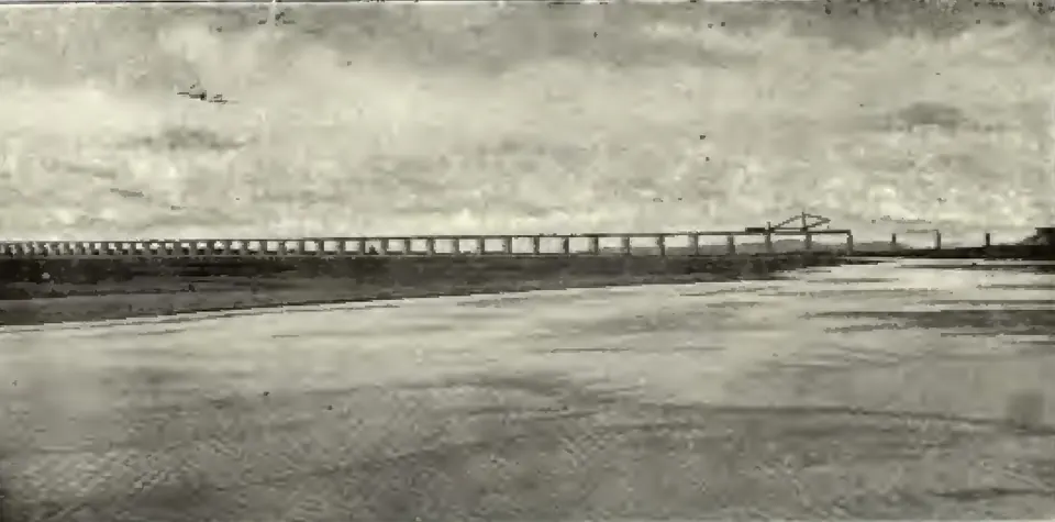
The Kothagudem line was built for coal, but in practice it also helped pilgrims going to Bhadrachalam, who had gone by cart before.13 The Kazipet–Balharshah line crossed the Godavari at Ramagundam on a bridge wide enough for carts too.13 By 1931 the state had 1,180.49 miles of railway.13
The Nizam buys his railway
On 1 April 1930 the Nizam’s government bought the railway from the company for £8,300,000.19 After taking off its own shares and funds, it paid £4,570,000.19 The line was renamed H.E.H. the Nizam’s State Railway.4 Its profits now went to the state instead of to the shareholders.20
In 1938 the system had 1,348 miles of line, 688 on the broad gauge and 660 on the metre gauge.4 In 1932 it began to run buses as well (see Roads, buses and ports).21 In 1945–46 its net earnings came to 18.9 per cent of the money invested in it.21 For all Indian railways the figure was only 8.51 per cent.21
After 1947: the railways join the zones
From 1 April 1950 the railways of the former princely states passed to the Government of India.22 In 1948 the Nizam’s State Railway, with 1,306 miles, had been the largest of them.23 The government then grouped all railways into zones:22
- the Southern Railway, formed on 14 April 1951 from the Madras and Southern Mahratta, South Indian and Mysore railways22
- the Central Railway, formed on 5 November 1951 from the Great Indian Peninsula, Nizam’s State and other railways22
By 1966–67 a newer zone, the South Central Railway, with its offices at Secunderabad, ran about half the railway in Andhra Pradesh. It had 403 of the state’s 819 stations.24 The Southern Railway had 365 stations and the South Eastern Railway 49.24
Where the sources disagree
The sources give three different years for the Kazipet–Balharshah line:
- The Hyderabad Statistical Year Book of 1938 says the line first opened for traffic on 1 February 1924.2
- A Hyderabad government souvenir of 1947 says it opened for through traffic in 1928.14
- The censuses of 1931 and 1951 say it was completed in 1929.1325
The dates may describe different stages of the work. The sources do not explain the difference.
They also differ by a few days on the first opening east of Secunderabad. Campbell (1898) says the Nizam formally opened the line to Warangal on 3 April 1886.26 The Statistical Year Book gives 8 April 1886 for the first opening of the Secunderabad–Vijayawada line.2
Footnotes
-
W. Francis, Madras District Gazetteers: Anantapur (1905), p. 76 (archive.org (opens in a new tab)). ↩ ↩2 ↩3 ↩4 ↩5 ↩6 ↩7 ↩8 ↩9 ↩10 ↩11
-
H.E.H. the Nizam’s Government: Statistical Year Book 1347 Fasli (1938) (1941), p. 768, table of railways open for traffic (archive.org (opens in a new tab)). Paraphrased. ↩ ↩2 ↩3 ↩4 ↩5 ↩6 ↩7 ↩8 ↩9
-
Imperial Gazetteer of India, Provincial Series: Madras, Vol. I (1908), p. 75 (archive.org (opens in a new tab)). ↩ ↩2
-
Statistical Year Book 1347 Fasli (1938) (1941), p. 790 (archive.org (opens in a new tab)). Paraphrased. ↩ ↩2 ↩3 ↩4 ↩5
-
Imperial Gazetteer: Madras, Vol. I (1908), p. 77 (archive.org (opens in a new tab)). ↩ ↩2 ↩3 ↩4 ↩5 ↩6
-
Imperial Gazetteer of India, Provincial Series: Hyderabad State (1909), p. 44 (archive.org (opens in a new tab)). ↩ ↩2
-
Census of India, 1931, Vol. XIV: Madras, Part I, Report (1932), p. 62 (archive.org (opens in a new tab)). ↩ ↩2 ↩3 ↩4
-
F. R. Hemingway, Madras District Gazetteers: Godavari, Vol. I (1907), p. 133 (archive.org (opens in a new tab)). ↩ ↩2 ↩3 ↩4 ↩5
-
W. Francis, Madras District Gazetteers: Vizagapatam, Vol. I (1907), p. 144 (archive.org (opens in a new tab)). ↩ ↩2 ↩3 ↩4
-
W. E. Johns, Gazetteer of the Nellore District, brought up to 1938, Vol. A (1942), p. 185 (archive.org (opens in a new tab)). Paraphrased. ↩ ↩2 ↩3 ↩4 ↩5
-
Imperial Gazetteer: Madras, Vol. I (1908), p. 76 (archive.org (opens in a new tab)). ↩ ↩2 ↩3 ↩4 ↩5 ↩6 ↩7
-
Imperial Gazetteer: Hyderabad State (1909), p. 45 (archive.org (opens in a new tab)). ↩ ↩2 ↩3
-
Census of India 1931, Vol. XXIII: H.E.H. the Nizam’s Dominions, Part I: Report (1933), p. 29 (archive.org (opens in a new tab)). ↩ ↩2 ↩3 ↩4 ↩5 ↩6 ↩7 ↩8 ↩9
-
Hyderabad-Deccan (souvenir of H.E.H. the Nizam’s Government for the Asian Regional Labour Conference, 1947), p. 99 (archive.org (opens in a new tab)). Paraphrased. ↩ ↩2 ↩3
-
Johns, Nellore District Gazetteer (1942), p. 186 (archive.org (opens in a new tab)). Paraphrased. ↩ ↩2 ↩3 ↩4 ↩5 ↩6 ↩7
-
Johns, Nellore District Gazetteer (1942), p. 205 (archive.org (opens in a new tab)). Paraphrased. ↩
-
Census of India, 1951, Vol. IX: Hyderabad, Part I-A: Report (1953), p. 259 (archive.org (opens in a new tab)). Paraphrased. ↩
-
Hyderabad-Deccan (1947), p. 101 (archive.org (opens in a new tab)). Paraphrased. ↩ ↩2
-
Census of India 1931, Vol. XXIII: H.E.H. the Nizam’s Dominions, Part I (1933), p. 32 (archive.org (opens in a new tab)). ↩ ↩2
-
Statistical Year Book 1347 Fasli (1938) (1941), p. 791 (archive.org (opens in a new tab)). Paraphrased. ↩
-
Hyderabad-Deccan (1947), p. 100 (archive.org (opens in a new tab)). Paraphrased. ↩ ↩2 ↩3
-
India 1955: A Reference Annual (1955), p. 302 (archive.org (opens in a new tab)). Paraphrased. ↩ ↩2 ↩3 ↩4
-
India 1955: A Reference Annual (1955), p. 301 (archive.org (opens in a new tab)). Paraphrased. ↩
-
Statistical Abstract, Andhra Pradesh, 1966 and 1967 (1967), p. 145, table 11.2 (archive.org (opens in a new tab)). Cite-only; figures only. ↩ ↩2
-
Census of India, 1951, Vol. IX: Hyderabad, Part I-A: Report (1953), p. 75 (archive.org (opens in a new tab)). Paraphrased. ↩
-
A. Claude Campbell, Glimpses of the Nizam’s Dominions (1898), p. 144 (archive.org (opens in a new tab)). ↩
Photos
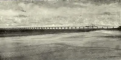 "Railway Bridge across the Godavari on the Kazipet-Balharshah Railway" (Census of India 1931, Hyderabad, PDF p. 50)Historic photograph · 1933
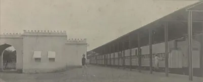 Hyderabad: "H. H. the Nizam's Private Railway Station" (Campbell 1898, p. 209)Historic photograph · 1898
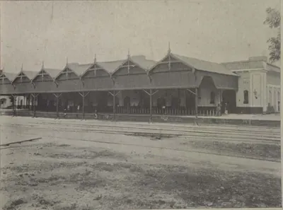 Hyderabad: "The Hyderabad Railway Station" (Campbell 1898, p. 143)Historic photograph · 1898
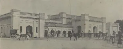 Hyderabad: "The Railway Station, Hyderabad" (Campbell 1898, p. 209)Historic photograph · 1898
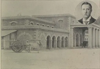 Secunderabad: "The Secunderabad Railway Station" (Campbell 1898, p. 144)Historic photograph · 1898
References
Notes (0)
Sources (14)
Spotted an error on this page? Tell us
Last updated: