Kondapalli
Town and hill fortress on the north side of the Krishna, about ten miles north-west of Vijayawada. The fort is said to have been built by the Reddi kings of Kondavidu in the 14th century. It passed to the Gajapatis, was ceded to the Bahmanis in 1470, and was taken by Krishnadeva Raya about 1515 and by Golconda in 1531. It was later the seat of the Kondapalli or Mustafanagar Circar.
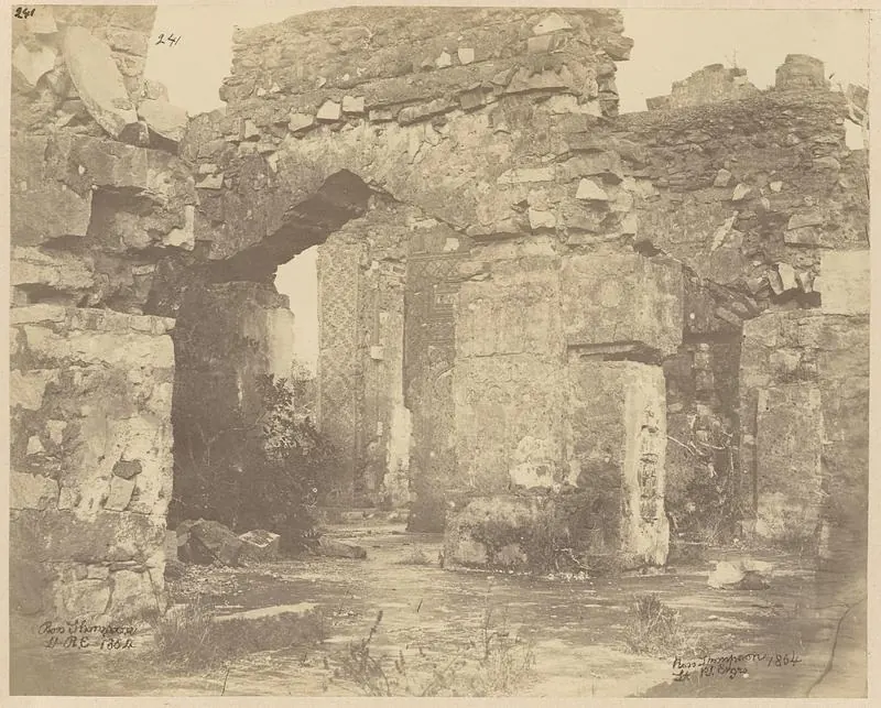
Kondapalli is a town and hill fortress in the Vijayawada (then Bezwada) taluk of the old Krishna (then Kistna) district. The Imperial Gazetteer of 1908 places it at 16°37′ N, 80°33′ E, and gives its population as 4,799 in 1901.1 It describes the town as “now unimportant, but … formerly a fortress of considerable strength and the capital of one of the five Northern Circars”.1 In 1882 Robert Sewell called it “a fine hill-fortress very picturesquely situated amongst hills and forest”, eight miles north-west of Vijayawada.2
The Reddi fort
The Kistna manual says that “Kondapalle hill fort is said to have been built” in the reign of Anuvema Reddi.3 The Imperial Gazetteer says that it was “built about A.D. 1360 by the Reddi kings of Kondavid”.1
Judging from an inscription of the tenth century, Sewell thought the fort was not in existence then.2 He wrote that “it probably dates from about the fourteenth century when the Reddis were in power”.2 One of his correspondents gave the dates within which it was completed as 1334 to 1362, though the first figure is indistinct in the print.2
M. Somasekhara Sarma says that Peda Komati Vema gave the country north of the Krishna to his brother Macha.4 Macha fortified Kondapalli and made it his seat.4 See the Kondapalli fort and the Reddis of Kondavidu.
Later history
The Kistna manual says that when the Reddi dynasty ended, the Gajapati kings of Orissa extended their power over the district.3 It adds that the Gajapati Vidyadhara built a reservoir at Kondapalli.3 In 1470 the Gajapati Purushottama was seeking help against a rival.56 He ceded “the districts of Rajahmundry and Kondapalle” to the Bahmani sultan.56 The Hindu people of Kondapalli soon revolted and killed the Muslim governor.56 About 1477–78 the sultan retook the place, destroyed its temple and built a mosque on the site.56
The Imperial Gazetteer records later captures of the fort:1
- by Krishnadeva Raya of Vijayanagar about 15151
- by Sultan Quli Qutb Shah of Golconda in 15311
- by the troops of Aurangzeb in 16871
- by General Caillaud in 17661
Sewell noted inscriptions recording the Muslim capture of Kondapalli.7 He also noted a copper-plate grant of 1350 in the name of Ana Vema Reddi.7 M. Somasekhara Sarma considered that grant spurious (false), because its date details do not agree.8
Footnotes
-
Imperial Gazetteer of India: Madras, Vol. I (1908), p. 323 (archive.org (opens in a new tab)). ↩ ↩2 ↩3 ↩4 ↩5 ↩6 ↩7 ↩8
-
Robert Sewell, Lists of the Antiquarian Remains in the Presidency of Madras, Vol. I (1882), p. 49 (archive.org (opens in a new tab)). ↩ ↩2 ↩3 ↩4
-
Gordon Mackenzie, A Manual of the Kistna District (1883), p. 10 (archive.org (opens in a new tab)). ↩ ↩2 ↩3
-
M. Somasekhara Sarma, History of the Reddi Kingdoms (1948), p. 158 (archive.org (opens in a new tab)). ↩ ↩2
-
F. R. Hemingway, Madras District Gazetteers: Godavari, Vol. I (1907), p. 26 (archive.org (opens in a new tab)). ↩ ↩2 ↩3 ↩4
-
Hemingway, Godavari (1907), p. 27 (archive.org (opens in a new tab)). ↩ ↩2 ↩3 ↩4
-
Sewell, Lists of the Antiquarian Remains, Vol. I (1882), p. 50 (archive.org (opens in a new tab)). ↩ ↩2
-
M. Somasekhara Sarma, History of the Reddi Kingdoms (1948), p. 42 (archive.org (opens in a new tab)). ↩
Photos
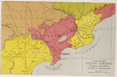 "Part of the Telugu Country, including Masulipatam, Guntoor, & Rajahmundry", map from the Church Missionary Atlas, 3rd edition, London, 1862 (cropped to the map)Map · 1862
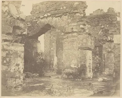 "Ruin of old palace [i.e. Kondapalli Fort], Condapilly hills, Kistnah District": albumen photograph signed "Ross Thompson, Lt. R.E., 1864"Photograph · 1864
Related
People
Peda Komati Vema
c. 1402–1420 CE
Fifth Reddi king of Kondavidu (c. 1402–1420), a grandson of Prolaya Vema's elder brother Macha, known as a scholar-king. The Sringaradipika commentary on the Amarusataka and other works are ascribed to him, and the poet Srinatha served him as vidyadhikarin and composed his grants. His reign was spent in wars with the Rajahmundry Reddis, Vijayanagara and the Recherla Velamas.
Muhammad Shah III
1463–1482 CE
Bahmani sultan (1463–1482) who came to the throne as a boy. He brought Rajahmundry, Kondapalli and the Krishna–Godavari coast under Bahmani rule, and spent three years settling Telangana. In 1481 he had his great minister Mahmud Gawan executed because of a forged letter, a deed the sources blame for the break-up of the kingdom.
Purushottama (Gajapati)
c. 1470–1497 CE
Gajapati king of Orissa from 1469–70 to 1496–97, son of Kapilendra. Early in his reign the Bahmanis took Rajahmundry and Kondapalli or Kondavidu, after a disputed succession in which he may have bought their help. His attempt to recover the Godavari country in the 1470s ended with Muhammad Shah III's invasion of Orissa. But by 1489 his grants and inscriptions reach the Krishna and the Ongole country again. Orissan tradition credits him with an expedition to Kanchi and a romantic marriage.
Prataparudra (Gajapati)
c. 1497–1540 CE
Gajapati king of Orissa from 1496–97 to about 1540, son of Purushottama, and the last great king of the Suryavamsi line. At his accession his empire reached from Bengal to the Guntur and Nellore country. In 1512–19 the Vijayanagara king Krishnadeva Raya took Udayagiri, Kondavidu and Kondapalli, captured his son Virabhadra, marched to Simhachalam and married his daughter. The Qutb Shahi sultan of Golconda then took the Godavari–Krishna country. The legal digest Sarasvativilasa bears his name. He was a disciple of Chaitanya.
Shitab Khan (Sitapati) of Warangal
c. 1504–1516 CE
A Telugu chief of humble birth who held Warangal, Khammam and Bellamkonda in the early sixteenth century. Hirananda Sastri identified him with an officer who had fled the Bahmani Sultan Humayun Shah about 1461, and with the Sitapati of the Golconda chronicle. His pillar inscription in Warangal fort records that he took the fort from the Muslims on 21 January 1504. He put back the images of Krishna and of the Kakatiya family goddess. He supported Telugu poets and called himself king of the Bhogi family. Sultan Quli Qutb Shah of Golconda defeated him. He took shelter with the Gajapati prince at Kondapalli and fought on the losing side at Palanchinur. The Kistna manual thought he was a vassal of Orissa.
Krishnadeva Raya
1509–1529 CE
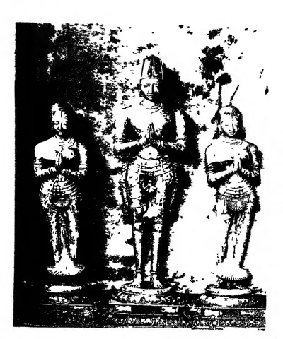
King of Vijayanagara from 1509 to 1529, of the Tuluva dynasty, and the most famous ruler of the empire. In 1512–16 he took Udayagiri, Kondavidu and Kondapalli from the Gajapati Prataparudra. He marched to Simhachalam and married the Gajapati's daughter. In 1520 he defeated the Adil Shah at Raichur. He wrote the Telugu poem Amuktamalyada, in which the god says Telugu is the best of the languages of the land. His court, with Allasani Peddana and Nandi Timmana, began the age of the Telugu prabandha (long narrative poem).
Ibrahim Qutb Shah
1530–1580 CE
Fourth Qutb Shahi sultan of Golconda (1550–1580), a younger son of Sultan Quli. He spent seven years as an exile at Vijayanagara under Rama Raya. He came back to take the throne with the help of the Telugu foot soldiers who held the forts. He joined the alliance that destroyed Vijayanagara at Talikota in 1565, and he conquered Rajahmundry, the northern coast and Kondavidu. Telugu poets dedicated works to him and to his officers, and Telugu records call him Ibharama. A Sanskrit copper-plate grant from Nellore calls him Malikibharama.
Aurangzeb (Alamgir)
1658–1707 CE
Sixth Mughal emperor (1658–1707). As his father's viceroy of the Deccan, he made Golconda pay its unpaid tribute. With Mir Jumla's help he besieged Abdullah Qutb Shah in Golconda in 1656, and won the handover of Ramgir and the Karnatak. As emperor he took Golconda in 1687 after an eight months' siege. He made the kingdom the Mughal province (subah) of Haidarabad and stayed near the fort until January 1688 to settle it. This page covers only his part in the history of the Telugu country.
Mahmud Gawan
before 1481 CE
Persian merchant who became chief minister of the Bahmani sultanate (c. 1461–1481). He was regent for two boy kings, fought in Telangana and on the west coast, reorganised the provinces and the army, and founded a great college at Bidar. Muhammad Shah III had him executed on a forged charge of treason in 1481.
Malik Hasan Bahri
before 1486 CE
Bahmani noble, born a Brahman and brought up as a Muslim. As Nizam-ul-Mulk he took Rajahmundry and Kondapalli or Kondavidu for Muhammad Shah III in about 1471, and governed all of Telingana. He resented its division by Mahmud Gawan and led the plot that had the minister executed in 1481. He then ruled the kingdom as Malik Naib until he was killed in 1486 after a campaign at Warangal. His son Ahmad founded the Nizam Shahi kingdom of Ahmadnagar.
Sultan Quli Qutb-ul-Mulk
before 1543 CE
Persian-born officer of the Bahmani sultanate who governed Telingana from Golconda. He conquered much of Telangana and the Krishna–Godavari coast, and founded the Qutb Shahi dynasty. He was assassinated in 1543. According to the Golconda chronicle, he was killed at prayer in the mosque of Golconda fort. According to Ferishta, a slave killed him while he was examining jewels.
Monuments
References
Notes (0)
Sources (5)
Spotted an error on this page? Tell us
Last updated: