Machilipatnam
Port near the mouth of the Krishna, known to Europeans as Masulipatam and locally as Bandar. It was the main sea outlet of the Golconda kingdom, where the English, Dutch and French traded from the 17th century. Later it was the chief town of the Northern Circars and of Kistna district.
Machilipatnam (Masulipatam) stands on the Bay of Bengal.1 The Imperial Gazetteer of 1908 places it at 16°11′ N, 81°8′ E, and 215 miles north of Madras.1 It explains the Hindustani name Machhlipatan as “fish-town”.1 It says the town was popularly called Bandar, “the port”.1 It was then the headquarters of Krishna (then Kistna) district, and the surrounding taluk was named Bandar after it.2
Before the Europeans
The gazetteer says that nothing certain is known of the town’s origin.1 In its words, “its real history begins early in the seventeenth century”.1 But the Kistna manual says that the Bahmani sultan Muhammad Shah III, after three years at Rajahmundry, “reduced” Machilipatnam “with all the dependent country”.3 It also guesses that the first mosque there may date from the time of the Reddi kings, who employed Muslim officers.3
Under the Bahmanis the governor of Telingana at Golconda ruled as far as the east coast, with ports at Machilipatnam and Coconada.4 Sultan Quli, founder of the Qutb Shahi kingdom, later counted the whole country “from the borders of Varangal to Masulipatam and Rajahmundry” among his conquests.5
The port of Golconda
W. H. Moreland edited Dutch and English reports on the Golconda coast from the early 17th century.6 He notes that the iron and steel made in the interior were exported from Machilipatnam.6 He also describes the large quantities of cotton cloth woven for export.6 Foreign merchants, he notes, rarely went beyond the coastal lowlands where they bought their goods.6
Tavernier gives the road from Golconda to Machilipatnam as about 100 coss (a measure of distance) by the direct route.7 By way of the diamond mine at Kollur on the Krishna it was 112.7 He also mentions ships sailing from Machilipatnam to Mocha with goods and pilgrims bound for Mecca.8
The European companies
The Imperial Gazetteer gives the European chronology:9
- In 1611 the East India Company’s ship Globe, under Captain Hippon, opened trade on this coast.9
- The Dutchman Peter Floris sailed with Hippon and left a diary of the beginning of English trade.9
- After disputes with the Dutch, the English left for Armagon in 1628.9
- They returned in 1632 with a farman (royal order) from the Sultan of Golconda.9
- In 1686 the Dutch seized the government of the town.9
- In 1690, after the Mughal conquest of Golconda, the English obtained a farman from the Mughal emperor to reopen their factories (trading posts).9
A Dominican friar visited the town in 1670.9 He called it “famous all along the coast of Coromandel”.9 He said it resembled “Babel in the variety of tongues and the differences of garbs and costumes”.9
The Circars and the Company
The Imperial Gazetteer calls Machilipatnam the chief town of the five Northern Circars, a grouping that dated from Muslim rule.10 The French took it in 1750.11 In 1759 Colonel Forde stormed the fort.11 By a treaty of 14 May 1759 the Nizam ceded Machilipatnam and the surrounding country to the Company.11 It then became the seat of a Chief and Council, replaced by a Collector in 1794.11
The town kept the marks of its trading past.12 The gazetteer describes French-pettah, where the land (but not the sovereignty) still belonged to France.12 It also describes English-palem, and Valanda-palem (“Hollander-town”) with its old Dutch graveyard.12 The former council chamber of the Dutch East India Company was in use as a court-house.12
Decline
By 1908 the gazetteer thought the interest of Machilipatnam lay “in the past”.12 English piece-goods had driven its chintzes (printed cotton cloth) and coloured cloths from the market.12 Since the railway to Bombay opened, Bombay had replaced it as the port for the Nizam’s dominions.12
European troops left the fort in 1834 and the Indian garrison in 1864.13 The new canal from Vijayawada (then Bezwada), opened in 1863, had raised hopes for the town.13 In 1864 a tidal wave and cyclone destroyed the houses of the fort and ruined those hopes.13
Footnotes
-
Imperial Gazetteer of India: Madras, Vol. I (1908), pp. 323–324 (archive.org (opens in a new tab)). ↩ ↩2 ↩3 ↩4 ↩5 ↩6
-
Imperial Gazetteer: Madras, Vol. I (1908), p. 319 (archive.org (opens in a new tab)). ↩
-
Gordon Mackenzie, A Manual of the Kistna District (1883), pp. 16, 20 (archive.org (opens in a new tab)). ↩ ↩2
-
J. D. B. Gribble, A History of the Deccan, Vol. I (1896), p. 171 (archive.org (opens in a new tab)). ↩
-
Mackenzie, Kistna District (1883), pp. 28–29 (archive.org (opens in a new tab)). ↩
-
W. H. Moreland (ed.), Relations of Golconda in the Early Seventeenth Century (1931), pp. xvii–xviii (archive.org (opens in a new tab)). ↩ ↩2 ↩3 ↩4
-
Jean-Baptiste Tavernier, tr. V. Ball, Travels in India, Vol. I (1889), pp. 172–174 (archive.org (opens in a new tab)). ↩ ↩2
-
Tavernier, Travels in India, Vol. I (1889), p. 162 (archive.org (opens in a new tab)). ↩
-
Imperial Gazetteer: Madras, Vol. I (1908), pp. 324–325 (archive.org (opens in a new tab)). ↩ ↩2 ↩3 ↩4 ↩5 ↩6 ↩7 ↩8 ↩9 ↩10
-
Imperial Gazetteer: Madras, Vol. I (1908), p. 185 (archive.org (opens in a new tab)). ↩
-
Imperial Gazetteer: Madras, Vol. I (1908), p. 325 (archive.org (opens in a new tab)); F. R. Hemingway, Madras District Gazetteers: Godavari, Vol. I (1907), p. 32 (archive.org (opens in a new tab)). ↩ ↩2 ↩3 ↩4
-
Imperial Gazetteer: Madras, Vol. I (1908), p. 324 (archive.org (opens in a new tab)). ↩ ↩2 ↩3 ↩4 ↩5 ↩6 ↩7
-
Imperial Gazetteer: Madras, Vol. I (1908), pp. 324–325 (archive.org (opens in a new tab)). ↩ ↩2 ↩3
Photos
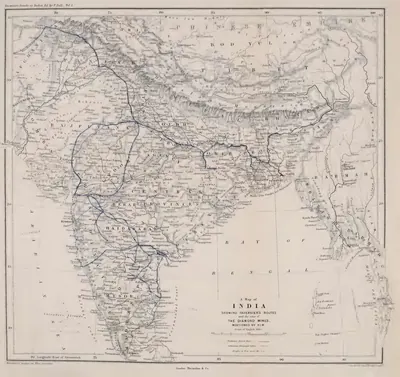 "A Map of India showing Tavernier's routes and the sites of the diamond mines mentioned by him" (Tavernier/Ball 1889, vol. I, folding map, PDF p. 499)Map · 1889
 "D.—Masulipatam Plates of Amma I.", plates ii a and iii (Epigraphia Indica V, plate between pp. 132 and 133 (PDF p. 184))Inscription rubbing · 1899
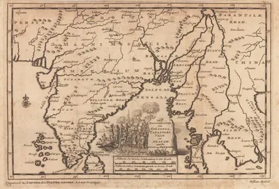 "De Koninkryken van Golconda, Tanassari, Pegu en Aracam, aan de Golf van Bengale", map published by Pieter van der Aa, Leiden, 1706Map · 1706
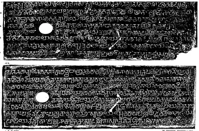 "F.—Masulipatam Plates of Amma II.", plates i and ii b (Epigraphia Indica V, plate between pp. 140 and 141 (PDF p. 196))Inscription rubbing · 1899
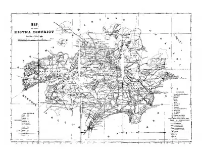 "Map of the Kistna District" (folding map) (Mackenzie 1883, folding map, PDF p. 1)Map · 1883
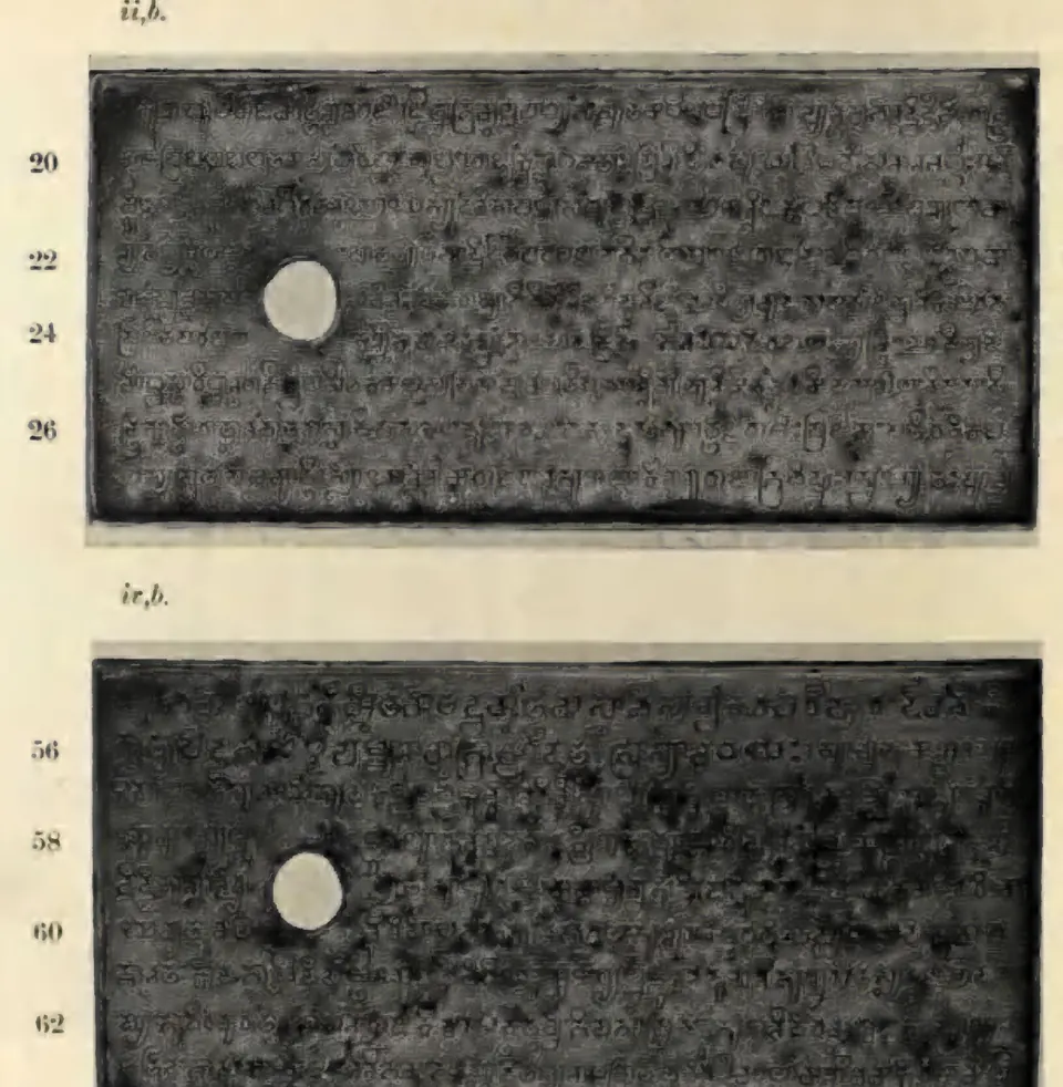
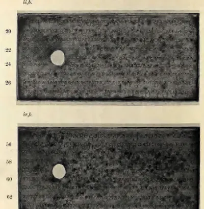 "Masulipatam Plates of Ammaraja II.—(I). (From Photographs)", plates ii b and iv b (Epigraphia Indica XXIV, plate between pp. 274 and 275 (PDF p. 345))Historic photograph · 1938
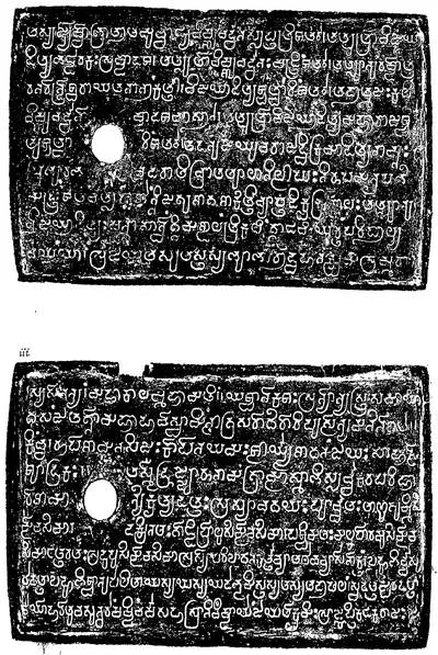
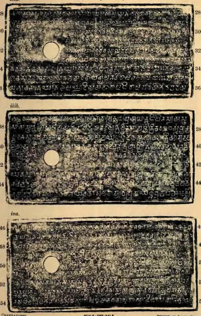 "Masulipatam Plates of Ammaraja II.—(II). (From impressions)", plates iii a, iii b and iv a (Epigraphia Indica XXIV, plate between pp. 276 and 277 (PDF p. 348))Inscription rubbing · 1938
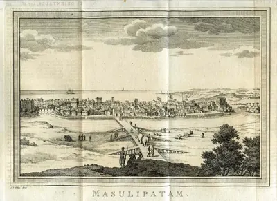 "Masulipatam": engraved view of the town from the landward side, after Bellin, from Prévost's Histoire générale des voyages (1752), when the French held it (1750–59)Drawing · 1752
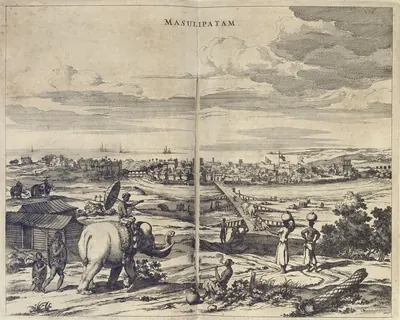 "Masulipatam": engraved view published by Johannes Janssonius van Waasbergen, 1672Drawing · 1672
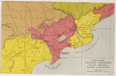 "Part of the Telugu Country, including Masulipatam, Guntoor, & Rajahmundry", map from the Church Missionary Atlas, 3rd edition, London, 1862 (cropped to the map)Map · 1862
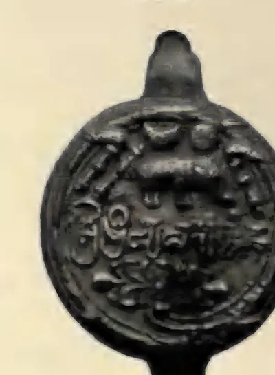 "Seal", seal of the Masulipatam plates of Ammaraja II (Epigraphia Indica XXIV, plate between pp. 274 and 275 (PDF p. 345))Historic photograph · 1938
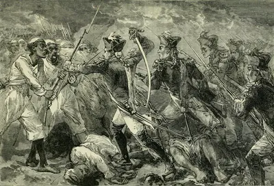 Captain Yorke leading the forlorn hope at Masulipatam (the Commons title of the plate): the storm of 7 April 1759, in which Orme says Yorke led the second division and fell with a ball through each thigh (Cassell's Illustrated History of India, 1879)Drawing · 1879
Show all (16)
![Sujet : Machilipatnam -- ca 1750 Couverture : Inde Langue : français Éditeur : [s.n.]](https://media.teluguhistory.org/hyd/plan-de-masulipatnam-et-environs-par-le-capitaine-du-g-nie-leveux-btv1-400.webp) Plan de Masulipatnam et environs - par le capitaine du génie Leveux - btv1b53030090vMap · 1750
Plan de Masulipatnam et environs - par le capitaine du génie Leveux - btv1b53030090vMap · 1750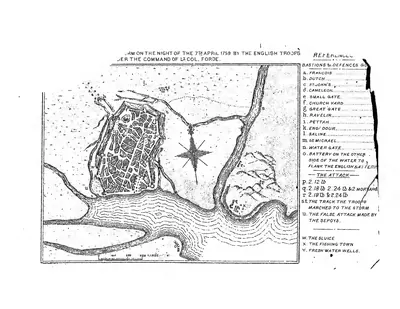 Plan of the storm "on the night of the 7th April 1759 by the English troops under the command of Lt. Col. Forde" (Masulipatam) (Mackenzie 1883, folding plan, PDF p. 2)Plan · 1883
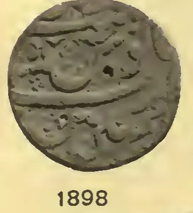 Silver rupee of Aurangzeb struck at Machhlipatan (Machilipatnam), AH 1118, regnal year 51 (Whitehead 1914, No. 1898, pl. XI)Coin · 1914
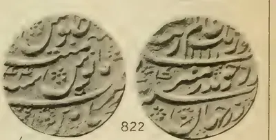 Silver rupee of Aurangzeb struck at Masulipatan (Machilipatnam), regnal year 44, obverse and reverse (Lane-Poole 1892, No. 822, pl. XX)Coin · 1892
Related
Dynasties
French East India Company
1750–1759 CE
The French Compagnie des Indes in the Telugu country. It traded at Masulipatam (Machilipatnam) from 1669 and at Yanam from before 1750. Dupleix and Bussy helped the Nizams Muzaffar Jang and Salabat Jang to the throne. In return the Company received Masulipatam and its country (1750), the Kondavid country (1751–52) and the four Northern Circars of Mustafanagar (Kondapalli), Ellore, Rajahmundry and Chicacole (1753), to pay for Bussy's army in the Deccan. Bussy governed the Circars through the Raja of Vizianagaram and the zamindars. In 1757 he destroyed Bobbili and took the English factories. Colonel Forde's victory at Condore (Chandurti) in December 1758 and his storm of Masulipatam in April 1759 ended French rule on the coast. By the treaty of May 1759 Salabat Jang shut the French out of the Deccan. Yanam, taken and given back several times, stayed French until 1954.
East India Company
1759–1858 CE
The English East India Company in the Telugu country, from its first landing on the coast in 1611 to the Crown's take-over in 1858. For a century and a half it traded through factories at Masulipatam, Nizampatnam, Madapollam, Viravasaram, Vizagapatam, Injaram and Bendamurlanka, under farmans of the Golconda kings and the Mughals. Its fort at Madras stood on land granted in 1639 through the Nayaka Damarla Venkatadri. After Forde drove out the French it received the Masulipatam country (1759), the five Northern Circars by the emperor's grant of 1765 and the treaties with the Nizam of 1766 and 1768, Guntur (1788), the Ceded Districts of Rayalaseema (1800) and Nellore with the Carnatic (1801). It governed through Chiefs and Councils, then Collectors. It settled the coastal zamindars permanently in 1802–03, and the Rayalaseema cultivators under Thomas Munro's ryotwari system. It broke the power of the Vizianagaram raja at Padmanabham (1794) and of the poligars. After the Guntur famine of 1832–33 it built the Godavari and Krishna anicuts.
People
Muhammad Shah III
1463–1482 CE
Bahmani sultan (1463–1482) who came to the throne as a boy. He brought Rajahmundry, Kondapalli and the Krishna–Godavari coast under Bahmani rule, and spent three years settling Telangana. In 1481 he had his great minister Mahmud Gawan executed because of a forged letter, a deed the sources blame for the break-up of the kingdom.
Sultan Muhammad Qutb Shah
1593–1626 CE
Sixth Qutb Shahi sultan of Golconda (1611/12–1626), nephew and son-in-law of Muhammad Quli. He was a scholarly and peaceful king. He founded the Mecca Masjid in Hyderabad, began a new town called Sultannagar, sheltered the rebel Mughal prince Khurram (Shah Jahan) and had the first history of his dynasty written. His queen, Hayat Bakhsh Begum, was the mother of Abdullah Qutb Shah.
Abdullah Qutb Shah
1614–1672 CE
Seventh Qutb Shahi sultan of Golconda (1626–1672). He was crowned as a boy and left the government to his mother Hayat Bakhsh Begum and his ministers. In 1636 he accepted the Mughal emperor Shah Jahan as his overlord. His minister Mir Jumla conquered the Karnatak and its diamond mines. In 1656 Mir Jumla's quarrel with him brought Aurangzeb to besiege Golconda. An inscription in Persian and Telugu records the siege. He died without a son in 1672.
Aurangzeb (Alamgir)
1658–1707 CE
Sixth Mughal emperor (1658–1707). As his father's viceroy of the Deccan, he made Golconda pay its unpaid tribute. With Mir Jumla's help he besieged Abdullah Qutb Shah in Golconda in 1656, and won the handover of Ramgir and the Karnatak. As emperor he took Golconda in 1687 after an eight months' siege. He made the kingdom the Mughal province (subah) of Haidarabad and stayed near the fort until January 1688 to settle it. This page covers only his part in the history of the Telugu country.
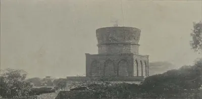
Abul Hasan Tana Shah
c. 1672–1699 CE
Abul Hasan, called Tana Shah, was the last Qutb Shahi sultan of Golconda (1672–1687). He was a kinsman and son-in-law of Abdullah Qutb Shah. He left the government to the Brahmin brothers Madanna and Akkanna, who allied the kingdom with the Marathas. Aurangzeb made this a charge against him and took Hyderabad in 1685. In 1687 Aurangzeb besieged Golconda for eight months, until a gate was opened by treachery. Abul Hasan died a state prisoner at Daulatabad.
Joseph François Dupleix
1697–1764 CE
Governor of Pondicherry and of the French settlements in India from 1742 to 1754. By backing Muzaffar Jang and then Salabat Jang in the war for the Nizam's throne, he won for the French Company the grant of Masulipatam (1750) and, through his officer Bussy, the Northern Circars (1753). Superseded by Godeheu in 1754, he died in poverty in France.
Kam Bakhsh
1707–1709 CE
Youngest son of Aurangzeb (1667–1709). When his father died in 1707 he was on his way to govern Bijapur. He proclaimed himself emperor, struck coins and made Hyderabad his seat, where he had the subahdar Rustam Dil Khan trampled to death. His brother Bahadur Shah marched south and defeated him near Hyderabad on 13 January 1709, and he died of his wounds that night.
Charles de Bussy
1718 CE
French general, born in 1718, who commanded the French troops at the court of the Nizams Muzaffar Jang and Salabat Jang from 1751 to 1758. He raised Salabat Jang to the throne and obtained from him the four Northern Circars for the French Company in 1753. He governed them through the Raja of Vizianagaram and the zamindars. In 1757 he destroyed the fort of Bobbili and took the English factories on the coast. Lally recalled him to the Carnatic in 1758, and he left the Circars to be lost to Colonel Forde.
Muzaffar Jang (Hidayat Muhi-ud-din Khan)
1750–1751 CE
Grandson of Nizam-ul-Mulk Asaf Jah I through a favourite daughter, and governor of Bijapur. He claimed the Deccan on his grandfather's death in 1748, with the help of Chanda Sahib and the French. His uncle Nasir Jang imprisoned him in 1750. He was proclaimed Subahdar when Nasir Jang was murdered in December 1750, and granted the French Masulipatam and other land. The Nawab of Kurnool killed him on the march back to the Deccan early in 1751.
Salabat Jang
1751–1761 CE
Third son of Nizam-ul-Mulk Asaf Jah I, raised to the throne of the Deccan by the French commander Bussy in 1751. Under Bussy's protection he defeated the Marathas and his elder brother Ghazi-ud-din, and in 1753 assigned the Northern Circars to the French. After Colonel Forde drove the French from the coast, he ceded Masulipatam to the English (1759). His brother Nizam Ali took power as his minister, deposed him in 1761 or 1762 and had him killed in prison about 1763.
Mutnuri Krishna Rao
1879–1945 CE
Editor of the Krishna Patrika of Machilipatnam (1879–1945), a leading Telugu nationalist paper. He organised Bipin Chandra Pal's tour of the Telugu districts in 1907, helped build the National College at Machilipatnam, and was jailed in the salt satyagraha of 1930, the civil disobedience of 1932 and the individual satyagraha of 1940–41.
Cherukuvada Venkata Narasimham
1887–1964 CE
Congress speaker and writer from Ghantasala in Krishna district (1887–1964). He worked on the nationalist papers Desabhimani and Krishna Patrika, taught at the National College in Machilipatnam, and was jailed for a year each in the non-cooperation movement of 1921, the salt satyagraha of 1930 and the civil disobedience of 1932. He was known as Upanyasa Chakravarti.
Vemuri Ramji Rao
c. 1891–1963 CE
Social worker of Machilipatnam (about 1891–1963) who worked for Dalits and tribal people. He set up a high school and hostel for Dalit students at Machilipatnam. In 1930, when Gandhi was arrested, he gave up the title Rao Saheb and his nominated seat in the Madras Legislative Council in protest. He founded and edited the Telugu weekly Deenabandhu.
Gora (Goparaju Ramachandra Rao)
1902–1975 CE
Teacher, social reformer and atheist of Vijayawada (1902–1975), known as Gora. A science lecturer until 1940, he was jailed in 1943 for celebrating Independence Day and detained twice during the Quit India movement. He worked against untouchability, encouraged his children to marry across caste, edited the Telugu weekly Sangham and the English monthly The Atheist, and wrote Positive Atheism.
Francis Forde
before 1770 CE
Irish officer of the 39th Foot, sent by Clive from Bengal in 1758. He routed the French under Conflans at Condore (Chandurti) near Pithapuram on 9 December 1758 and stormed Masulipatam in April 1759, so winning the Northern Circars from the French for the East India Company. He had earlier led the English detachment in the failed attack on Nellore (1757). Appointed one of the Company's Supervisors in 1769, he was lost at sea when the frigate Aurora disappeared after leaving the Cape at the end of that year.
Gadicherla Harisarvottama Rao
Nationalist journalist who, as a teacher trainee at Rajahmundry, was expelled and barred from government service in 1907 for his part in the Vande Mataram movement. He was jailed in 1908 for an article in his weekly Swaraj, and later led the Home Rule League in Andhra. Regani counts him among the first political prisoners of the movement in Andhra.
Kala Venkata Rao
Congress organiser from Amalapuram in the Godavari district. He left his B.Sc. studies at Machilipatnam in the non-cooperation movement of 1920–21 and was jailed then. He was among the leaders banned from public work in 1932, was sentenced in the satyagraha of 1940–41, and on 29 July 1942 drafted the Andhra Congress instructions known as the Kurnool circular.
Mir Jumla (Mir Muhammad Said Ardastani)
before 1663 CE
A Persian merchant who became chief minister and army commander of Abdullah Qutb Shah of Golconda. He is known by the title of his office, Mir Jumla. He conquered the Karnatak south of the Krishna, including Gandikota and the diamond country of Cuddapah, and he leased the diamond mines. His quarrel with the king in 1655–56 brought the Mughal prince Aurangzeb to besiege Golconda. He then joined Mughal service as Mu'azzam Khan and died in 1663 after an expedition to Assam.
Mubariz Khan (Khwaja Muhammad, Imad-ul-Mulk)
before 1724 CE
Last Mughal governor of Haidarabad (Hyderabad), which he ruled for nearly twelve years from about 1713. He came from Balkh and had governed Gujarat and Malwa. He fought the Marathas instead of paying them the chauth (a quarter of the revenue). He began the city wall of Hyderabad and held lands on the coast as far as Srikakulam (Chicacole). In 1724 the court at Delhi made him viceroy of the Deccan against Nizam-ul-Mulk. He was defeated and killed with two of his sons at Shakar Kheda in Berar on 11 October 1724 (Irvine's date).
Pattabhi Sitaramayya
Congress leader of Machilipatnam and historian of the Indian National Congress. He worked for the National College and khadi in the Krishna district, planned the salt satyagraha in the Telugu districts in 1930, and was arrested during the boycott of the Simon Commission and again in 1930, 1932 and 1942. In 1939 he lost the election for Congress president to Subhas Chandra Bose.
Rustam Dil Khan
before 1708 CE
Mughal subahdar (governor) of Haidarabad (Hyderabad) under Aurangzeb, and son of the earlier subahdar Jan Sipar Khan. He built the Kali Masjid outside the Yaqutpura gate in AH 1114 (1702). After Aurangzeb's death he submitted to the rebel prince Kam Bakhsh. The prince suspected him of a plot and had him trampled to death by an elephant in 1708.
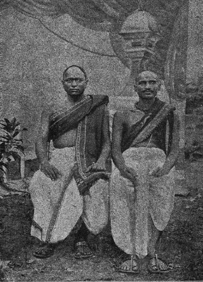
Tirupati Venkata Kavulu
Pair of Telugu poets, Tirupati Sastri and Venkata Sastri, who wrote together in the early 20th century. They were famous for satavadhanam, composing verse on a hundred subjects at once before an audience, and for plays on the Mahabharata such as Pandavavijayamu. Writers of the old school, they translated the Devi Bhagavatam and Arnold's Light of Asia, and trained many later poets.
Monuments
Inscriptions
References
Notes (0)
Sources (6)
Spotted an error on this page? Tell us
Last updated: