Amaravati & Dharanikota
Neighbouring sites on the south bank of the Krishna. The ramparts of Dharanikota are usually identified with ancient Dhanyakataka. The town of Amaravati is the site of the great Buddhist stupa and the Amaresvara temple.
Amaravati and Dharanikota lie side by side on the south bank of the Krishna, in what was Sattenapalle taluk of Guntur district. The Imperial Gazetteer placed Amaravati at 16° 34′ N, 80° 22′ E.1
Dharanikota
Dharanikota is the older site. A massive embankment of earth and broken brick marks its square citadel.2 Each side is about 650 yards long, but a bend of the river cuts the west side short.2 Colin Mackenzie recorded a local tradition that the ancient city had stretched some three and a half miles along the river.2
The 1883 district manual reported coins of about the 1st century CE from the site.3 It also recorded that the old rampart had hardened into a mass that could be quarried, with ancient bricks visible in it.3
Nineteenth-century writers identified Dharanikota with Dhanyakataka. Inscriptions on the Amaravati stupa (relic mound) name that city as Dhannakataka or Dhanakataka.245 The Chinese pilgrim Xuanzang knew it as the capital of a kingdom in the 7th century.245 Burgess recorded a tradition that the Satavahana capital moved here from Srikakulam on the lower Krishna.6 A temple inscription of 1361 calls the place Sri-Dhanyavatipura.7 The identification is not certain. In 1933 J. Ph. Vogel noted that archaeologists had looked for Dhanyakataka both at Dharanikota and at Vijayawada (then Bezwada).5 He asked whether Nagarjunakonda might be the site instead.5
A rock inscription about a mile and a half west of Dharanikota opens with the name of an Eastern Chalukya king, Vishnuvardhana.89 Sewell put its script at about the 7th century.89 Groups of stone circles, or circular tumuli (burial mounds), stand west of the fort and around the hills to the south-east.1011
Amaravati
The present town of Amaravati lies half a mile east of Dharanikota.28 Raja Vasireddi Venkatadri Nayudu, zamindar (landholder) of Chintapalle, laid it out at the end of the 18th century.28 He made it his capital, with broad streets at right angles and a palace.28 His search for building material led to the discovery and destruction of the great stupa at the south edge of the town (see Amaravati Mahachaitya).2
The town’s Saiva temple of Amaresvara carries inscriptions from the 12th century onward:
- a 12th-century record of the Kota chief Keta II (see below)
- a 1361 inscription of Anavema Reddi of Kondavidu
- a grant of two villages in 1515 in the time of Krishnadeva Raya
- a record of the temple’s reconsecration in 162698
The Kota chiefs
In the 12th and 13th centuries Dharanikota was the seat of the Kotas, chiefs of the “Six-thousand” country on the south bank of the Krishna.12 E. Hultzsch suggested that their family name, Kota, “the fort”, “perhaps refers to the fort of Dharanikota near Amaravati”.12 Their titles call them lords of Sri-Dhanyakataka.12
A pillar stands at the southern entrance to the central shrine of the Amaresvara temple.131214 It bears the inscription of Keta II, probably of 1182–83, recording his gifts to Brahmans.131214 It also records villages and lamps given to the Buddha, whose “very lofty Chaitya” stood close to the city.131214 Hultzsch identified the chaitya (Buddhist shrine) with the great stupa.131214 See the Amaravati pillar inscription of Keta II.
Keta II’s grandson Beta married Ganapamba, daughter of the Kakatiya king Ganapatideva.1516 After his death she placed golden pinnacles on the shrine of Amaresvara.1516 She also built a temple called Ganapesvara at Dhanyakataka, named after her father.1516 See Ganapamba. The Annual Report on Epigraphy for 1916 called the Kotas the next rulers of the six-thousand country after the Kondapadumati chiefs.17
The 1883 manual also reports legends of a contest between Jains and Brahmans at Dharanikota.3 It reports a local line of “Jain kings” too, which it compiled partly from the Kota inscriptions.3 According to these legends, this line was absorbed by marriage into the Warangal dynasty.3 The manual presents these as tradition rather than established history, and this page does not rely on them.3
The Amaresvara temple
The Amaresvara temple is one of the five Pancharama shrines of Shiva. M. Rama Rao took a version of the legend from the Skanda Purana.1819 In it, Indra set up one of the five pieces of the Tripura demons’ linga (stone emblem of Shiva) at Dharanikota on the bank of the Krishna.1819 It became Amaresvara of Amararama.1819 The Godavari district gazetteer of 1907 also named “Amaravati (or Amara-rama) in the Guntur district” among the five.20
In the preface to his survey of 1964, Rama Rao attributed the Shiva shrines of all five Pancharamas, Amaravati among them, to the Eastern Chalukya king Chalukya-Bhima I.21 The foreword to the same monograph, by M. A. Waheed Khan, was more cautious about this temple.22 It wrote that the Amaresvara temple seemed to have been altered for unknown reasons, with many later additions to its structure.22
Rama Rao’s own chapter on the temple does not discuss its builder, but it lists thirty-five inscriptions dated between 1129 and 1626.19 Half of them come from the Later Chalukyas, the Kota and Chagi chiefs, the Velanadu chiefs, the Kakatiyas, the Reddis and Vijayanagara.19 None is earlier than 1129.19 The Kistna district manual of 1883 recorded the local belief that the temple was four thousand years old.23 It judged that “one thousand years is a very much more probable age”.23
Rama Rao described a central shrine standing on a raised platform inside three enclosures.242526 It is entered from the south through a later gopura (gateway tower).242526 The linga is worshipped on the upper floor of a small two-storeyed shrine, under a four-sided Nagara tower.242526 He compared it with the two-storeyed temples at Draksharama, Chalukya-Bhimavaram and Chebrolu.242526 He noted that at Amaravati, as at Chebrolu, the ground floor is closed.242526
The large hall in front contains a life-size statue of Raja Vasireddi Venkatadri Nayudu, the zamindar who founded the modern town.24 He stands with joined hands before the god.24 See Bhimesvara temple, Draksharama and Bhimesvara temple, Chebrolu.
Footnotes
-
Imperial Gazetteer of India: Madras, Vol. I (1908), p. 332 (archive.org (opens in a new tab)). ↩
-
Burgess, Amaravati and Jaggayyapeta (1887), p. 13 (archive.org (opens in a new tab)). ↩ ↩2 ↩3 ↩4 ↩5 ↩6 ↩7 ↩8 ↩9
-
Gordon Mackenzie, A Manual of the Kistna District (1883), p. 163 (archive.org (opens in a new tab)). ↩ ↩2 ↩3 ↩4 ↩5 ↩6
-
Burgess, Amaravati and Jaggayyapeta (1887), p. 9 (archive.org (opens in a new tab)). ↩ ↩2
-
J. Ph. Vogel, “Prakrit Inscriptions from a Buddhist Site at Nagarjunikonda”, Epigraphia Indica XX (1933), p. 9 (archive.org (opens in a new tab)). ↩ ↩2 ↩3 ↩4
-
James Burgess, The Buddhist Stupas of Amaravati and Jaggayyapeta (1887), pp. 3–4 (archive.org (opens in a new tab)). ↩
-
Burgess, Amaravati and Jaggayyapeta (1887), p. 10, n. 3 (archive.org (opens in a new tab)). ↩
-
Mackenzie, Kistna District Manual (1883), p. 164 (archive.org (opens in a new tab)). ↩ ↩2 ↩3 ↩4 ↩5 ↩6
-
Robert Sewell, Lists of the Antiquarian Remains in the Presidency of Madras, Vol. I (1882), p. 64 (archive.org (opens in a new tab)). ↩ ↩2 ↩3
-
Burgess, Amaravati and Jaggayyapeta (1887), p. 21 (archive.org (opens in a new tab)). ↩
-
Mackenzie, Kistna District Manual (1883), p. 168 (archive.org (opens in a new tab)). ↩
-
Hultzsch, “Two Pillar Inscriptions at Amaravati” (1901), p. 147 (archive.org (opens in a new tab)). ↩ ↩2 ↩3 ↩4 ↩5 ↩6 ↩7
-
E. Hultzsch, “Two Pillar Inscriptions at Amaravati”, Epigraphia Indica VI (1901), p. 146 (archive.org (opens in a new tab)). ↩ ↩2 ↩3 ↩4
-
Hultzsch, “Two Pillar Inscriptions at Amaravati” (1901), p. 148 (archive.org (opens in a new tab)). ↩ ↩2 ↩3 ↩4
-
E. Hultzsch, “Yenamadala Inscription of Ganapamba”, Epigraphia Indica III (1895), p. 94 (archive.org (opens in a new tab)). ↩ ↩2 ↩3
-
Hultzsch, “Yenamadala Inscription of Ganapamba” (1895), p. 95 (archive.org (opens in a new tab)). ↩ ↩2 ↩3
-
Annual Report on Epigraphy, Madras, for 1915–16 (G.O. No. 99, Home (Miscellaneous), 29 August 1916), Part II, para. 55, p. 137 (archive.org (opens in a new tab)). ↩
-
Rama Rao, Eastern Calukyan Temples (1964), p. 16 (archive.org (opens in a new tab)). ↩ ↩2 ↩3
-
Rama Rao, Eastern Calukyan Temples (1964), p. 39 (archive.org (opens in a new tab)). ↩ ↩2 ↩3 ↩4 ↩5 ↩6
-
F. R. Hemingway, Madras District Gazetteers: Godavari (1907), p. 207 (archive.org (opens in a new tab)). ↩
-
M. Rama Rao, Eastern Calukyan Temples of Andhra Desa (1964), preface (unnumbered) (archive.org (opens in a new tab)). ↩
-
Mohd. Abdul Waheed Khan, foreword to M. Rama Rao, Eastern Calukyan Temples of Andhra Desa (1964), p. i (archive.org (opens in a new tab)). ↩ ↩2
-
Gordon Mackenzie, A Manual of the Kistna District (1883), p. 163 (archive.org (opens in a new tab)). ↩ ↩2
-
Rama Rao, Eastern Calukyan Temples (1964), p. 40 (archive.org (opens in a new tab)). ↩ ↩2 ↩3 ↩4 ↩5 ↩6 ↩7
-
Rama Rao, Eastern Calukyan Temples (1964), p. 41 (archive.org (opens in a new tab)). ↩ ↩2 ↩3 ↩4 ↩5
-
Rama Rao, Eastern Calukyan Temples (1964), p. 46 (archive.org (opens in a new tab)). ↩ ↩2 ↩3 ↩4 ↩5
Photos
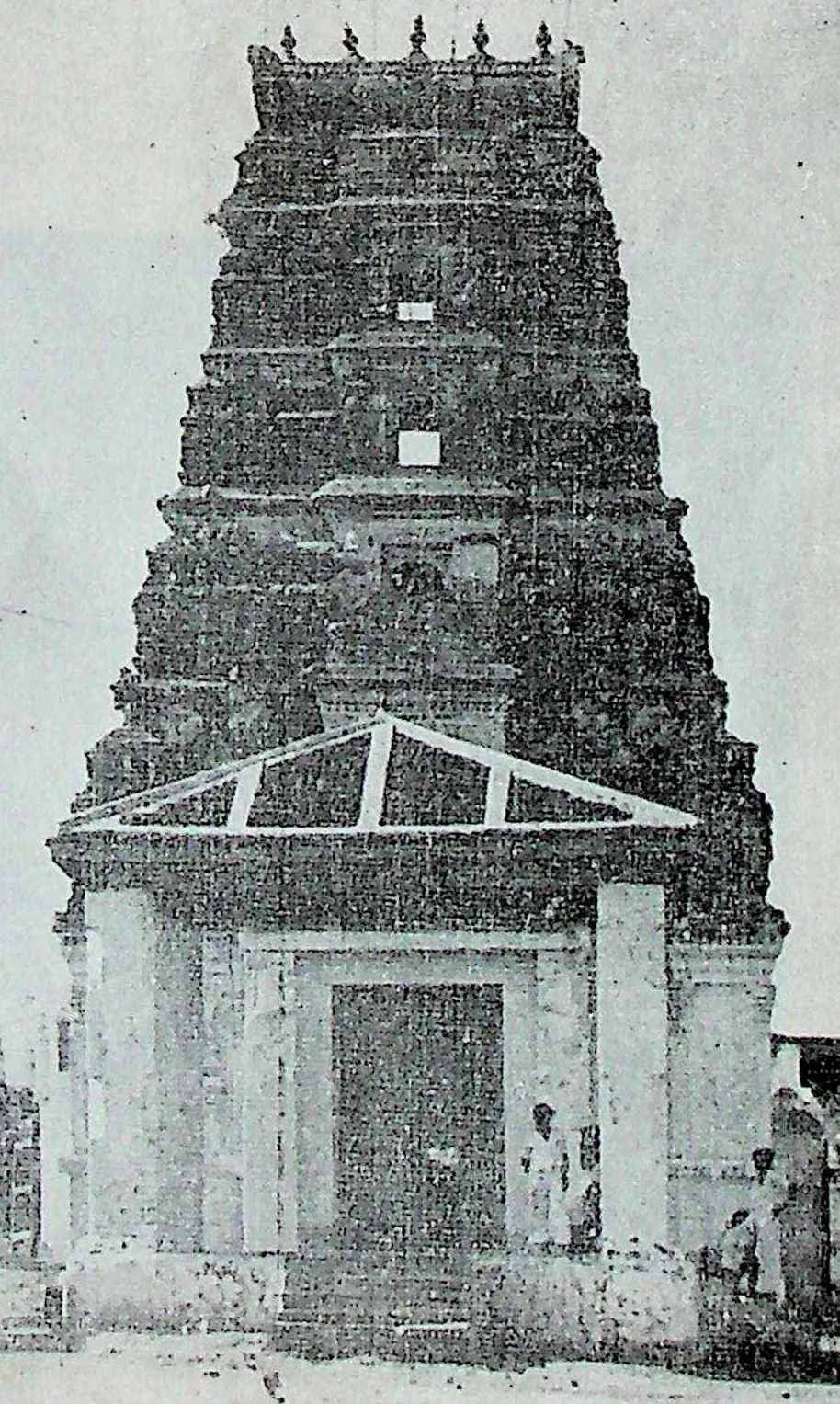
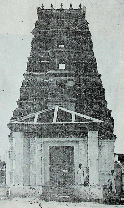 "43. Amarēśvara Temple - Amarāvati - South Gōpura" (M. Rama Rao, Eastern Calukyan Temples of Andhra Desa, 1964, Fig. 43 (PDF p. 115))Historic photograph · 1964
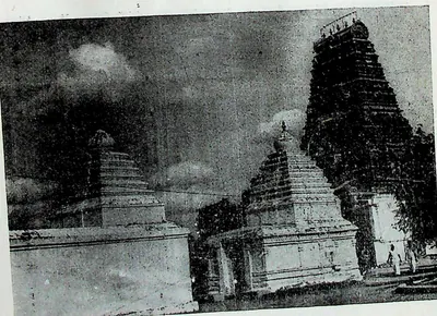 "44. Outer Enclosure - Amarāvati" (M. Rama Rao, Eastern Calukyan Temples of Andhra Desa, 1964, Fig. 44 (PDF p. 117))Historic photograph · 1964
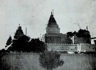 "45. Amarēśvara Temple—Amarāvati—Inner Enclosure" (M. Rama Rao, Eastern Calukyan Temples of Andhra Desa, 1964, Fig. 45 (PDF p. 119))Historic photograph · 1964
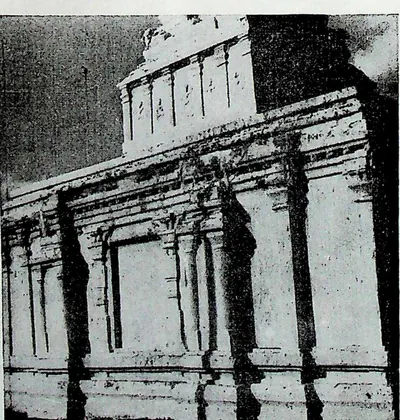 "46. Walls of the Temple - Amarāvati" (M. Rama Rao, Eastern Calukyan Temples of Andhra Desa, 1964, Fig. 46 (PDF p. 121))Historic photograph · 1964
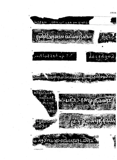 "Amaravati Inscriptions", Nos. 1-16 (left half of the folding plate), including No. 1, dated in the reign of Vasishthiputra Sri Pulumavi, and No. 2, naming "king Sri Sivamaka Sada" (Burgess 1887, Pl. LVI)Inscription rubbing · 1887
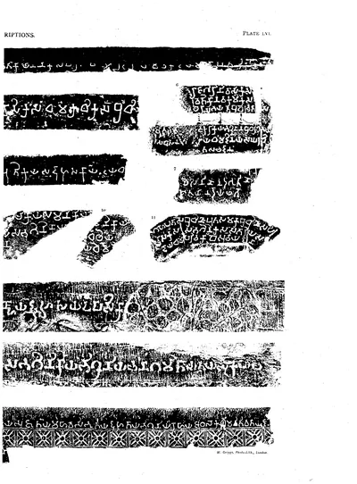 "Amaravati Inscriptions", Nos. 1-16 (right half of the folding plate) (Burgess 1887, Pl. LVI)Inscription rubbing · 1887
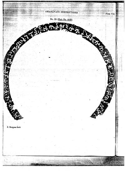 "Amaravati Inscriptions": inscription round the rim of a carved slab (Pl. VII) (Burgess 1882, Pl. VII (PDF p. 57))Inscription rubbing · 1882
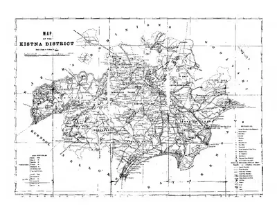 "Map of the Kistna District" (folding map) (Mackenzie 1883, folding map, PDF p. 1)Map · 1883
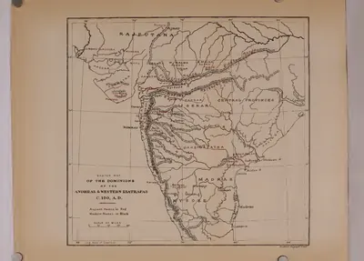 "Sketch map of the dominions of the Andhras & Western Ksatrapas, c. 150 A.D." (Rapson 1908, map)Map · 1908
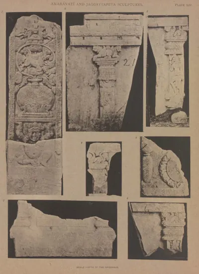 A pillar slab from Amaravati, and six fragments from Jaggayyapeta (Burgess 1887, Pl. LIV)Book plate · 1887
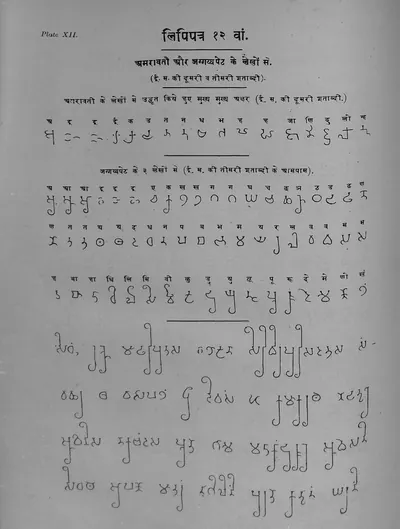 Alphabet table from the inscriptions of Amaravati and Jaggayyapeta, 2nd and 3rd centuries CE (Ojha, Bharatiya Prachin Lipimala, 1918, Plate 12)Book plate · 1918
 Amaravati inscription No. 4, "... Senagopasa Mudakutalasa thabho ..." ("a pillar of the General Mudakutala"), in letters of the Mauryan type (Burgess 1887, Pl. LVI, No. 4)Inscription rubbing · 1887
Show all (144)
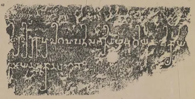 Amaravati inscription No. 42, ink impression (Burgess 1887, Pl. LIX, No. 42)Inscription rubbing · 1887
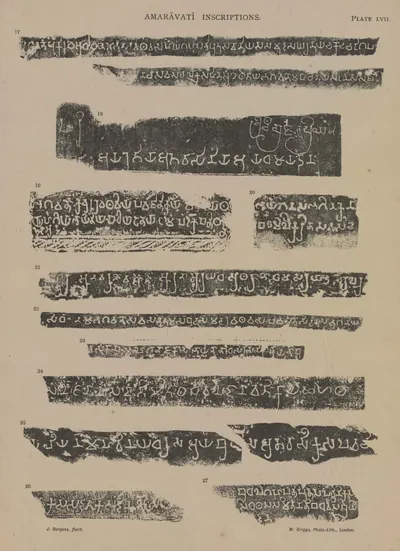 Amaravati inscriptions, Nos. 17-27 (Burgess 1887, Pl. LVII)Inscription rubbing · 1887
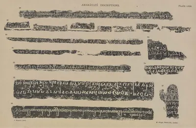 Amaravati inscriptions, Nos. 28-37 (Burgess 1887, Pl. LVIII)Inscription rubbing · 1887
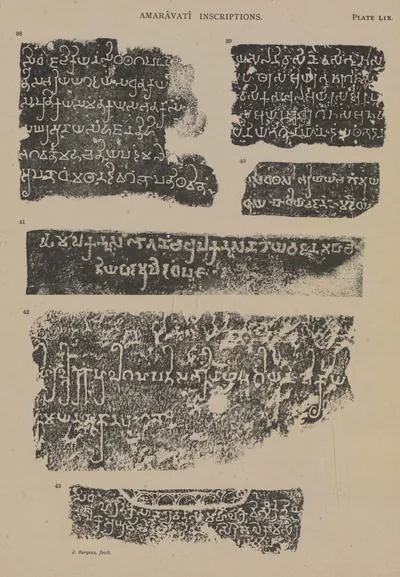 Amaravati inscriptions, Nos. 38-43 (Burgess 1887, Pl. LIX)Inscription rubbing · 1887
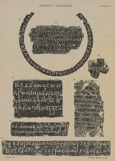 Amaravati inscriptions, Nos. 44-50 (Burgess 1887, Pl. LX)Inscription rubbing · 1887
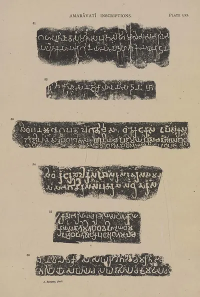 Amaravati inscriptions, Nos. 51-56 (Burgess 1887, Pl. LXI)Inscription rubbing · 1887
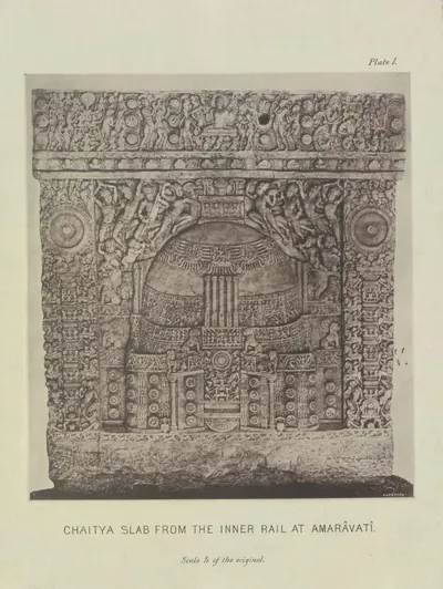 Amaravati: "Chaitya slab from the inner rail at Amaravati" (Burgess 1887, Pl. I)Book plate · 1887
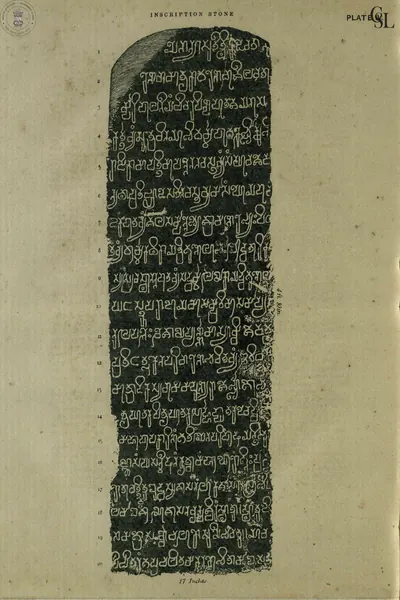 Amaravati: "Inscription Stone" (plate) (Sewell 1880, plate (PDF p. 62))Inscription rubbing · 1880
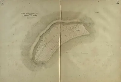 Amaravati: "Plan of the excavations in 1877 at the Amaravati Tope, on an enlarged scale" (Pl. III) (Sewell 1880, Pl. III (PDF p. 40))Plan · 1880
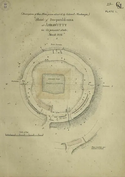 Amaravati: "Sketch of Deepauldinna at Amrawutty in its present state, March 1816", description by Colonel Mackenzie (Pl. I) (Sewell 1880, Pl. I (PDF p. 21))Plan · 1880
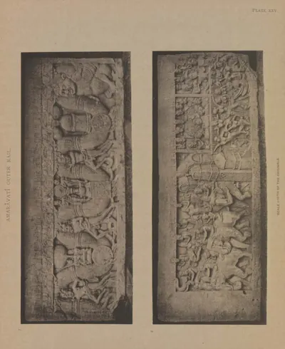 Amaravati: a fifth coping-stone, both sides (Burgess 1887, Pl. XXV)Book plate · 1887
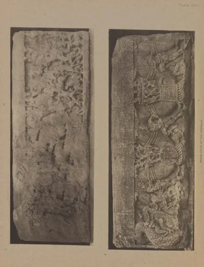 Amaravati: a fourth coping-stone, both sides (Burgess 1887, Pl. XXIV)Book plate · 1887
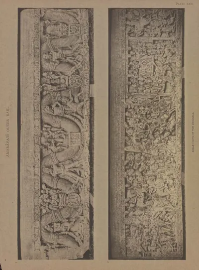 Amaravati: a third large coping-stone, both sides (Burgess 1887, Pl. XXII)Book plate · 1887
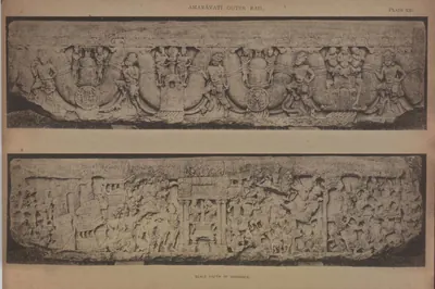 Amaravati: another large coping-stone, both sides (Burgess 1887, Pl. XXI)Book plate · 1887
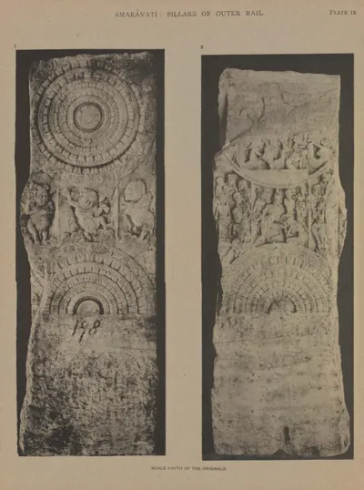 Amaravati: another rail pillar, back and front (Burgess 1887, Pl. IX)Book plate · 1887
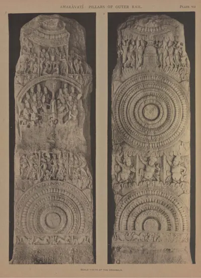 Amaravati: another rail pillar, back and front (Burgess 1887, Pl. VII)Book plate · 1887
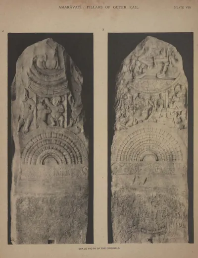 Amaravati: another rail pillar, back and front (Burgess 1887, Pl. VIII)Book plate · 1887
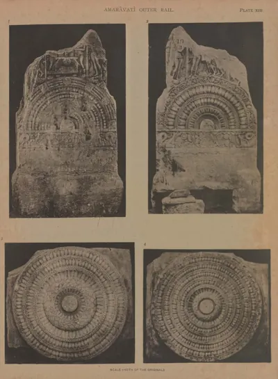 Amaravati: back and front of the base of a rail pillar, and two cross-bars (Burgess 1887, Pl. XIII)Book plate · 1887
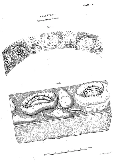 Amaravati: Buddhist marble carving (Rea 1894, Pl. XL)Drawing · 1894
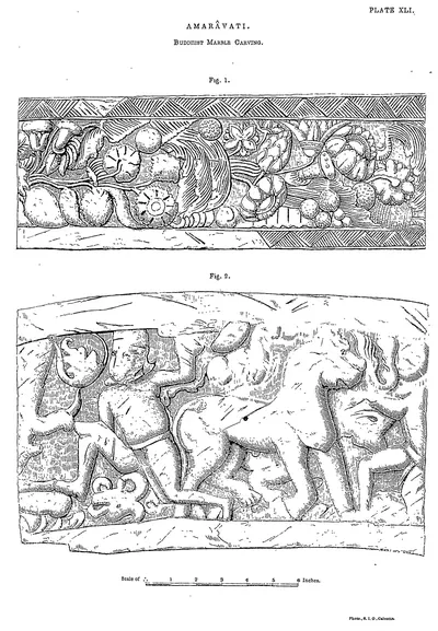 Amaravati: Buddhist marble carving (Rea 1894, Pl. XLI)Drawing · 1894
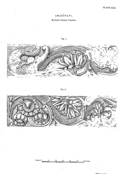 Amaravati: Buddhist marble carving (Rea 1894, Pl. XLII)Drawing · 1894
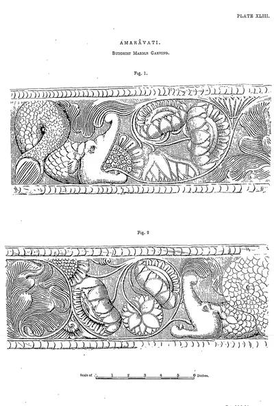 Amaravati: Buddhist marble carving (Rea 1894, Pl. XLIII)Drawing · 1894
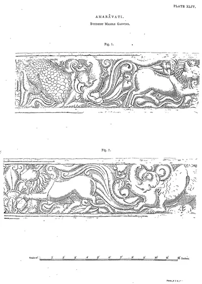 Amaravati: Buddhist marble carving (Rea 1894, Pl. XLIV)Drawing · 1894
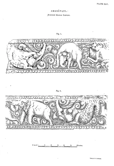 Amaravati: Buddhist marble carving (Rea 1894, Pl. XLV)Drawing · 1894
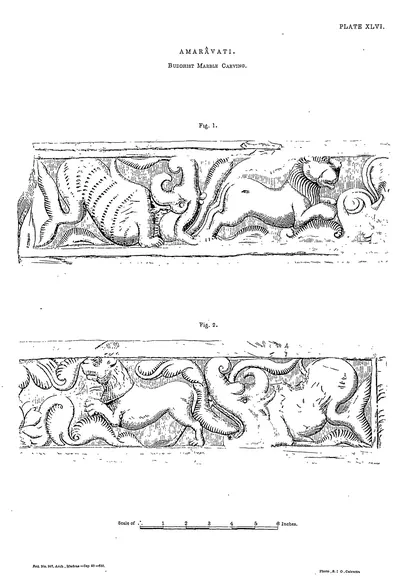 Amaravati: Buddhist marble carving (Rea 1894, Pl. XLVI)Drawing · 1894
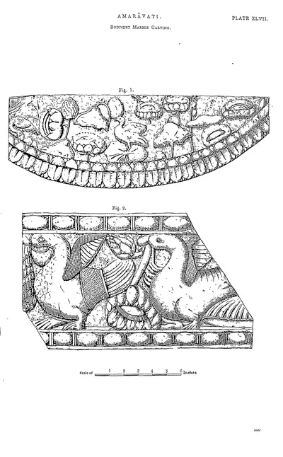 Amaravati: Buddhist marble carving (Rea 1894, Pl. XLVII)Drawing · 1894
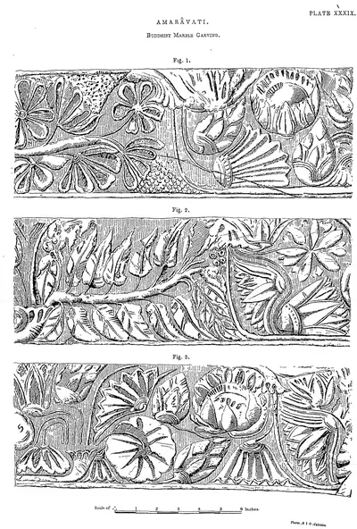 Amaravati: Buddhist marble carving (Rea 1894, Pl. XXXIX)Drawing · 1894
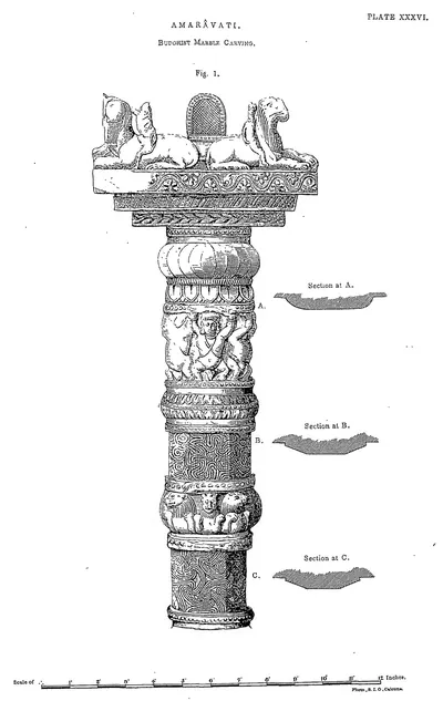 Amaravati: Buddhist marble carving (Rea 1894, Pl. XXXVI)Drawing · 1894
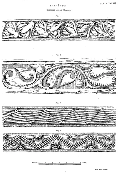 Amaravati: Buddhist marble carving (Rea 1894, Pl. XXXVII)Drawing · 1894
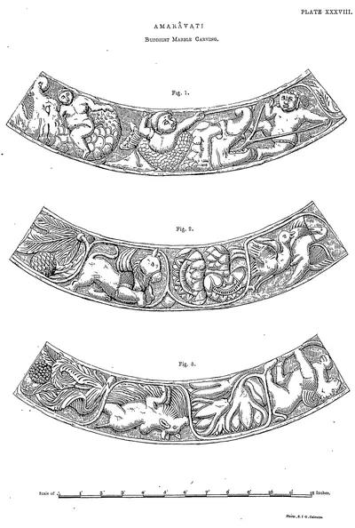 Amaravati: Buddhist marble carving (Rea 1894, Pl. XXXVIII)Drawing · 1894
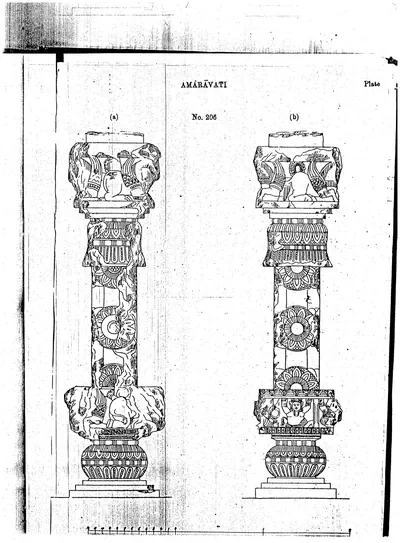 Amaravati: drawings of a carved pillar, two views (Burgess 1882, PDF p. 73)Drawing · 1882
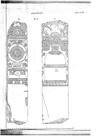 Amaravati: drawings of the two faces of a carved slab (Pl. VIII) (Burgess 1882, Pl. VIII (PDF p. 67))Drawing · 1882
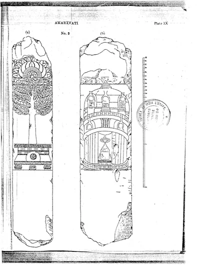 Amaravati: drawings of the two faces of a carved slab with a tree and a stupa (Pl. IX) (Burgess 1882, Pl. IX (PDF p. 68))Drawing · 1882
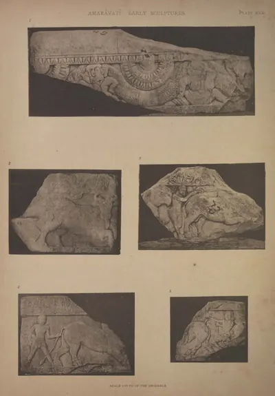 Amaravati: five pieces of early coping (Burgess 1887, Pl. XXX)Book plate · 1887
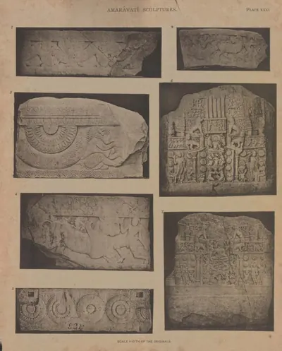 Amaravati: five pieces of early coping, and two chaitya slabs (Burgess 1887, Pl. XXXI)Book plate · 1887
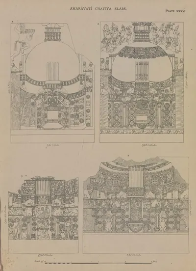 Amaravati: four chaitya slabs (drawn by Colonel Mackenzie's assistants) (Burgess 1887, Pl. XXXVI)Drawing · 1887
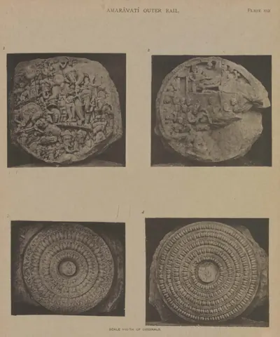 Amaravati: four cross-bars of the outer rail (Burgess 1887, Pl. XIX)Book plate · 1887
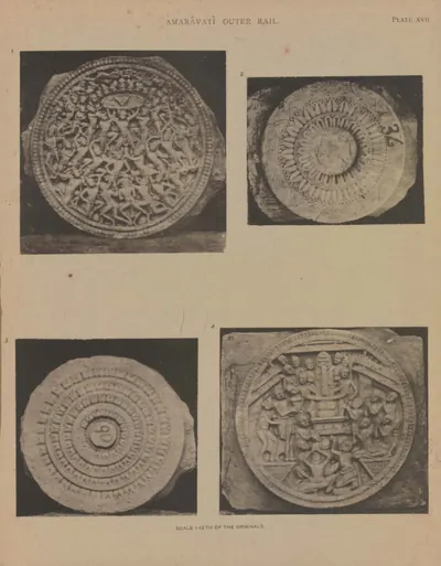 Amaravati: four cross-bars of the outer rail (Burgess 1887, Pl. XVII)Book plate · 1887
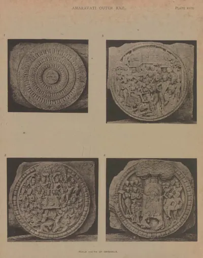 Amaravati: four cross-bars of the outer rail (Burgess 1887, Pl. XVIII)Book plate · 1887
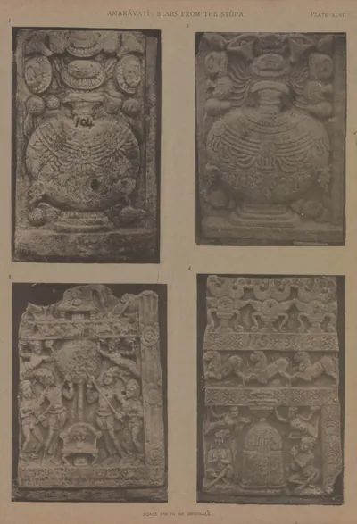 Amaravati: four other slabs from the great chaitya (Burgess 1887, Pl. XLVII)Book plate · 1887
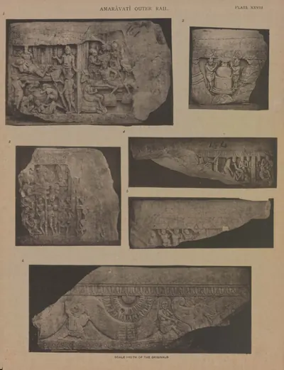 Amaravati: four pieces of coping, and one of an older form (Burgess 1887, Pl. XXVIII)Book plate · 1887
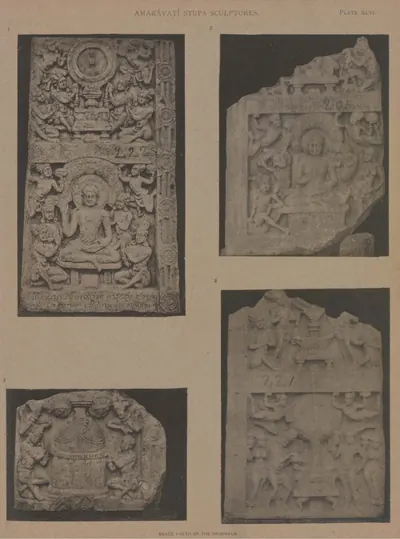 Amaravati: four slabs from the central chaitya (Burgess 1887, Pl. XLVI)Book plate · 1887
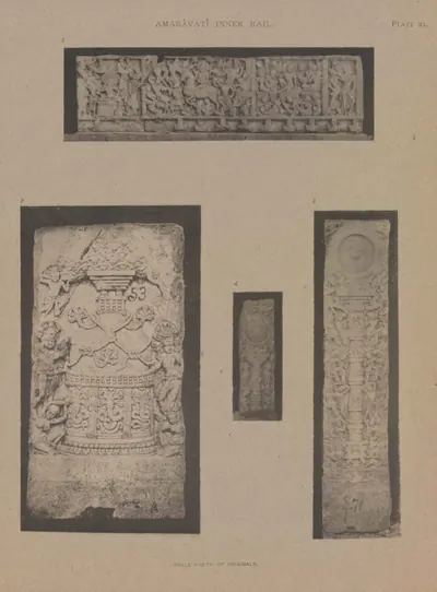 Amaravati: fragments of four chaitya slabs and two pillars from the inner rail (Burgess 1887, Pl. XL)Book plate · 1887
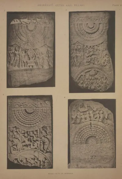 Amaravati: fragments of four rail pillars (Burgess 1887, Pl. XII)Book plate · 1887
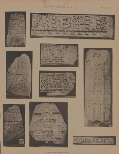 Amaravati: fragments of two chaitya slabs, three pieces of the frieze of the inner rail, &c. (Burgess 1887, Pl. XLII)Book plate · 1887
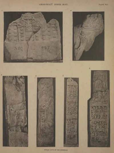 Amaravati: frieze, dagaba slab, chakra pillar, and fragment from the inner rail (Burgess 1887, Pl. XLI)Book plate · 1887
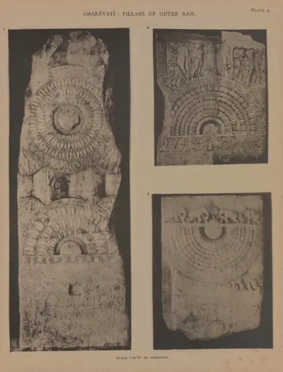 Amaravati: front of a rail pillar, and portions of other two (Burgess 1887, Pl. X)Book plate · 1887
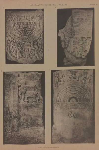 Amaravati: fronts of portions of two, and back and front of a third rail pillar (Burgess 1887, Pl. XI)Book plate · 1887
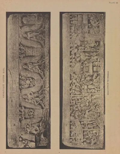 Amaravati: large coping-stone of the outer rail, both sides (Burgess 1887, Pl. XX)Book plate · 1887
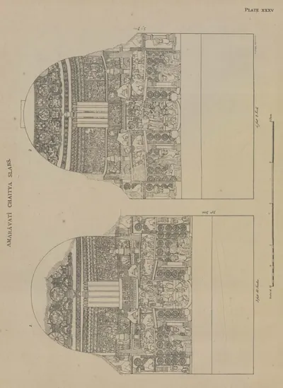 Amaravati: other two chaitya slabs (drawn by Colonel Mackenzie's assistants) (Burgess 1887, Pl. XXXV)Drawing · 1887
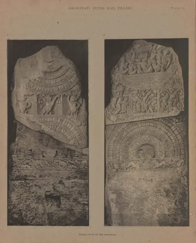 Amaravati: outer rail pillar, back and front (Burgess 1887, Pl. VI)Book plate · 1887
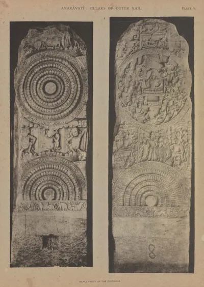 Amaravati: outer rail pillar, front and back (Burgess 1887, Pl. V)Book plate · 1887
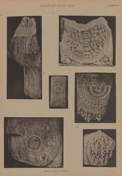 Amaravati: parts of three rail pillars, two cross-bars, and an old sculpture (Burgess 1887, Pl. XIV)Book plate · 1887
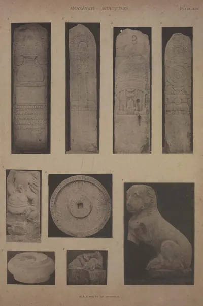 Amaravati: pillar from the East entrance, chhattra, lion, &c. (Burgess 1887, Pl. XLV)Book plate · 1887
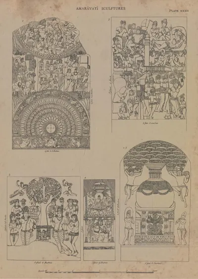 Amaravati: pillar of outer rail and four other slabs (drawn by Colonel Mackenzie's assistants) (Burgess 1887, Pl. XXXII)Drawing · 1887
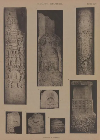 Amaravati: pillars and fragments (Burgess 1887, Pl. XLIV)Book plate · 1887
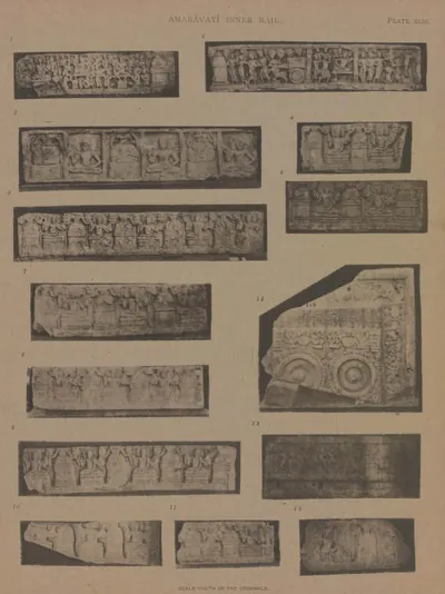 Amaravati: portions of an early frieze and of a Sripada (Burgess 1887, Pl. XLIII)Book plate · 1887
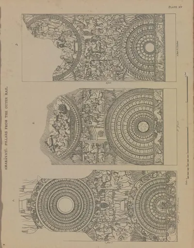 Amaravati: portions of three rail pillars (drawn by Colonel Mackenzie's assistants) (Burgess 1887, Pl. XV)Drawing · 1887
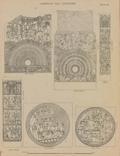 Amaravati: portions of two outer rail pillars, two cross-bars, and two inner rail pillars (drawn by Colonel Mackenzie's assistants) (Burgess 1887, Pl. XVI)Drawing · 1887
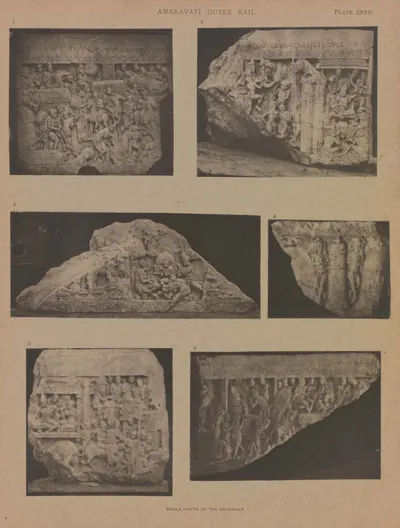 Amaravati: six other pieces of coping-stones (Burgess 1887, Pl. XXVII)Book plate · 1887
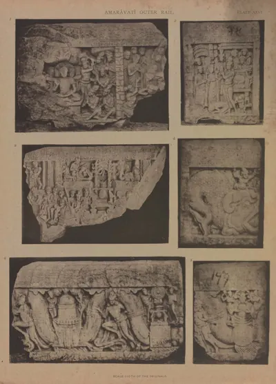 Amaravati: six pieces of coping-stones (Burgess 1887, Pl. XXVI)Book plate · 1887
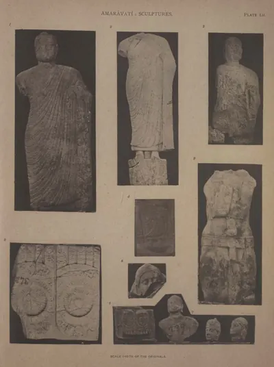 Amaravati: statues and Sripadas (Burgess 1887, Pl. LII)Book plate · 1887
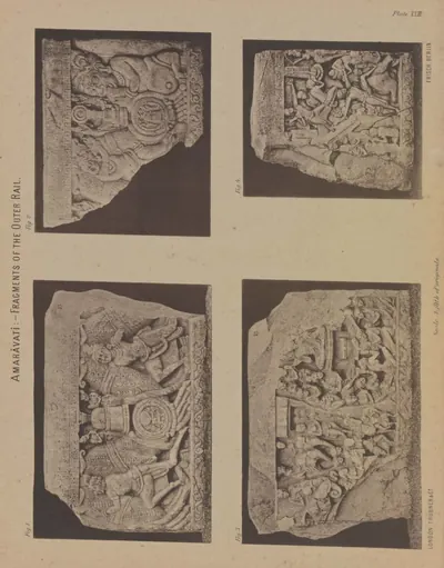 Amaravati: three broken coping-stones (Burgess 1887, Pl. XXIII)Book plate · 1887
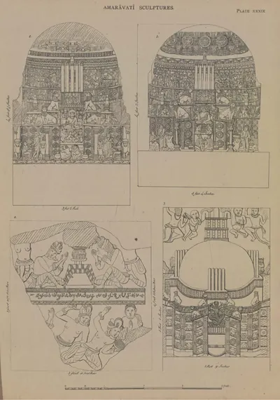 Amaravati: three chaitya slabs, and part of a slab from the stupa (drawn by Colonel Mackenzie's assistants) (Burgess 1887, Pl. XXXIX)Drawing · 1887
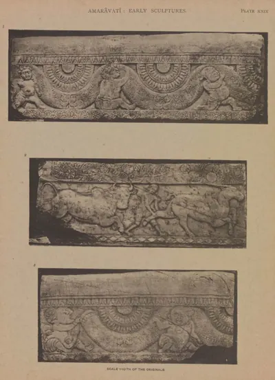 Amaravati: three pieces of earlier coping (Burgess 1887, Pl. XXIX)Book plate · 1887
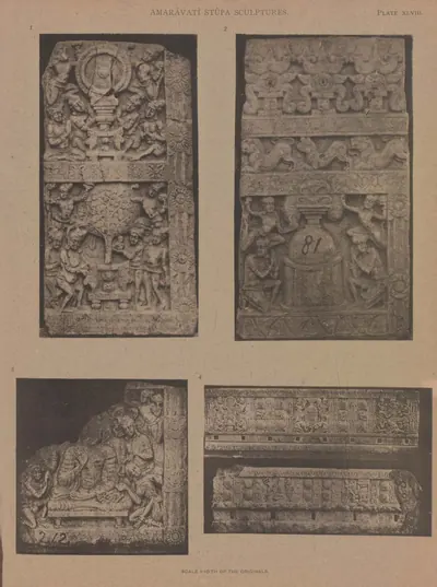 Amaravati: three slabs from the great chaitya, and two pieces of an early frieze (Burgess 1887, Pl. XLVIII)Book plate · 1887
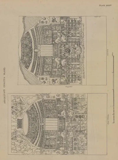 Amaravati: two chaitya slabs (drawn by Colonel Mackenzie's assistants) (Burgess 1887, Pl. XXXIV)Drawing · 1887
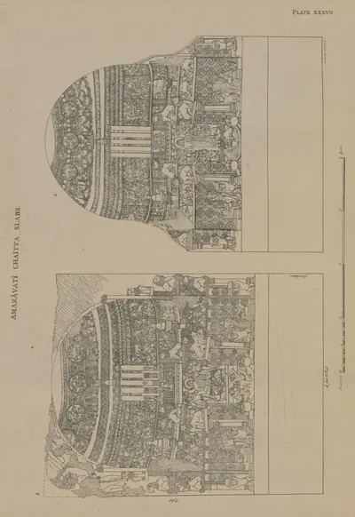 Amaravati: two chaitya slabs (drawn by Colonel Mackenzie's assistants) (Burgess 1887, Pl. XXXVII)Drawing · 1887
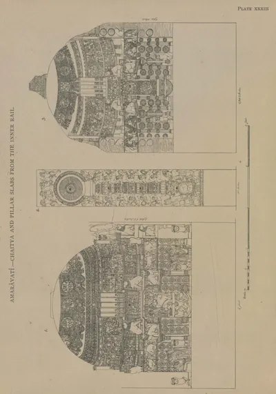 Amaravati: two chaitya slabs and a chakra pillar (drawn by Colonel Mackenzie's assistants) (Burgess 1887, Pl. XXXIII)Drawing · 1887
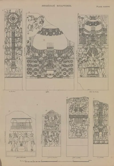 Amaravati: two chakra pillars, a chaitya slab, and four other sculptures (drawn by Colonel Mackenzie's assistants) (Burgess 1887, Pl. XXXVIII)Drawing · 1887
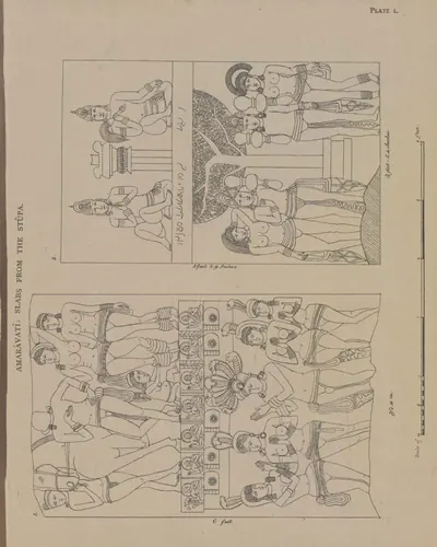 Amaravati: two early slabs, probably from the chaitya (drawn by Colonel Mackenzie's assistants) (Burgess 1887, Pl. L)Drawing · 1887
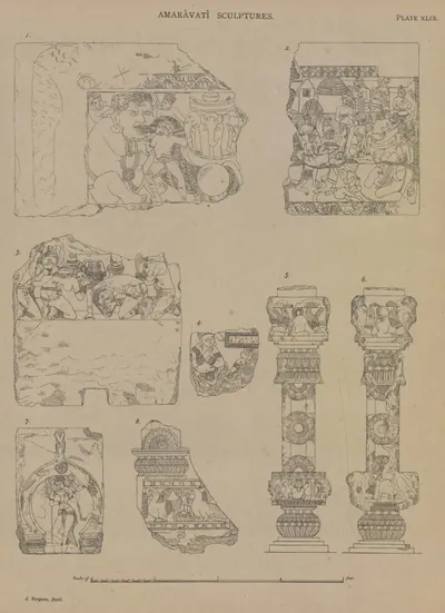 Amaravati: two pieces of coping of the outer rail, and various fragments (drawn by the Survey) (Burgess 1887, Pl. XLIX)Drawing · 1887
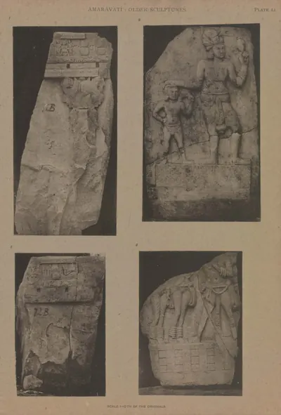 Amaravati: two slabs of an early stupa, and two early sculptures (Burgess 1887, Pl. LI)Book plate · 1887
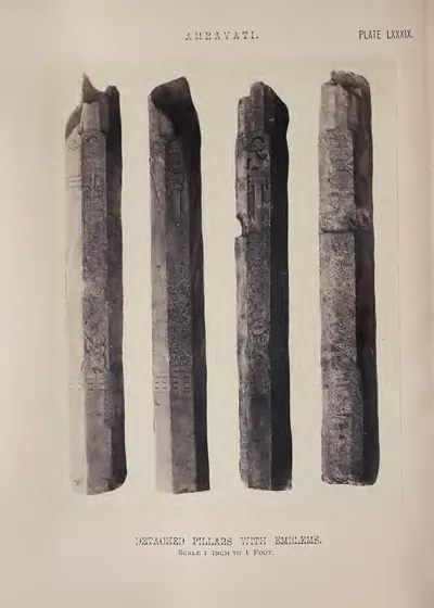 Amravati: detached pillars with emblems (Fergusson 1868, Pl. LXXXIX)Book plate · 1868
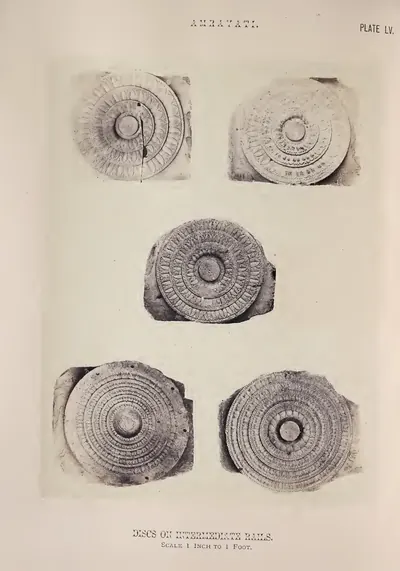 Amravati: discs on intermediate rails (Fergusson 1868, Pl. LV)Book plate · 1868
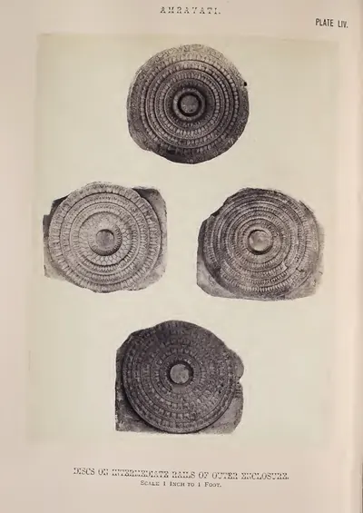 Amravati: discs on intermediate rails of outer enclosure (Fergusson 1868, Pl. LIV)Book plate · 1868
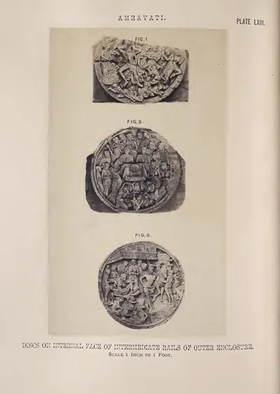 Amravati: discs on internal face of intermediate rails of outer enclosure (Fergusson 1868, Pl. LXIII)Book plate · 1868
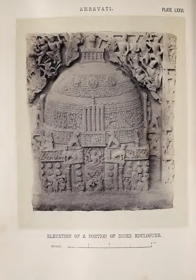 Amravati: elevation of a portion of inner enclosure (Fergusson 1868, Pl. LXXVI)Book plate · 1868
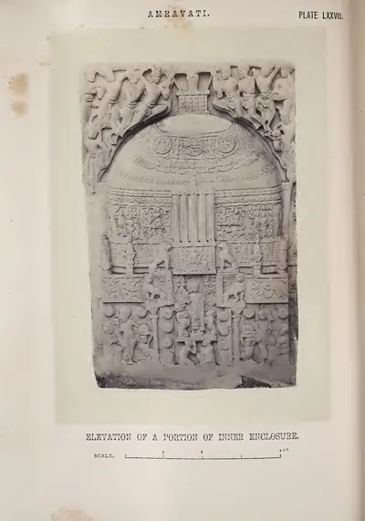 Amravati: elevation of a portion of inner enclosure (Fergusson 1868, Pl. LXXVII)Book plate · 1868
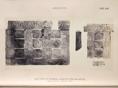 Amravati: elevation of external face of outer enclosure (restored by J. Fergusson) (Fergusson 1868, Pl. XLVIII)Book plate · 1868
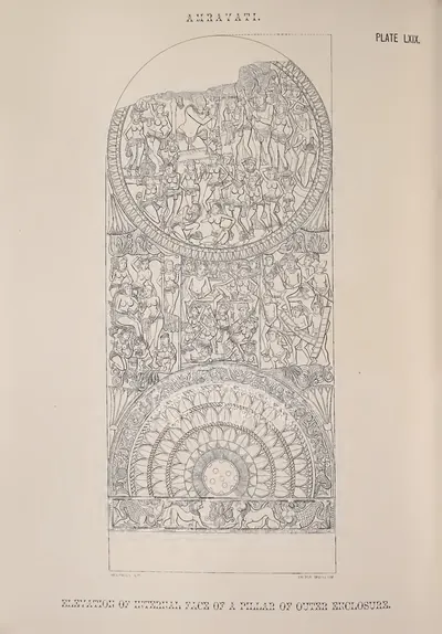 Amravati: elevation of internal face of a pillar of outer enclosure (from a drawing in the Mackenzie Collection) (Fergusson 1868, Pl. LXIX)Drawing · 1868
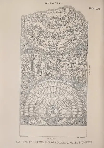 Amravati: elevation of internal face of a pillar of outer enclosure (from a drawing in the Mackenzie Collection) (Fergusson 1868, Pl. LXVII)Drawing · 1868
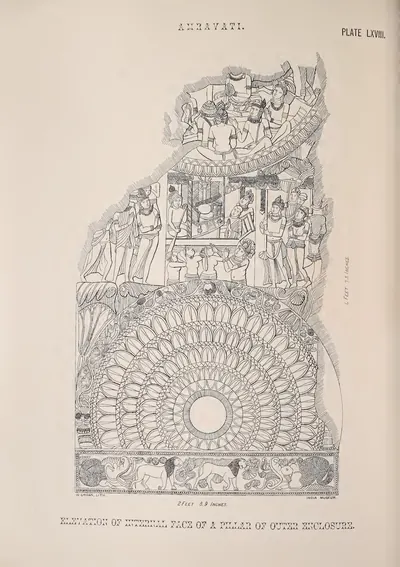 Amravati: elevation of internal face of a pillar of outer enclosure (from a drawing in the Mackenzie Collection) (Fergusson 1868, Pl. LXVIII)Drawing · 1868
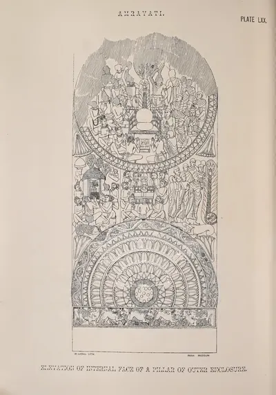 Amravati: elevation of internal face of a pillar of outer enclosure (from a drawing in the Mackenzie Collection) (Fergusson 1868, Pl. LXX)Drawing · 1868
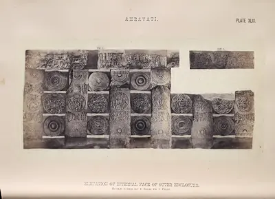 Amravati: elevation of internal face of outer enclosure (restored by J. Fergusson) (Fergusson 1868, Pl. XLIX)Book plate · 1868
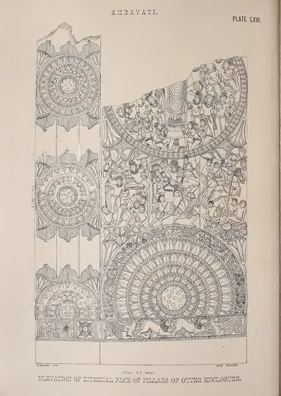 Amravati: elevation of internal face of pillars of outer enclosure (from a drawing in the Mackenzie Collection) (Fergusson 1868, Pl. LXVI)Drawing · 1868
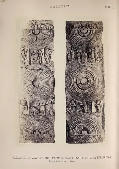 Amravati: elevations of external faces of two pillars of outer enclosure (Fergusson 1868, Pl. L)Book plate · 1868
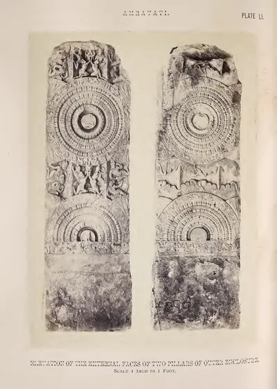 Amravati: elevations of external faces of two pillars of outer enclosure (Fergusson 1868, Pl. LI)Book plate · 1868
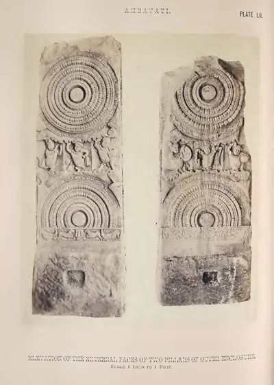 Amravati: elevations of external faces of two pillars of outer enclosure (Fergusson 1868, Pl. LII)Book plate · 1868
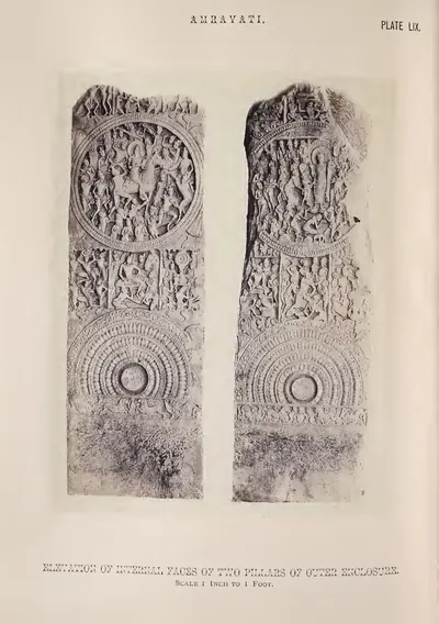 Amravati: elevations of internal faces of two pillars of outer enclosure (Fergusson 1868, Pl. LIX)Book plate · 1868
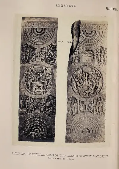 Amravati: elevations of internal faces of two pillars of outer enclosure (Fergusson 1868, Pl. LVIII)Book plate · 1868
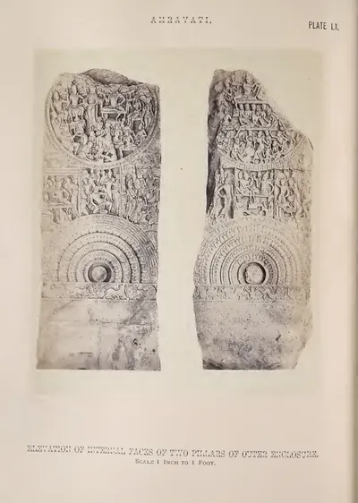 Amravati: elevations of internal faces of two pillars of outer enclosure (Fergusson 1868, Pl. LX)Book plate · 1868
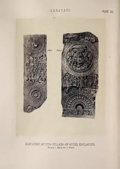 Amravati: elevations of internal faces of two pillars of outer enclosure (Fergusson 1868, Pl. LXI)Book plate · 1868
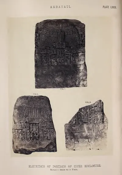 Amravati: elevations of portions of inner enclosure (Fergusson 1868, Pl. LXXIX)Book plate · 1868
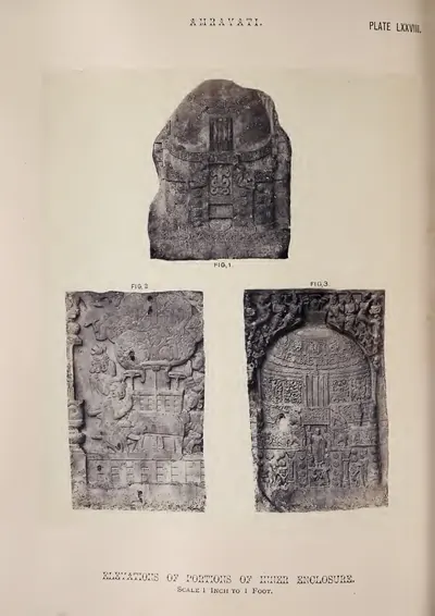 Amravati: elevations of portions of inner enclosure (Fergusson 1868, Pl. LXXVIII)Book plate · 1868
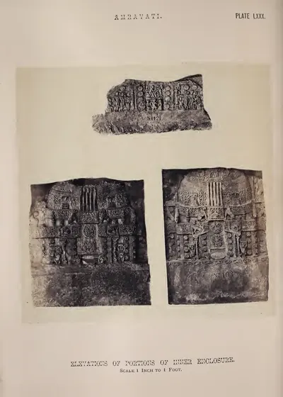 Amravati: elevations of portions of inner enclosure (Fergusson 1868, Pl. LXXX)Book plate · 1868
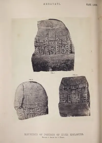 Amravati: elevations of portions of inner enclosure (Fergusson 1868, Pl. LXXXI)Book plate · 1868
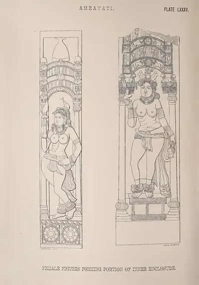 Amravati: female figures forming portion of inner enclosure (from a drawing in the Mackenzie Collection) (Fergusson 1868, Pl. LXXXV)Drawing · 1868
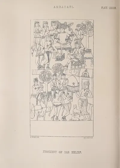 Amravati: fragment of bas-relief (from a drawing in the Mackenzie Collection) (Fergusson 1868, Pl. LXXXVI)Drawing · 1868
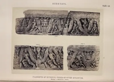 Amravati: fragments of external frieze of outer enclosure (Fergusson 1868, Pl. LVI)Book plate · 1868
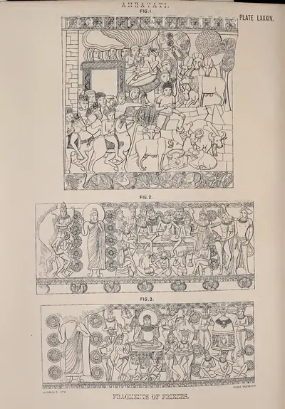 Amravati: fragments of friezes (from a drawing in the Mackenzie Collection) (Fergusson 1868, Pl. LXXXIV)Drawing · 1868
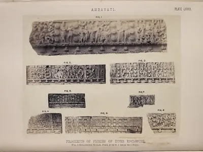 Amravati: fragments of friezes of inner enclosure (Fergusson 1868, Pl. LXXXII)Book plate · 1868
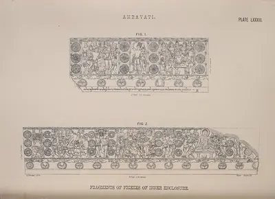 Amravati: fragments of friezes of inner enclosure (Fergusson 1868, Pl. LXXXIII)Drawing · 1868
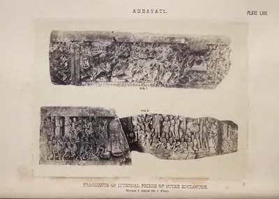 Amravati: fragments of internal frieze of outer enclosure (Fergusson 1868, Pl. LXIV)Book plate · 1868
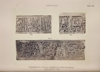 Amravati: fragments of internal friezes of outer enclosure (Fergusson 1868, Pl. LXV)Book plate · 1868
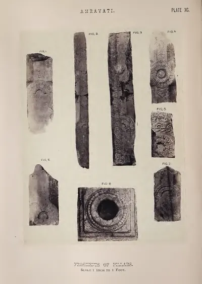 Amravati: fragments of pillars (Fergusson 1868, Pl. XC)Book plate · 1868
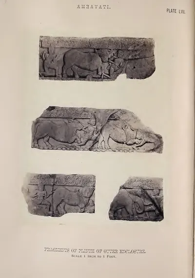 Amravati: fragments of plinth of outer enclosure (Fergusson 1868, Pl. LVII)Book plate · 1868
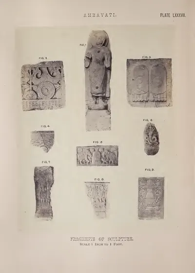 Amravati: fragments of sculpture (Fergusson 1868, Pl. LXXXVII)Book plate · 1868
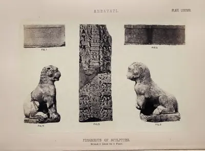 Amravati: fragments of sculpture (Fergusson 1868, Pl. LXXXVIII)Book plate · 1868
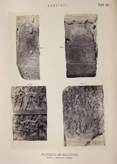 Amravati: fragments of sculpture (Fergusson 1868, Pl. XCI)Book plate · 1868
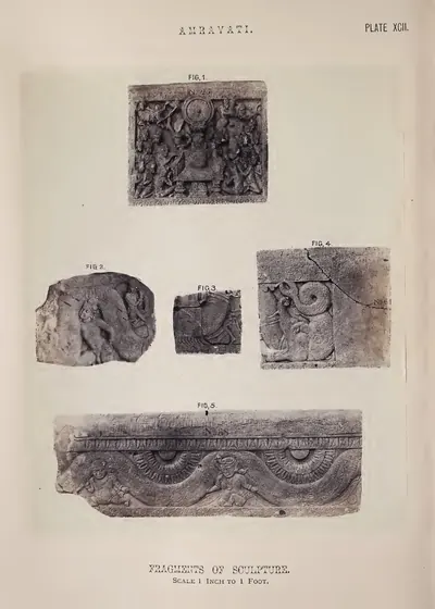 Amravati: fragments of sculpture (Fergusson 1868, Pl. XCII)Book plate · 1868
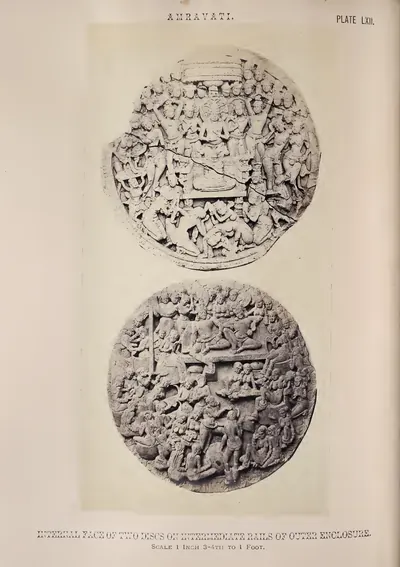 Amravati: internal face of two discs on intermediate rails of outer enclosure (Fergusson 1868, Pl. LXII)Book plate · 1868
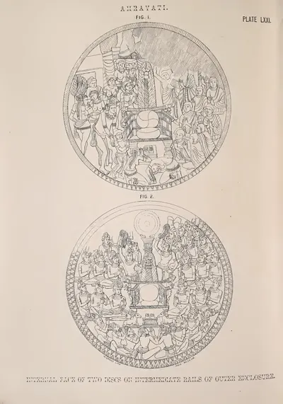 Amravati: internal faces of two discs on intermediate rails of outer enclosure (from a drawing in the Mackenzie Collection) (Fergusson 1868, Pl. LXXI)Drawing · 1868
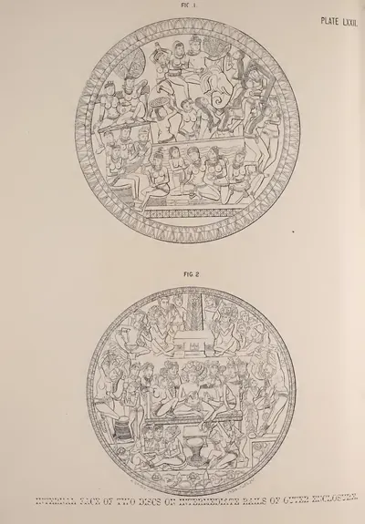 Amravati: internal faces of two discs on intermediate rails of outer enclosure (from a drawing in the Mackenzie Collection) (Fergusson 1868, Pl. LXXII)Drawing · 1868
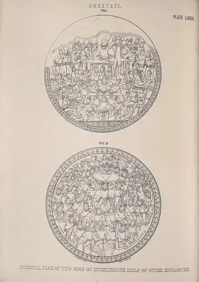 Amravati: internal faces of two discs on intermediate rails of outer enclosure (from a drawing in the Mackenzie Collection) (Fergusson 1868, Pl. LXXIII)Drawing · 1868
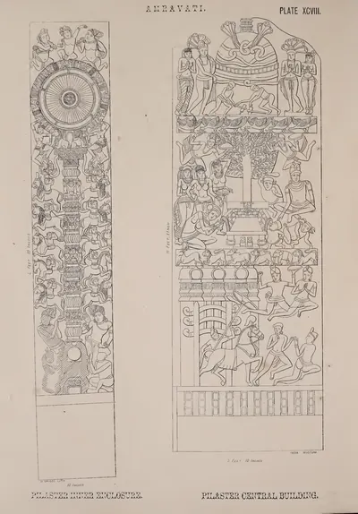 Amravati: pilaster of inner enclosure and of central building (from a drawing in the Mackenzie Collection) (Fergusson 1868, Pl. XCVIII)Drawing · 1868
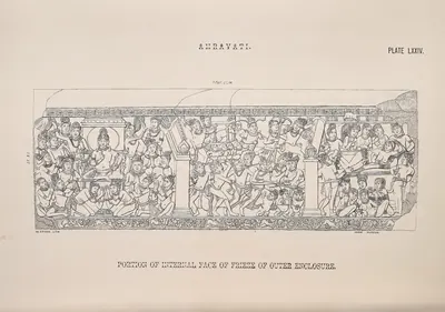 Amravati: portion of internal face of frieze of outer enclosure (from a drawing in the Mackenzie Collection) (Fergusson 1868, Pl. LXXIV)Drawing · 1868
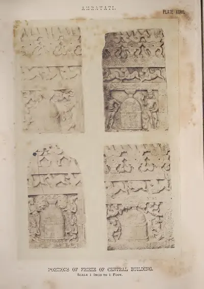 Amravati: portions of frieze of central building (Fergusson 1868, Pl. XCVII)Book plate · 1868
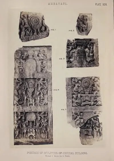 Amravati: portions of sculpture of central building (Fergusson 1868, Pl. XCIV)Book plate · 1868
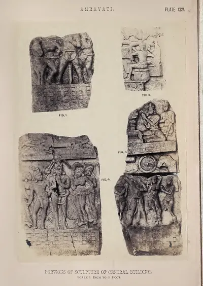 Amravati: portions of sculpture of central building (Fergusson 1868, Pl. XCV)Book plate · 1868
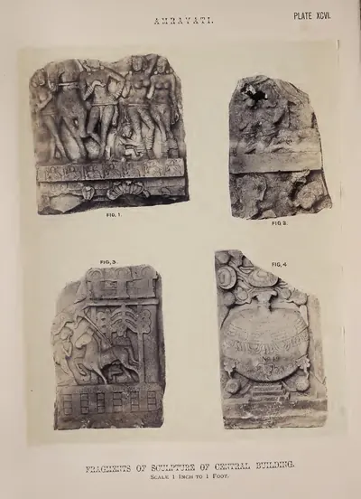 Amravati: portions of sculpture of central building (Fergusson 1868, Pl. XCVI)Book plate · 1868
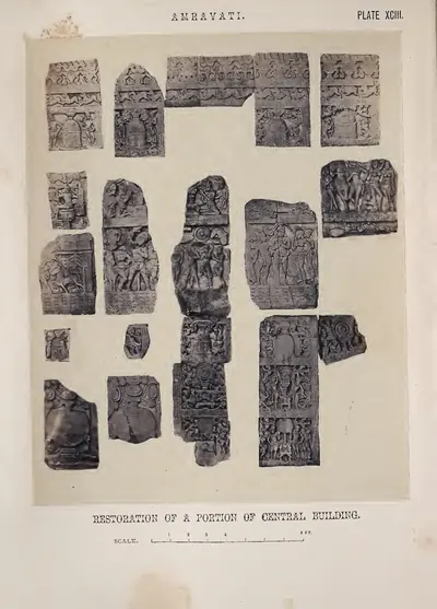 Amravati: restoration of a portion of central building (by J. Fergusson) (Fergusson 1868, Pl. XCIII)Book plate · 1868
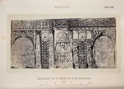 Amravati: restoration of a portion of inner enclosure (Fergusson 1868, Pl. LXXV)Book plate · 1868
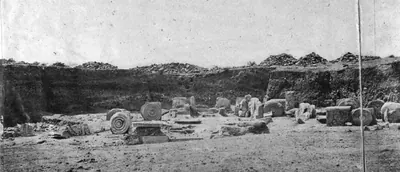 Excavation of the south gate, Amaravati, 1880Historic photograph · 1880
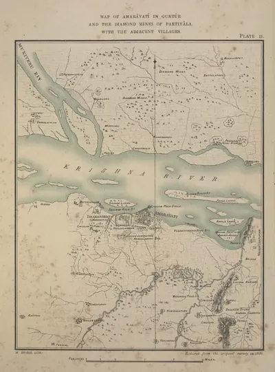 Map of Amaravati in Guntur with the adjacent villages, and the diamond mines of Partiyala (reduced from the survey of 1816) (Burgess 1887, Pl. II)Map · 1887
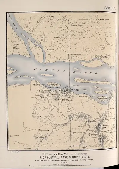 Map of Amravati in Guntoor & of Purtyall & the diamond mines, with the villages adjacent, reduced from the original survey in 1816 (Fergusson 1868, Pl. XLVI)Map · 1868
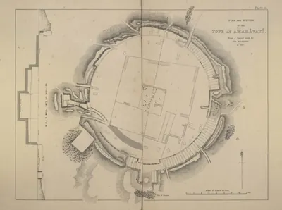 Plan and section of the tope at Amaravati, from a survey made by Colonel Mackenzie in 1817 (Burgess 1887, Pl. III)Plan · 1887
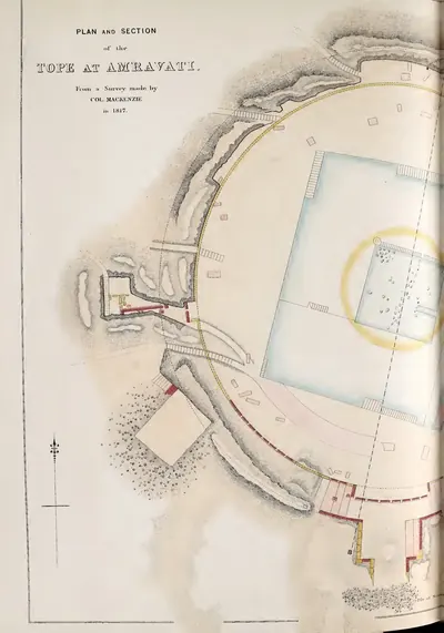 Plan and section of the tope at Amravati, from Colonel Mackenzie's survey in 1817 (left half of folding plate) (Fergusson 1868, Pl. XLVII)Plan · 1868
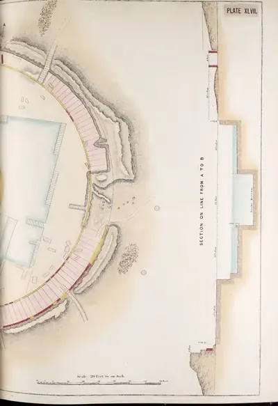 Plan and section of the tope at Amravati, from Colonel Mackenzie's survey in 1817 (right half of folding plate) (Fergusson 1868, Pl. XLVII)Plan · 1868
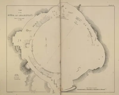 Plan of the stupa at Amaravati, from a survey made in December 1881 (Burgess 1887, Pl. IV)Plan · 1887
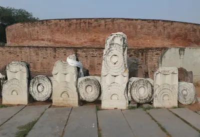 Re-erected railing at the Amaravati stupaPhotograph · 2024
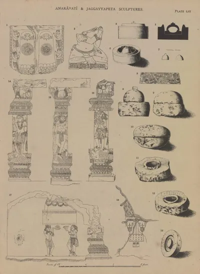 Sripada, salika, casket, &c., from Amaravati; caskets from other places in the Krishna District, three pilasters and two slabs from Jaggayyapeta (Burgess 1887, Pl. LIII)Drawing · 1887
Related
Dynasties
Satavahanas
c. 200 BCE – 225 CE
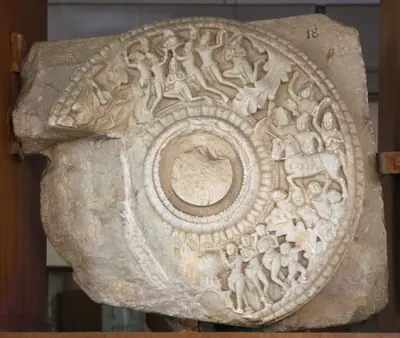
Deccan dynasty, called the Andhras in the Puranas, whose later kings ruled the Krishna valley, the Godavari delta and parts of Rayalaseema in the 2nd and early 3rd centuries CE. Its beginnings, its dates and when it reached the Telugu country are all debated.
Kotas of Dharanikota
c. 1100–1276 CE
A family of chiefs of Amaravati–Dharanikota on the south bank of the Krishna, lords of the 'Six-thousand' country (Konnatavadi). Robert Sewell traced their line from about 1100, and their inscriptions run to the 1270s. Keta II, who probably came to power in 1182, still gave lamps and villages to the Buddha at Amaravati. Related by marriage to the Velanati Chodas and the Kakatiyas, they were brought under Kakatiya rule about 1185. Kota Beta married Ganapamba, daughter of the Kakatiya king Ganapatideva, and she ruled the family's lands as a widow in the 1250s.
People
Vasishthiputra Pulumavi
c. 138–170 CE
Son and successor of Gautamiputra Satakarni, and the earliest Satavahana king named in an inscription from the lower Krishna valley. He lost much of the western Deccan to the Saka satrap Rudradaman, who was probably his father-in-law. A King Pulumavi is also named in a rock inscription at Myakadoni in Bellary district.
Yajna Sri Satakarni
c. 184–213 CE
Late Satavahana king of the later 2nd century CE, the last whose inscriptions and coins are found in both the western Deccan and the Krishna–Godavari country. His Chinna inscription, from the coast south of the Krishna, is dated in his 27th year. His silver coins bear what E. J. Rapson in 1908 called the only known coin-portrait of a Satavahana king.
Sivaskandavarman (Pallava)
c. 250–275 CE
Earliest Pallava king known from his own charters. As crown prince he sent the Mayidavolu plates from Kanchipura to his officer at Dhannakada (Amaravati), granting a village in Andhrapatha, the Telugu country. As king he issued the Hirahadagalli plates and claimed the horse sacrifice. His date is disputed: from the early 3rd century to the middle of the 4th.
Kota Keta II
c. 1182–1209 CE
Chief of Amaravati–Dharanikota, the Mahamandalesvara Kota Ketaraja, lord of the Six-thousand country south of the Krishna. His long inscription on a pillar of the Amaresvara temple is dated in Saka 1104, probably the day he came to the throne (about 1182–83). It records grants to Brahmans, and lamps and villages for the Buddha at Amaravati. His mother was a sister of a Gonka of Velanandu. His records run to about 1209.
Ganapamba
c. 1250–1257 CE
Kakatiya princess, daughter of Ganapatideva, married to the Kota chief Beta of Amaravati–Dharanikota. After Beta's death she ruled his lands as a Mahamandalesvara with the male titles of his family. She gilded the Amaresvara temple at Amaravati, and built temples named Betesvara and Ganapesvara after her husband and her father. Her Yenamadala pillar inscription is the main record of the Kota family.
Kota Beta
c. 1250–1257 CE
Chief of Amaravati–Dharanikota, grandson of Kota Keta II, who married Ganapamba, daughter of the Kakatiya king Ganapatideva. He was alive in 1251, when he founded a temple at Yenamadala, and dead by 1257. His widow built temples in his memory and ruled his lands with the masculine titles of the family.
Prolaya Vema Reddi
c. 1325–1353 CE
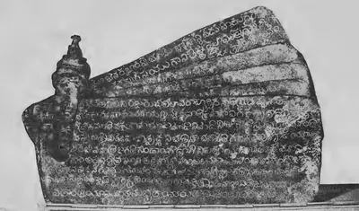
Founder of the Reddi kingdom of Addanki and Kondavidu (c. 1325–1353). He took over the country between Srisailam and the sea after the fall of the Kakatiyas. His grants of 1345 and 1346 say he restored the Brahman villages seized by the Muslim conquerors of Warangal. Later records remember him for the flights of steps at Srisailam and Ahobilam, and the poet Errapragada dedicated his Harivamsa to him.
Anavota Reddi
c. 1353–1364 CE
Second Reddi king of Addanki (c. 1353–1364), elder son of Prolaya Vema. His only known copper-plate grant, from Koduru (1358), and his renewal of the Kakatiya charter for sea merchants at Motupalli (1358) survive. A Velama chronicle claims a victory over him at Dharanikota in 1361. His son Kumaragiri and his son-in-law Kataya Vema later ruled at Kondavidu and Rajahmundry.
Monuments
Inscriptions
Amaravati inscription of the time of Vasishthiputra Pulumavi
c. 130 CE
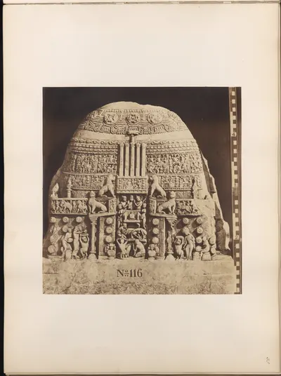
A two-line Prakrit inscription on a broken coping stone from the Amaravati stupa. It records a Dharmachakra (wheel of the law) set up at the western gate of the Great Chaitya, in a regnal year of the Satavahana king Vasishthiputra Sri Pulumavi. The year itself is lost.
Amaravati inscription of King Sri Sivamaka Sada
c. 150 CE
Fragment of a one-line Prakrit inscription on a carved coping stone of the Amaravati stupa, recording a gift by the 'superintendent of the water establishment' of a king Sri Sivamaka Sada. The king has been taken for the founder Simuka, for Siva Sri Satakarni, or for a ruler of another family altogether.
Amaravati pillar inscription of Keta II
c. 1182 CE
A Sanskrit and Telugu inscription dated in Saka 1104 (probably 1182–83) on a pillar of the Amaresvara temple at Amaravati. It records the grants made by the Kota chief Keta II, probably on the day he came to the throne: villages and lamps for the Buddha, and villages for Brahmans. A second inscription on the same pillar, of 1234, records a lamp given to the Buddha by Kota Bayyalamahadevi.
Amaravati inscription of Krishnadeva Raya (1515)
1515 CE
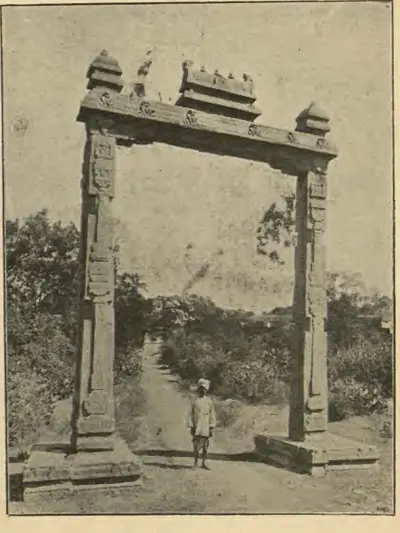
A Sanskrit verse inscription in Telugu letters on a slab in the Amaresvara temple at Amaravati, edited by H. Luders in 1903. It praises Krishnadeva Raya as the conqueror of Sivanasamudram, Udayagiri, Vinukonda and Bellamkonda, who took Kondavidu after capturing the Gajapati's son Virabhadra alive. It records that in Saka 1437 (1515) the king performed the tulapurusha gift (giving away his weight in gold) and gave agraharas (Brahmin villages) before the god Amaresa on the bank of the Krishna. It was the first inscription found to describe his eastern campaign.
References
Notes (0)
Sources (10)
Spotted an error on this page? Tell us
Last updated: