Mauryas & Satavahanas
The Telugu lands enter written history with Asoka's edicts in Kurnool district and the Buddhist relic inscriptions of the Krishna delta. The Satavahanas, whose dates are still debated, ruled the Krishna valley by the 2nd century CE, when Amaravati and other stupas flourished.
Swipe sideways to see the whole chart; tap a bar for details.
Each bar is a ruling power in its region; time runs left to right. Dashed = approximate dates. Select a bar for details.
Show as a list
Mauryas & Satavahanas 300 BCE – 225 CE
- Telangana
- Mauryas (c. 272 BCE – 185 BCE) · Satavahanas (c. 220 BCE – 225 CE) · Kotilingala coin kings (c. 200 BCE – 52 BCE)
- Coastal Andhra
- Mauryas (c. 260 BCE – 185 BCE) · Satavahanas (c. 220 BCE – 225 CE)
- Rayalaseema
- Mauryas (c. 268 BCE – 185 BCE) · Satavahanas (c. 1–225 CE)
Ikshvakus, Vishnukundins & early kingdoms 225–624 CE
- Coastal Andhra
- Ikshvakus (c. 225–350 CE) · Pallavas (c. 250–630 CE) · Salankayanas of Vengi (c. 300–470 CE)
- Rayalaseema
- Pallavas (c. 300–900 CE)
Kingdoms and empires
Mauryas
Open page- Telangana: c. 272 BCE – 185 BCE (c. 87 years)
IG Hyderabad says Asoka's dominions covered a considerable part of the eastern tracts of the Nizam's State; no Telangana edict cited. Asoka 272-231 BCE in IG Hyderabad, 268-226 BCE in Sewell
- Rayalaseema: c. 268 BCE – 185 BCE (c. 83 years)
Asokan edicts at Erragudi and Rajula-Mandagiri, Pattikonda taluk, Kurnool; Bindusara (296-268 BCE) is believed to have extended rule south
- Coastal Andhra: c. 260 BCE – 185 BCE (c. 75 years)
Asoka's Kalinga war (260 BCE in the Godavari gazetteer, 256 BCE in Sewell) and a Mauryan-script record at Amaravati; empire ended 185/184 BCE
Rulers
Inscriptions
Sources (5)
Kingdoms and empires
Ikshvakus
Open page- Coastal Andhra: c. 225–350 CE (c. 125 years)
Lower Krishna valley (Vijayapuri at Nagarjunakonda, Jaggayyapeta, Uppugundur); four kings known; dated inscriptions of 273–74 and 333–34 (Sircar), with an Abhira interlude about 278–79
- Telangana: c. 225–352 CE (c. 127 years)
Partial: the lower Krishna valley on the Nalgonda side. Inscriptions of the Ikshvaku kings Chamtamula and Rudrapurushadatta at Phanigiri (Nalgonda); the editors of Epigraphia Telanganica date Rudrapurushadatta's pillar to 352 and take it as the end of Ikshvaku rule.
Rulers
Capitals
Monuments
Inscriptions
Sources (5)
Kingdoms and empires
Satavahanas
Open page- Telangana: c. 220 BCE – 225 CE (c. 445 years)
IG Hyderabad: rise c. 220 BCE, end about a century after Pulumayi II (acc. c. 138 CE); Sewell: by c. 170 BCE the Andhra king ruled Hyderabad as well as the Telugu tracts
- Coastal Andhra: c. 220 BCE – 225 CE (c. 445 years)
Sources disagree: IG Madras 220 BCE-236 CE; Sewell 'from at least 250 BCE' to c. 225 CE when the Pallava Bappa ended the line; Godavari gazetteer dates the known kings c. 110-220 CE, last inscriptions c. 218
- Rayalaseema: c. 1–225 CE (c. 224 years)
Sewell: about 1 CE the Andhra king ruled parts of Cuddapah and Kurnool; an inscription of Pulumayi II (c. 145 CE) in Adoni taluk proves Andhra rule there; Bellary gazetteer: the Andhras ruled that district in the 2nd century CE. When their rule here began is not recorded
Rulers (12)
- Simuka (c. 220 BCE – 197 BCE)
- Krishna (Kanha) (c. 197 BCE – 179 BCE)
- Sri Satakarni (c. 179 BCE – 169 BCE)
- Sivasvati (c. 85–113 CE)
- Gautamiputra Satakarni (c. 113–138 CE)
- Vasishthiputra Pulumavi (c. 138–170 CE)
… and 6 more
- Siva Sri Satakarni (c. 170–177 CE)
- Sivaskanda Satakarni (c. 177–184 CE)
- Yajna Sri Satakarni (c. 184–213 CE)
- Vijaya Satakarni (c. 213–219 CE)
- Chandra Sri Satakarni (c. 219–229 CE)
- Pulumavi III (c. 229–236 CE)
Capitals
Inscriptions
Sources (5)
Kingdoms and empires
Vakatakas
Open page- Telangana: c. 300–500 CE (c. 200 years)
Partial: the Adilabad, Nizamabad and Karimnagar country north of the Godavari, as part of the Vakataka lands of central India and the northern Deccan. Goel et al. (2022) place the Vakataka lands from the findspots of their 37 inscriptions and name only these three Telangana districts. Jouveau-Dubreuil (1920) claimed much more: almost the whole of the Hyderabad State, and up to Kurnool. A Vakataka princess married the Vishnukundin Madhavavarman (Chikkulla plates). No Vakataka inscription from Telangana is listed in Epigraphia Telanganica I; this span rests on modern histories. Dates follow the Sewell table (Vindhyasakti c. 275-300 to Harishena c. 465-500).
Rulers (8)
- Vindhyasakti (c. 275–300 CE)
- Pravarasena I (c. 300–330 CE)
- Rudrasena I (c. 330–340 CE)
- Prithvisena I (c. 340–390 CE)
- Rudrasena II (c. 390–395 CE)
- Pravarasena II (c. 395–420 CE)
… and 2 more
- Devasena (c. 445–465 CE)
- Harishena (c. 465–500 CE)
Sources (5)
Kingdoms and empires
Kotilingala coin kings
Open page- Telangana: c. 200 BCE – 52 BCE (c. 148 years)
Partial: the Godavari country of the old Karimnagar district (Kotilingala, Peddabankur, Dhulikatta), known only from coins of four kings: Gobhada, Kamvaya, Narana and Samagopa, in that order (Lodaya). Dating disputed: the excavators date Gobhada to the first half of the 2nd century BCE, K. D. Bajpai to c. 125-100 BCE; Samagopa to the 1st century BCE. Lodaya has Simuka oust Samagopa about 52 BCE and Shastri puts the Satavahana rise in the mid-1st century BCE; Parabrahma Sastry instead took Gobhada and Samagopa for Sunga kings with the early Satavahanas as their subordinates, and Krishna Sastry left open whether such local rulers served the Satavahanas or another power
Sources (3)
Kingdoms and empires
Pallavas
Open page- Coastal Andhra: c. 250–630 CE (c. 380 years)
Krishna-Guntur, Ongole and Nellore. Prakrit grant of the crown prince Sivaskandavarman to his officer at Dhanyakataka (Amaravati), dated from about 234 (Sewell) or 250-275 (Jouveau-Dubreuil) to the first half of the 4th century (Sircar); Sanskrit grants of a Nellore-Guntur line (Omgodu, Uruvupalli, Pikira, Mangalur, Vilavatti, Chura) in the 5th and 6th centuries. Karmarashtra (Ongole-Bapatla) was Chalukya by about 630 (Kopparam plates of Pulakesin II). The Godavari gazetteer calls 200-615 a Pallava age, and IG Madras calls Vengi originally a Pallava province; Sircar found no evidence that the Pallavas held Vengi itself.
- Rayalaseema: c. 300–900 CE (c. 600 years)
Partial. Pallava frontier guards at Sriparvata (Kurnool) in the 4th century (Talagunda inscription; Sircar); Ganga kings of the Penukonda plates installed by Pallava kings (5th century); inscription of Paramesvaravarman II at Ulchala near Kurnool (728-29); Bana vassals in the Chittoor country under Nripatunga (9th century). The Cuddapah gazetteer has the Pallavas hold the eastern Cuddapah taluks for four centuries until the Chola Aditya I crippled them at the end of the 9th century. The Cuddapah gazetteer says the Pallavas of Kanchi pushed up the Penner from Nellore into north Cuddapah for a time and then ruled the eastern Cuddapah taluks for four centuries, until the Chola Aditya I crippled them at the end of the 9th century; Sewell gives a Pallava regnal-year record in Chittoor (864-65), with the Banas as Pallava vassals.
- Coastal Andhra: c. 670–750 CE (c. 80 years)
Southern Nellore only: grants of Paramesvaravarman I (Podili-Kandukur country, 687) and Narasimhavarman II (Revuru, Atmakur taluk, about 700-711), and a Tamil record of the 15th year of Nandipottarasar at Mallam (Gudur taluk), read as Pallava supremacy (Nellore gazetteer, 1942) or as Pallava rule under the Western Chalukyas (Butterworth and Venugopaul Chetty, 1905).
Rulers (18)
- Bappa (c. 225–250 CE)
- Sivaskandavarman (Pallava) (c. 250–275 CE)
- Vishnugopa of Kanchi (c. 325–350 CE)
- Kumaravishnu II (Pallava) (c. 425–450 CE)
- Skandavarman II (Pallava) (c. 450–475 CE)
- Simhavarman II (Pallava) (c. 500–525 CE)
… and 12 more
- Vishnugopavarman (c. 525–550 CE)
- Simhavishnu (c. 575–600 CE)
- Mahendravarman I (c. 600–630 CE)
- Narasimhavarman I (c. 630–668 CE)
- Mahendravarman II (c. 668–670 CE)
- Paramesvaravarman I (c. 670–690 CE)
- Narasimhavarman II (c. 690–715 CE)
- Nandivarman II Pallavamalla (c. 717–779 CE)
- Dantivarman (c. 779–830 CE)
- Nandivarman III (c. 830–854 CE)
- Nripatunga (c. 854–880 CE)
- Aparajita (c. 880–900 CE)
Capitals
Inscriptions (14)
Sources (19)
Kingdoms and empires
Salankayanas of Vengi
Open page- Coastal Andhra: c. 300–470 CE (c. 170 years)
Vengi (Pedavegi near Eluru), between the Krishna and the Godavari. Dates debated: D. C. Sircar (1939) about 320-470, from Devavarman to Skandavarman; B. V. Krishna Rao puts Nandivarman I at the close of the 3rd century, Sircar (1960) the Ellore and Kanukollu grants in the mid-4th; Subramanian about 275-450; Subba Rao has the Vishnukundins take Vengi about 450. Older works call these rulers Pallavas
Rulers
Capitals
Inscriptions
Sources (5)
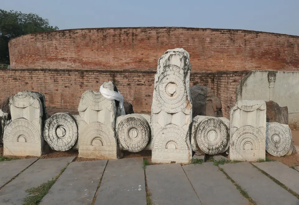
Between about the 3rd century BCE and the early 3rd century CE, the Telugu country passes from prehistory into recorded history.12 Three kinds of evidence mark the change:1342
- the edicts of the Mauryan emperor Asoka, cut into rocks in Kurnool district1
- short Buddhist inscriptions on relic caskets and stone slabs in the Krishna valley3
- the coins and Prakrit inscriptions of the Satavahana kings, whom the Puranas call the Andhras42
Scholars have argued for more than 150 years about how these pieces fit together. The sources on this page run from 1868 to 1959.56 Their dates for the same kings differ by up to two centuries. So the page sets out the main positions, not a single chronology.56
Asoka and the Mauryan south
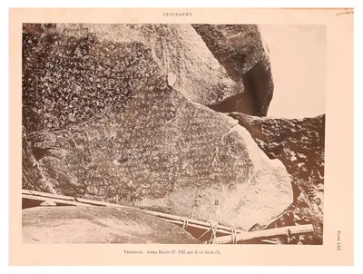
The edicts at Erragudi are carved on six large boulders of a low hill called Yenakonda. The hill is near the southern border of Kurnool district.1 A. Ghose of the Geological Survey of India found them at the end of 1928, while he was looking for minerals.1 D. C. Sircar edited them.1 He dated Asoka to about 272–232 BCE.1
A second Asokan text was found on 26 December 1953 at Rajula-Mandagiri.7 It is a copy of the Minor Rock Edict.7 Rajula-Mandagiri is a hamlet about four miles north-west of Pattikonda, and some twenty miles from Erragudi.7
Asoka’s Rock Edict XIII is also found at Erragudi.8 It names the Andhras, the Paulindas and other peoples.8 It counts them among the peoples within the king’s own dominions who followed his teaching in dharma (moral law).8
Older writers saw Asoka’s link with the Andhras differently.910 The Godavari gazetteer of 1907 said Asoka claimed to have subdued them.9 Robert Sewell’s list, published in 1932, treated the Andhra kings as rulers whom Asoka recognised as independent.10 Sircar’s translation of the Erragudi text places the Andhras inside the empire.8
The Imperial Gazetteer of 1908 was written before Erragudi was known.11 It could only make a guess from the Jaugada edict in Ganjam and the edicts on the Mysore border.11 From these it inferred that the northern half of the Madras Presidency was probably Mauryan around 250 BCE.11
The Mauryan empire broke up after Asoka. Sewell’s outline follows the scholarship of his day.12 In it, the last Maurya, Brihadratha, was killed by his commander Pushyamitra in about 184 BCE.12
The earliest local writing
The oldest writing made in the Krishna valley itself is on reliquaries (containers for relics). Alexander Rea found three relic caskets and a small piece of crystal in the stupa (relic mound) at Bhattiprolu, in the Krishna delta.3 They carry ten short inscriptions.3 Their language is a Prakrit (one of the spoken languages related to Sanskrit), close to Pali. Their script is a form of Brahmi, the script of Asoka’s edicts.3
Georg Bühler studied them. He found that most of their letters match Asoka’s, but several forms occur nowhere else.3 The inscriptions name a king Kubiraka who is not known from any other source.3
Bühler compared the script with the Asokan edicts and with inscriptions of the mid-2nd century BCE.313 He concluded that the caskets could not be later than about 200 BCE, and might be somewhat earlier.313 But he warned that this kind of argument “may mislead”.13
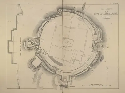
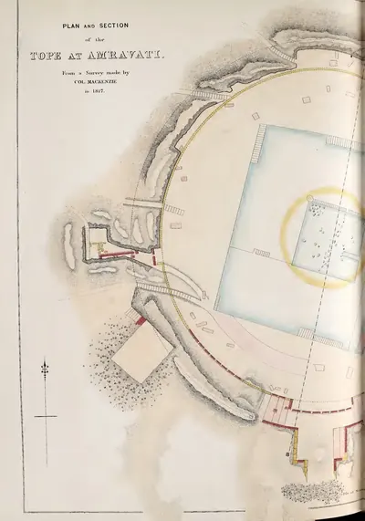
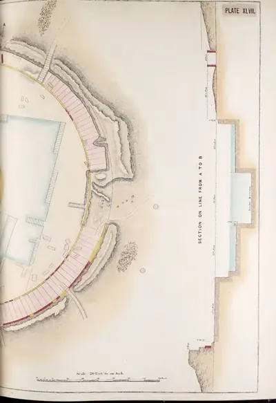
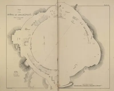
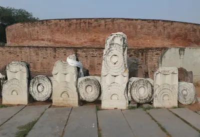
At Amaravati, James Burgess found a fragment reading “a pillar of the General Mudakutala”. Its letters are of the Mauryan type.14 He took it as evidence that the great stupa was first built in perhaps about 200 BCE. In his view it was largely rebuilt in the 2nd century CE.14 Sewell’s list of dates also puts the foundation of the Amaravati stupa at about 200 BCE.10
The Satavahanas
The dynasty’s family name is certain from a label at Nanaghat in western India. The label, “Raya Simuka Satavahano”, was carved for a statue of the founder, Simuka.4 Later kings used the name Satakarni. They told themselves apart by metronymics, names taken from their mothers’ families.4 Examples are Gautamiputra (“son of Gautami”) and Vasishthiputra.4
The Roman author Pliny wrote in the 1st century CE.1516 He wrote of a people he called the Andarae, whom James Burgess took to be the Andhras.1516 He said their king had thirty walled and towered towns.1516 Pliny also gave him 100,000 infantry, 2,000 cavalry and 1,000 elephants.1516
The dynasty’s early records are in the western Deccan.15 They are in the caves at Nanaghat, Nasik, Karle and Kanheri.15 The geographer Ptolemy wrote in the 2nd century CE. He called Paithana on the upper Godavari the capital of “Siri Polemaios”.17 Burgess identified this ruler with King Pulumavi.17
In the Telugu country, Sircar listed four inscriptions of the later Satavahanas:2
- the Amaravati inscription of Vasishthiputra Pulumavi
- the Chinna inscription of Gautamiputra Yajna Satakarni, in Krishna district
- the Kodavali inscription of Chanda (or Chandra) Sata
- the Myakadoni inscription of Pulumavi, in what was then Bellary district2
Nineteenth-century writers placed the Satavahanas in the Krishna valley much earlier. Burgess recorded a tradition that their first capital was Srikakulam on the Krishna. This place is about nineteen miles west of Machilipatnam (then Masulipatam).15 According to the same tradition, the capital later moved to Dhanyakataka (Dharanikota, beside Amaravati). The Godavari gazetteer repeated this.1518 Sewell thought Gautamiputra Satakarni lived at Dhanyakataka, while his heir governed the west from Paithan.16
Sircar argued the opposite.192 No Satavahana inscription from before Pulumavi’s reign had been found in the Krishna–Guntur area.19 A Nasik inscription lists Gautamiputra’s territories, and the list seems to include no land south of the Krishna.19 In Sircar’s view, the dynasty reached the Krishna–Guntur region only when Vasishthiputra Pulumavi (about 130–159 CE) conquered it.2 Before that, an inscription at Velpuru names a local king, Manasada, of the Aira family.192
Dating the period
Each generation of scholars in the library placed these kings at a different point on the timeline:
- Fergusson (1868) began the dynasty in 31 BCE.5 He placed Gautamiputra in 309 CE and the last Pulumavi in the 5th century.5
- Burgess (1887) gave the dynasty about four centuries, from the 2nd century BCE to the end of the 2nd or beginning of the 3rd century CE. He dated Gautamiputra Satakarni about 114–135 CE and Pulumavi about 135–163 CE.152021 He pointed out that an 1852 study had put the Nasik inscriptions in the 4th century, a date by then given up.152021
- The Imperial Gazetteer (1908) dated the Andhras from 220 BCE to 236 CE.11
- Sewell’s list (1932) uses Vincent Smith’s dates. It numbers thirty kings from Simuka, in the late 3rd century BCE, to a third Pulumavi, with the line ending about 236 CE.2223 It notes that the dates are not all certain, and that the Puranas differ in their reign-lengths.2223
- Jayaswal and Banerji (1933) identified the Satakarni named in King Kharavela’s Hathigumpha inscription in Orissa with the dynasty’s first Satakarni. They dated Kharavela, through a king of Magadha who lived at the same time, to the first half of the 2nd century BCE.424
- Sircar (1959) dated Gautamiputra Satakarni to about 106–130 CE and Pulumavi to about 130–159 CE. He placed Kharavela at about the end of the 1st century BCE.619 He placed the end of Satavahana rule in the Krishna–Guntur region at about the close of the first quarter of the 3rd century CE.619
About the sources. All of these positions are older than the modern work collected in The Age of the Satavahanas (1999), which has not been consulted page by page for this article.
Buddhist centres of the Krishna valley
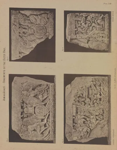
A stupa is a solid, dome-shaped mound built over relics. The inscriptions call the great stupa at Amaravati the mahachetiya (great chaitya, a sacred monument).2514 They record that it belonged to the Chaitika school of monks.2514 Burgess dated the outer railing to the 2nd century, and the inner railing to around the end of the 3rd.26
At Jaggayyapeta, across the Krishna, Burgess found sculptures in the style of the oldest work at Amaravati.2726 He also found inscriptions recording five ayaka pillars.2726 These were the group of pillars set on a platform at each of the four entrances of an Andhra stupa.28
A. H. Longhurst excavated Nagarjunakonda.28 He noted that these jutting platforms served as altars for offerings.28 They were a feature of Andhra stupas unknown in northern India.28 Other remains of the period include stupas at Bhattiprolu, Gudivada and Ghantasala. There is also a rock-cut chaitya cave with monks’ cells at Guntupalli.2930
Most of the Amaravati inscriptions record gifts of carved slabs by individual donors, named with their parents.31 Kings usually appear only in the dates of these records. For example, Pulumavi’s inscription records a gift by householders “in the year …” of his reign.25
The Imperial Gazetteer described the Andhras as Buddhists who also supported Brahmins.32 Burgess cited the long Nanaghat cave inscription as a record of great Brahmanical sacrifices. He attributed it to the early king Simuka.15 Jayaswal and Banerji linked the Nanaghat inscriptions instead with Queen Nayanika, wife of the third king, Sri Satakarni.33
Coins, towns and trade
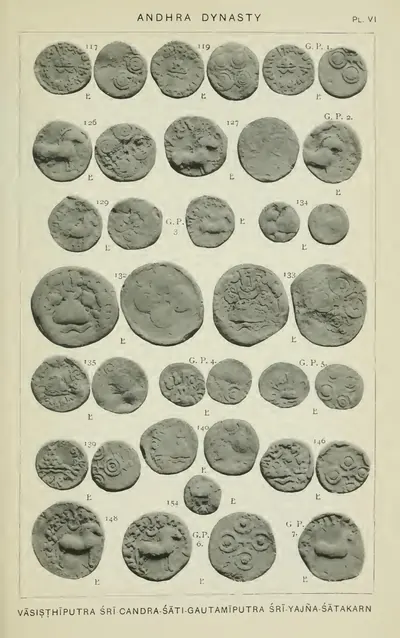
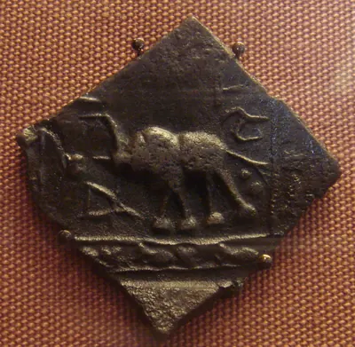
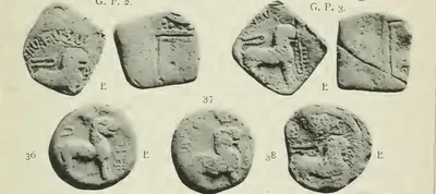
Lead coins of the Andhras were still being found in large numbers in the Krishna valley in the early 20th century.1132 Robert Sewell collected lead coins at Gudivada. Alexander Cunningham read three of them as coins of Gautamiputra Yajna Sri and Sri Chanda.34 Another type showed a two-masted ship.34
Alexander Rea later described seventy-two lead coins from the same site.3536 He grouped them by their main design: a chaitya, a horse, a lion, a ship or an elephant.3536 The commonest design on the back was the so-called Ujjain symbol. It is four circles joined by crossed lines.3536
At Nagarjunakonda, Longhurst found small lead coins of the usual Andhra type in a monastery cell.37 With them were a lump of lead ore and an earthenware die (a stamp for making coins).37 He inferred that the monks made their own coins.37
Sewell’s introduction gathers what the classical writers say about trade between the Roman Empire and India at this time.38 The Periplus and Ptolemy describe the goods traded. They name places on this coast, among them Machilipatnam.38 Longhurst saw Roman influence in some of the Nagarjunakonda sculptures. He linked it with the sea trade with Rome.39
The end of the period
Burgess guessed that some other dynasty had ruled between the Andhras and the later Pallavas.21 Perhaps, he thought, it was the line of King Purushadatta, whose inscriptions he had found at Jaggayyapeta.21
The Nagarjunakonda excavations confirmed this.4041 J. Ph. Vogel identified a line of “Southern Ikhaku” (Ikshvaku) kings.4041 They copied the Satavahana style of metronymics.40 Longhurst placed their rule in the Andhra country in the 2nd and 3rd centuries CE.41 Sircar placed the Ikshvaku king Virapurushadatta in about the middle of the 3rd century.6
Earlier accounts had passed straight from the Andhras to the Pallavas.4218 For example, Sewell said the Pallava Bappa ended the Andhra dynasty around 225 CE.42 He cited a copper-plate grant from Mayidavolu addressed to a Pallava governor at Dhannakada (Amaravati).42 Those accounts were written before the Ikshvaku evidence was known.4218
Footnotes
-
D. C. Sircar, “Erragudi Edicts of Asoka”, Epigraphia Indica XXXII (1959), p. 1 (archive.org (opens in a new tab)). ↩ ↩2 ↩3 ↩4 ↩5 ↩6 ↩7
-
D. C. Sircar, “Two Inscriptions from Guntur District”, Epigraphia Indica XXXII (1959), p. 86 (archive.org (opens in a new tab)). ↩ ↩2 ↩3 ↩4 ↩5 ↩6 ↩7 ↩8
-
G. Bühler, “The Bhattiprolu Inscriptions”, Epigraphia Indica II (1894), p. 323 (archive.org (opens in a new tab)). ↩ ↩2 ↩3 ↩4 ↩5 ↩6 ↩7 ↩8 ↩9
-
K. P. Jayaswal and R. D. Banerji, “The Hathigumpha Inscription of Kharavela”, Epigraphia Indica XX (1933), p. 74 (archive.org (opens in a new tab)). ↩ ↩2 ↩3 ↩4 ↩5 ↩6
-
James Fergusson, Tree and Serpent Worship (1868), Appendix F, PDF p. 460 (archive.org (opens in a new tab)). ↩ ↩2 ↩3 ↩4
-
D. C. Sircar, “Two Inscriptions from Guntur District”, Epigraphia Indica XXXII (1959), p. 83 (archive.org (opens in a new tab)). ↩ ↩2 ↩3 ↩4 ↩5
-
D. C. Sircar, “Rajula-Mandagiri Inscription of Asoka”, Epigraphia Indica XXXI (1960), p. 212 (archive.org (opens in a new tab)). ↩ ↩2 ↩3
-
D. C. Sircar, “Erragudi Edicts of Asoka”, Epigraphia Indica XXXII (1959), p. 24 (archive.org (opens in a new tab)). ↩ ↩2 ↩3 ↩4
-
F. R. Hemingway, Madras District Gazetteers: Godavari (1907), p. 17 (archive.org (opens in a new tab)). ↩ ↩2
-
Robert Sewell, The Historical Inscriptions of Southern India (1932), p. 12 (archive.org (opens in a new tab)). ↩ ↩2 ↩3
-
Imperial Gazetteer of India, Provincial Series: Madras, Vol. I (1908), pp. 15–16 (archive.org (opens in a new tab)). ↩ ↩2 ↩3 ↩4 ↩5
-
Robert Sewell, The Historical Inscriptions of Southern India (1932), p. 7 (archive.org (opens in a new tab)). ↩ ↩2
-
G. Bühler, “The Bhattiprolu Inscriptions”, Epigraphia Indica II (1894), p. 325 (archive.org (opens in a new tab)). ↩ ↩2 ↩3
-
James Burgess, The Buddhist Stupas of Amaravati and Jaggayyapeta (1887), p. 101 (archive.org (opens in a new tab)). ↩ ↩2 ↩3 ↩4
-
James Burgess, The Buddhist Stupas of Amaravati and Jaggayyapeta (1887), p. 3 (archive.org (opens in a new tab)). ↩ ↩2 ↩3 ↩4 ↩5 ↩6 ↩7 ↩8 ↩9 ↩10 ↩11
-
Robert Sewell, The Historical Inscriptions of Southern India (1932), p. 14 (archive.org (opens in a new tab)). ↩ ↩2 ↩3 ↩4 ↩5
-
James Burgess, The Buddhist Stupas of Amaravati and Jaggayyapeta (1887), p. 4 (archive.org (opens in a new tab)). ↩ ↩2
-
F. R. Hemingway, Madras District Gazetteers: Godavari (1907), p. 18 (archive.org (opens in a new tab)). ↩ ↩2 ↩3
-
D. C. Sircar, “Two Inscriptions from Guntur District”, Epigraphia Indica XXXII (1959), p. 85 (archive.org (opens in a new tab)). ↩ ↩2 ↩3 ↩4 ↩5 ↩6
-
James Burgess, The Buddhist Stupas of Amaravati and Jaggayyapeta (1887), p. 5 (archive.org (opens in a new tab)). ↩ ↩2
-
James Burgess, The Buddhist Stupas of Amaravati and Jaggayyapeta (1887), p. 11 (archive.org (opens in a new tab)). ↩ ↩2 ↩3 ↩4
-
Robert Sewell, The Historical Inscriptions of Southern India (1932), p. 324 (archive.org (opens in a new tab)). ↩ ↩2
-
Robert Sewell, The Historical Inscriptions of Southern India (1932), p. 325 (archive.org (opens in a new tab)). ↩ ↩2
-
K. P. Jayaswal and R. D. Banerji, “The Hathigumpha Inscription of Kharavela”, Epigraphia Indica XX (1933), p. 75 (archive.org (opens in a new tab)). ↩
-
James Burgess, The Buddhist Stupas of Amaravati and Jaggayyapeta (1887), p. 100 (archive.org (opens in a new tab)). ↩ ↩2 ↩3
-
James Burgess, The Buddhist Stupas of Amaravati and Jaggayyapeta (1887), p. 112 (archive.org (opens in a new tab)). ↩ ↩2 ↩3
-
James Burgess, The Buddhist Stupas of Amaravati and Jaggayyapeta (1887), pp. 110–111 (archive.org (opens in a new tab)). ↩ ↩2
-
A. H. Longhurst, The Buddhist Antiquities of Nagarjunakonda (1938), p. 12 (archive.org (opens in a new tab)). ↩ ↩2 ↩3 ↩4
-
Alexander Rea, South Indian Buddhist Antiquities (1894), Contents, PDF p. 10 (archive.org (opens in a new tab)). ↩
-
Imperial Gazetteer of India, Provincial Series: Madras, Vol. I (1908), p. 322 (archive.org (opens in a new tab)). ↩
-
Gordon Mackenzie, A Manual of the Kistna District (1883), p. 167 (archive.org (opens in a new tab)). ↩
-
Imperial Gazetteer of India, Provincial Series: Madras, Vol. I (1908), p. 193 (archive.org (opens in a new tab)). ↩ ↩2
-
K. P. Jayaswal and R. D. Banerji, “The Hathigumpha Inscription of Kharavela”, Epigraphia Indica XX (1933), p. 83 (archive.org (opens in a new tab)). ↩
-
Alexander Rea, South Indian Buddhist Antiquities (1894), p. 20 (archive.org (opens in a new tab)). ↩ ↩2
-
Alexander Rea, South Indian Buddhist Antiquities (1894), p. 21 (archive.org (opens in a new tab)). ↩ ↩2 ↩3
-
Alexander Rea, South Indian Buddhist Antiquities (1894), p. 23 (archive.org (opens in a new tab)). ↩ ↩2 ↩3
-
A. H. Longhurst, The Buddhist Antiquities of Nagarjunakonda (1938), p. 10 (archive.org (opens in a new tab)). ↩ ↩2 ↩3
-
Robert Sewell, The Historical Inscriptions of Southern India (1932), p. 9 (archive.org (opens in a new tab)). ↩ ↩2
-
A. H. Longhurst, The Buddhist Antiquities of Nagarjunakonda (1938), p. 15 (archive.org (opens in a new tab)). ↩
-
J. Ph. Vogel, “Prakrit Inscriptions from a Buddhist Site at Nagarjunikonda”, Epigraphia Indica XX (1933), p. 6 (archive.org (opens in a new tab)). ↩ ↩2 ↩3
-
A. H. Longhurst, The Buddhist Antiquities of Nagarjunakonda (1938), p. 4 (archive.org (opens in a new tab)). ↩ ↩2 ↩3
-
Robert Sewell, The Historical Inscriptions of Southern India (1932), p. 16 (archive.org (opens in a new tab)). ↩ ↩2 ↩3 ↩4
Milestones
- Rise of a power
- End of a power
- Inscription
- Monument
- c. 272 BCERise of a power:Mauryas
- c. 250 BCEInscription:Erragudi edicts of Asoka
- c. 250 BCEInscription:Rajula-Mandagiri inscription of Asoka
- c. 220 BCERise of a power:Satavahanas
- c. 200 BCEInscription:Bhattiprolu relic-casket inscriptions
- c. 200 BCEMonument:Amaravati Mahachaitya
- c. 200 BCEMonument:Bhattiprolu stupa
- c. 200 BCEMonument:Jaggayyapeta stupa
- c. 200 BCERise of a power:Kotilingala coin kings
- c. 185 BCEEnd of a power:Mauryas
- c. 52 BCEEnd of a power:Kotilingala coin kings
- c. 130Inscription:Amaravati inscription of the time of Vasishthiputra Pulumavi
- c. 145Inscription:Myakadoni inscription of Pulumavi
- c. 150Inscription:Amaravati inscription of King Sri Sivamaka Sada
- c. 195Inscription:Chinna inscription of Yajna Sri Satakarni
- c. 200Monument:Ghantasala stupa
- c. 210Inscription:Kodavali rock inscription of Chandasati
- c. 225End of a power:Satavahanas
- c. 225Rise of a power:Ikshvakus
Photos
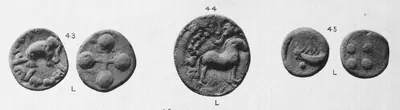 "Andhra Coins": lead coins from the Krishna district with an elephant, a horse and a two-masted ship (Elliot 1886, Pl. II, Nos. 43-45)Coin · 1886
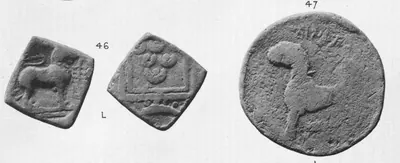 "Andhra Coins": square and round lead coins with a maneless lion, from the Krishna district (Elliot 1886, Pl. II, Nos. 46-47)Coin · 1886
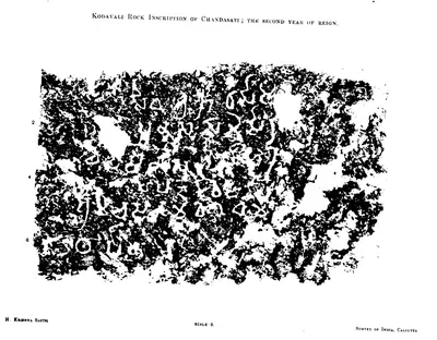 "Kodavali Rock Inscription of Chandasati; the second year of reign" (Epigraphia Indica XVIII, plate)Inscription rubbing · 1926
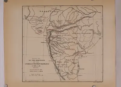 "Sketch map of the dominions of the Andhras & Western Ksatrapas, c. 150 A.D." (Rapson 1908, map)Map · 1908
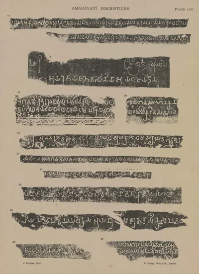 Amaravati inscriptions, Nos. 17-27 (Burgess 1887, Pl. LVII)Inscription rubbing · 1887
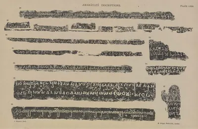 Amaravati inscriptions, Nos. 28-37 (Burgess 1887, Pl. LVIII)Inscription rubbing · 1887
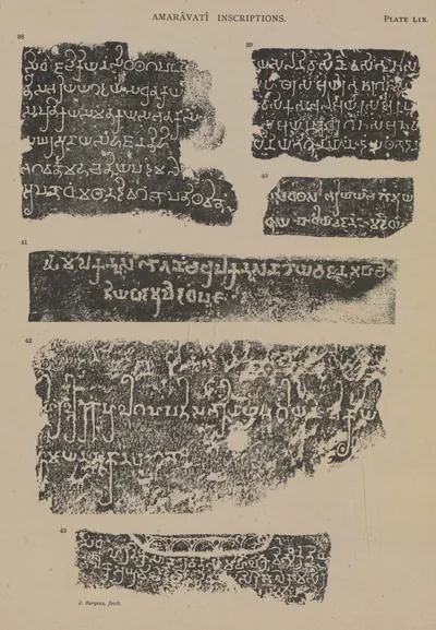 Amaravati inscriptions, Nos. 38-43 (Burgess 1887, Pl. LIX)Inscription rubbing · 1887
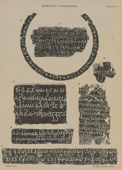 Amaravati inscriptions, Nos. 44-50 (Burgess 1887, Pl. LX)Inscription rubbing · 1887
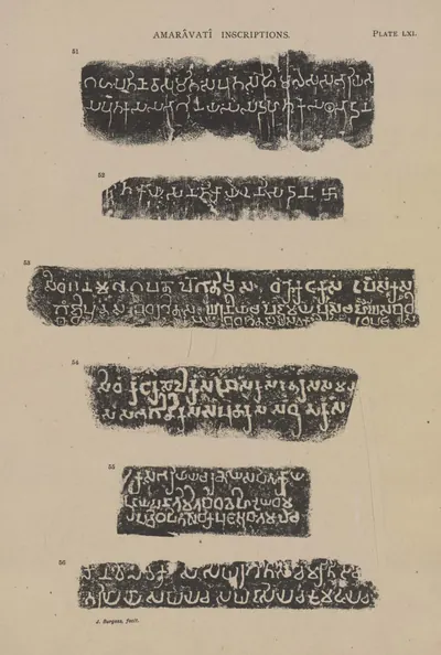 Amaravati inscriptions, Nos. 51-56 (Burgess 1887, Pl. LXI)Inscription rubbing · 1887
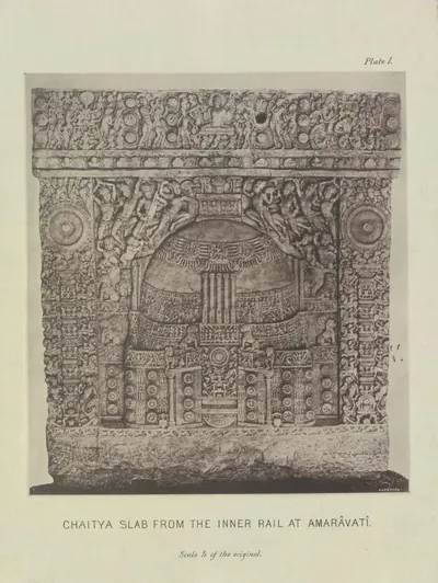 Amaravati: "Chaitya slab from the inner rail at Amaravati" (Burgess 1887, Pl. I)Book plate · 1887
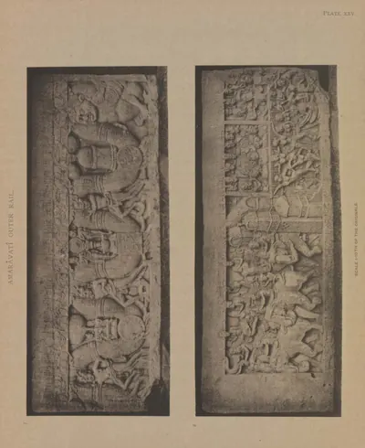 Amaravati: a fifth coping-stone, both sides (Burgess 1887, Pl. XXV)Book plate · 1887
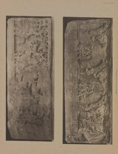 Amaravati: a fourth coping-stone, both sides (Burgess 1887, Pl. XXIV)Book plate · 1887
Show all (133)
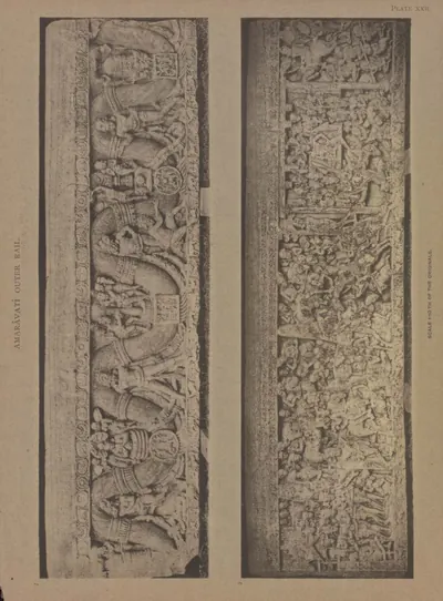 Amaravati: a third large coping-stone, both sides (Burgess 1887, Pl. XXII)Book plate · 1887
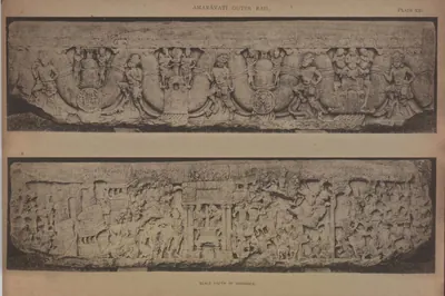 Amaravati: another large coping-stone, both sides (Burgess 1887, Pl. XXI)Book plate · 1887
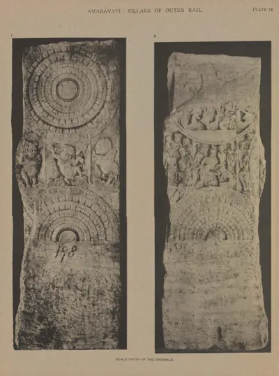 Amaravati: another rail pillar, back and front (Burgess 1887, Pl. IX)Book plate · 1887
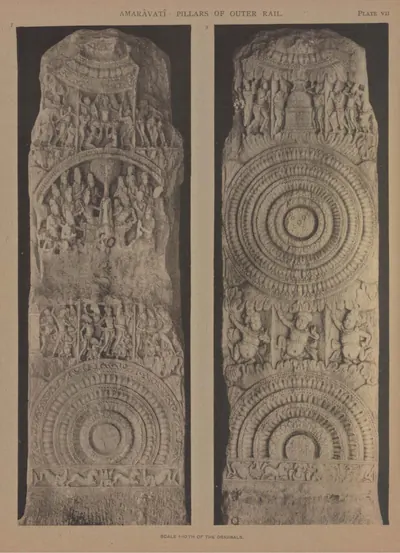 Amaravati: another rail pillar, back and front (Burgess 1887, Pl. VII)Book plate · 1887
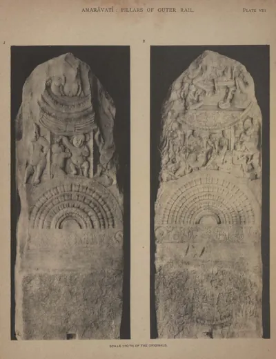 Amaravati: another rail pillar, back and front (Burgess 1887, Pl. VIII)Book plate · 1887
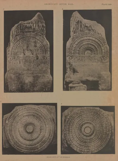 Amaravati: back and front of the base of a rail pillar, and two cross-bars (Burgess 1887, Pl. XIII)Book plate · 1887
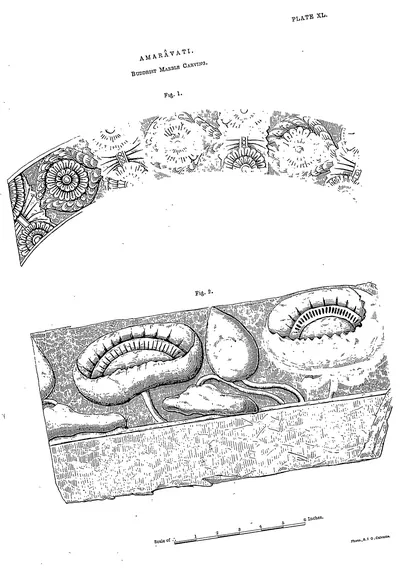 Amaravati: Buddhist marble carving (Rea 1894, Pl. XL)Drawing · 1894
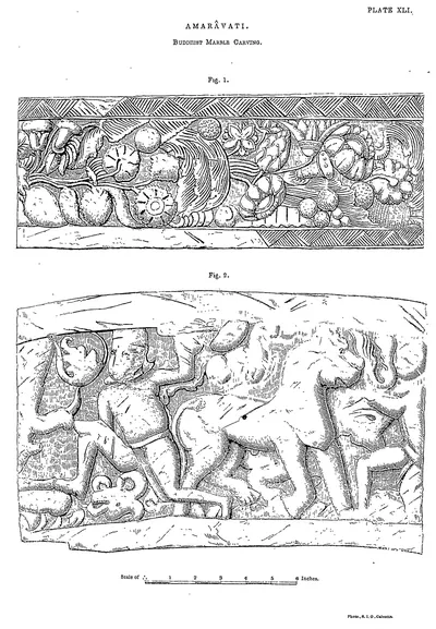 Amaravati: Buddhist marble carving (Rea 1894, Pl. XLI)Drawing · 1894
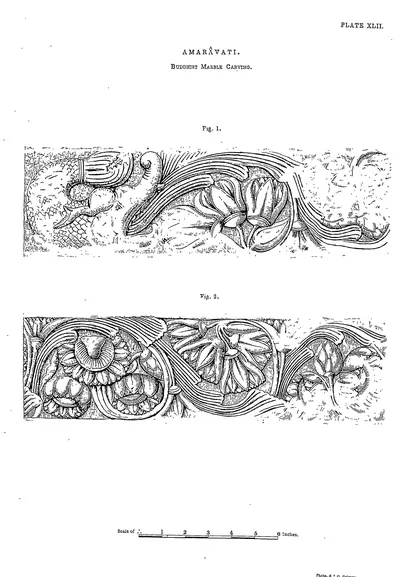 Amaravati: Buddhist marble carving (Rea 1894, Pl. XLII)Drawing · 1894
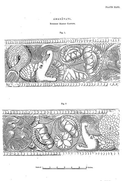 Amaravati: Buddhist marble carving (Rea 1894, Pl. XLIII)Drawing · 1894
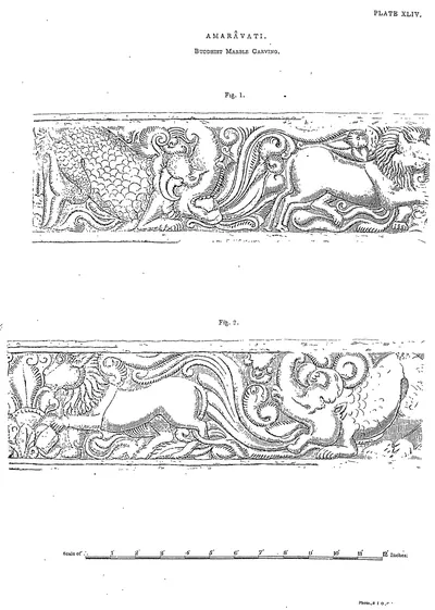 Amaravati: Buddhist marble carving (Rea 1894, Pl. XLIV)Drawing · 1894
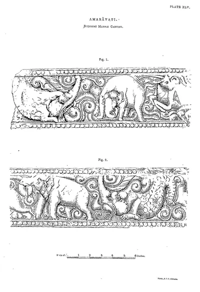 Amaravati: Buddhist marble carving (Rea 1894, Pl. XLV)Drawing · 1894
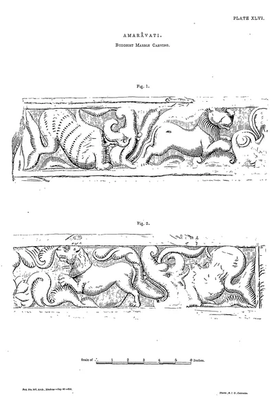 Amaravati: Buddhist marble carving (Rea 1894, Pl. XLVI)Drawing · 1894
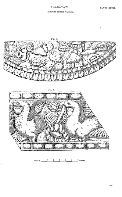 Amaravati: Buddhist marble carving (Rea 1894, Pl. XLVII)Drawing · 1894
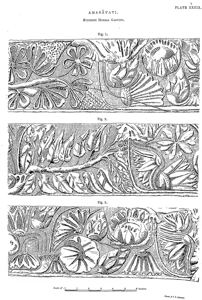 Amaravati: Buddhist marble carving (Rea 1894, Pl. XXXIX)Drawing · 1894
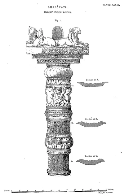 Amaravati: Buddhist marble carving (Rea 1894, Pl. XXXVI)Drawing · 1894
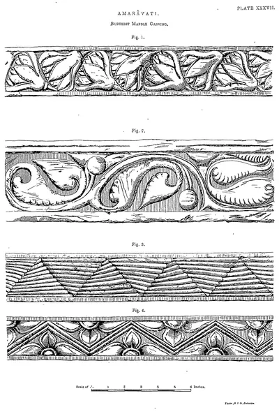 Amaravati: Buddhist marble carving (Rea 1894, Pl. XXXVII)Drawing · 1894
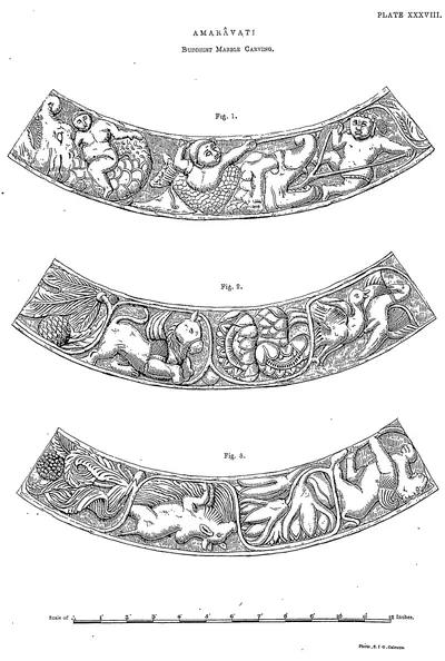 Amaravati: Buddhist marble carving (Rea 1894, Pl. XXXVIII)Drawing · 1894
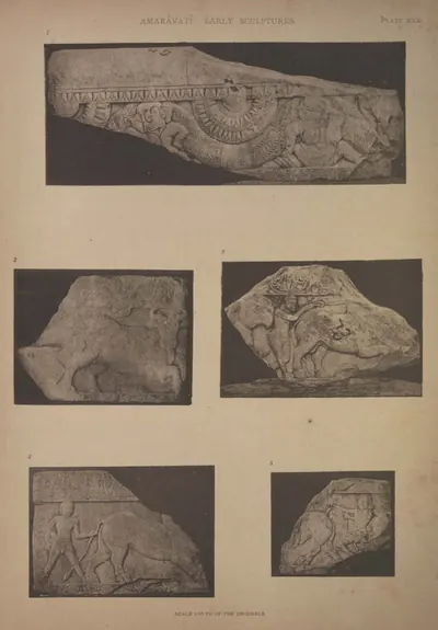 Amaravati: five pieces of early coping (Burgess 1887, Pl. XXX)Book plate · 1887
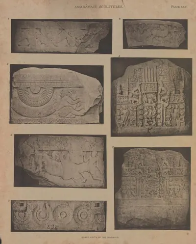 Amaravati: five pieces of early coping, and two chaitya slabs (Burgess 1887, Pl. XXXI)Book plate · 1887
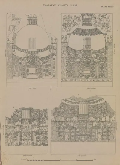 Amaravati: four chaitya slabs (drawn by Colonel Mackenzie's assistants) (Burgess 1887, Pl. XXXVI)Drawing · 1887
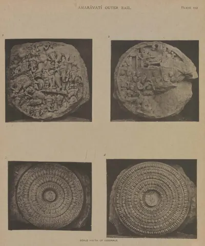 Amaravati: four cross-bars of the outer rail (Burgess 1887, Pl. XIX)Book plate · 1887
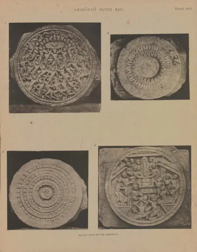 Amaravati: four cross-bars of the outer rail (Burgess 1887, Pl. XVII)Book plate · 1887
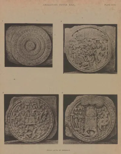 Amaravati: four cross-bars of the outer rail (Burgess 1887, Pl. XVIII)Book plate · 1887
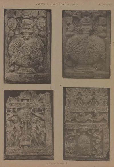 Amaravati: four other slabs from the great chaitya (Burgess 1887, Pl. XLVII)Book plate · 1887
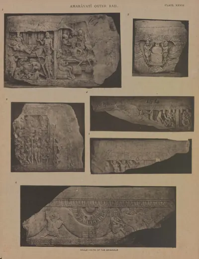 Amaravati: four pieces of coping, and one of an older form (Burgess 1887, Pl. XXVIII)Book plate · 1887
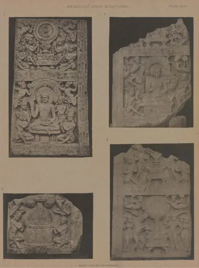 Amaravati: four slabs from the central chaitya (Burgess 1887, Pl. XLVI)Book plate · 1887
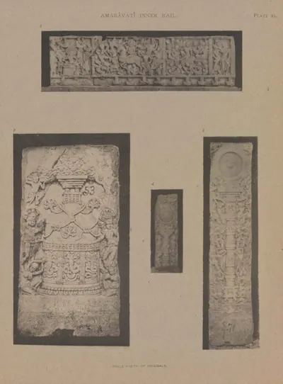 Amaravati: fragments of four chaitya slabs and two pillars from the inner rail (Burgess 1887, Pl. XL)Book plate · 1887
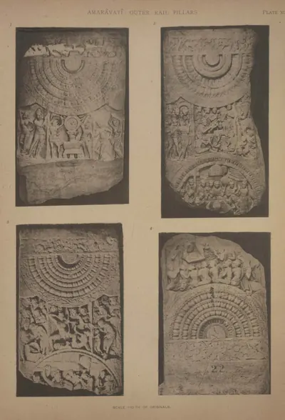 Amaravati: fragments of four rail pillars (Burgess 1887, Pl. XII)Book plate · 1887
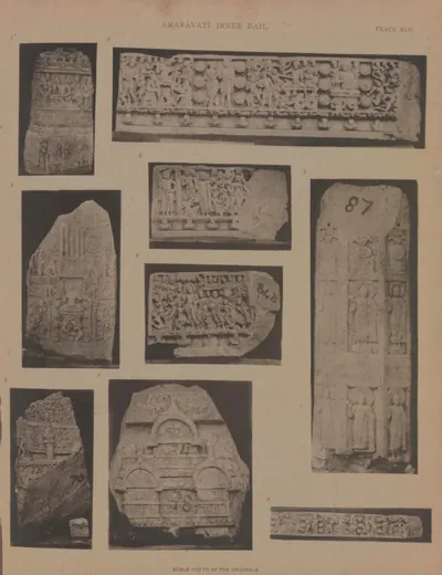 Amaravati: fragments of two chaitya slabs, three pieces of the frieze of the inner rail, &c. (Burgess 1887, Pl. XLII)Book plate · 1887
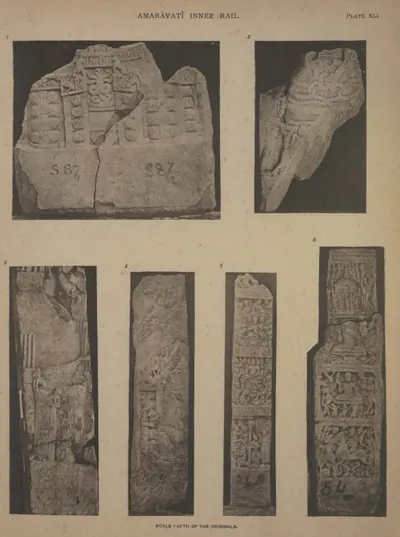 Amaravati: frieze, dagaba slab, chakra pillar, and fragment from the inner rail (Burgess 1887, Pl. XLI)Book plate · 1887
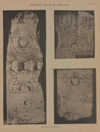 Amaravati: front of a rail pillar, and portions of other two (Burgess 1887, Pl. X)Book plate · 1887
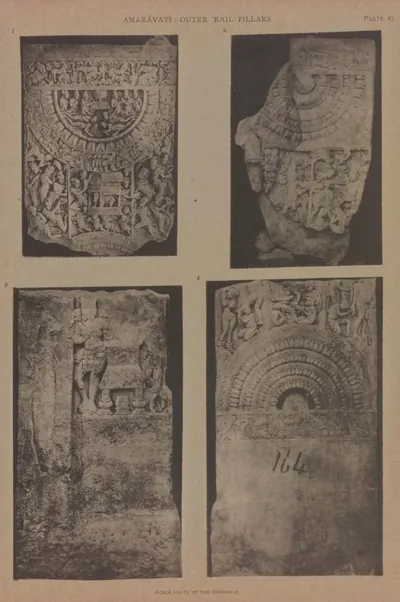 Amaravati: fronts of portions of two, and back and front of a third rail pillar (Burgess 1887, Pl. XI)Book plate · 1887
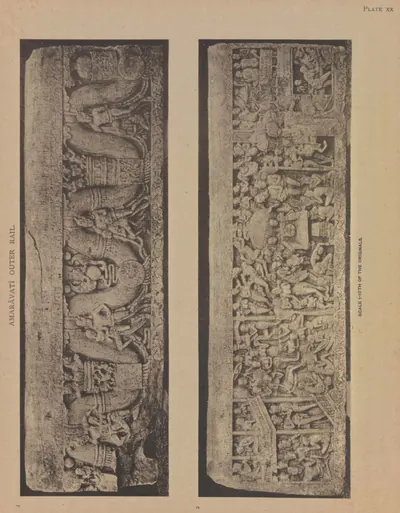 Amaravati: large coping-stone of the outer rail, both sides (Burgess 1887, Pl. XX)Book plate · 1887
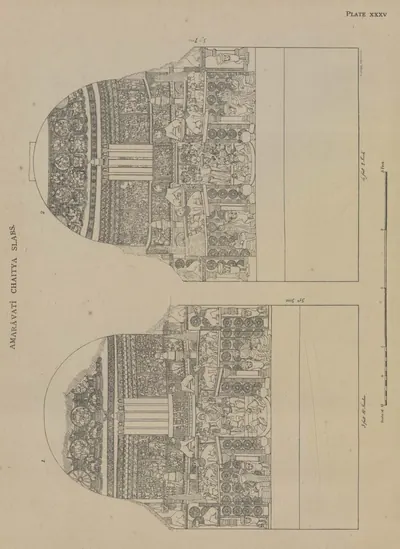 Amaravati: other two chaitya slabs (drawn by Colonel Mackenzie's assistants) (Burgess 1887, Pl. XXXV)Drawing · 1887
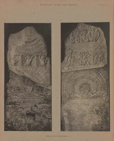 Amaravati: outer rail pillar, back and front (Burgess 1887, Pl. VI)Book plate · 1887
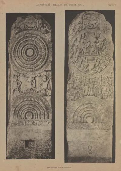 Amaravati: outer rail pillar, front and back (Burgess 1887, Pl. V)Book plate · 1887
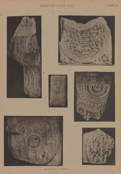 Amaravati: parts of three rail pillars, two cross-bars, and an old sculpture (Burgess 1887, Pl. XIV)Book plate · 1887
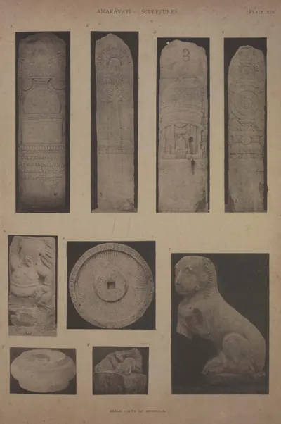 Amaravati: pillar from the East entrance, chhattra, lion, &c. (Burgess 1887, Pl. XLV)Book plate · 1887
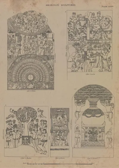 Amaravati: pillar of outer rail and four other slabs (drawn by Colonel Mackenzie's assistants) (Burgess 1887, Pl. XXXII)Drawing · 1887
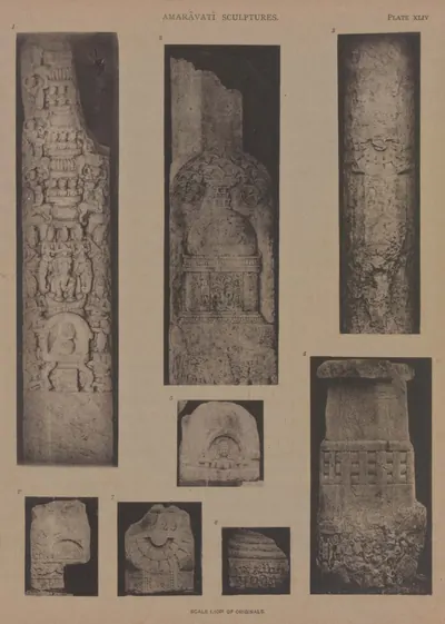 Amaravati: pillars and fragments (Burgess 1887, Pl. XLIV)Book plate · 1887
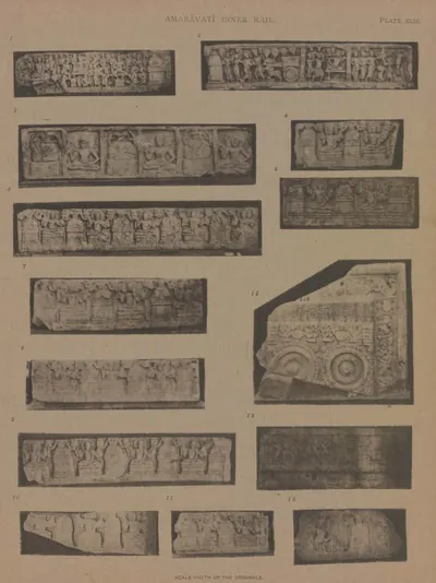 Amaravati: portions of an early frieze and of a Sripada (Burgess 1887, Pl. XLIII)Book plate · 1887
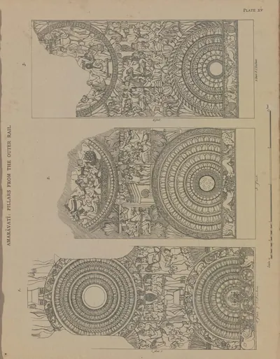 Amaravati: portions of three rail pillars (drawn by Colonel Mackenzie's assistants) (Burgess 1887, Pl. XV)Drawing · 1887
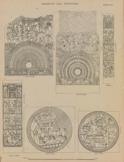 Amaravati: portions of two outer rail pillars, two cross-bars, and two inner rail pillars (drawn by Colonel Mackenzie's assistants) (Burgess 1887, Pl. XVI)Drawing · 1887
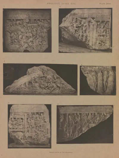 Amaravati: six other pieces of coping-stones (Burgess 1887, Pl. XXVII)Book plate · 1887
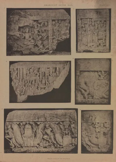 Amaravati: six pieces of coping-stones (Burgess 1887, Pl. XXVI)Book plate · 1887
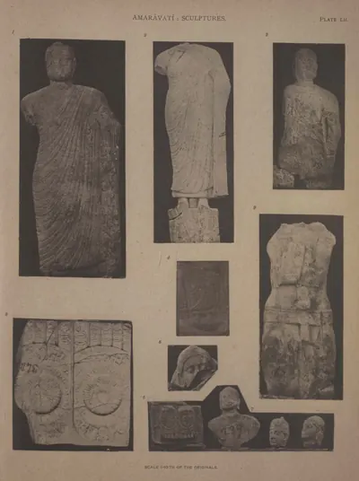 Amaravati: statues and Sripadas (Burgess 1887, Pl. LII)Book plate · 1887
 Amaravati: three broken coping-stones (Burgess 1887, Pl. XXIII)Book plate · 1887
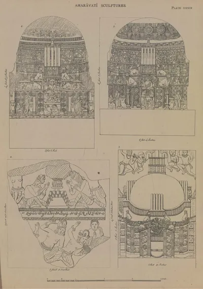 Amaravati: three chaitya slabs, and part of a slab from the stupa (drawn by Colonel Mackenzie's assistants) (Burgess 1887, Pl. XXXIX)Drawing · 1887
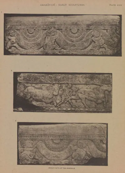 Amaravati: three pieces of earlier coping (Burgess 1887, Pl. XXIX)Book plate · 1887
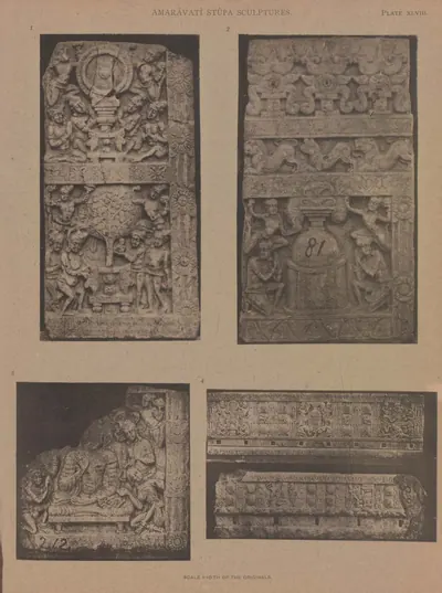 Amaravati: three slabs from the great chaitya, and two pieces of an early frieze (Burgess 1887, Pl. XLVIII)Book plate · 1887
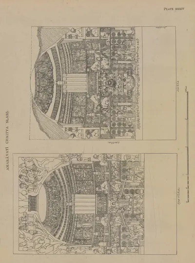 Amaravati: two chaitya slabs (drawn by Colonel Mackenzie's assistants) (Burgess 1887, Pl. XXXIV)Drawing · 1887
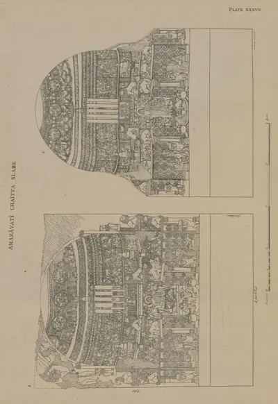 Amaravati: two chaitya slabs (drawn by Colonel Mackenzie's assistants) (Burgess 1887, Pl. XXXVII)Drawing · 1887
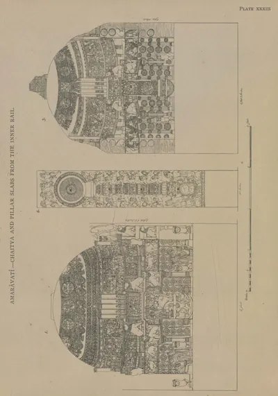 Amaravati: two chaitya slabs and a chakra pillar (drawn by Colonel Mackenzie's assistants) (Burgess 1887, Pl. XXXIII)Drawing · 1887
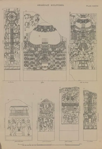 Amaravati: two chakra pillars, a chaitya slab, and four other sculptures (drawn by Colonel Mackenzie's assistants) (Burgess 1887, Pl. XXXVIII)Drawing · 1887
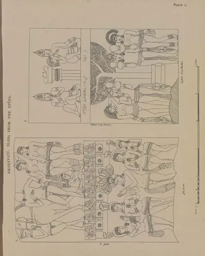 Amaravati: two early slabs, probably from the chaitya (drawn by Colonel Mackenzie's assistants) (Burgess 1887, Pl. L)Drawing · 1887
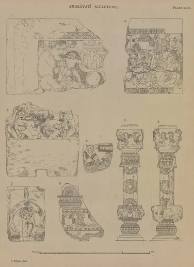 Amaravati: two pieces of coping of the outer rail, and various fragments (drawn by the Survey) (Burgess 1887, Pl. XLIX)Drawing · 1887
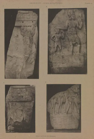 Amaravati: two slabs of an early stupa, and two early sculptures (Burgess 1887, Pl. LI)Book plate · 1887
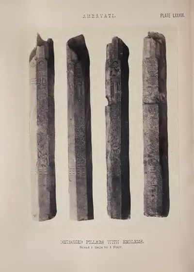 Amravati: detached pillars with emblems (Fergusson 1868, Pl. LXXXIX)Book plate · 1868
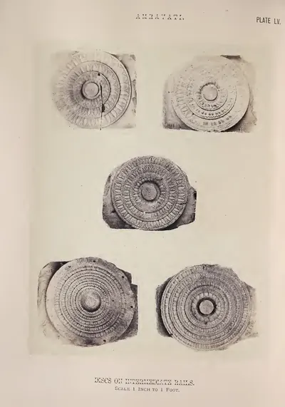 Amravati: discs on intermediate rails (Fergusson 1868, Pl. LV)Book plate · 1868
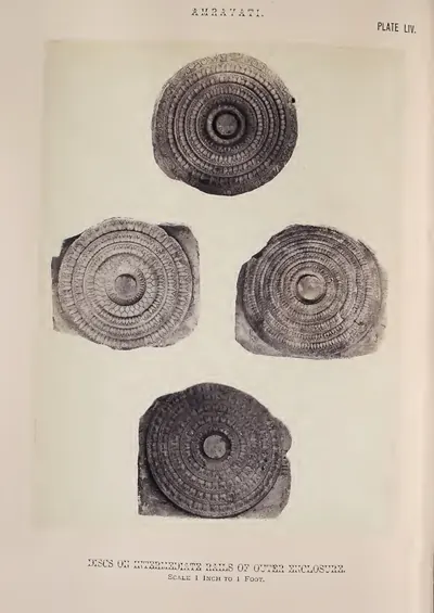 Amravati: discs on intermediate rails of outer enclosure (Fergusson 1868, Pl. LIV)Book plate · 1868
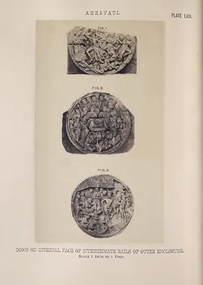 Amravati: discs on internal face of intermediate rails of outer enclosure (Fergusson 1868, Pl. LXIII)Book plate · 1868
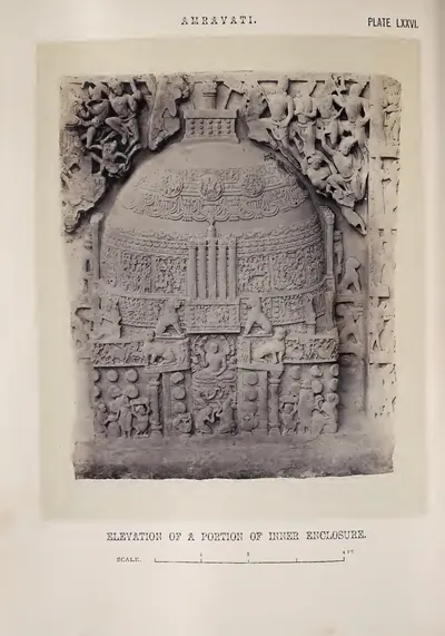 Amravati: elevation of a portion of inner enclosure (Fergusson 1868, Pl. LXXVI)Book plate · 1868
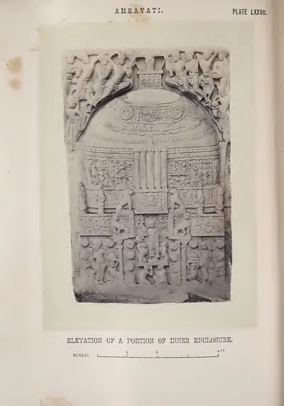 Amravati: elevation of a portion of inner enclosure (Fergusson 1868, Pl. LXXVII)Book plate · 1868
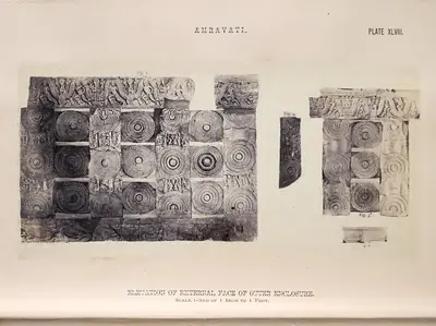 Amravati: elevation of external face of outer enclosure (restored by J. Fergusson) (Fergusson 1868, Pl. XLVIII)Book plate · 1868
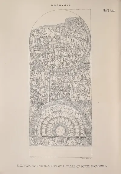 Amravati: elevation of internal face of a pillar of outer enclosure (from a drawing in the Mackenzie Collection) (Fergusson 1868, Pl. LXIX)Drawing · 1868
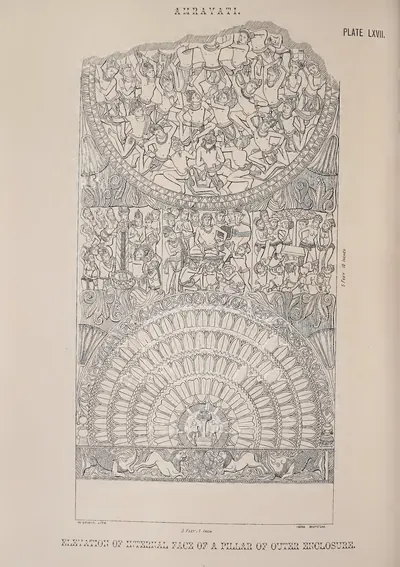 Amravati: elevation of internal face of a pillar of outer enclosure (from a drawing in the Mackenzie Collection) (Fergusson 1868, Pl. LXVII)Drawing · 1868
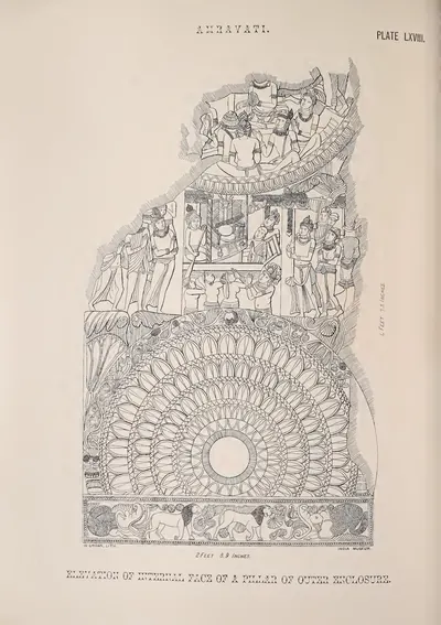 Amravati: elevation of internal face of a pillar of outer enclosure (from a drawing in the Mackenzie Collection) (Fergusson 1868, Pl. LXVIII)Drawing · 1868
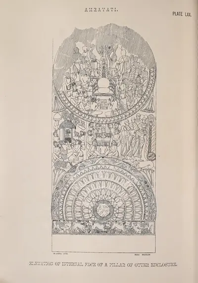 Amravati: elevation of internal face of a pillar of outer enclosure (from a drawing in the Mackenzie Collection) (Fergusson 1868, Pl. LXX)Drawing · 1868
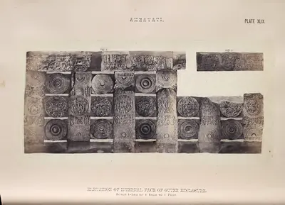 Amravati: elevation of internal face of outer enclosure (restored by J. Fergusson) (Fergusson 1868, Pl. XLIX)Book plate · 1868
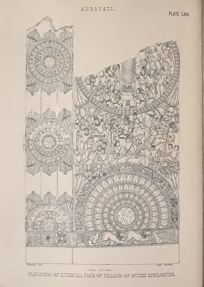 Amravati: elevation of internal face of pillars of outer enclosure (from a drawing in the Mackenzie Collection) (Fergusson 1868, Pl. LXVI)Drawing · 1868
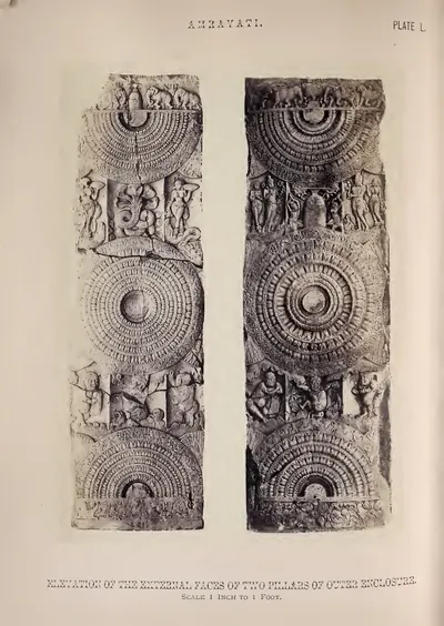 Amravati: elevations of external faces of two pillars of outer enclosure (Fergusson 1868, Pl. L)Book plate · 1868
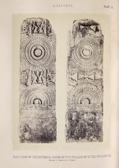 Amravati: elevations of external faces of two pillars of outer enclosure (Fergusson 1868, Pl. LI)Book plate · 1868
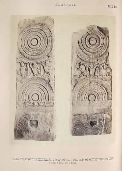 Amravati: elevations of external faces of two pillars of outer enclosure (Fergusson 1868, Pl. LII)Book plate · 1868
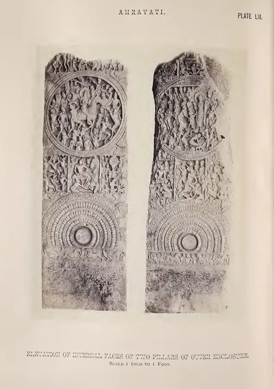 Amravati: elevations of internal faces of two pillars of outer enclosure (Fergusson 1868, Pl. LIX)Book plate · 1868
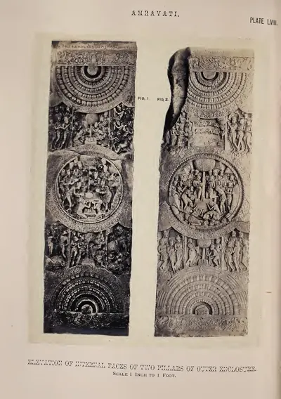 Amravati: elevations of internal faces of two pillars of outer enclosure (Fergusson 1868, Pl. LVIII)Book plate · 1868
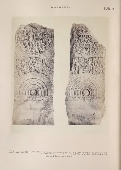 Amravati: elevations of internal faces of two pillars of outer enclosure (Fergusson 1868, Pl. LX)Book plate · 1868
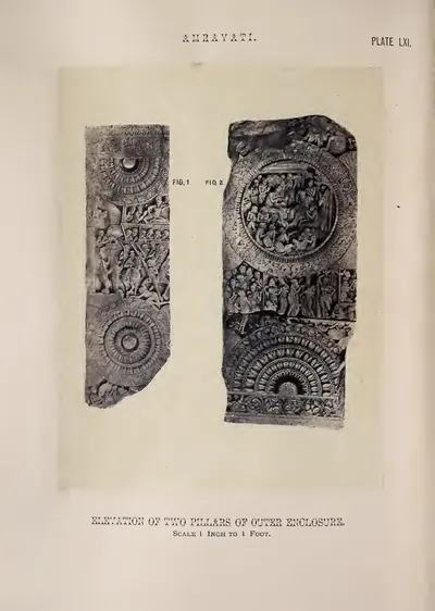 Amravati: elevations of internal faces of two pillars of outer enclosure (Fergusson 1868, Pl. LXI)Book plate · 1868
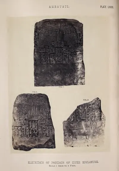 Amravati: elevations of portions of inner enclosure (Fergusson 1868, Pl. LXXIX)Book plate · 1868
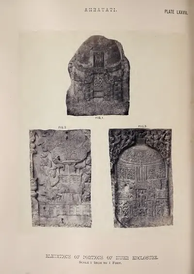 Amravati: elevations of portions of inner enclosure (Fergusson 1868, Pl. LXXVIII)Book plate · 1868
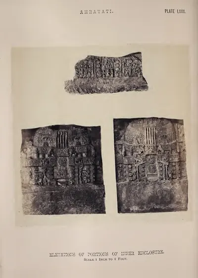 Amravati: elevations of portions of inner enclosure (Fergusson 1868, Pl. LXXX)Book plate · 1868
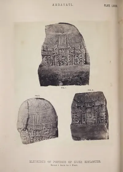 Amravati: elevations of portions of inner enclosure (Fergusson 1868, Pl. LXXXI)Book plate · 1868
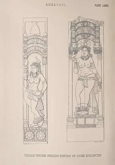 Amravati: female figures forming portion of inner enclosure (from a drawing in the Mackenzie Collection) (Fergusson 1868, Pl. LXXXV)Drawing · 1868
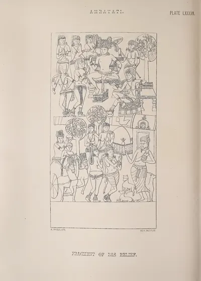 Amravati: fragment of bas-relief (from a drawing in the Mackenzie Collection) (Fergusson 1868, Pl. LXXXVI)Drawing · 1868
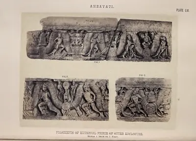 Amravati: fragments of external frieze of outer enclosure (Fergusson 1868, Pl. LVI)Book plate · 1868
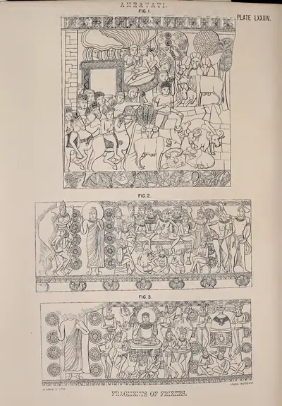 Amravati: fragments of friezes (from a drawing in the Mackenzie Collection) (Fergusson 1868, Pl. LXXXIV)Drawing · 1868
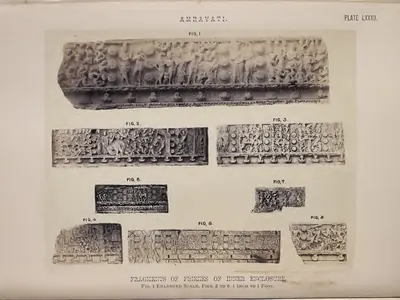 Amravati: fragments of friezes of inner enclosure (Fergusson 1868, Pl. LXXXII)Book plate · 1868
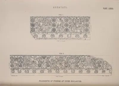 Amravati: fragments of friezes of inner enclosure (Fergusson 1868, Pl. LXXXIII)Drawing · 1868
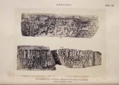 Amravati: fragments of internal frieze of outer enclosure (Fergusson 1868, Pl. LXIV)Book plate · 1868
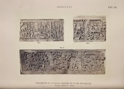 Amravati: fragments of internal friezes of outer enclosure (Fergusson 1868, Pl. LXV)Book plate · 1868
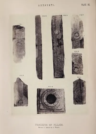 Amravati: fragments of pillars (Fergusson 1868, Pl. XC)Book plate · 1868
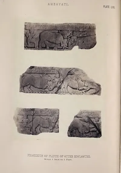 Amravati: fragments of plinth of outer enclosure (Fergusson 1868, Pl. LVII)Book plate · 1868
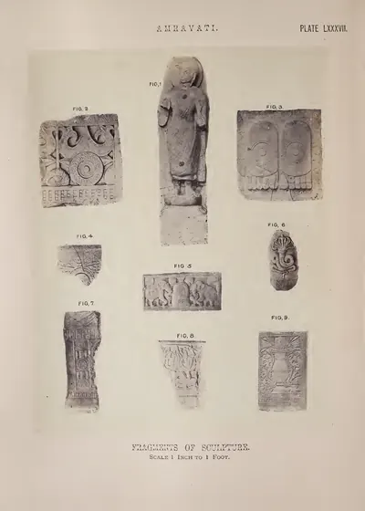 Amravati: fragments of sculpture (Fergusson 1868, Pl. LXXXVII)Book plate · 1868
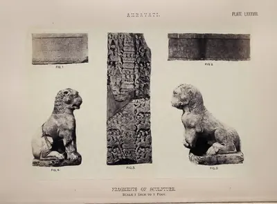 Amravati: fragments of sculpture (Fergusson 1868, Pl. LXXXVIII)Book plate · 1868
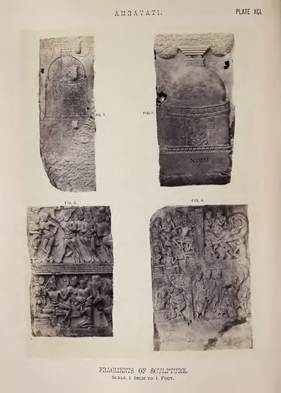 Amravati: fragments of sculpture (Fergusson 1868, Pl. XCI)Book plate · 1868
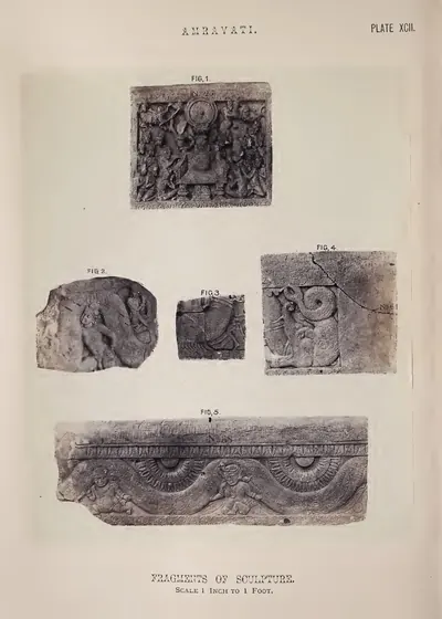 Amravati: fragments of sculpture (Fergusson 1868, Pl. XCII)Book plate · 1868
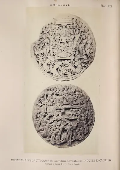 Amravati: internal face of two discs on intermediate rails of outer enclosure (Fergusson 1868, Pl. LXII)Book plate · 1868
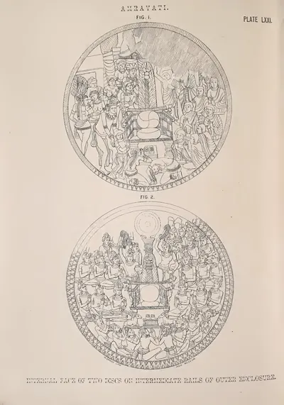 Amravati: internal faces of two discs on intermediate rails of outer enclosure (from a drawing in the Mackenzie Collection) (Fergusson 1868, Pl. LXXI)Drawing · 1868
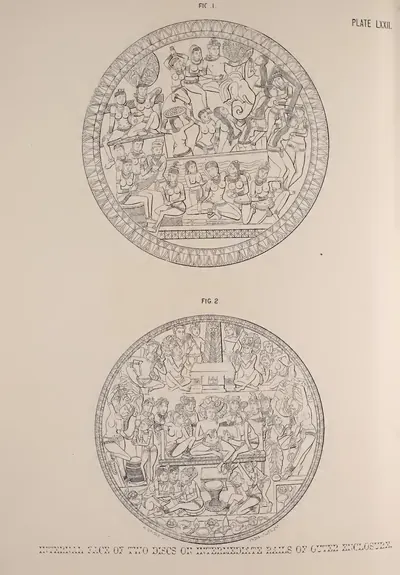 Amravati: internal faces of two discs on intermediate rails of outer enclosure (from a drawing in the Mackenzie Collection) (Fergusson 1868, Pl. LXXII)Drawing · 1868
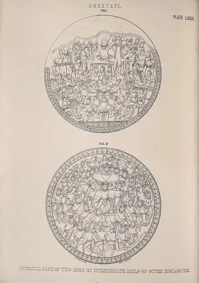 Amravati: internal faces of two discs on intermediate rails of outer enclosure (from a drawing in the Mackenzie Collection) (Fergusson 1868, Pl. LXXIII)Drawing · 1868
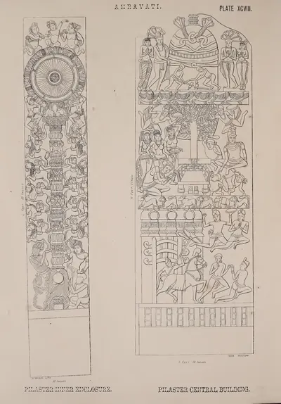 Amravati: pilaster of inner enclosure and of central building (from a drawing in the Mackenzie Collection) (Fergusson 1868, Pl. XCVIII)Drawing · 1868
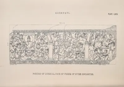 Amravati: portion of internal face of frieze of outer enclosure (from a drawing in the Mackenzie Collection) (Fergusson 1868, Pl. LXXIV)Drawing · 1868
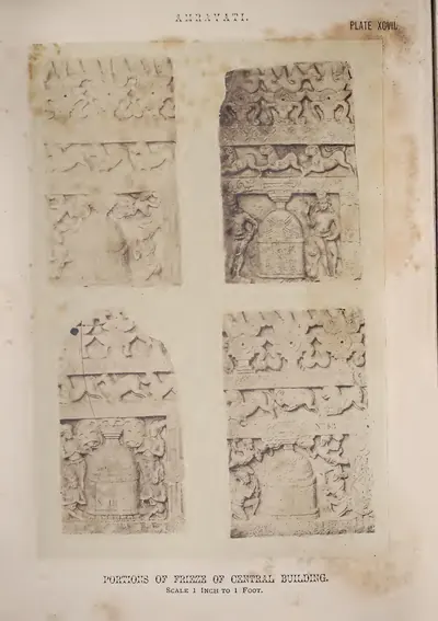 Amravati: portions of frieze of central building (Fergusson 1868, Pl. XCVII)Book plate · 1868
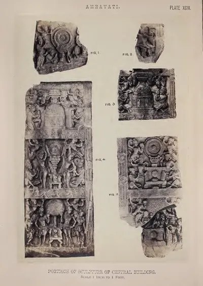 Amravati: portions of sculpture of central building (Fergusson 1868, Pl. XCIV)Book plate · 1868
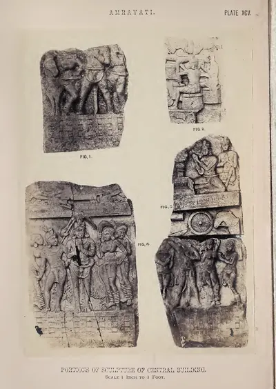 Amravati: portions of sculpture of central building (Fergusson 1868, Pl. XCV)Book plate · 1868
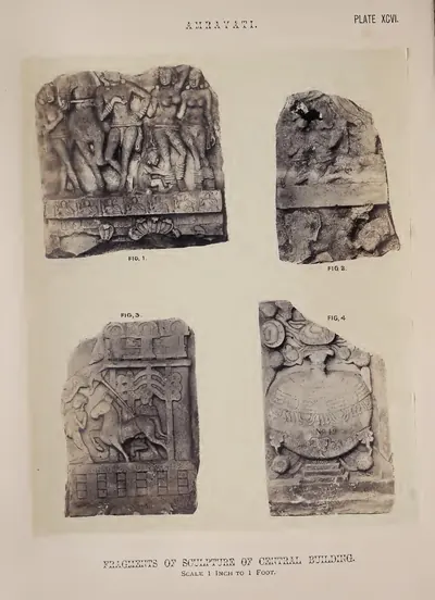 Amravati: portions of sculpture of central building (Fergusson 1868, Pl. XCVI)Book plate · 1868
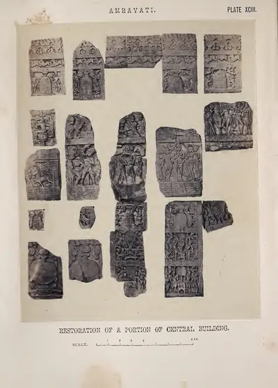 Amravati: restoration of a portion of central building (by J. Fergusson) (Fergusson 1868, Pl. XCIII)Book plate · 1868
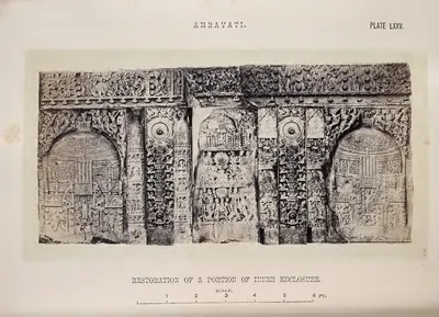 Amravati: restoration of a portion of inner enclosure (Fergusson 1868, Pl. LXXV)Book plate · 1868
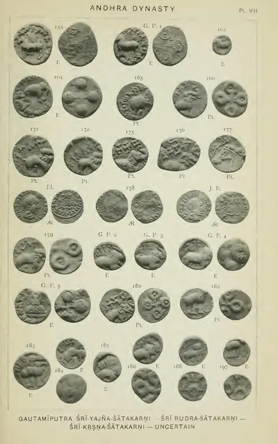 Coins of "Gautamiputra Sri-Yajna-Satakarni - Sri Rudra-Satakarni - Sri-Krsna-Satakarni - uncertain" (Rapson 1908, Pl. VII)Coin · 1908
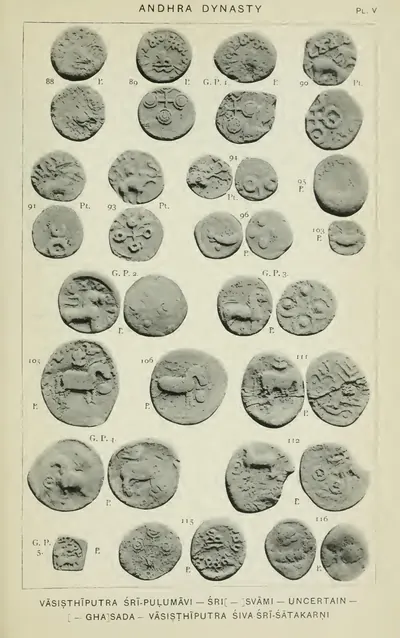 Coins of "Vasisthiputra Sri-Pulumavi - Sri[ ]svami - uncertain - [ ]ghasada - Vasisthiputra Siva Sri-Satakarni", including two-masted ship coins (Rapson 1908, Pl. V)Coin · 1908
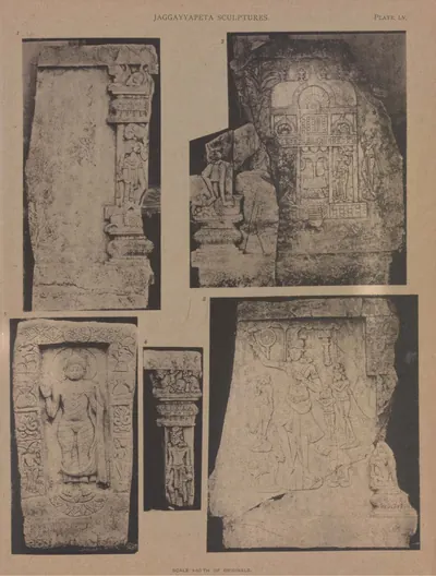 Jaggayyapeta: four slabs and a pilaster (Burgess 1887, Pl. LV)Book plate · 1887
 Lead coins of "Vasisthiputra Sri Candra-Sati" and "Gautamiputra Sri-Yajna-Satakarni" from the Kistna and Godavari districts (Rapson 1908, Pl. VI)Coin · 1908
 Plan and section of the tope at Amaravati, from a survey made by Colonel Mackenzie in 1817 (Burgess 1887, Pl. III)Plan · 1887
 Plan and section of the tope at Amravati, from Colonel Mackenzie's survey in 1817 (left half of folding plate) (Fergusson 1868, Pl. XLVII)Plan · 1868
 Plan and section of the tope at Amravati, from Colonel Mackenzie's survey in 1817 (right half of folding plate) (Fergusson 1868, Pl. XLVII)Plan · 1868
 Plan of the stupa at Amaravati, from a survey made in December 1881 (Burgess 1887, Pl. IV)Plan · 1887
 Re-erected railing at the Amaravati stupaPhotograph · 2024
 Satavahana copper coin, 1st century BCECoin · 1st century BCE
 Silver portrait coins of Gautamiputra Sri-Yajna-Satakarni, catalogued under Surastra (Rapson 1908, Pl. VII, row 4)Coin · 1908
 Square and round lead coins with a lion and a tree in railing, name uncertain ("perhaps Sakasada or Sakasena"), Kistna and Godavari districts (Rapson 1908, Pl. III, G.P. 2-3, Nos. 36-38)Coin · 1908
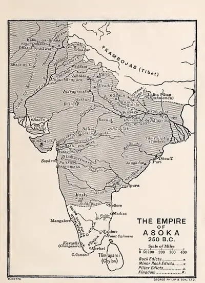 The Empire of Asoka, 250 B.C. (Smith 1920, map at end)Map · 1920
Maps
- Unified Andhra Pradesh (pre-2014)
- Present-day state borders, for orientation
- Approximate extent
Where Asoka's edicts have been found in and near the Telugu country, with the southern frontier of his empire as Vincent Smith drew it in 1920. The frontier is approximate: Smith drew it just north of Nellore, eight years before the Kurnool edicts were found.
Historical boundaries are approximate. Base map: Natural Earth (opens in a new tab) (public domain). Redrawn from: The Empire of Asoka, 250 B.C. (opens in a new tab), Vincent A. Smith, 1920 (Public domain). Attributions
- Unified Andhra Pradesh (pre-2014)
- Present-day state borders, for orientation
Seats of power in the Telugu land, from Satavahana Dhanyakataka to Qutb Shahi Hyderabad.
Base map: Natural Earth (opens in a new tab) (public domain).
- Unified Andhra Pradesh (pre-2014)
- Present-day state borders, for orientation
Where the region's earliest writing has been found, from Asoka's edicts in Kurnool to the stupas of the Krishna valley.
Base map: Natural Earth (opens in a new tab) (public domain).
- Unified Andhra Pradesh (pre-2014)
- Present-day state borders, for orientation
- Approximate extent
Where coins and inscriptions of the Satavahana kings have been found in and near the Telugu country, from the lead coins of the Krishna and Godavari districts catalogued by E. J. Rapson in 1908 to the royal inscriptions at Amaravati, Chinna Ganjam, Kodavali and Myakadoni. The shaded area is approximate.
Historical boundaries are approximate. Base map: Natural Earth (opens in a new tab) (public domain). Redrawn from: Sketch map of the dominions of the Andhras & Western Ksatrapas, c. 150 A.D. (opens in a new tab), E. J. Rapson, 1908 (Public domain). Attributions
- Unified Andhra Pradesh (pre-2014)
- Present-day state borders, for orientation
- Route
Ports of the Telugu coast in the sources, from the Periplus's Masalia and the Kakatiya port of Motupalli to the Dutch and English factories of the 17th century and the steamer ports of about 1900, with the road from Golconda that Tavernier took to Masulipatam. Sea routes show only the direction of the voyages the sources name; all routes are approximate.
Base map: Natural Earth (opens in a new tab) (public domain).
Related
Dynasties
Mauryas
c. 322 BCE – 184 BCE
The Mauryan empire of Magadha (c. 322–185 BCE) held part of the Telugu country in the 3rd century BCE. Asoka's edicts at Erragudi and Rajula-Mandagiri in Kurnool district are among the earliest written records found in the region. His conquest of Kalinga reached the coast north of the Godavari.
Satavahanas
c. 200 BCE – 225 CE
Deccan dynasty, called the Andhras in the Puranas, whose later kings ruled the Krishna valley, the Godavari delta and parts of Rayalaseema in the 2nd and early 3rd centuries CE. Its beginnings, its dates and when it reached the Telugu country are all debated.
People
Chandragupta Maurya
c. 322 BCE – 296 BCE
Founder of the Maurya empire (reigned c. 322–296 BCE). His empire probably did not reach the Telugu country, but Megasthenes, the Greek envoy at his court, described the Andhras and the Kalingas as powerful peoples with kings and armies of their own.
Bindusara
c. 296 BCE – 268 BCE
Second Maurya emperor (reigned c. 296–268 BCE), son of Chandragupta and father of Asoka. Later writers believed he carried Mauryan rule into the south. But no record says when the Telugu country came under the empire.
Asoka
c. 268 BCE – 226 BCE
Third Maurya emperor (3rd century BCE). His edicts at Erragudi and Rajula-Mandagiri in Kurnool district are among the oldest written records found in Andhra Pradesh. His Kalinga war reached the coast north of the Godavari, and his Rock Edict XIII names the Andhras.
Simuka
c. 220 BCE – 197 BCE
Founder of the Satavahana dynasty, named on a label over a carving at Nanaghat in the western Ghats. The Puranas call him the first Andhra king. A tradition of the Telugu country, recorded by James Burgess, gave a legendary founder a first capital at Srikakulam on the Krishna. Depending on the scholar, his dates range from the late 3rd to the 1st century BCE.
Sri Satakarni
c. 179 BCE – 169 BCE
Third Satavahana king and husband of Queen Nayanika of the Nanaghat inscriptions. He was probably the Satakarni whom Kharavela of Kalinga defied in the Hathigumpha inscription. Nothing of his is known from the Telugu country, but Kharavela's campaign is said to have reached the Krishna.
Gautamiputra Satakarni
c. 113–138 CE
Satavahana king of the early 2nd century CE. He overthrew the Kshaharata satrap Nahapana and won back the western Deccan. His deeds are known mainly from the Nasik cave inscription set up by his mother, Gautami Balasri. Whether he also ruled the Krishna valley is disputed.
Vasishthiputra Pulumavi
c. 138–170 CE
Son and successor of Gautamiputra Satakarni, and the earliest Satavahana king named in an inscription from the lower Krishna valley. He lost much of the western Deccan to the Saka satrap Rudradaman, who was probably his father-in-law. A King Pulumavi is also named in a rock inscription at Myakadoni in Bellary district.
Siva Sri Satakarni
c. 170–177 CE
Satavahana king of the later 2nd century CE. He is known almost only from lead coins found in the Krishna and Godavari districts, among them examples from Gudivada. He was probably a successor, perhaps a brother, of Vasishthiputra Pulumavi.
Yajna Sri Satakarni
c. 184–213 CE
Late Satavahana king of the later 2nd century CE, the last whose inscriptions and coins are found in both the western Deccan and the Krishna–Godavari country. His Chinna inscription, from the coast south of the Krishna, is dated in his 27th year. His silver coins bear what E. J. Rapson in 1908 called the only known coin-portrait of a Satavahana king.
Chandra Sri Satakarni
c. 219–229 CE
Satavahana king, called Vasishthiputra Chandra Sati on his lead coins from the Krishna and Godavari districts. A rock inscription at Kodavali near Pithapuram calls him Chandasati. Scholars disagree whether he reigned soon after Pulumavi or near the end of the dynasty, and whether two kings of the name are involved.
Gobhada
King known only from copper coins found at Kotilingala on the Godavari, inscribed 'Rajno Gobhadasa'. Rachna Lodaya counts him as the first local king of the Deccan to put his name on coins. The excavators dated his coins to the first half of the 2nd century BCE and K. D. Bajpai to about 125–100 BCE. P. V. Parabrahma Sastry took him for the Sunga king Bhagabhadra, an identification Lodaya rejects.
Samagopa
King known only from his coins, found at Kotilingala, Peddabankur and Dhulikatta in the old Karimnagar district and at Chandrapur in Maharashtra. He issued more coins than any other Kotilingala king. Rachna Lodaya takes him for the last local king before the Satavahanas, ousted by Simuka about 52 BCE; P. V. Parabrahma Sastry took him for a Sunga king.
Places
Amaravati & Dharanikota
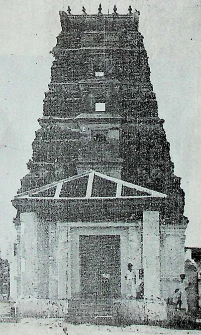
Neighbouring sites on the south bank of the Krishna. The ramparts of Dharanikota are usually identified with ancient Dhanyakataka. The town of Amaravati is the site of the great Buddhist stupa and the Amaresvara temple.
Bhattiprolu
Village in the Krishna delta. In 1892 its great brick stupa yielded three relic caskets inscribed in an early and unusual variety of Brahmi, dated to about 200 BCE.
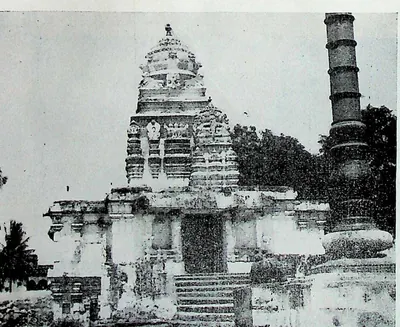
Chebrolu
Old town on a sandstone ridge nine miles south-east of Guntur, called Tamrapuri or the 'city of Shanmukha' in its inscriptions, after its temple of Kumarasvamin. Its records run from 1006. They include gifts of the Velanadu chiefs, and a long inscription of 1213 by Jaya, the Kakatiya king Ganapati's general, who received the town and rebuilt its temples and walls. M. Rama Rao attributed its Bhimesvara temple to the Eastern Chalukya king Chalukya-Bhima I.
Dhulikatta
Village on the Hussaini Vagu in the old Karimnagar district, beside an early walled town of 18 hectares. V. V. Krishna Sastry dug its south gate, a palace complex with a granary and a Buddhist stupa a kilometre to the north, which he dated from the late 3rd century BCE. Coins of the local king Samagopa and a silver portrait coin of the Satavahana king Sivasri Pulumavi were found here.
Erragudi
Village in Pattikonda taluk, Kurnool district, near Gooty. Asoka's fourteen Rock Edicts and Minor Rock Edicts I–II are carved on boulders of the Yenakonda hill nearby.
Ghantasala
Village west of Machilipatnam in the Krishna delta, site of a large brick Buddhist stupa excavated by A. Rea in 1892. Carved limestone slabs and inscribed pillars from it survive scattered through the village.
Gudivada
Taluk town in the Krishna delta, about twenty miles north-west of Machilipatnam. It has the remains of a demolished Buddhist stupa. An old village mound here has yielded large numbers of Satavahana (Andhra) lead coins, beads and pottery.
Jaggayyapeta
Market town on the Paleru near where it meets the Krishna, formerly called Betavolu. On a hill nearby, James Burgess excavated in 1882 the remains of an early Buddhist stupa with an inscription of the Ikshvaku period.
Kotilingala
Village on the south bank of the Godavari in the old Karimnagar district, at the mouth of the Peddavagu stream. Its large early mound, ringed by a mud fort, has given what its excavation report calls the earliest inscribed coins of the Deccan. They name local kings, Gobhada, Kamvaya, Narana and Samagopa, and the only known coins of Simuka, first king of the Satavahanas. Scholars disagree on whether these kings ruled before the Satavahanas, under them or beside them.
Peddabankur
Village near Peddapalli in the old Karimnagar district, beside a 30-hectare early settlement dug for the Andhra Pradesh Department of Archaeology and Museums before 1978. The dig found brick enclosures and 22 wells, two hoards of silver punch-marked coins, Roman coins of Augustus and Tiberius with Satavahana coins, and coins of the local king Samagopa.
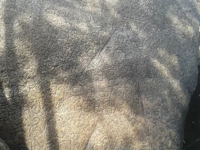
Rajula-Mandagiri
Hamlet of Juthru near Pattikonda, Kurnool district, where a damaged copy of Asoka's Minor Rock Edicts is carved on the rock of the Ramalingesvara temple.
Suvarnagiri
Seat of Asoka's southern province, named in his Mysore edicts as the residence of a royal prince and his high officers. Its site is unknown: Kanakagiri, the gold country around Maski and a hill in Bihar have all been proposed, and scholars disagree on whether the Kurnool edicts were sent through it.
Monuments
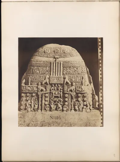
Amaravati Mahachaitya
c. 200 BCE – 300 CE
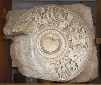
The great Buddhist stupa of Amaravati on the Krishna, founded perhaps around 200 BCE and rebuilt with carved limestone rails in the 2nd–3rd centuries CE. From 1796 it was dug up for building material, and it is now known mainly from its scattered sculptures.
Bhattiprolu stupa
c. 200 BCE
Large brick Buddhist stupa in the Krishna delta, about 148 feet across at its base. Most of it was pulled down for road material and canal works in the 1870s. In 1892 A. Rea found three inscribed relic caskets of about 200 BCE in its core.
Jaggayyapeta stupa
c. 200 BCE
Small early Buddhist stupa on Dhana Bodu hill near Jaggayyapeta. Its old limestone casing slabs and Mauryan-type letters point to the 2nd century BCE. Pillar inscriptions of the Ikshvaku king Virapurushadatta record a later dedication.
Inscriptions
Erragudi edicts of Asoka
c. 250 BCE
Asoka's fourteen Rock Edicts and his Minor Rock Edicts I–II, carved on six boulders of the Yenakonda hill near Erragudi in Kurnool district in the mid-3rd century BCE. They were found in 1928.
Rajula-Mandagiri inscription of Asoka
c. 250 BCE
A badly weathered 15-line copy of Asoka's Minor Rock Edicts I–II on a rock beside the Ramalingesvara temple at Rajula-Mandagiri near Pattikonda, Kurnool district. A Mackenzie surveyor copied part of it around 1800, and the stone was found again in 1953.
Bhattiprolu relic-casket inscriptions
c. 200 BCE
Ten short Prakrit inscriptions on three stone relic caskets and a crystal from the Bhattiprolu stupa, found by A. Rea in 1892. Bühler dated them no later than about 200 BCE. Their unusual variety of Brahmi is among the earliest writing found in the region.
Amaravati inscription of the time of Vasishthiputra Pulumavi
c. 130 CE
A two-line Prakrit inscription on a broken coping stone from the Amaravati stupa. It records a Dharmachakra (wheel of the law) set up at the western gate of the Great Chaitya, in a regnal year of the Satavahana king Vasishthiputra Sri Pulumavi. The year itself is lost.
Myakadoni inscription of Pulumavi
c. 145 CE
A four-line Prakrit inscription on a granite boulder called Jangli Gundu near Myakadoni, Adoni taluk, Bellary district. It is dated in the eighth year of 'Siri-Pulumavi, King of the Satavahanas'. It records a reservoir dug by a householder and names a district, Satavahani-hara, held by a great general. It is the only Satavahana inscription from Rayalaseema in these sources.
Amaravati inscription of King Sri Sivamaka Sada
c. 150 CE
Fragment of a one-line Prakrit inscription on a carved coping stone of the Amaravati stupa, recording a gift by the 'superintendent of the water establishment' of a king Sri Sivamaka Sada. The king has been taken for the founder Simuka, for Siva Sri Satakarni, or for a ruler of another family altogether.
Chinna inscription of Yajna Sri Satakarni
c. 195 CE
A damaged six-line Prakrit inscription on a stone found on the sea-shore south of the Krishna near the village of Chinna, Kistna district, and later kept in the Madras Museum. It is dated in the 27th year of Gautamiputra Siriyana Satakani (Yajna Sri Satakarni). It is the latest dated record of that king.
Kodavali rock inscription of Chandasati
c. 210 CE
A six-line Prakrit inscription cut into a rock-cut well beside a ruined Buddhist mound near Kodavali, north-west of Pithapuram in the Godavari district. It is dated in a regnal year of the Satavahana king Vasishthiputra Chandasati (Chandra Sati) and records a gift by a minister. Its year and wording have been read in three different ways.
Themes
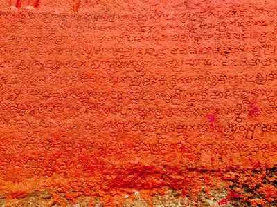
Language & literature
From Prakrit inscriptions and the first Telugu records to Nannaya, Pothana, Vemana and modern prose.
Music & dance
Annamacharya, Tyagaraja, Kuchipudi, Perini and the folk performance traditions.
Religion & philosophy
Buddhism, Jainism, Shaiva and Vaishnava movements, Islam and the Sufi orders, Christianity and village deities.
Temples & architecture
Stupas, rock-cut caves, temples, mosques, tombs and palaces, and how they were built.
Forts & warfare
Hill forts, city walls, armies and the battles that changed who ruled the region.
Trade & economy
Ports such as Motupalli and Machilipatnam, Golconda diamonds, tanks and farming, merchant guilds.
Crafts & textiles
Kalamkari, ikat weaving, Nirmal paintings, Kondapalli and Etikoppaka toys and other crafts.
Society & communities
Castes, communities and tribes, and how social life changed over time, from scholarly sources.
Inscriptions & sources
How we know: inscriptions, coins, travellers' accounts, the Mackenzie kaifiyats and archives.
Old names of regions
The old country names of the Telugu lands and where the sources place them: Andhra and Telingana, Vengi between the two deltas, Kammanadu round Ongole, Velanadu in the western Krishna delta, Pakanadu between Ongole and Nellore, Renadu round Kadapa, the Kondapalli and Kondavidu countries, and the later names Circars and Ceded Districts. Names only: for how borders changed, see How the map changed.
References
Notes (0)
Sources (13)
Spotted an error on this page? Tell us
Last updated: