British Crown (Madras Presidency)
The government of the Telugu districts of the Madras Presidency by the British Crown, from the transfer of the East India Company's territories in 1858 to independence in 1947. Under a Governor in Council at Madras, the coast and Rayalaseema were ruled through Collectors, a Board of Revenue, district and taluk boards and municipalities. The districts were redrawn (Godavari and Kistna in 1859, Anantapur in 1882, Guntur in 1904, Chittoor in 1911, West Godavari in 1925), and the Nizam ceded the Bhadrachalam and Rekapalli taluks in 1860. The ryotwari lands were surveyed and settled, and the inams registered by the Inam Commission. The great zamindaris of Vizianagaram, Bobbili, Pithapuram, Venkatagiri, Kalahasti and Karvetinagar kept their permanent settlements. The Godavari and Krishna deltas were irrigated, and railways reached Bezwada and Waltair. The great famine of 1876–78 emptied the Ceded Districts. The Rampa rising of 1879–80 was the last that needed regular troops in the Presidency.
Swipe sideways to see the whole chart; tap a bar for details.
Each bar is a ruling power in its region; time runs left to right. Dashed = approximate dates. Select a bar for details.
Show as a list
Mughals, Asaf Jahis & the British 1687–1948 CE
- Telangana
- Asaf Jahi Nizams of Hyderabad (1724–1948 CE) · British Crown (Madras Presidency) (1860–1947 CE)
- Coastal Andhra
- Nawabs of the Carnatic (Arcot) (c. 1710–1801 CE) · French East India Company (1817–1954 CE) · East India Company (1759–1858 CE) · Madras State (1947–1953 CE) · Asaf Jahi Nizams of Hyderabad (1759–1788 CE) · British Crown (Madras Presidency) (1858–1947 CE)
- Rayalaseema
- Nawabs of Kurnool (c. 1690–1839 CE) · British Crown (Madras Presidency) (1858–1947 CE) · Nawabs of the Carnatic (Arcot) (c. 1710–1801 CE) · Madras State (1947–1953 CE) · Banganapalle State (c. 1724–1948 CE) · Asaf Jahi Nizams of Hyderabad (c. 1724–1800 CE) · Mysore under Haidar Ali and Tipu Sultan (c. 1762–1799 CE) · East India Company (1792–1858 CE)
- Movements
- Godavari hill risings (1858–1862 CE) · Vandemataram and Swadeshi (1905–1911 CE) · Non-cooperation (1920–1922 CE) · Salt satyagraha (1930 CE) · Hyderabad State Congress satyagraha (1938–1946 CE) · Andhra movement (c. 1911–1953 CE) · Andhra Jana Sangham and Andhra Mahasabha (1921–1946 CE) · Rampa rebellion (Alluri Sitarama Raju) (1922–1924 CE) · Quit India (1942 CE) · Telangana armed struggle (1946–1951 CE)
Reform, freedom & people's movements 1850–1956 CE
- Telangana
- Asaf Jahi Nizams of Hyderabad (1724–1948 CE) · British Crown (Madras Presidency) (1860–1947 CE) · Hyderabad State (Indian Union) (1948–1956 CE)
- Coastal Andhra
- French East India Company (1817–1954 CE) · East India Company (1759–1858 CE) · Madras State (1947–1953 CE) · British Crown (Madras Presidency) (1858–1947 CE) · Andhra State (1953–1956 CE)
- Rayalaseema
- British Crown (Madras Presidency) (1858–1947 CE) · Andhra State (1953–1956 CE) · Madras State (1947–1953 CE) · Banganapalle State (c. 1724–1948 CE) · East India Company (1792–1858 CE)
- Movements
- Godavari hill risings (1858–1862 CE) · Vandemataram and Swadeshi (1905–1911 CE) · Non-cooperation (1920–1922 CE) · Salt satyagraha (1930 CE) · Hyderabad State Congress satyagraha (1938–1946 CE) · Andhra movement (c. 1911–1953 CE) · Andhra Jana Sangham and Andhra Mahasabha (1921–1946 CE) · Rampa rebellion (Alluri Sitarama Raju) (1922–1924 CE) · Quit India (1942 CE) · Telangana armed struggle (1946–1951 CE)
Andhra State & Andhra Pradesh 1953–2014 CE
- Telangana
- Andhra Pradesh (united) (1956–2014 CE) · Hyderabad State (Indian Union) (1948–1956 CE)
- Coastal Andhra
- French East India Company (1817–1954 CE) · Andhra Pradesh (united) (1956–2014 CE) · Andhra State (1953–1956 CE)
- Rayalaseema
- Andhra State (1953–1956 CE) · Andhra Pradesh (united) (1956–2014 CE)
- Movements
- Telangana movement (c. 1969–1973 CE) · Jai Andhra movement (c. 1972–1973 CE)
Kingdoms and empires
Asaf Jahi Nizams of Hyderabad
Open page- Telangana: 1724–1948 CE (224 years)
Asaf Jah, viceroy of the Deccan from 1713, independent after defeating Mubariz Khan at Shakar Kheda (11 October 1724 in Irvine; 1723 in Gribble); Telangana remained the Telugu heart of the Nizam's Dominions, with the samasthans of Gadwal, Wanaparthy, Jatprole, Amarchinta and Palvancha as tributary estates. Regular districts were formed in 1865-66 and the Telugu divisions surveyed and settled by 1905; the districts were redrawn in 1905 and an Executive Council governed from November 1919. The Standstill Agreement with India was signed on 29 November 1947. Indian troops entered the state on 13 September 1948 (the Police Action); the Nizam ordered a ceasefire on 17 September, and a military governor took charge on 18 September
- Coastal Andhra: 1724–1753 CE (29 years)
The Nizam's governor at Rajahmundry collected the tribute of the coastal zamindars; Masulipatam granted to the French by Muzaffar Jang in 1750 and the lands of Nizampatnam and Kondavid by Salabat Jang in 1751; the four Circars of Mustafanagar, Ellore, Rajahmundry and Chicacole assigned to the French on 4 December 1753 to pay Bussy's army
- Rayalaseema: c. 1724–1800 CE (c. 76 years)
Nominal over much of the region (Kurnool and Cuddapah Nawabs, Maratha tribute, Morari Rao at Gooty, Haidar Ali from 1761); the Nizam gained Tipu Sultan's districts by the treaties of 1792 and 1799 and ceded them to the Company by the treaty of 12 October 1800 to pay the subsidiary force (the Ceded Districts)
- Coastal Andhra: 1759–1788 CE (29 years)
Guntur (Murtazanagar) stayed with the Nizam's brother Basalat Jang after the French were driven out; it was excluded from the cessions of 1766 and 1768, rented by the Company in 1779 and restored, and handed over to the Company only in 1788; the Nizam's claims to the Circars' payments were bought out in 1823
Rulers (10)
Capitals
Monuments (11)
Inscriptions
Sources (16)
Indian states (1947 onward)
Andhra Pradesh (united)
- Telangana: 1956–2014 CE (58 years)
Formed on 1 November 1956; divided into Telangana and Andhra Pradesh in 2014
- Coastal Andhra: 1956–2014 CE (58 years)
Formed on 1 November 1956; divided into Telangana and Andhra Pradesh in 2014
- Rayalaseema: 1956–2014 CE (58 years)
Formed on 1 November 1956; divided into Telangana and Andhra Pradesh in 2014
Sources (4)
Colonial powers
British Crown (Madras Presidency)
Open page- Coastal Andhra: 1858–1947 CE (89 years)
The East India Company's government passed to the Crown by Act of Parliament of 2 August 1858 (Maclean); the Queen's proclamation is dated 4 November (Maclean) and the transfer of the Company's territories 1 November 1858 (Sewell). Ruled through the Governor in Council at Madras, the Board of Revenue and district Collectors. Godavari and Kistna were formed in December 1859, Guntur in 1904 and West Godavari, from the old Kistna, in 1925; the hill tracts of Vizagapatam and Godavari were governed as Agencies under special laws (1839, 1879). Ended with independence in 1947
- Rayalaseema: 1858–1947 CE (89 years)
The Ceded Districts and the Carnatic districts passed to the Crown with the rest of the Company's territories in 1858. Kurnool was made a full Collectorate in 1858, Anantapur was separated from Bellary in 1882 and Chittoor was formed on 1 April 1911; the state of Banganapalle stayed under the Madras Government until the 1920s, when it was placed under an Agent to the Governor-General. Ended with independence in 1947
- Telangana: 1860–1947 CE (87 years)
Partial (the Bhadrachalam and Rekapalli taluks only): ceded by the Nizam by the treaty of 26 December 1860; administered until 1874 as part of the Upper Godavari district of the Central Provinces, then transferred to the Godavari district of Madras and made part of the Godavari Agency in 1879
Rulers (22)
- Lord Harris (1854–1859 CE)
- Sir Charles Trevelyan (1859–1860 CE)
- Sir Henry Ward (1860 CE)
- Sir William Denison (1861–1866 CE)
- Lord Napier (1866–1872 CE)
- Lord Hobart (1872–1875 CE)
… and 16 more
- Duke of Buckingham and Chandos (1875–1880 CE)
- W. P. Adam (1880–1881 CE)
- M. E. Grant Duff (1881–1886 CE)
- Robert Bourke (Lord Connemara) (1886–1890 CE)
- Lord Wenlock (1891–1896 CE)
- Sir Arthur Havelock (1896–1900 CE)
- Lord Ampthill (1900–1906 CE)
- Sir Arthur Lawley (1906–1911 CE)
- Sir Thomas Gibson-Carmichael (1911–1912 CE)
- Lord Pentland (1912–1919 CE)
- Lord Willingdon (1919–1924 CE)
- Viscount Goschen (1924–1929 CE)
- Sir George Stanley (1929–1934 CE)
- Lord Erskine (1934–1940 CE)
- Sir Arthur Hope (1940–1946 CE)
- Sir Archibald Nye (1946–1947 CE)
Sources (11)
Indian states (1947 onward)
Hyderabad State (Indian Union)
- Telangana: 1948–1956 CE (8 years)
Under Indian administration after the Police Action of September 1948: governed by a Military Governor, and from 1 December 1949 by a civil Chief Minister. It became a Part B State of the Indian Union when the Constitution came into force on 26 January 1950, with the Nizam as Rajpramukh; the first elected ministry took office after the elections of March 1952. Trifurcated on 1 November 1956, when its Telangana districts joined Andhra Pradesh
Sources (6)
Indian states (1947 onward)
Telangana
- Telangana: 2014–present (since 2014)
State of Telangana from 2014
Sources (1)
Kingdoms and empires
Nawabs of the Carnatic (Arcot)
Open page- Coastal Andhra: c. 1710–1801 CE (c. 91 years)
Partial (Nellore and Ongole, the Palnad, the jagir of Udayagiri and the tributary zamindaris of Venkatagiri and Kalahasti). Saadatullah Khan became Nawab of the Carnatic, the coast from Guntur to the Coleroon, in 1710 (Orme) or 1713 (Wilks), and his fauzdar governed Nellore; he granted the Udayagiri jagir in 1720. Under Muhammad Ali Walajah (1749-95) his brother Najib-ullah held Nellore, rebelled in 1757 and was dislodged by an English force in 1762. The revenues were assigned to the Company in 1781-85 and managed by it in 1790-92; by the treaty of 31 July 1801 Azim-ud-daula handed over the government of the Carnatic, and Nellore, Ongole and the Palnad became British
- Rayalaseema: c. 1710–1801 CE (c. 91 years)
Partial (Chittoor taluks). The Nawabs at Arcot, first as deputies under the Nizam, took tribute from the Chittoor and Chendragiri poligars and the Kalahasti and Karvetnagar zamindars; Muhammad Ali gave Chittoor and Chendragiri to his brother Abdul Wahab as a jagir, and the Carnatic was handed to the Company on 31 July 1801.
Rulers
- Saadatullah Khan (c. 1710–1732 CE)
- Dost Ali Khan (1732–1740 CE)
- Safdar Ali Khan (c. 1740–1742 CE)
- Anwar-ud-din Khan (1744–1749 CE)
- Muhammad Ali Khan Walajah (1749–1795 CE)
- Umdat-ul-Umara (1795–1801 CE)
Capitals
Sources (11)
Colonial powers
French East India Company
Open page- Coastal Andhra: 1750–1759 CE (9 years)
Partial at first (Masulipatam and the island of Divi, seized in July 1750 under Muzaffar Jang's grant; Nizampatnam, Narsapur and Kondavid added by Salabat Jang in 1751-52); from December 1753 the four Northern Circars of Mustafanagar (Kondapalli), Ellore, Rajahmundry and Chicacole, granted for the pay of Bussy's army and settled by Bussy in person from July 1754. Forde routed the French at Condore (Chandurti) on 9 December 1758 and stormed Masulipatam on 7-8 April 1759; by the treaty of May 1759 Salabat Jang ceded the Masulipatam country to the English and excluded the French from the Deccan
- Coastal Andhra: c. 1765–1793 CE (c. 28 years)
Partial (Yanam only): the French factory town on the Godavari, ceded to them in 1752, reoccupied after the peace of 1763 (the restored possessions 'were not occupied before 1765'); the French possessions were also in English hands in 1778-83
- Coastal Andhra: 1817–1954 CE (137 years)
Partial (Yanam only): occupied by the English from 1793 (except 1802-03) and handed back in 1817 under the treaties of 1814-15; about 2,258 acres. The Government of India took over the French Establishments, Yanam among them, from 1 November 1954 after the agreement with France of 21 October 1954
Rulers
- Joseph François Dupleix (1750–1754 CE)
- Charles de Bussy (1754–1758 CE)
- Marquis de Conflans (1758–1759 CE)
Capitals
Sources (10)
Colonial powers
East India Company
Open page- Coastal Andhra: 1759–1858 CE (99 years)
Partial at first: the Masulipatam and Nizampatam Circars ceded by Salabat Jang on 14 May 1759 after Forde's defeat of the French. The emperor Shah Alam granted the five Northern Circars on 12 August 1765; by the treaties of 12 November 1766 and 23 February 1768 the Nizam ceded Kondapalli, Ellore, Rajahmundry and Chicacole for a yearly payment (capitalised in 1823), Guntur following in September 1788. Governed through renters until 1769, Chiefs and Councils at Masulipatam and Vizagapatam until 1794, then Collectors; the zamindaris were permanently settled in 1802-03. Nellore, Ongole and the Palnad came with the Carnatic from the Nawab of Arcot on 31 July 1801. Transferred to the Crown in 1858
- Rayalaseema: 1792–1858 CE (66 years)
Partial at first: Kangundi came to the Company with the Baramahal in 1792, when it also began collecting the Kalahasti and Karvetnagar tribute for the Nawab; Punganur and Venkatagirikota (Palmaner) followed from Tipu's lands in 1799. On 12 October 1800 the Nizam ceded the territories he had gained from Mysore in 1792 and 1799, the Ceded Districts of Bellary (with Anantapur) and Cuddapah, with the tribute of the Nawab of Kurnool; Thomas Munro, Principal Collector 1800-1807, reduced the poligars and made the ryotwari settlement. The Nawab of Arcot's Chittoor and Chendragiri country came with the Carnatic in 1801, and the Kurnool Nawab's jagir was annexed in 1839. Transferred to the Crown in 1858
Rulers (23)
- George Pigot (1755–1763 CE)
- Robert Palk (1763–1767 CE)
- Charles Bourchier (1767–1770 CE)
- Josias Du Pré (1770–1773 CE)
- Alexander Wynch (1773–1775 CE)
- Lord Pigot (1775–1776 CE)
… and 17 more
- Sir Thomas Rumbold (1778–1780 CE)
- Lord Macartney (1781–1785 CE)
- Sir Archibald Campbell (1786–1789 CE)
- William Medows (1790–1792 CE)
- Sir Charles Oakeley (1792–1794 CE)
- Lord Hobart (1794–1798 CE)
- Lord Clive (Edward Clive) (1798–1803 CE)
- Lord William Bentinck (1803–1807 CE)
- Sir George Barlow (1807–1813 CE)
- Hugh Elliot (1814–1820 CE)
- Sir Thomas Munro (1820–1827 CE)
- Stephen Rumbold Lushington (1827–1832 CE)
- Sir Frederick Adam (1832–1837 CE)
- Lord Elphinstone (1837–1842 CE)
- Marquis of Tweeddale (1842–1848 CE)
- Sir Henry Pottinger (1848–1854 CE)
- Lord Harris (1854–1859 CE)
Capitals
Monuments
Sources (10)
Indian states (1947 onward)
Madras State
- Coastal Andhra: 1947–1953 CE (6 years)
The Telugu districts remained in Madras Province (Madras State from 1950) until Andhra State was formed in 1953
- Rayalaseema: 1947–1953 CE (6 years)
The Telugu districts remained in Madras Province (Madras State from 1950) until Andhra State was formed in 1953
Sources (2)
Indian states (1947 onward)
Andhra Pradesh
- Coastal Andhra: 2014–present (since 2014)
Residuary state of Andhra Pradesh from 2014
- Rayalaseema: 2014–present (since 2014)
Residuary state of Andhra Pradesh from 2014
Sources (1)
Indian states (1947 onward)
Andhra State
- Coastal Andhra: 1953–1956 CE (3 years)
Formed on 1 October 1953 from the Telugu districts of Madras State, with its capital at Kurnool; merged into Andhra Pradesh on 1 November 1956
- Rayalaseema: 1953–1956 CE (3 years)
Formed on 1 October 1953 from the Telugu districts of Madras State, with its capital at Kurnool; merged into Andhra Pradesh on 1 November 1956
Sources (7)
Kingdoms and empires
Nawabs of Kurnool
Open page- Rayalaseema: c. 1690–1839 CE (c. 149 years)
Partial (Kurnool proper, the taluks of Ramallakota, Nandikotkur, Nandyal and Sirvel). The Mughals took Kurnool in 1686-88 and gave it as a jagir to the Pathan general Daud Khan Panni in the latter part of the seventeenth century (about 1698 in Burhanuddin); his kinsman Ibrahim Khan seized the fort in 1715, and his son Alif Khan acknowledged Asaf Jah in 1724. The French and Salabat Jang stormed Kurnool in March 1751 and held it for the Nizam until Ranmast (Munawwar) Khan recovered it in 1752. The Nawabs paid tribute to the Nizam and, from 1769, to Haidar Ali and Tipu Sultan; in 1800 the Nizam ceded the tribute to the Company, which fixed it in 1804 at a lakh and a quarter of Gadwal rupees, then a lakh. The last Nawab, Ghulam Rasul Khan, was deposed in 1839 and the jagir annexed
Rulers (8)
- Daud Khan Panni (c. 1690–1715 CE)
- Ibrahim Khan (1715–1724 CE)
- Alif Khan (1724–1733 CE)
- Himmat Bahadur Khan (Nawab of Kurnool) (1733–1751 CE)
- Ranmast Khan (Munawwar Khan, Nawab of Kurnool) (1752–1792 CE)
- Alif Khan II (Nawab of Kurnool) (1792–1815 CE)
… and 2 more
- Munawwar Khan II (1815–1823 CE)
- Ghulam Rasul Khan (Nawab of Kurnool) (1823–1839 CE)
Capitals
Sources (6)
Kingdoms and empires
Banganapalle State
Open page- Rayalaseema: c. 1724–1948 CE (c. 224 years)
Partial (a nawabi enclave of about 255 square miles round Banganapalle in the Kurnool district). Muhammad Beg Khan, Mughal killedar of Banganapalle from the late seventeenth century, became a petty Nawab when Asaf Jah made himself independent, and Asaf Jah confirmed the jagir. Tipu Sultan occupied it from 1783 until the family, with the Nizam's troops, won it back at Tammadapalle in 1790. In 1800 the Nizam transferred his control to the East India Company, which took no tribute; the Madras government managed the indebted jagir from 1825 (1832 in the Imperial Gazetteer) to 1848 and restored it by the sanad of 1849. The ruler became a hereditary Nawab in 1876; the Madras government took over the administration on 23 February 1948
Rulers (10)
- Muhammad Beg Khan (c. 1724–1758 CE)
- Muhammad Beg Khan Laug (regent) (c. 1758–1766 CE)
- Fazl Ali Khan (Gulli Nawab) (c. 1766–1782 CE)
- Husain Ali Khan (c. 1782–1783 CE)
- Ghulam Ali Khan (Mansur-ud-daula) of Banganapalle (c. 1790–1821 CE)
- Husain Ali Khan II (c. 1821–1848 CE)
… and 4 more
- Ghulam Muhammad Ali Khan of Banganapalle (1848–1868 CE)
- Fateh Ali Khan, Nawab of Banganapalle (1868–1905 CE)
- Ghulam Ali Khan III (1905–1922 CE)
- Fazl-i-Ali Khan (1922–1948 CE)
Capitals
Sources (5)
Kingdoms and empires
Mysore under Haidar Ali and Tipu Sultan
Open page- Rayalaseema: c. 1762–1799 CE (c. 37 years)
Partial (the Anantapur, Bellary and Cuddapah uplands). Haidar Ali, master of Mysore from 1761, took Penukonda, Madakasira and Kodikonda from Morari Rao of Gooty in 1762 (some went back to Morari Rao in 1764-66). Gurramkonda came to him through Mir Sahib in 1768, was lost to the Marathas in 1771 and recovered by Tipu in 1773-74. He took Bellary in 1775 and Gooty in April 1776 (1775 in the Anantapur gazetteer), and the Nawab of Cuddapah surrendered at Sidhout on 27 May 1779 (1780 in the Cuddapah gazetteer); the Nawab of Kurnool and the poligars of the Bellary and Anantapur country paid him tribute. By the treaty of 18 March 1792 Tipu ceded the Cuddapah taluks, Gurramkonda, Bellary and the Gooty taluks of Tadpatri and Tadimarri to the Nizam; Gooty, Penukonda, Madakasira, Anantapur and the rest of Gurramkonda went to the Nizam after Tipu's death in May 1799, and the Nizam ceded both gains to the Company in 1800
Rulers
Sources (7)
Movements
Godavari hill risings
Open page- Coastal Andhra: 1858–1862 CE (4 years)
Subba Reddi's revolt near Yernagudem in 1858 and disturbances in the Rampa hills, 1858–1862
- Coastal Andhra: 1879–1881 CE (2 years)
The "Rampa rebellion" of 1879, put down in 1881 when its leader Chendrayya was killed
Sources (2)
Movements
Vandemataram and Swadeshi
Open page- Coastal Andhra: 1905–1911 CE (6 years)
Protests against the partition of Bengal; Bipin Chandra Pal's tour of the Telugu districts in April 1907
Sources (1)
Movements
Non-cooperation
Open page- Coastal Andhra: 1920–1922 CE (2 years)
Chirala–Perala (1921), the Palnadu forest satyagraha (1921) and the no-tax campaign of 1922 in Guntur district
Sources (1)
Movements
Salt satyagraha
Open page- Coastal Andhra: 1930 CE
Volunteers from district camps made salt on the coast at Machilipatnam, Chollangi, Mypadu, Vadarevu and elsewhere
Sources (1)
Movements
Hyderabad State Congress satyagraha
Open page- Telangana: 1938–1946 CE (8 years)
The Hyderabad State Congress, founded in 1938, was banned before its first meeting; its satyagraha began that year; the ban was lifted in 1946
Sources (1)
Movements
Telangana movement
Open page- Telangana: c. 1969–1973 CE (c. 4 years)
Agitation over the safeguards under way by January 1969 (all-party accord of 19 January; police firing at Godavarikhani on 31 January); statehood demanded at a convention of 8-9 March 1969; Prime Minister's statement of 11 April 1969 (Lok Sabha debates, 1969); Six-Point Formula of 21 September 1973
- Telangana: c. 2004–2014 CE (c. 10 years)
A "persistent demand" for a separate state acknowledged by the Home Ministry in the Lok Sabha on 13 July 2004 (its start is not dated in the sources used); the decision announced on 9 December 2009; the Srikrishna Committee, 2010; the Andhra Pradesh Reorganisation Act, 2014, in force from 2 June 2014
Sources (12)
Movements
Andhra movement
Open page- Coastal Andhra: c. 1911–1953 CE (c. 42 years)
The demand for a separate Andhra province, from about 1911; Potti Sriramulu's fast and death in 1952; Andhra State formed on 1 October 1953
- Rayalaseema: c. 1911–1953 CE (c. 42 years)
The demand for a separate Andhra province, from about 1911; Potti Sriramulu's fast and death in 1952; Andhra State formed on 1 October 1953
Sources (3)
Movements
Jai Andhra movement
Open page- Coastal Andhra: c. 1972–1973 CE (c. 1 year)
The agitation in the Andhra region against the Mulki rules, which official records date from 25 October 1972, after the Supreme Court judgment of 3 October 1972 (Lok Sabha debates, 1972-73); President's rule from 18 January 1973; settled for the time being by the Six-Point Formula of 21 September 1973 and the end of President's rule on 10 December 1973
- Rayalaseema: c. 1972–1973 CE (c. 1 year)
The agitation in the Andhra region against the Mulki rules, which official records date from 25 October 1972, after the Supreme Court judgment of 3 October 1972 (Lok Sabha debates, 1972-73); President's rule from 18 January 1973; settled for the time being by the Six-Point Formula of 21 September 1973 and the end of President's rule on 10 December 1973
Sources (6)
Movements
Andhra Jana Sangham and Andhra Mahasabha
Open page- Telangana: 1921–1946 CE (25 years)
Founded in Hyderabad in November 1921; became the Andhra Mahasabha at Jogipet in 1930; its nationalist wing merged into the Hyderabad State Congress in 1946
Sources (1)
Movements
Rampa rebellion (Alluri Sitarama Raju)
Open page- Coastal Andhra: 1922–1924 CE (2 years)
Alluri Sitarama Raju's rising in the Godavari and Vizagapatam agencies, from the raid on Chintapalli police station on 22 August 1922 to his capture and death on 7 May 1924
Sources (1)
Movements
Quit India
Open page- Coastal Andhra: 1942 CE
The "Kurnool circular"; risings at Tenali, Chirala and Bhimavaram in August 1942
Sources (2)
Movements
Telangana armed struggle
Open page- Telangana: 1946–1951 CE (5 years)
Intensified from October 1946 in Jangaon and Bhongir taluks (Regani); called off by the Communist Party in 1951 (police history)
Sources (2)
Reigns
Each bar is one ruler’s reign; time runs left to right. c. = approximate date.
- Lord Harris1854–1859 CE · 5 yrs
- Sir Charles Trevelyan1859–1860 CE · 1 yr
- Sir Henry Ward1860 CE
- Sir William Denison1861–1866 CE · 5 yrs
- Lord Napier1866–1872 CE · 6 yrs
- Lord Hobart1872–1875 CE · 3 yrs
- Duke of Buckingham and Chandos1875–1880 CE · 5 yrs
- W. P. Adam1880–1881 CE · 1 yr
- M. E. Grant Duff1881–1886 CE · 5 yrs
- Robert Bourke (Lord Connemara)1886–1890 CE · 4 yrs
- Lord Wenlock1891–1896 CE · 5 yrs
- Sir Arthur Havelock1896–1900 CE · 4 yrs
- Lord Ampthill1900–1906 CE · 6 yrs
- Sir Arthur Lawley1906–1911 CE · 5 yrs
- Sir Thomas Gibson-Carmichael1911–1912 CE · 1 yr
- Lord Pentland1912–1919 CE · 7 yrs
- Lord Willingdon1919–1924 CE · 5 yrs
- Viscount Goschen1924–1929 CE · 5 yrs
- Sir George Stanley1929–1934 CE · 5 yrs
- Lord Erskine1934–1940 CE · 6 yrs
- Sir Arthur Hope1940–1946 CE · 6 yrs
- Sir Archibald Nye1946–1947 CE · 1 yr
The Governors of Madras, who with a Council ruled the Presidency in the Crown's name; the Telugu districts had no separate head below them. Dates are from the lists of Governors of Fort St. George in Maclean's Manual of the Administration (Vol. II, 1885, to Grant Duff) and in the India Office List of 1939 (to Lord Erskine, 1934), with Sir Arthur Hope (March 1940) and Sir Archibald Nye (6 May 1946) from the India Office List of 1947; the two later lists are cited only. Acting governors, who sometimes held office for weeks or months between appointments, are left out. Lord Harris had been the East India Company's Governor since 1854 and stayed on as the Queen's until March 1859; Nye was still Governor at independence in August 1947. The Bhadrachalam and Rekapalli taluks, ceded in 1860, were governed until 1874 from the Central Provinces, not from Madras.
For ninety years after 1858, the British Crown governed the Telugu districts of the coast and of Rayalaseema as part of the Madras Presidency.12 In these years Telangana belonged to the Nizam’s Hyderabad State.12 This page follows the Crown’s government in the Telugu districts from the transfer of 1858 to independence in 1947. Hyderabad State and the Nizams after 1858 are on the Asaf Jahis page and The Nizams and the British.345 The movements for freedom and for an Andhra province are on Reform, freedom & people’s movements.
The Crown inherited the Presidency that the East India Company had built up by 1839, as told on the East India Company page.345 It ruled from Fort St. George through a Governor in Council, a Board of Revenue and the Collectors of the districts.345
The sources
The Madras Government described itself at length.678 C. D. Maclean’s Manual of the Administration of the Madras Presidency (1885) sets out each department.678 It also prints a chronology and a list of Governors.678 The district manuals ordered in 1873, and the Madras District Gazetteers of the 1900s, describe each district’s administration, settlement and famines.678 Among them are those for Godavari (Hemingway, 1907), Visakhapatnam (then Vizagapatam; Francis, 1907), Anantapur (Francis, 1905) and North Arcot (Stuart, 1895).678
The Imperial Gazetteer volume for Madras (1908) summarises the Presidency.9 The census reports, from 1871 to 1931, record the population and the changing districts.10
The great zamindars (holders of large estates) are described in A. Vadivelu’s Aristocracy of Southern India (1903).11 They are also described in a family history of the Venkatagiri Rajas (1922), written under the Raja’s patronage.12 Both are admiring accounts.1112 The later Governors are listed in the India Office Lists of 1939 and 1947.1314 These lists are cited here only for the Governors’ names and dates.1314
The transfer of 1858
Maclean’s chronology records that in 1858 the government of India was transferred on 2 August.1 It passed “from the East India Company to the Crown, by Lord Stanley’s Bill, and the Government vested in a Secretary of State, and a Council of fifteen”.1 The “Queen’s Proclamation, announcing the assumption of the Government of India” was issued on 4 November.1 Robert Sewell’s chronology of southern India (1932) dates the transfer of the Company’s territories to the Crown to 1 November 1858.15
In Madras the Governor did not change at once.161 Lord Harris, Governor since April 1854, handed over to Sir Charles Trevelyan only on 28 March 1859.161 The same year’s entries show the new government at work:1
- The Directors’ last orders authorised an Inam Commission for Madras.1
- A Revenue Settlement Department was constituted.1
- A Public Works Department was formed.1
In 1860 Trevelyan was recalled.113 His successor, Sir Henry Ward, died of cholera in Madras within a month of taking office.113
The Council and the courts were reshaped in the next few years.1 A new Legislative Council met at Madras for the first time on 22 January 1862.1 On 16 August of that year the old Supreme and Sadr Courts were abolished, and the High Court of Madras opened.1
By 1908 the Government consisted of the Governor and a Council of two members of the Indian Civil Service.45 All were appointed by the Crown, and they did their business through a Secretariat.45 Revenue matters went to a Board of Revenue of four members.45 This Board was also the Court of Wards for estates whose owners were minors or otherwise unable to manage them.45 On 1 January 1877, Maclean notes, the Queen was proclaimed Empress of India at the Imperial Assemblage at Delhi.6
The Telugu districts and their changes
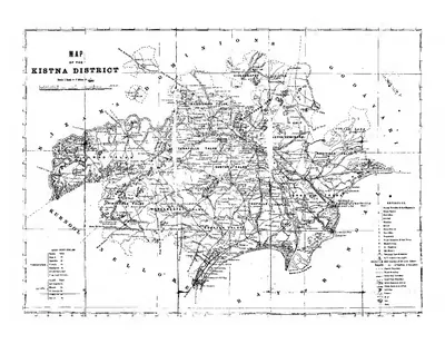
In December 1859 the coast districts were recast under the orders of Trevelyan’s Government.17187 The Company’s districts of Rajahmundry, Machilipatnam (then Masulipatam) and Guntur were made into two.17187 One was Godavari, with its headquarters at Kakinada (then Cocanada).17187 The other was Krishna (then Kistna).17187 The boundary between them followed the Upputeru and Tamaleru rivers.17187
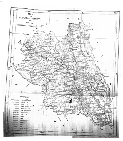
Kurnool had been made a full Collectorate (district) in 1858.19 Three taluks of Kadapa (then Cuddapah) and the Pattikonda taluk of Bellary were added to the old Nawab’s country to form it.19
By a treaty of 26 December 1860, Maclean records, the Nizam’s debt was cancelled.1 By the same treaty, “Bhadrachellam and Rekapully talooks are ceded by the Nizam”.1
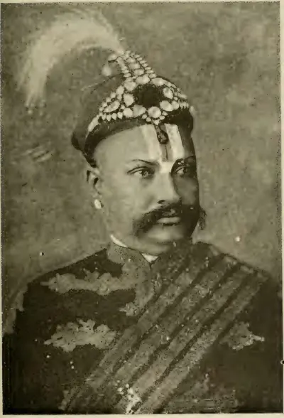
The Godavari gazetteer adds that this tract beyond the Ghats became British territory in 1860.202122 But until 1874 it was governed as part of the Upper Godavari district of the Central Provinces.202122 In 1874 it was transferred to Godavari “in view of its racial and geographical affinities”.202122 The rest of the Bhadrachalam zamindari (landholder’s estate) had stayed in the Nizam’s Dominions.202122
Two hill muttas (groups of hill villages) of the Golgonda Agency were added to Godavari in 1881.22 See Bhadrachalam and Rekapalli.
In Rayalaseema, the old Bellary Collectorate had held the present Anantapur since 1808.2324 It was divided “early in 1882”.2324 Its southern taluks “were constituted a separate district”, with Anantapur as its headquarters.2324
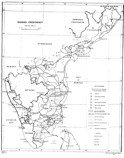
In 1904 the growth of the delta districts led to a second redrawing on the coast.2225 The taluks of Godavari south and west of the river were moved to Krishna.2225 Krishna’s own taluks of Tenali, Guntur, Sattanapalle, Palnad, Bapatla, Narasaraopet and Vinukonda became the new Guntur District, together with the Ongole taluk of Nellore.2225
Chittoor District “was formed on 1st April 1911”.262728 It took in what the 1911 census calls “the then Telugu portion of North Arcot”.262728 It also took in the Madanapalle and Vayalpad taluks of the Deccan division.262728
The census of 1931 says that in 1925 two districts, Krishna and West Godavari, were formed “from the old Kistna district”.1029 West Godavari was made by “the scission of seven taluks” (cutting off seven taluks).1029 See Guntur, Anantapur, Chittoor and the map The Telugu districts of the Madras Presidency.
The Agency tracts
The hill country behind the coast was governed under a separate law.3031 There had been disturbances in the Ganjam and Visakhapatnam hills.3031 After them, Act XXIV of 1839 excluded those tracts “from the operation of much of the ordinary law”.3031 It placed them under the Collectors, “who were endowed with special and extraordinary powers within them in their capacity as ‘Agents to the Governor’”.3031
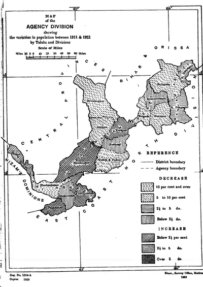
Under the Scheduled Districts Act of 1874, a similar Agency was formed in 1879.30 It covered the Bhadrachalam and Rekapalle taluks and the Rampa country.30 It was enlarged in 1881, 1883 and 1891.30 Within it the Collector was both District Magistrate and Sessions Judge.30 The Imperial Gazetteer notes that the ordinary civil courts had no jurisdiction (legal power) in the Agency tracts of the three northern districts.32
The 1921 census shows these tracts separated from Ganjam, Visakhapatnam and Godavari.33 They formed “a separate administrative unit called the Agency division”.33 By 1931 that “short-lived Agency division” had been absorbed again into the three districts.1029
Government in the districts
The unit of administration was the district, or Collectorate.5 Its chief executive and magisterial officer was the Collector and Magistrate.5 The Imperial Gazetteer says his duties “embrace almost every subject which comes within the functions of a civilized government”.5 They covered revenue, the magistrates, forests, irrigation, police, jails, schools, sanitation, hospitals and roads.5
Each district was divided into subdivisions under divisional officers.534 Most of these officers were Deputy Collectors recruited in India.534 The subdivisions were divided into taluks under tahsildars (taluk officers).534 The village, with its hereditary headman and accountant, remained “the ultimate unit for all fiscal and administrative purposes”.534
The chief judicial officer of the district was the District and Sessions Judge.535 By 1908 there was a District Court in every district except Anantapur, which came under the court at Bellary.535
Local self-government grew out of road cesses (local taxes for roads) collected from 1854.3637 The Madras Local Funds Act of 1871 “established the first local boards”.3637 The Local Boards Act of 1884 created the system that lasted:3637
- district boards, with the Collector as president3637
- taluk boards under the divisional officers3637
- village panchayats in unions3637
These bodies were paid for chiefly by a cess on land.3637 They spent it on roads, dispensaries, vaccination and schools.3637
Towns received municipal councils under the Towns Improvement Act of 1865.383940 Kakinada received one in 1866, and Anantapur in 1869.3940 From 1884 the councils came under the District Municipalities Act.383940 By 1904, 450 of the 944 municipal councillors in the Presidency were elected by the ratepayers.383940
The district police were organised in 1859 by William Robinson, under Act XXIV of that year.414243 They replaced the old kaval (village watch) system, though the village watchmen (talaiyaris) were kept.414243
Land revenue
Most of the Telugu country outside the zamindaris was held on the ryotwari tenure (land held by each cultivator directly from the Government).44 Thomas Munro had made this tenure the rule in the Ceded Districts.44 Under it, the Imperial Gazetteer explains, “the registered occupant of each field deals directly with Government”.44 It adds: “so long as he pays the assessment he is entitled to hold the land for ever and cannot be ejected by Government”.44
In 1855 the Madras Government found the old assessments confused and too high.4546 It decided “to survey the whole ryotwari area and to base the assessments on the productive power of the soil”.4546 In 1864 it settled that the assessment should be half the net produce, fixed in cash for thirty years.4546
In the Godavari district the first scientific settlement was introduced in 1862–63 and 1866–67.74720 A resettlement in 1900 covered 320,000 acres settled in 1866.74720 It raised the assessment on them from Rs. 11,38,000 to Rs. 18,36,000.74720
A resettlement was proposed for East and West Godavari in 1926.4849 It “came in for much criticism in the Madras Legislative Council”.4849 The Council elected a committee of seven non-official members.4849 The committee was to inquire into the economic condition of those districts and of Krishna.4849 The new rates were finally sanctioned in July 1931, for thirty years.4849
The rent-free lands, or inams, were brought under rule by the Madras Inam Commission.50 It was “established on the 16th November 1858 during the administration of Lord Harris”, with G. N. Taylor as Commissioner.50 Trevelyan’s minute (official note) of 13 May 1859 laid down a rule.50 Land held without land-tax for fifty years was to be confirmed as inam, whatever its origin.50 The holders were offered the right to “enfranchise” their grants into private property for a moderate quit-rent (a small fixed rent).50
The Godavari gazetteer says that the inams of that district were settled by the Inam Commissioner between 1860 and 1870.225152 The village service inams were enfranchised when the village establishments were reorganised in 1866.225152 By 1908 inams covered 7.75 million acres of the Presidency.53
The zamindars
The permanently settled estates survived the Company.5453 The Imperial Gazetteer says that the zamindaris ranged “from ancient principalities and baronies to mere modern fiscal creations”.5453 It adds that “so long as they pay the peshkash (permanent assessment) they are secure in their estates as against Government”.5453 In 1908 they covered 29 per cent of the Presidency.5453
The position of their cultivators was “not everywhere clear”, and the rent law of 1865 was admitted to be imperfect.53 A new law, the Madras Estates Land Act (I of 1908), followed.5355 In the Nellore district of the 1930s, the divisional officers held revenue courts under it, and the Collector heard appeals.55
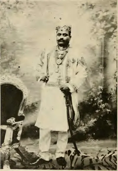
The Raja of Bobbili spoke against the Tenancy Bill in the Legislative Council, his biographer says.56 The Venkatagiri history credits its Raja with a part in framing the Impartible Estates Act.57
The greatest of the northern estates was Vizianagaram.5859 It paid a peshkash of about Rs. 5,82,000, “much more than any other in the Presidency”.5859 Act II of 1904 declared it inalienable and impartible (it could not be sold or divided).5859
Vijayarama Gajapati Raju III returned to the district in 1848, and received his estate clear of debt in 1852.5859 He became a member of the Viceroy’s Council, Maharaja in 1864 and K.C.S.I. in 1876.5859 His son Ananda Gajapati Raju sat for many years in the Madras Legislative Council.5859 He died without issue (children) in 1897.5859
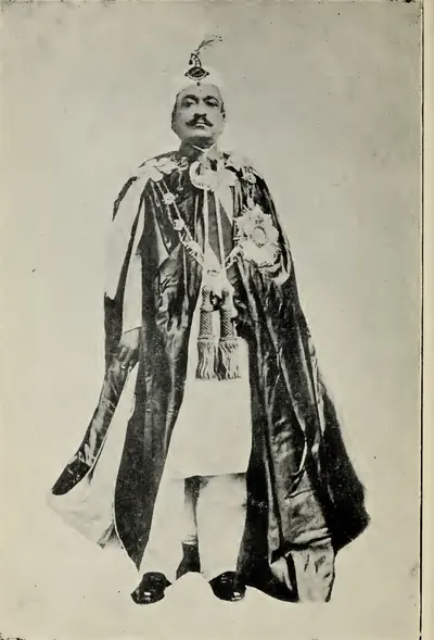
The Bobbili zamindari covered about 920 square miles, with a peshkash of Rs. 95,315.1160 In 1872 it passed by adoption to a younger son of the Raja of Venkatagiri, Venkata Swetachalapati Ranga Rao.1160 His biographer says that the Government of India gave him the title of Maharaja “in the last year of the nineteenth century”.1160
Two of his brothers were adopted into Pithapuram and Jetprole.6112 The eldest, Rajagopala Krishna Yachendra, succeeded to Venkatagiri in 1879.6112 Pithapuram covered 383 square miles, with an income of Rs. 9,14,000 in 1903–04.62 It was twice under the Court of Wards in the later nineteenth century.62
In the south were the Kalahasti and Karvetinagar zamindaris, held since their sanads (grants) of September 1802.6364 In Stuart’s time they paid peshkash of Rs. 1,73,140 and Rs. 1,73,911.6364 See Vizianagaram, Bobbili, Pithapuram, Venkatagiri and Srikalahasti.
Irrigation, railways and ports
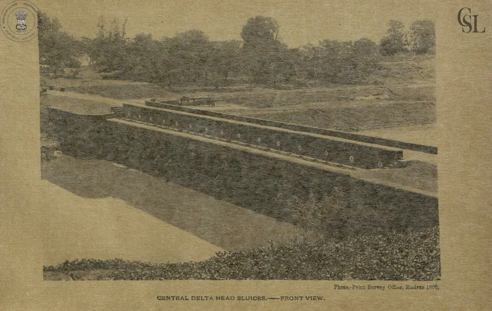
The Godavari anicut (dam) at Dowlaishweram was built under Arthur Cotton from 1847.6566 With the Krishna anicut at Vijayawada (then Bezwada), it was the foundation of the delta districts’ wealth under the Crown.6566 By 1903–04 the Godavari works watered 662,000 acres through 493 miles of main canals, all navigable.65 They returned 17 to 18 per cent on their cost.65 The Krishna system irrigated 616,760 acres of Government land, besides a large area in zamindaris, and returned nearly 13 per cent.66
The Godavari dam itself was raised by two feet between 1862 and 1867.67 In 1897–99 it was raised by nine inches more, with self-acting shutters.67 The Imperial Gazetteer calls the larger irrigation works “a product of British rule”.68 But most of the thousands of tanks in the Presidency had been built before it.68 See Dowlaishweram anicut, Arthur Cotton and Godavari delta works.
The Kurnool–Kadapa Canal was a different story.6970 It was built by the Madras Irrigation and Canal Company, “a body incorporated by Act of Parliament in 1858”.6970 The company was meant to bring English capital into Indian irrigation.6970 It ran through its guaranteed capital and Government loans, £1,600,000 in all, without finishing the canal.6970
The Secretary of State bought the canal in 1882.6970 The Imperial Gazetteer judged that “it has never been a success”, though it gave valuable protection in bad seasons.6970
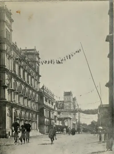
The Buckingham Canal was a salt-water waterway running 262 miles from Pedda Ganjam in Guntur to Merkanam.7071 It was completed as a relief work in the famine of 1876–78.7071 It was named after the Duke of Buckingham and Chandos, then Governor.7071 It linked the Krishna and Godavari canals with Madras.7071
Railways came late to the Telugu districts.7273 The East Coast line from Madras to Calcutta was worked by the Madras Railway as far as Visakhapatnam.7273 In the Godavari district it was opened from Rajahmundry to Waltair, with a branch to Kakinada, in 1893.7273 The bridge over the Godavari at Rajahmundry, 56 spans of 150 feet, was opened to goods traffic in 1900.7273
The Southern Mahratta line from Vijayawada to Guntakal joined “the rich deltas of the Kistna and Godavari with the infertile Deccan”.74 In 1908 Kakinada was “the chief port on the Coromandel coast north of Madras”.3975 It shipped cotton, oilseeds and rice abroad.3975 But the railway and the silting of its bay had taken trade from it.3975
At Visakhapatnam, the census of 1931 reports a deep-water harbour being built.76 It also reports the new line from Vizianagaram to Raipur, through which goods began to run in 1932.76 See Kakinada, Rajahmundry and Visakhapatnam.
Famines
The Crown’s first decades were marked by famine.9 The Imperial Gazetteer lists these scarcities (food shortages) and famines:9
- scarcity in Bellary in 1865–669
- the great famine of 1876–78 in the Deccan districts and Nellore9
- Bellary and Anantapur (1884–85)9
- the Deccan districts and Nellore (1891–92)9
- the Deccan districts, Visakhapatnam and part of Godavari (1896–97)9
- the Deccan districts again in 1899–19009
The four Deccan districts, it says, “have suffered more consistently than any others”.9 In them “the rainfall is light, the soil usually infertile, and large irrigation works are few”.9
The great famine “lasted twenty-two months”.9 It “affected fourteen of the twenty-one Districts of the Presidency”, and “is calculated to have caused the death of 3½ millions of people”.9 It cost the state 630 lakhs of rupees in relief and 191 lakhs in lost revenue.9 In one week of September 1877, more than 2¼ millions were on relief.9 Famine had been reported in Bellary, Kadapa and Nellore on 12 October 1876.6
The census of 1881 found the population of the Presidency 462,897 smaller than in 1871.77 In the districts worst affected by the famine, it was smaller by 1,751,327, or 12.8 per cent.77 Kurnool had lost 26 per cent of its people, Bellary nearly 20, Kadapa 17 and Nellore 11.78 The irrigated coastal districts of Godavari, Krishna and Visakhapatnam had grown.78
The old Bellary district still included Anantapur.7980 There more than a fifth of the people, some 330,000, were reckoned to have died.7980 At the census of 1891 the population of Anantapur was still smaller than it had been in 1871.7980
Relief methods improved.816 The railways carried grain in 1876–78, and weavers were given advances to work at their looms.816 A Famine Code was published in 1883.816 The Famine Commission of 1898 found that in the famine of 1896–97 “the loss of life due to the indirect results of privation was remarkably small”.816
The hill country and the Rampa rebellion
In the Rampa hills of the Godavari Agency there was a hereditary mansabdar (chief), whose oppressions had provoked risings in 1858, 1861 and 1862.8283 By 1879 he had taken eight muttas into his own hands and doubled the quit-rents of others.8283 New excise rules taxed the toddy that the hill people tapped.8283 The exactions (unfair demands) of the police and the decrees of the plains courts made matters worse.8283
The Godavari gazetteer reports what the people said.8283 They “could not stand all the taxes that were being imposed”.8283 And “as they could not live, they might as well kill the constables and die”.8283
In March 1879 armed hill men fired on the Sub-Collector’s camp at Chodavaram.8384 Two captured constables were sacrificed at the Rampa shrine.8384 In April the rising spread to the Golgonda hills of Visakhapatnam, and in July to Rekapalle.8384 It covered some 5,000 square miles.8384
By the end of 1879, six regiments of Madras infantry, sappers and miners, and Hyderabad Contingent troops were in the field.8485 Their worst enemy, the gazetteer says, was malaria.8485
A member of the Board of Revenue, Sullivan, was sent in July 1879.858687 The mansabdar was deposed and held as a state prisoner.858687 The muttadars (heads of the muttas) were given new sanads binding them directly to the Government.858687 The leader Chandrayya, who had burnt the police station at Addatigela, was killed in February 1880.858687 By November 1880 quiet was restored.858687
The Imperial Gazetteer records that this was “the last occasion on which the employment of regular troops has been necessary” in the Presidency.3 The Agency rose again in 1922–24 under Alluri Sitarama Raju, whose rising is told on his page.88
Schools, colleges and the press
The Government college at Rajahmundry began as a district school in 1853.899091 It became a provincial school in 1868, and a first-grade college with a B.A. class in 1877.899091 Its training college for Telugu teachers was raised to collegiate rank in 1894.899091
The Pithapuram Raja’s College at Kakinada was founded in 1852, and endowed by the Raja of Pithapuram.9275 By 1908 there were Arts colleges also at Machilipatnam, Guntur, Ongole and Bellary.9394959697 The one at Machilipatnam was the Noble College, founded by the missionary Robert Noble.939495
C. R. Reddy took office as the first Vice-Chancellor of the Andhra University in April 1926.9899 Viscount Goschen, the Governor, was Chancellor, and the Maharaja of Bobbili was Pro-Chancellor.9899 The university’s headquarters, first at Vijayawada, had moved to Visakhapatnam by 1931.100
The Imperial Gazetteer counted 65 vernacular and diglot (two-language) newspapers and periodicals in the Presidency.101 About a fifth of them were political.101 Sarojini Regani dates the first Telugu political paper, the Andhra Prakasika, to 1885.102
Banganapalle
The small state of Banganapalle, within Kurnool, was the only Telugu-country state under the Madras Government.341 The Imperial Gazetteer says that it “was a feudal estate at the time when it was ceded by the Nizam to the Company, and its position was continued”.34 In 1862 its chief received a sanad recognising the right of adoption.341
Between 1921 and 1931, Banganapalle and the other states were taken from the control of the Madras Government.10 They were placed under an Agent to the Governor-General, so the Collector of Kurnool ceased to be its political agent.10 Its history is on the Banganapalle State page.
The national and Andhra movements
Public life in the Telugu districts is told on Reform, freedom & people’s movements. In outline:
- Telugu delegates attended the first Congress in 1885.102
- After about 1910, Regani writes, the national movement in the Telugu districts became also a movement for a separate Andhra province.103
- The Congress recognised Andhra as a separate circle in 1917.104
- The salt campaign of 1930, led in Andhra by Konda Venkatappayya, brought arrests and police firing across the districts.105
- The Quit India rising of 1942 did the same.106
- In 1937 T. Prakasam joined the Congress ministry at Madras.107
See also Kandukuri Veeresalingam, Duggirala Gopalakrishnayya and Potti Sriramulu.
The end of Crown rule
According to the India Office List of 1947, the Government of Madras had a council of ministers under T. Prakasam as Premier.14 Its Governor was Lieutenant-General Sir Archibald Nye, who had taken office on 6 May 1946.14 India became independent in 1947, and the Crown’s rule of the Telugu districts ended.108
The Linguistic Provinces Commission of 1948 found the demand for an Andhra province strongest in the coastal districts.109 Rayalaseema was less affected and partly opposed.109 See Andhra State & Andhra Pradesh for the Andhra State of 1953 and the later Andhra Pradesh.
Where the sources disagree
- The transfer. Maclean dates the Act transferring India to the Crown to 2 August 1858, and the Queen’s proclamation to 4 November.1 Sewell dates the transfer of the Company’s territories to 1 November 1858.15
- The Krishna and Godavari districts, 1859. The Kistna manual dates the new Krishna district to December 1859.17 The Godavari gazetteer and the Imperial Gazetteer give only the year.725
- Bhadrachalam and Rekapalli. Maclean’s chronology records their cession among the Madras annals for 1860, as though they came to Madras then.1 The Godavari gazetteer shows that they were governed from the Central Provinces until 1874.20
- East and West Godavari. The 1931 census says that West Godavari was formed in 1925 “from the old Kistna district”, not from Godavari.29 But the taluks west of the Godavari had belonged to the Godavari district until 1904.25 The 1933 resettlement report lists Eluru (then Ellore), Tanuku, Bhimavaram and Narasapuram among the taluks of West Godavari.110
- Vizianagaram, 1878 or 1879. Maclean’s chronology puts the death of the Maharaja of Vizianagaram and the succession of Ananda Raju in 1878.6 Francis’s gazetteer says 1879.59
- The great famine. The Imperial Gazetteer reckons 3½ million deaths.9 The census of 1881 estimates the loss to the population at 2¾ millions, including births that did not happen.77 It adds about three-quarters of a million more for the defects of the 1871 count.77
Footnotes
-
C. D. Maclean (ed.), Manual of the Administration of the Madras Presidency, Vol. II (1885), p. 266, chronological annals, 1858–1863 (archive.org (opens in a new tab)). ↩ ↩2 ↩3 ↩4 ↩5 ↩6 ↩7 ↩8 ↩9 ↩10 ↩11 ↩12 ↩13 ↩14 ↩15 ↩16 ↩17 ↩18 ↩19 ↩20 ↩21 ↩22
-
Sarojini Regani, Highlights of the Freedom Movement in Andhra Pradesh (1956), p. 5 (archive.org (opens in a new tab)). ↩ ↩2
-
Imperial Gazetteer of India: Madras, Vol. I (1908), p. 23 (archive.org (opens in a new tab)). ↩ ↩2 ↩3 ↩4
-
Imperial Gazetteer: Madras, Vol. I (1908), p. 82 (archive.org (opens in a new tab)). ↩ ↩2 ↩3 ↩4 ↩5 ↩6 ↩7
-
Imperial Gazetteer: Madras, Vol. I (1908), p. 83 (archive.org (opens in a new tab)). ↩ ↩2 ↩3 ↩4 ↩5 ↩6 ↩7 ↩8 ↩9 ↩10 ↩11 ↩12 ↩13 ↩14 ↩15 ↩16 ↩17
-
Maclean, Manual of the Administration, Vol. II (1885), p. 267, chronological annals, 1864–1884 (archive.org (opens in a new tab)). ↩ ↩2 ↩3 ↩4 ↩5 ↩6 ↩7 ↩8 ↩9 ↩10 ↩11 ↩12
-
Hemingway, Godavari (1907), p. 169 (archive.org (opens in a new tab)). ↩ ↩2 ↩3 ↩4 ↩5 ↩6 ↩7 ↩8 ↩9 ↩10 ↩11 ↩12 ↩13 ↩14
-
W. Francis, Madras District Gazetteers: Vizagapatam, Vol. I (1907), p. 2 (archive.org (opens in a new tab)). ↩ ↩2 ↩3 ↩4 ↩5
-
Imperial Gazetteer: Madras, Vol. I (1908), p. 80 (archive.org (opens in a new tab)). ↩ ↩2 ↩3 ↩4 ↩5 ↩6 ↩7 ↩8 ↩9 ↩10 ↩11 ↩12 ↩13 ↩14 ↩15 ↩16
-
Census of India, 1931, Vol. XIV: Madras, Part I, Report (1932), p. 3 (archive.org (opens in a new tab)). ↩ ↩2 ↩3 ↩4 ↩5 ↩6
-
A. Vadivelu, The Aristocracy of Southern India (1903), p. 33, “H. H. the Maharajah of Bobbili” (archive.org (opens in a new tab)). ↩ ↩2 ↩3 ↩4 ↩5
-
A Family History of Venkatagiri Rajas (1922), p. 123 (archive.org (opens in a new tab)). ↩ ↩2 ↩3 ↩4
-
The India Office and Burma Office List for 1939, p. 109, “Governors of Madras” (archive.org (opens in a new tab)). ↩ ↩2 ↩3 ↩4
-
The India Office and Burma Office List 1947, p. 17, “Government of Madras” (archive.org (opens in a new tab)). ↩ ↩2 ↩3 ↩4
-
Robert Sewell, The Historical Inscriptions of Southern India and Outlines of Political History (1932), p. 317 (archive.org (opens in a new tab)). ↩ ↩2
-
Maclean, Manual of the Administration, Vol. II (1885), pp. 269–270, list of Governors of Fort St. George (archive.org (opens in a new tab)). ↩ ↩2
-
Gordon Mackenzie, A Manual of the Kistna District (1883), p. 3 (archive.org (opens in a new tab)). ↩ ↩2 ↩3 ↩4 ↩5 ↩6
-
Mackenzie, Kistna District (1883), p. 86 (archive.org (opens in a new tab)). ↩ ↩2 ↩3 ↩4 ↩5
-
Imperial Gazetteer: Madras, Vol. I (1908), p. 409, s.v. Kurnool District (archive.org (opens in a new tab)). ↩ ↩2
-
Hemingway, Godavari (1907), p. 174 (archive.org (opens in a new tab)). ↩ ↩2 ↩3 ↩4 ↩5 ↩6 ↩7 ↩8
-
Hemingway, Godavari (1907), p. 175 (archive.org (opens in a new tab)). ↩ ↩2 ↩3 ↩4
-
Hemingway, Godavari (1907), p. 178 (archive.org (opens in a new tab)). ↩ ↩2 ↩3 ↩4 ↩5 ↩6 ↩7 ↩8 ↩9 ↩10
-
Francis, Anantapur (1905), p. 101 (archive.org (opens in a new tab)). ↩ ↩2 ↩3
-
Imperial Gazetteer: Madras, Vol. I (1908), p. 433, s.v. Bellary District (archive.org (opens in a new tab)). ↩ ↩2 ↩3
-
Imperial Gazetteer: Madras, Vol. I (1908), p. 328, s.v. Guntur District (archive.org (opens in a new tab)). ↩ ↩2 ↩3 ↩4 ↩5
-
Madras District Gazetteers: Statistical Appendix for Chittoor District (1915), p. 25, Table XV, note (archive.org (opens in a new tab)). ↩ ↩2 ↩3
-
Census of India, 1911: Madras, Part I (1912), p. 88 (archive.org (opens in a new tab)). ↩ ↩2 ↩3
-
Census of India, 1911, Vol. XII: Madras, Part I, Report (1912), p. 80 (archive.org (opens in a new tab)). ↩ ↩2 ↩3
-
Census of India, 1931: Madras, Part I (1932), p. 12 (archive.org (opens in a new tab)). ↩ ↩2 ↩3 ↩4
-
Hemingway, Godavari (1907), p. 190 (archive.org (opens in a new tab)). ↩ ↩2 ↩3 ↩4 ↩5 ↩6 ↩7 ↩8
-
Francis, Vizagapatam (1907), p. 196 (archive.org (opens in a new tab)). ↩ ↩2 ↩3 ↩4
-
Imperial Gazetteer: Madras, Vol. I (1908), p. 86 (archive.org (opens in a new tab)). ↩
-
Census of India, 1921, Vol. XIII: Madras, Part I, Report (1922), p. 7 (archive.org (opens in a new tab)). ↩ ↩2
-
Imperial Gazetteer: Madras, Vol. I (1908), p. 84 (archive.org (opens in a new tab)). ↩ ↩2 ↩3 ↩4 ↩5 ↩6 ↩7
-
Imperial Gazetteer: Madras, Vol. I (1908), p. 87 (archive.org (opens in a new tab)). ↩ ↩2
-
Imperial Gazetteer: Madras, Vol. I (1908), p. 108 (archive.org (opens in a new tab)). ↩ ↩2 ↩3 ↩4 ↩5 ↩6 ↩7 ↩8
-
Imperial Gazetteer: Madras, Vol. I (1908), p. 109 (archive.org (opens in a new tab)). ↩ ↩2 ↩3 ↩4 ↩5 ↩6 ↩7 ↩8
-
Imperial Gazetteer: Madras, Vol. I (1908), p. 110 (archive.org (opens in a new tab)). ↩ ↩2 ↩3
-
Imperial Gazetteer: Madras, Vol. I (1908), p. 293, s.v. Cocanada Town (archive.org (opens in a new tab)). ↩ ↩2 ↩3 ↩4 ↩5 ↩6 ↩7
-
Imperial Gazetteer: Madras, Vol. I (1908), p. 488, s.v. Anantapur Town (archive.org (opens in a new tab)). ↩ ↩2 ↩3 ↩4
-
Imperial Gazetteer: Madras, Vol. I (1908), p. 114 (archive.org (opens in a new tab)). ↩ ↩2
-
Imperial Gazetteer: Madras, Vol. I (1908), p. 115 (archive.org (opens in a new tab)). ↩ ↩2
-
Hemingway, Godavari (1907), p. 194 (archive.org (opens in a new tab)). ↩ ↩2
-
Imperial Gazetteer: Madras, Vol. I (1908), p. 94 (archive.org (opens in a new tab)). ↩ ↩2 ↩3 ↩4
-
Imperial Gazetteer: Madras, Vol. I (1908), p. 95 (archive.org (opens in a new tab)). ↩ ↩2 ↩3
-
Imperial Gazetteer: Madras, Vol. I (1908), p. 96 (archive.org (opens in a new tab)). ↩ ↩2 ↩3
-
Hemingway, Godavari (1907), p. 170 (archive.org (opens in a new tab)). ↩ ↩2 ↩3
-
Madras Government, Revenue Department, G.O. No. 2233, 9 December 1933, Settlement — Resettlement (East Godavari, West Godavari and Kistna) — Introduction Report, p. 4 (archive.org (opens in a new tab)). ↩ ↩2 ↩3 ↩4 ↩5
-
G.O. No. 2233, Revenue (1933), p. 5 (archive.org (opens in a new tab)). ↩ ↩2 ↩3 ↩4 ↩5
-
Maclean, Manual of the Administration, Vol. I (1885), p. 167, “Inam Commission” (archive.org (opens in a new tab)). ↩ ↩2 ↩3 ↩4 ↩5
-
Hemingway, Godavari (1907), p. 179 (archive.org (opens in a new tab)). ↩ ↩2
-
Hemingway, Godavari (1907), p. 180 (archive.org (opens in a new tab)). ↩ ↩2
-
Imperial Gazetteer: Madras, Vol. I (1908), p. 101 (archive.org (opens in a new tab)). ↩ ↩2 ↩3 ↩4 ↩5 ↩6 ↩7
-
Imperial Gazetteer: Madras, Vol. I (1908), p. 100 (archive.org (opens in a new tab)). ↩ ↩2 ↩3 ↩4
-
Gazetteer of the Nellore District, brought up to 1938, Vol. A (1942), p. 269 (archive.org (opens in a new tab)). ↩ ↩2
-
Vadivelu, Aristocracy (1903), p. 61 (archive.org (opens in a new tab)). ↩
-
Family History of Venkatagiri Rajas (1922), p. 130 (archive.org (opens in a new tab)). ↩
-
Francis, Vizagapatam (1907), p. 338, s.v. Vizianagram (archive.org (opens in a new tab)). ↩ ↩2 ↩3 ↩4 ↩5 ↩6 ↩7
-
Francis, Vizagapatam (1907), p. 340 (archive.org (opens in a new tab)). ↩ ↩2 ↩3 ↩4 ↩5 ↩6 ↩7 ↩8
-
Vadivelu, Aristocracy (1903), p. 40 (archive.org (opens in a new tab)). ↩ ↩2 ↩3
-
Vadivelu, Aristocracy (1903), p. 41 (archive.org (opens in a new tab)). ↩ ↩2
-
Hemingway, Godavari (1907), p. 237, s.v. Pithapuram (archive.org (opens in a new tab)). ↩ ↩2
-
Harold A. Stuart, Madras District Manuals: North Arcot, Vol. I (1895), p. 175 (archive.org (opens in a new tab)). ↩ ↩2
-
Stuart, North Arcot (1895), p. 176 (archive.org (opens in a new tab)). ↩ ↩2
-
Imperial Gazetteer: Madras, Vol. I (1908), p. 165, s.v. Godavari Canals (archive.org (opens in a new tab)). ↩ ↩2 ↩3 ↩4
-
Imperial Gazetteer: Madras, Vol. I (1908), p. 168, s.v. Kistna Canals (archive.org (opens in a new tab)). ↩ ↩2 ↩3
-
F. R. Hemingway, Madras District Gazetteers: Godavari, Vol. I (1907), p. 84 (archive.org (opens in a new tab)). ↩ ↩2
-
Imperial Gazetteer: Madras, Vol. I (1908), p. 51 (archive.org (opens in a new tab)). ↩ ↩2
-
Imperial Gazetteer: Madras, Vol. I (1908), p. 180, s.v. Kurnool-Cuddapah Canal (archive.org (opens in a new tab)). ↩ ↩2 ↩3 ↩4 ↩5 ↩6
-
Imperial Gazetteer: Madras, Vol. I (1908), p. 181, s.v. Kurnool-Cuddapah Canal and Buckingham Canal (archive.org (opens in a new tab)). ↩ ↩2 ↩3 ↩4 ↩5 ↩6 ↩7 ↩8 ↩9 ↩10
-
Imperial Gazetteer: Madras, Vol. I (1908), p. 182, s.v. Buckingham Canal (archive.org (opens in a new tab)). ↩ ↩2 ↩3 ↩4
-
Imperial Gazetteer: Madras, Vol. I (1908), p. 75 (archive.org (opens in a new tab)). ↩ ↩2 ↩3 ↩4
-
Hemingway, Godavari (1907), p. 133 (archive.org (opens in a new tab)). ↩ ↩2 ↩3 ↩4
-
Imperial Gazetteer: Madras, Vol. I (1908), p. 76 (archive.org (opens in a new tab)). ↩
-
Imperial Gazetteer: Madras, Vol. I (1908), p. 294, s.v. Cocanada Town (archive.org (opens in a new tab)). ↩ ↩2 ↩3 ↩4
-
Census of India, 1931: Madras, Part I (1932), p. 30 (archive.org (opens in a new tab)). ↩ ↩2
-
Imperial Census of 1881: Operations and Results in the Presidency of Madras, Vol. I (1883), p. 10 (archive.org (opens in a new tab)). ↩ ↩2 ↩3 ↩4
-
Census of 1881: Madras, Vol. I (1883), p. 18, Table No. 5 (archive.org (opens in a new tab)). ↩ ↩2
-
Francis, Anantapur (1905), p. 85 (archive.org (opens in a new tab)). ↩ ↩2 ↩3
-
W. Francis, Madras District Gazetteers: Anantapur (1905), p. 25 (archive.org (opens in a new tab)). ↩ ↩2 ↩3
-
Imperial Gazetteer: Madras, Vol. I (1908), p. 81 (archive.org (opens in a new tab)). ↩ ↩2 ↩3 ↩4
-
Hemingway, Godavari (1907), p. 272, s.v. Rampa (archive.org (opens in a new tab)). ↩ ↩2 ↩3 ↩4 ↩5 ↩6 ↩7
-
Hemingway, Godavari (1907), p. 273 (archive.org (opens in a new tab)). ↩ ↩2 ↩3 ↩4 ↩5 ↩6 ↩7 ↩8 ↩9 ↩10 ↩11
-
Hemingway, Godavari (1907), p. 274 (archive.org (opens in a new tab)). ↩ ↩2 ↩3 ↩4 ↩5 ↩6
-
Hemingway, Godavari (1907), p. 275 (archive.org (opens in a new tab)). ↩ ↩2 ↩3 ↩4 ↩5 ↩6 ↩7
-
Hemingway, Godavari (1907), p. 276 (archive.org (opens in a new tab)). ↩ ↩2 ↩3 ↩4 ↩5
-
Hemingway, Godavari (1907), p. 284, s.v. Addatigela (archive.org (opens in a new tab)). ↩ ↩2 ↩3 ↩4 ↩5
-
Sarojini Regani, Highlights of the Freedom Movement in Andhra Pradesh (1956), pp. 96, 100 (1922 rising (opens in a new tab), end in 1924 (opens in a new tab)). ↩
-
Hemingway, Godavari (1907), p. 154 (archive.org (opens in a new tab)). ↩ ↩2 ↩3
-
Hemingway, Godavari (1907), p. 155 (archive.org (opens in a new tab)). ↩ ↩2 ↩3
-
Hemingway, Godavari (1907), p. 156 (archive.org (opens in a new tab)). ↩ ↩2 ↩3
-
Hemingway, Godavari (1907), p. 157 (archive.org (opens in a new tab)). ↩
-
Imperial Gazetteer: Madras, Vol. I (1908), p. 305, s.v. Kistna District (archive.org (opens in a new tab)). ↩ ↩2
-
Imperial Gazetteer: Madras, Vol. I (1908), p. 315, s.v. Kistna District (archive.org (opens in a new tab)). ↩ ↩2
-
Imperial Gazetteer: Madras, Vol. I (1908), p. 326, s.v. Masulipatam Town (archive.org (opens in a new tab)). ↩ ↩2
-
Imperial Gazetteer: Madras, Vol. I (1908), p. 347, s.v. Nellore District (archive.org (opens in a new tab)). ↩
-
Imperial Gazetteer: Madras, Vol. I (1908), p. 455, s.v. Bellary Town (archive.org (opens in a new tab)). ↩
-
Andhra University, The Annual Register 1935–36 (1935), p. 51, “Succession Lists of Officers” (archive.org (opens in a new tab)). ↩ ↩2
-
The India Office and Burma Office List 1947, p. 206, record of service of Viscount Goschen (archive.org (opens in a new tab)). ↩ ↩2
-
Census of India, 1931: Madras, Part I (1932), p. 62 (archive.org (opens in a new tab)). ↩
-
Imperial Gazetteer: Madras, Vol. I (1908), p. 125 (archive.org (opens in a new tab)). ↩ ↩2
-
Sarojini Regani, Highlights of the Freedom Movement in Andhra Pradesh (1956), pp. 19–20 (archive.org (opens in a new tab)). ↩ ↩2
-
Regani, Highlights (1956), p. 49 (archive.org (opens in a new tab)). ↩
-
Regani, Highlights (1956), p. 56 (archive.org (opens in a new tab)). ↩
-
Regani, Highlights (1956), pp. 114–117 (archive.org (opens in a new tab)). ↩
-
Regani, Highlights (1956), pp. 150–154 (archive.org (opens in a new tab)). ↩
-
Regani, Highlights (1956), pp. 141–142 (archive.org (opens in a new tab)). ↩
-
Census 1961, Andhra Pradesh: District Census Handbook, Nalgonda District (1964), p. A 12. ↩
-
Report of the Linguistic Provinces Commission, 1948, p. 27 (archive.org (opens in a new tab)). ↩ ↩2
-
G.O. No. 2233, Revenue (1933), pp. 1–2 (archive.org (opens in a new tab)). ↩
Photos
 "Central Delta Head Sluices - front view" (Walch 1896, PDF p. 89)Historic photograph · 1896
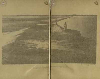 "Dowlaishveram Anicut from near the under sluices" (photograph by Messrs. Nicholas & Co., two halves joined) (Walch 1896, PDF pp. 81-82)Historic photograph · 1896
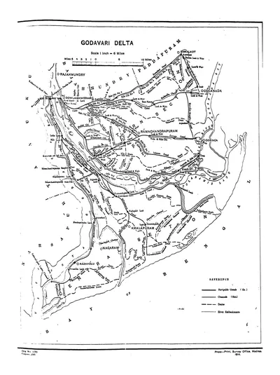 "Godavari Delta" map, with navigable canals, channels, drains and river embankments (Hemingway 1907, PDF p. 97)Map · 1907
 "H. H. The Maharajah of Bobbili. K. C. I. E.": Venkata Swetachalapati Ranga Rao, Raja (later Maharaja) of Bobbili (Vadivelu 1903, plate facing p. 33)Historic photograph · 1903
 "H. H. The Rajah of Palavancha & Bhadrachalam" (Vadivelu 1903, plate in the section on the Rajah of Palavancha and Bhadrachalam)Historic photograph · 1903
 "Indra-Mahal at Venkatagiri. Opened by H.E. Sir Mountstuart Elphinstone Grant Duff, G.C.I.E., on 22nd July, 1883" (Family History of Venkatagiri Rajas, 1922, plate 126a)Historic photograph · 1922
 "Madras Presidency": key map of the districts and natural divisions, with East and West Godavari, Guntur and Chittoor (Census of India 1931, Madras, Part I, 1932)Map · 1932
 "Maharaja Sir V. Rajagopala Krishna Yachendra Bahadur, G.C.I.E. (28th Generation)" of Venkatagiri, 1857–1916 (Family History of Venkatagiri Rajas, 1922, plate 123a)Historic photograph · 1922
 "Map of the Agency Division showing the variation in population between 1911 & 1921 by Taluks and Divisions": the hill tracts of Ganjam, Vizagapatam and Godavari (Census of India 1921, Madras, Part I, 1922)Map · 1922
 "Map of the Cuddapah District 1915" (Brackenbury 1915, folding map, PDF p. 1)Map · 1915
 "Map of the Kistna District" (folding map) (Mackenzie 1883, folding map, PDF p. 1)Map · 1883
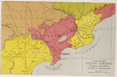 "Part of the Telugu Country, including Masulipatam, Guntoor, & Rajahmundry", map from the Church Missionary Atlas, 3rd edition, London, 1862 (cropped to the map)Map · 1862
Show all (19)
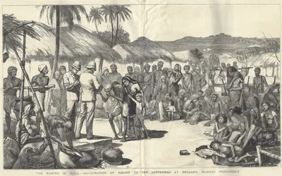 "The Famine in India—Distribution of Relief to the Sufferers at Bellary, Madras Presidency": wood engraving after Herbert Johnson in The Graphic, 20 October 1877Drawing · 1877
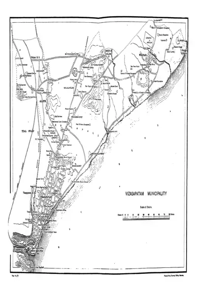 "Vizagapatam Municipality" town plan (Francis 1907, PDF p. 344)Map · 1907
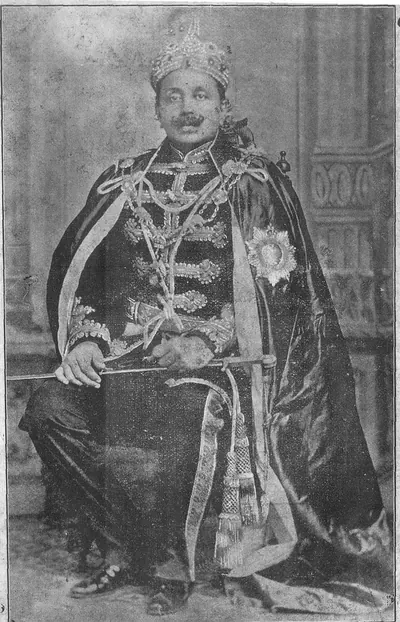 Ananda Gajapati Raju, Maharaja of Vizianagaram (d. 1897): portrait in the Andhra Patrika annual number of 1911, whose printed Telugu caption names him "Sri Raja Ananda Gajapati Maharaju"Historic photograph · 1911
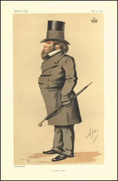 Caricature captioned "A safe Duke" by Carlo Pellegrini ("Ape") in Vanity Fair, 29 May 1875, identified on Commons as the 3rd Duke of Buckingham and Chandos, Governor of Madras in 1875–80 during the great famineDrawing · 1875
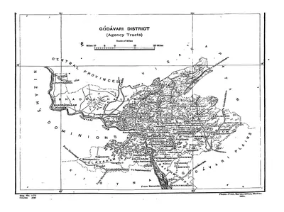 Map of the "Godavari District (Agency Tracts)" (Hemingway 1907, PDF p. 4)Map · 1907
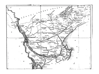 Map of the Godavari District (plains), folding map (Hemingway 1907, PDF p. 3)Map · 1907
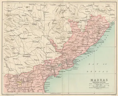 Northern Madras Presidency (Imperial Gazetteer, 1909)Map · 1909
References
Notes (0)
Sources (24)
Spotted an error on this page? Tell us
Last updated: